
Leaderboard


Popular Content
Showing content with the highest reputation on 06/27/22 in all areas
-
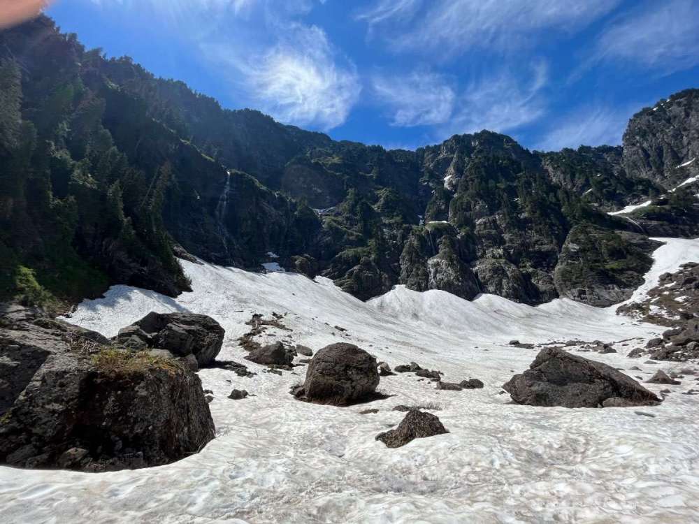
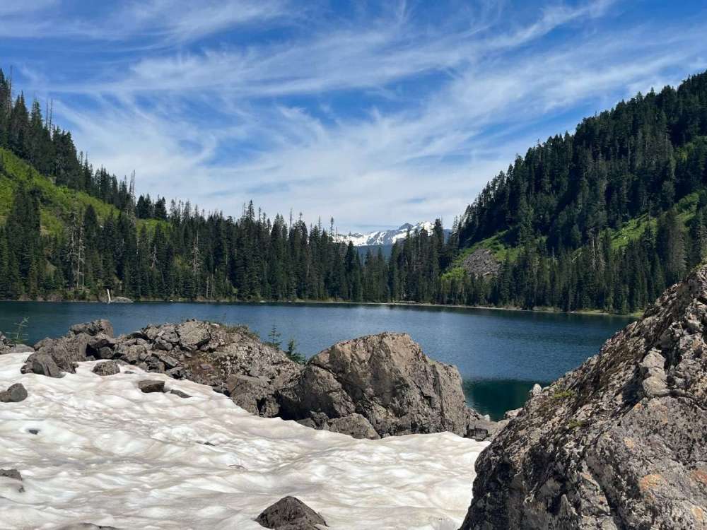
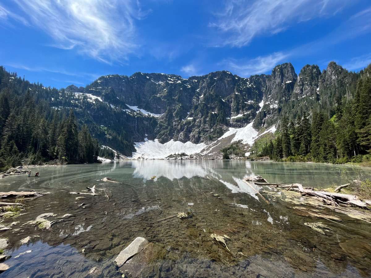
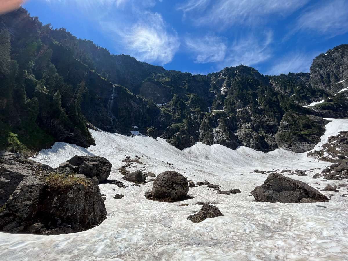
What a day today was…91/61 today in Tacoma and anxiously awaiting the marine push. Went all the way up to lake 22 and it was amazing! By the time me and my friend got back down to the car it was already in the mid 90s in the granite falls area. The drive up and the hike was awesome…the drive back was one of my worst experiences ever driving lol. No AC in my car and in the mid 90s the whole drive from granite falls through falls city/issaquah home…took nearly 3 hours and felt like I was gonna pass out by the time I got home!

 10 points
 -
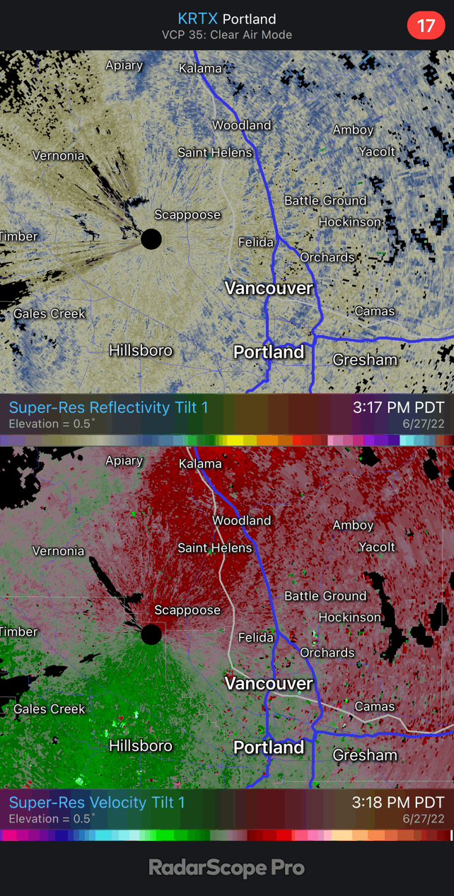
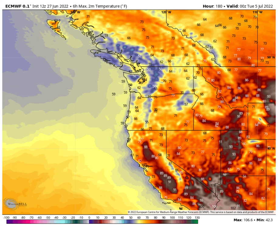
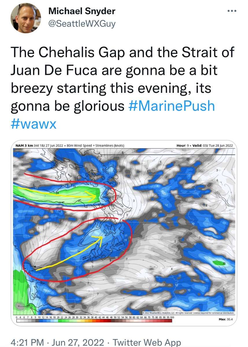
Marine push moving through the coastal Columbia gap.
 10 points
 -
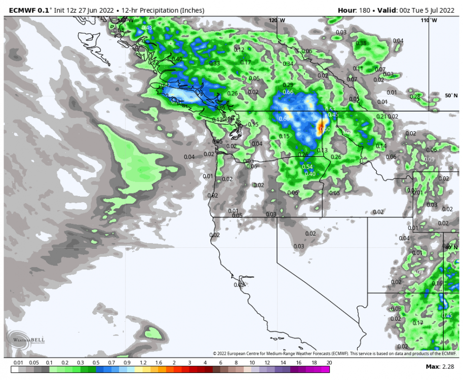
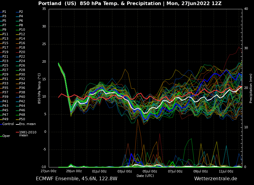
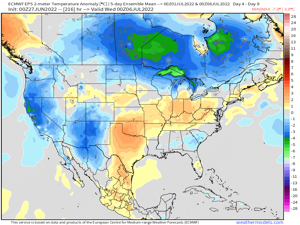
Alright then... 12Z ECMWF says a rainy and chilly 4th. One week out now so its probably locking in.
 9 points
 -
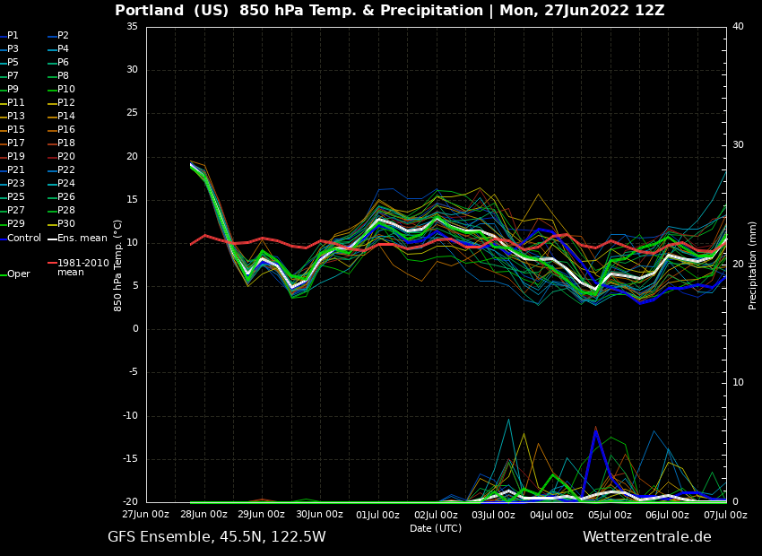
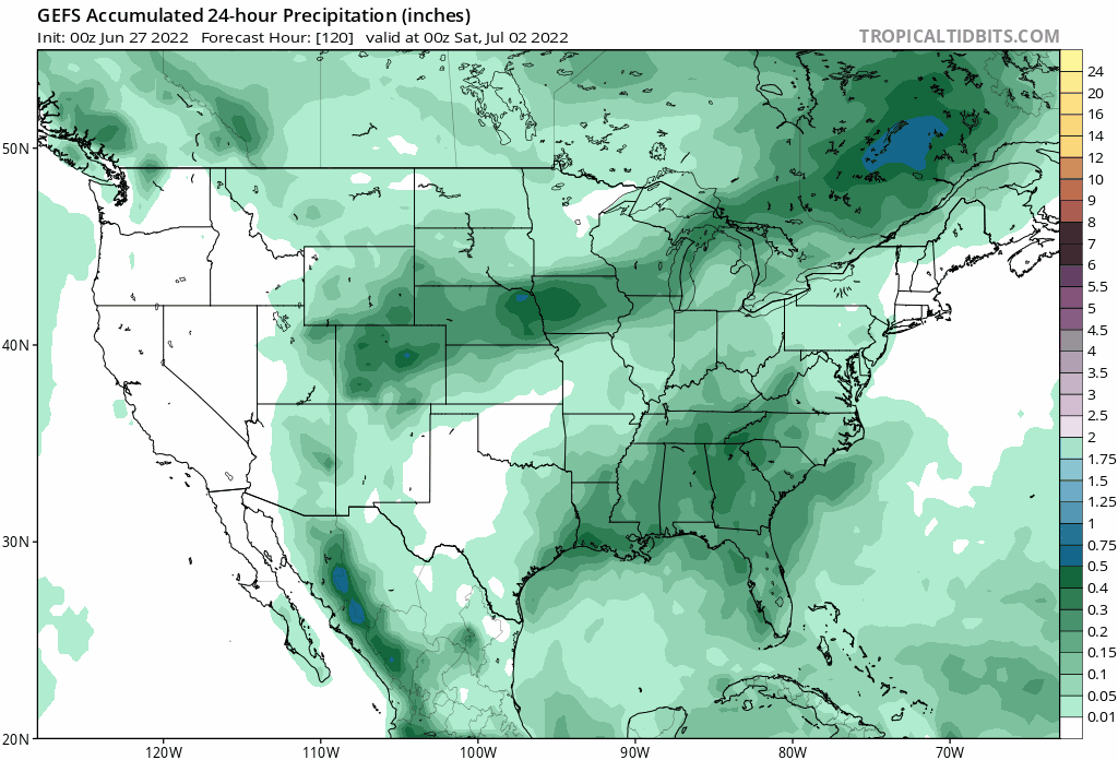
Nice to see slight precip chances the whole first week of July on the ensembles
 8 points
 -
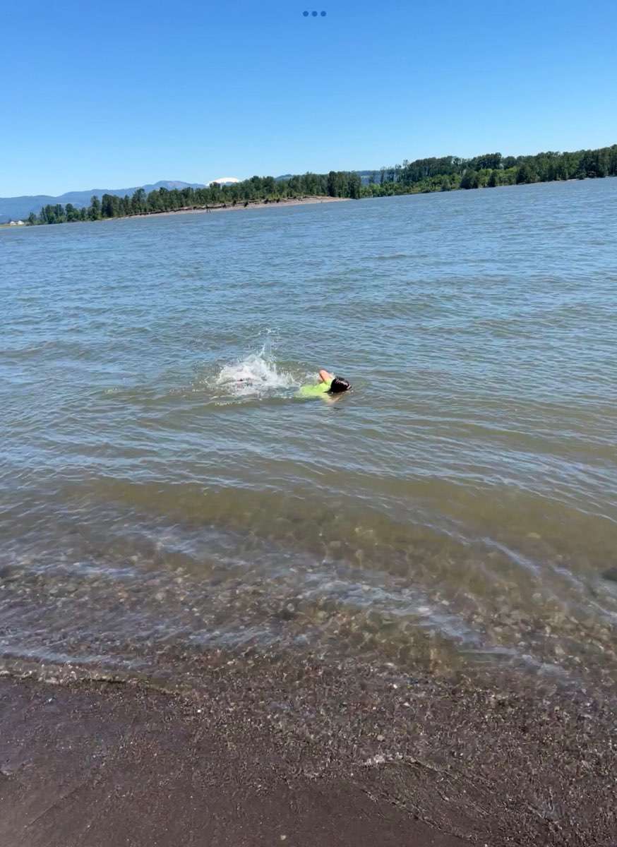
Back home after a little camping trip on Sand Island (right across from St. Helens town, aka…HalloweenTown). It was HOT! Grandson stayed cool though swimming in the Columbia. I have no idea how these kids do it?!? The water was Ccccoold! Federal Way currently at 92* Yesterdays high was 86* at the house
 7 points
 -
7 points
-
It's a beautiful morning, currently it's 58 on its way to 80 with very little humidity.7 points
-
Full 12z EPS. Looking pretty nice the next few weeks.
 6 points
 -
Summer troughing is notoriously hard to pin down at this range. Especially wandering ULL type patterns. It takes pretty exact placement to get a true cool and wet day, especially down here. I’ll believe it when I see it.6 points
-
U ready for a 1949/50 repeat this winter? #SuperNiña5 points
-
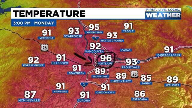
82F-85F among most Everett stations, some stations say 88F towards the south and the highest I've seen in Everett says 94F toward the east. Downtown Everett is 84F and the Port of Everett is 78F. Much hotter here today than Saturday. It started out hotter too, having reached 78F by 11am. Skies were mixed with clouds all day, including this morning. Looking towards the Cascades, the skies were hazy. Looking at the smog monitor, parts of Eastern King County are now in moderate to unhealthy air. The rest of the metro appears to still be good.
 5 points
 -
Astoria is -28!5 points
-
Looks like the 12z Euro operational, EPS and the control run are in pretty good agreement for the 4th. Who knows, maybe we’ll get lucky. ️5 points
-
06Z GFS was comically bad for the 4th... all day rain. The only such day in sight.
 5 points
 -
Beautiful morning with the windows open and cool/comfy air filtering into the house....62F/50F...Happy Monday!5 points
-
We care, though. As the forums most prolific poster we deserve a front row seat to the data behind the Tim show. I bet @Philwould pay for it and a live cam too. You could probably charge a few bucks even!4 points
-
Lightning west of Bellingham!4 points
-
Down to 70. Brrrr! 24 degree drop in 4hrs.
 4 points
 -
4 points
-
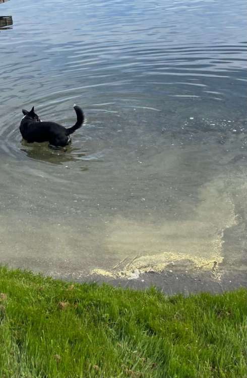
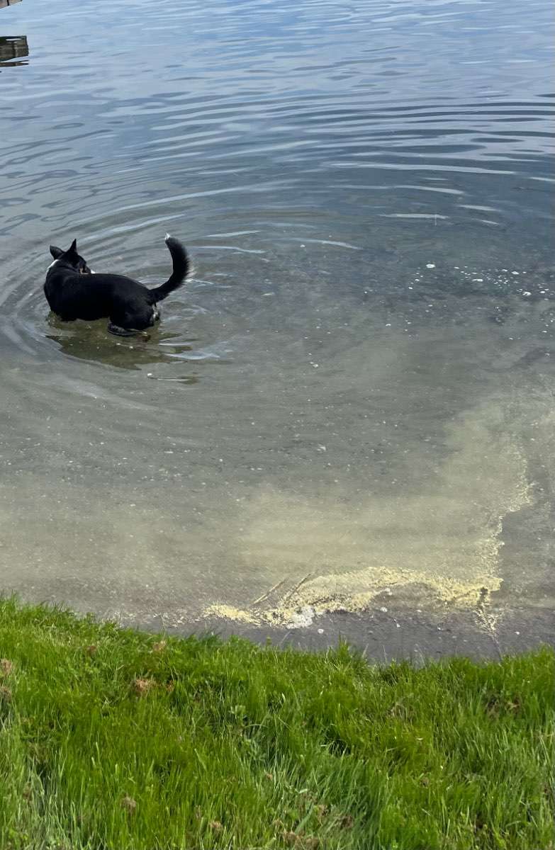
Like others mentioned earlier the pollen has been really bad the last few days, and this picture really drives the point home…That is not algae, that is concentrated pollen that was blown into shore with this mornings very light NW breeze. Anyway, what a day to play on the lake!! High of 94 low of 59. Currently partly cloudy and 79.

 4 points
 -
The crash is ongoing here. Maxed out at 85F today, but down to 75F now.4 points
-
THE CRASH HAS BEGUN! Temperature is dropping like a rock. I reached 88F less than 2hrs ago, the temp has dropped to 75F. Marine push to the rescue! You can see on the map the cooler air pushing through based on the temps. It goes on through the Peninsula, across Whidbey Island, and hitting many northern coastal communities. The relief is coming.
 4 points
 -
66 in Aberdeen…79 in Shelton and 87 here. So excited this heatwave is coming to an end.4 points
-
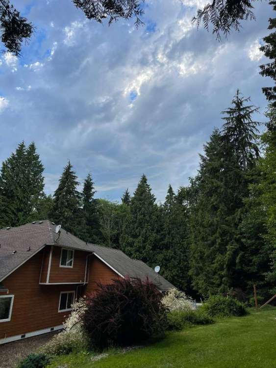
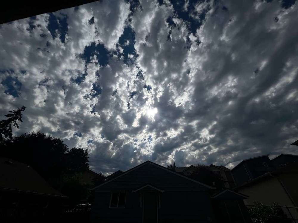
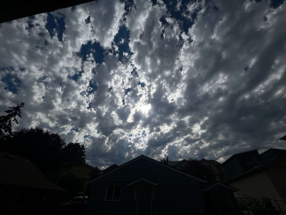
Nothing breaking the cap just yet, but man is this sky pretty. Altocumulus castellanus going absolutely bonkers. RGEM actually had some initiation around 6-7pm so it might be onto something.
 4 points
 -
Speaking of stations not representative of their metro areas
 4 points
 -
No one station is going to representative of a geographically large and varied metro area. PDX runs way warmer and drier than pretty much any other location, for instance. I notice there are SSW winds at EUG, and they’ve only gone up a degree in the last hour. They are probably starting to feel the effects of marine influence through the Siuslaw gap, moreso than eastern parts of town. Just a matter of time before it reaches you.4 points
-
1pm………..88 degrees!! Wow. So this is how normal people live in summer.4 points
-
Lakeview, OR.......93-39 spread. Not bad4 points
-
00Z ECMWF did not stick to its guns. Looks similar to the GFS... and pretty wet Sunday into Monday. Referring to western WA and not Oregon of course.4 points
-
Central sound and Portland metro are holding out still lol. Pretty decent marine push here overall feels great outside now. Might even get a midnight low tonight.3 points
-
A mom is a special part of our lives, I pray it is peaceful and she is surrounded by as many loved ones as possible.3 points
-
You can't trust Tims current updates on temp or precip, he doesn't have a weather station, which is still and will always be weird, he relies on google and websites lol!!3 points
-
Let’s go BIG!! Especially now that I have a tractor lol!3 points
-
Already down to 85 here. Down 5 degrees in the last hour.3 points
-
Unstable skies on the metro
 3 points
 -
Should be a thundery weekend ahead at least for the Cascades.3 points
-
3 points
-
Only off of Orange County.3 points
-
1916-17, 1973-74, and 1988-89 all seem to be contenders.3 points
-
It’s a complicated pattern, though. Clearly some degree of destructive interference there. Background La Niña circulation does seem to want to re-emerge, though. As it has consistently done since April. Question for me is how long that process will take. Could be I’ve underestimated it again.3 points
-
EURO douses us with 0.23" of rain.3 points
-
Good chance they get a midnight low.3 points
-
Only got down to 66 overnight here, but today is running at a slightly cooler pace than yesterday despite that. Currently 78.3 points
-
Needles, CA yesterday recorded their first instance of precipitation on June 26th since records began in 1940, totaling 0.02"... after a high of 111F. Per NWS Seattle3 points
-
No measurable rain in last 12 days, looking at 14 days straight at least. I've recorded .71 inches of rain in June. I'm not sure how, at least locally, we are not in the "abnormally" dry drought index. I believe officially GR has received .85 inches in June. Anyone who hasn't watered every day, their lawn is burnt toast. We built a rain barrel two weeks ago, obviously it's empty still. We need rain. Near perfect day today in the low 70's. Even more perfect tomorrow around 80. Extended forecast looks relatively dry. Experts, when are we going to see rain? Why is it so dry all of the sudden?3 points
-
Down to 44 this am.3 points
-
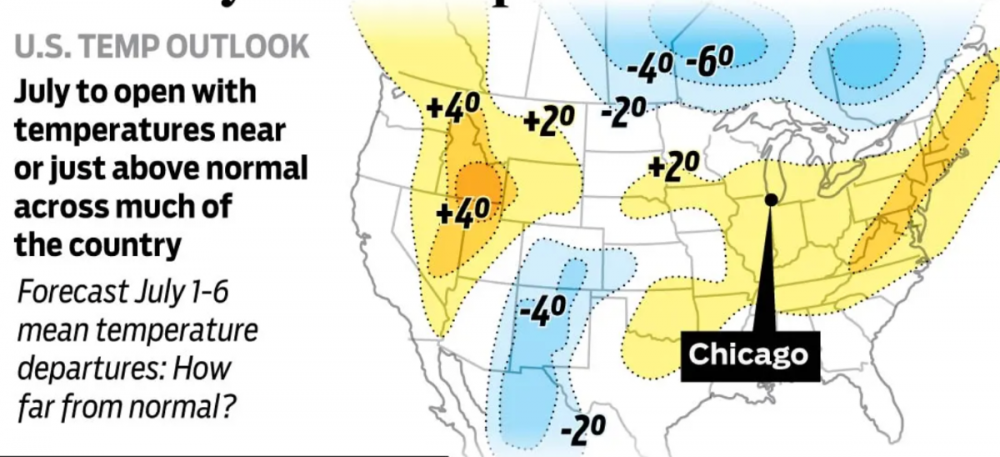
All in all, our Nation should enjoy seasonal temps for the big Holiday weekend...except for TX/OK, no Big Heat but there are some nice pockets of BN temps, especially for the Intermountain & West/4 corners region where it's been a bonafide Monsoon season this year. How many years in a row have we seen Cali/OR/WA baking in the Heat during the 4th of July? It's nice to see those folks enjoying some cooler wx. The Yoopers look rather chilly! I'm sure the icy water of Lake Superior won't help. Some difference between the EPS/GEFS were the strongest convection sets up over the Holiday weekend but a clear signal is showing it will generally be from I-80 on south.

 3 points
 -
Hasn't it been nice? It was a wonderful day yesterday with daytime temps mostly in the mid/upper 70's, comfy DP's and a stiff NW breeze. Man, I could get used to this. This coming week is suggesting more of the same till a brief spike in temps on Thu before a CF sweeps through on Fri.
 3 points
 -
Perfect out here this evening. 60s and clear with a slight NW breeze. No humidity. Almost fall like. Busy day but was still able to get burgers, hotdogs and sweetcorn on the Weber. Got the hammock set up in the backyard finally as well. Bit late but will be nice to relax in on the cooler days and during the fall3 points
-
79 here! Down 12 degrees in 3 hours.2 points


This leaderboard is set to Vancouver/GMT-07:00