
Leaderboard


Popular Content
Showing content with the highest reputation on 01/18/23 in all areas
-
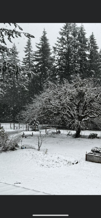
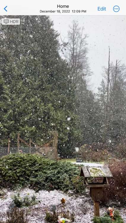
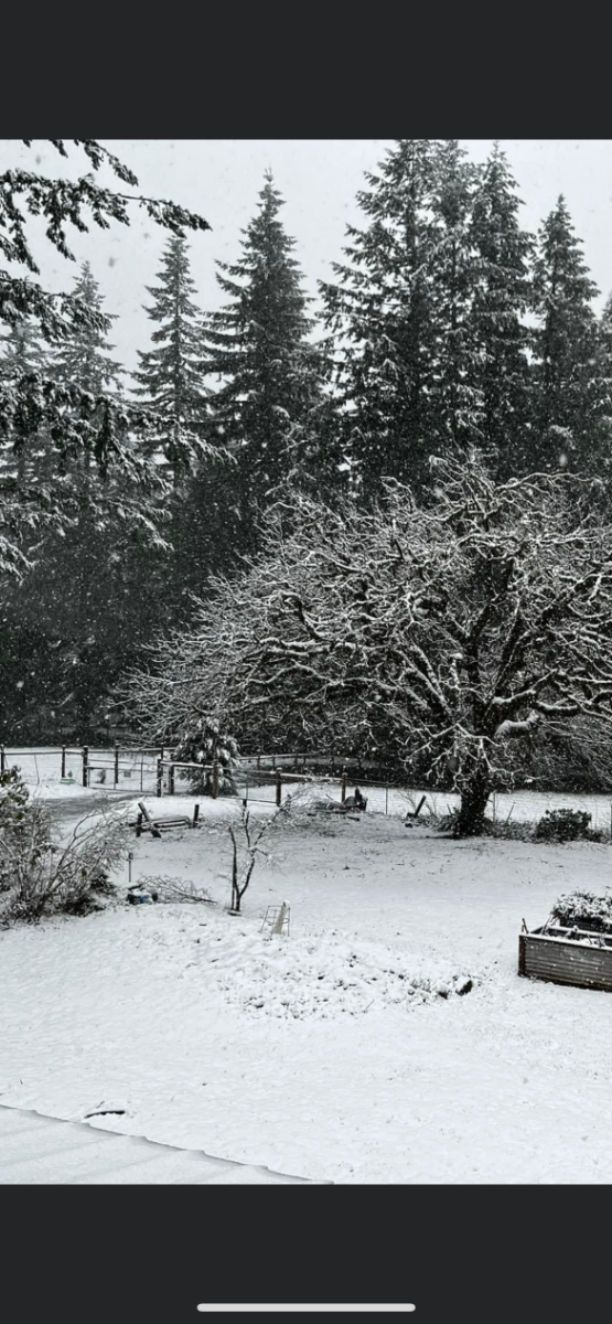
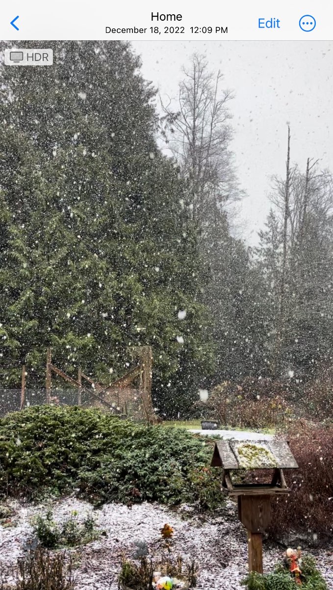
Snowing at my place. We won’t get skunked this month.
 12 points
 -
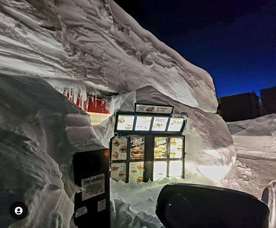
Somebody posted this picture of the Carl's Jr drive though in Mammoth lakes. lol
 11 points
 -
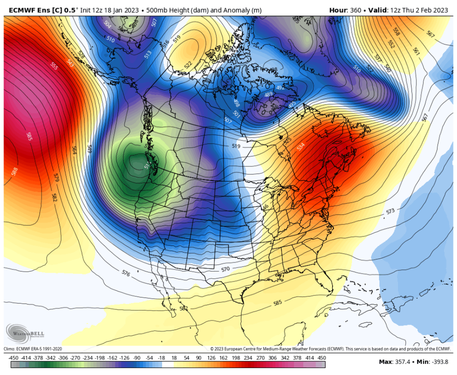
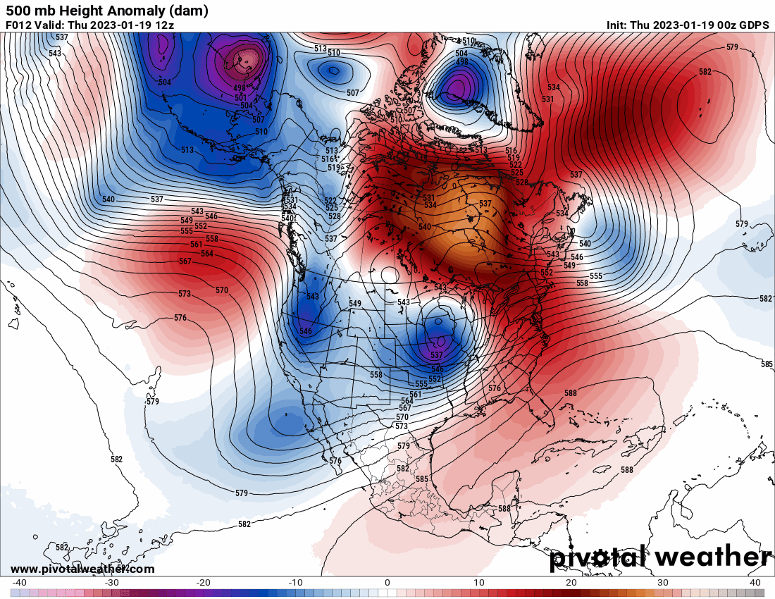
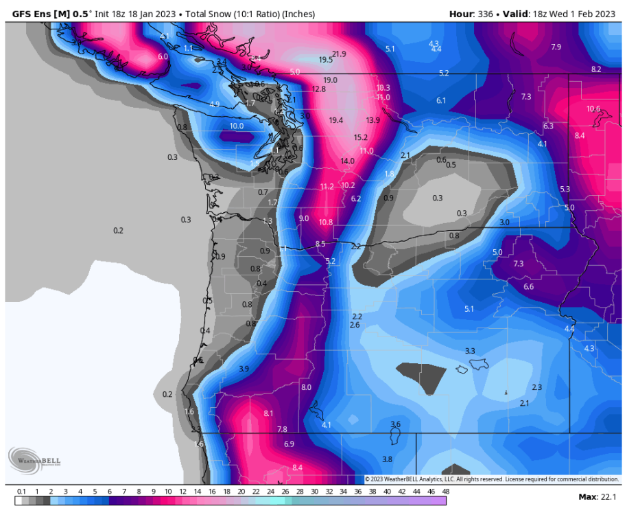
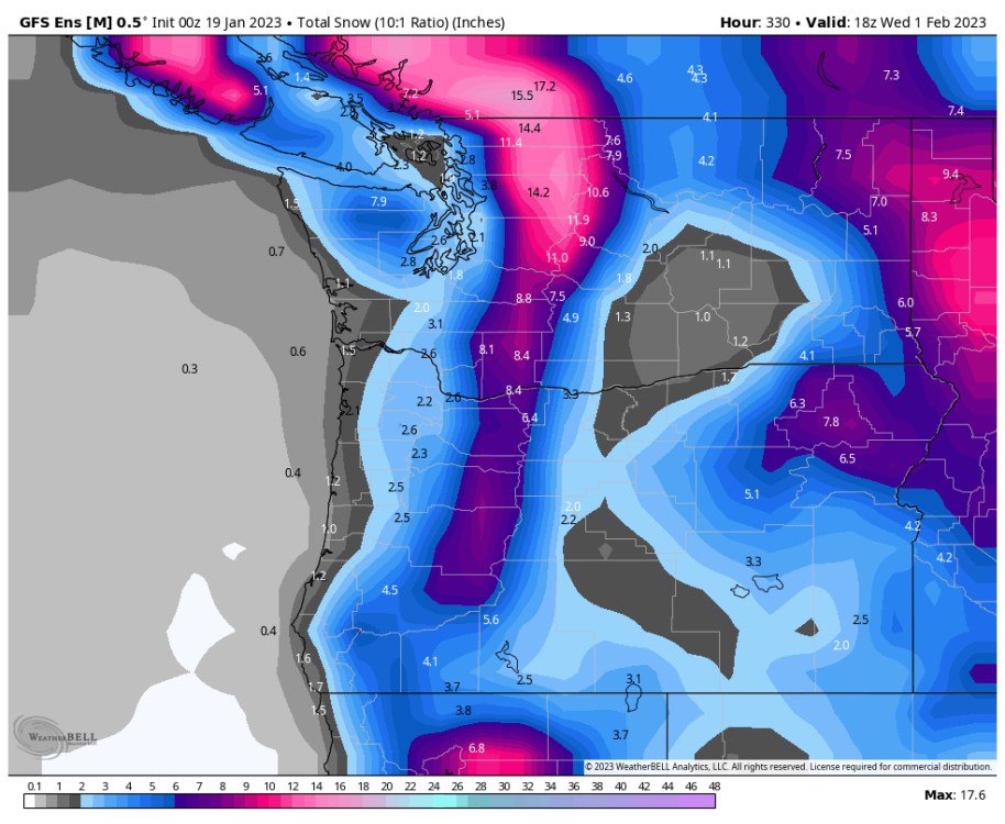
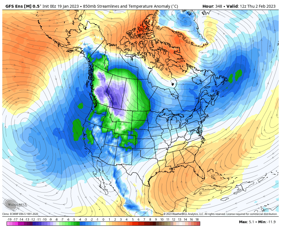
End of the control run just for fun... agrees on the GOA ridging.
 10 points
 -
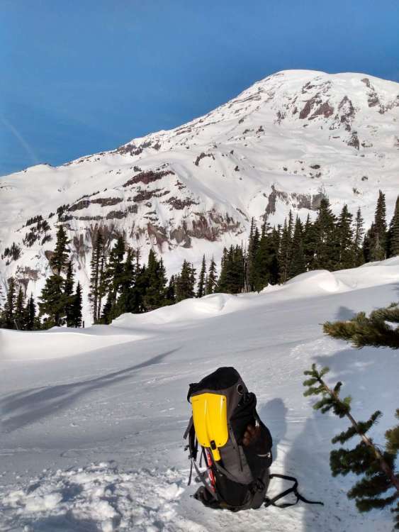
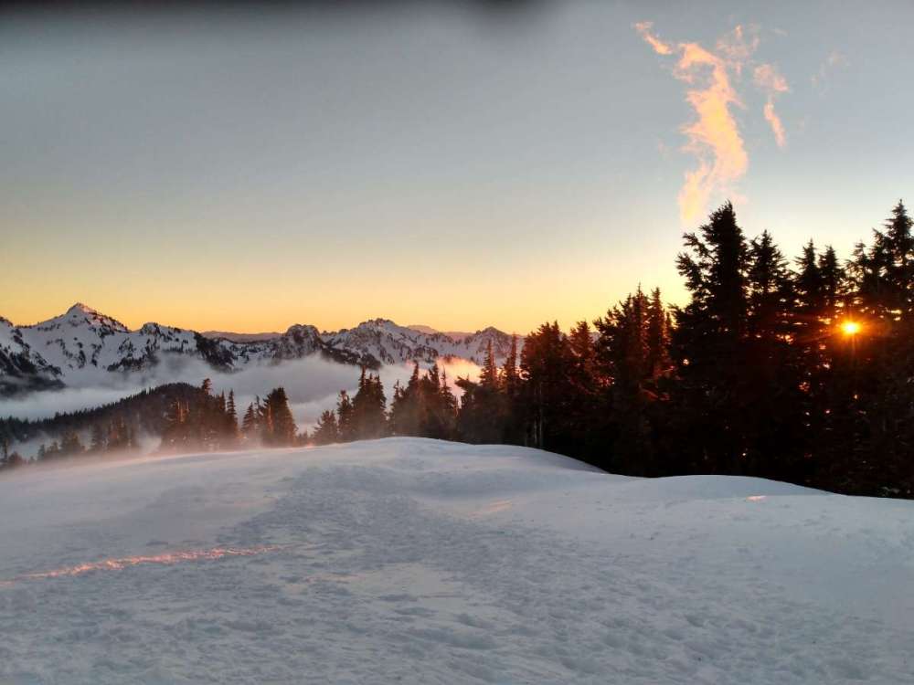
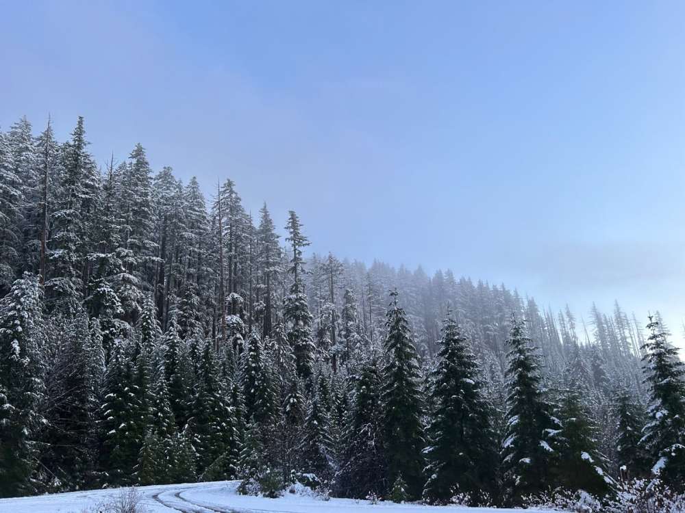
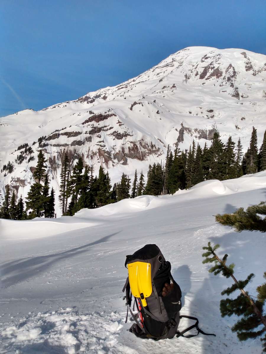
Two years ago today I was camping near Paradise at Mt. Rainier. Highly recommended for snow-lovers + you get the place to yourself after all the day-trippers leave.
 9 points
 -
No school again tomorrow for us. Just cleared the driveway. Most snow I can remember clearing since the Feb. 1st Blizzard of 2016. Law enforcement reports of 12” or more. That seems right to me, but the wind is also causing some blowing and drifting. Might get to 14”. Accuweather predicted this amount first several days ago with 10-15”.9 points
-
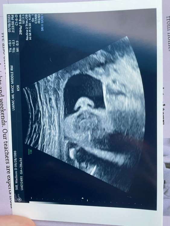
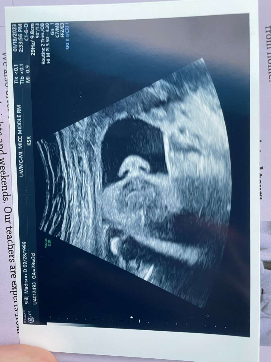
Just got out of doc apt and the baby had 10 weeks left. Any analogs?
 8 points
 -
My wish for humanity is to love their fellow man/woman as much as Tim loves posting the QPF 10-Day Anomaly map when it shows red for the PNW.8 points
-
12Z EPS is significantly improved after 300 hours compared to the 00Z run.8 points
-
Operational GFS continues to diverge from the GEFS/EPS in the long range with the more zonal pattern. Suspect it’s wrong but we’ll see. There is often a degradation of model skill ahead of/during SSW events as dynamic trop/strat coupling is difficult to simulate, and many of the mechanisms are still poorly understood.8 points
-
I told my entire extended family that it’s coming
 7 points
 -
7 points
-
00z GEM full run
 7 points
 -
Sounds like some people may not have seen this. Yuge improvmenty from previous runs.7 points
-
First pic from the neighbor. 2nd pic from Mary s Peak. Wasn’t expecting anything really.
 7 points
 -
The only reason people aren't freaking out yet is because of a lack of pretty colors on the operational runs. Funnily enough, if ensemble support remained unchanged while operational runs started showing Arctic fun again, the whole big picture wouldn't be all that different, but we'd have forty new pages on this thread within an hour.7 points
-
It is very clearly and obviously coming. Ensemble support and climo indicators are so strongly consistent and bullish that I'd bet real money.7 points
-
This video doesn’t do it justice for how hard it is snowing. IMG_0988.MOV7 points
-
Good luck to all the snow lovers in the path of today's storm. We'll enjoy our rain here in KC. Better than nothing!!! Moisture is always a good thing....7 points
-
Sitting in a hotel room in Barstow, CA (What a craphole). Heading to Flagstaff in the morning by way of Grand Canyon if it reopens after the snows of the past couple days. Looks pretty heavy over there. Driving my daughter's car out to Missouri where her husband is stationed in the Army. Hoping for no eventful weather on I 40 east of Flagstaff.6 points
-
I have an album on my phone called “snow pics” that has 1070 photos/videos. Goes back as early as November 3rd 2017. Probably a lot more than I need but it’s really cool just cataloging events from start to finish.6 points
-
The 12z EPS was quite good actually. -3 PNA by the end.6 points
-
One month ago today it was beginning!
 6 points
 -
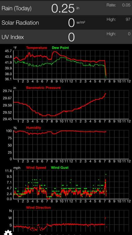
It is really coming down, with strong north winds. It is a much drier snow. All of my work clearing the driveway and sidewalks is now being covered back up. Forecast went from virtually nothing to now possibly up to 3”. If that occurs, we probably get over 15” or a little more. This is a storm we’ll remember for a long time.6 points
-
Just need to beef up the trough and ridge on the GEFS.6 points
-
It’s been a crazy day here. I seen snowfall rates of one to 2 inches an hour for a solid four hours. Just when I thought the dry air would win out, we now have switched back over to heavy snow. roughly eye balling 5” here and hoping to continue to add to the amount. Hastings seem to think so. They had a great disco today. Glad you did well! Elsewhere, likely looking at another 1-3hr of hvy snow for most areas between Hwy 6 and Hwy 92. By 6-7PM, the best snw accums will have shifted to areas along and N of Hwy 92 where another 3-4" will be possible. Areas along I-80 can expect about another 1-2". When all is said and done, based on current reports and ideas outlined above...think a significant portion of the CWA along and north of a line from HDE to GRI to OLU will have 12-18" of snow, perhaps higher in the ODX area. Even Hastings, which was essentially snow free thru noon, may wind up with 10-12", which would be very impressive. No other way to put it besides saying this is one of the most intense bursts of snow this forecaster has experienced in this area - particularly in terms of snow rates AND duration of high snow rates. IMG_2335.MOV6 points
-
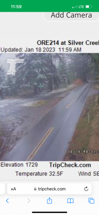
About an hour ago through Silver Falls State Park. 528 line strikes again. IMG_1137.MOV6 points
-
Beautiful. EPS has way better ridging.6 points
-
IMG_2332.MOV Finally transitioned over to snow about 12:45! That was something to see. We slowly went from graupel and ice pellets, with flakes slowly mixing in. Then boom, flakes got huge and it's just puking snow! Big old fat flakes falling.6 points
-
Slight ensembles improvement on the 6z
 6 points
 -
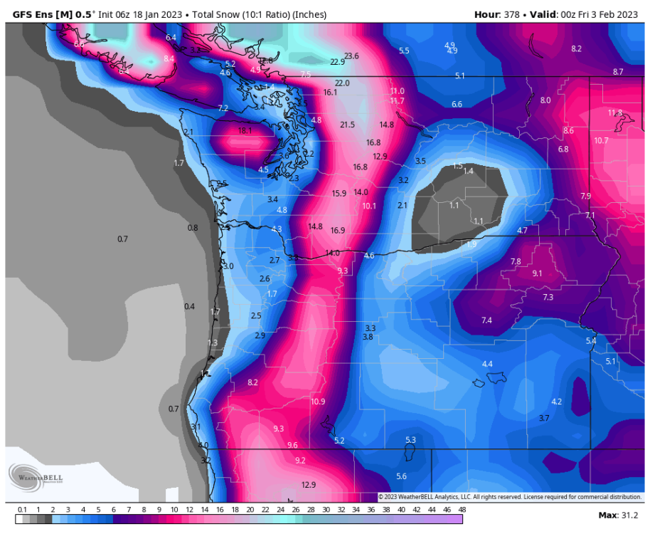
For those that have been around the block a few times- here's Instant Wx Maps snowfall (I like to compare it to Pivotal for old times sake for Instant WX maps used to be the gold standard and want to compare and contrast) Impressive in C.NE!!!
 6 points
 -
Another way to put in perspective the GEFS's massive switch.5 points
-
It's been confusing to me. They talk about an upgrade, but when you read about it, all they are doing is replacing the power components so that it is less likely to go out of service. Yes, that's very important, but when it is back online, it will be the same radar as before. So not an upgrade in performance, more of an upgrade in reliability.5 points
-
Significant improvement on the GEFS
 5 points
 -
Strat warming has finally begun.5 points
-
Much better GFS run tonight. This is starting to come together finally.5 points
-
I swear you have more snow pics than a 14 year old girl has IG selfies.5 points
-
This C-Zone is dropping the temps pretty impressively. 18/90 junction is down to 33 now. That's just about 1000 feet.5 points
-
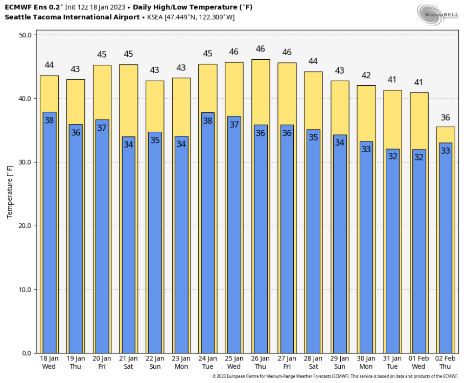
Down to 36! This is a good one
 5 points
 -
Some of the biggest flakes this season coming down in Cedar Falls.5 points
-
I ride or die with 384 GFS operational maps.5 points
-
Been on here for 5 years but never comment however I enjoy all of your posts on weather. Living in Omaha as a weather enthusiast could be the most depressing thing ever. Today was a complete bust! It looked very promising for an hour or so this morning but flipped quick and dry air killed everything.5 points
-
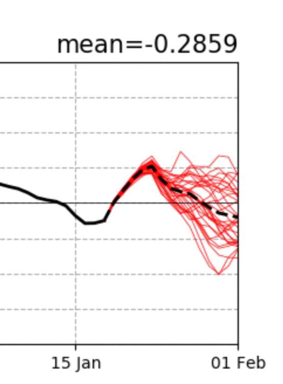
Definite downward turn on the EPS meteogram.
 5 points
 -
OK. I guess 850s tell the story here then?
.thumb.png.0a5b65725f79c128f02fe539666330e3.png)
.thumb.png.6ce6b0c4365c00599b19d02560002232.png) 5 points
5 points -
Day 12 vs last night
.thumb.png.e2da902add33737170711d5e91d0f81f.png)
.thumb.png.6227e071bf0452bc3c28aa5ba9217cac.png) 5 points
5 points -
Quite the spread on the fuzz this morning.
 5 points
 -
6z GEFS Day 8-16. I believe this was the coldest run thus far for the Gorge and eastern Washington. Pretty decent improvements. 12z ECMWF in 3 hours 45 minutes
.thumb.gif.aabc4952c0ece0cbe3693b27c2adbb49.gif)
.thumb.gif.7a84512887712d79edc637355782f6b4.gif) 5 points
5 points -
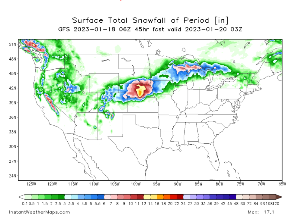
Well, did the GFS/GEFS just score a coupe for the weekend appetizer?? You win some, you loose some...but the King just caved per the GFS on this system and it should fill up the snow starved Plains/MW/Lower Lakes region with some snowfall. while the NFL Playoff season begins! Not bad timing I'd say?? Alright, alright, alright...let's see what we have going on in the model world for the Big Dog potential later next week. Last night's 0z EPS starting to turn the corner and veering away from and EC storm and more so towards my idea of a deep GOM Low that cuts up thru the S MW/OHV region and will possibly bomb out somewhere over this region. My gut tells me that with the -NAO dipping during this period along with a tanking -EPO, the teleconnections favor a deepening/strengthening storm coming out of the Deep S Plains/TX/OK region and cutting NNE up thru the OHV. Let's take a look at the ensembles... 0z EPS...chances of snow are on the rise for our KC peeps and down in OKIE land @Iceresistance @Black Hole @OKwx2k4 What an impressive NE PAC ridge that drives the energy deep into the southern states and this allows for a GOM SLP to form and literally track almost due north. I like the grouping of the ensembles coming more into more focus for a major storm to cut up the OHV or S MW region. Lot's of time to pin down the details but this system has BOMB potential similar to what "coulda", or rather, "shoulda" happened during the Christmas storm but that eventually bombed out over Ontario Canada. Not this time, however, due to the key blocks setting up downstream and upstream. Nevertheless, this storm has been on my calendar for a long time and it's nice to see the Global Op's starting to sniff it out. 0z Euro Control....

 5 points


.png.65748d8276e5c31fe729b1db06a6ddcf.png)


.png.43f704c172fa9ae7ffc54f44a4f86790.png)
.png.9dd0f01d290cf64490689e5ca24f0336.png)
.png.d15c279ba6ce993e628150842aa31fea.png)
.png.de961f52476c150f0ded50c0acb127b5.png)

.gif.9ba9e2f45e15466287216dfc7f3bba7a.gif)
.gif.eddd7d6219573117ce732050d4a9e892.gif)


This leaderboard is set to Vancouver/GMT-07:00