
Leaderboard


Popular Content
Showing content with the highest reputation on 11/04/22 in all areas
-
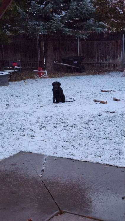
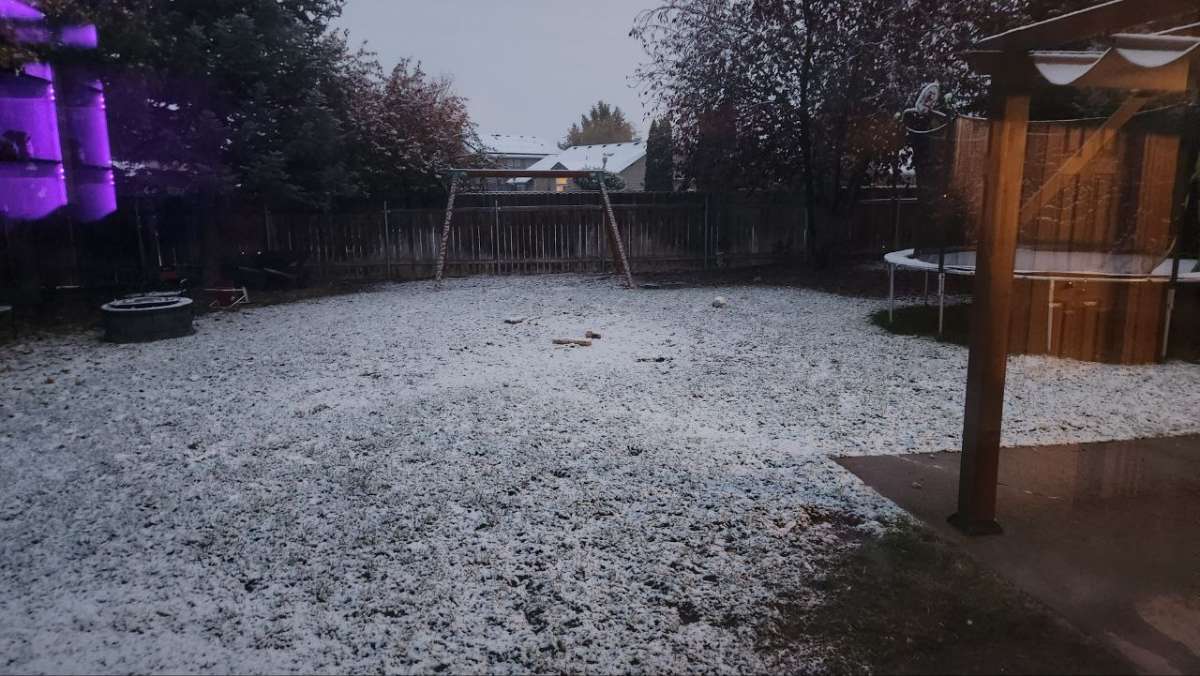
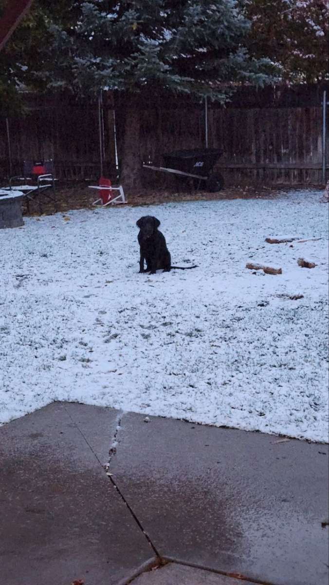
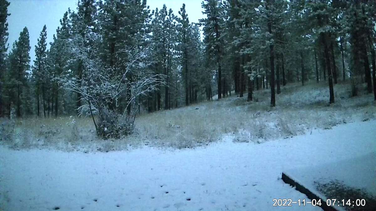
First dusting of snow in Kuna ID! Currently 34 and snowing.

 19 points
 -
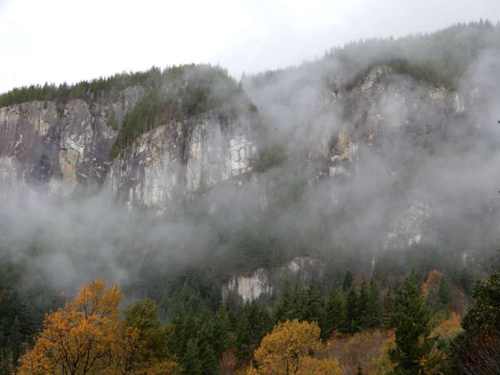
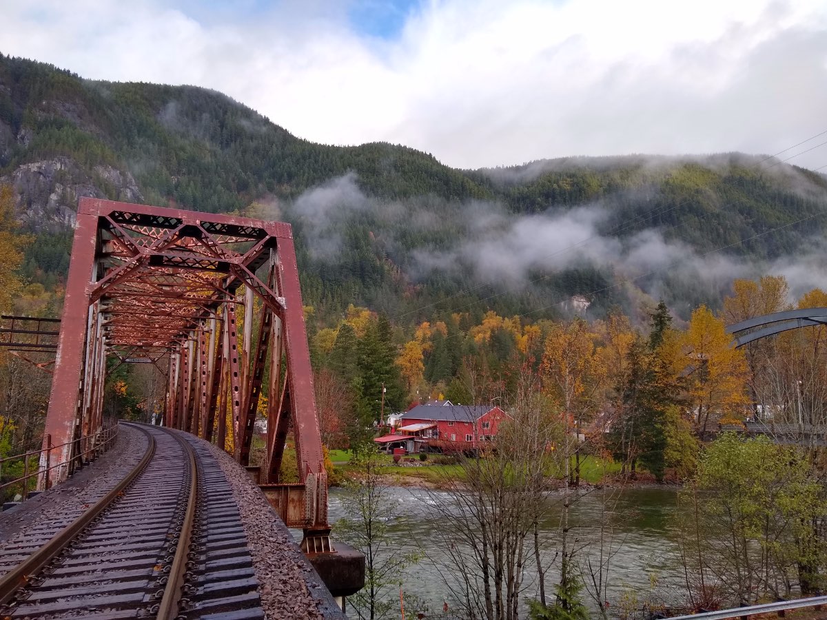
Whatever I want! lol I just go places for no reason when I have days off. I like taking pictures. Maybe this pic is more colorful.
 18 points
 -
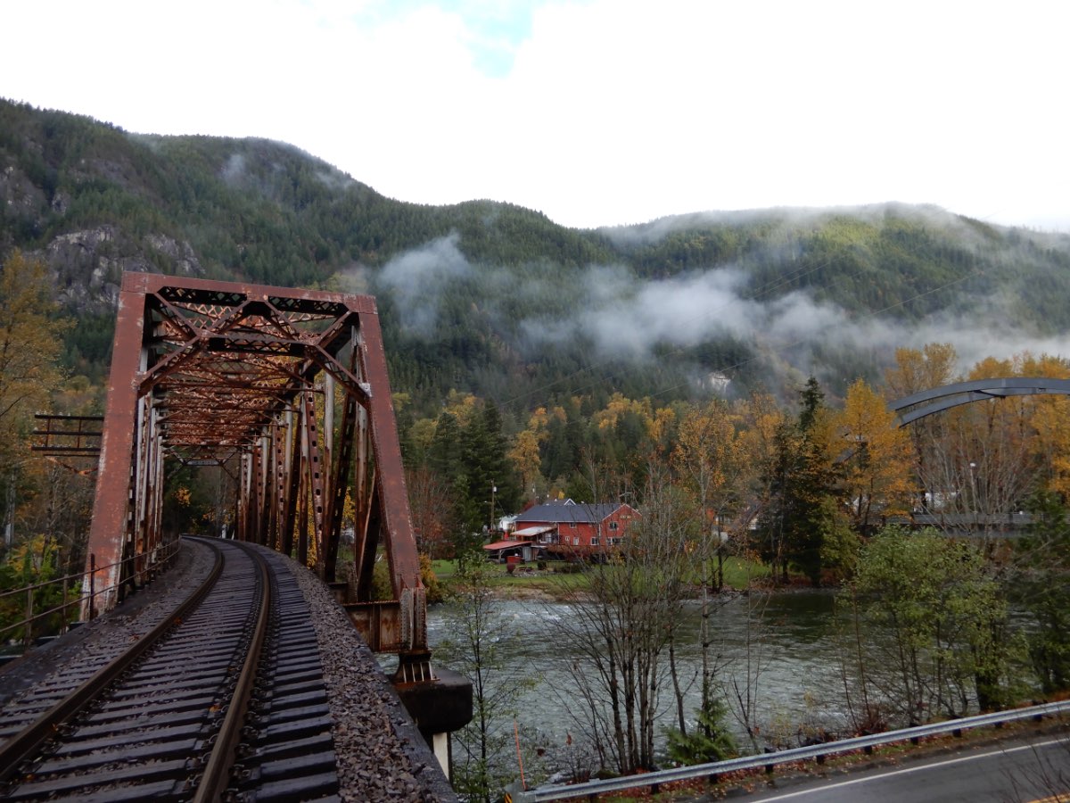
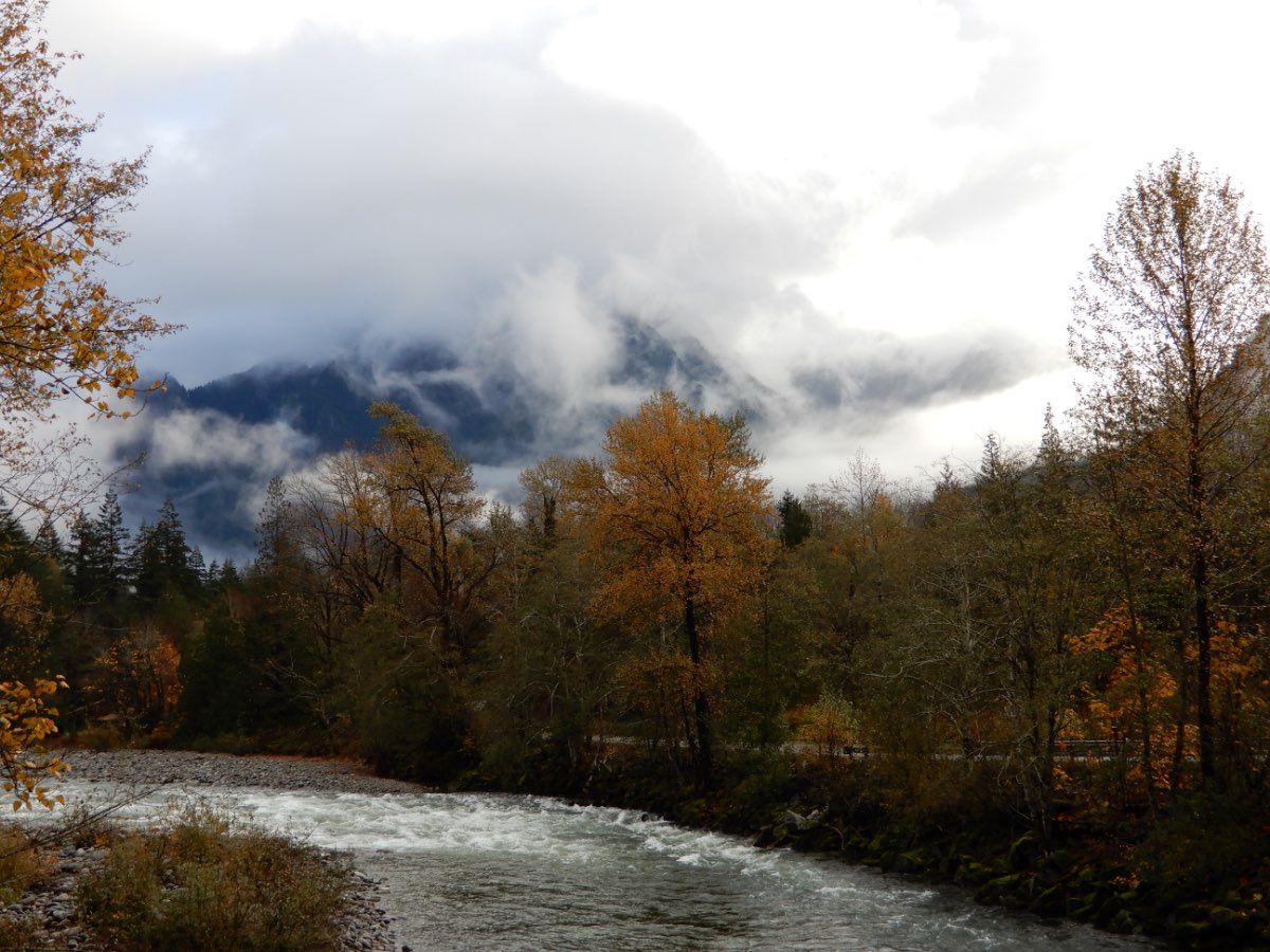
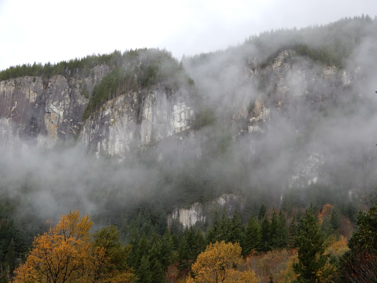
Mossman year 2077.
 12 points
 -
Sorry everyone, I'm going to have to go to save the batteries on my phone. Unless something major happens I probably won't be on. Hopefully we can laugh this off tomorrow and everything will be okay. I will check all quotes and responses that people have left tomorrow. I know there are several notifications I got but I can't see them all on my phone. Good night.11 points
-
Wet. It's wet! I love it!


 11 points
 -
Moderate Snow, 32 degrees looks like about 1/2" on the ground and 1" on elevated surfaces11 points
-
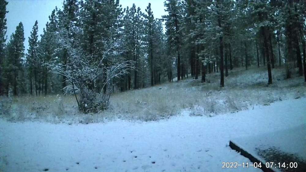
Good morning! Live look from the cabin cam just outside Winthrop in the beautiful Methow Valley. Looking forward to heading over Saturday for the expected big dump on Sunday.
 11 points
 -
Property in Eastern Washington is getting nuked. The flow is perfect right now. Looks like about 6 inches so far.11 points
-
Wow the house is shaking!!9 points
-
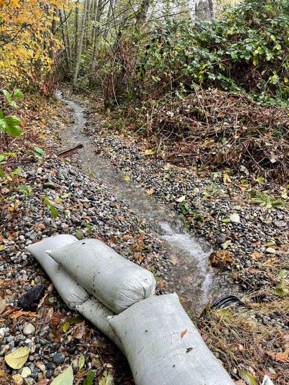
Up to 3” on the day! And the main drainage is doing great!
 9 points
 -
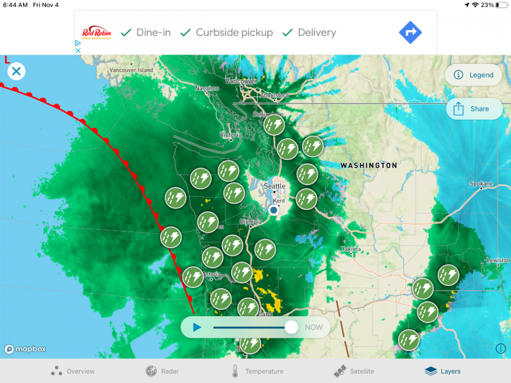
This is looking like a serious snow storm for north east WA. Nws predicting 10-20 inches above 3k feet in Okanagan highlands. Heavy duty.9 points
-
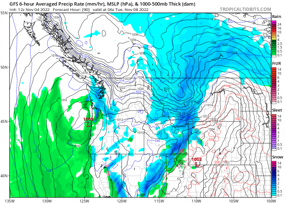
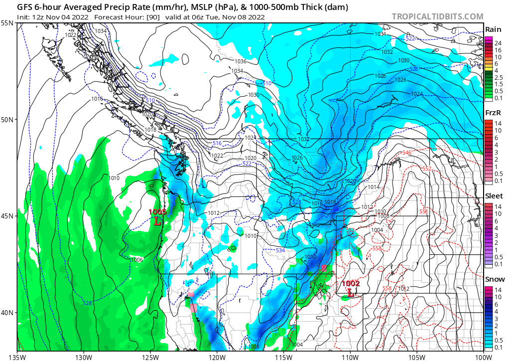
On the 12z GFS, this is probably the most realistic window to see some snow in the western lowlands. Monday night, any decent precip that is still around will probably be at least snow in the air. Airmass is cold enough by then and we have offshore flow as the trough continues to push south. Soundings around PDX look good GEM still dries us out by this point. Hopefully models trend towards throwing in a bit more precip.9 points
-
Enough of a shift north for Puget sound to see snow Monday night.
 9 points
 -
Stevens Pass [Chelan Co, WA] PUBLIC reports SNOW of 11.00 INCH at 2:00 AM PDT -- 11 INCHES OF NEW SNOW AND STILL SNOWING AS OF 2AM. SNOW STARTED A BIT AFTER 4PM THURSDAY NOV 3RD.9 points
-
What an awesome stormy Fall day! More please!8 points
-
Uh, pretty sure we just had about 10-12 weeks of unabated historic torching and ridging. We're not exactly due for a huge pattern flip again right away.8 points
-
The NAM 00z shows about 2 inches of snow for Seattle on Monday night at temps that are below freezing8 points
-
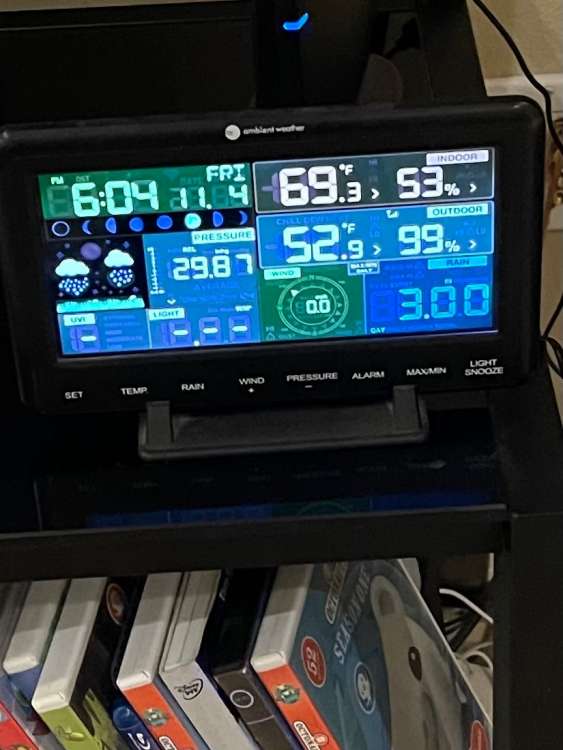
1.79" for the day so far. My all time record is 2.54"...8 points
-
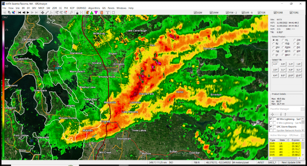
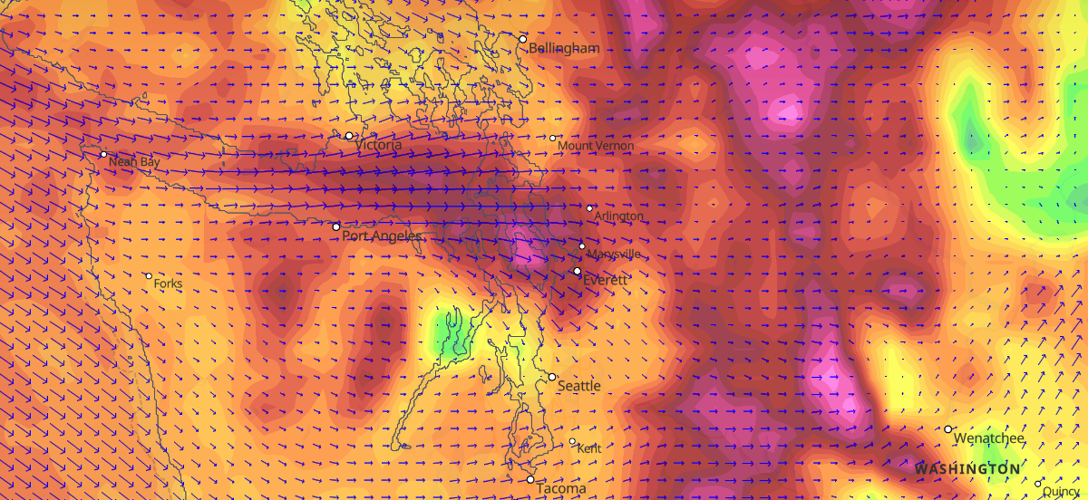
Everett is currently seeing 60+ mph winds. Coastal locations in Snohomish and Island County are varying around 50-70mph winds that have just come out of nowhere.
 7 points
 -
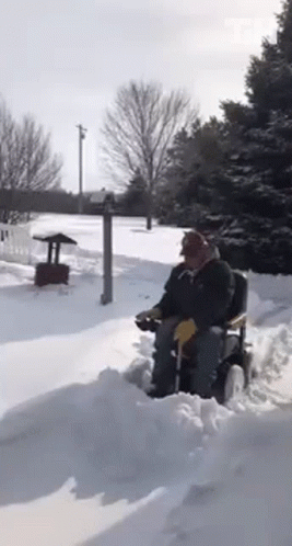
This looks nice.
 7 points
 -
Tacoma Narrows just gusted to 56.7 points
-
12z GFS brings 850mb temps of -8 to Portland7 points
-
Euro trying at 192 hours.7 points
-
Wow 12z gfs buries Shawnigan Lake on Sunday and into Monday. Friendly trendly.7 points
-
Video from my mother in Nampa. Looks like a pretty good chunk of moisture coming through but will turn to rain soon. Sounds pretty wet in the video. VID-20221104-WA0001.mp47 points
-
Just heard a massive wind blast and a very large thud. No idea what fell over.... One more quick little update, I no longer see any lights on the landmass where the Tulalip reservation is. There's a couple different communities there and they appear to all be black now. Marysville is also all black from what I can see. And downtown Everett is black but the Navy base and port has power. But it looks like the residential areas are black.6 points
-
Thank you Cloud and others for the updates. I really appreciate them. I am really curious about what the wind blasts look like on that model tomorrow that you were showing TT_SEA. Hopefully If I have power tomorrow I look forward to reading through all this. Be safe everyone.6 points
-
What a crazy active Fall it has been!6 points
-
I was recording and my power went out. I'll upload the video tomorrow. Everything's black. I watched the whole city go dark... It is literally the strongest winds I have ever seen here. And it's constant. I just can't get over that it's amazing.6 points
-
Basically when I was a student at UW, I was part of a group project in a non-atmospheric sciences class. We reached out to atmospheric sciences professors to ask them some questions via email about the convergence zone and pissed them off. Mass was the only one who replied and chewed us out for emailing everyone when he was the expert and all we had to do was consult his book. Fun times. Yeah, it wasn't smart, but we weren't hounding them and they all ignored the email. Except Mass probably didn't like the injury to his ego in that we asked other people too and not his expertise and we didn't get everything we needed to know from his book. Sorry it's not a better story. I can make up another if you would prefer. Many years later it just makes me think about how no matter how smart he is, how arrogant and petty he is too. Like dude, we were stupid college kids. Just hit delete.6 points
-
No one will see anything because it's so dark, but you'll hear the wind! It's insane! Probably the strongest I've seen or heard ever living here! The flag on the flag pole is stretched out like a tablecloth and the trees are completely bent. I've seen gusts here, but never nonstop like this. The power of nature is amazing. I am in a protected spot in this video. 1719398028_2022-11-0422_07_39.mp46 points
-
Winds have suddenly picked up and are extremely powerful. Leaves and branches blowing everywhere! Where's my lantern... and teddy bear... I wish I could share video and pics with you all. The trees are suddenly sideways and blowing nonstop, not just gusts. It's too dark for my camera to pick up.6 points
-
You’re getting close to a ban with statements like these6 points
-
Windy as a mofo here.6 points
-
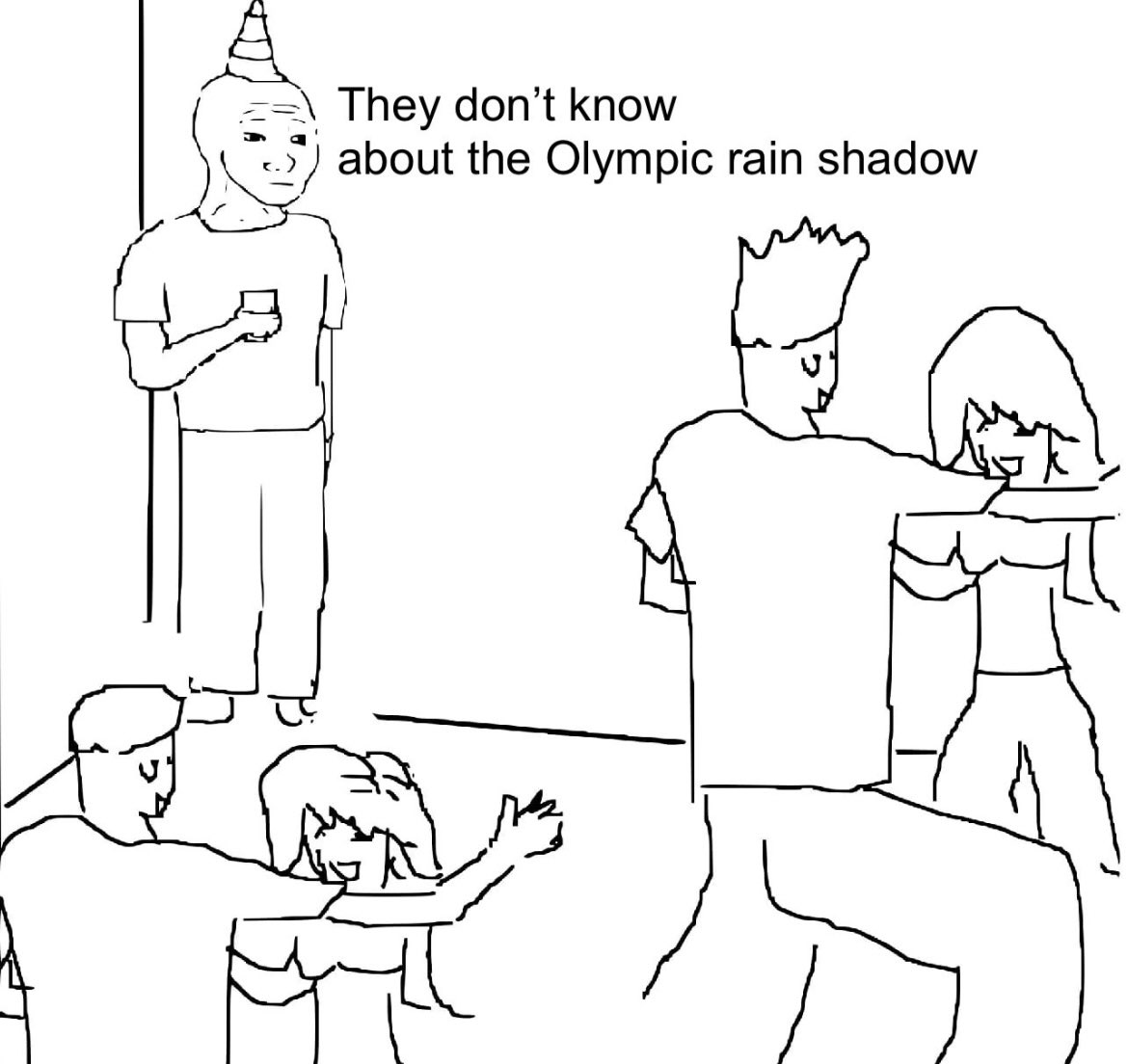
The coastal mountains west of Eugene have a very low elevation compared to most of the PNW. No rain shadowing for us.6 points
-
SEA clocked a 51mph gust.6 points
-
Judah follows this guy of course6 points
-
CMC last three runs trend. A few more notches and things will get more interesting,
.thumb.gif.e6d8fc3c898c06f5619b639df91290ad.gif) 6 points
6 points -
The MJO is on the move through the cold phases of 7 and 8, then it will head into the null phase. What happens after that will be huge as we go into Thanksgiving weekend. The JMA is indicating a possible move into phase 5 while the GFS and Euro show a move into the Winter killer phase 6. Good news with the Euro Ext is it quickly moves back into phase 7 before the end of the month. GFS Ext is even better. It's good to see the MJO playing in the cold phases6 points
-
Might work in the yard in a bit ,… ..what rain ?
 6 points
 -
I love reading the Spokane AFD. The arctic front marches southward sounds good to me. Spokane will quickly change back over to snow somewhere between 7-10PM PST Sunday. Pullman will change back to snow somewhere between 8PM Sunday-12AM PST Monday. Locations in SE WA will change a few hours later as the arctic front continues to march south.6 points
-
Snowing in leavenworth at least! A true winter wonderland. Congrats Brian! https://youtu.be/lim5hCR59kw6 points
-
EPS a touch colder 850s, but definitely colder surface temps. Let's keep that going. Looking at the GFS/ECMWF next 24 hours there are two lobes to watch. The first is currently near the southeast AK coast, and the main player is near Barrow. It's that secondary lobe that is forecast to drop south off Alaska that doesn't allow the brunt of arctic air to dig over us. I'll watch IR Loop to see if that slides any further east. If I have to I'll make that bastard dig closer to the BC coast.6 points
-
It’s freaky how dead calm it is outside now at my location. Just flipped the switch to “wind off”5 points
-
This is one of the top surges down the Strait I've ever seen. There was one back in the 90s when I was living in Woodinville that might have been about the same, but this could well be worse.5 points
-
The GFS and ECMWF Op sure turn splitty after about Day 5.5 ..... I hope not. Maybe we do see that and weak systems for 7-10 days before renewed blocking and a MASSIVE BITTER BLAST!5 points


.thumb.jpeg.e3014abf99ef08a9f9ac2c0cd31b485b.jpeg)


.gif.6eeac55541bbe9c52d716263fc36e87d.gif)


This leaderboard is set to Vancouver/GMT-07:00