
Leaderboard
.thumb.jpeg.e3014abf99ef08a9f9ac2c0cd31b485b.jpeg)


Popular Content
Showing content with the highest reputation on 11/07/20 in all areas
-
Not very often we get convergence like this over here. It usually slides east.6 points
-
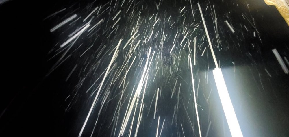
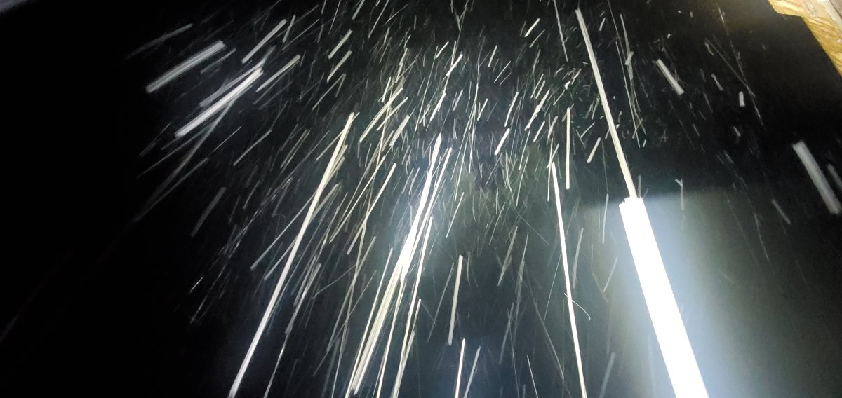
34.4 and all snow. Cars are turning white! Wtf!!!
 6 points
 -
5 points
-
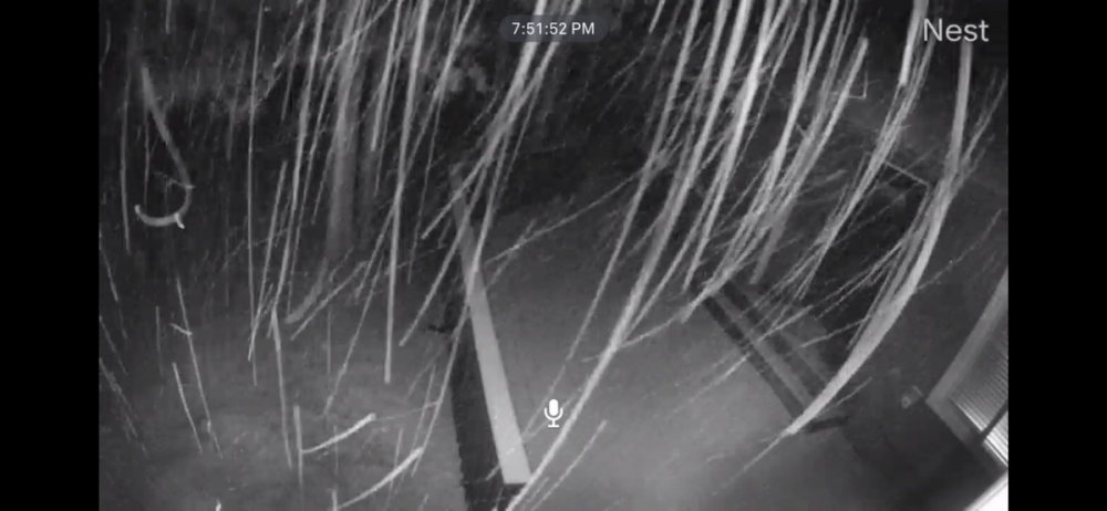
Snowing strings in La pine as well My brothers place
 5 points
 -
To top it off the wind is gusting from the north about 25mph. 33.7 and sticking snow.5 points
-
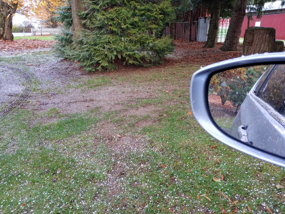
Hail in California today too.5 points
-
Uhhh it's trying to snow here. Down to 36.1 and can now see flakes floating down with the rain.5 points
-
Ha funny you say that I just checked and I have my first positive splat test of the season. 37 degrees and a definite mix here.5 points
-
What the...5 points
-
35.3 and more snow than rain.4 points
-
Wow just had thunder here!! Surprised me.4 points
-
Whatcom special WOW4 points
-
Anyone get any sleet today? Temp down to 39 now and heavy sleet is coming down. Very weird.4 points
-
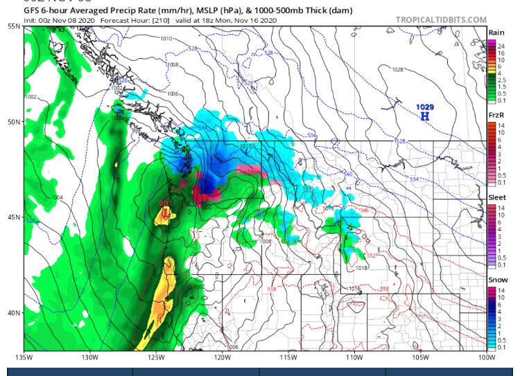
The pattern for the next 10 days on the GFS is amazing for this time of year. Cool and wet with plenty of mountain snow. Great start to the season and then we can worry about low elevation events later. (I like snow)4 points
-
Strikingly good agreement with all models in that Day 6-7 time frame to spin up a powerhouse major low around 956-967mb near Vancouver Island. This is fueled by an incredible 180kt+ jet. Very important the next few days to see if the jet is suppressed further south which could put us at risk for a major regional south wind storm. We are long overdue for a big one as we've dodged the bullet. This Fall may be it. 6z GFS in 1 hour 45 minutes4 points
-
Nov 2006 repeat! (Nov 29, 2006)3 points
-
Fun night to look around all the pass cams! Snowy night in the mountains.3 points
-
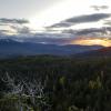
Chilly out!3 points
-
Models nailed it! said no one. Ya gotta love surprises! LeT iT SnoW!!!!3 points
-
Arctic front!3 points
-
I really feel all of us will get a good shot of snow this month.3 points
-
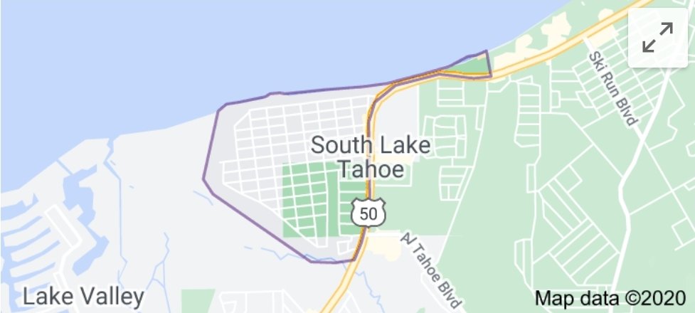
1889-1890 was thought the be the lowest at -2.4C That winter was called the white death in Lake Tahoe/Reno area. Reno's all time coldest temp was that winter. Here in my neighborhood on south shore near the water we had a 15' snowpack on the ground and it collapsed the 3 story resort hotel down the street from me.3 points
-
Temp dropped pretty quick with the precipitation. My car thermometer, which is.....hardly scientific. But fell from 42 to 38 in about two minutes right when the rain started to turn chunky.3 points
-
Actually, more like soft hail now.
 3 points
 -
Upper 30s, but some definite frozen precipitation mixing in near Lynden right now.3 points
-
Photoshopped? If not, that's a big change. Mega strong Nina. 1949-50 here we go!!!!!3 points
-
This reminds me of the chilly trough we had the first weekend of November 2011. A similar trough dropped in two weeks later and was cold enough to deliver 6.5” of wet snow. It’s the only significant snow I’ve had here in November.3 points
-
"Arctic front" just rolled through here with some light showers. Obviously too warm for snow, but kind of interesting to watch now at the edge of it with the clouds it induced piling against the Olympics to the south. Currently 43F.3 points
-
Wow. Incredible storm.3 points
-
Again, looking at some early openings for Meadows, Hoodoo, Bachelor, etc. This is wonderful!!3 points
-
There were more flurries earlier but again they didn't stick. 34 and overcast here.3 points
-
I'm wondering if this might end up being one of the relatively rare winters where we end up with nearly constant moderately below normal temperatures. Ones like 1916-17, 1948-49, 1978-79, and 1992-93 started off a lot like this. If we follow the script of those winters it will stay below normal much of the time and grow progressively colder until something more meaningful happens in December and January. That type of winter usually delivers one or two significant Arctic outbreaks. I'm not saying it will happen, but it bears some resemblance in the early going to winters that play out that way3 points
-
Day 10 One deep trough after another2 points
-
Amazing to see that snow over by Lake Cushman. Went through that area two years ago after our wedding. Beautiful area.2 points
-
Kitsap County special2 points
-
Haha. Its this area for those interested.
 2 points
 -
You will get 49 inches of snow this winter.2 points
-
High of only 43 today. NWS says 39 tomorrow.2 points
-
Had some periods of very heavy showers with massive rain drops. It was incredible. Picked up 0.25" today, not too bad. It's cold!2 points
-
Could see some snow up this way Monday night in Vancouver.2 points
-
I'll do my best! Looks like things will be most epic further north where there is a Blizzard Warning but we should still see some deep accumulations and strong winds!2 points
-
I believe the winds are for later on tonight2 points
-
41 with moderate rain falling. Eugene and Salem hit 32 this morning.2 points
-
I probably get the warmest overnight lows of almost anyone here on the forum. My location is close to the water and lots of times the wind doesn’t die down here either were fairly exposed.2 points
-
Snowmizer’s cabin is going to get completely buried this winter season!!2 points
-
Only got down to 37 this morning.2 points
-
Yeah, Euro weeklies are absolutely garbage. Learned that last month.2 points
-
Sea Ice Index UPDATE After a bit of a delay with the Arctic Sea Ice recovery building more gradually, now over just the past 2 weeks alone we have gained over 2 million square kilometers of ice! I would love to see that abrupt rapid upward trend continue and by late November reach closer to the 1981-2010 average. C'MON!!!!2 points
-
Now it's at 1950. It's a sign!2 points


This leaderboard is set to Vancouver/GMT-07:00