
Leaderboard


Popular Content
Showing content with the highest reputation on 07/21/21 in all areas
-
It's getting cloooooooseeeerrrrr.........4 points
-
Anyone who thinks Jim disappeared because things aren't going his way are wrong... he absolutely loves this type of weather. I am sure he is just taking a break and gearing up for fall.4 points
-
Today will be two minutes and ten seconds SHORTER than yesterday!4 points
-
3 points
-
Just turned it on... looks beautiful!
 3 points
 -
The warmth has in fact been very real and persistent, in spite of a lack of high end heat this month. Pretty elementary level of nuance there.3 points
-
The main takeaway is that July isn’t torching for W. Wa, which is what Jim was predicting. The rest of the month looks reasonable as well. Outside of SEA my area is also running warmer. So strange when SEA is the cool station. I’m thinking we’ll pay for this in August as I could see another heatwave for next month.3 points
-
Seattle is dying.3 points
-
Nice to see a legit summer trough verify. Though of course, would have been nicer to see rain with it.

 3 points
 -
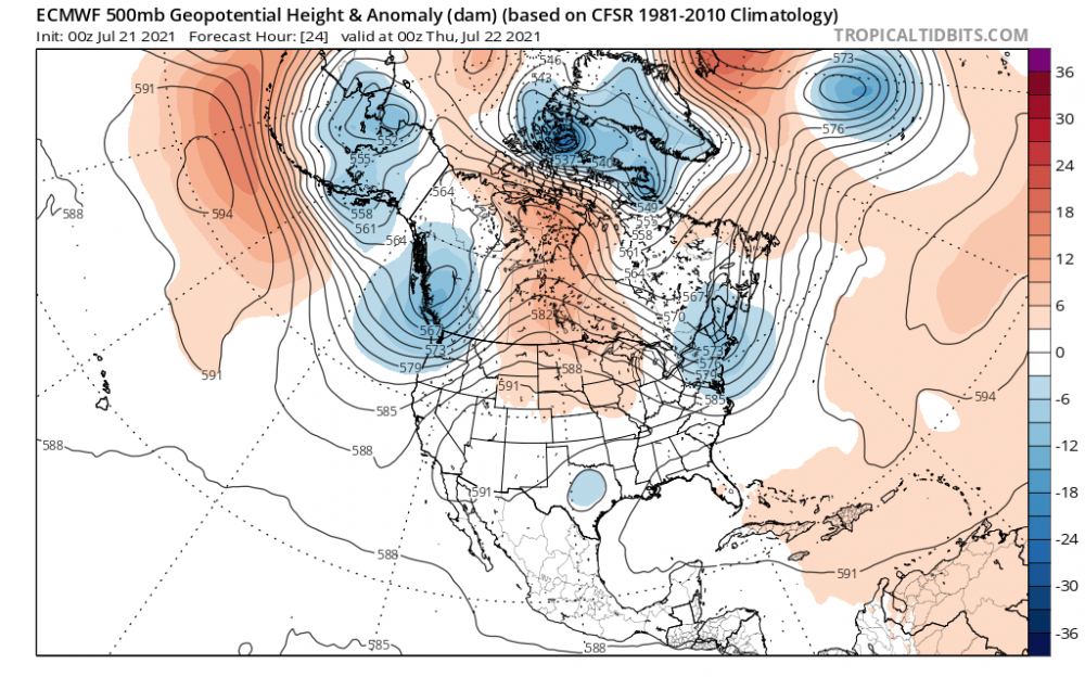
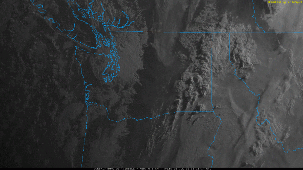
Looks like its mostly clear along the WA coast... with the marine layer focused inland again. The 00Z ECMWF showed today being the last day with the marine layer inland. Very little in the way of low clouds being shown over the next 10 days other than along the coast. That also means the ECMWF cool bias will likely be back after today.
 3 points
 -
This graph shows the July lows below 50 at my station in Vancouver, WA (since 1996). Average is 1.6. For my Battle Ground station the average is 7.7.
 2 points
 -
+2 to +4 is not "very close to normal" lmao2 points
-
Nice to see the smoke scoured out of eastern WA as well with this trough...
.thumb.gif.cdba25c3c792caa2a4f30557bc5b8200.gif) 2 points
2 points -
It’s been a cold July.2 points
-
Looks like a pair of 90+ days on tap this weekend, could easily see that turn into a 3-4 pack.2 points
-
Everyone is always posting about the sun being out, so I figured I'd go the opposite.2 points
-
Excessive heat watch issued for the KC metro. ...EXCESSIVE HEAT WATCH IN EFFECT FROM FRIDAY AFTERNOON THROUGH WEDNESDAY EVENING... * WHAT...Dangerously hot conditions with heat index values up to 105 possible. * WHERE...In Kansas, Leavenworth, Wyandotte and Johnson KS Counties. In Missouri, Platte, Clay and Jackson Counties. * WHEN...From Friday afternoon through Wednesday evening. * IMPACTS...Extreme heat and humidity will significantly increase the potential for heat related illnesses, particularly for those working or participating in outdoor activities. * ADDITIONAL DETAILS...Prolonged period of heat expected. Heat indices near 100 or above expected each day. Additionally, overnight lows expected to remain above 75 degrees each night, leading to minimal relief from2 points
-
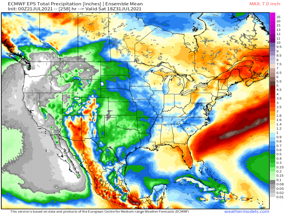
The Heat is ON after today's one day reprieve. Going to enjoy every bit of it bc I think our seasons 1st Heat Advisory could be issued for parts of N IL later this weekend and into next week. As tropical moisture flows into the region along with mature crop, we are in the time of year where we see peak DP's unfortunately. I feel ya for those who live in the agricultural parts of our country, esp in IA. I could see DP's hitting near 80F during this Heat Wave. Yesterday evening as the lake enduced CF swept through, the wild fire smoke made it down to ground level and it smelled like someone was burning a fire next door. I felt like I was up north in the woods of Wisco for a time as it brought back childhood memories. Smoky skies are in the forecast yet again today as there is an Air Quality Alert in place today. Overnight model runs are coming in-line with one another that storms erupt over E NE into the central MW region Sun pm into Mon. "Ring of Fire" pattern fires up during this period and beyond. The EPS, especially, continues to hold steady for next week as the model "sees" this Ring of Fire ignite. Quite the Fuel will be present and could possibly bring some dangerous storms IMHO. The eastern Ag Belt/GL's region in the most ideal place. 0z EPS through months end...
 2 points
 -
In a league where star players constantly pick up and build a super-team to chase titles, Giannis did it the right way. He had the chance to leave Milwaukee but stuck around. Good for him... still only 26.2 points
-
Had some beautiful soothing stratiform rainfall this afternoon thanks to monsoonal moisture. Smoke is gone (for now) and the vegetation was very thankful for the slight reprieve from this forgettable summer.
 2 points
 -
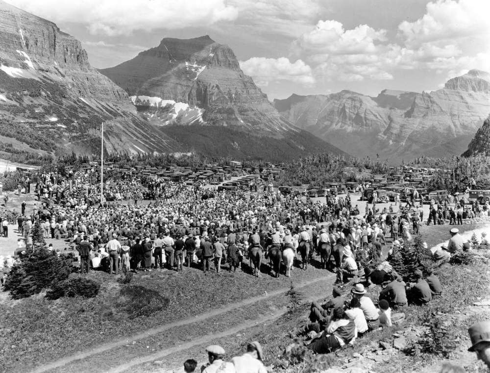
Because I am fascinated with old photos and it pertains to the Mountain West... this photo was taken 88 years ago this week in Glacier National Park on 7/15/1933 at Logan Pass and the opening of the Going-to-the-Sun Road.
 2 points
 -
Quick! We need to tell Robert Felix this! ICE AGE IS A LOCK! We could have very nasty crop failure next spring if we keep having this happen...........All preppers arm yourselves against the city invaders 2022! .............................. The Great Willamette Valley Crop Failure The Movie coming soon to a cinema near you but remain 2m apart from all patrons at all times and wear double masks. We don't want you to breathe one bit during this film since you will die anyways from the crop failure.1 point
-
Salem scored a sub-80 high today. WHOA!1 point
-
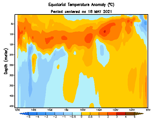
Subsurface cooling really cranking now.
 1 point
 -
Our frigid, merely 2-3F above average July could be in jeopardy.1 point
-
In the not so distant past those would just be regular summer vibes, since lows in the 40s were far from uncanny even at this juncture of the season. And unfortunately today looked to be the last sub 80 day for a long while to come, with still no rain in sight either.1 point
-
As someone who works outside all day, I am not looking forward to Friday and next week1 point
-
Really beautiful day here. 74/51 spread with partly to mostly cloudy skies. Enjoying it considering we are likely barreling toward another major heatwave to close out July due to the simple fact that the west Pacific exists and someone might have sneezed there at some point in the last 18 months.1 point
-
If there’s good news it’s that models seem to be latching onto a strong polar blocking regime late this month into early August. Basically the opposite of late June/early July. Historically speaking, strong polar/greenland blocks don’t usually teleconnect to big heat in the PNW, particularly at this time of year.1 point
-
I wish I could downvote this six thousand times.1 point
-
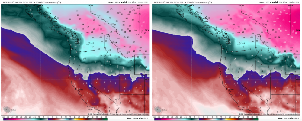
Maybe I’m blind but these are 0 to +2 colors?1 point
-
Far cry from those blood red EPS maps we’ve seen posted for the last month. As I said awhile back, there are correct and incorrect ways to interpret an ensemble mean.1 point
-
That is one thing I noticed. Around here we are never at a shortage of wind.1 point
-
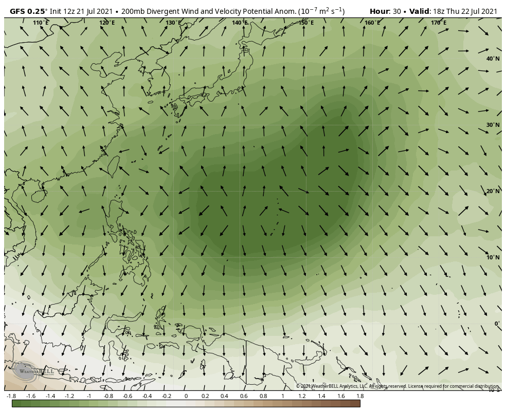
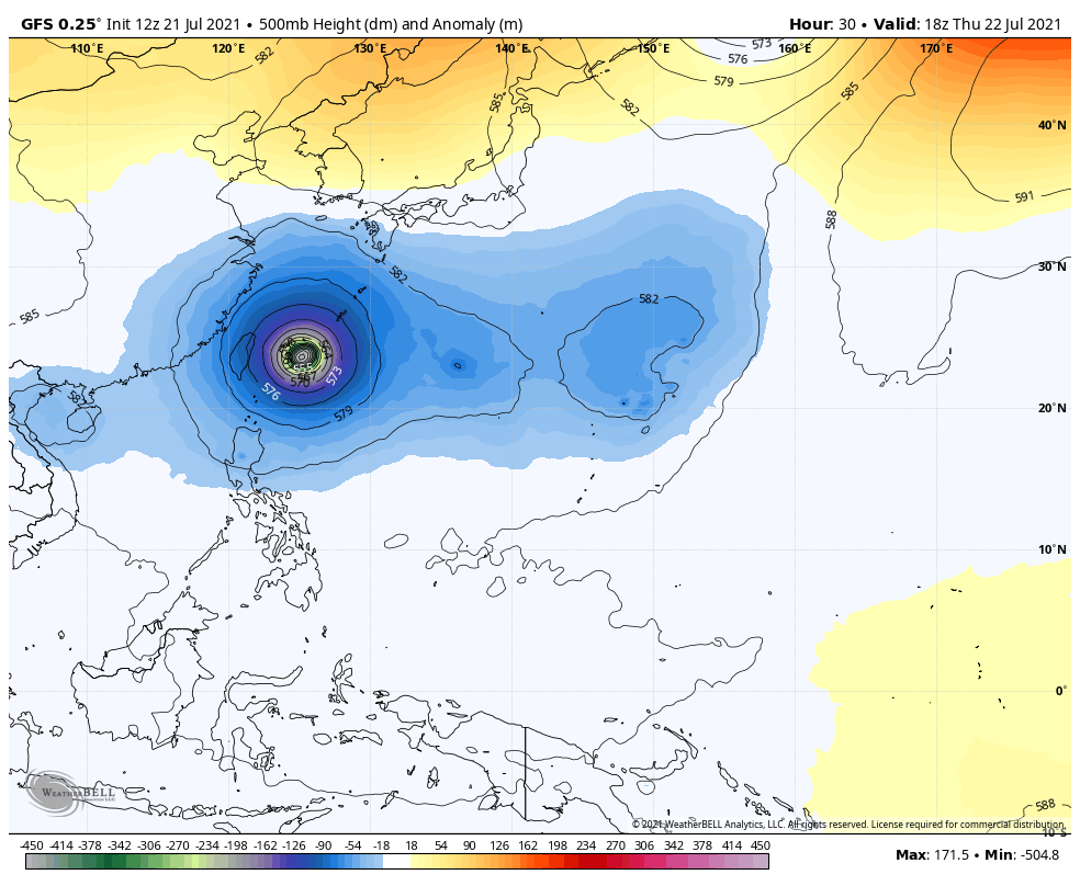
West-Pacific typhoon influence galore. Slow recurve west of climo with a stall. Models will have a blast trying to figure this one out.

 1 point
 -
That’s a beautiful -NAO on the LR GFS. Too bad it’s the GFS.1 point
-
1991-2020 Tacoma averages. It ended up just normal here just because we had a low of 59 yesterday despite a below average high temp. Today has a better shot since we cleared out last night and cooled off.1 point
-
Would be nice to get down into the 40s! Haven’t had a low temp below 50 since 6/17.1 point
-
Hope your family cabin is still there by the end of the summer. About a month to at most 6 weeks left of fire season up there.1 point
-
820,000 acres burned in BC so far. Dozens of fires that are forcing evacuation alerts and orders. Fire crews have been forced to pull off of many fires in the afternoon and evenings the past 2 days as it has been to dangerous to continue suppression efforts. 25-35 mph wind gusts are forecast for this afternoon on many of these fires. The flat lake fire moved a couple miles towards our cabin last night. Sounds like it is burning near hwy97 and Green Lake road. There are more than 1000 residential properties threatened east of hwy 97 if the fire crossed in that area.1 point
-
KC seems to have some hot and humid days with no wind to mix the air. This is the time of year for that.1 point
-
Been to KC many times over the years during summers. As a kid we went to many Royals games and Worlds and Oceans of Fun. Then my brother got a job in KC in 1994 and he and his family have lived in Shawnee ever since. The humidity in KC was almost unbearable on many of our visits. There were times at Worlds of Fun it felt like you were standing in the tropics. The urban heat island just adds to the misery with low temps not dropping that far.1 point
-
Nice morning. Yesterday was the day from hell at work, so I'm taking it a little easy this morning before I go in.1 point
-
Models haven't picked up on it yet but we should see a strong tropical system target the Louisiana coast around Aug 3rd or 4th. There are 2 reasons I'm watching this, the 1st is we have a family vacation to the Florida panhandle and leave on the 8th and the second reason is some believe a new cycle length begins to take shape in late July and early August. This is certainly an easy system to look for.1 point
-
Well, it is almost midnight so...1 point
-
Can't say enough about that guy.1 point
-
Happy for Giannis and the Bucks.1 point
-
Beautiful sunset. And a beautiful NBA finals game 6!1 point
-
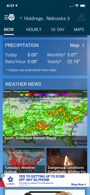
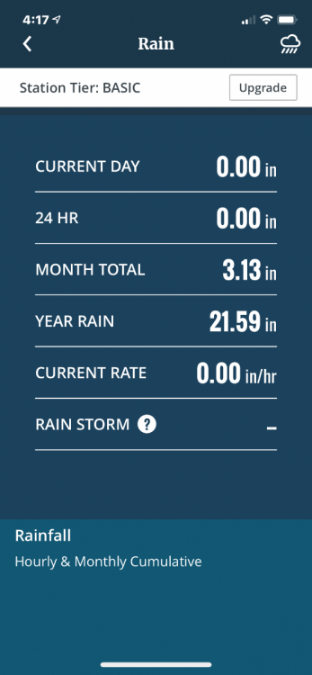
Compared my weatherbug app to a friend’s digital weather station just a mile northeast of me in the country. Pretty close for precipitation amounts through July 19th.
 1 point
 -
Y’all have a serious pollution problem. Drowning in a sea of western wildfire smoke this evening. Sun completely blocked out. Like a thick, smelly fog.0 points


.gif.9f50204b75f5f1ebff94d87757f47324.gif)


This leaderboard is set to Vancouver/GMT-07:00