
Leaderboard


Popular Content
Showing content with the highest reputation on 07/17/21 in all areas
-
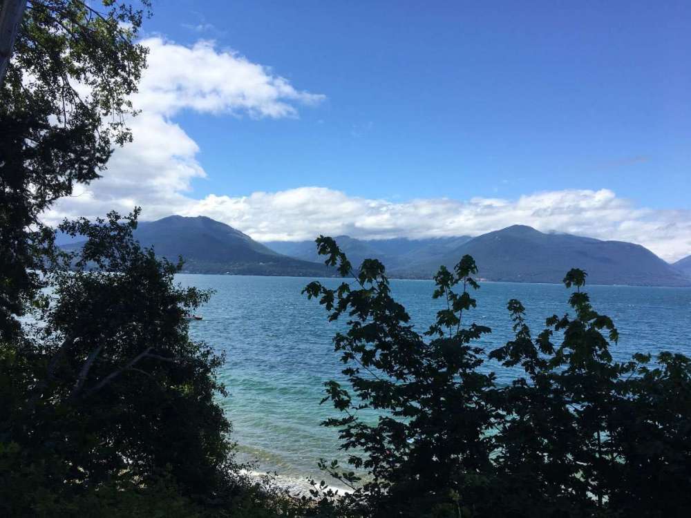
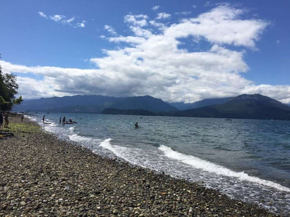
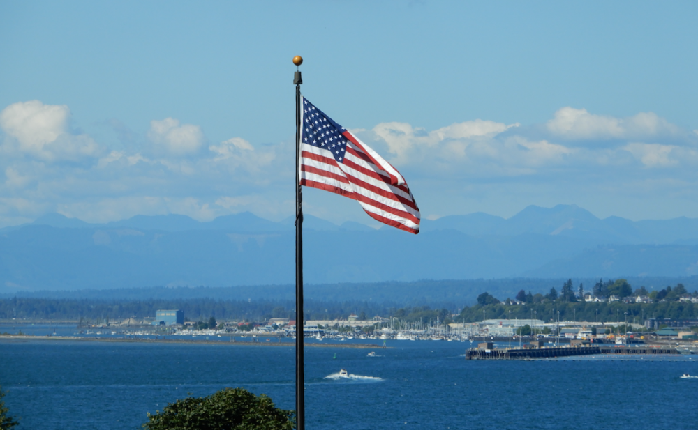
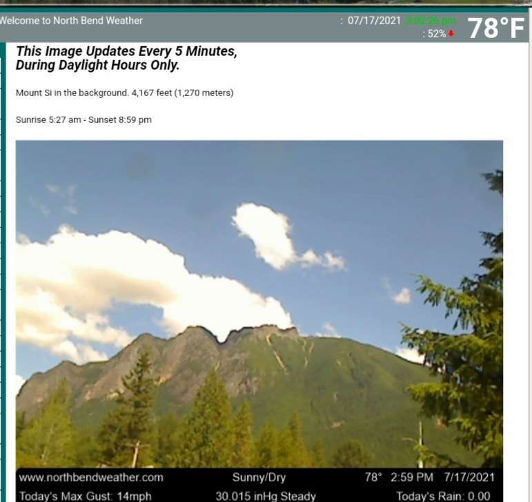
Went out to Scenic Beach St Park on Hood Canal today. Nice day and not too crowded. 70 degrees out there according to the car thermometer.

 10 points
 -
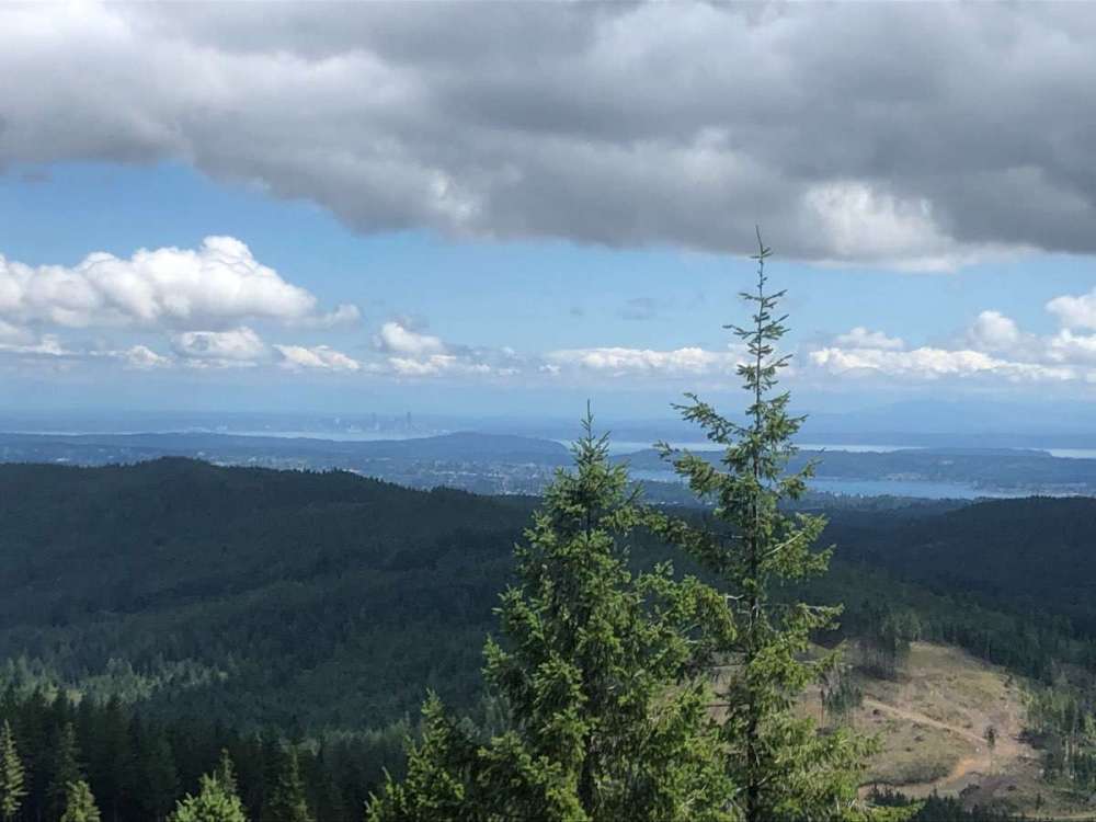
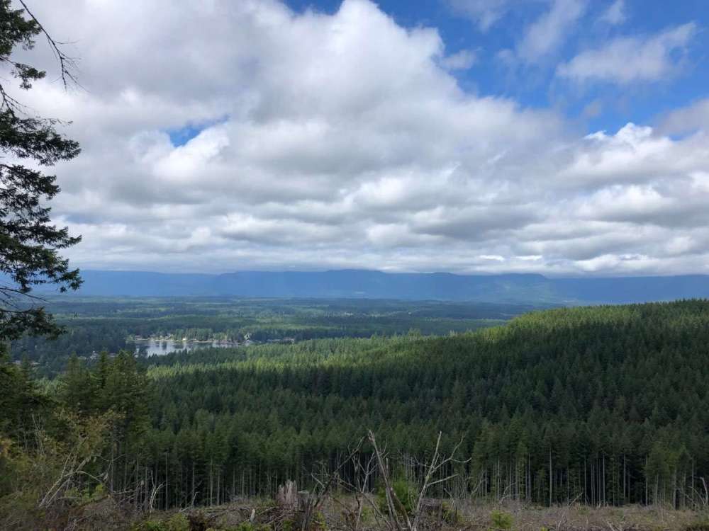
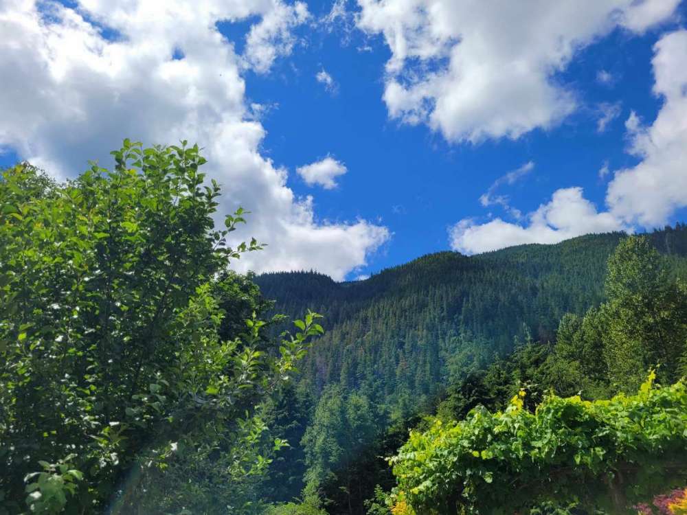
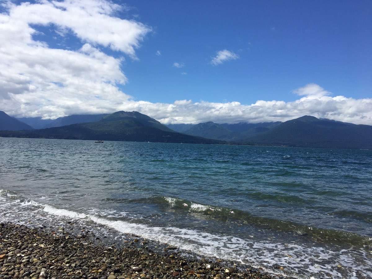
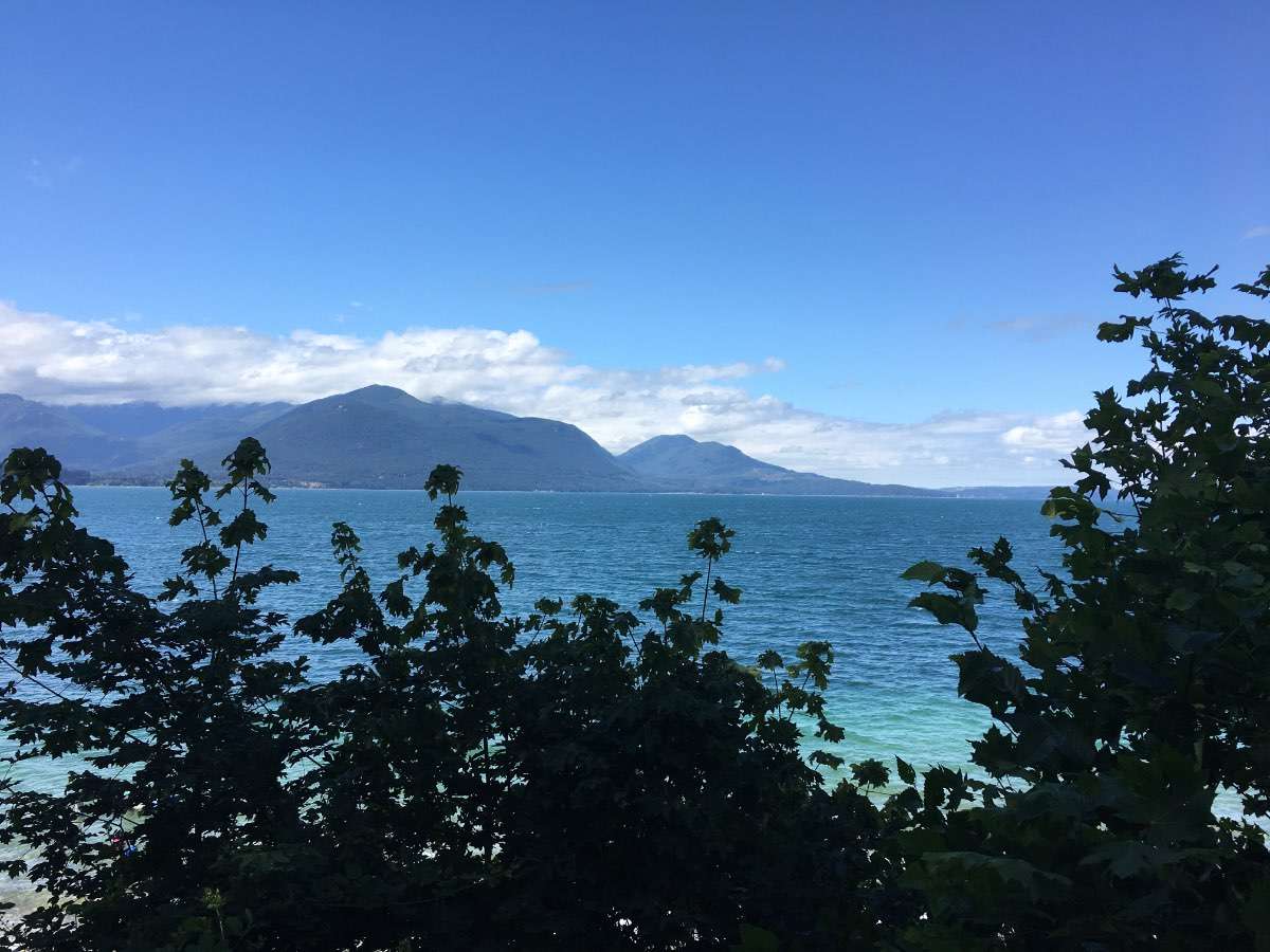
Beautiful day for a hike at gold mountain.
 8 points
 -
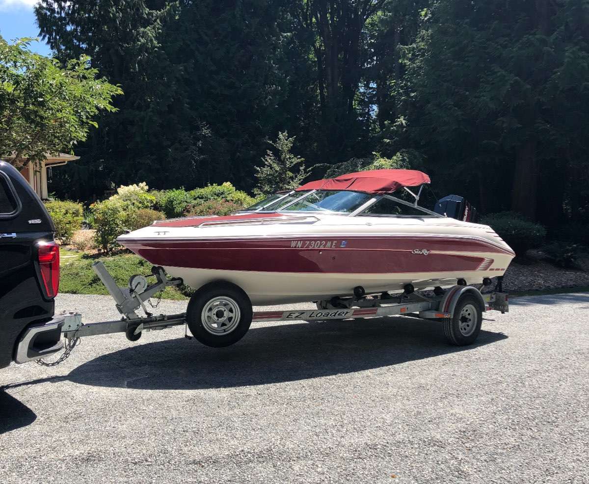
It was a nice day to buy a boat in Renton and sit in traffic all the way back north! It’s time to move on from the 1980’s Bayliner and move on up to a 1990’s Sea Ray! Luckily it also has a cassette deck in it so I can continue to rock my MC Hammer cassette on the water!
 7 points
 -
Third day in a row of sub-70 weather. Today topped out at 65F, now down to 64F. Just wishing for some rain and moisture. I hope everyone has a wonderful weekend and enjoys this traditional PNW summer weather. It's lovely. I hope our friends on the eastside of our respective states are able to enjoy cooler weather too and the smoke dissipates. Wishing our firefighters the best as well.
 7 points
 -
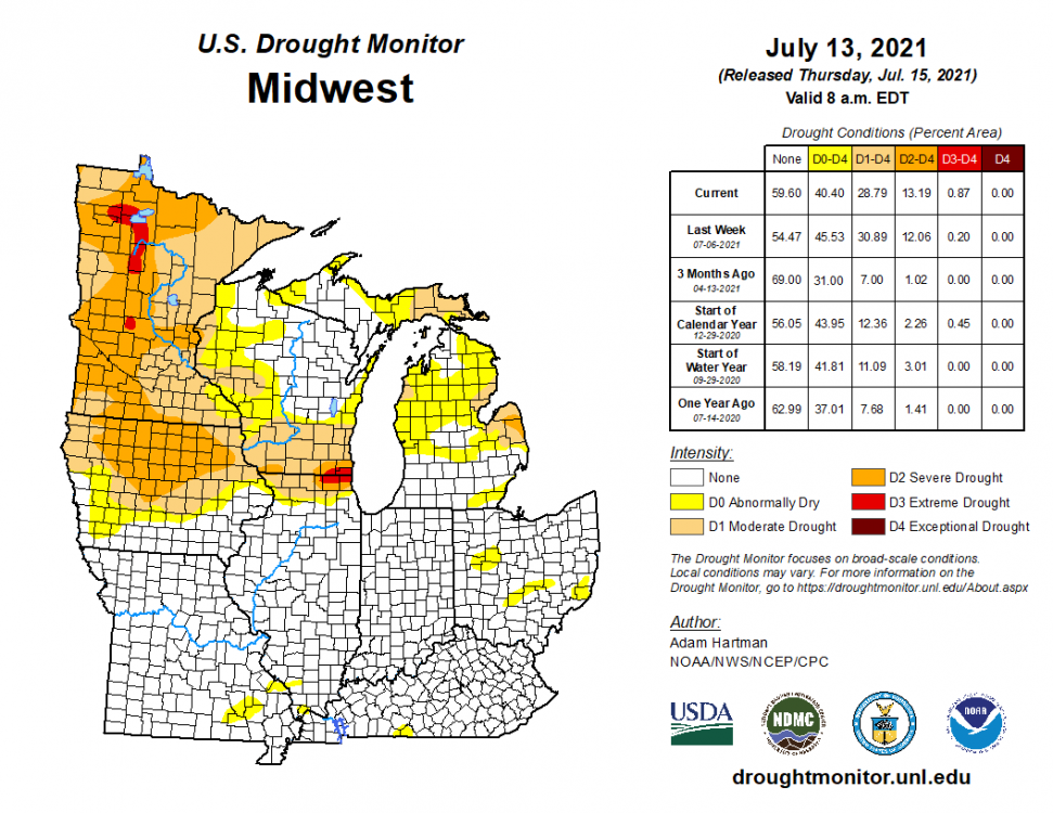
Our stretch of cloudy, rainy and dreary days are over and I'm truly looking forward to the sunnier and drier stretch of weather over the course of the upcoming week. I'm staying up in Volo, IL which is in Lake county that is still categorized in the severe/extreme drought. Surprisingly, the grass and crop look pretty good up here even though soil moisture is lacking. Timely rains? Anyway, I think we are heading to a local lake here in Waucanda, IL for the day to soak in the sun and enjoy this beautiful weather. As for next week, it looks like the GFS was onto the right idea of a backdoor CF to hit late Tue pm into Wed as a trough slides through the eastern GL's. I think this is the likely pattern as we roll through the 2nd half of July. The Upper MW and parts of the Plains will Fry, while the rest of us in the central/eastern Sub will Thrive in a top notch mid summer pattern. No big Heat (3+ consecutive days of 90's) signals out this way yet and don't expect to see any in the foreseeable future. 00z GEFS painting a classic "Ring of Fire" pattern for Week 2 that the JMA weeklies showed the other day as well. The 0z EPS is picking up on this also. End the month of July with a bang?
 6 points
 -
I just want rain.6 points
-
Storms have ended. Picked up another 0.80”. Gotta love it. ⛈4 points
-
Woken up at 4:20 AM by more non forecasted thunderstorms. IMG_0027.MOV4 points
-
Gorgeous, smoke-free sky today... deep blue with some puffy clouds and 73 degrees.
 3 points
 -
I can only imagine what your feeling up there bud. As a wx enthusiast, this pattern would drive me crazy! It's like living in the deserts of the SW...dry and hot is not what you want. Heck, even most of the valley in PHX is getting much more precip than Fargo of late. Crazy pattern. However, I do see your region in the vicinity of where the more active pattern may set up later next week. I'm sending you my blessings for wetter days!3 points
-
The last few frames of the animation below are indicative of the beginnings of the La Nina Part 2. A rather large cold pool upwelling in the eastern central PAC as the SOI surges to almost record highs.3 points
-
Today will be one minute and fifty seven seconds SHORTER than yesterday! Last 9:00pm sunset, too!3 points
-
With all these average to cool temps...does this mean Phil won?3 points
-
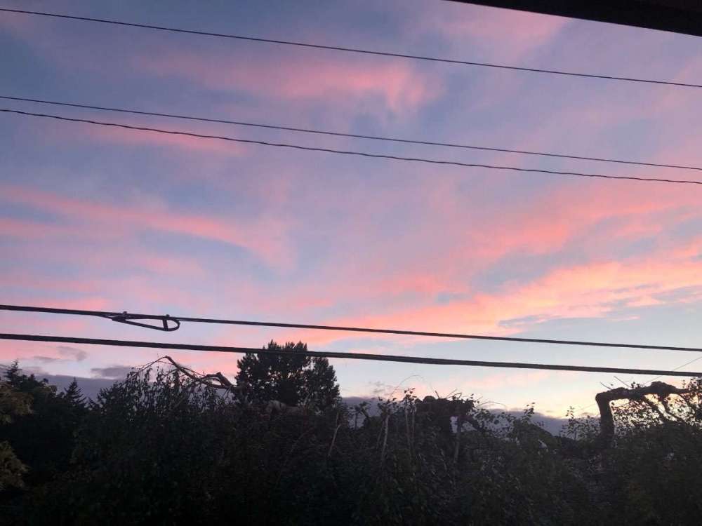
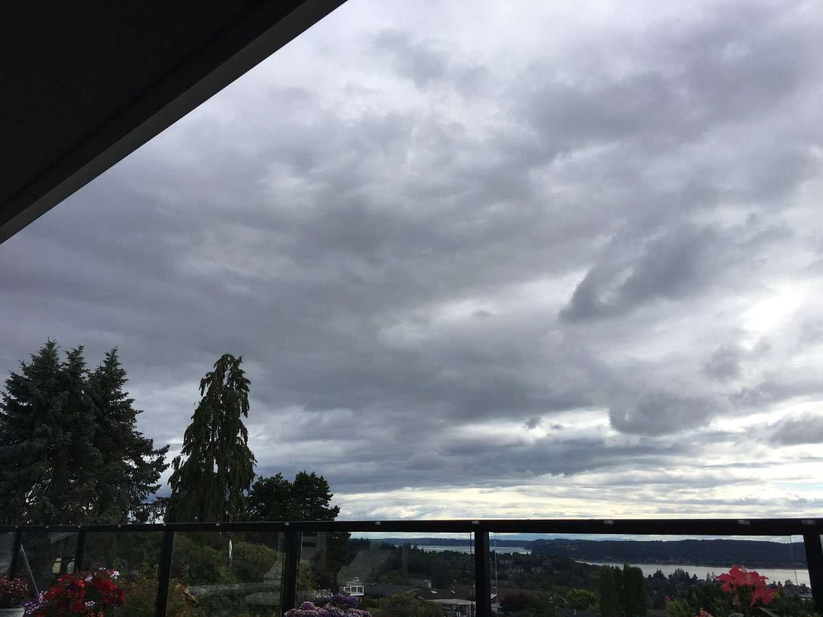
Cleared out enough for a nice sunset but it’s clouded back up now.
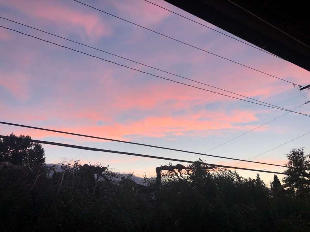 3 points
 -
Wednesday’s tornado outbreak was one of Iowa’s largest on record! This was as of yesterday when I forgot to post this screenshot from Twitter. Kind of unusual to have it occur in July. BTW, tornado records on go back to 1980 according to another post on Twitter.
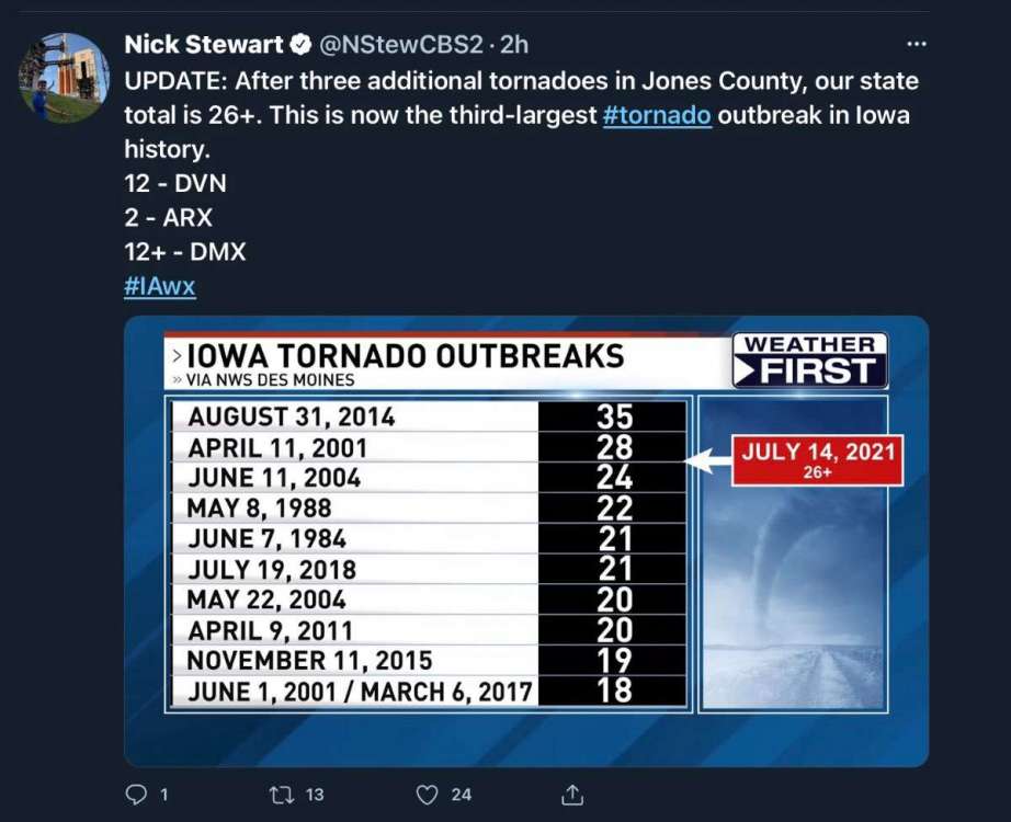 3 points
 -
2 points
-
lol. Not pictured: Hot, hot.
 2 points
 -
PLEASE for the love of God. This has been a dust bowl summer here. Seems like I have hit the 90s every other day since June and we have only received one night of decent heavy rain.2 points
-
You’re correct sir. I told my wife just yesterday that I hadn’t run the sprinkler system since the last week of June. Saving money.2 points
-
Taken just now on the return to camp
 2 points
 -
Jim comes and goes. His current absence has nothing to do with the models, figure he’s taking a mental break from the forums.1 point
-
1 point
-
Yeah... this is not a good time to check. This afternoon it was 77 at WFO SEA and SEA. Safe to say it was in the mid to upper 70s across most of Seattle. You could probably walk away from the water and gain 4 or 5 degrees in a few minutes. It was close to 80 on the east side of Seattle. No such issues with lakes... it will be 80 tomorrow when we are on Lake Sammamish.1 point
-
Let's check out some current temps just for fun. All temps are from 8:30pm, give or take a few minutes. Coldest / Warmest WASHINGTON Bellingham 65F Everett 60F Seattle 67F Tacoma 67F Olympia 68F Longview 67F Vancouver 73F Ocean Shores 57F Port Angeles 58F Ellensburg 74F Yakima 85F Wenatchee 82F Kennewick 87F Walla Walla 86F Moses Lake 82F Spokane 81F OREGON Astoria 60F Newport 57F Coos Bay 59F Portland 74F Salem 73F Eugene 74F Medford 86F The Dalles 83F Bend 75F Burns 78F Ontario 91F Lakeview 77F CALIFORNIA Crescent City 55F Eureka 56F San Francisco 56F Yreka 85F Redding 93F ALASKA Juneau 67F Sitka 60F Anchorage 78F Fairbanks 78F Nome 42F Unalaska 54F1 point
-
79/58 today after a 76/55 yesterday. Quite nice. Although some rain would be nicer.1 point
-
Monsoonal moisture is moving in.1 point
-
Nice and congrats with the boat! Nothing better than to sit in a Puget Sound traffic. You see something new everyday around here with the traffic around here! Yesterday I was stuck in traffic on 405 at Renton/Newcastle for about 10 minutes because a piglet decided its had enough with the owner and jumped out the window of a car and ran down the freeway in opposite direction. It was actually a cute black piglet!1 point
-
The 90's are back, oh how I've missed you.1 point
-
No Hammer pants!1 point
-
Awesome!1 point
-
Hey that is awesome! Congrats on the 'new' boat! That will be a lot of fun!1 point
-
Nice day...
 1 point
 -
Mon-Fri looks gorgeous west of the WA Cascades on the 12z. Highs in the 70s and plenty of intermittent marine cloudcover. Near perfect summer weather. Willamette Valley continues to bake, unfortunately.1 point
-
Have fun! Perfect summer weather here as well though still a little on the muggy side.1 point
-
Model trends seem to be towards less 4CH influence as we move into week 2.1 point
-
Storms coming over the ridge may produce for you but once that drought pattern grabs a hold storms just seem to find a way to miss. I hope you get some I feel for ya.1 point
-
For SEA the 70 streak is over but the dry streak lives on and it could go on for quite a while. This month looks like it go completely dry and who knows what August will bring…. Could be more dryness.1 point
-
The "haves" and "have not's" in this summer pattern...nature keeps on delivering for your area. Looks good out your way.1 point
-
Just scrolling through the ECMWF surface maps in more detail... that is some serious goldilocks weather. What a perfect balancing act. Highs basically in the mid 70s to low 80s for the entire run and almost entirely sunny. No waiting until the middle of the afternoon for the low clouds to burn off. Combination of good mixing with troughing offshore and cooler 850mb temps to prevent an inversion from locking in.1 point
-
ECMWF says today was the last mostly cloudy day in sight. Some clouds tomorrow morning and then we embark on another very sunny period for the foreseeable future. Side note... I realize it was never cloudy from Portland southward. But we did manage a couple mostly cloudy days up here.1 point
-
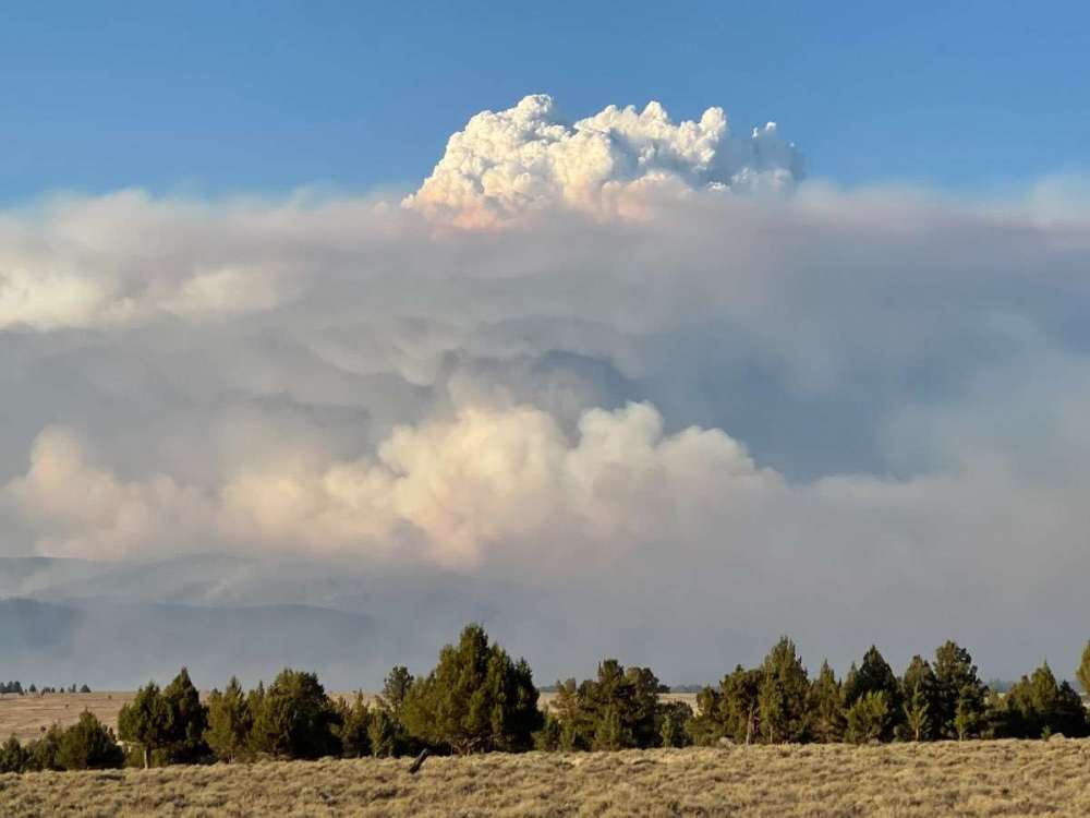
Bootleg Fire finally updated. 22% contained. 273,582 acres. Big jump from the previous update. Likely over 300k tomorrow...1 point
-
Looks like we got up to 87F. Nice, clear day.1 point
-
Absolutely. And I lived on the coast and then in Monmouth during those times, so I was speaking from a personal standpoint on not having experienced a thunderstorm during that stretch. I was just unlucky.1 point
-
I had 0.01" that morning. There was patchy, low-topped drizzle showers around that day through the region before it cleared out completely in the afternoon. Definitely not an error, just as there were definitely thunderstorms in the Eugene area between 2006 and 2020.1 point
-
Sometimes it's the other way around where I'm from. I've had legit wet days get downplayed by my airport. It's life though.1 point
-
Obviously aquariusradar or anything else mankind might think up is overwhelmed by the giant power of Mother Nature's regional storms like the one to strike northern Europe. Like hurricanes-awesome and scary.1 point
-
Possible sprinkles!?!?!?
 1 point
 -
Yeah, it's honestly gotten pretty annoying.1 point
-
Yep, merely been a historically warm first half of summer there. As opposed to an all time recordbreaking one with a record-shattering pace for a major historic benchmark (I mean besides the big one that both of those cities already set three weeks ago). Great point! And yeah Western OR has never felt like the PNW to me, either. And the eastside is gross and doesn't count and there's not a lot of real people out there anyways.1 point
-
Love it how the 2 people trying to downplay how warm it’s been this summer live thousands of miles away and aren’t actually even experiencing it.1 point


This leaderboard is set to Vancouver/GMT-07:00