
Leaderboard


Popular Content
Showing content with the highest reputation on 11/26/21 in all areas
-
Getting t shirts made to commemorate. Lmk if u want one and what size
 8 points
 -
It’s not going in our yard, Russ. It’s going in our living room!
 8 points
 -
7 points
-
I am ready to fork this winter .
 6 points
 -
This is nothing… The whiner thread days of 2007-08 were the ultimate. We were all so young…6 points
-
Might as well be historic!6 points
-
got 5 notifs in 10 seconds and its just....5 points
-
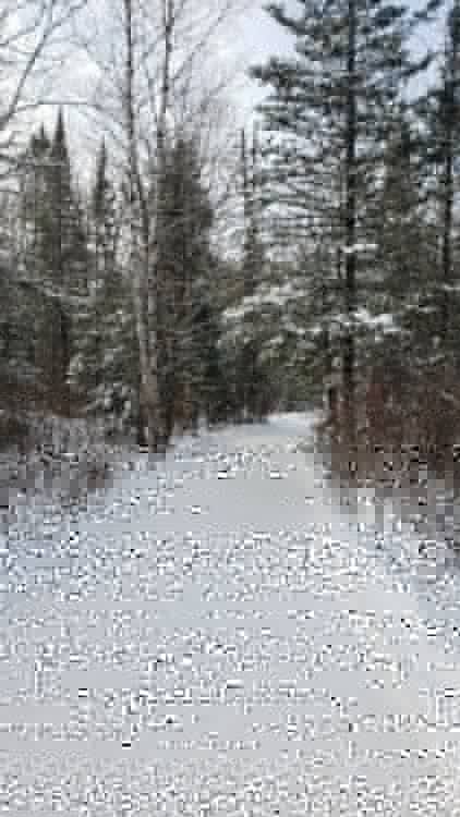
Snow looks kinda wet. Not much drifting. Meh!5 points
-
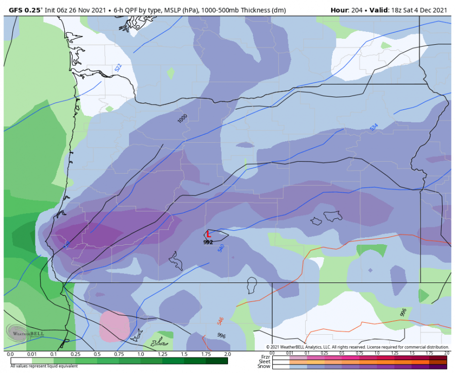
00z GFS in 10 minutes Root for a ridge merger with the strong Aleutian ridge/offshore ridge and for the energy south of the Aleutians to cut-off from the trough sooner! IF we were to miraculously see that we could go into a very cold pattern! C'MON!!!! Think Cold and SNOW! C'MON!!!!5 points
-
5 points
-
Thanks, Jesse!5 points
-
The inflection point on the upcoming pattern change is almost within the 7-day period now so the models should start focusing in on similar solutions over the next couple day. The details seem to hinge on how the GOA trough splits which happens around next Friday and Saturday. The fact the 06Z GFS went in a favorable direction for cold and snow makes me think there is a still a decent chance of something big happening.5 points
-
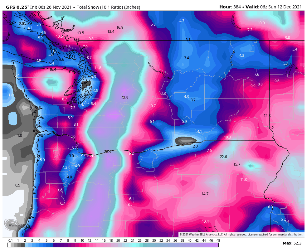
6z GFS Analog Composite Day 6-10, 8-14. Outstanding5 points
-
Final totals

 5 points
 -
Well how about that!
 5 points
 -
It’s November 26th we know nothing4 points
-
GEMS ends with the anchorage express on its way down
 4 points
 -
4 points
-
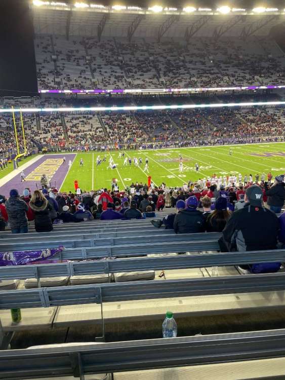
Stormed the field and not even a Cougar fan IMG_1974.MP4 IMG_1973.MOV4 points
-
Huskies looking worse than the model runs lmao
 4 points
 -
Analogs gone wild4 points
-
The UK is getting hammered tonight4 points
-
Throwing the whole lot at you vibe party poopers ! Aka Deweydog prescription
 4 points
 -
Lol y’all are ridiculous with the winter cancel posts but I’ve seen worse here.4 points
-
Pretty obvious this winter will be the warmest on record.4 points
-
Just 0.19" for me so far today, but that's enough to make this the wettest fall (September-November) I've recorded here. Been here since 2011.4 points
-
4 points
-
I like Jim’s optimism. Keep the positive vibes going, there’s no need to be negative.4 points
-
Winter starts in February and summer starts in April. It’s the new normal.4 points
-
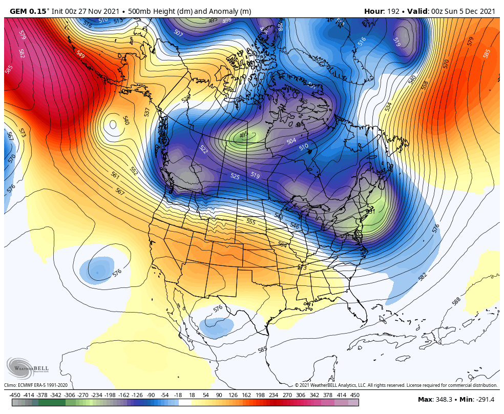
I really hope people realize how precariously close we are to going into a major arctic pattern. 2 of the pieces are in place. Strong Aleutian ridge and the ridge over us has trended slowly to back offshore with building heights more quickly. We just need the ridge merger now.4 points
-
Yeah....my heart goes out to him. In reality a lot of people on this forum would rather live in a better climate, but there is always something to keep you here. In my case I still plan on getting out of here eventually. Until then let's hope for at least a few really good winters over the next 5 years.4 points
-
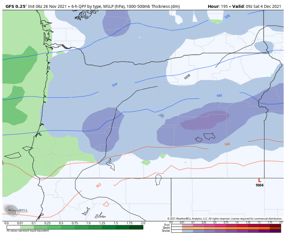
12z does show a bit of wet snow up around the border next weekend before the ridge builds overhead.4 points
-
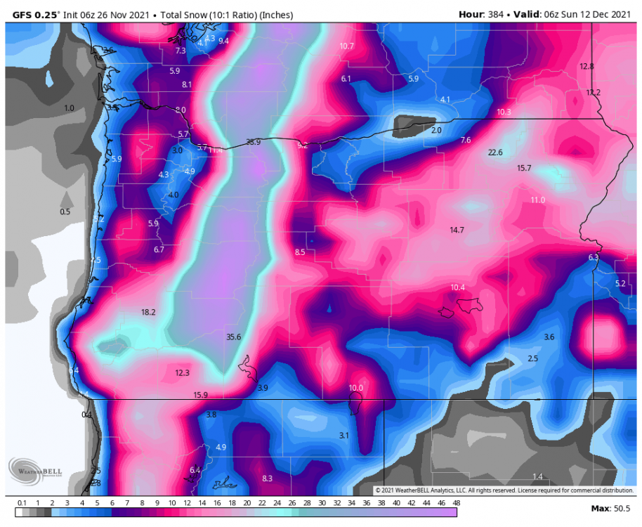
Snow Outlook 2 - 4 in Snow Upcoming Starts at 8:00 PM Saturday, 11/27 Ends 6:00 PM Sunday, 11/28 Snowfall Amount Probability Greater than 8 in 1% 4 - 8 in 24% 2 - 4 in 39% An inch or two 20% Less than 1 inch 16%4 points
-
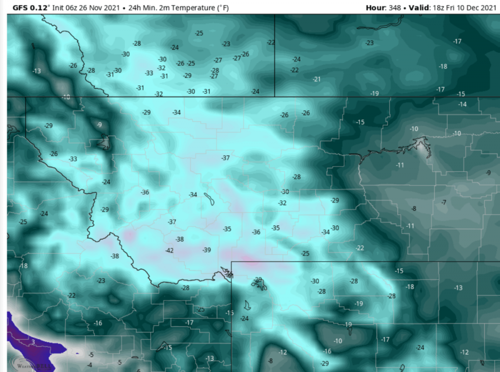
-40F lows and -20F for highs for here on the 06Z GFS... Very 1990 like!
 4 points
 -
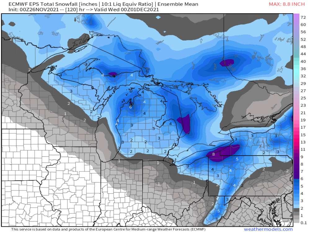
0z Euro/EPS still suggesting a nice first "taste of winter" to close out November for you guys....
 4 points
 -
Anal logs gone wild.4 points
-
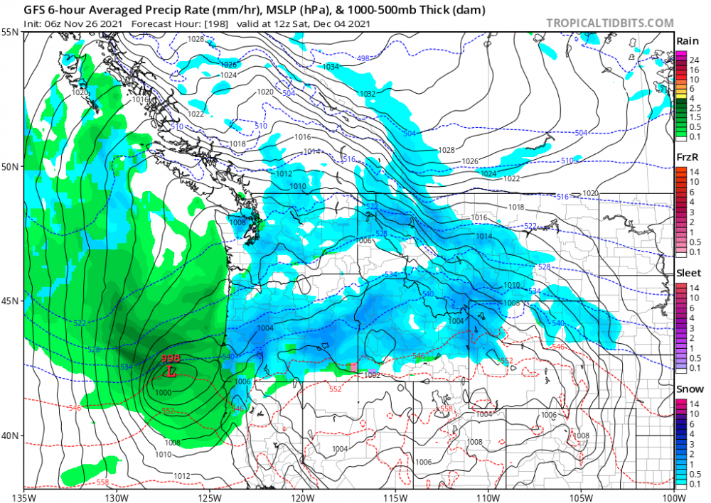
It's a chilly 25 this morning but the winds have switched to the south and the warm up is beginning. The GFS and Euro are showing a major change in the pattern starting on the 4th. The GFS has a parade of major snow storms and a strong artic outbreak including a 1060mb artic high. Winter could arrive with a vengeance so enjoy the warm up, finish up your outdoor chores things look to get fun soon! #58daycycle4 points
-
This is one of the coldest model runs I've ever seen in our area... Truly a throwback to Dec 1990/Dec 1968.4 points
-
End of the run turns pure unabated Arctic Medford northward. Highs in low 20s and lows in single digits/lower during mother of all east wind events.4 points
-
LOCK IT IN!!!
 4 points
 -
TOUCHDOWN!!!
 4 points
 -
Gonna stay up tonight for what will inevitably be a depressing run but I'll be damned if I still don't have a relaxing night.3 points
-
Wow! This has really sped-up. Just 24 hrs ago, it wasn't supposed to begin here until 7 pm, then go all night. Now, this latest published guidance from less than an hour ago, has it mostly an evening event, and outta here wrt the real accumulating stuff. Could be some steady flakes coming down when we sit down for our holiday dinner about 4:30 tomorrow.
 3 points
 -
Calling my shot. The historic -pdo overrides the epo. We get our ridge, and an epic 2nd half of December. The cold we see on the deteminstic models will be the teaser to the blast to end the year.3 points
-
If the torch is muted, then the Euro may be onto something. Still waiting for Tom to back the Euro up with a nice loop of the GEFS backing up the Euro. Right now, they're not in the same camp. Plenty of time ofc for that to improve.3 points
-
Just reading last Nov's thread from this same time-frame a year ago. We're basically in the same spot - hoping Dec would get cold and rock big snows. I know it didn't work out for too many of us in that respect and kudos to Grizz for calling it from roughly mid-Nov. His follow-up post wrt the state of the AO was true too. Needed a -AO to get colder air to take hold. The cold never pressed into SWMI, as seen in my daily snow log showing only 9.4% of my rather meager total was via LES. Normal is in the mid-20's percent. Cold blasting through with a NW fetch wasn't a feature of last winter at all.3 points
-
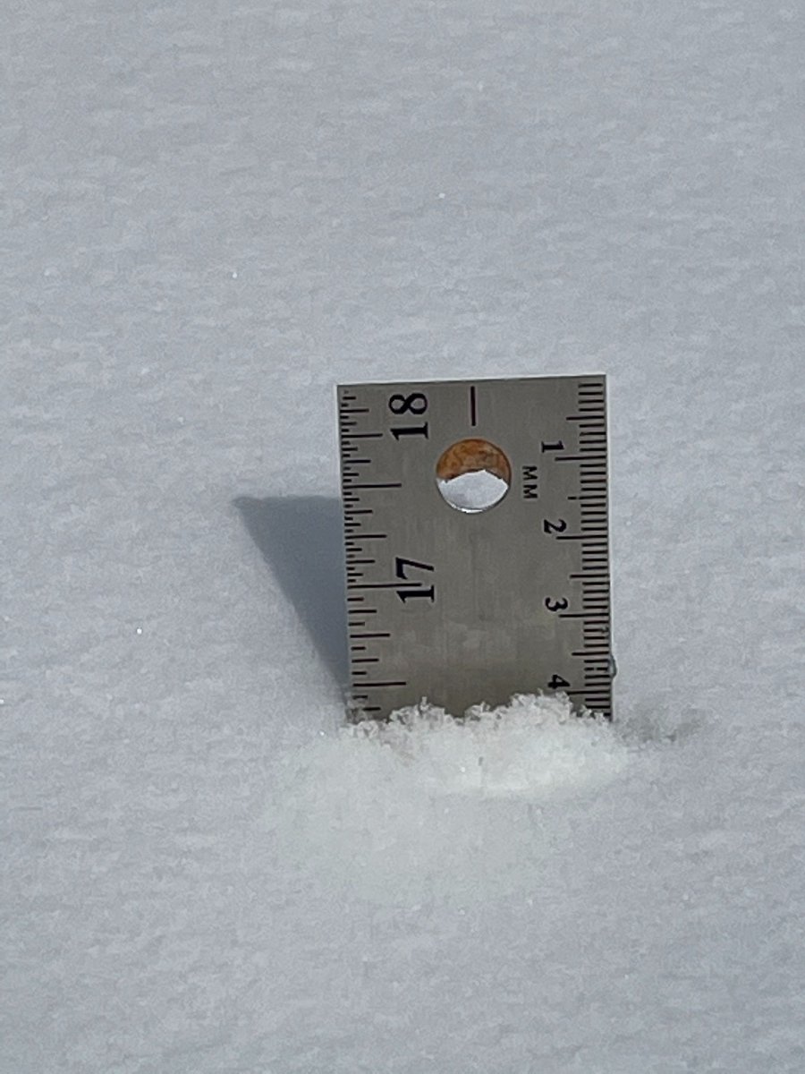
A light dusting of snow on rooftops here this am. Very noticeable with a dark brown building theme. Must've caught one stray SHSN off Lk Mich. Slow fall of temps all night with 7 hrs of winds gusting 25-30 mph. You know it's not the warm season when winds gust during the normally calm hours. WC's in the upper teens gonna feel nasty cold.3 points
-
3 points
-
We endured the heat dome-- would be very on-color for 2021 to pull out an unmovable record-strength arctic high.3 points
-
This is very interesting!3 points


This leaderboard is set to Vancouver/GMT-07:00