
Leaderboard


Popular Content
Showing content with the highest reputation on 11/29/20 in Posts
-
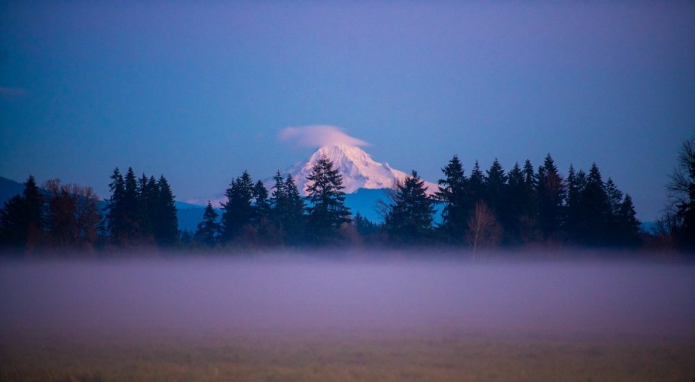
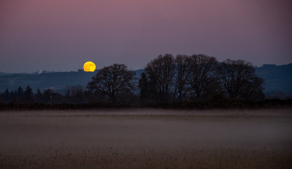
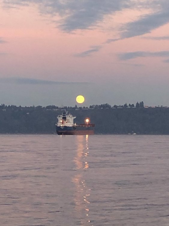
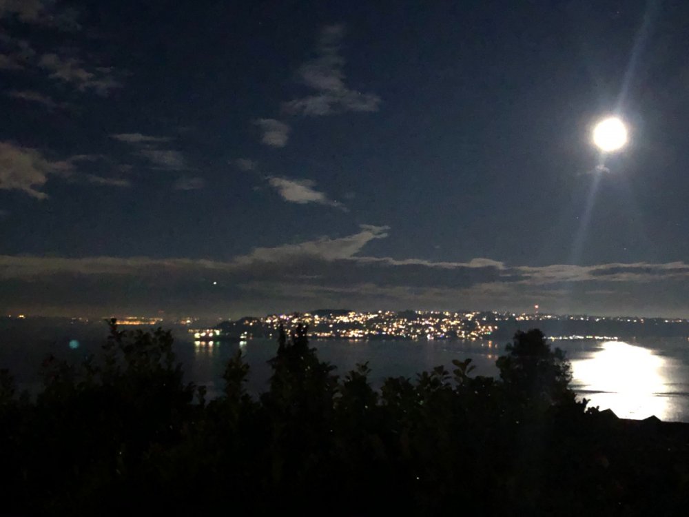
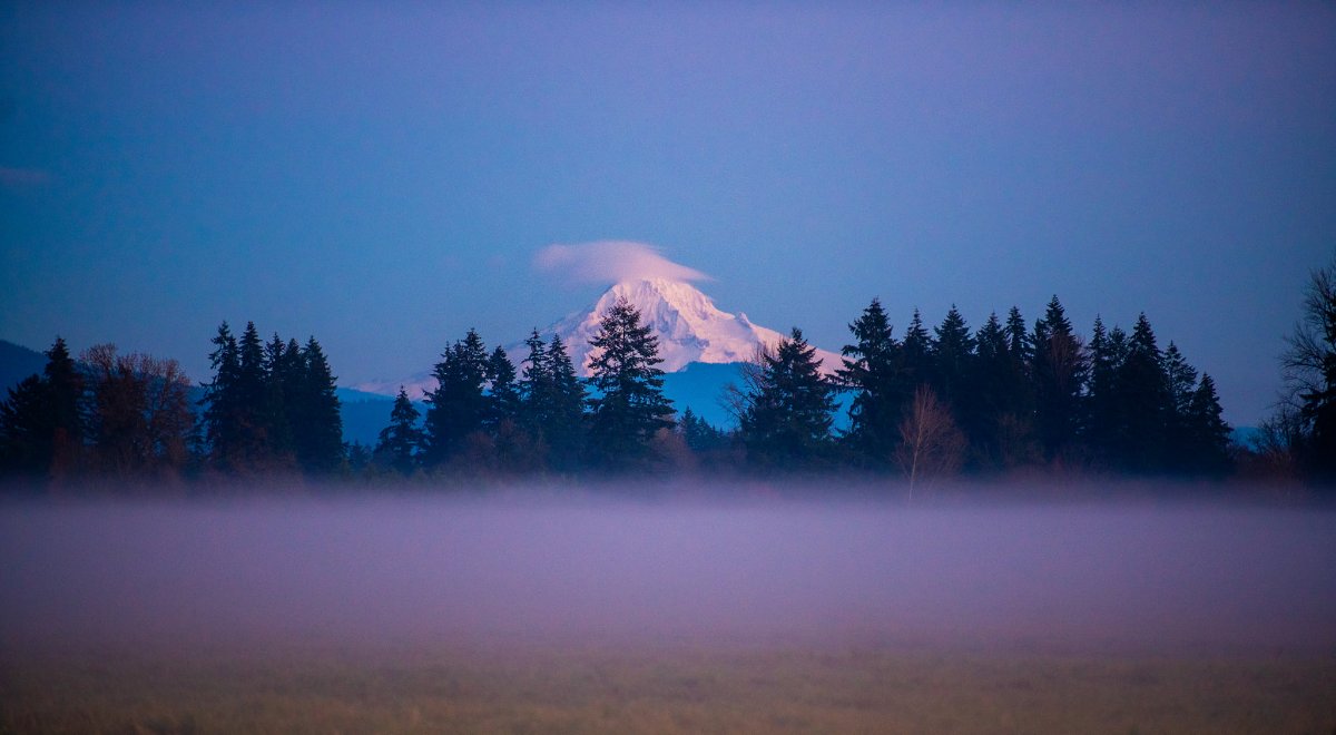
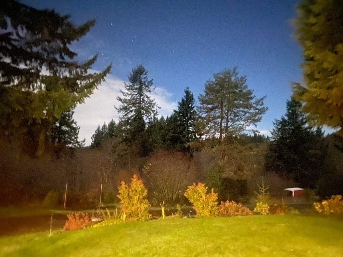
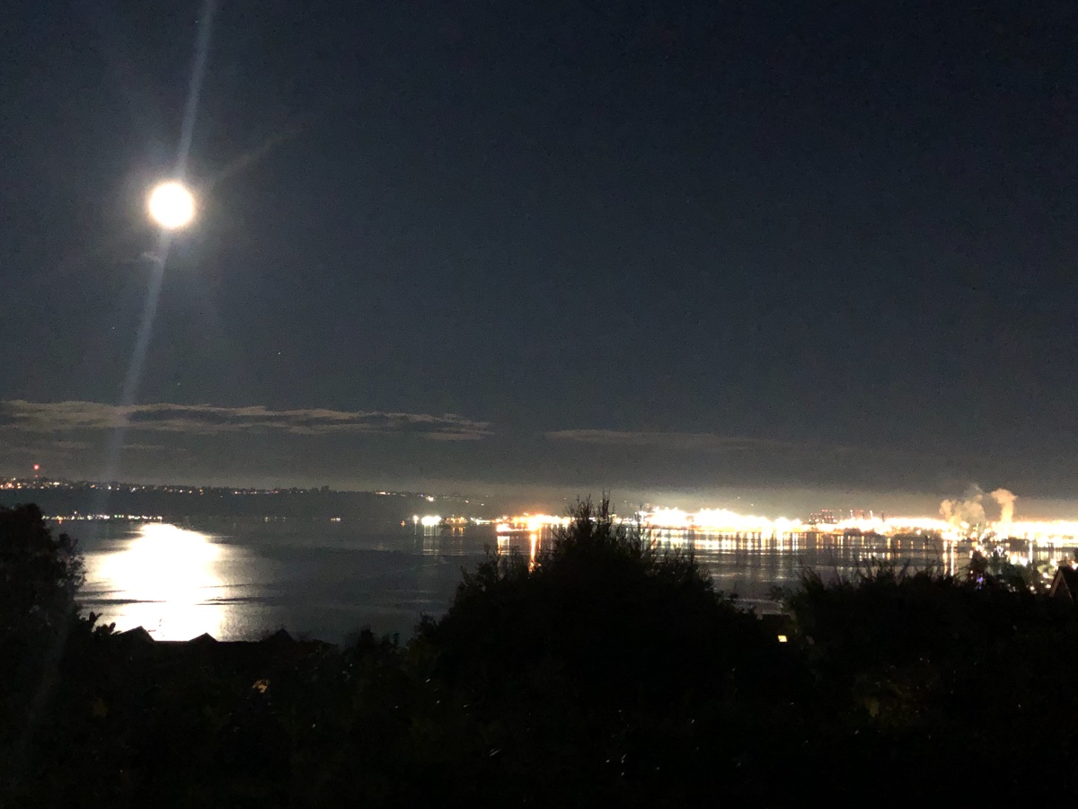
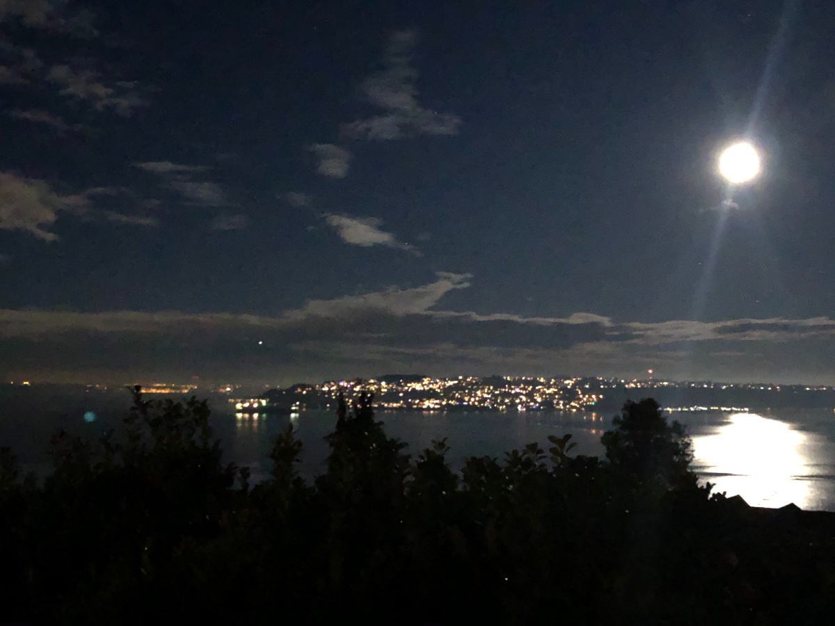
I love when the low lying fog forms, so picturesque. The rising full moon only added to it!
 11 points
 -
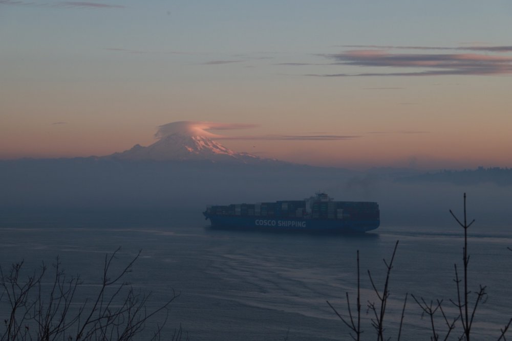
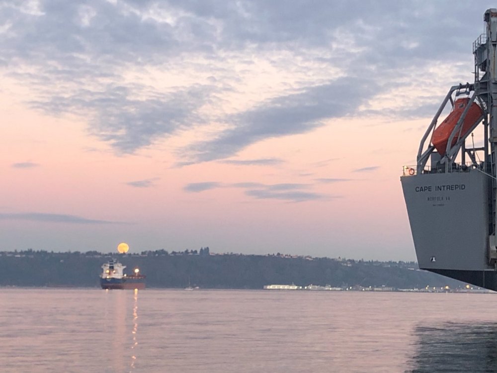
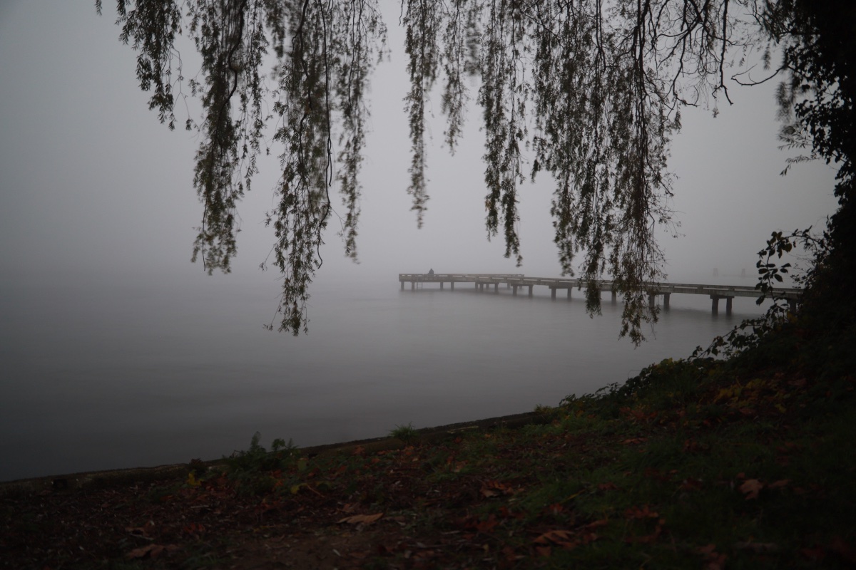
Fog thick over Lake Washington, but crystal clear out over the Sound.

 7 points
 -
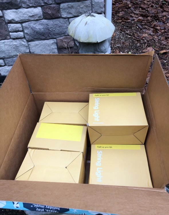
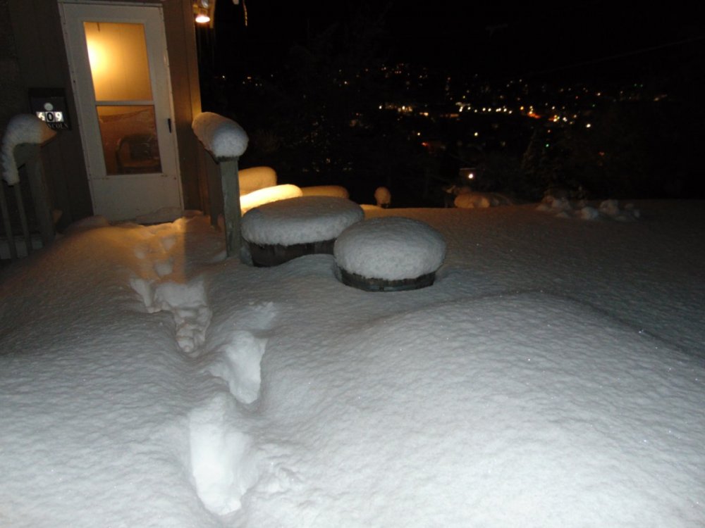
My Christmas lights are hot off the Amazon Sprinter van...Winter is saved! Going up now!
 7 points
 -
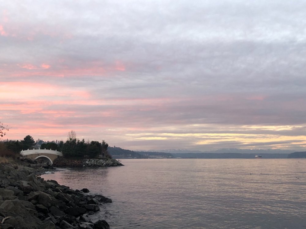
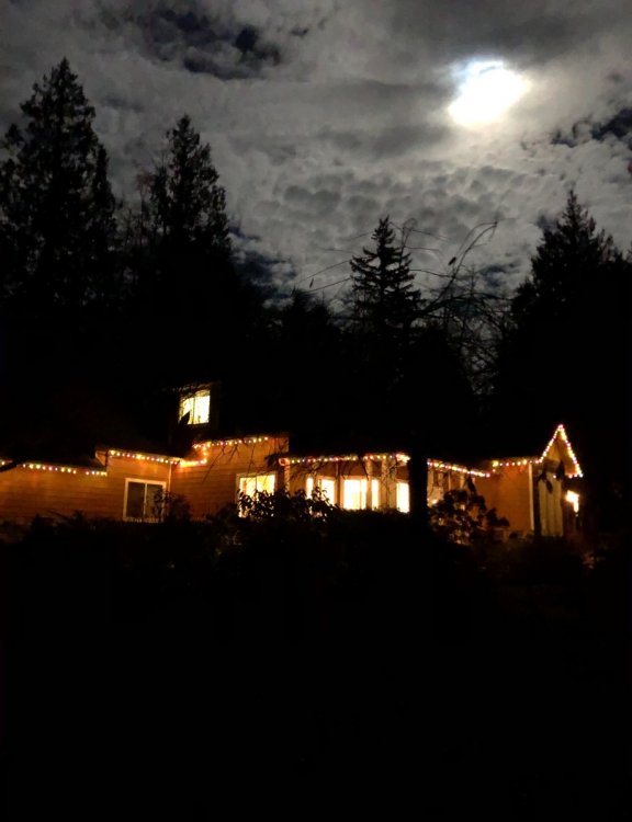
Beautiful night.
 6 points
 -
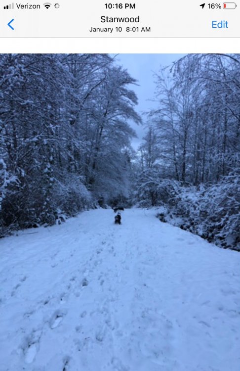
Random pic I just saw on my phone... January 16, 2020 at 9:30 a.m. PST in my backyard.
 5 points
 -
My friend and my 12yr old self rode our bikes across Lake Goodwin during that event (without the parents knowledge of course) it was rock solid!5 points
-
Can see the clouds moving in from the NW now.
 4 points
 -
Conversation MJVentrice @MJVentrice The African standing wave is now breaking down as low-frequency tropical forcing slowly shifts eastward with time, moving towards more of a canonical La Nina forcing state.4 points
-
Good morning. Woke up at 5am and thought the security light had been tripped outside. Turned out to be the moon. It was sure bright. Right now it's 29 and frosty. Looks like a beautiful morning is ahead. Hope everybody has an awesome day!4 points
-
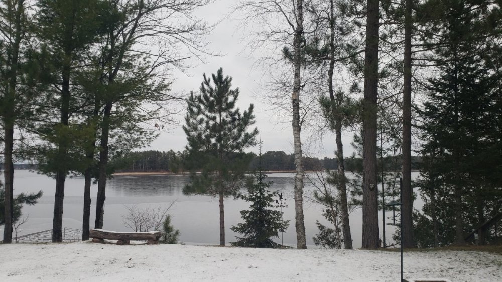
1-3" or 2-4" off the lake thus afternoon and tonight...a great welcome to the north! Lake just locked up last night
 4 points
 -
I'd argue that the snow magnet was in the Twin Cities, and I got their scraps.4 points
-
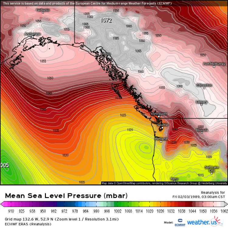
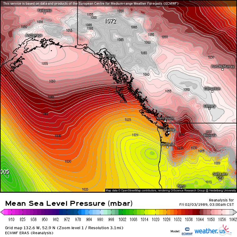
I was playing with reanalysis from the last century, and decided to revisit February 1989. It's crazy to see just how anomalous that event really was..... A 1972mb Frankensteinian PV lobe directly from Russia locked into western Canada with true arctic air funneling into the Region. The result? The Siberian Express of the century with Seattle notching its first sub-20 high temperature since the infamous January of 1950, this time without the aid of a two foot snowpack, then barely kissing the vingt mark the very next day. To top it off, five inches of powdered sugar to coat the region in a glistening, enchanting white. The stuff of dreams for model weenies and aspiring mets like those on our forum... It gets me so worked up that I may never see something like this in and around the Seattle area in my lifetime. Our warming climate is making these kinds of events nearly impossible nowadays, growing ever more unlikely each year, no matter how few sunspots manifest, or how many cubic meters of ash from Indonesia are injected into the stratosphere... Though I do sometimes hold out hope that we may squeeze out another event like this, or two, god forbid, before our climate drifts off into obscurity and unrecognition when I am an older man. After all, anomalous events are bound to happen.
 4 points
 -
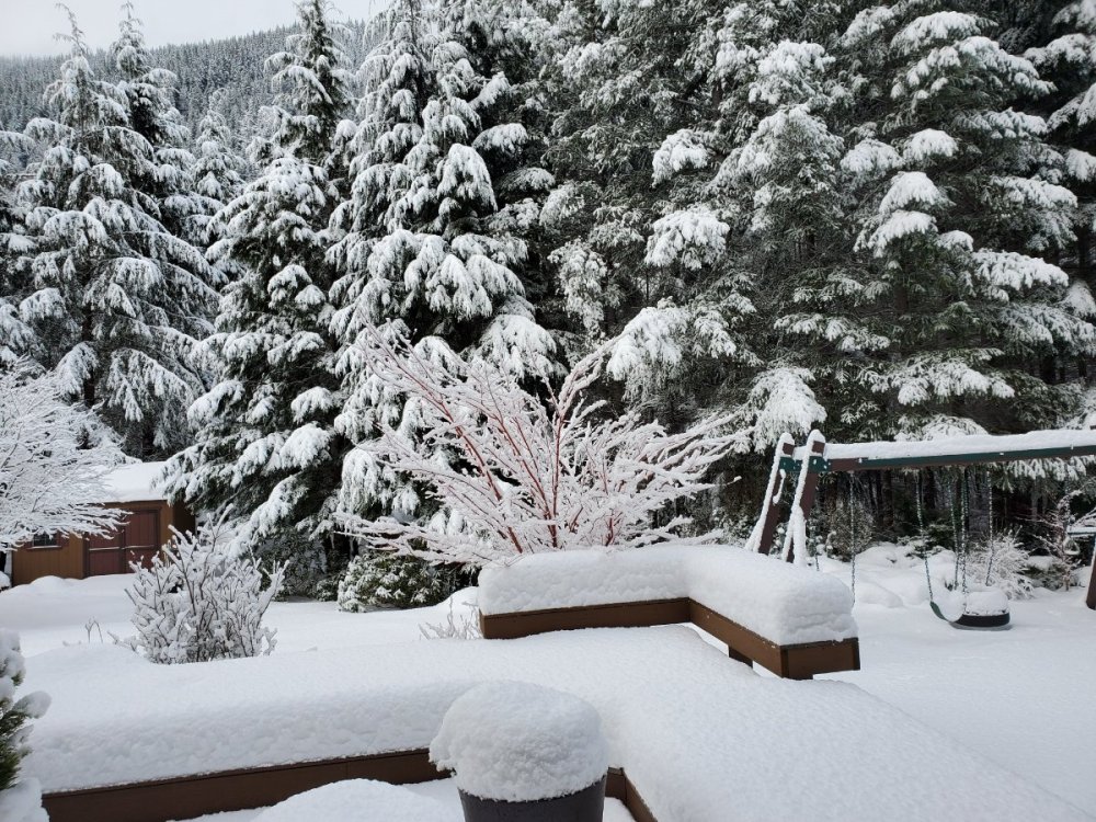
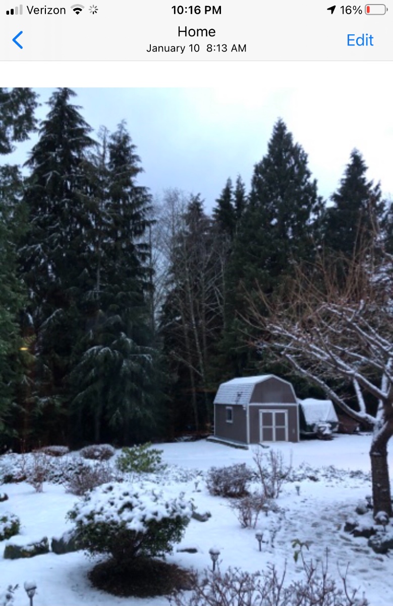
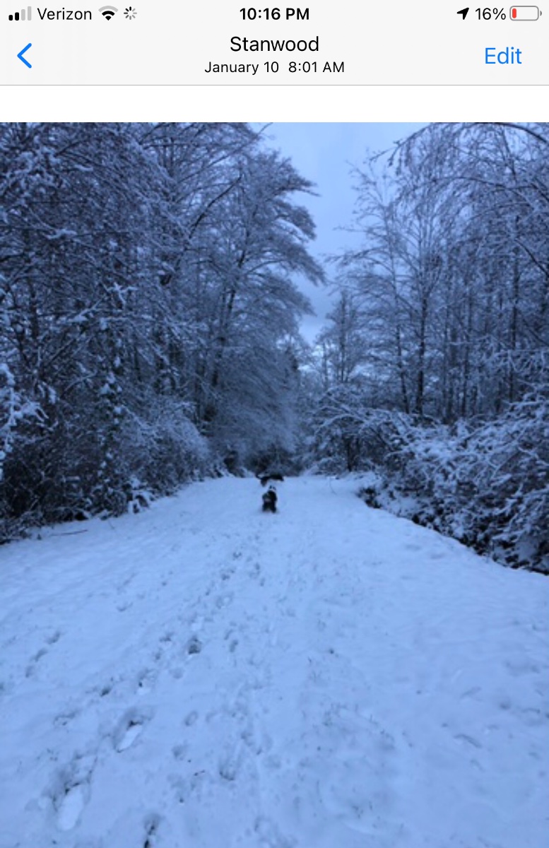
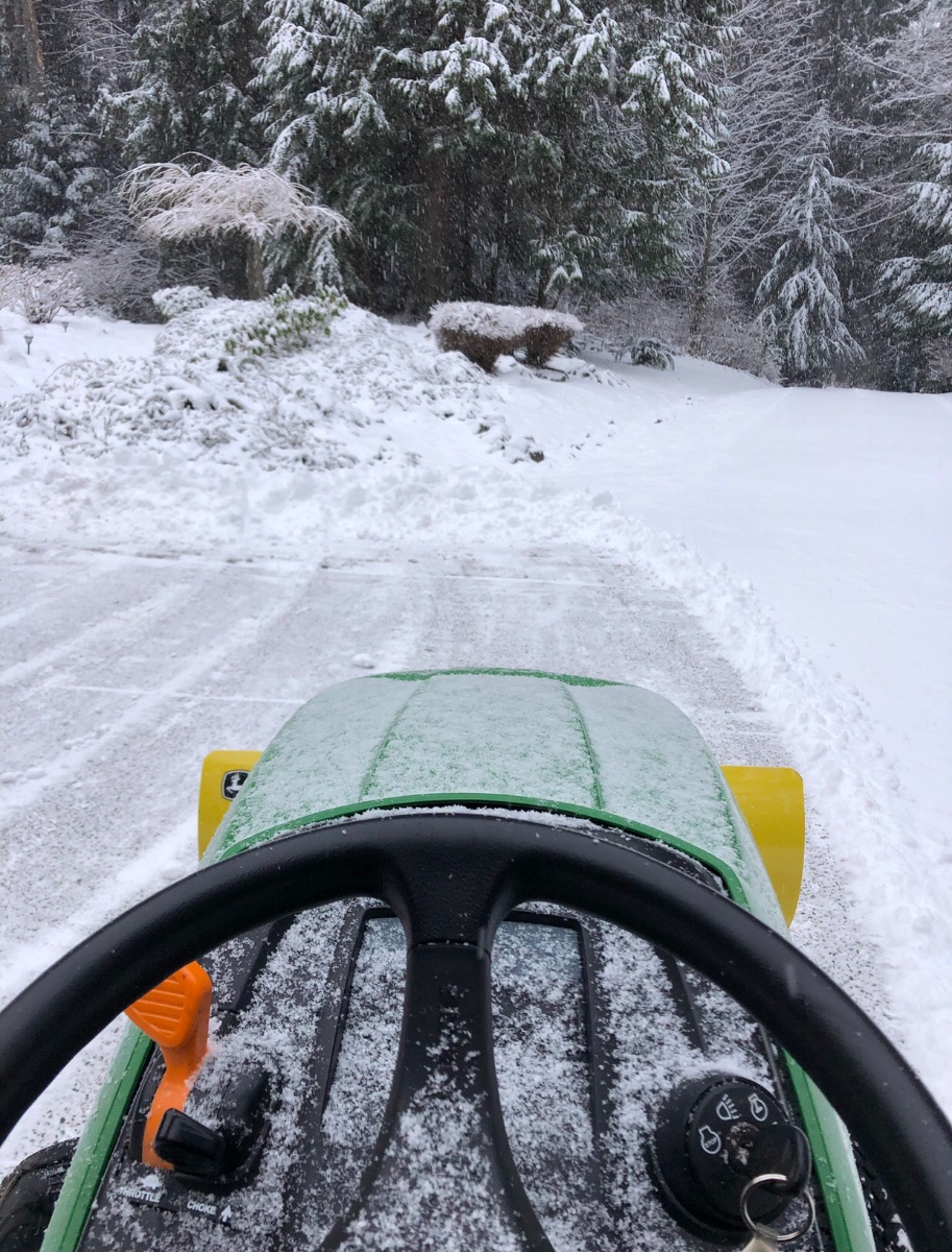
Going though my January 2020 snow pics I had forgotten that I had documented a good example of how just a tad more elevation makes all the difference when the setup is marginal. This was on the 10th, I had some sloppy accumulations here at my house at 550’ but had quickly melted off the trees. I took the dogs up to our neighbors 40 acres which is nearly 700’ and it was a winter wonderland. All I had to to was take a couple minute walk up the steep pathway to get to it. I love where I live!

 3 points
 -
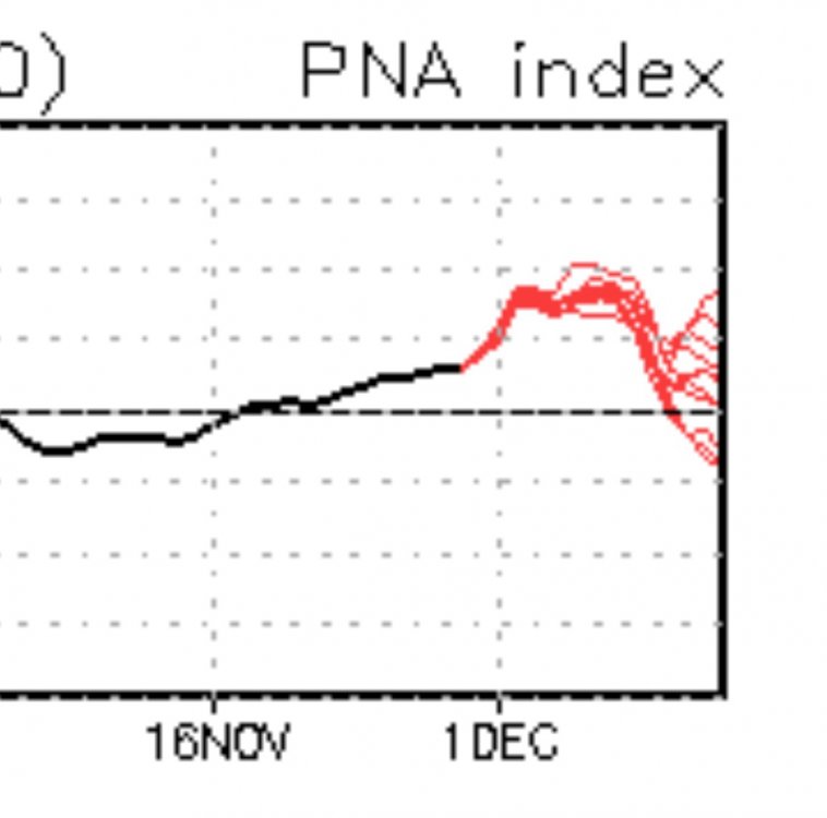
BTW the 00z GFS is back to -PNA/canonical niña by the end of week 2. Which is what I think the pattern will look like by then.3 points
-
Greenland block (verbatim) is helping the retrogression back to -PNA mid-month. Most retrogressions involve NAMT. Vortex pattern wouldn’t be helpful there.3 points
-
3 points
-
I was just outside and the sky looks exactly the same here.3 points
-
Down to 35 already.3 points
-
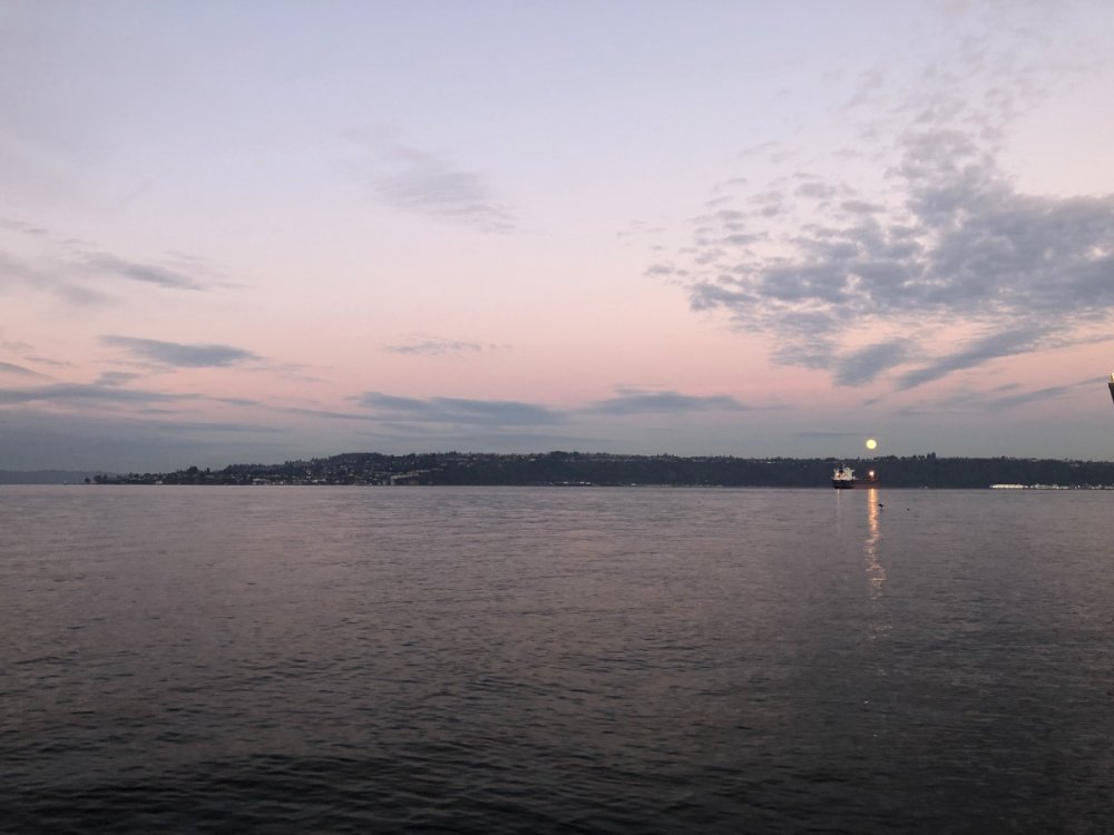
Bright moon tonight.

 3 points
 -
That was a poor decision posting that cabin online.3 points
-
I was and still am...fully onboard! I’m heading to Brennan’s illegal cabin in the woods shortly to enjoy the Siberian Express February 1989 style! Currently 50 degrees and partly cloudy. Lovely day!3 points
-
Accu-Weather's thinking on this storm: A rapidly developing and fast-moving storm is poised to bring heavy snow and wind to parts of the Ohio Valley, Great Lakes and southern Appalachian regions. Enough snow to shovel and plow is in store for Cleveland, Akron, Cincinnati, Dayton, Columbus and Toledo, Ohio; Indianapolis and Fort Wayne, Indiana; Detroit, Flint and Ann Arbor, Michigan; Erie, Pennsylvania and Toronto and London, Ontario. Several inches of snow can pile up over the higher elevations of the southern Appalachians with a few inches over parts of middle Tennessee, central Kentucky and Indiana. Snow amounts will trend upward across Ohio, West Virginia, western Pennsylvania, southern Ontario and southeastern Michigan. Note: To sum it all up, the further east you are, the more snow you will receive w this storm.3 points
-
I'll take 7" and run w it as fast as possible. Not too shabby at all.3 points
-
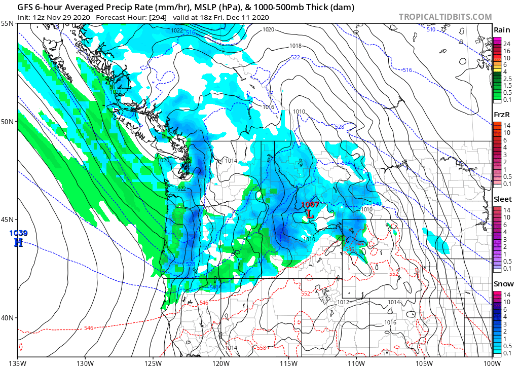
Snow is only 294 hours away for you Andrew.
 3 points
 -
i was living in Prosser at the time and remember the weather going from shirtsleeve conditions one weekend to the Yakima River being completely frozen from bank to bank the next. For most of a week, highs were in the single digits with blustery winds.3 points
-
15 degrees, crunchy grass and glitter on vehicles. No fog this morning though.3 points
-
It's a part of the storm. Thats where the NNW winds and added moisture are coming from3 points
-
34 degrees under clear skies. Decent chance we could bag a 32 degree midnight low before clouds move in. Also a decent chance of seeing freezes just about every day for the next week.2 points
-
Phase 1 complete. Phase 2 will be white lights on a few of the larger trees/shrubs in the landscaping, but that will be next weekend.
 2 points
 -
Lowest temp I had in January 2020 was 19 if I remember correctly...But had moderate snow falling at that time! I was okay with freezing my a** off plowing!
 2 points
 -
1950 Gig Harbor frozen over!2 points
-
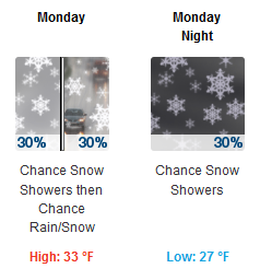
Lets see if mine changes tomorrow.......... Monday Night Snow Low: 27 °F Tuesday Snow High: 34 °F2 points
-
It’s been awhile since the Puget sound froze over lol2 points
-
Guess I'll be able to put at least one BN day in the November bag..
 2 points
 -
GRR NWS: .DISCUSSION...(This evening through next Sunday) Issued at 316 PM EST Sun Nov 29 2020 -- Snow Potential for Southeast Lower Michigan Monday into Tuesday -- Two potential storms may have at least peripheral effects for southwest Lower Michigan, one early in the week and another next weekend. The track of the surface low on Monday and Tuesday across eastern Ohio/western Pennsylvania will keep the deformation axis and best f-gen forcing across central Ohio and southeast Lower Michigan on Monday lingering into Tuesday as a trowal persists across the eastern Great Lakes. Lake enhanced snow showers in northwest flow will be affecting the southwest forecast area during this time as well. So POPs Monday into Tuesday will be highest across the SE zones especially Jackson County, along with the SW zones especially Van Buren County. Accumulations and impacts in our forecast area should be low as the stronger mesoscale snow bands are expected to remain off to the east of the forecast area where the best mid level F-gen will be, while the heavier lake effect bands remain to the southwest, across Berrien County and northern Indiana. The storm pulls away Tuesday night while our attention turns to a low cutting off across the Southern Plains. -- Lowering chances for a Big Storm next weekend -- The Southern Plains low is now trending to move along the Gulf Coast and take longer to phase with a northern stream low. This greater separation and slower phasing means the bulk of the heavier precipitation remains south and east of Lower Michigan. There could still be some light snow or snow showers as the northern stream low moves through late in the weekend, but this is looking like less of a significant storm for Lower Michigan. && You in the right spot thus far @Niko this winter!2 points
-
I checked the archived NOWDATA for that and you weren't kidding... Multiple days in the low-mid 20s with snow off and on for five straight days, then a fairly huge AR overrunning event dumping nearly a foot of wet slop, followed by multiple days in the 60s with consistent daily precip totals above .5" for a straight week. The month finished off with the state of Hawaii practically breathing on us, topping out in the upper 60s on the sunny southern end of another AR branch.2 points
-
Yup a storm has been popping up around the 12-13th in the middle of the country.2 points
-
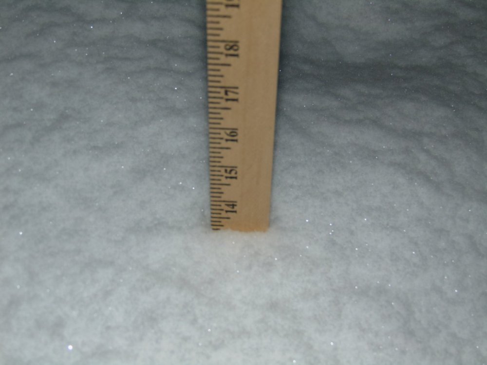
My place 01/16/2020. 13" depth. In that week from Jan 9-16 about 18" fell. I think 6" fell on the 16th. Interesting what a dud the next month was. I didn't see one flake in February. And it rained one night.
 2 points
 -
What a gorgeous afternoon it was. Played a little basketball today, if you can believe that at this time of the year w temps flirting w 50F. Felt great shooting some hoops right after a real hard work-out in my basement gym. Also, I was going to grill too afterwards, but was in the mood for Chinese food and some red wine.2 points
-
When I stop and think about how much I’ve spent over the years on putting obnoxious lights my house for a month I start to feel like a real schmuck. Money that could have been spent on helping Trump with his election litigation or ending climate change.2 points
-
It should not contain demons since we are nearly in December. Demons only appear from The Fog from October 1st thru October 31st.2 points
-
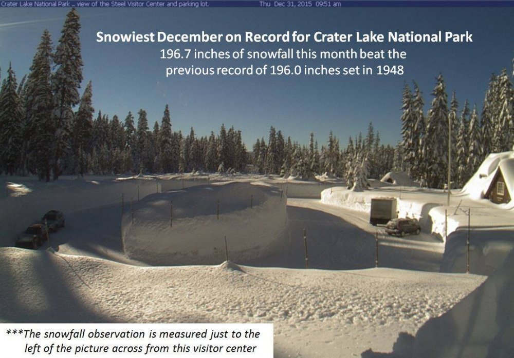
Anything can go between now and the second week of December. This was 2015, Klamath Falls the first 10-11 days or so had no measurable snow, then it just dumped white rest of the month. And look what Crater Lake NP did once that winter really got serious. This was my snowiest December in the last decade here (33.1"). 2nd one was 2010 with around 22".
 2 points
 -
GEFS is starting to paint up. It also is getting more bullish for the Wed and Thur system.2 points
-
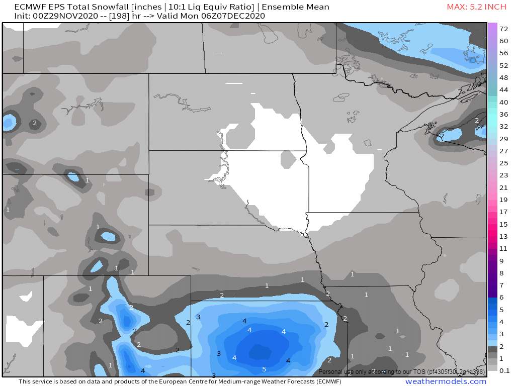
12Z ECMWF showing a warm rain pattern by day 9.2 points
-
12z euro still hanging in there with some light accumulation for KC area heavier out in Kansas.
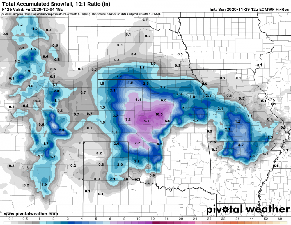 2 points
 -
PMA Forecast looks a little confused in the long range.
 2 points
 -
Attm, its 31F under partly cloudy skies. Looks to be another excellent sunny day today, but the only exception is clouds will be rolling on in as the storm approaches. Overall dry and great to do any activities outside, i.e, decorations, cleaning and etc.2 points
-
Meantime, 00z EPS shifted the snow mean a bit west and N into NE...AND...that is not the last snow opportunity coming for ya'll out west! #WinterIsComing
 2 points
 -
Came home tonight from visiting family for a belated Thanksgiving dinner to find my town's lit up for the holidays..
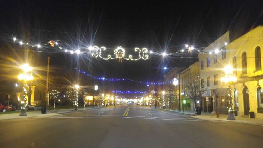 2 points


This leaderboard is set to Vancouver/GMT-07:00