
Leaderboard


Popular Content
Showing content with the highest reputation on 05/03/21 in Posts
-
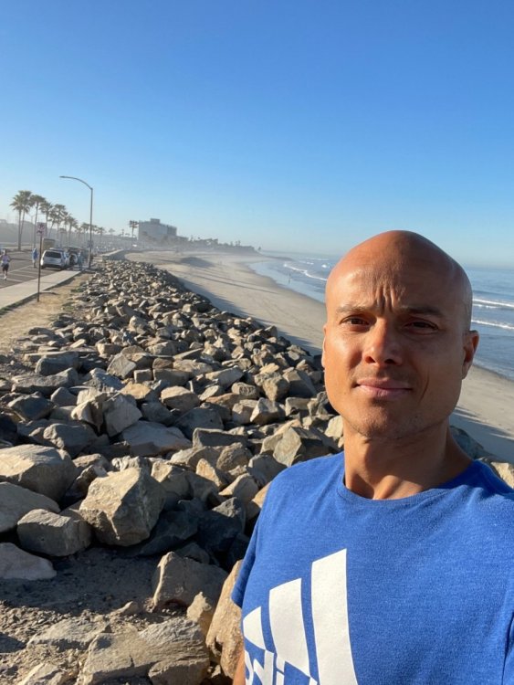
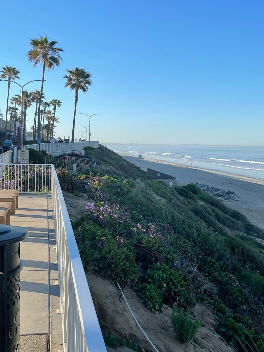
Here are some more short vids and pics from my trip. Thursday and Friday were the best days weather wise. Spending time along the ocean is such a treat when HP is over the region in the spring. The locals say June-Oct is prime time as one would expect to see. The only issue I have with Cali living, is the traffic and pricy gas ($4.20/ gal regular)! It ain’t cheap living there. IMG_0436.MP4 IMG_0428.MP4 IMG_0423.MP4

 6 points
 -
Steady light rain here. Amazing.5 points
-
12z GFS looks a little wetter for the Portland area with the Thursday-Saturday trough.5 points
-
I had over 1.5" in my gauge. Very slim heavy rain corridor, but some nice rains for the area.4 points
-
First tstorms of the season last night. Non severe, but had some gusty winds and pea sized hail. Ended up with .81" of rain4 points
-
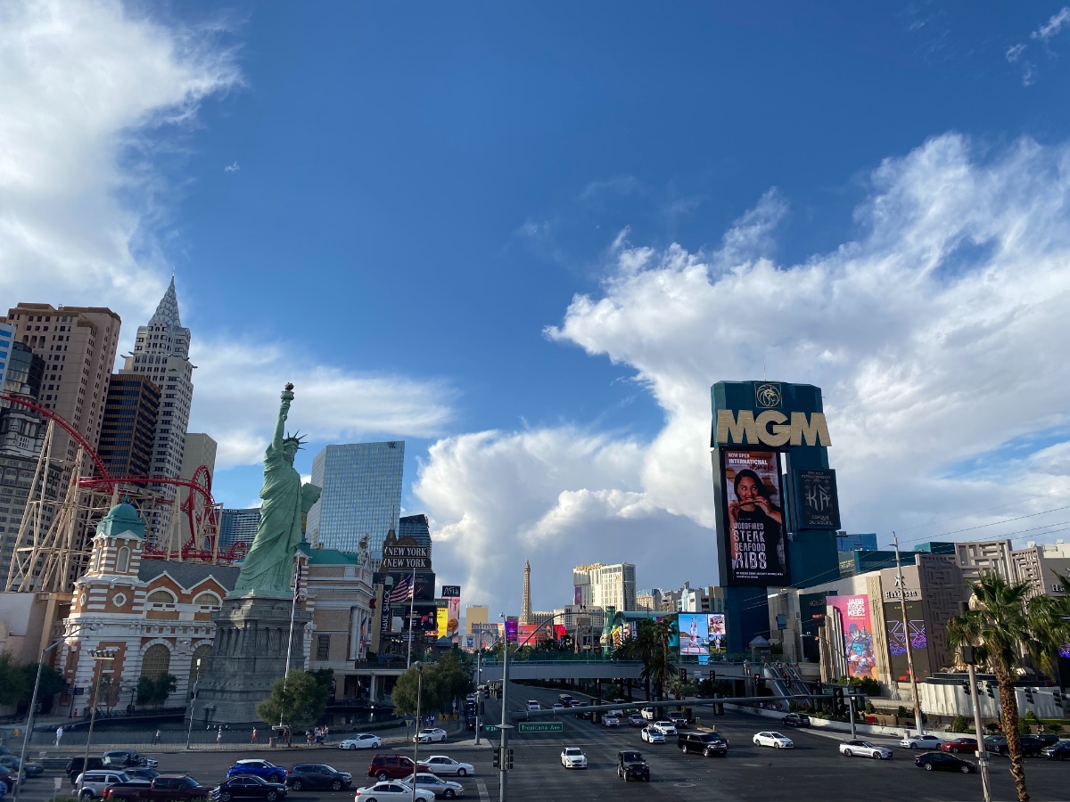
I had a wonderful time in So Cal during our short road trip. The climate in the region is quite diverse in a rather short distance if you've never been down there, esp during the Spring "shoulder" season. Interestingly, one of the mets down there made a comment on why the waves were higher than normal. There were a lot of surfers out during our stay riding 3-5 foot swells. As you know, Winter is just getting going down in the southern hemisphere near Australia and they call it the "Roaring 40's". Powerful winter storms produced huge waves and they flow into the western shores of Cali during the spring. This is the first time I've heard of it before and it makes a lot of sense. Sunday was a chilly, breezy, cloudy and cool day as we departed Carlsbad up through Temecula (wine country) onto the I-10 east bound into Palm Springs. Right before we approached Palm springs, the cloud deck disappeared and howling NW/W developed causing dust to obscure viz and looked like a ground blizzard. I've never driven through one before and this was a first for me. I'll post a couple vids but they don't do justice from what I experienced it firsthand. There was a Wind Advisory out for gusts up to 55-65 mph right between the towering mountains on both sides of I-10 heading into the valley of Palm Desert when the "squeeze effect" occurs.4 points
-
That has been a common theme in the weather lately.3 points
-
Just as the brightest reds moved in it weakened and it appears the heavier cores scraped by just nw. and south. Still had good downpours for awhile. I just checked my gauges and was pleasantly surprised to see nearly 1” fell so far. Crazy robin had pooped into 3 of my gauges before it rained so was glad I had cleaned them, but noticed dirt on one again from muddy feet from hopping in the garden. Sure enough that gauge had less rain because it sat there while it rained. Max. rainfall rates around 3.5” at times (which isn’t real high), and the wind gusted over 30 mph.3 points
-
Down to 45 so far tonight, fell asleep last night with the windows and sliding glass door open and the house was 55 this morning (the low outside last night was 40). If looks could kill, I would be dead after the look my daughter gave me this morning when she came down for breakfast (she HATES the cold).3 points
-
The increased frequency in February events doesn't really jive with that, though.2 points
-
Yeah, that map only tells part of the story since it doesn’t show the seasonal distribution of precip. My guess is the increases up north are mostly in the November-March period, simply because the mean cold season jet position is farther north.2 points
-
I was thinking sprinkles this evening, but pleasantly surprised by 0.17" so far. Looks like it's winding down though.2 points
-
I am reminded of the weakness of man every time I read a Tim post.2 points
-
Raining harder here now. And SEA has picked up .21 just in the last couple of hours.2 points
-
Raining again... play with sound up if you want to be soothed by our wetness. No cracked ground up here. 20210503_165146.mp42 points
-
Speaking of the IO..wowzers. Those waters are about to spontaneously combust.2 points
-
My conditions have been different and I hate you for that.2 points
-
The rain was a bit heavier than radar suggested. It also filled in just a bit as it passed through, so I ended up with a decent 0.25". Iowa City experienced a heavy cell that dumped over an inch.2 points
-
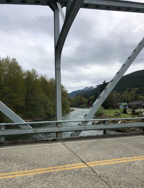
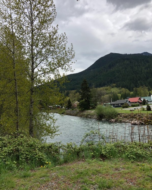
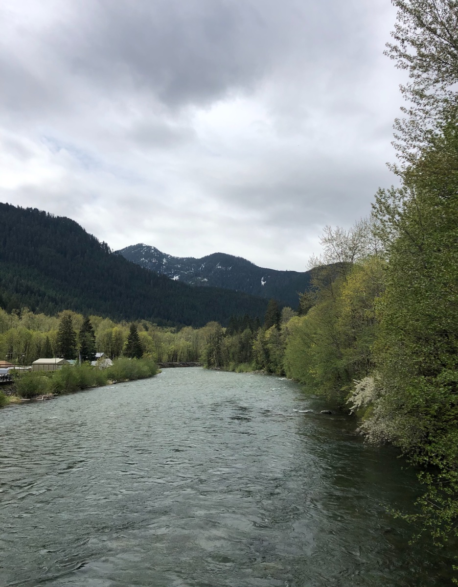
Walked out on the bridge at Skykomish since I had a few extra minutes...I just love this area! Oh and the bridge was built in 1939...Analog?

 2 points
 -
This wave is moving quicker and more cloudiness than expected is lowering any severe risk here and probably lower rainfall . But at least rainfall rates are higher than they appear on radar with higher atmospheric moisture. Currently some rain falling here.2 points
-
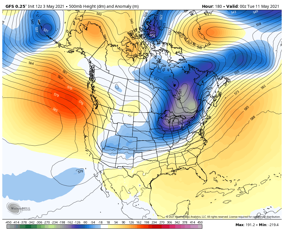
The "spike" is pretty tepid now. But a huge crash next week for sure... look at that deep trough one week from today on the 12Z GFS.
 2 points
 -
I like to oot, oot, oot oopples and boonnoonoos.2 points
-
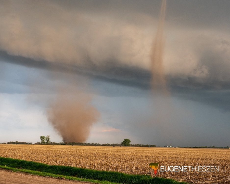
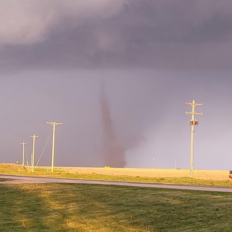
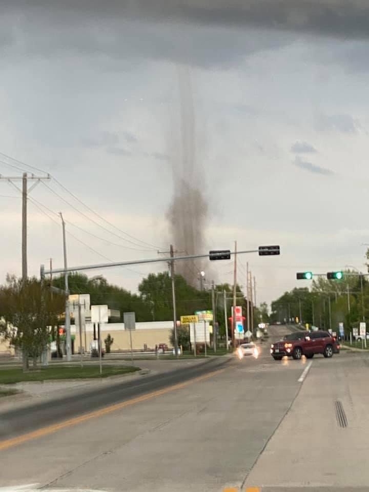
Several landspouts last night out by Aurora including twins! Even some damage was reported.

 2 points
 -
Waterloo had a record high of 93 on Saturday. Might be a while before we hit that again.2 points
-
2 points
-
Does look like February held serve for the most part, which is a win. The airport crosses the 50 degree average max threshold only a day earlier. Doesn’t do much to change the mid winter dynamic, however. Moderately strong mid/upper level advection events just don’t carry the same weight in February.1 point
-
Benjamin Franklin documented this Brood X emergence in May of 1715 and 1732... but they did not have a name for it back then. And they did not figure out the recurring 17-year cycle until the 1749 and 1766 events.1 point
-
Persistently wet to the north and east of Seattle!!!1 point
-
Pretty decent 00z GFS run. Hoping to get off on a good foot for our May 2001-2030 normals.1 point
-
I had no idea these critters emerged from the ground like that!!! Glad you posted the video. It’s been many many years since I first heard the orchestra of cicadas at Canyon Lake just out of San Antonio. Could not believe the noise they make. Made me really appreciate the PNW quiet nights. Fascinating stuff1 point
-
These new 30 year climate normals seem to indicate that the global climate may indeed be warming. Someone should probably look into this.1 point
-
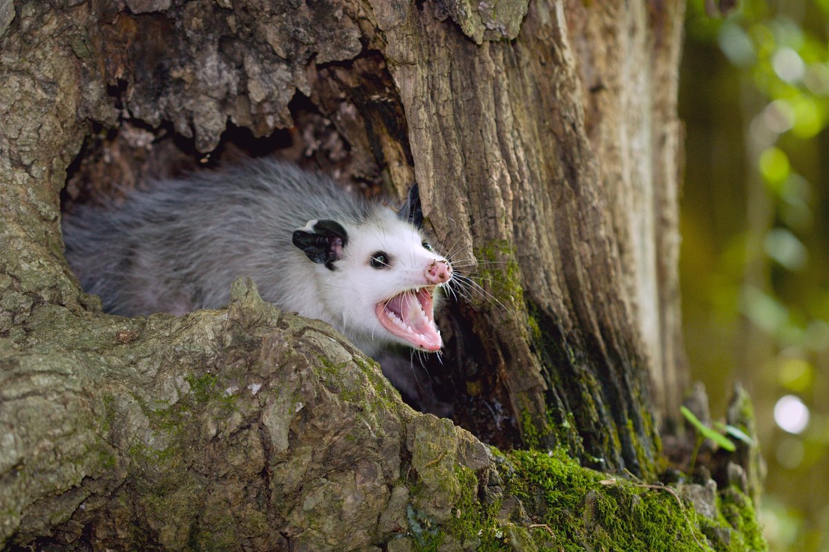
Marmots screaming and now the possums are angry at everything. A few drops of rain is all I ask
 1 point
 -
They started emerging in the DC heat island last night. But so far it’s confined to the warmest locations only. Not nearly as much UHI here so we probably won’t see them until next week. But we’re also surrounded by old woods and protected land, so when they do emerge it’ll be in much larger numbers than downtown DC. In 2004 it was full on bonkers.1 point
-
Now THATS what I call a beautiful spring day. Have you considered making a sleeping sound soother track with that?1 point
-
"This is a Sim Copter emergency news broadcast: Citizens have reported mysterious water droplets appearing from the sky and the bright orange (now a days white) disc in the sky obscured. This liquid is NOT harmful to breathe or digest and the bright disc in the sky will reappear real soon. Now pay attention to your flying."1 point
-
1 point
-
My sister who lives approximately 7 to 8 miles se. of here said they got 2”! I kinda got screwed for my community, but thankful for what we got though! Always seems to rain more a few miles se. during dry periods. Storms appear weaker currently and were near max intensity earlier.1 point
-
Here’s a helpful resource from Dr. Paul Roundy on seasonal cycle of MJO relationship(s) to the extratropical wave field. I’d recommend bookmarking it. http://www.atmos.albany.edu/facstaff/roundy/waves/rmmcyc/index200reg.html1 point
-
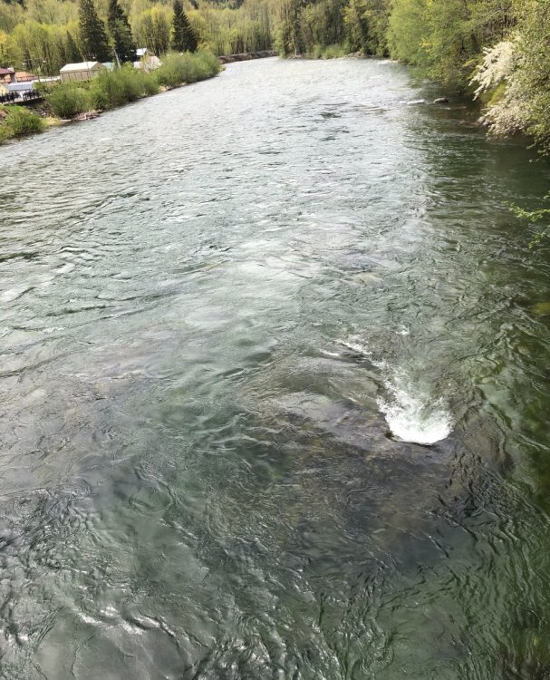
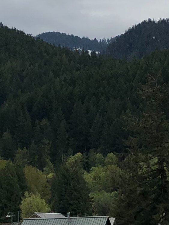
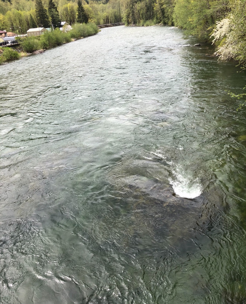
Today’s dose of Skykomish! Still some scattered snow up the hill. Currently 60 here.
 1 point
 -
54F and partly cloudy. Got a half inch of rain on the 1st tho and it looks like some more much-needed rain later this week.1 point
-
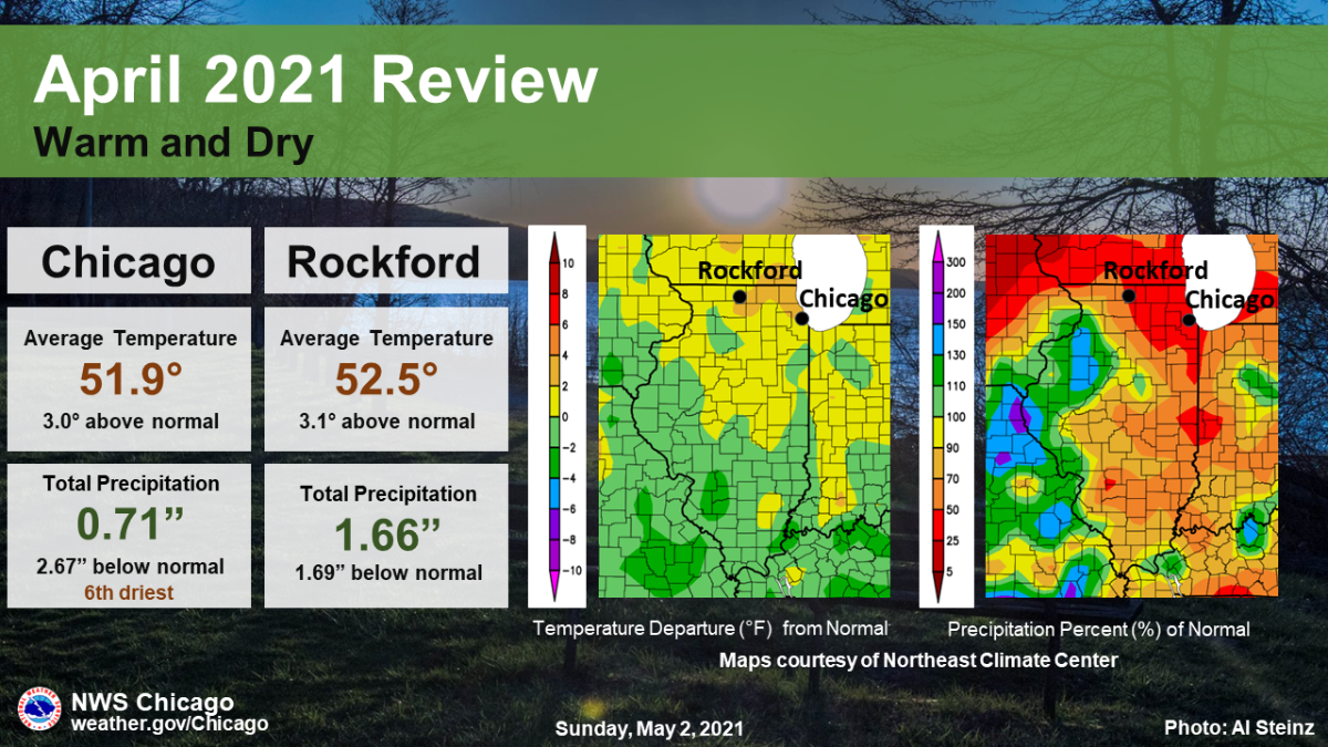
I was impressed with April, just not for the right reasons. First true record dry month at PDX since September 1993!1 point
-
I must admit I was a bit disappointed by the final third of April, but it looks like we will be getting back on track again. A huge spike and then a huge crash coming up. I love the cool northerly flow being shown a bit down the road. I still ended up with an average low of 38 last month in spite of pretty lame mins in the final stretch. As far as monthly averages...let's hope for 3 out of 4 below normal for Feb through May.1 point
-
To sum it up, it was overall a warm and dry April for practically all of the GL's region...let's see nature balance out in the precip dept for the month of May.
 1 point
 -
The late 90s summer often didn't start till at or after the fourth!1 point
-
Ahhh man sorry to hear that, usually weddings go off with a hitch(ing). Thank you everybody, I'll be here all week, try the veal! Seriously though, congrats and glad the weather cooperated!!1 point
-
Around midnight I had stepped outside to find it actually drizzling here, although not enough to wet the ground.1 point
-
1 point
-
My home has had 2.24" of rain in the last year! It's gotten so bad that I've had to will myself to not lose my interest in weather entirely. Obviously nothing of interest is coming in the next 2 months or so with it being our climatologically driest time of year. We all need some rain! I hope you can similarly have a better monsoon than last year.1 point


This leaderboard is set to Vancouver/GMT-07:00