
Leaderboard


Popular Content
Showing content with the highest reputation on 07/24/21 in all areas
-
Beautiful day on Hyalite today. Picked up about 0.5" of rainfall over the last few days and today blue skies. Heat and likely smoke return tomorrow unfortunately.
 6 points
 -
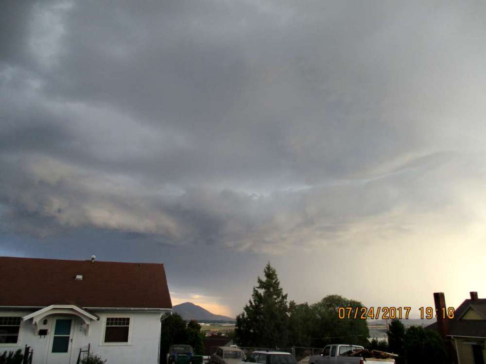
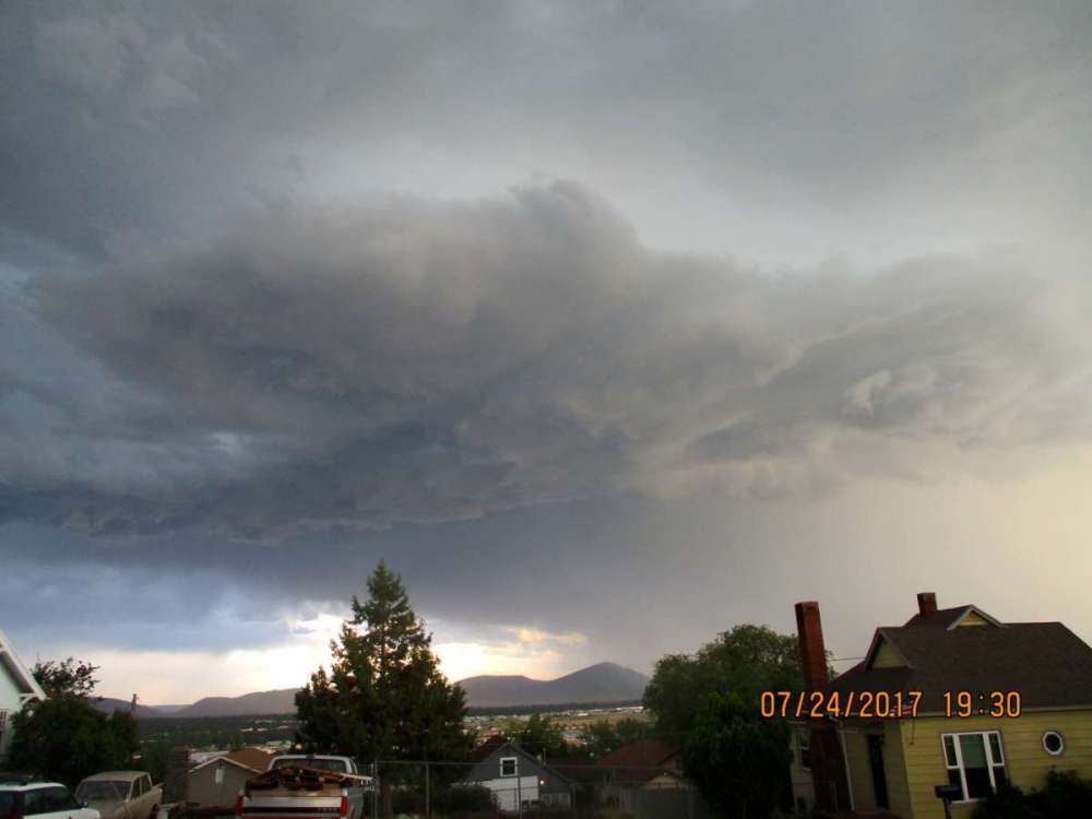
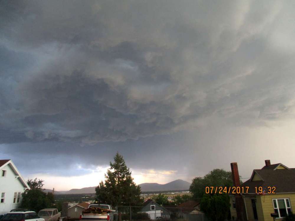
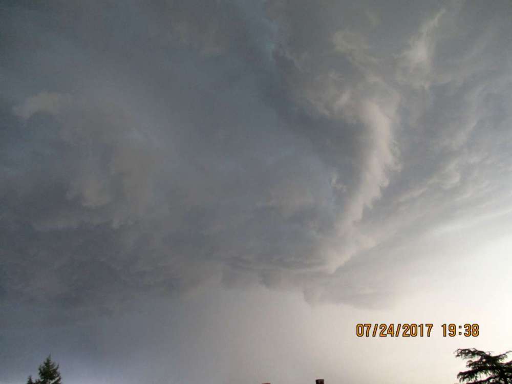
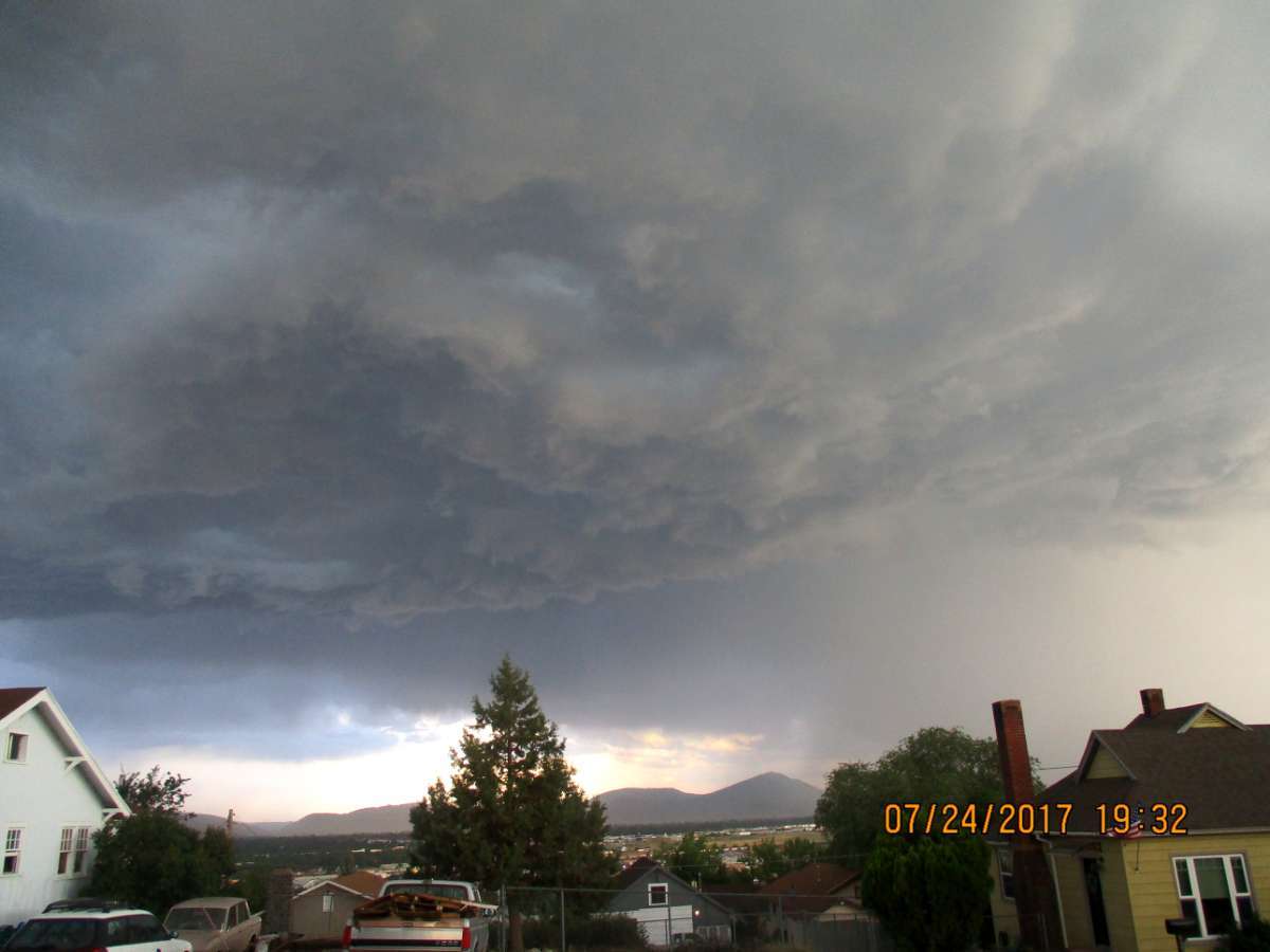
That shelf cloud passage was awesome. I haven't seen anything like it since then.
 6 points
 -
This is from July 30th last year……hoping to get up there this next week for another hike and I’ll snap another photo for comparison. North side of mountain fyi
 6 points
 -
It's a top tier warm month for most of the PNW. You are arguing semantics and will never give up on a losing argument, you can continue to spread misinformation, that is your prerogative, I am done arguing with reality. Funny the two people telling us it hasn't been hot, do not live here.5 points
-
So much anger on the forum this morning! Everyone should go out and play a nice round of golf and relax today!5 points
-
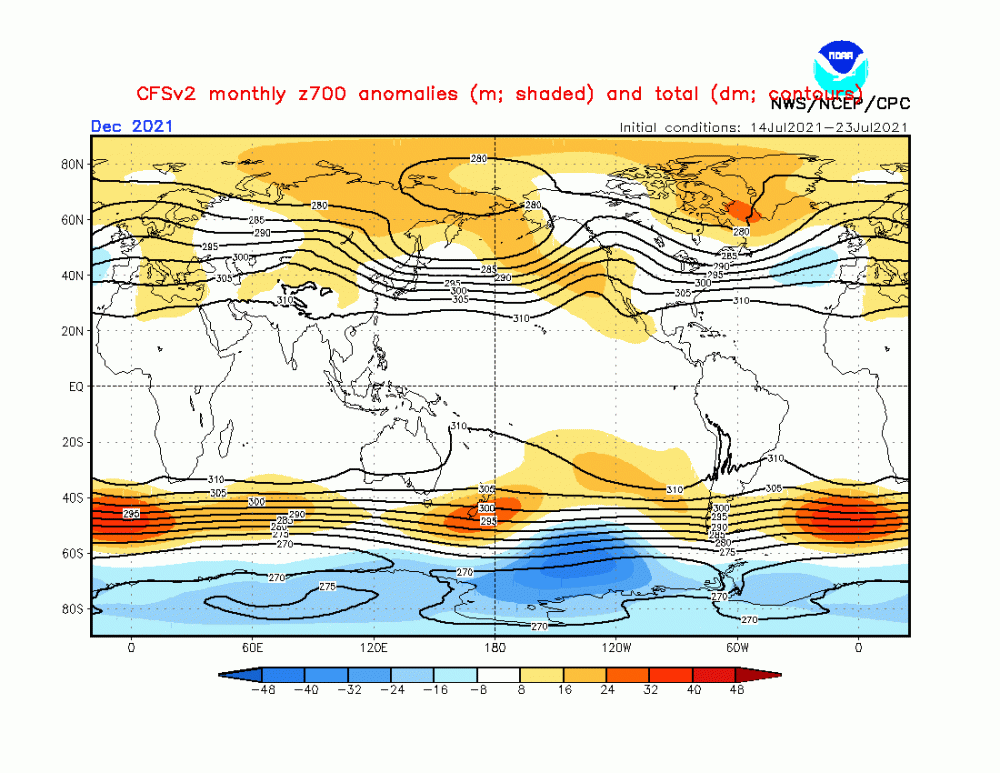
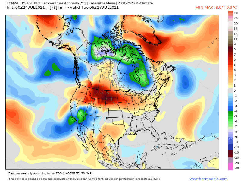
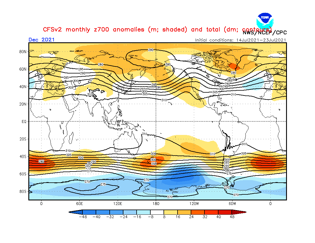
While I was flipping through the models this morning, is this a coincidence??? Nature dialing up some blocking??? December preview??? August will open up the doors with some cool and refreshing air for the MW/GL's region. Check this out and you can't script this any better. The 500mb pattern being forecast by the GEFS/EPS for Aug 1st is earily similar to the CFSv2 forecast for December....Hmmmm, this is intriguing....just saying, winter on my mind while we are in the midst of a heat wave. #CoolThoughts I see you Greenland Block...I'll see you Rock in a Bigly way... Lastly, I found this animation off last nights 0z EPS quite interesting as we see the LRC's colder phase showing up and the predictable Vortex to take hold across eastern Canada late month into August. Not just 1, but 2 rounds of cold 850's coming directly off the N Pole into the eastern CONUS. There is no doubt in my mind, that this is most def a signal of where we are heading down the road. Cooler days are heading our way soon.... #WeatherGeekin'
 5 points
 -
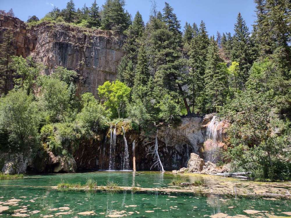
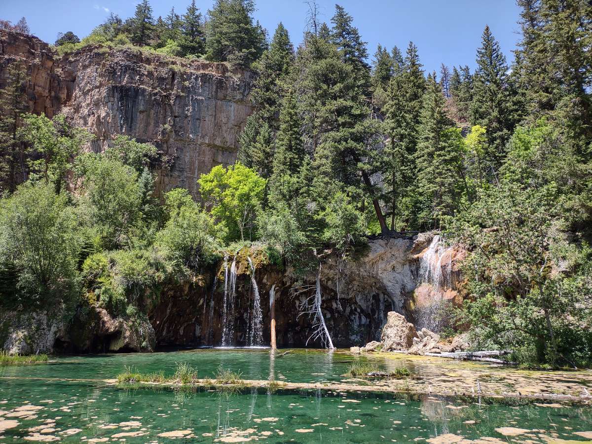
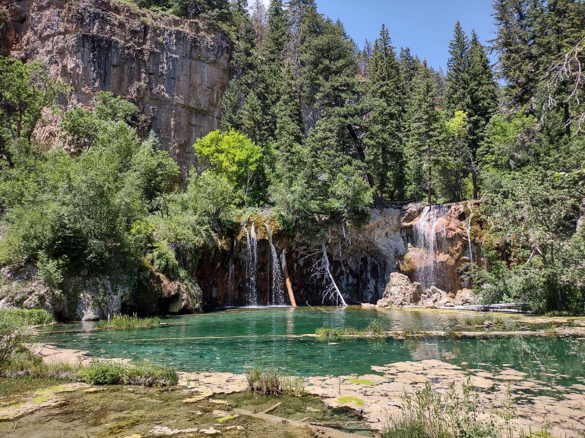
Hiked up to Hanging Lake near Glenwood Springs.
 3 points
 -
Anniversary dinner on Lake Washington waterfront in Kirkland was lovely on an 80-degree evening.3 points
-
Here is the "misinformation" that I'm spreading, according to Andrew. Somehow I am twisting the stats to push my narrative that SLE is a warm outlier. Monthly anomalies to date. SEA is the cool outlier. SLE is the warm outlier. The mean falls in the +1 to +2 range. SEA: -.4 AST: -.3 Quillayute: -.1 OLM: +.3 HIO: +1.2 Hoquiam: +1.2 BLI: +1.6 VUO: +1.6 WFO Seattle: +1.8 PDX: +1.8 EUG: +2.4 MMV: +2.4 TTD: +2.6 SLE: +2.93 points
-
Best storm of the season that I’ve experienced with torrential rains, wind, vivid light and very loud thunder. Over 1” of rain in about 20-30min. Local reporting station shows 1.27”. Very pleased.3 points
-
12Z EPS... warmth seems to peak and then we return to a pattern similar to what we have now.
 3 points
 -
There was a record rain fall at Grand Rapids and Muskegon yesterday. A total of 2.65" of rain fell at GRR yesterday the old record was 1.02" in 1968. Here at my house I reported a total of 2.03" with the bulk falling in some very heavy rain yesterday around 5 AM I will not call that a thunderstorm because there was at most one or maybe two rumbles of thunder. At Muskegon they reported 1.78" and that is also a new record with the old one being just one inch set in 1912. The overnight low here was a warm 74 it looks like the official overnight low at GRR was 72. At this time there is some hazy sunshine with a temperature of 78 and a DP of 71. There is some heavy rain and a few thunderstorms in northern Michigan with the thunderstorms mostly in the Traverse City area.3 points
-
Terry Swails has been talking about the upcoming heat and possible break. Considering the GFS and Euro have both been showing the MJO in phase 6, which is a cold phase for our region, he's been thinking the Euro may be overdoing the heat wave.3 points
-
First time we have seen Lake Stevens... its was gorgeous and packed with boats!2 points
-
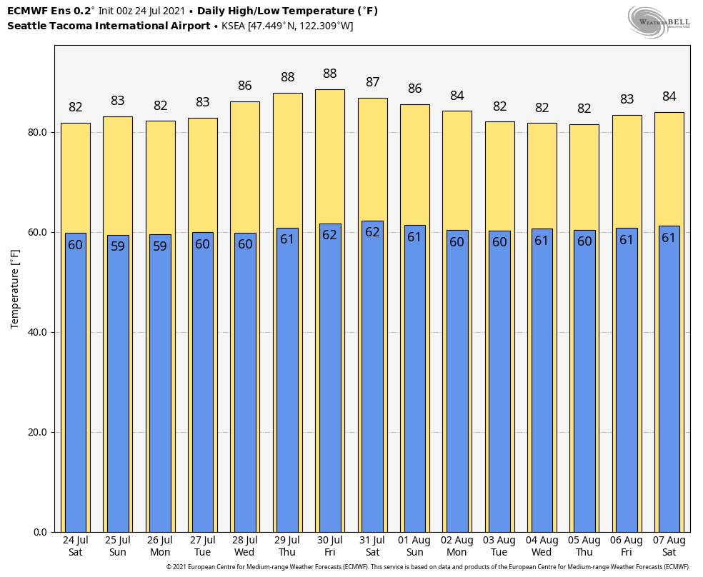
Looks like we hit 94F today. Nice and normal temps.2 points
-
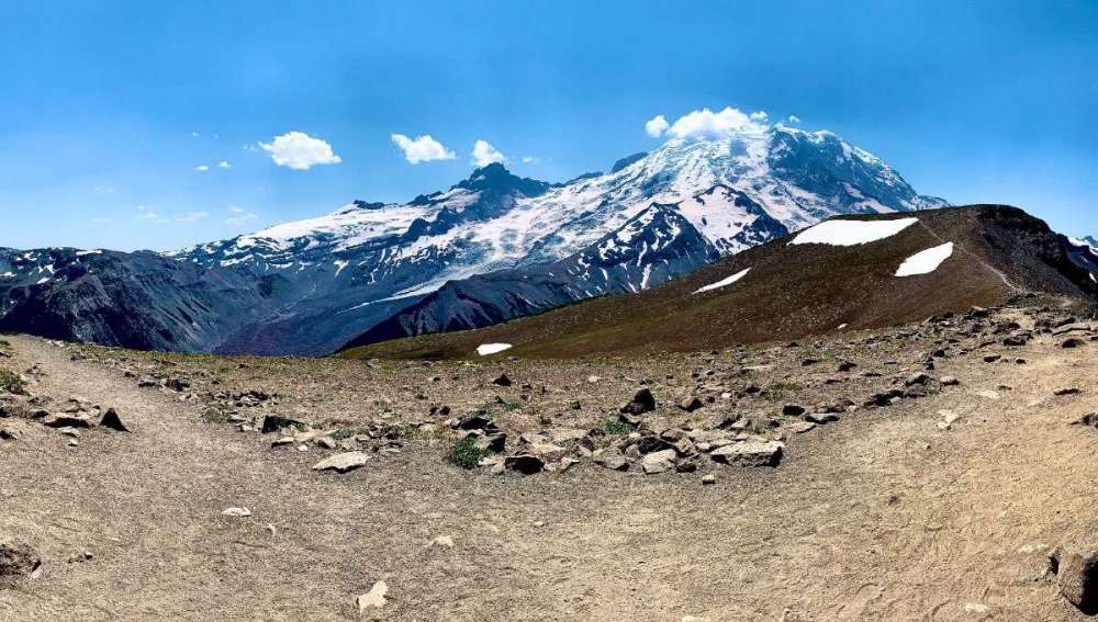
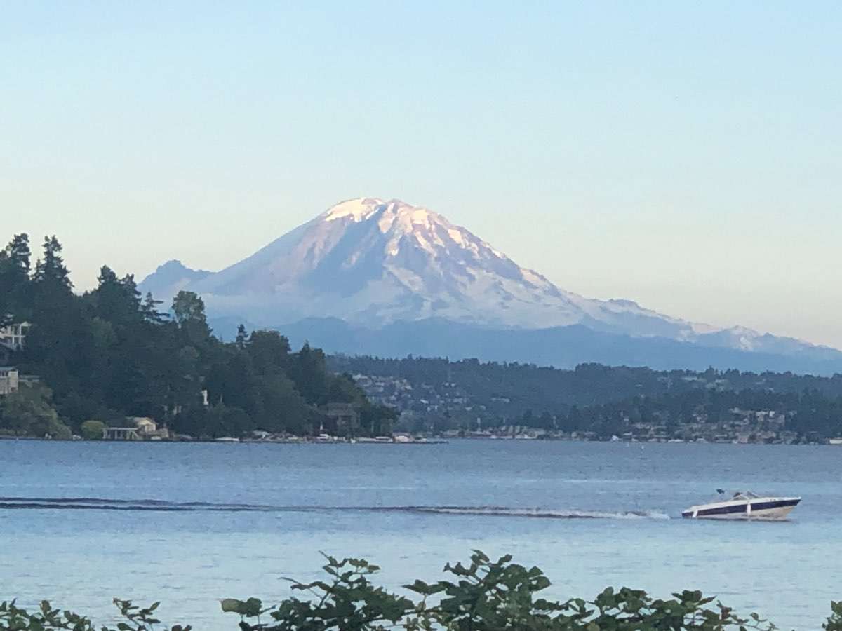
I’ve lived here for 30 years, I don’t recall seeing her this bare. This was taken couple days ago. Also, if you dig deeper into the thread, the NWS said south side of the mountain at Paradise lost 3 to 4 feet of snow during the heatwave.
 2 points
 -
I miss those stormy skies Awesome photos2 points
-
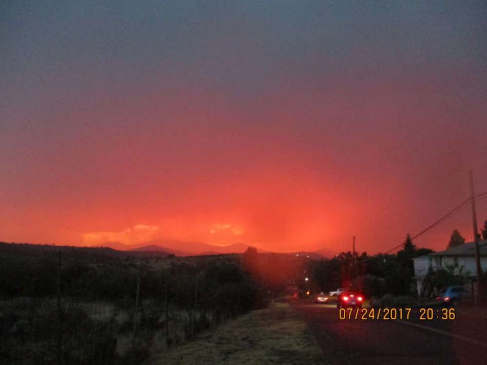
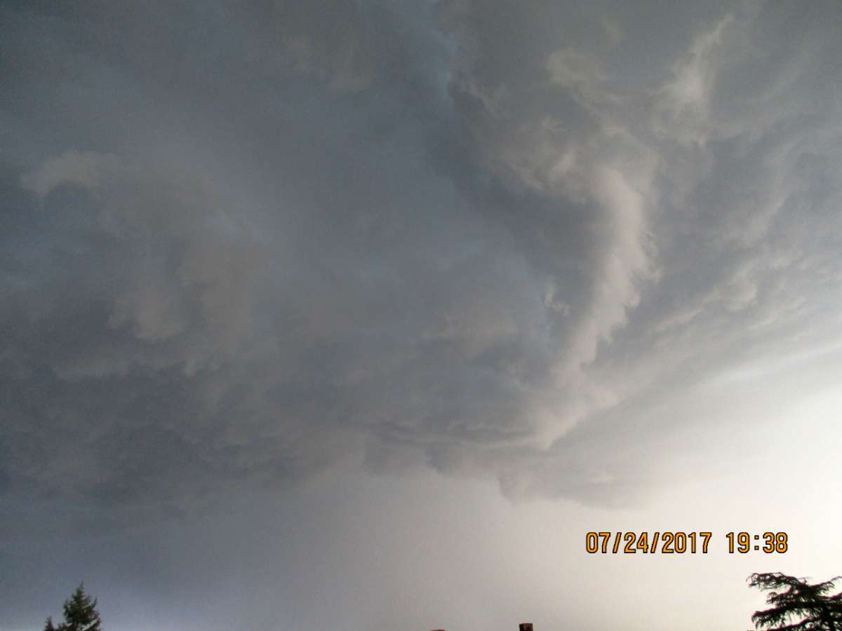
A nice memory from 2017. Back when it wasn't so impossible to have thunderstorms. lol2 points
-
Beautiful Saturday, clear blue skies. Currently breezy and 68F at 4:52pm in Everett. Would love to see some rain though, or even clouds to darken the skies.2 points
-
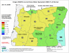
A map like this is why many Nebraskans head west to the Panhandle in the summer. 39 Dew. Wow.
 2 points
 -
93 with a heat index of 103. Pure peanut butter outside.2 points
-
Today is a scorcher, especially with the high dew points which are the highest of the year! It felt like a sauna while I was outside watering things and mowing some grass. The dew hit the 80°s (83° max. on my station) for the first time! The lawns still are green, but growth suddenly slowed (it was lush and growing like mad) with all this heat and dryness. Had to mow every few days for awhile. Anyway, a weak front should move through soon.2 points
-
Extended seems to call for more of the same. Slightly warmer than historical average (but average for recent years). The biggest change you can see comparing 1991-2020 normals to older ones is the marked rise in average nighttime lows, especially inland. 50s in July are largely a relic of the past for the San Fernando Valley except during unusually cool years. Plus, the number of 90+ days in central LA has skyrocketed compared to older data.2 points
-
Wednesday in Lincoln: GFS: 113 Euro: 99 OAX: 101 I think I would lean towards the "cooler" end lol. There would have to be conditions similar to the Dust Bowl to hit 113 and we're currently on the border of D0 drought/no drought. The biggest outlier is 1911, which hit 110, the highest temp outside of the Dust Bowl era.2 points
-
Okay? So my post was accurate, then? I don’t see what the issue is.2 points
-
12z GFS trending Jesse’s way.2 points
-
Phoenix was 83/73 yesterday with 0.80” rainfall. Nearly a third of their YTD precip in a single day.2 points
-
Good morning everyone!! It’s going to be a beautiful Saturday!! Currently 59 and sunny!!2 points
-
The 00Z ECMWF was much more reasonable... kept Portland below 100. The 00Z EPS just showed consistent warmth...
 2 points
 -
I think one would consider that these are the "dog days of summer"...hot and humid conditions prevail on this summery morning 76F/72F with a bit of haze. I took a step outside on my deck and looked out and what struck me was the reddish tint the moon had. It was almost an eary looking color. That's a first. Well, the heavens have been delivering abundant moisture in the PHX valley. I'm happy to say that PHX recorded .80" of precip which was a record for the date. Scottsdale received in the order of 2-3" of rain the other day! Much BN temps with a high of ONLY 83F and that is good for 23 degrees BN. Crazy wx for those out there. More torrential rains are in the forecast today and tomorrow. Most models have a bullseye of precip right over our place out there... Meanwhile, I'm looking forward to hopefully score severe storms later this afternoon...2 points
-
There are a lot of great lakes in Snohomish County. Lake Stevens is very built up, but if you prefer surroundings of forest, there are plenty of those lakes nearby too. But if you live in North Bend, you already have nature's bounty all around you. I have no scientific temperature gauges here, but decided to take a peak at what Weather Underground has for current temps in the Everett vicinity. At my current spot, it is 60F. I am near sea level. Another station at the port says it is 61F. A weather station in Downtown Everett which is a higher elevation says 64F. At the far southeast end of the city away from the water, the temp is ranging from as low as 58F to 62F. Now we head east to a downtown Snohomish station which says 64F. A north Lake Stevens station reads 63F right at the water, while two nearby say 66F and 67F near Walker Hill. I realize this isn't the optimal time to look at temperature variations in the region, but there we have it.1 point
-
The temperature difference is massive. Much of Everett's waterfront is sea level, but then if you go to the south, the elevation is higher and temps can sometimes run 5 degrees warmer. Then as you get further from the water, temps get even hotter as you pointed out. It seems like on average (I have no evidence, just go with me here, lol) Everett is 5-10 degrees cooler than Seattle. It is definitely cooler than Tacoma. Hope you had a great time at least seeing the lake. Beautiful day to enjoy it or see it from your car at the very least.1 point
-
92 with a max HI of 104 today. Only the 5th time this month we’ve reached 90, but it looks like the last 8 days will have no problem. Biggest question next week will be dew points. On the days the GFS has us so hot dews are down in the 50s. Most forecasters don’t see them being that low so it keeps our highs cooler with the muggy air.1 point
-
Looks like you did all the dirty work for me. Interestingly, I was in the middle of doing something like this yesterday but had to wrap it up early for some business and couldn't get back to it. Weather happens and no way we can take it back, but the extreme heatwave skewed the data if you want to take a look at this summer up to date. I'd say it's been quite reasonable, but hey, it is what is with the narrative. I will say though that we still have August to go through and as it stands right now, I'm actually quite afraid for what this month will bring.1 point
-
81/56 and currently hanging onto 79*1 point
-
This is a narratives-only zone. Facts aren’t allowed here.1 point
-
They’re forecasting 100 to 101 over the next week. Hope the grid doesn’t crash. A change in the jet stream pattern means the triple-digit heat continues across North Texas into early next week. The high-pressure system responsible for the hot weather will be centered over North Texas from Sunday through Tuesday. But by midweek that high will drift back towards New Mexico. Thank heavens.1 point
-
Just incredible humidity here today. The weak front dropping in squeezed out more moisture! A nice shower went over city of Ottumwa missing me, but it added moisture! Incredible 85f dewpoint highest since purchasing my davis pro 6 years ago. Possibly high dewpoint of my life. High temp was 94.
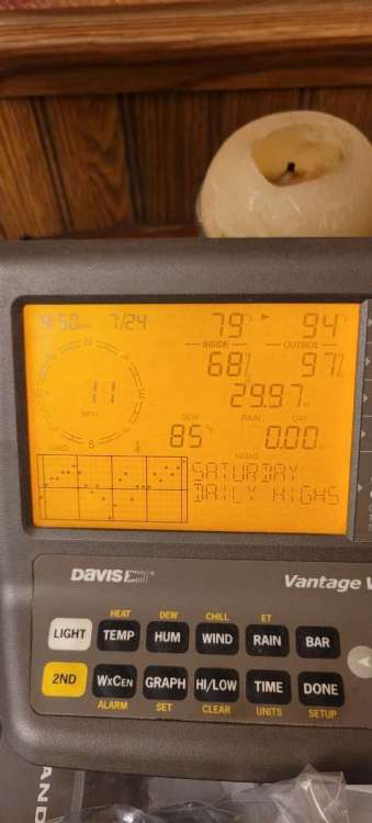 1 point
 -
Whew, congrats! That’s what we need right now!1 point
-
81 here.1 point
-
I’m thinking 81-83 on this side of the bay.1 point
-
76* here currently (72* yesterday at this time). Should be able to reach 83* today here locally1 point
-
12Z ECMWF shows 78 for a high at SEA today. It's 77 at noon. Cold bias is back with the marine layer inversion gone.1 point
-
I think the second week of August should turn wet so that should cool things down for ya a little.1 point
-
The GFS is trending everyone's way... more reasonable temps and less chance of being inundated with smoke.1 point
-
Another stupid comment. Lets fine them for climate change being caused by the rest of the world when the western states are doing the most to make a difference.1 point
-
This is a really stupid comment. No one on here is cheering for more extreme heat and smoke.1 point
-
I saw this post last night and though, my God Jesse is angry. Then I read back through the comments and realized why.1 point
-
Up to 88F beautiful day. Been following NCAA conference realignment very closely as it directly affects my charity and I have the kiddos over so not a lot of time to post.1 point
-
Not bad there. We hit 95* and 47% humidity in Ft. Worth. Welcome to Texas.1 point


This leaderboard is set to Vancouver/GMT-07:00