
Leaderboard


Popular Content
Showing content with the highest reputation on 08/05/22 in all areas
-
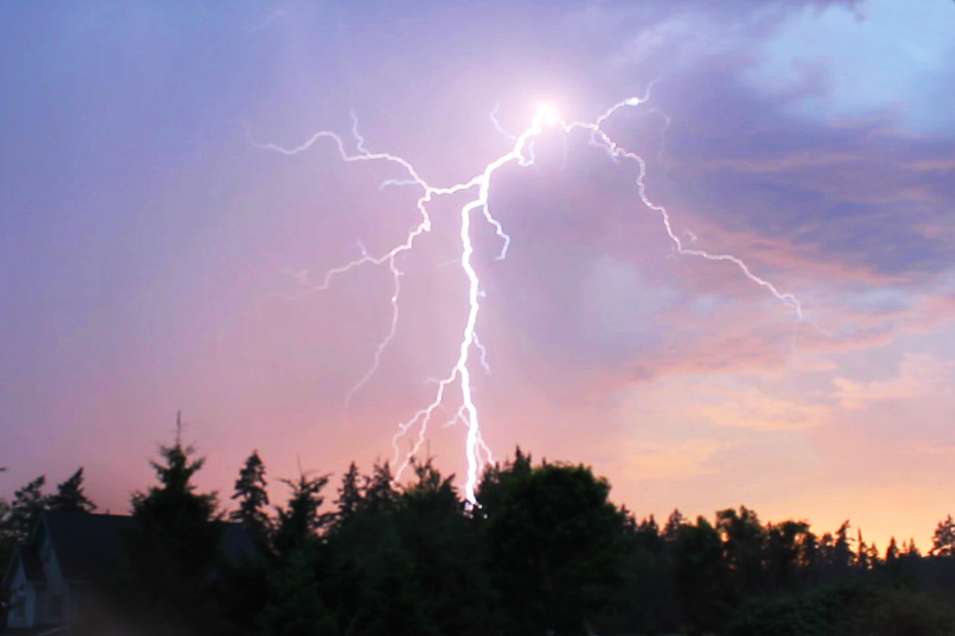
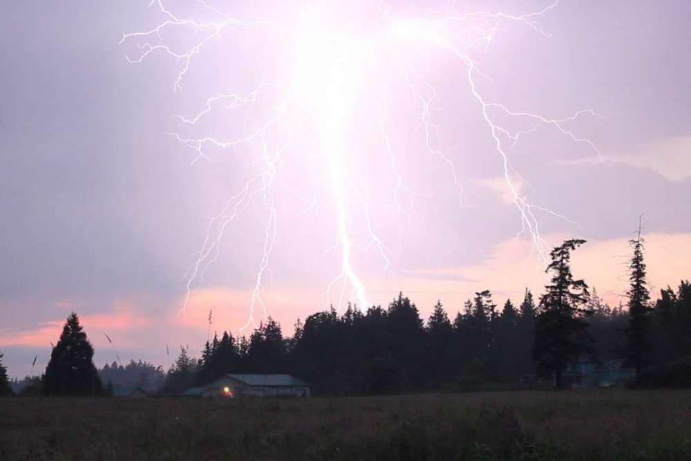
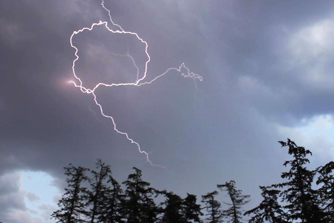
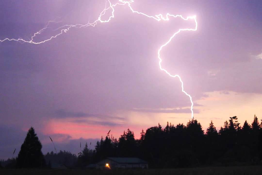
The best evening thunderstorm set-up I've witnessed here was July 13, 2012. A thunderstorm with a couple hundred strikes rolled overhead just about sunset and lead to some incredible strikes, some even within a couple hundred meters. These photos are all still frames from videos I took. Can we get another one of those next week?

 14 points
 -
Winter Storm Warning URGENT - WINTER WEATHER MESSAGE National Weather Service Fairbanks AK 353 AM AKDT Fri Aug 5 2022 AKZ206-060100- /O.UPG.PAFG.WS.A.0011.220806T0500Z-220807T0600Z/ /O.NEW.PAFG.WS.W.0009.220806T0600Z-220807T1200Z/ Northeastern Brooks Range- Including Anaktuvuk Pass, Atigun Pass, Galbraith Lake, Sagwon, and Franklin Bluffs 353 AM AKDT Fri Aug 5 2022 ...WINTER STORM WARNING IN EFFECT FROM 10 PM THIS EVENING TO 4 AM AKDT SUNDAY... * WHAT...Heavy snow expected. Plan on difficult travel conditions. Total snow accumulations of 8 inches are possible above 3000 feet, with 2 to 4 inches from 2000 to 3000 feet. * WHERE...Northeastern Brooks Range above 2000 feet. * WHEN...10 PM today to 4 AM Sunday. * ADDITIONAL DETAILS...Significant reductions in visibility are possible. Rain will develop today and change to snow late tonight. Snow will continue through Saturday night before tapering off. Snow will be heavy at times with low visibility. This will make travel on the Dalton Highway over Atigun Pass difficult from late tonight through Saturday night. PRECAUTIONARY/PREPAREDNESS ACTIONS... A Winter Storm Warning for snow means severe winter weather conditions are expected. This will make travel very difficult or impossible. The latest road conditions can be obtained by calling 5 1 1. $$12 points
-
You are such a great addition to the forum. I just thought I would mention that again.11 points
-
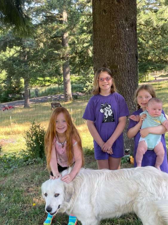
Nice day. Fire weather watch this weekend. Yay. My eldest daughters decided the hottest week in PNW history was equivalent to spring in Oklahoma. I may be biased but they are the greatest kids a guy could ever be blessed with.
 11 points
 -
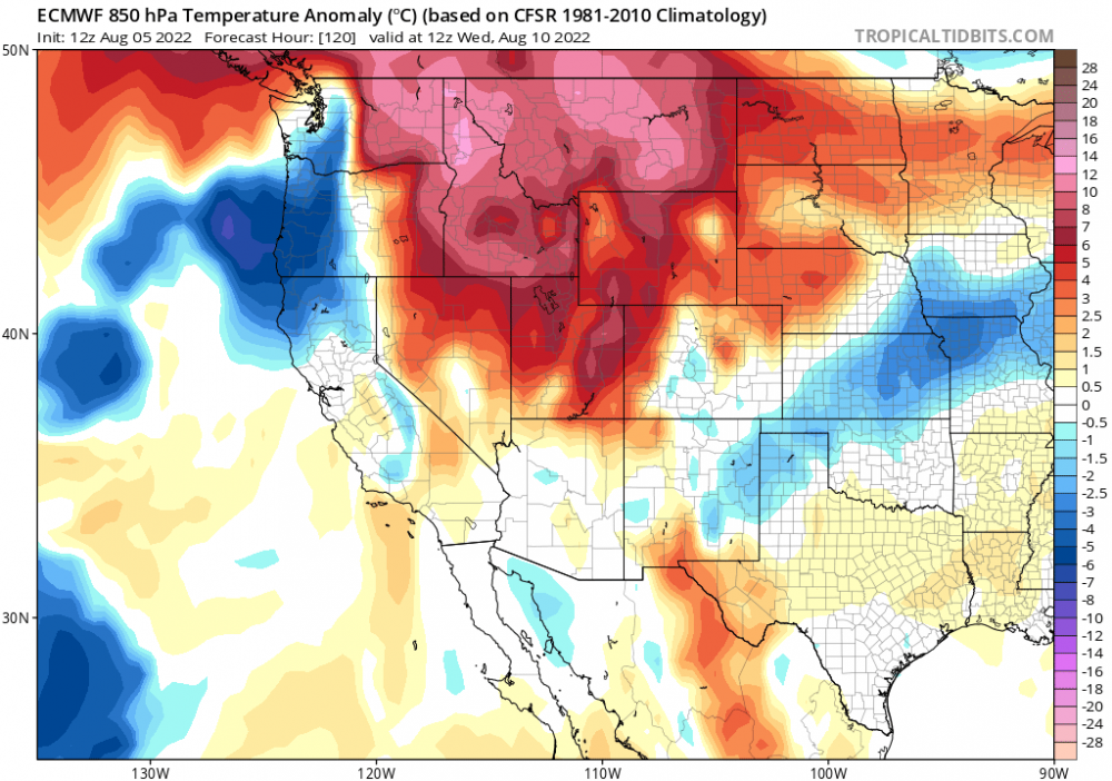
Yeah it's much more of a canonical thunderstorm setup than those earlier this summer with transient shortwaves that would orbit around a parent trough offshore, giving the best dynamics to only those who were under its crossfire at the right time, when SSE flow and solid diffluence aloft were attained for 6-10 hours (before proceeding to retrograde back NNW.) This time we have a solitary ULL drifting northward, gifting almost everyone in its path excelent shear, diffluence, and moisture. Much better than a "hope I get sniped from across the pacific" kind of deal.10 points
-
Looks like some pretty good PWAT values with the storms Tuesday into Wednesday, not as much as the 18z though9 points
-
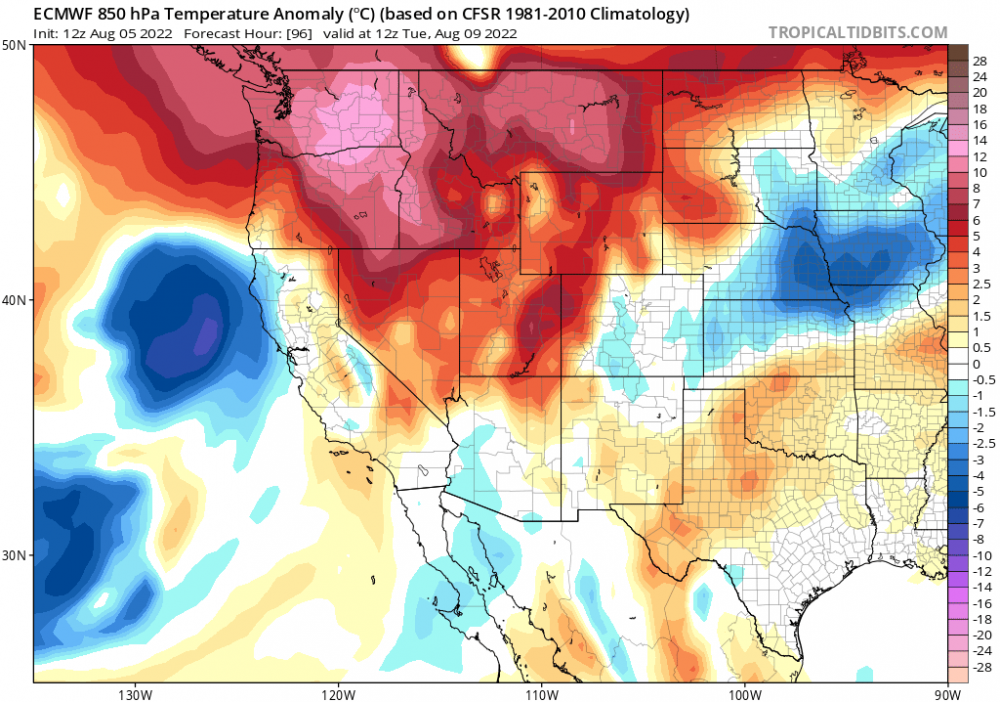
It really is a primo setup for storms, particularly nocturnal ones. Can't ask for too much more this time of the year than a <570dm height cutoff trough rotating up from the south directly off the coast over a hot, unstable airmass across the region. With great PWAT values and strong diffluence aloft.8 points
-
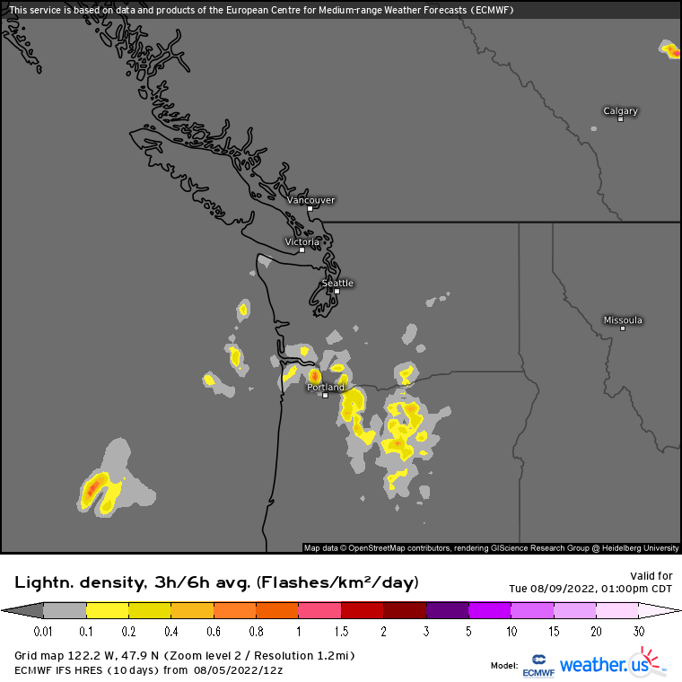
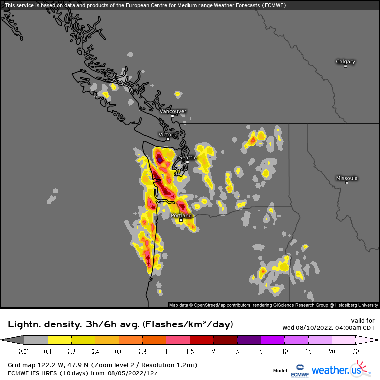
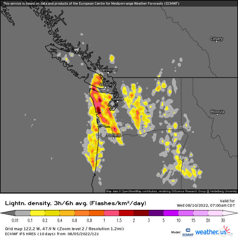
12z EURO showing some lightning west of the Cascades on Tuesday and even more so on Wednesday morning.
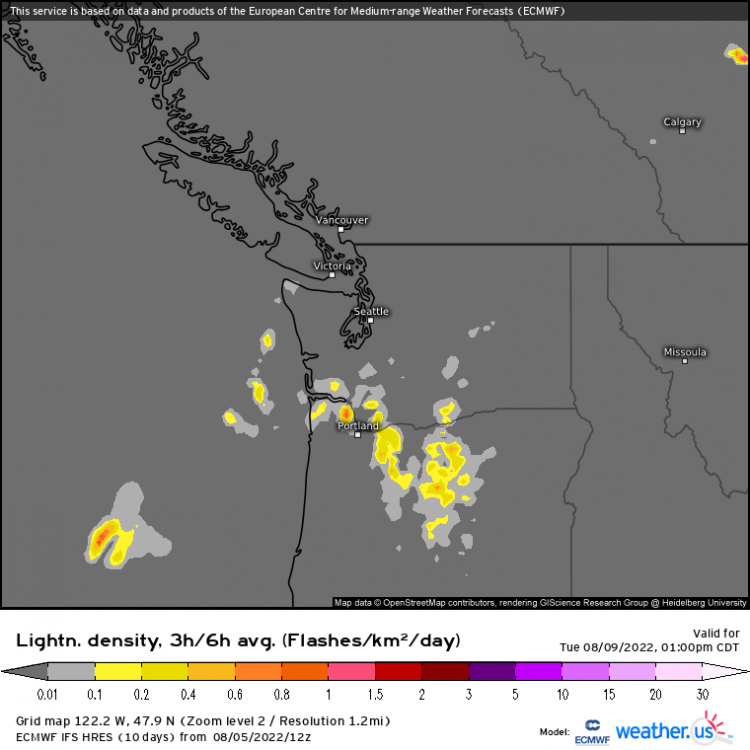

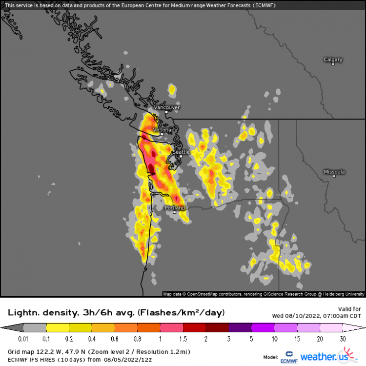 8 points
 -
12z ICON shows two rounds of convection as the cutoff low drags ashore. One spotty outbreak on Tuesday morning and then a bigger regional event Tuesday overnight.
 8 points
 -
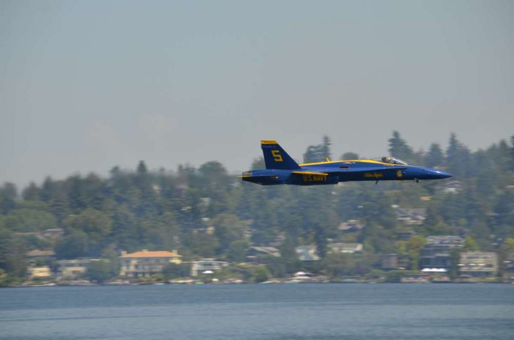
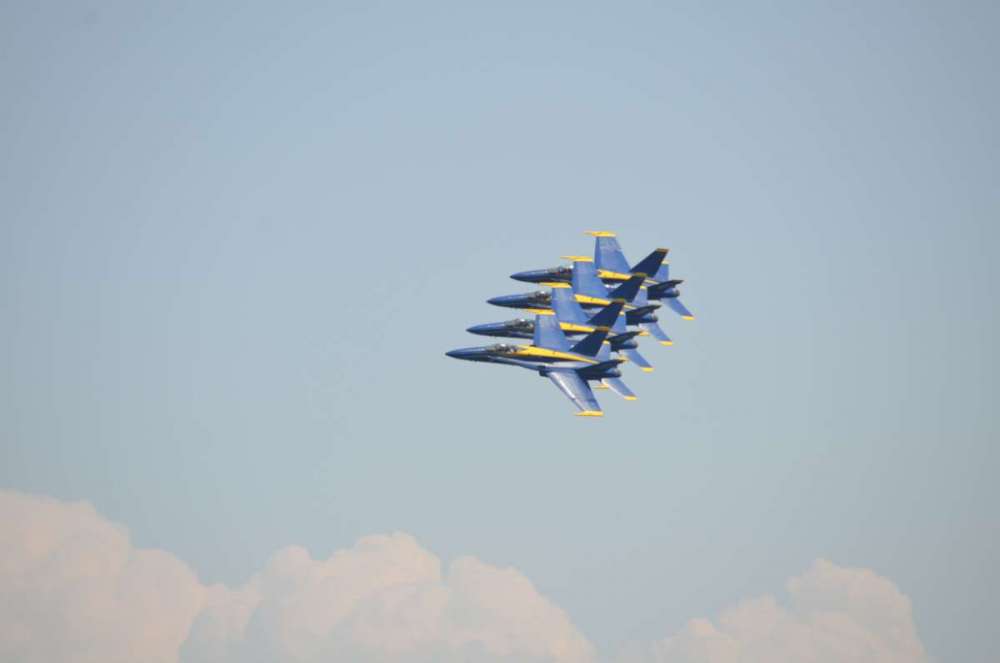
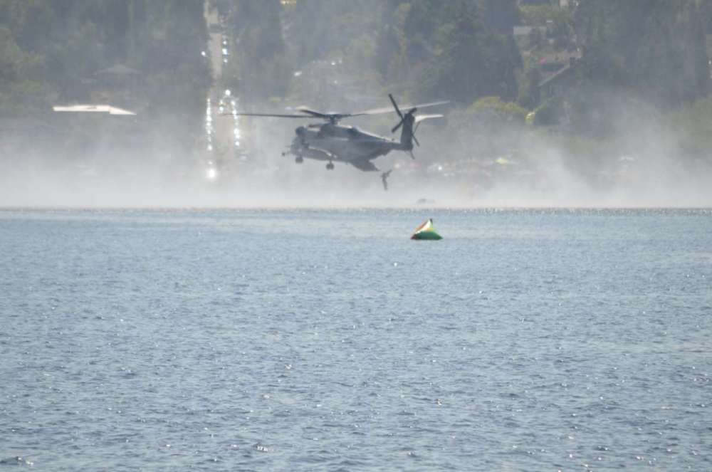
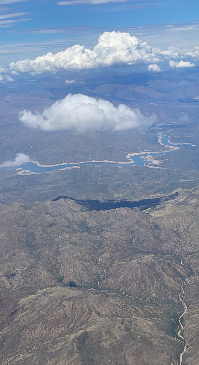
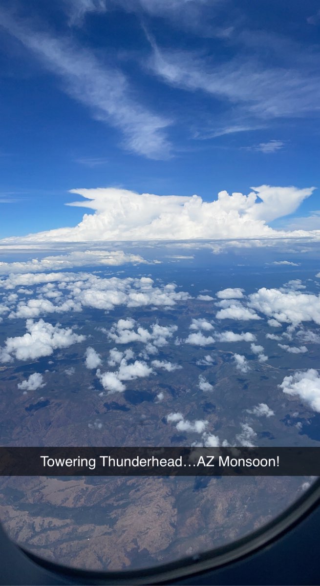
Hello from the “Valley of the Sun!” Took a last minute trip out west for a couple weeks and take some road trips. Some views of the plane ride over the mountains of the SW…the lighter color of the shoreline of the lake below shows how much water has receded. The towering Thunderhead was a cool shot from 30,000ft+ in the air. IMG_1995.MOV
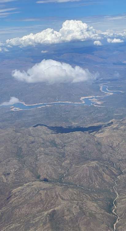
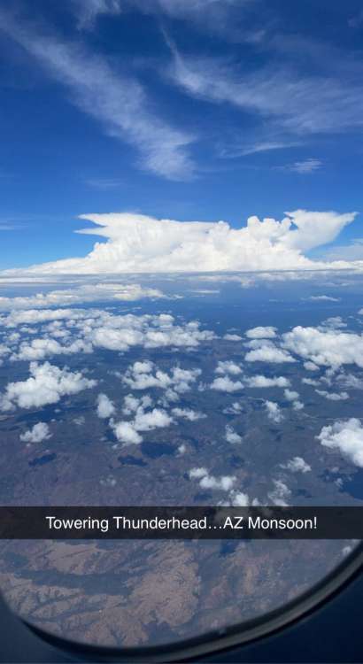 8 points
 -
Lots of cleanup on the boards this evening. Unfounded accusations are never acceptable. Tonight could also be a good night to educate yourself about the language and symbols/emojis that we use on a public forum. Please be respectful of others because you know what, we're all not perfect.7 points
-
I would never hang out with either of you if you paid me7 points
-
Ppl, there will be liquor at the forum meet up next weekend. We can work through this7 points
-
82/52 day here. Beautiful out. Back to hell the next three days. Would be cool to see some thunderstorms next week.7 points
-
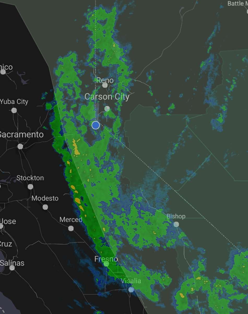
Stratiform rain in Aug is very unusual. Good news is that the Sierra fire season should be pretty much over. Then we just have to get through offshore fire season in Southern Cal.
 7 points
 -
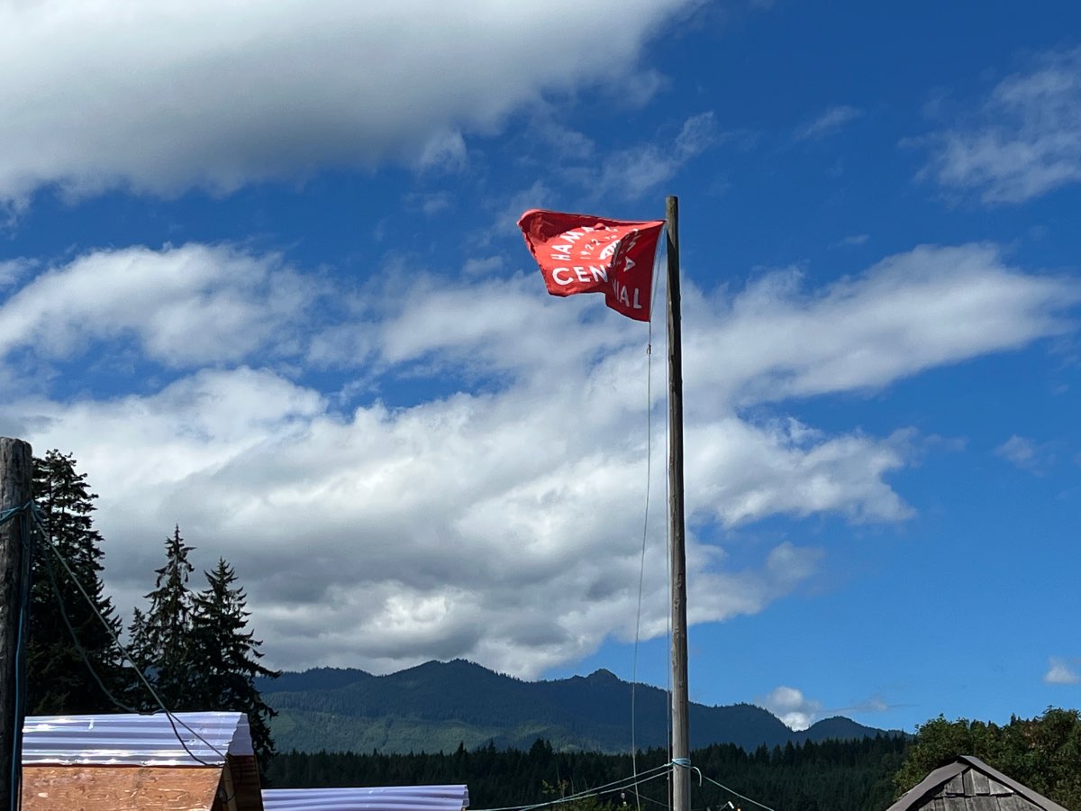
Beautiful day out at Hama Hama today. Sunny and mid seventies.
 6 points
 -
WILDFIRE UPDATE (Got to Admit it's gettin' Better Edition!) NEW Known Wildfires started today! 8/5/22 Washington - 0 (This is good news. There are no reported new fires in the past 24hrs. There are now four large fires in WA all of which have crews actively trying to put them out. A brush fire neat Lind sprouted and reportedly burned some buildings, but as of today, the fire is now out. Many fires have been put out, the total has dropped from 26 to 19. ) Total: 19 Oregon - 1 (One new fire started in rural-nowhere between Bend and Burns. The amount of large fires has dropped to three. The long-going brushfire near Ontario is finally out. The main watch is the spread of fires from Northern CA that are still raging and their embers are causing smaller fires. The total has dropped from 50 to 42 thanks to effective firefighting.) Total: 42 Idaho - 5 (Five new fires started, but have all either been contained or taken out already. All were located within the Boise metro from human causes The total fire count will still count these new fires, until tomorrow when they are officially removed from the fire list. Two major fires still exist, the Moose Fire and Woodtick Fire in remote locations within the Bitterroot Range. The total number of fires in ID is now 8. ) Total: 8 British Columbia - 9 (Firefighters really need the help in BC and today was that day. Only nine new fires. There are currently six large fires, all located within the Kamloops and Southeast Districts. The Keremeos Creek Fire has become extremely dangerous, requiring the evacuation of much of Keremeos, over 1,600 properties. BC mapping has admitted they are days behind at mapping and keeping up with wildfire growth. There are also some evacuations due to another major fire near Penticton. The total amount of fires in the province drops from 62 to 58.) Total: 58 SMOKE UPDATE Smoke models show the majority of smoke blowing eastward. Oregon's Jackson County and Klamath County remain under a poor air quality advisory due to the smoke from fires in California. Eastern Oregon is going to be socked in by smoke aloft, and some low to mid-level smoke the closer you get to Klamath County. Smoke has led to moderate conditions in the Treasure Valley extending towards Ontario, Oregon. All of Boise can expect this moderate to poor air for several days due to California wildfires. While air quality has improved in WA's Okanogan Valley, continue to expect smoke from BC to mix in during the course of their uncontrolled wildfires. Spokane's air quality has improved to good for the time being. Smoke from the six major fires in BC is effecting mainly the regions the fires are located in, with smoke low to the ground, mid level, and aloft, as it gets trapped in the mountain valleys. The large fire near Penticton BC is causing dangerous air conditions around Penticton, but not Kelowna to the north as the smoke is flowing south into. One can expect this smoke from BC to flow aloft over Idaho and Montana in the coming days. Smoke from California is currently aloft over southern Idaho, Montana, and Wyoming.6 points
-
It could be close, but for now the overall pattern configuration is pretty legit. Just have to wait to see where the best mid level trigger emerges, but anywhere north of Salem or so will probably be under the gun.6 points
-
Really that position off the SW OR coast is a prime one for the Willamette Valley as well. About as classic as it gets with the valleys maintaining SSE gradients aloft and advecting in mid level moisture. I get the sense there would be widespread opportunities for everyone west of the crest as that puppy moves north.6 points
-
18z jumping on board for a nice nocturnal show Tuesday night into Wednesday morning.
 6 points
 -
Yep, that was an awesome month for the region. The big light show in the Puget Sound on the 7th, the juicy cold core storms on the 8th that produced the tornadic storm over the west metro, and then we got pounded again on the 10th with about 2" of rain falling here. Then the "arctic front" on the 29th which produced a 49F high here. All in all finished with about 6" of rain that month. The second historically active September in the last decade, following 2013.6 points
-
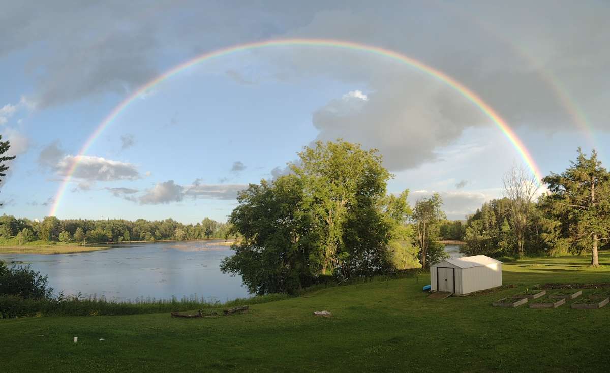
I really enjoyed today’s perfect weather! Quite the sky I was heading home from the lake house after loading up the jetski. Going to trend east for a few days!
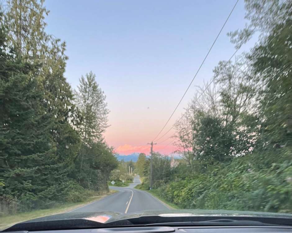
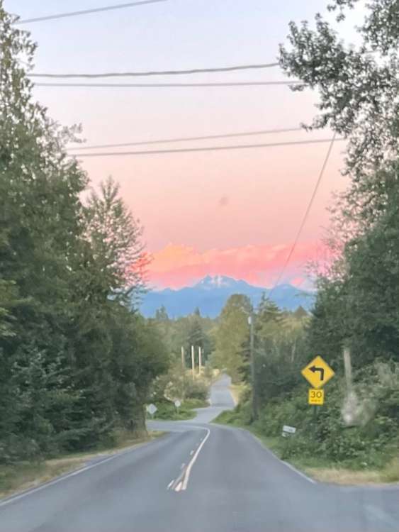 5 points
 -
I feel bad for people who have joined the forum in the last couple years having absolutely no idea what the forum politics are like. I’ve been here long enough to kinda understand the history now but it must be like “wtf is wrong with these people” for the first couple months. That’s how it was for me anyways5 points
-
Not gonna lie, my kids are not the best. They need significant work.5 points
-
That's good to hear, a full regionwide event would be very nice5 points
-
Not sure if anyone mentioned it but KSEA's normals started dropping on August 4th. All downhill from here, in terms of average temperature.5 points
-
This is from last week but still thought it was cool enough to share.
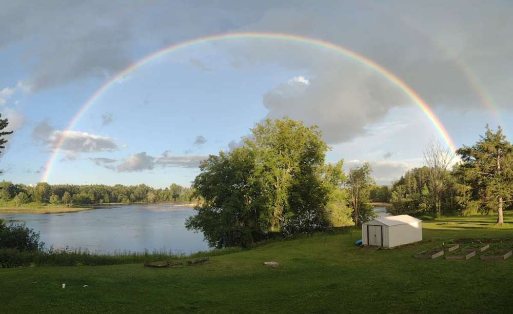 5 points
 -
They’re all pretty smart dudes when they’re not busy arguing with eachother. I’ve been here 4 years now and have learned a lot.4 points
-
Wow, possibly some strong updraft's in those developed cells (if they materialize).4 points
-
Seems like the summer version of a transition event. This time instead of warmer air colliding with colder air already in place it's the opposite. Gonna be exciting on Tuesday and Wednesday.

 4 points
 -
I... don't think it ever went anywhere.4 points
-
Looks pretty good for the Portland area northwards. Best dynamics may cut off a little further south.4 points
-
Arctic front dropped down on the 4th from a moderately impressive arctic airmass. A rather deep, slow, and broad offshore low really helped every step of the way with that. First with top tier gap CAA from the strong easterly gradients that developed, and then from the delayed warmup as it was too slow and far offshore to mix anything out at the lowest levels for days following the warm front. That airmass also produced an unusually deep Columbia Basin cold pool, which was assisted by the heavy, widespread snowcover over there following the late December and New Years storms. Here's a good visual of the setup on the 6th as the warm front approached and the big snowstorm got going for the westside. https://meteocentre.com/reanalyses/get_reanalyses.php?lang=en&mod=ncep&area=na&yyyy=2004&mm=01&dd=06&run=06 Also a fun site to play around with whenever you want to view a historic setup. The evolution of the beautiful Friday the 13th blizzard in January 1950, just as a fun example4 points
-
By the time 2011-40 averages come out, Seattle's average number of 90+ days will likely be close to double digits. Just getting to be the way it works now. 8-9 will start to feel like a totally average year there. Seattle's present summer climo is roughly what Portland's was from 1950-1980. And Portland's present summer climo is roughly what Roseburg's was from 1950-1980.4 points
-
A pretty chilly 49F here, just 3F shy of the daily record. KSEA has only dropped to 55F, which is honestly *peak* KSEA, considering that they fell to 51F the other morning with more cloudcover and a slightly warmer airmass. Totally agree that elevating a thermometer 100' off the ground on the highest point in the city surrounded by fields of concrete is the best representation of a city's weather ()4 points
-
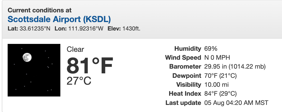
The Monsoon seasons has been incredible thus far for the state of AZ. 95% of the valley has received over 1" of rain which is AN through this period of the season. There is a LOT more to come. The pattern is going to fire back up this weekend and then again the following weekend. I'm excited to capture some pictures while I'm out here and some videos. One thing I noticed right away while flying over the mountains was how lush and green they looked from up top. That was not the case when I left here back in the Spring. Very early yesterday morning morning there was a massive cluster of strong storms that erupted over the valley around 3:00am local time that swept the valley from East to West causing flooding and wind damage. The high temp was a very cool 93F (106F is Normal). Heading up into the low 100's today and its quite humid...it's like I never left the soupy air from back home. Of note, current DP at Scottsdale is 70F...make it a Fantastic Friday!
 4 points
 -
70/54 here for Thursday. That's a bona fide miracle by recent standards for early August. Looks like an easy sub 50 low here for Friday. That would be my first sub 50 low in the first week of August since 2008.4 points
-
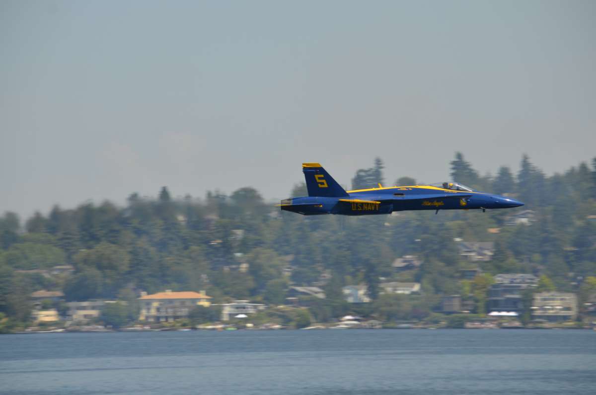
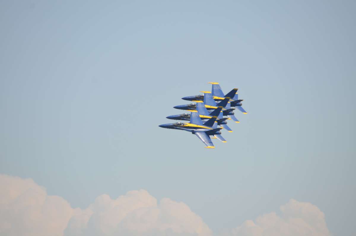
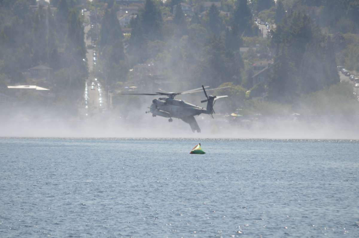
D**n....the conversation earlier got me going through the photos from 2014. I don't know what in the hell I am doing with photography but I still got some pretty decent shots.
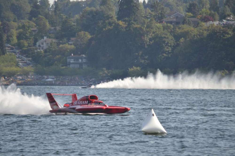

 4 points
 -
BTW, this psycho swell is absolutely nothing compared to the old (and chillier) dayz.3 points
-
Tim/Andrew, please just chill, please. I will turn this forum around and go back home if I have to. Play nicely or else you can forget about Wally World.3 points
-
We have a local groundhog that occasionally pops by, looks around, then retreats into this little forested area located behind my street. MVI_5081.MOV3 points
-
The GFS is showing PWAT values 1.5"+ around the area as well. Hoping it moves south slightly though3 points
-
Was going to say the parameters are great, the best in a few years.3 points
-
Yeah, the late November chilly stretch was more of a hybrid longwave Pacific trough + ensuing low level inversion rather than a true arctic airmass with deep offshore flow. But the other airmasses were all legitimate offseason arctic airmasses, and the late September setup in particular likely would have been a pretty major snowstorm and gorge outflow event on par with anything else we've seen this century had it been peak season. Think January 2004 or February 2014.3 points
-
November will be our time to shine this year! Also January.3 points
-
Night shift in Springfield currently at 58F and very pleasant. Beautiful starscape right now if y’all can get away from light pollution.3 points


.png.b76eff5cfb3a335f74e4c37da346fa6e.png)


This leaderboard is set to Vancouver/GMT-07:00