
Leaderboard


Popular Content
Showing content with the highest reputation on 09/13/22 in all areas
-
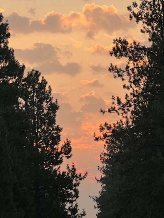
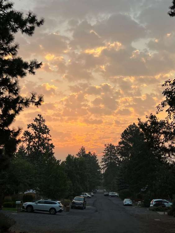
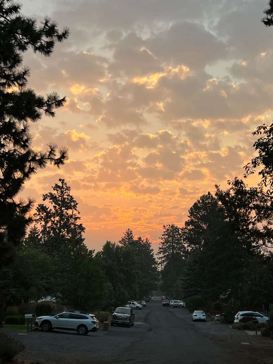
Smokey sunrise in Bend. Much better air quality today though. Looks like a nice day ahead.
 9 points
 -
Jesus christ I gotta go inside
 8 points
 -
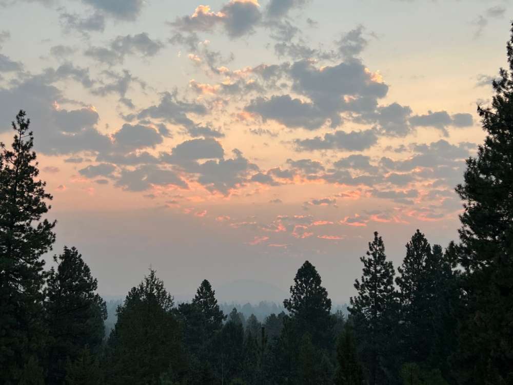
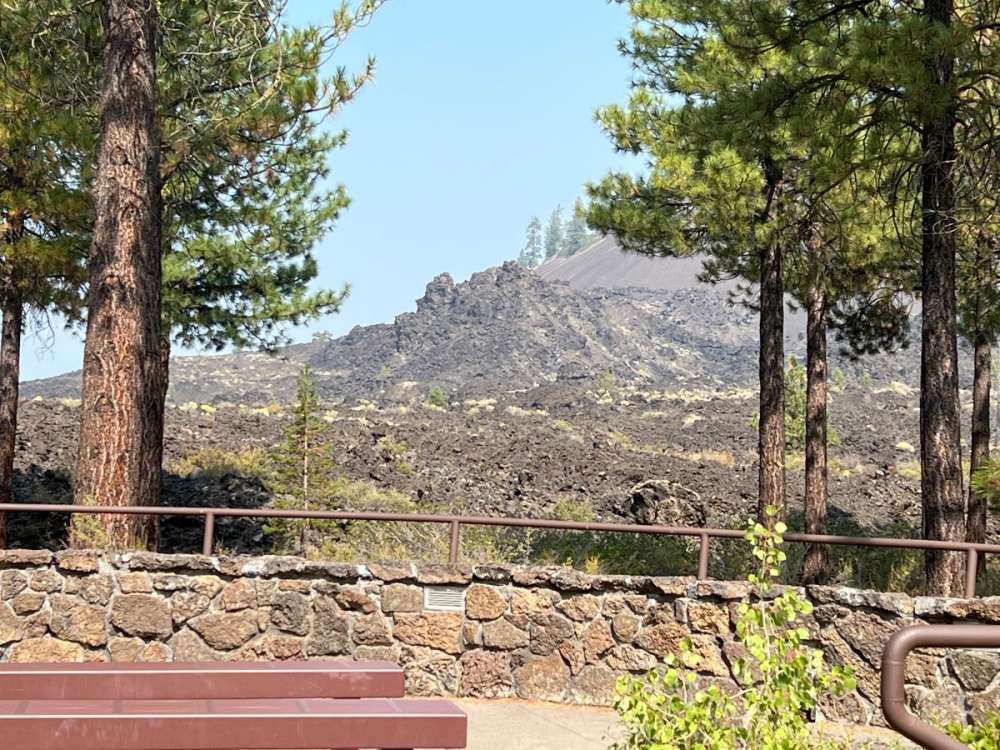
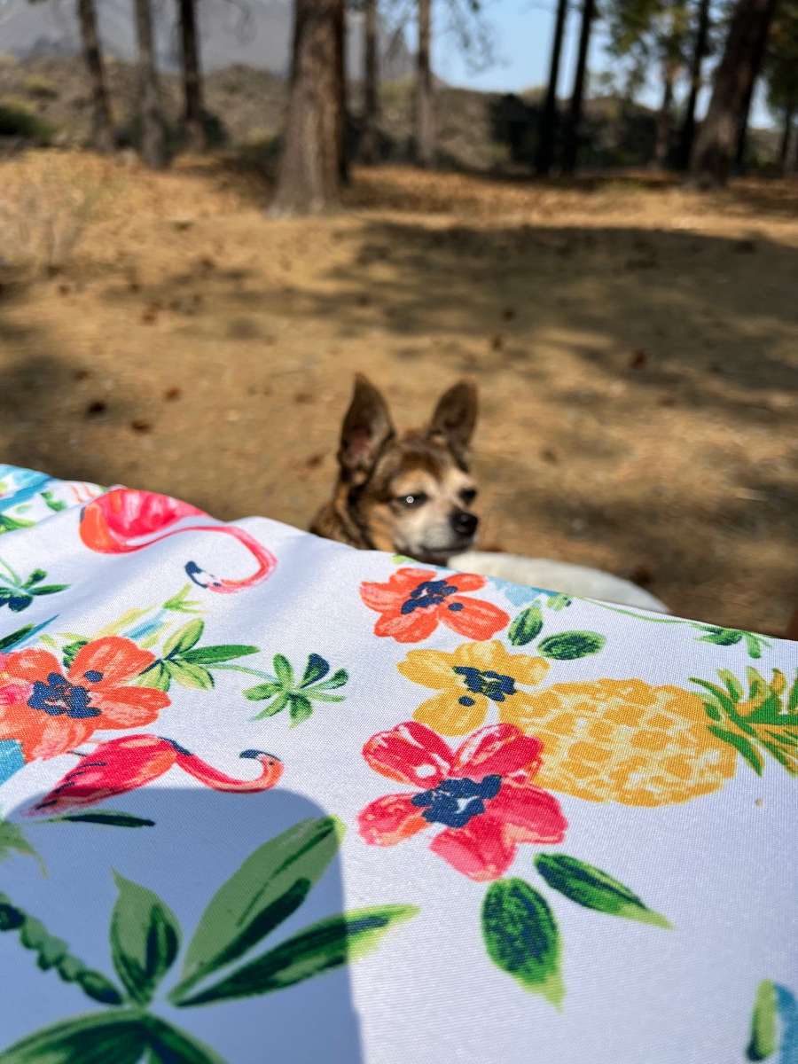
Went to Lava Lands and Benham Falls today in Newberry Crater NM. Bella tolerated some light hiking with the promise of a picnic lunch afterwards. Still kind of smoky but very tolerable compared to yesterday.


 8 points
 -
I’ve got a bunch of videos I’ll probably post em to youtube and post the links tomorrow. Last one for tonight
 6 points
 -
Also good news - tons of rain. 0.25 in the last 7 minutes5 points
-
5 points
-
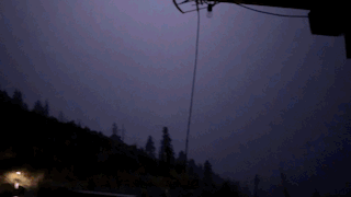
I’m surrounded on all sides by lightning…it’s closing in on me5 points
-
Pond inlet definitely does not average more snow in July than January. Doesn’t look like any major stations up there have had any blizzards yet this season either. edit. Nanisivik has a pretty different climate as that station is over 2000ft in elevation5 points
-
for the period of 2000-2022 the earliest below 32 was on 9/22/00, number 2 was 9/28/19. latest was 11/3/15. Mean of 10/12 if we go back to 1900 the earliest is 9/13/70 and the Latest is 11/11/44 with a Mean of 10/85 points
-
Always with the negativity and fear mongering5 points
-
I’ll never be able to do this storm justice. Straight out of a movie. Sorry guys. Also my dog is like YO gtf back inside before I poop EVERYWHERE4 points
-
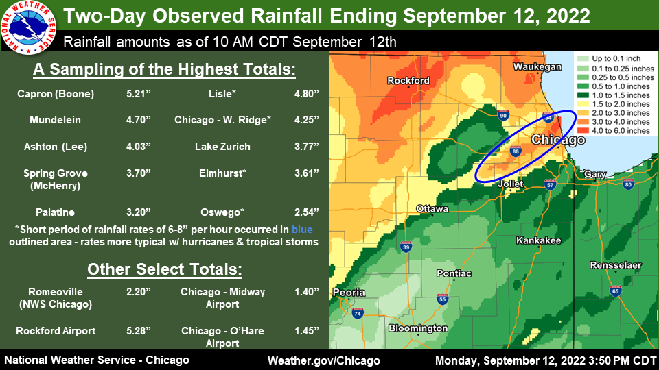
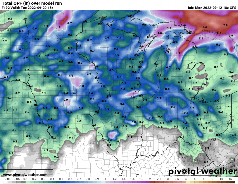
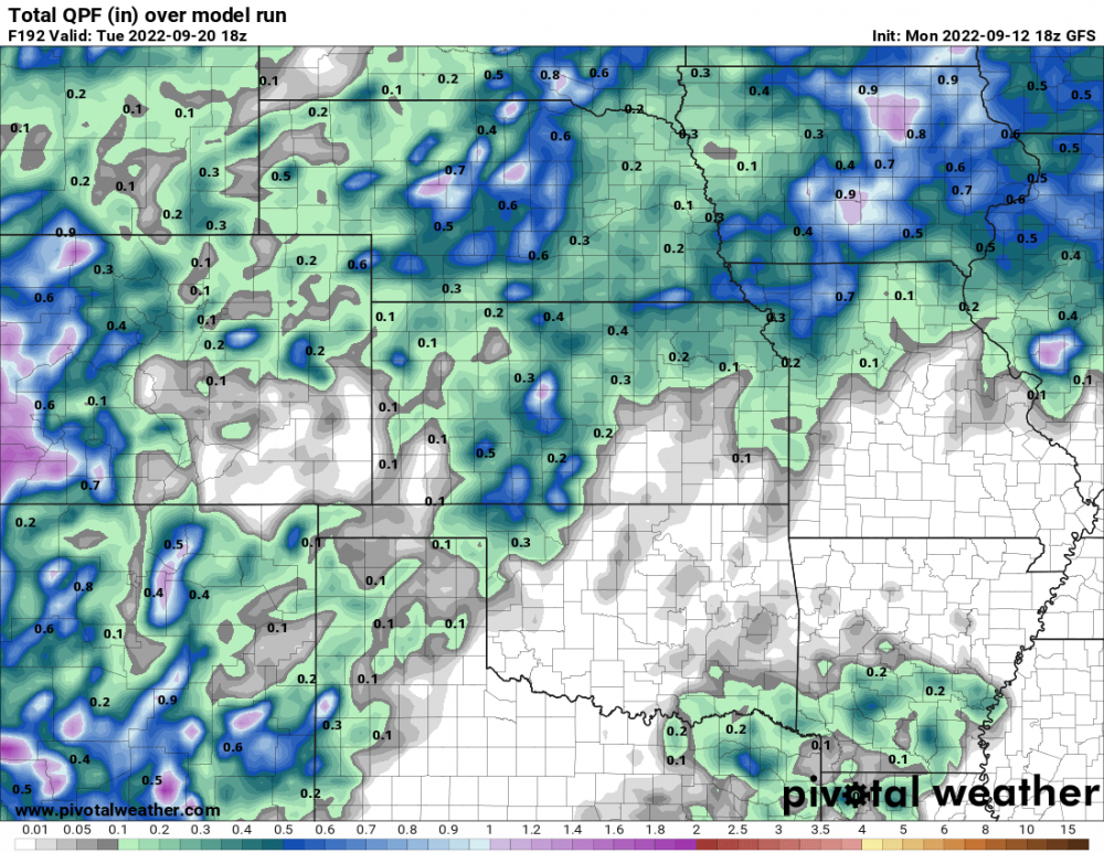
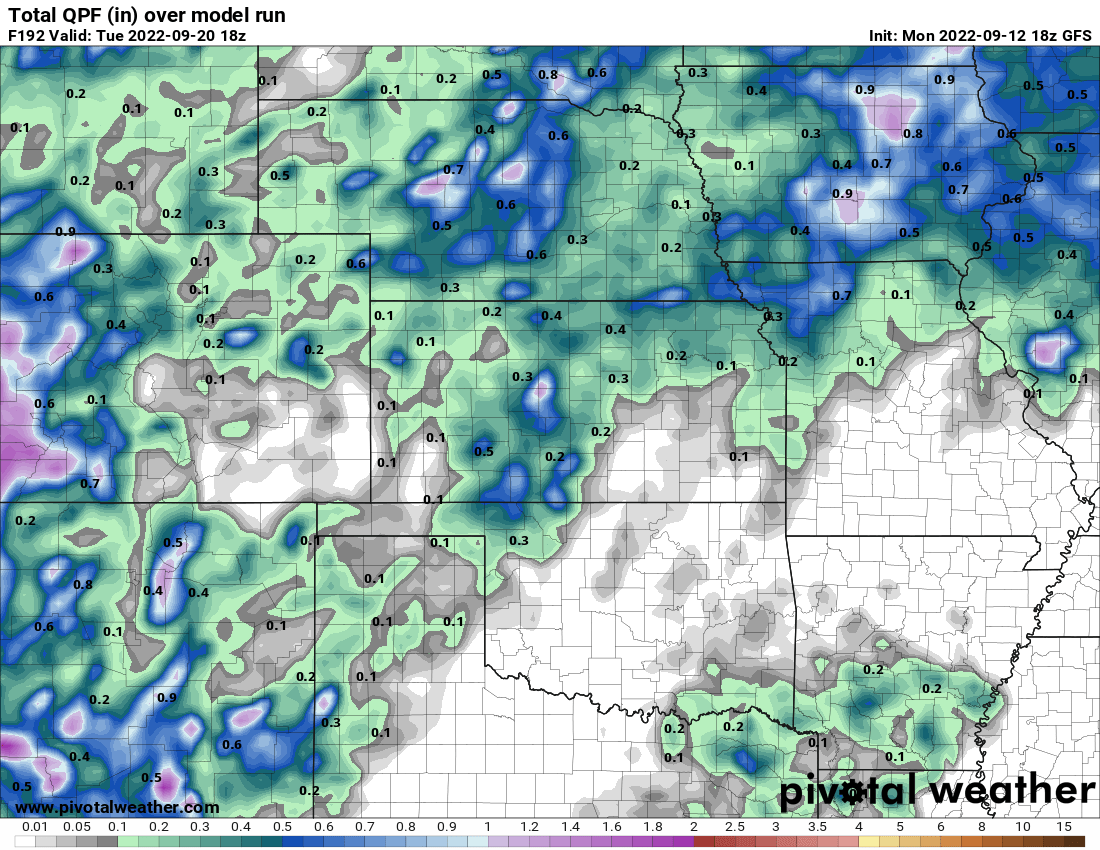
Morning EC precip totals...
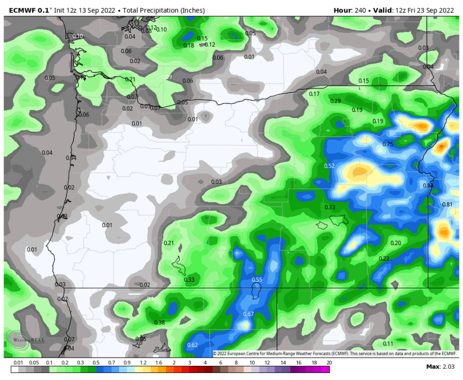
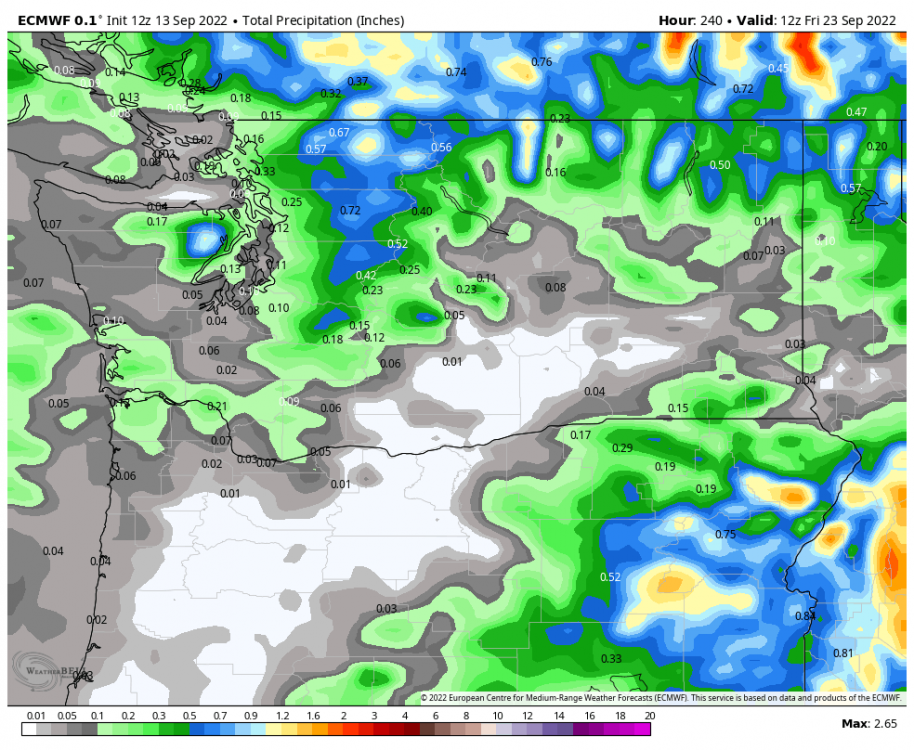
 4 points
 -
well in 2019 we had accumulating snow the last week of Sept in Spokane. not sure about earliest freeze though4 points
-
3 nights in the 40s here, dipped to 43 on the 8th.4 points
-
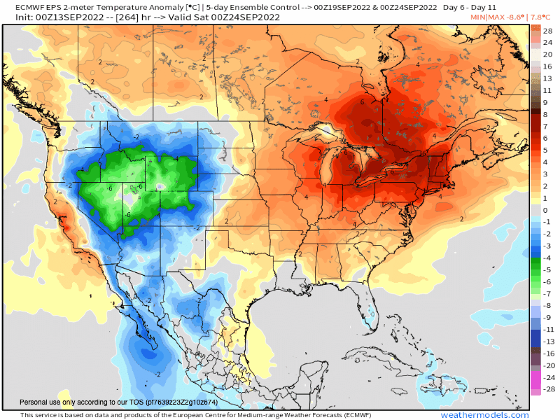
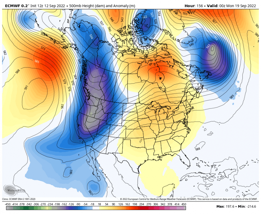
The target period of the 19th-21st is starting to show some interesting runs on the models. We will go from the late season "Summer Sizzle"...to the "September Chill"... 0z Euro...night time lows as we welcome the Autumnal Equinox... Some local storm reports from the excessive rains that fell in N IL...

 4 points
 -
As a Nation, we commemorate the 21st anniversary of 9/11 today, a day that is engraved in my memory, one that I will Never Forget. #NeverForget...We Stand Stronger together as Nation and let's not forget those who sacrificed their lives to serve and protect.4 points
-
wowowowowow!!!!! supper excited for you dude enjoy the show!!3 points
-
It is just constant lightning over there. Fun to see but hard to capture since it’s on the other side of the county3 points
-
yeah, no one would ever suspect you'd prefer the "50%" of the time it's dry by what you post every day. lol3 points
-
We could be choking on wildfire smoke and Tim would still be not wanting it to rain very much. Wait… that’s actually what’s happening.3 points
-
Uh, yes, it is absolutely needed. The entire western half of the lower-48 would benefit from a sustained wet pattern. To suggest otherwise is the height of absurdity.3 points
-
12z GFS would be something if it verified for Sunday. Bend struggles to break out of the 30s lol. Summer to winter in a week3 points
-
Looks like mid 80's to low 90's around here through next Monday. After that, looks like we start getting into a sustained fall like pattern. Been a long summer with a few breaks here and there.3 points
-
I hope so. I want some 60s/40s in the forecast.3 points
-
I hadn't seen that yet but I came here to mention my grids post 21st for both IA and MN homes have me down into the upper 60s for highs. Could we actually have some real fall weather just time for fall equinox?3 points
-
I love these cool mornings, with the low humidity temps really drop at night. Oh and here it is the first fantasy land GFS snow event lol
 3 points
 -
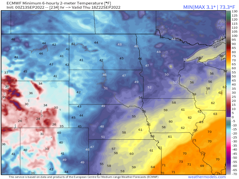
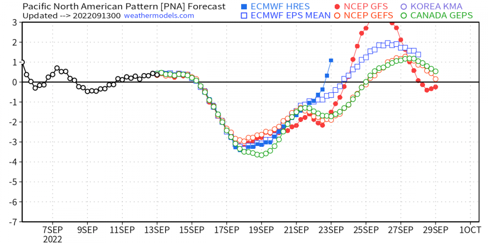
Over the past several runs, the EPS is starting to hone in on a more sustained "flip" in the N.A. pattern that should usher in a cooler and refreshing airmass. All the models are starting to spike the +PNA which is a clue that a more amplified North American 500mb pattern will develop. The Euro Control seeing a Big Time cool down...fits with the idea that SEP will be a tale of two seasons...
 3 points
 -
This thunderstorm blew up just after sunset. Some of the light from the horizon was reflecting off the cloud, giving off the glow as a result. IMG_8579.MOV3 points
-
Just went out on the deck and captured this gorgeous video of a large severe cell to my south… IMG_2252.MOV3 points
-
Doesn't always work like that. Plenty of years have seen a sustained wet pattern in September and then flipped to an extended dry one again.2 points
-
🌨 https://www.bbc.com/weather/features/628903612 points
-
Gonna be really disappointing if we go through this troughy pattern without meaningful regionwide rain. Another smokefest is probably on the way late month late month if the next week ends up dry.2 points
-
Pond Inlet averages more snowfall in July than January, and the record high is 65°F. The average low in February is -35°F. Even for 72°N that is impressive (especially considering it’s only 200ft in elevation. Edit: Actually this station is at the port in Nanisivik, but close enough.2 points
-
Your portrayal of the current state of things is a greatly exaggerated picture of despair and death. The upcoming weather doesn’t look terrible and this fire season hasn’t been extreme at all despite a couple days of smoke.2 points
-
Northern Oregon Cascades!2 points
-
Time to get excited!!!!2 points
-
Its cloudy and coolish w temps at 52Fatm. That stubborn upper level low is a very slow mover. Looking forward to the big warm-up b4 temps really drop for good as Autumn settles in.2 points
-
Out in the desert, I'm enjoying the temps in the low/mid 90's the last couple days and for the next few days. TBH, its funny saying this, but when the local mets here talk about a "Cool" down of 5 degrees I used to laugh at it, but you can definitely feel the difference...albeit minimal. As I spend more time out here, I get acclimated to the weather and I'm getting used to the warmth. TBH, I'm yearning for those nice cool, crisp Autumn mornings. Meantime, back at home, ORD topped out at a chilly 66F which are OCT level temps. I'm sure many are ready for the sun to return as they have been stuck in some gloomy, cloudy days.2 points
-
Pretty hard to call that gorgeous trough a buzz kill. Then you have the fact that anything after a week is bound to change anyway.2 points
-
Division is ours!2 points
-
I just want the fire season to end. We are at the stage where summer has worn out its welcome.2 points
-
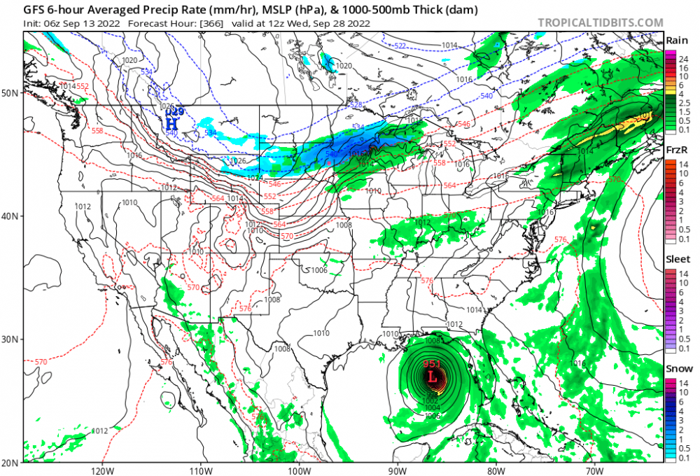
The GFS continues to wanna combine some of the remnants of Kay with a weak disturbance over the Rockies and bring some rain to the northern Plains and the lakes this weekend. It would bring some added rainfall to parts of Nebraska and Iowa. The Euro not so much on board with this yet.
 2 points
 -
Living in North Bend and complaining about rain is like living in Death Valley, CA and complaining about heat. You get what you pay for.1 point
-
yeah it will all be over here1 point
-
That was a great stretch for Utah as well. I recall it started off with a 10" storm at the end of December with several good events through the first 2/3 of Dec. I got 13" on Christmas and then another 13" in early January. By the middle of January I could barely shovel snow off the driveway anymore the drifts were so high. I ended up with 95" that season, my highest of all my years in Utah, with something like 50" of that in a 3 week stretch.1 point
-
Only 76 at PDX and some rain last night and today! Still a slight bit of smoke but much better than the past few days.1 point
-
I can take public transit to such scenes!1 point
-
In a really crude, generalized manner the PDO is the inverse of the average anomalies in a box between 150w and 150e, 30n and 50n.1 point
-
Its a beaut!
 1 point
 -
It was very legit in terms of how it stacked up for duration. Expanding it even further, the December 5-January 17 period was the 2nd coldest on record for PDX behind 1978-79 and averaged an impressive and old school 33.0 there for that stretch. Just very sustained cold in the tradition of our classic cold years, albeit with no extreme upper level airmasses. We managed the rare combo of persistent, sustained cold offshore flow and healthy gorge/eastside snowcover the whole way through, which kept things refueling throughout the season. It will likely be a long time to come before we see another winter like that one for consistent cold.1 point


This leaderboard is set to Vancouver/GMT-07:00