
Leaderboard


Popular Content
Showing content with the highest reputation on 01/27/23 in all areas
-
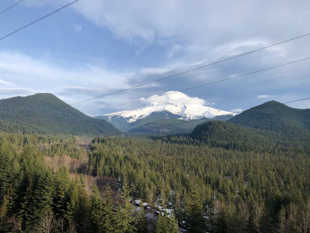
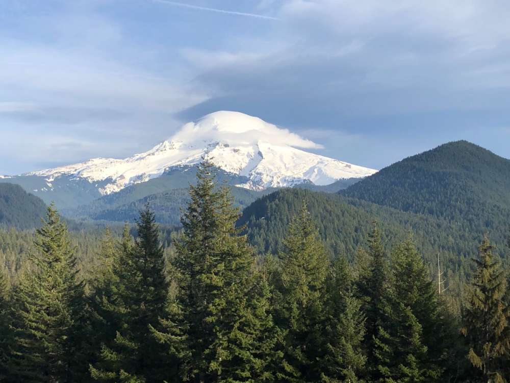
Caught a neat cloud cap over Mount Hood from Lolo Pass road earlier this week.
 15 points
 -
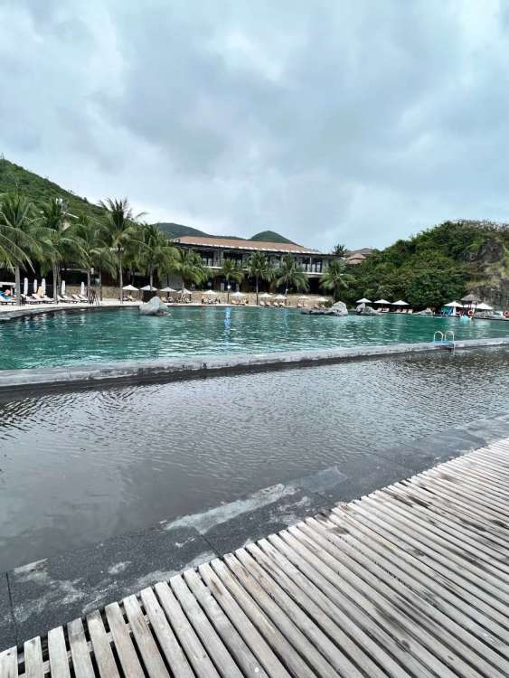
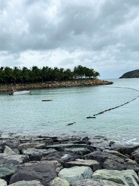
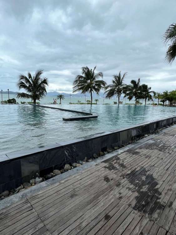
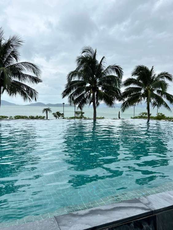
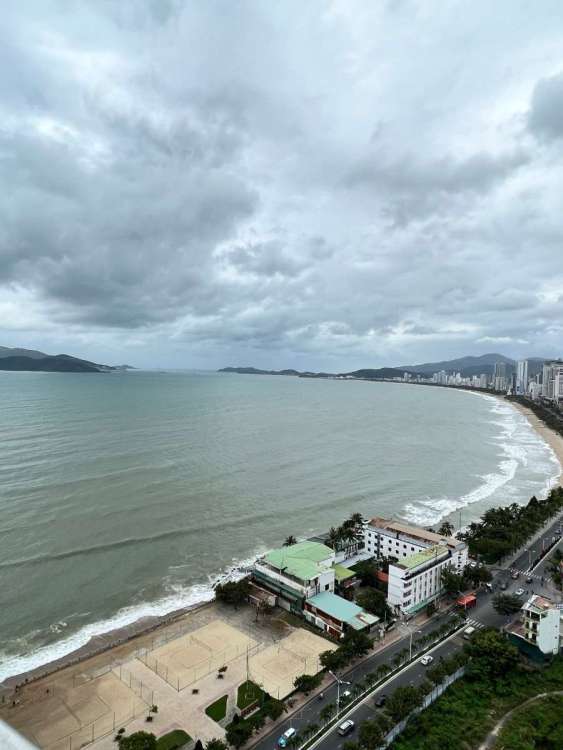
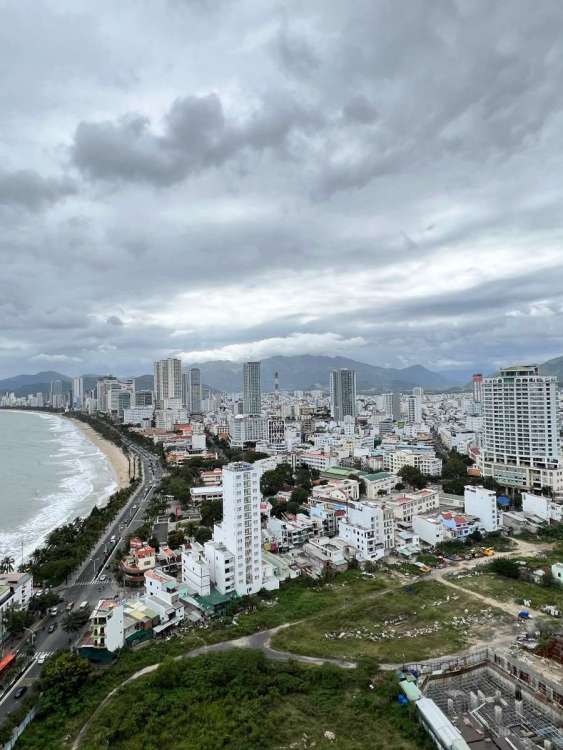
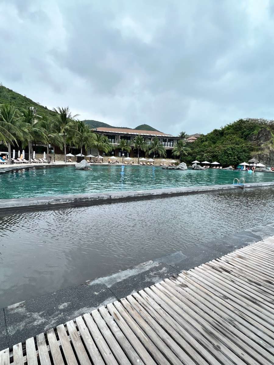
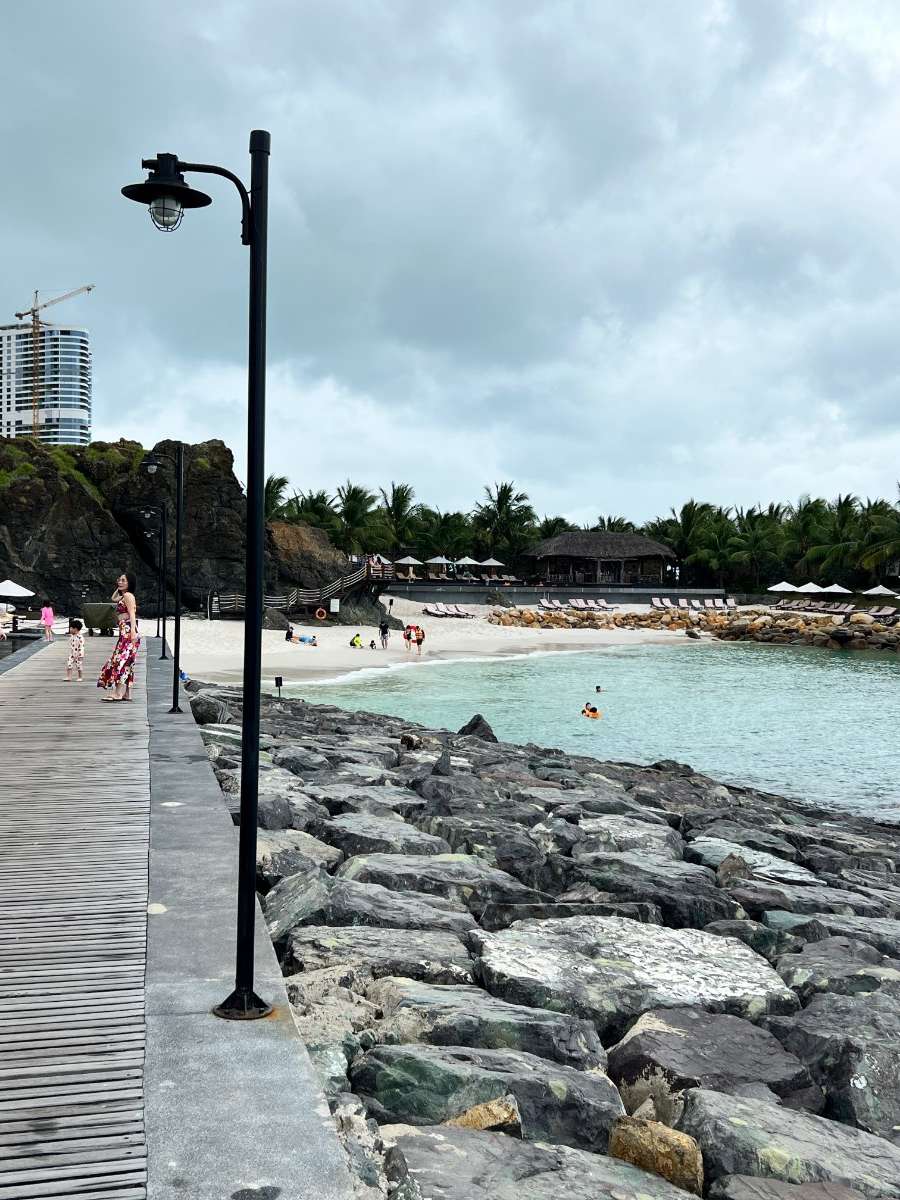
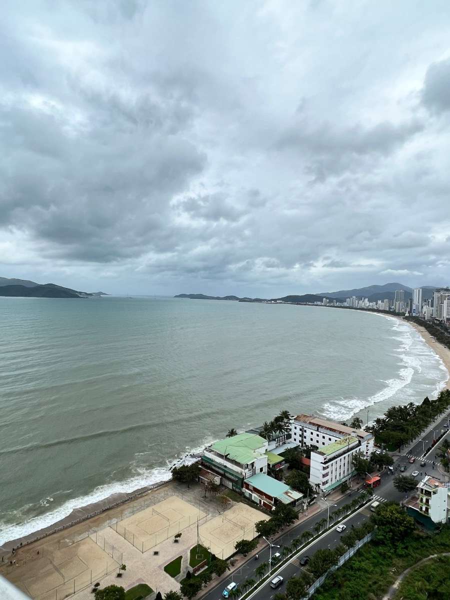
The weather here in Viet Nam in January has been absolutely perfect compared to last September. Mid-70s to low 80s with low humidity. This is our stay at the Coastal City of Nha Trang. At one point last night it got real windy and broke stuff

 9 points
 -
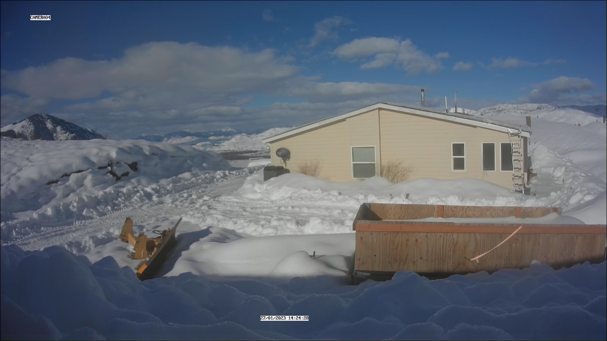
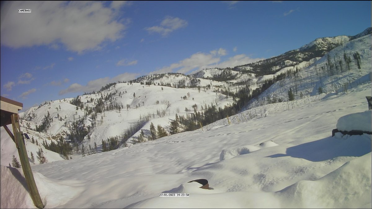
Stunner of a day in the methow. 45 degrees over there. Good day for melting

 9 points
 -
I actually may see flakes! Lot of members with a dusting. Temps marginal though. Maybe a slushy inch.9 points
-
You know it’s been a rough 5 weeks when sub 50 streaks are highlights.8 points
-
Nice uptick for Portland!
 7 points
 -
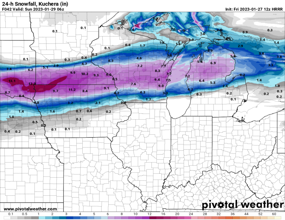
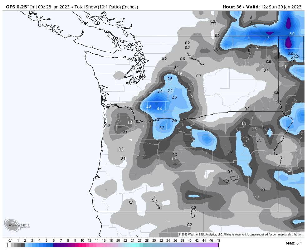
Picked up 7" of very wet snow throughout the day here today. Snow has really picked up this evening and temps are starting to drop so accumulations should really pick up overnight. Should still end up with 15-20" of snow by the time all is said and done. Currently 27F with heavy snow.7 points
-
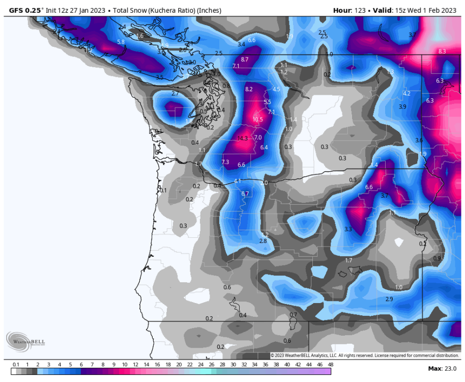
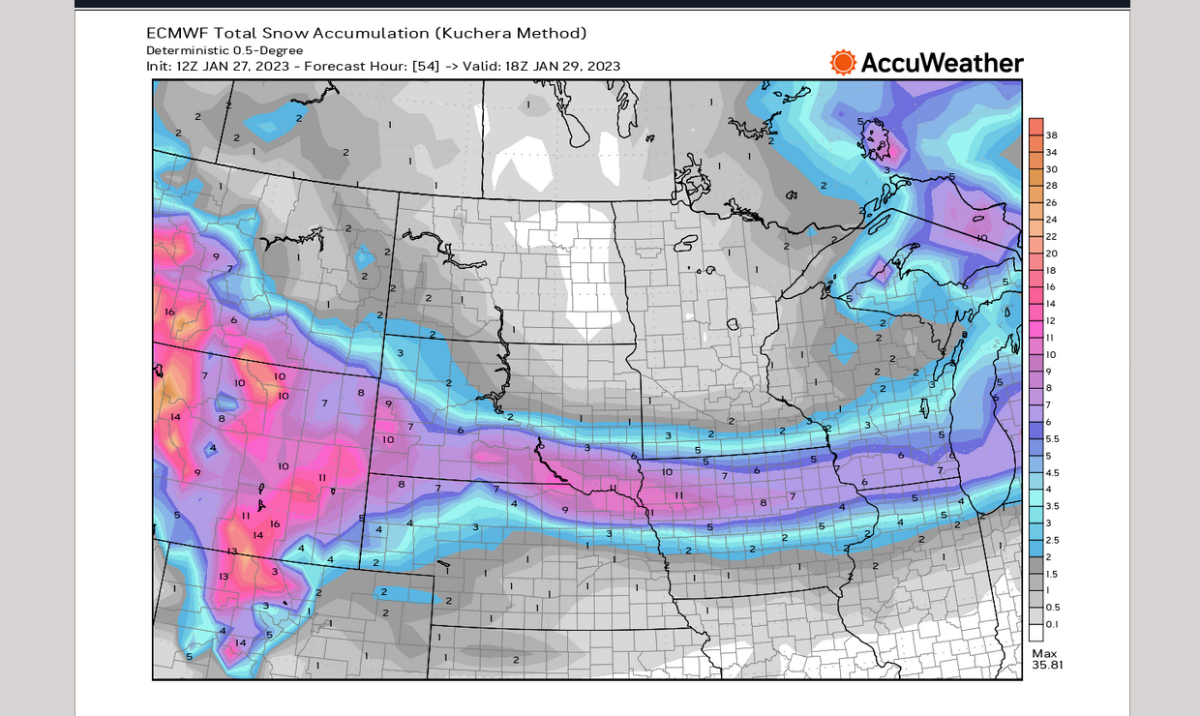
This theme really gained traction in the model runs today... the big 3 all show something. Maybe the start of a trend?7 points
-
score!.gif6 points
-
Euro-- 12Z vs 18Z-
 6 points
 -
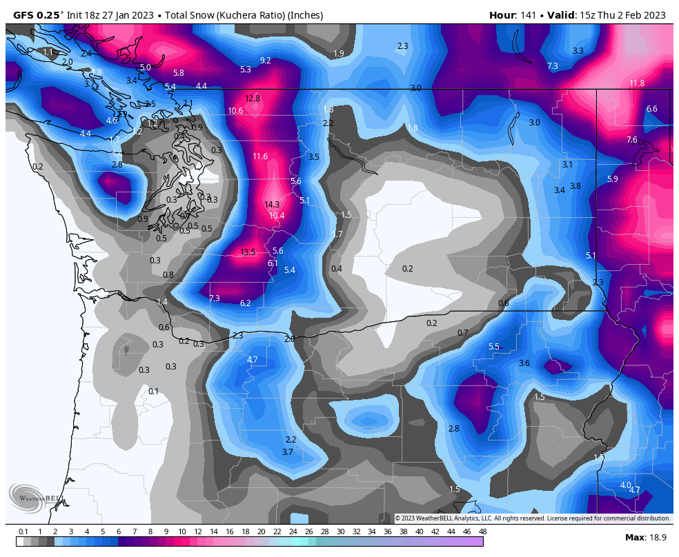
Just imagine if this were shown at 240 hours instead of 24. Oh the possibilities…
 6 points
 -
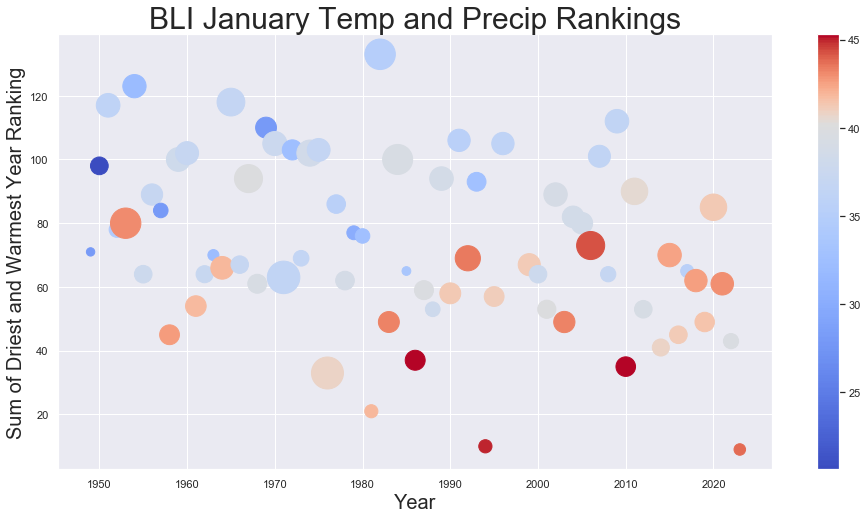
As of yesterday BLI is at 1.33" for the month. Unless something crazy happens this will be their 4th driest January on record behind 1949, 1985, and 1963. However, all of those months will also end up almost 10 degrees colder (or more) for the average temperature than this month. So probably safe to say this will end being one of the most boring (warmest and driest) Januaries in the last century for the North Sound. I tried to quickly come up with a somewhat interesting way to represent this. Of course it's hard to compare precipitation and temperature so I ranked all of the last 75 years of Januaries at BLI. In terms of temperatures the warmest January received #1 (coldest was #75) and in terms of precipitation the driest January received #1 (wettest was #75). Then I summed the rankings together. So the highest possible rating was 150 (an epically cold and wet January) and the lowest possible rating was 2 (a boringly warm and dry January). Then I graphed the years here (removing 1997, 1998, and 2013 which all have bad data at BLI). Additionally the color of the dots corresponds to the average temperature for the month (colder than the 30 year average are blue, warmer are red) and the size of the dots corresponds to the total precipitation that month. It's pretty clear that 2023, 1994, and 1981 are the worst (most boring) years. It's a little hard to decipher the "best" years because Januaries that are quite cold also tend to be dry (and thus don't get much of a bump from their precipitation rankings). Using this metric you might think 1982 was the most interesting January. BLI had 16.4" of snow and 9.3" of rain and an average temperature of 35.1F (5F below today's 30 year average), but I think many would agree the shockingly blue January 1950 lurking off to the left was more "interesting." Edit: added an average temperature key to clarify
 6 points
 -
Me and Jim have private messaged about this, I DON'T want to complain and look like a asss because i have had a bunch of snow but i still rate the winter lame because it wasn't a region wide event year so far. The fact is if you like winter weather you should NOT live west of the cascades at all. 6-10 days of what i consider winter weather just don't make it a good winter at all. If everyone Had snow from Portland to Bellingham for a week then that would of been much better.6 points
-
Sure seeing lot of indications the Feb 10 to Feb 15 period might be a period to watch for things to get interesting again.5 points
-
HRRR is decently snowy by Portland standards as well5 points
-
Whenever I talk to visitors from really snowy climates like Alaska or South Dakota, the main point about the snow and cold is usually all of the problems it causes! Nice to have it every once in a while but not a constant.5 points
-
Some Monday night flurries IMBY on the 18Z Euro.
 5 points
 -
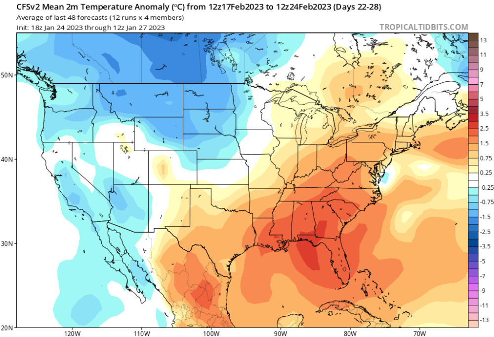
CFS for late February
.thumb.png.37d336644e433487660ae5b1ada1c4b6.png) 5 points
5 points -
I was in Chicago for a week in September. Didn't really know just how flat it was until then. Having mountains in your backyard is really a pretty special thing. Man, imagine liking snow and living in Florida.5 points
-
Green lake in the 1920s. Not sure I’ve seen it like that in my short life.
 5 points
 -
18Z GFS definitely board with mid-week snow... most of this happens Tuesday night into Wednesday.
 5 points
 -
Weenie of the year5 points
-
Pattern GEFS extended has after EPS ends.5 points
-
That's a bump.5 points
-
ECMWF has jumped in the ring as well for Tuesday into Wednesday morning.
 5 points
 -
Thank you for your contributions5 points
-
With the additional snow yesterday, my snow depth is only about 2.5" bc of the melting during the storm. It should provide a nice base to the snow that falls this weekend. I'm looking forward to the snow showers today along with the gusty winds. Coldest morning of the season JAN as we have dipped down to 16F.5 points
-
Decent end to the EPS... pretty strong signal for 15 days out.5 points
-
Shows an inch or more in parts north and west of the metro area. That would be nice4 points
-
.57” on the day, 4.71” for the month. Currently 40 degrees. BBQ weather!
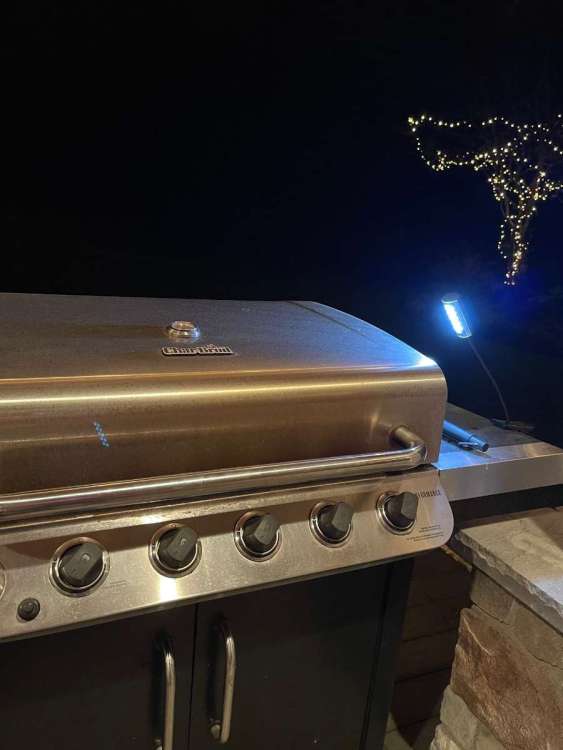 4 points
 -
Tonight's GFS is far from terrible. After the cold snap it shows suppressed jet and some incarnation of GOA ridging pretty consistently. Lots of opportunity for below normal temps.4 points
-
If they truly live in a snowy climate, snow doesn’t cause any disruptions. Even with a winter storm warning and about 10” (so far!) in Bozeman today it was business as usual. No school closures or delays (hasn’t been a snow day in Bozeman since the 70’s) and everyone still goes to work and is on time. When you live in a climate that averages ~100” of snow every year life continues on just like any other day.4 points
-
4 points
-
I like Whatcom County. Really intended on moving there quite some time ago.4 points
-
I have to say this is far from terrible and it has been trending a bit better each run. EPO also goes minus again later in the run. Still looking at a very high chance of a cold Feb. How cold is the question.4 points
-
Nahhh... go ahead and celebrate now. Seeing it on a GFS snow map is pretty much as good as it actually happening.4 points
-
I propose kicking all Whatcom County posters to the BC Forums. Everybody that approves, pls drop a weanie reaction.4 points
-
Gonna happen
 4 points
 -
4 points
-
Wednesday morning might be white for some.
 4 points
 -
This is really confusing and perhaps we need to find a new term or manner by which to address the matter. I say this because it makes no sense to suggest a sudden warming in the stratosphere is not a sudden stratospheric warming event. While I'm not disagreeing with the experts or the science, I am questioning how a sudden warming in the stratosphere could not be regarded as a sudden stratospheric warming. Another question would be what exactly causes the full wind reversal? Is it the result of the sudden stratospheric warming or is it something separate that finalizes the event? Now I admit that I don't know much at all about this subject so I can see how people who aren't experts like myself would assume that if the stratosphere warms suddenly, that it's a sudden stratospheric warming. That would be my assumption as well.4 points
-
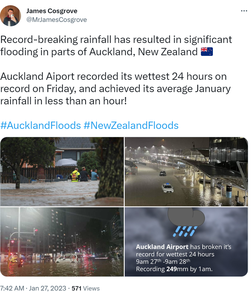
Meanwhile in NZ.. Also, Thanks, Tonga.
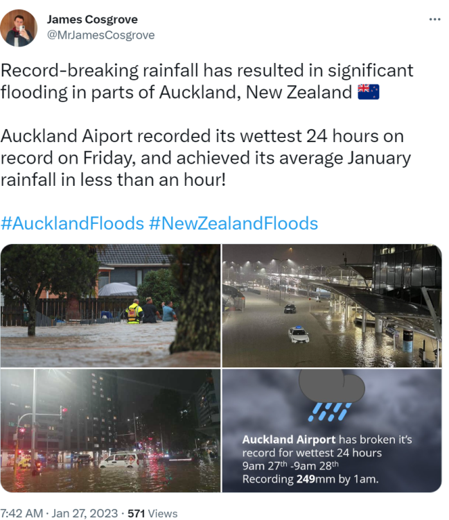 4 points
 -
Legit whiteout! IMG_2632.MOV4 points
-
I think we are all devastated by how disappointing this winter turned out. The worm could still turn, but it now seems unlikely. The pattern is just a meandering mess. It’s been our biggest issue the whole season sadly.4 points
-
Always a fun time with the GFS... it barely shows it going below freezing at all with the main cold air event but then assumes it will still be cold enough for lowland snow up north when the next system arrives.
 4 points
 -
Either the NAM and CAM's score a massive win..or...the GEFS/GEPS/UKIE fail bigly inside 48 hours...4 points
-
12z HRRR...
 4 points
 -
But I was told that it was coming
 4 points
 -
So as I see it, either we: 1) pull off an early/dynamic final warming in March/early April, igniting the MJO which triggers a WWB and DOKW as it crosses the IPWP, bringing about a rapid transition into El Niño. 2) We get the vanilla outcome..static final warming, PV slowly rots away. No substantial MJO response, and ENSO gradually goes dormant (neutral) in 2023. With easterly shear descending (transition to -QBO) later in 2023, the move to El Niño occurs in 2024, beginning the next intradecadal extension of the IPWP, which will produce more El Niño and ENSO neutral events through the mid/late 2020s. Similar to the 1991/92-1997/98, 2001/02-2006/07, and 2012/13 -2019/20 regimes.4 points


.thumb.jpeg.e3014abf99ef08a9f9ac2c0cd31b485b.jpeg)


.png.76f1d7d2bb8fcd3c5e84c50c285d9c90.png)


This leaderboard is set to Vancouver/GMT-07:00