
Leaderboard


.thumb.jpeg.e3014abf99ef08a9f9ac2c0cd31b485b.jpeg)

Popular Content
Showing content with the highest reputation on 03/03/23 in all areas
-
Hey folks -- been looking for a place that isn't Twitter to chat about PNW weather -- love the discussion and hoping to contribute a bit. Thoughts on this weekend...it's a modified oceanic airmass which is cursed by the wet bulb temperature. It's just a general rule of thumb for this region at any time of year that takes extraordinary circumstances to get it to snow below 500' without true arctic air via the passes. And this is just a typical spring cutoff low.16 points
-
11 points
-
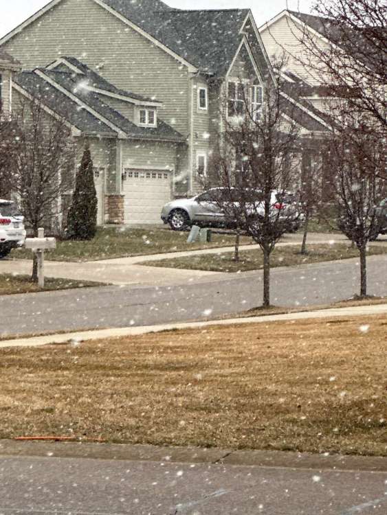
Let the fun begin! Down to 33 and all snow now8 points
-
Yeah I’m not very happy about that and want a full debrief as to why you failed me!8 points
-
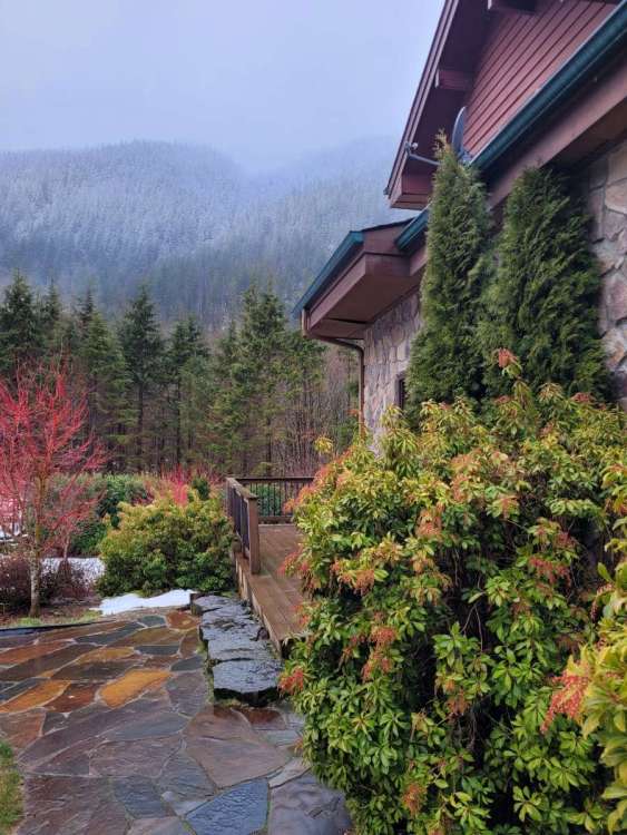
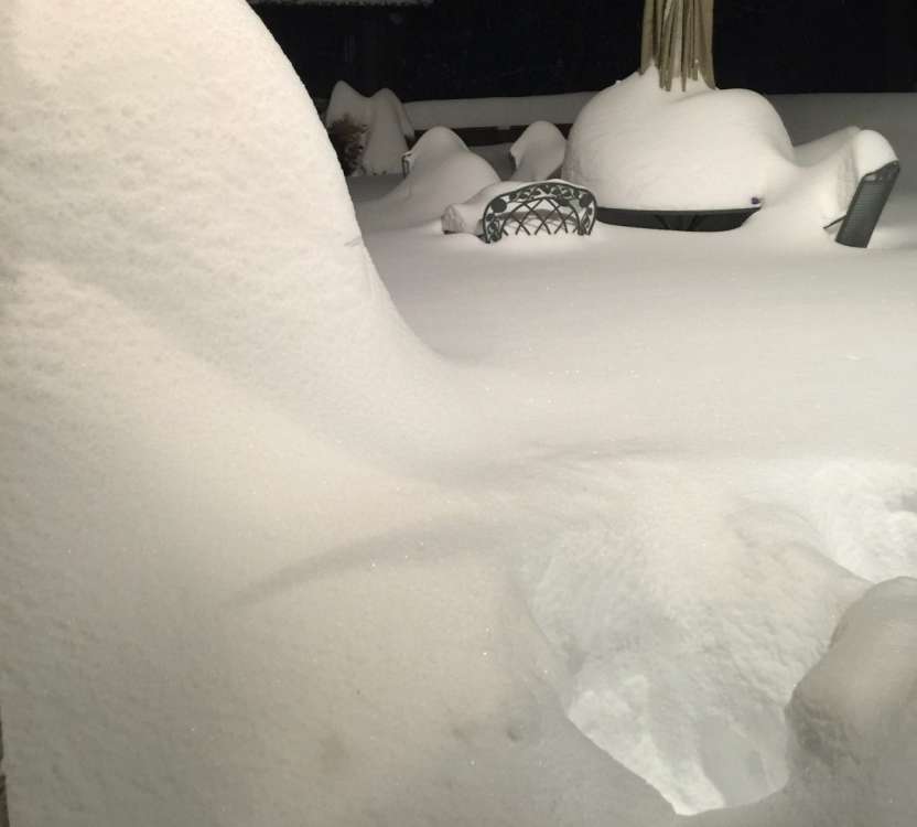
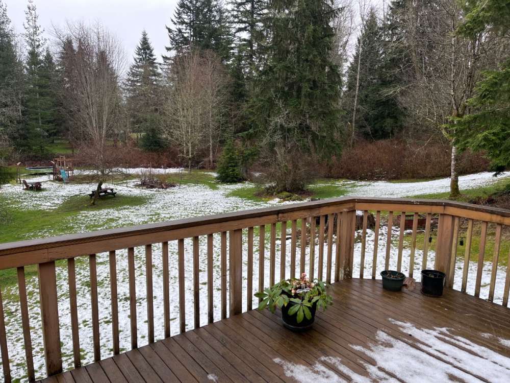
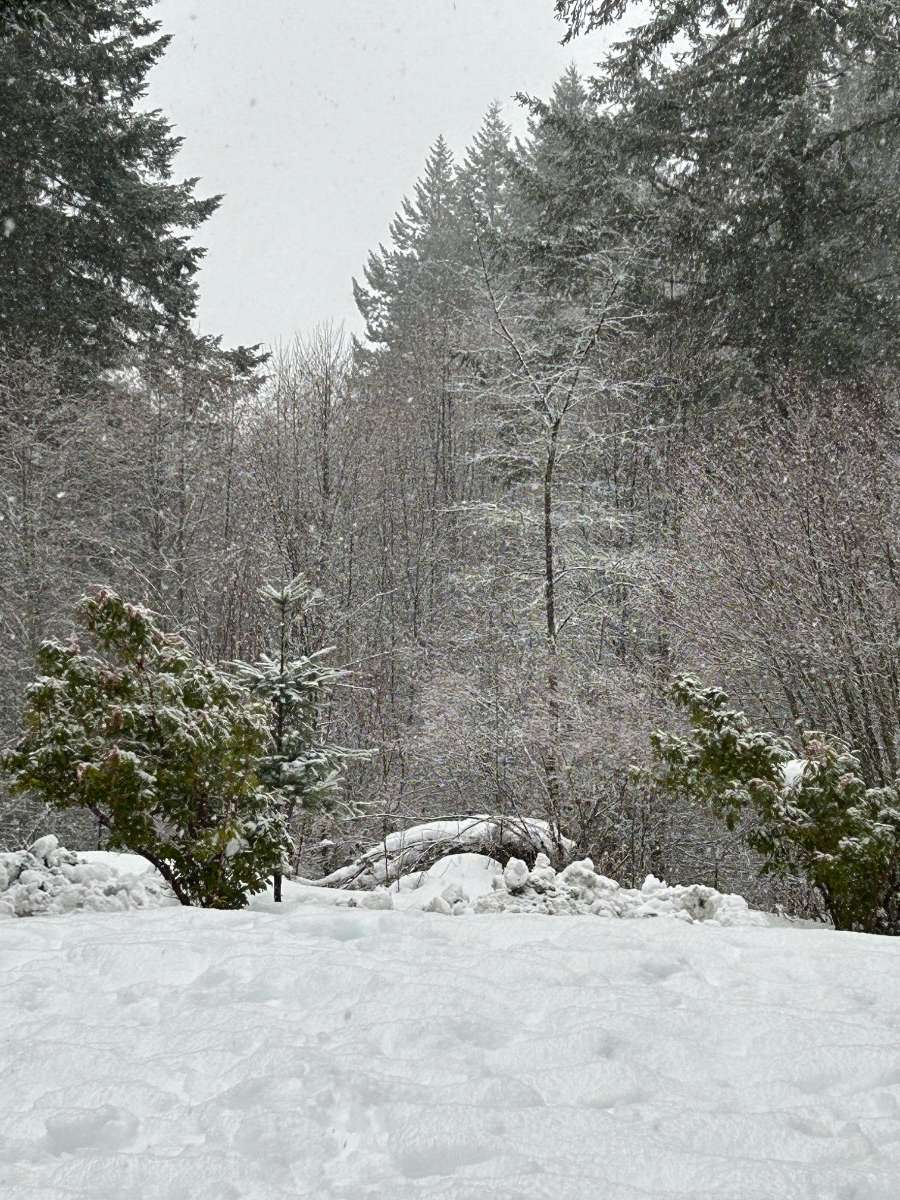
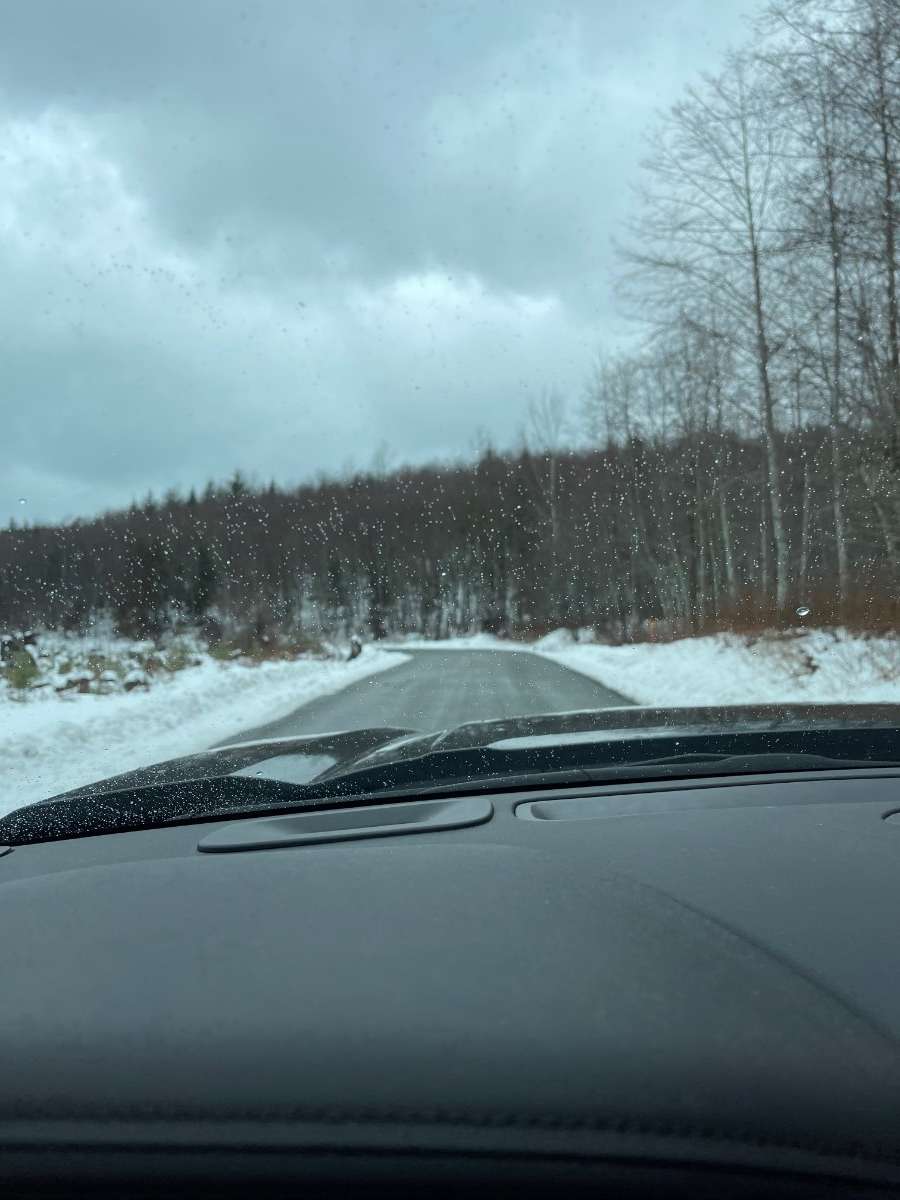
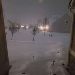
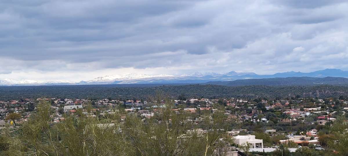
Nice view for morning coffee.
 8 points
 -
Nws has been on a phantom snow kick since the debacle a couple weeks ago7 points
-
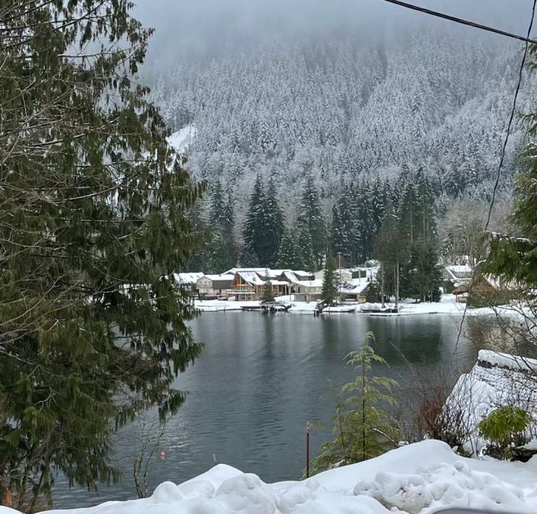
You can see the sticking snow level right now on the ridge... maybe 500-700 feet higher than our house. Should come down when it gets dark. Currently misty and drizzly with some random snowflakes.
 7 points
 -
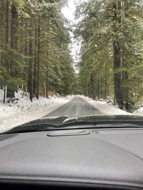
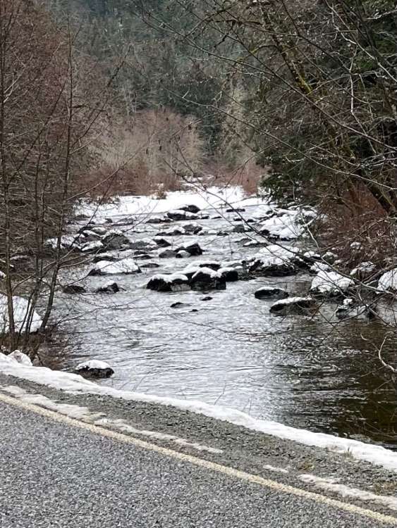
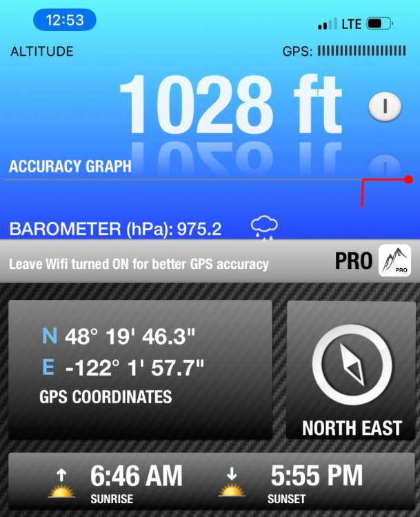
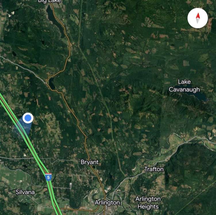
Okay Jim…I have your dream location (if staying west of the Cascade) I had some free time today so I took a drive to Lake Cavanaugh which is about a half hour NE from my house. It’s at just over 1,000ft and my dream location for snow and for very low population density. Think I passed 3 cars the entire drive there. If you don’t mind a 30min drive to I-5 or can work from home and don’t mind not being 2 minutes from a Costco or Target…It’s the perfect location!! Was 33 degrees with light snow falling when I was there a bit ago.

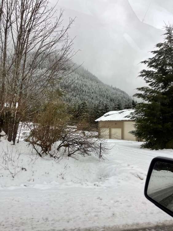

 7 points
 -
Mostly snow now.6 points
-
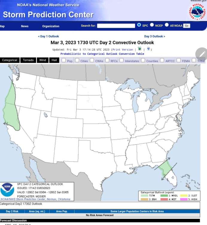
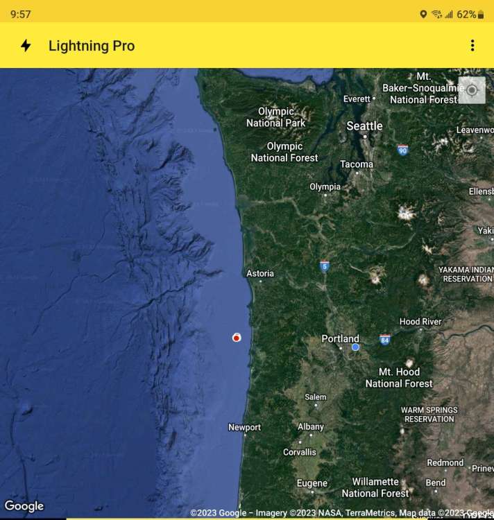
I just wanted to remind everyone, the change for snow isn't until tomorrow morning. If you look at the satellite picture, you can see the low forming out in the Pacific. It's gathering strength and moisture. It looks like a good amount of precipitation could be coming in. With the low snow levels and hopefully strong amount of moisture, that snow level will lower. Not sure if it will hit the valley floor but I think the higher elevations could get hit really good. Riding the models is good but you really need to look at other things because models can be a little behind on what's going on outside.
 6 points
 -
Random, arbitrary stat of the day: Today will mark the 119th consecutive day that PDX has stayed under 58 degrees, which ties the record set in 1948-49. Looks likely that we blow that record out of the water.6 points
-
Love you man. I promise not to post pics like this during the next El Niño.
 6 points
 -
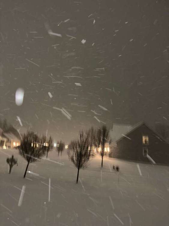
Really coming down here now. Huge flakes... almost like mini snowbombs falling from the sky. Given radar appearance, I'm getting a bit more optimistic again. Very windy in central IL with gusts near 70 mph, so those models with high gusts were onto something.6 points
-
So far just a bunch of wet snow and only 1/2 on ground. Way to early to call it a bust though.5 points
-
Thank you it's nice to hear everyone's input about the PNW weather I love the weather and love how everyone gets all enthusiastic when we have interesting weather 🌩5 points
-
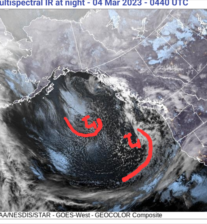
I thought I would update on the lows I'm seeing on the satellite picture. As you can see, the low is getting better organized. As you can see, there is a lot of cold air with this system. I think we probably will see snow at some very low elevations but I think there is a good chance we could see a thunderstorm or two. The second satellite picture shows another low developing with a lot of cold air with it too. If we go off what the 00Z GFS, that low will be moving in along the South Oregon Coast but that could change. We just need to keep an eye on where it's going to go. Let's see how this all plays out


 5 points
 -
Definitely looking forward to the longer days. I really do enjoy summer around here when it’s sunny and 75-80 degrees out and it stays bright until after 9pm. Though I don’t mind the occasional heat wave that brings 85-90 degree temps which is nice if I want to go out to the river and get in the water. The summers around here are really nice when they aren’t a complete torch. Even cool partly cloudy 65/45 days are welcome every now and then but I feel like those are becoming harder to pull off.5 points
-
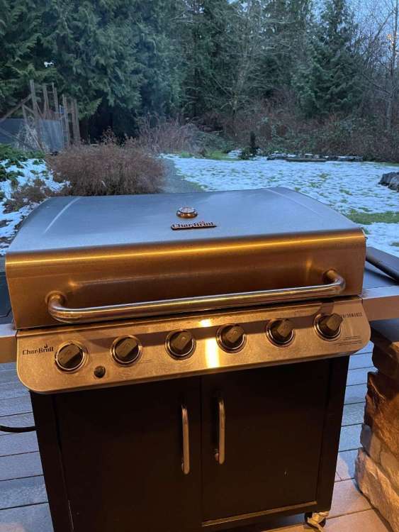
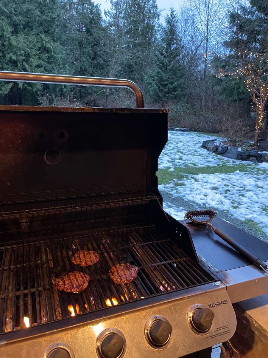
Anyone else BBQ’ing on this lovely Friday evening?
 5 points
 -
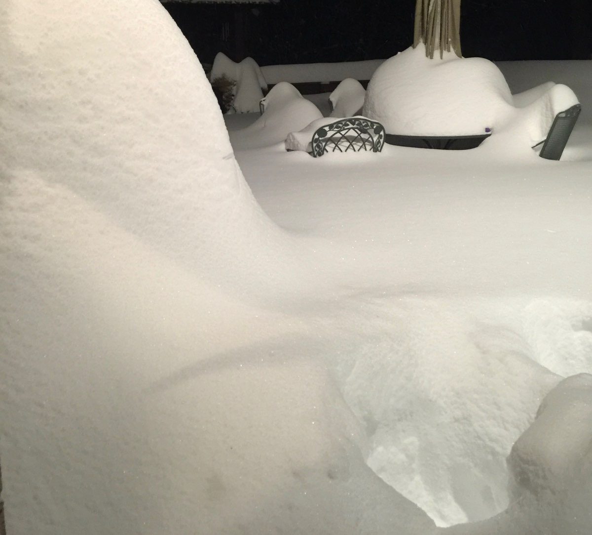
Pound town here ! Visibility down to 1/4 mile. Snow is wet and reminds me of the storms we used to get in the Cascade Mts.
 5 points
 -
Had a high of 40F and a low of 31.9F, now 38F. About to say goodbye to my snow.
 5 points
 -
Wife and I watching tv, saw lightning , out the window and then I heard the thunder about 5 seconds later. First time I have ever witnessed thundersnow!!! The strange thing was, it was barely snowing. Wow!!!!5 points
-
The family of deer made an appearance today. The only time they come through is right before we get snow. Thinking maybe the GFS is right.5 points
-
This place is way better than Twitter or FB for weather discussions.5 points
-
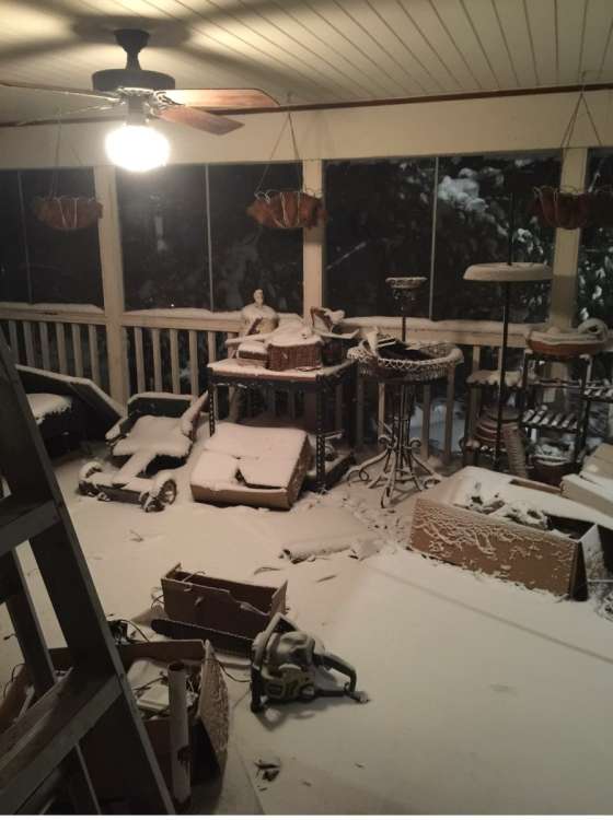
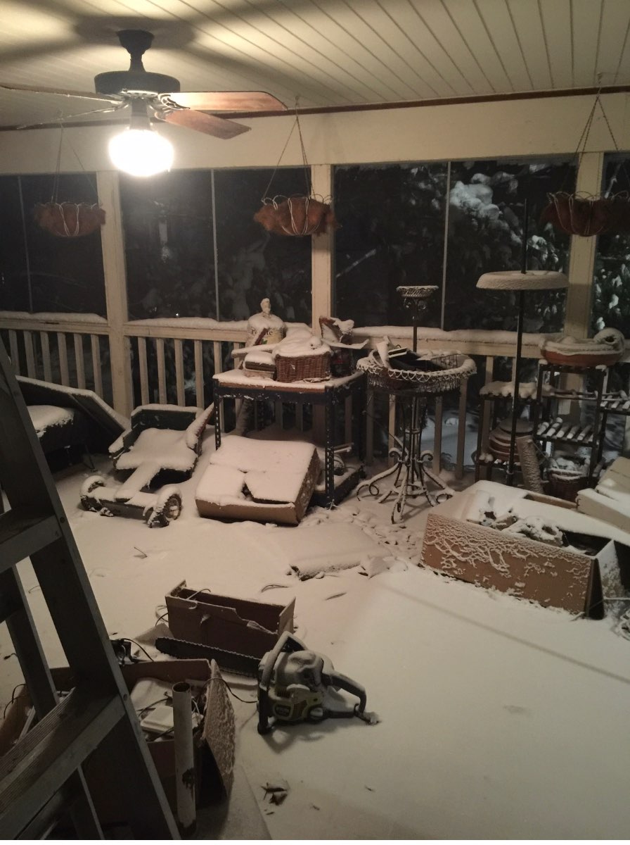
Started here. Hardest I have seen it snow in a while wind is picking up. IMG_4940.MOV
 5 points
 -
The 50-day cycle with this year's LRC would suggest that the data is right with a very active pattern starting next Wednesday and lasting a few weeks in the nation's midsection. IF you back to the second half of Jan. around 50days from Next Wednesday, you will see all the days we had storms. So, yes, it's going to be active next week, how far will the cold bleed and how strong will the disturbances/storms be?? The most recent runs of the EURO and GFS do suggest quite the cold pattern setting up mid next week. Should be some good set-ups for snow. We'll know by March 25th who finished strong in the snow department.5 points
-
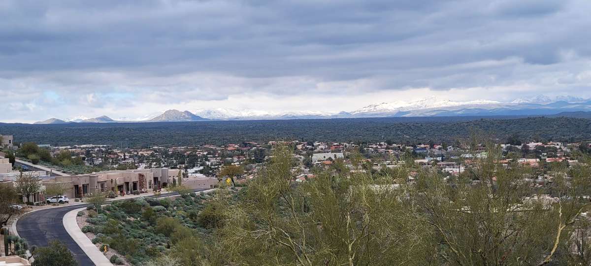
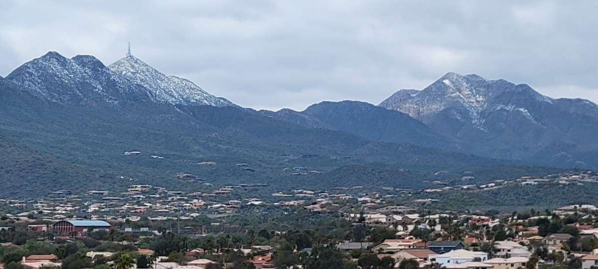
@Sparky, here are some photos of the surrounding mountain ranges in Fountain Hills. I can't believe it snowed on the McDowell Mtn's that border Scottsdale and Fountain Hills. It's the last photo with the towers on top of the mountain. This is pretty neat to see.

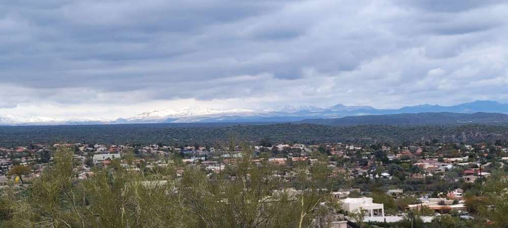
 5 points
 -
Ya know, the NAM was not too bad after all for KC. The storm is here this morning and it has been raining really good. I'm at 35 degrees. Closing in on .60 already, with what appears to be several more hours to go. The NAM was consistent with the farthest west track. The only thing the NAM misread, the thermals.....yes, kind of a big deal. But, if you know enough about March weather, you know how hard it is to get enough cold air for these storms and you knew it was going to be close. The storm we had several weeks ago in KC, 3-5" across the city, was almost identical to this storm. The NAM was aggressive with that one while others weren't. Interested in seeing what the storm does later today off to my NE.5 points
-
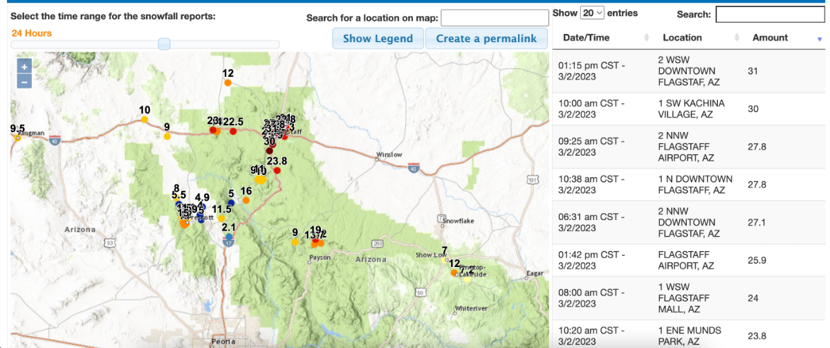
Holy smokes! Flagstaff got pummeled...tack on another 30" or so...No big deal!
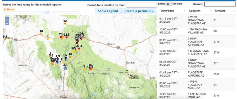 5 points
 -
Snow is back for the Sound on the 06z.5 points
-
I use to. I moved a little west of Wood Village. I'm close to 181st and Halsey now. I use this profile because it's the one I use on Mark Nelsen's blog. There are a few people here that know me by that profile.4 points
-
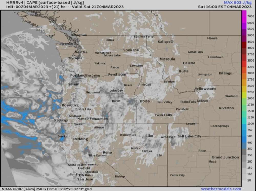
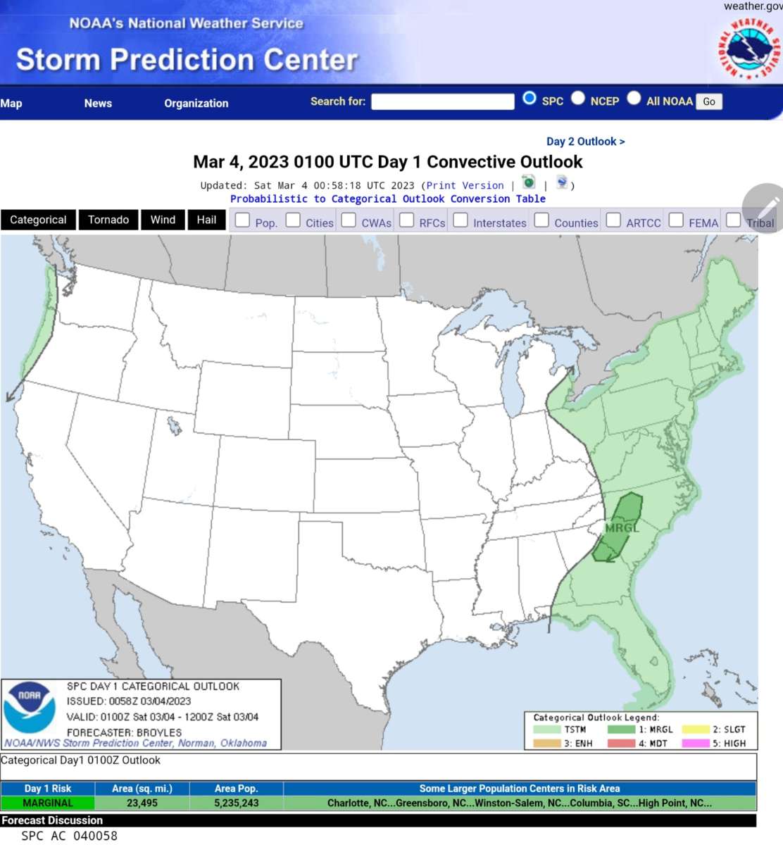
There is already some thunderstorms along the Oregon Coast.
 4 points
 -
Haha this is for March 10th!
 4 points
 -
Currently 34 and just a light mix but there is some heavy duty stuff on the radar coming so that should drop the snow level back down l.4 points
-
Good or bad depending on your viewpoint. Nonetheless, here we go.
 4 points
 -
Bremerton reporting 34 and light snow. Incredible for March and 4:30 in the afternoon.4 points
-
Just witness thundersnow. Anyone in Macomb saw this. Cool stuff.4 points
-
It was 85 when I was in Dallas the other day. Felt hawt.4 points
-
The ECMWF was awful and way over-estimated snow in the c-zone area last night.4 points
-
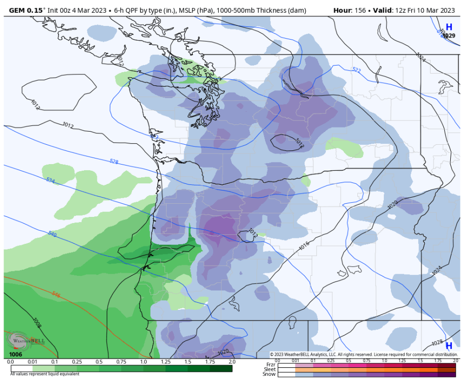
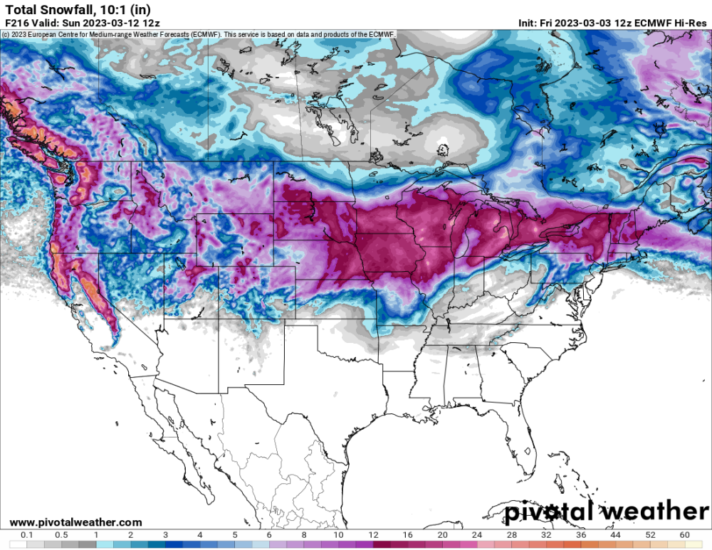
Total snow from now through 4 p.m. tomorrow per 18Z ECMWF
.thumb.png.726426c75aa38a4c114a281c683b09f9.png) 4 points
4 points -
Pretty impressive. I was thinking they had to be getting close to some sort of record for lack of mild weather. We are approaching four months since their last 60 degree day. Last 60 here was on 10/29. Unfortunately, unlike 1948-49, this record is fairly PDX centric. Areas south of Portland hit 60 a handful of times in late December/early January.4 points
-
Every time the precip has become heavier today its been in the form of snow... nothing to show for it though and the pre-existing snow is melting. Things might change once we get to sunset. I suspect we would have had 2-3 inches of snow today if it was December or if this moisture had been coming through at night.4 points
-
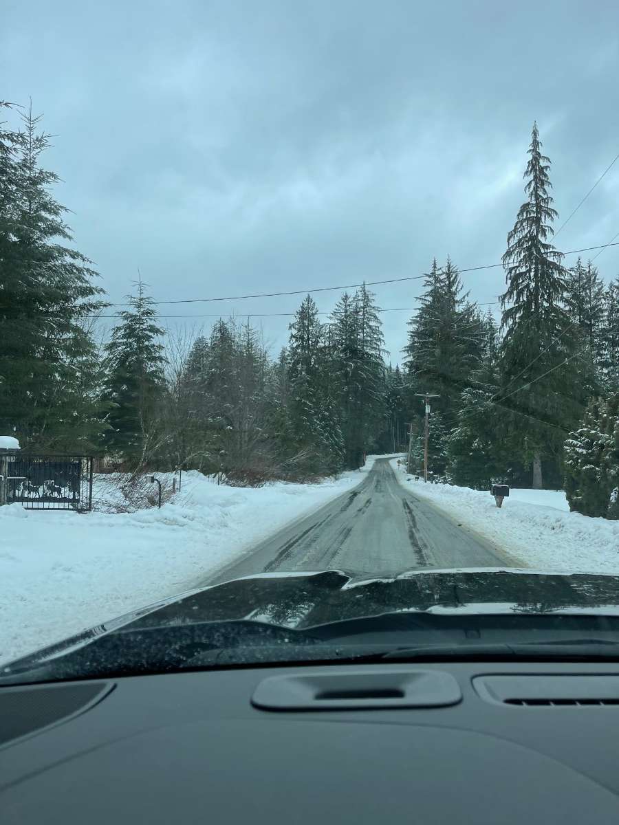
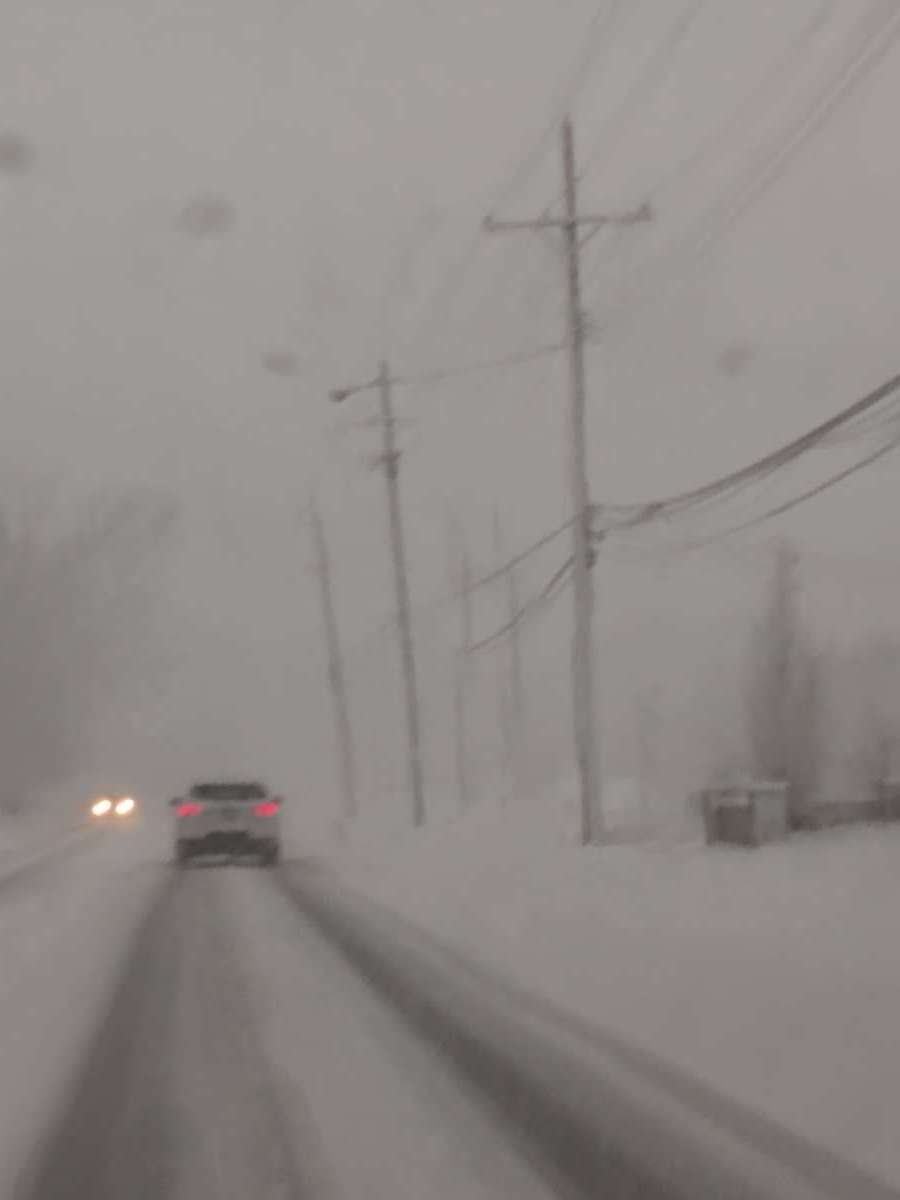
Crawling home
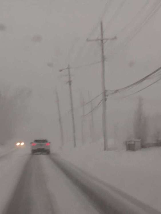 4 points
 -
This was a Signature storm and I'm sure it will be a Big time producer given the blocking and slow movement. I see all the global ensembles are starting to come on board and even increasing the size of this system. Cold Air will be prevalent and also the moisture. It's all going to come down on track. #MemorableMarch'23 12z EPS...
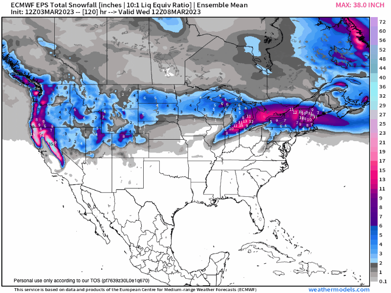 4 points
 -
Snowing hard at my house looking at my cams.4 points
-
Looks like this storm will be a major bust by the models since there is a large lack of cold air! The models the last several storms have really struggled for some reason! As i stated before, I’m over this winter and just ready for severe weather season4 points
-
Well the Euro would pretty much crush everyone along I-80 from Nebraska to Ohio. I've seen this before; all major models showing something big and then as we get closer to the event it's a dud. Next weekend couldn't be any more worse for us in Nebraska; we have our boys state B-Ball tournament in Lincoln. I guess I'll get excited about a snowstorm for us when we are 12 hours out.
 4 points
 -
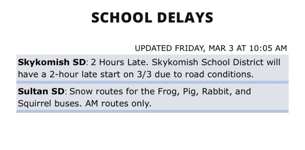
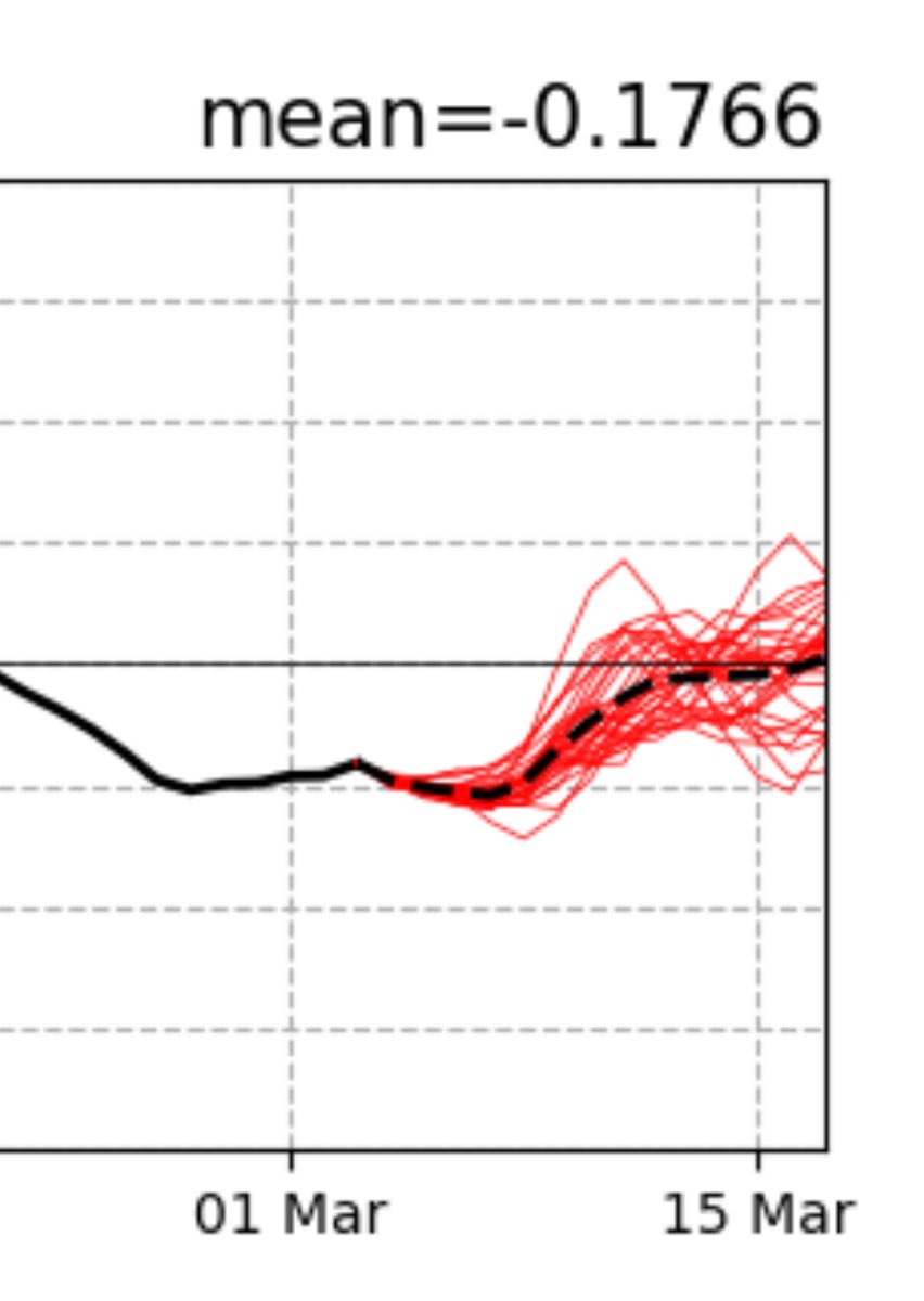
The winners from overnight. And Sultan has interesting bus names! And the PNA.
 4 points
 -
The Euro is now dead to me. I am now team JMA!4 points


.png.7abfa0bb19a6428460da619695d594a4.png)


This leaderboard is set to Vancouver/GMT-07:00