
Leaderboard


Popular Content
Showing content with the highest reputation on 11/13/20 in all areas
-
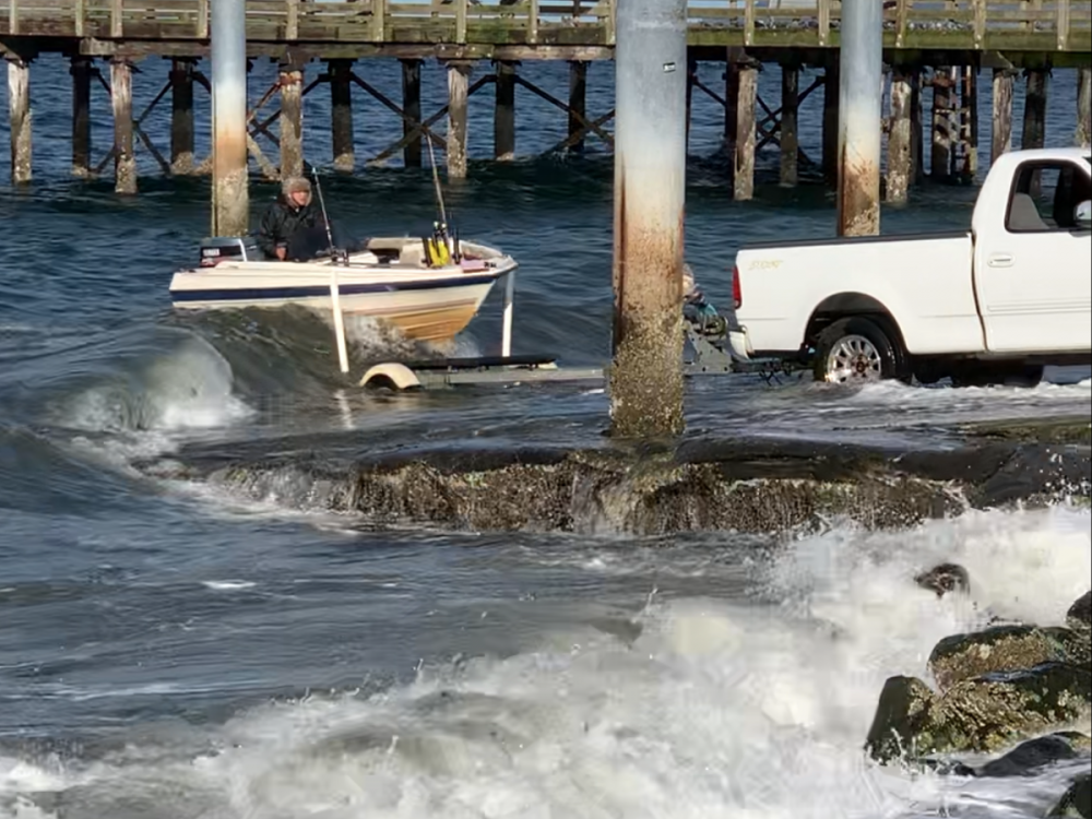
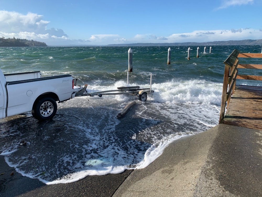
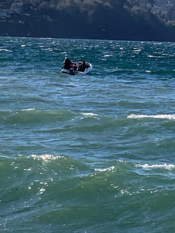
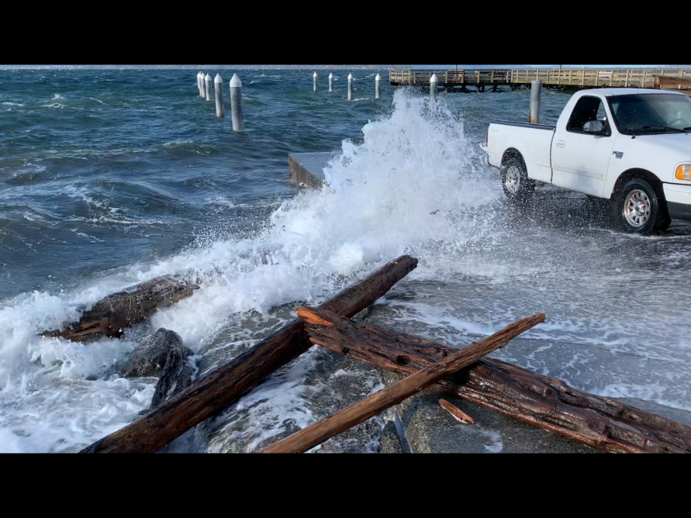
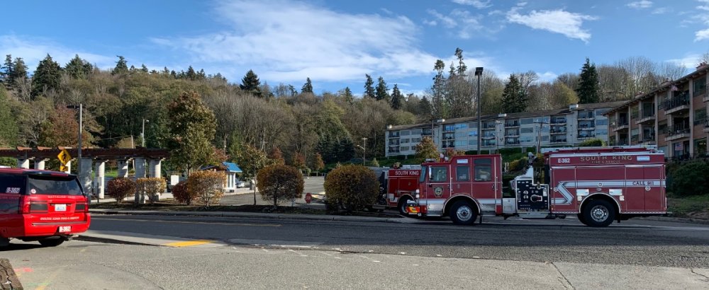
After that burst of winds earlier I went down to Redondo to do my walk. Upon arriving I saw a boat out fishing. I knew their was a small craft advisory posted but looked like they were doing ok until they decided to come in. That’s when the story began! Took the video of their first attempt. They tried many other attempts but just wasn’t going to happen as the wind and waves increased. They finally tried to tie off on the pillars and just sit to wait it out. I finally made the decision to call 911 for them. Their was also another fella there and he was on the phone with them as well ( he turned out to be a paramedic). long story short they ended up using divers to get some gas out to them as they were almost out. Then they journeyed towards Des Moines’s Marina which is shelter. Hope they made it ! winds were in the 30-40 mph category and crazy big waves at times.
 7 points
 -
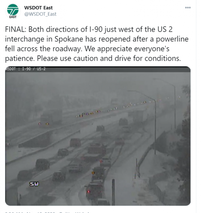
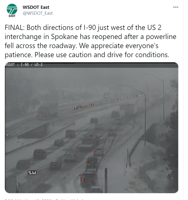
Meanwhile, in Spokane
 7 points
 -
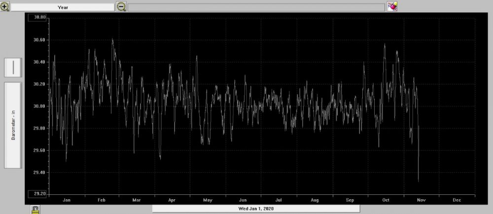
Looking back, my pressure reading of 29.31" is the lowest reading for me since February 14th, 2019.
 5 points
 -
Well +NAO would destructively interfere with -PNA (theoretically) beyond 4-5 days, so that wouldn’t be good, but there’s a growing signal for a Urals High/PV weakening event in December. MJO crossing IPWP would fit that sequence as well. So I’d highlight December 10-20 as the first opportunity for legitimate winter weather out there.5 points
-
Lock in the Euro!5 points
-
Well, well, well...5 points
-
Anyone else working extremely hard today, with the live Masters broadcast on another screen?
 5 points
 -
The trend away from a warmup after that huge low is really nice to see on the GFS. Plenty of mountain snow and cool troughs later next week on this run.5 points
-
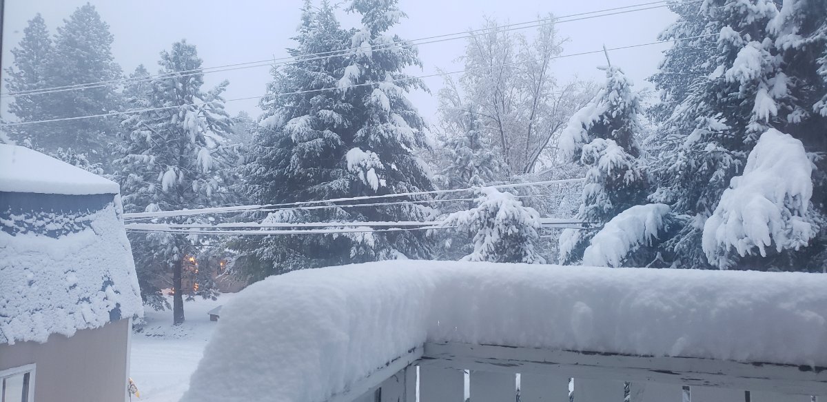
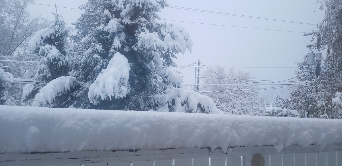
Just went out to measure. 9 inches, still snowing. Big victory for the WRF and the UW high resolution ensembles and the high resolution NAM. Big loss for the NWS and their automated forecasts, which have us less than 3 inches.5 points
-
6 inches at least of snow here and still snowing. The UW high resolution models were more accurate than the National Weather Service forecasts.5 points
-
I had a low of 3 this morning. Certainly not a record for my location, but still some pretty cold air for mid November considering it was 70 here only five days ago.5 points
-
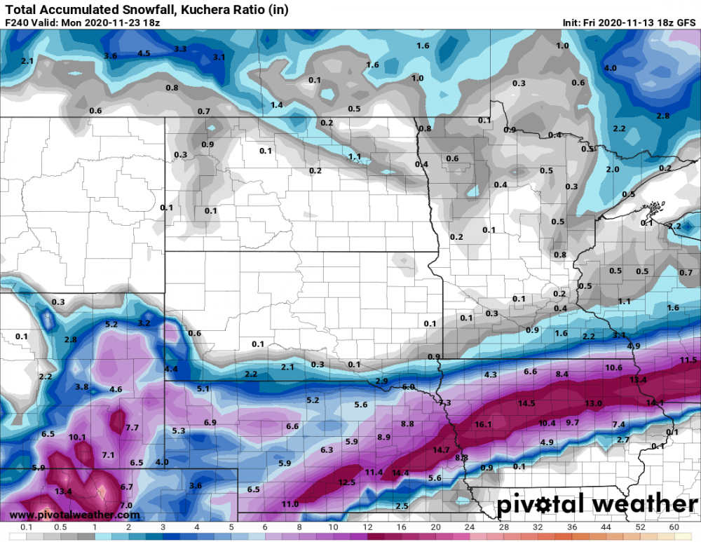
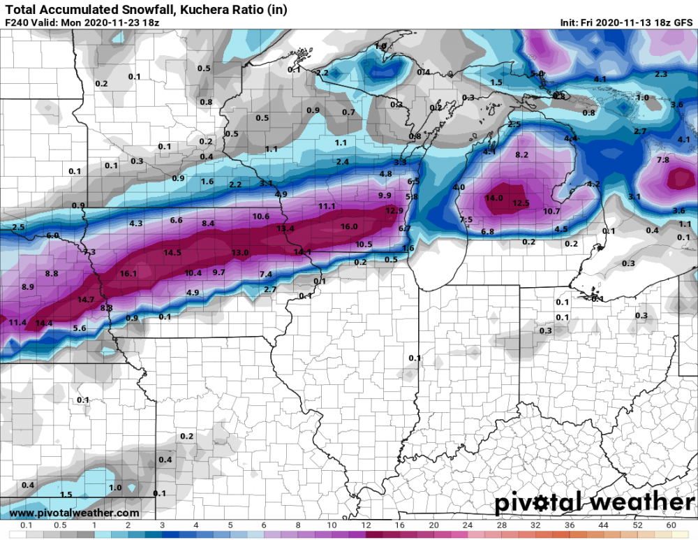
Happy Friday the 13th! #TGIF...things are about to warm up quite a bit around these parts while back home it's gonna get chilly and windy. The 00z Euro is showing daytime highs in the mid/upper 30's for Chitown and points N & E on Tuesday...Brrr!!! Meanwhile, over here in the desert SW we may be on the verge of more late season record heat as a string of upper 80's is on the way, with the possibility of touching 90F on a couple days next week. On a side note, before I left for AZ I was thinking about how early the leafs turned color this year and it appears almost likely that most, if not, all of the hardy trees will have no leafs on them by the time Thanksgiving week comes around. I haven't seen what it looks like back home but I'm sure there aren't many leaves left on the trees and after this weekends potent systems targeting the GL's there will be many bare trees. This has not happened in a number of years iirc. Was it Nov '13 or '14....gosh, I can't remember what year it was but I do recall how cold it was when I went fishing up into S WI and the edges of the lake was frozen over early one of those years. Anyway, I like the signals nature is showing and she may be gearing up for a "White Thanksgiving"....I'll explain below... In recent days, the models may now be starting to dial up on potential winter storm system around the 21st that may impact the all-important start of the holiday travel week. Last nights 00z Euro showing a classic pattern with a Canadian HP over the top seeding arctic air and a storm coming out of the central Rockies (CO LOW???). I like the set up and the potential is there for a lot of you north of I-80 to be in the game. Get those Christmas lights up!
 5 points
 -
Whoa... High latitude blocking signature w/ arctic air teasing with the border. This was not advertised on the 00z.5 points
-
Wind blown snow! The best4 points
-
Really if you reflect on how October and the 1st two weeks of November have progressed we should be very happy with things. A few cold shots. Nice mountain snows. Powerhouse westerly jet and perhaps a few deep lows to track. This has been far more interesting and active than previous years. The next two weeks it seems we'll see periods of NWLY flow for more rains and mountain snows. No signs of endless ridging over us either. Can't rule out pre-Thanksgiving snow for someone. C'MON!!!!4 points
-
The wind woke me up around 5:45 AM. Gusts around 6:30 AM were quite hefty 40mph+. I lost a few limbs off the fir tree. I just now have time to look at all 12z runs. No real big changes. A lot of rain, mountain snows, although the EURO is more bullish than the GFS with that. Still watching Monday night-Tuesday morning as a very deep low may develop offshore. Depending on the exact trough axis position should a sub 970mb low spin up and swing closer to us we'll have to watch that closely. I don't see any signs of a good/amplified block yet. I would say so far this November is playing out like most 1st year Ninas. Real Winter kicks in late December or mid-January usually in 1st year Ninas. Who knows though. Onto 00z!4 points
-
Just a breezy fall day here in Bellingham, I’m back working temporarily and they have me downstairs in the middle of the building so it’s difficult for me to GOLU. Weather station at my house is showing 45 degrees, barely any wind and .65” in the rain bucket. Last time I did look out the window here the trees were rustling a bit but nothing special.4 points
-
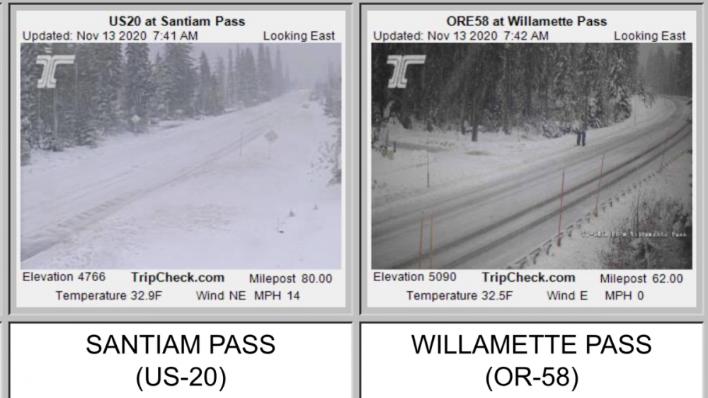
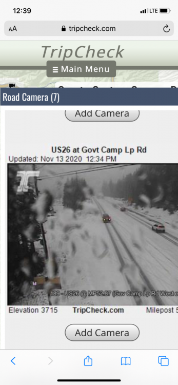
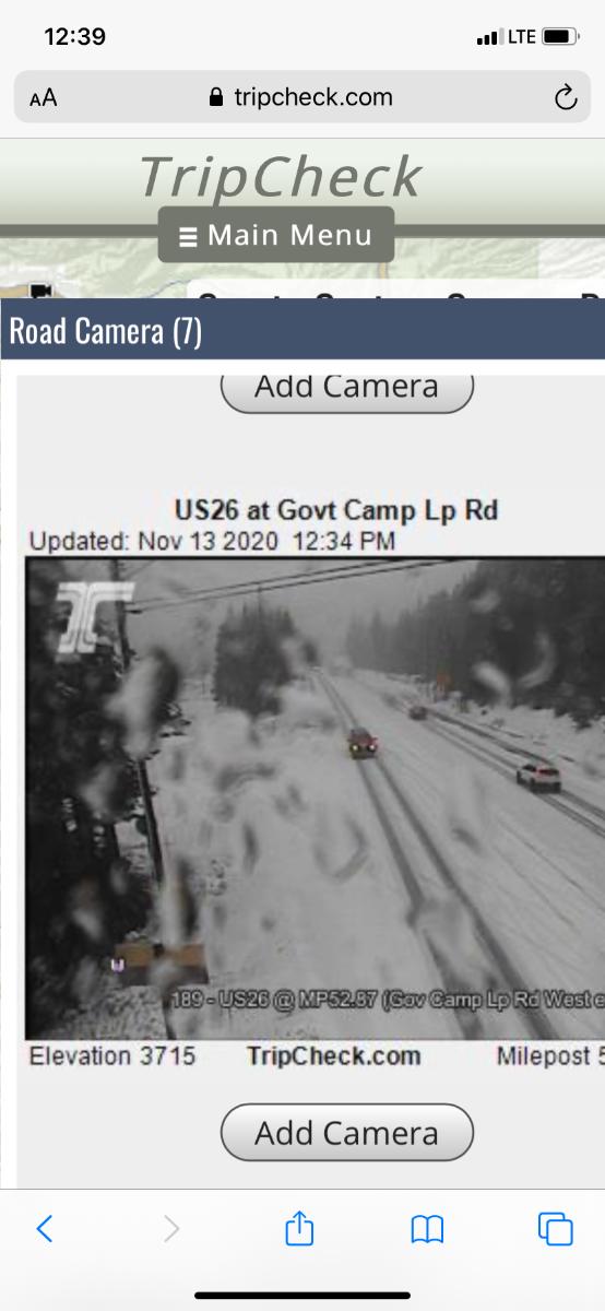
Willamette Pass and Santiam Pass are doing great this morning, considering we are in the “warm” part of the system.
 4 points
 -
Here is the storm Tom was referencing on the Euro. Long ways out so plenty to change, but this is looking like a possible overriding event. Those are always fun to be on the happy side of.4 points
-
Really if you reflect on how October and the 1st two weeks of November have progressed we should be very happy with things. A few cold shots. Nice mountain snows. Powerhouse westerly jet and perhaps a few deep lows to track. This has Nice to see the snow levels coming down below the passes again by the middle of next week.3 points
-
Was quite a bit windier today than I thought it was going to be, I have quite a clean up to do after this westerly windstorm. Still gusty out there but the power is back on.3 points
-
Bam as soon as it got dark the snow came, wind blowing it too. I will be up until 12-1am so I'll keep track of any accumulations. For now it seems wet.3 points
-
Getting some moderate winds here after about an inch of rain last night. I have to say though, a wind storm with mostly sunny skies just doesn't feel as stormy to me as one accompanied by clouds/rain. I found these storms more enjoyable growing up near the ocean where you could see storm's effect on the water.3 points
-
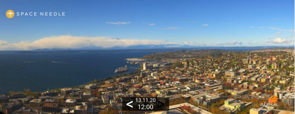
Beautiful early afternoon in Seattle...
 3 points
 -
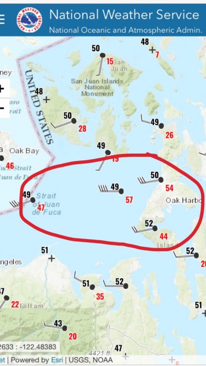
Not all the stations are shown but it was actually quite a bit stronger it looks like. Some spots actually hit 60mph.
 3 points
 -
Euro has a 980mb low going into Central Vancouver Island .
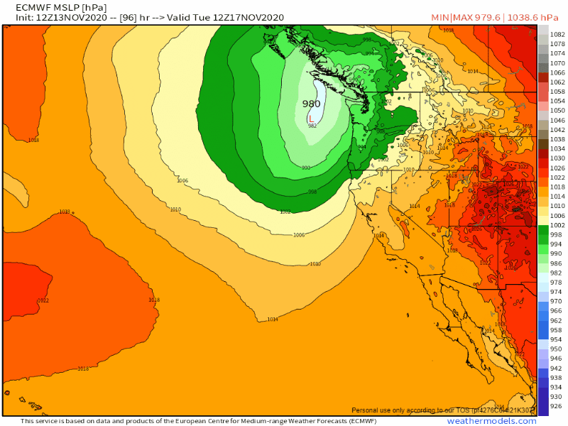 3 points
 -
Was listening to cliff masses friday podcast this morning he was talking about the potential for a big storm on Tuesday. The low on Tuesday is definitely taking a much better track than the potential track for the friday system was showing a couple days ago. It could be one of those storms that keeps all the damaging winds either offshore or just at the coastline or come in a little farther and deliver a big windstorm. Either way at the very least there will be breezy winds, lots of rain and mountain snows coming up with or without a major windstorm. Glad this November is actually acting like November.3 points
-
Why is that not a good sign? We're in the warm sector, the fact that they are only up to pass level is a good thing if you want to see the mountains do well today.3 points
-
Cape foul weather station on the Oregon coast gusting to 92mph!3 points
-
Day 7 Not a fan. 12z tomorrow will be different in several ways.2 points
-
Euro has the Tuesday low at 972 going into North Vancouver Island2 points
-
Meh...It’s not 11/20/20. Next!2 points
-
Lightning to our north! Looks like its in Abbotsford2 points
-
I was just looking at the long range models for this winter and all of them paint the same picture. GOA ridge / NW trough. The CFS and Canadian like January for the coldest anomalies and the ECMWF likes February. It's pretty impressive to see them all with a cold look though. Tropical Tidbits has a feature that gives a composite for the last 12 CFS runs and it clearly shows January being cold. Big anoms for a 12 run average.2 points
-
Things might get interesting next weekend.....take it with a grain of salt being the 18z run and 186+ hrs. out.....
 2 points
 -
In conditions like that you have to be extremely experienced with boating and loading onto trailers, and judging by those pics unless they got that little boat on the trailer and up the ramp extremely quickly (under 15 seconds or so) the waves slamming the back of the boat would have swamped it very quickly. You basically have 1 attempt to get it right and you need to be up that ramp faster than lightning!2 points
-
Dumping on the Oregon passes.
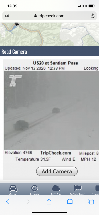
 2 points
 -
Westerly surge here just blew a transformer nearby and took out the internet. Gusts were in the mid 30s to near 40.2 points
-
These systems were rainers a couple days ago but are transitioning to more snowier solutions. The models seem to be grasping onto a colder outlook.2 points
-
Thx bud! If we could do snow squalls exactly 2 wks to the day prior, I'll be shocked if we can't with this beast. Idk what the SLP got down to then, but I think it was only 990's mb iirc. Thus my post wrt our forecaster "04" calling this a "typical autumn CF" (same person that hoisted the infamous WWA for the GHD-2 18-20" storm). Nice to have something to be excited for over this way. Edit: Also not sure why they merely have "gale watches" hoisted and not storm watches?? Help me understand..2 points
-
11/20 is only a week away. I think we are already fairly safe.2 points
-
Very heavy rain now!! Almost dark as night as well! A little spooky!2 points
-
Also, the tree is almost bare. Just a few stragglers left.
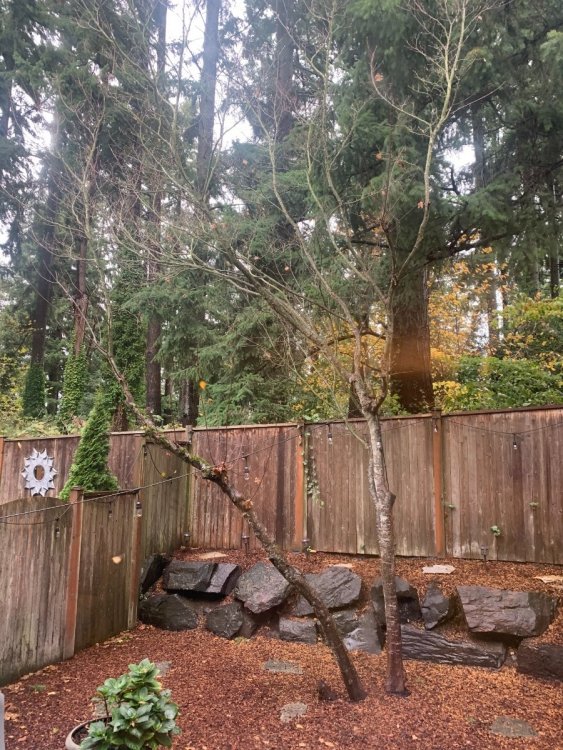 2 points
 -
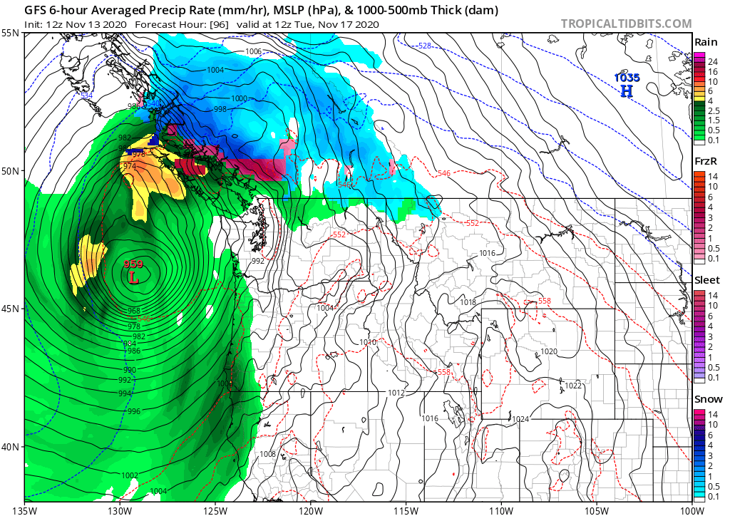
959 mb low west of Oregon on the 12z GFS. Crazy looking. Imagine if it trends just a bit more east...
 2 points
 -
Heavy rain here as the frontal passage moves through. Only a faint breeze here north of the low and in the lee of the Olympics, but I'm also currently situated in the prime spot for the PSCZ. Maybe some hail/graupel, lightning/thunder, downpours, or maybe even some convective winds.2 points
-
I recorded 0.09" of rain fall here overnight. At this time it is cloudy and 39. The temperature has been slowly falling since I woke up so this could be another day where the high was reached before sun rise if that is the case the high for today will be 43. There have been several days this fall when that has happened already. While this happens a lot in the winter it is more uncommon in the other seasons.2 points
-
2 points
-
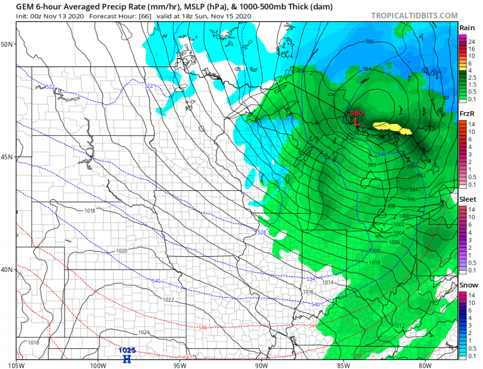
Wow. 13/0z GFS goes bonkers with a 973 mb SLP Sunday morning north east of Superior! NAM's no where near the deepest, but certainly the 12/18z was much colder than other models showing more snow flying on the N and W sides of the storm. Would be nice if things trended just cold enough for northern locales to get a nice blasting during gun season opener. Would be a flashback for those who hunted during the real bliz of 11/16/89. GEM's in lock-step with earlier GFS at 980 mb near the Sault.

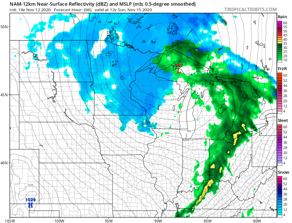
 2 points
 -
MQT on Sunday's storm2 points


This leaderboard is set to Vancouver/GMT-07:00