
Leaderboard


Popular Content
Showing content with the highest reputation on 11/28/20 in all areas
-
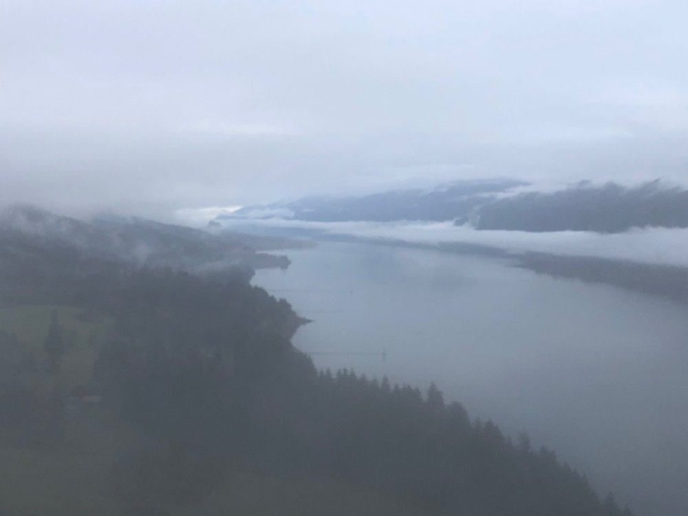
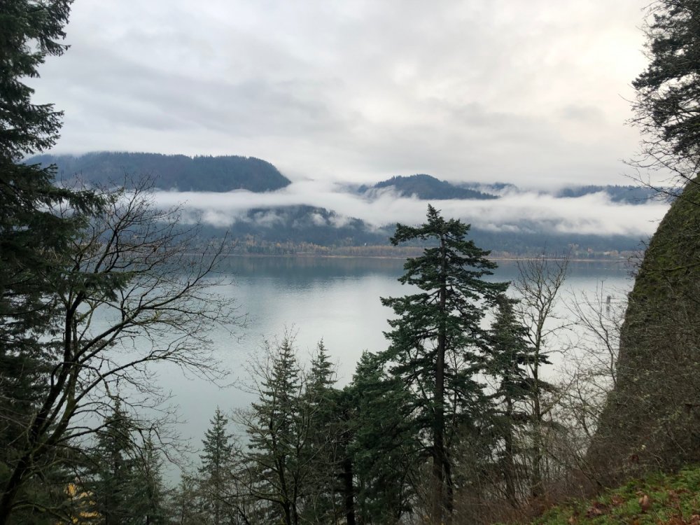
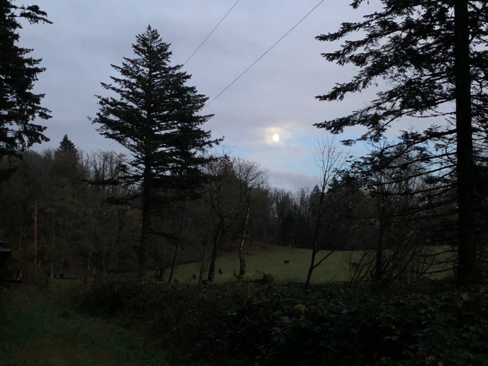
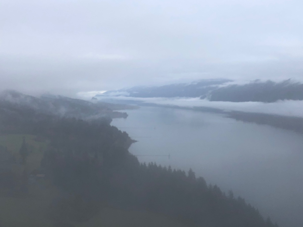
Low clouds and fog made for a neat scene at Cape Horn this afternoon. Managed to get a short hike in and catch the 4:45 pm moonrise at the end.
 12 points
 -
Don’t worry one bit and don’t shut up. Very few of us have passed through the Jesse gauntlet of perception/preference perfection and come out clean on the other side.10 points
-
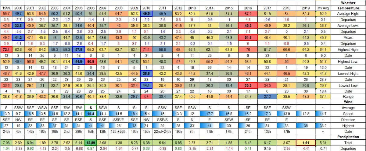
I’m pretty sure I can speak for everyone and say we’re all glad you post here. You do post valuable info here...it’s hard to know all the stats for your location unless your recording them and have access to records going back a long time.9 points
-
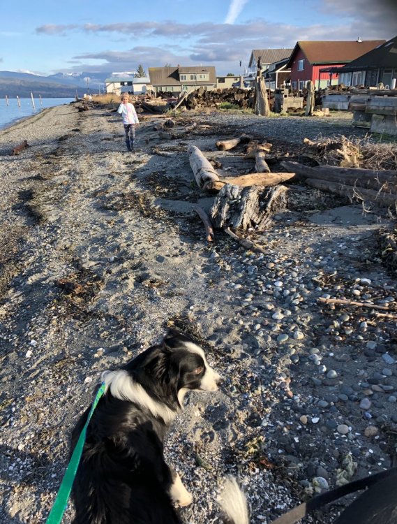
A lovely day up at Samish Bay! And a little snow up in the hills.
 8 points
 -
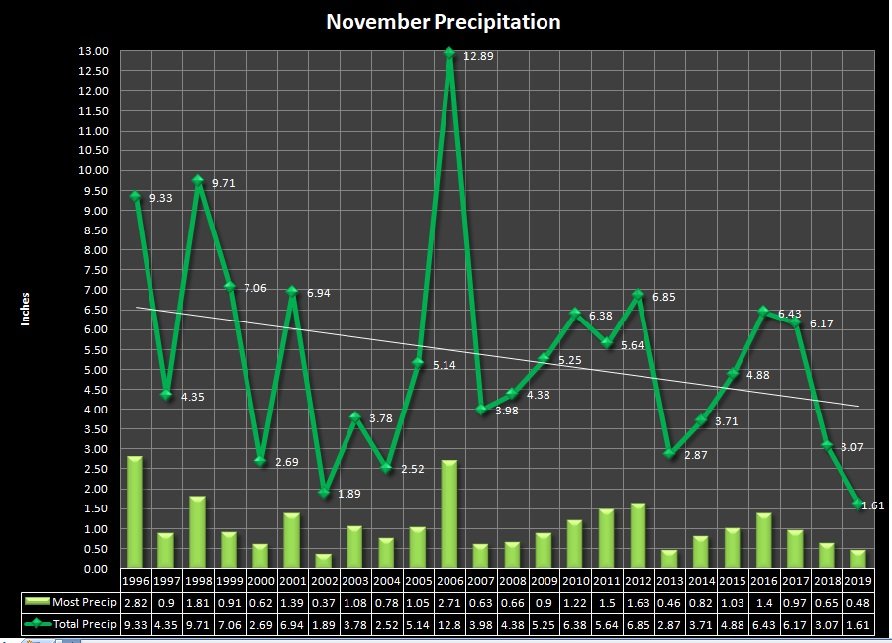
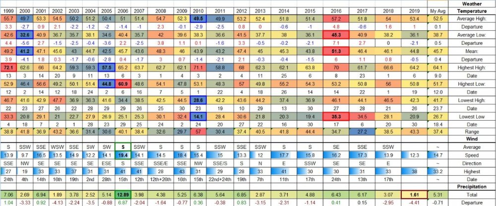
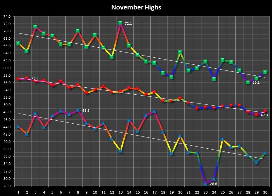
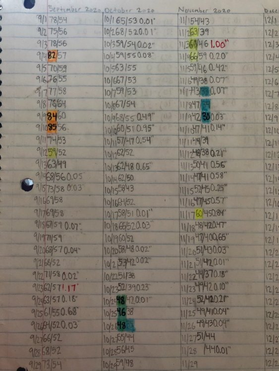
I go to the other extreme, excel sheet after excel sheet haha. Lots of data! I know there are a lot of other people out there with way more though. I've had records at my parents house since 1995 and my house since 2010 now. These are just a few of the sheets/graphs I have.
 7 points
 -
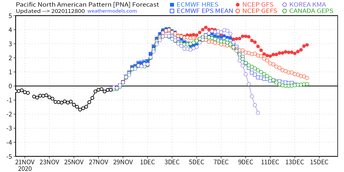
More EPS members have joined the -PNA/-NAO train for the middle of December.6 points
-
I apologize if I was coming off like a d*ck earlier. One problem I definitely have is when it feels like people are knowingly or carelessly pushing false information. I feel like it is to the detriment of collective knowledge on here. It's something that bugs me a lot about human nature in general and that's why it frequently manifests itself in my posts. But I need to understand it is often innocent and it's sometimes better to let things slide even if I feel like facts aren't being properly defended. It's better to be a little wrong than a lot mean in many cases.6 points
-
This is the first year since I've been watching models that I haven't looked beyond day 7 and it's been much more relaxing not looking at the garbage past 168hrs! At first it was hard to do but I'm good with it now.5 points
-
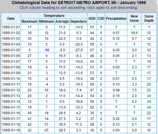
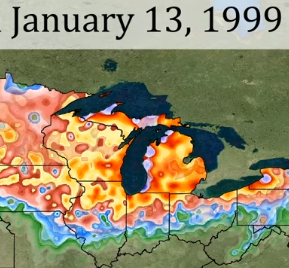
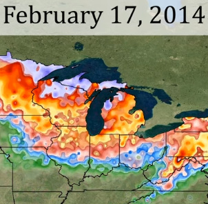
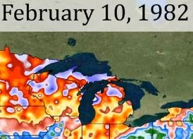
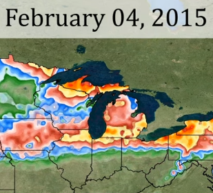
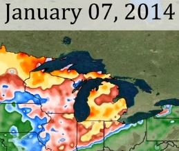
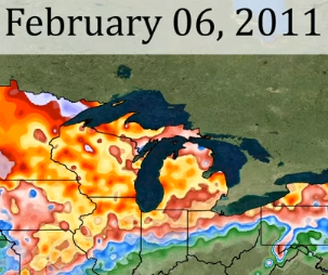
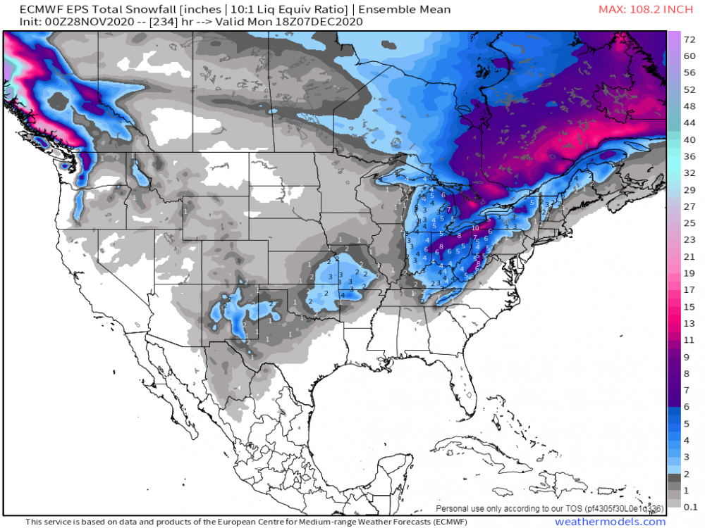
With SEMI having a pretty hot hand last winter and so far looking like they may continue that this winter I decided to hi-lite the top 5 snow depths for the modern era data site for the Motor City. DTW is one of the least snowy places in the Mitt, but even they can do winter proud now and again. Since 1965 when the official NWS records moved there from the Detroit City Airport, here's the list followed by some images. An impressive 2 foot depth was seen in Jan of '99 during that 2-wk snow blitz. The first time in about 90 years that depth was achieved for the record books. Footnote: City of Detroit's all-time greatest depth is listed as 26" tho it is believed to have briefly spiked at 28" the following night during a storm that then turned to +RN dropping the depth to 18" by the 7 am measuring hour. 24" January 1999 20" January 2014 19" December 1974 18" February 1982 & 2015 16" Jan 2014, Feb 2011

 5 points
 -
Sizeable eruption of Lewotolo volcano in Indonesia. Some estimates have the ash cloud rising to 17.8km.4 points
-
Feb 2019. Third coldest February on record.4 points
-
Yes sir! I am ready for Winter.4 points
-
00z Euro....@ToledoWx...I mean, @FAR_Weather has eyes for being close to the epicenter of this early season winter storm... @Niko will fair well as well... I know there are some peeps in NW and N IN that chime on here every once in a while as well so I will comment on the LES set up as it looks great TBH for a long duration event. @indianajohn may be getting his first bout of snow of the season along with that other guy in NW IN (pardon me for not remembering his name).

 4 points
 -
For MBY. December 2008 54” total snow with 7 sub freezing highs November 2006 33.5” of snow with a 23/19 day February 2019 34” of snow 39 consecutive freezes thru mid March January 2020 27.5” of snow including a 24/20 day with 15” of snow January 2005. 30” total snow. 6 sub freezing highs honourable mention to December 2018 windstorm and December 2006 windstorm. October 2003 rainstorm. Early December 2007 heavy snow to heavy rain event.3 points
-
Hopefully we can do better than that. Great two week period.3 points
-
There were a lot of Arctic outbreaks though. Dec 1983 - epic blast Oct 1984 - snow in the Seattle area on Halloween Dec 1984 - minor Arctic outbreak and snow around mid month and then another shot late month Feb 1985 - solid Arctic outbreak on the 1st with snow Nov 1985 - one for the ages Feb 1986 - nice little late season outbreak with snow The whole cold regime began with an abnormal cold shot in late September 1983 which brought heavy frost to many places. Then of course 1985 stands as the only year since the 1950s where SEA averaged below 50 degrees.3 points
-
Lots of blocking. Real and fake cold for really long stretches. Ironically, I remember wearing shorts on Xmas day in 1985 out at the coast.3 points
-
Has anyone seen the latest GFS for next weekend.....Looks crazy! 960mb.....3 points
-
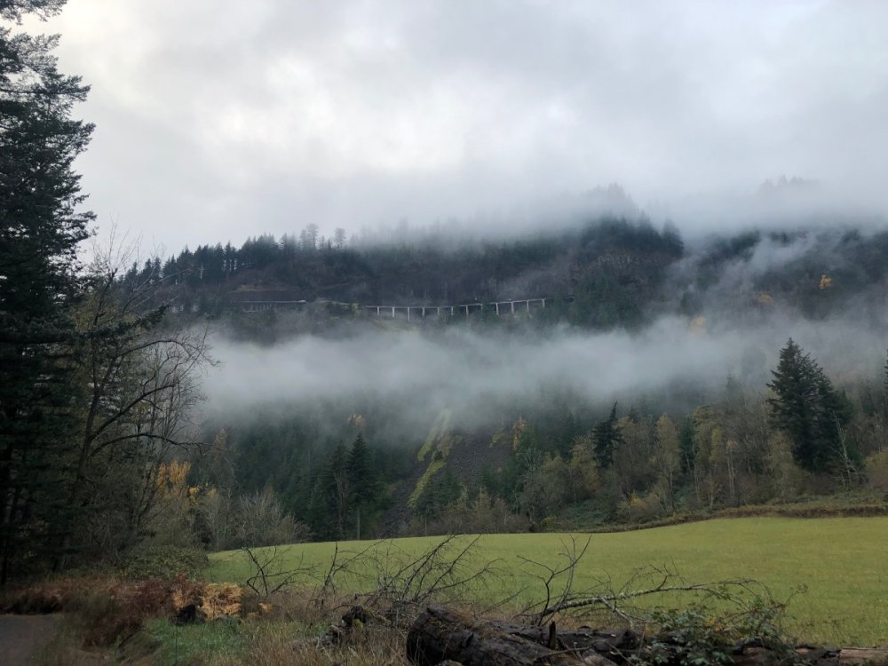
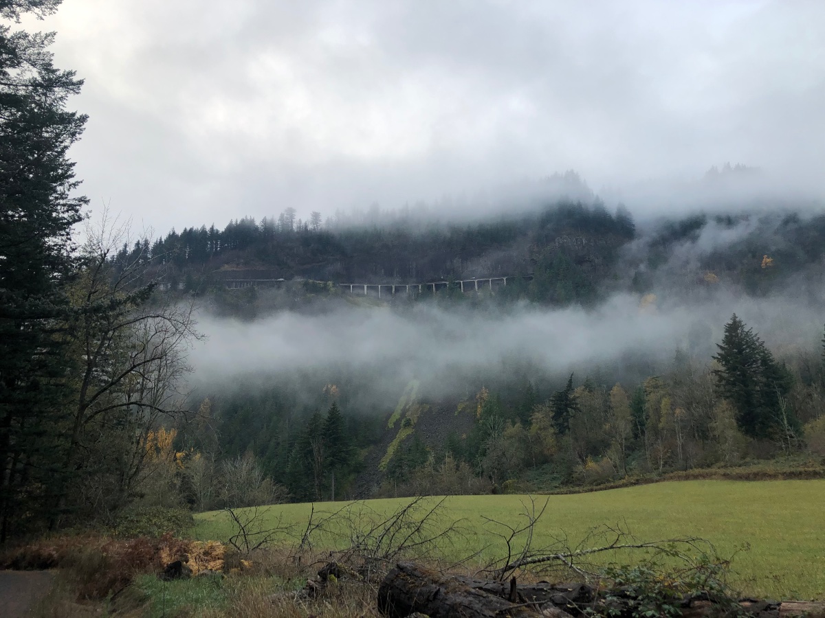
Might see a bunch of days like this down here in early Dec. No pack but hard freezes/fog. This picture was 12/26/2017.
 3 points
 -
You weren't acting like a prick, hope my post didn't come across that way. Just wanted to answer since you had asked about that stat. And you're still correct in pointing out that 2019-20 was a historically mild winter down your way. You're right that it was the first DJF to not have a sub 40 high at Eugene since 1933-34.3 points
-
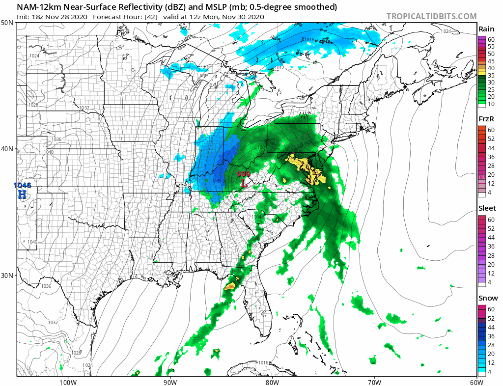
18z NAM features an improved "retrograde curling" of the SLP versus 12z. Keeps me in on/off flakes for 42 hours and is still going at EOR. That alone would be wild
 3 points
 -
I don’t really think your acting negatively at all. I wouldn’t worry too much about not having a complete 100% accurate memory of statistics for your location. I have a book where I record all my stats going back the last 15 years so I can remember specific dates with hi/lo temps for the day..rainfall and snowfall numbers too. It’s not super neat but it’s very helpful. Honestly I can only really remember events and stats of the last 15-20 years and know of a few bigger winter events from the 1900s. other than that I only am really familiar with the last 20 years of weather here. Wouldn’t worry too much about not knowing the high low temps and snowfall stats from events 30-50+ years ago.
 3 points
 -
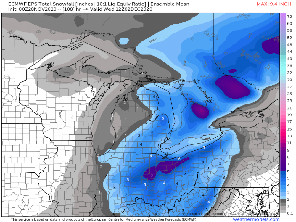
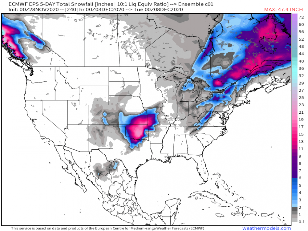
12 EPS...looking good for the S MW/Plains for a nice early hit...kinda fizzles out as the cut-off low heads east but there is time for adjustments. Then....the following weekend is when we begin to see REAL Winter set up shop and the EPS is signaling what I've been planning on, that being, a storm system coming out of the Rockies and into the Plains/MW along an Arctic Front. This should be a fun period around the 11th-13th and could last for a couple or more weeks.
 3 points
 -
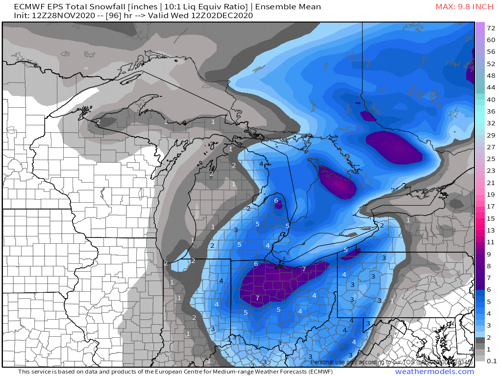
12z EPS...looking good for DTX & CLE...
 3 points
 -
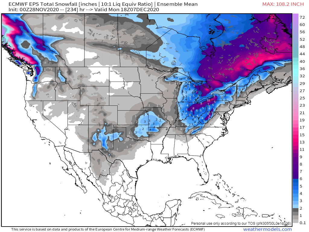
With the 12z ECMWF the surface pressure map at day 10 is much more telling than the 500mb. Low pressure is almost entirely gone over the NC and NE Pacific with it all shifting over NW Canada. A big shift right around the 8th which the EPS has been consistent on.
 3 points
 -
Baby steps. Deep breaths.3 points
-
Last nights 0Z GFS V16, which will soon be the new GFS, did show the pattern change, not as much as the 12Z did, but building heights in Alaska and some troughing in the PNW. Also, last nights Korean model, which goes through 12 days, showed a similar pattern to the 0Z GFS v16. Doesn't look, so far, like the GEFS will show it though. And the Canadian, through day 10, looked to be no change from previous runs.3 points
-
A widespread January 2004 like ice storm.3 points
-
3 points
-
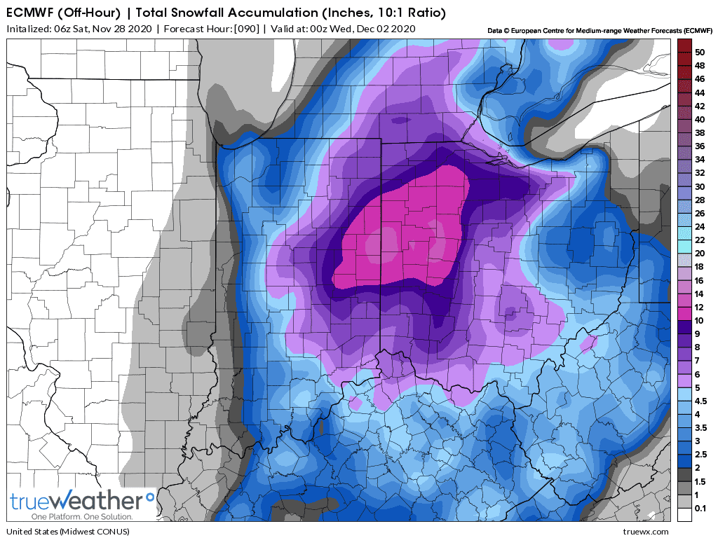
06z euro. Also west. @Niko@jaster220 Nice totals across the board
 3 points
 -
@OKwx2k4, @Clinton, @clintbeed1993 and KC members I'm sure are paying close attn to the system around the 4th/5th that's showing signs of potential to bring the seasons biggest snowfall of this early season. 00z EPS continues to show good signs for those in the S MW. It's rather unusual to see so much snow being flashed on the ensembles way down in the deep south of OK/AR. 00z Euro Control..."outta control"... Alright, Alright, Alright...I'm tickled to share with you the data that shows we are heading in the right direction for real Winter to begin showing up across our Sub. Once we get past the 2nd winter storm of this month, we will begin to focus our eyes on a shift in the Flow aloft that will begin to usher in the seasons coldest air mass of the season. I've been dialing in on this pattern and I'm beginning to see a very close 30-day harmonic pattern or what may in fact be a 60-day LRC cycle. There are a lot of systems this season that look very similar to one another which was has been confusing to me of late, however, now as I see where this pattern is heading I think this could be a longer repeating LRC than usual. I'm really curious to hear what Gary Lezak has to say. If anyone of you near KC can chime in that would greatly appreciated. I know @Clintonsaid he's throwing out the idea of a 45 day cycle but not sure if he's still believing that. Anyhow, I'm going to comment more on my ideas of the LRC later today when I get to my other comp that has all the maps I have saved. In the meantime, one of the big signals I have been looking for was the modeling to show signs of shifting the Flow aloft from a stout +PNA towards a neutral one and we are now seeing that from the EPS and Canadian in the extended. Why do I believe those two models and not the GEFS??? Look at both the 30mb/50mb animations below and focus in on the region of W NAMER where the warm pool grows around Nov 9th for about a week, then turns colder, but still has a warm pool just offshore the coast of the U.S. This, to me, signals a northern stream pattern and systems digging into the SW creating a SW Flow aloft by the time we enter the 2nd weekend of December or the Week of the 13th. Notice also the warm pool that grows near the GOM and along the EC. This is a sign of a SER trying to grow, but I don't foresee it to be as strong as it was in October. The pop in the PNA pattern correlates well with the burst of the warm pool that starts around Nov 8th/9th in W NAMER. There is about a 3-week lag period to this LR forecasting tool I've been using. The GEFS model is forecasting an ideal signal at 10mb for Week 2 which portray's a noteworthy storm track right through our Sub. This should translate to a neutral PNA or even slightly negative pattern out towards Week 2. The signal for a SSW event in Siberia is NOT going away which are all good signs for later.
 3 points
 -
0z EPS mean starting to color up, it will be fun to watch it fill in the next couple of days.3 points
-
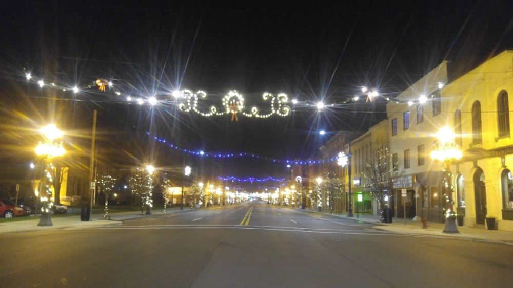
I love seeing the holiday lights dressed over your town...there's something that I enjoying seeing from a small town in rural America...I'd like to see this same shot by the time Christmas/New Year's rolls around this year when there is snow OTG!3 points
-
Came home tonight from visiting family for a belated Thanksgiving dinner to find my town's lit up for the holidays..
 3 points
 -
Day 10 begins to show a similar solution with the GFS. See the trough starting to cut-off, ridge retrograding, and Aleutian ridge sliding east-southeast. Likely merger at Day 11-12. Patience2 points
-
2 points
-
58” for the winter. February 2017 could have made the top 5 list. Kind of a coin toss with that and 3rd thru 5th place.2 points
-
I won't get excited about this "sea change" event advertised for mid-December but I sure do enjoy watching things unfold here in this forum. You guys make it all very interesting and I appreciate that.2 points
-
I used to live right off of 228th st in Bothell, right at the top of the hill, not too far from the fire station. It was amazing how different that extra 250' of elevation would make between where I lived and let's say the Applebees at the bottom. One time I had 3 inches of snow at my house and just ice pellets near the freeway.2 points
-
2 points
-
We need it to stick around through the holidays. Could this be one of the all time great winters we finally put it all together?!2 points
-
Then you get to my age and the notebook just kind of disappears as life takes a hold of you! Mines in a box somewhere from when I lived in Troutdale. Luckily Matt Zaffino who hasn’t aged has a copy of my notes as well2 points
-
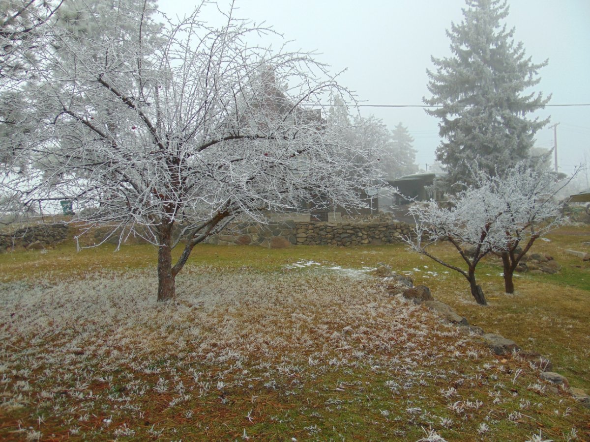
I’ve been outside since I saw it doing some maintenance to at least keep the ice dams somewhat manageable.2 points
-
The cold is ready to pound....
 2 points
 -
I can now add the ICON to the list of models showing snow on the 4th. Hope the moisture is there, this guy should head towards the great lakes. Amounts seem more realistic than what the Euro has advertised.2 points
-
I'm kind of feeling this winter. This would be a bit earlier than I am expecting. A warning shot so to speak.2 points
-
First of many folks, first of many. The winter of our dreams is about to beginnnnnnnnn!2 points
-
12z NAM agrees that my Monday high will be mid-30s but has colder air working into the system from the N and gets me to freezing by 1 pm. 850's are already plenty cold by then. Hoping it's onto something.
 2 points
 -
Now, I dont wanna jump the gun here, but, my forecast shows another snowevent for the following weekend (Dec 4-5th timeframe) and it has colder temps to go w it as well. This is the storm that will bring Clinton and potentially OKwx some appreciable snows and eventually towards the GL's area.2 points
-
0z Euro and CMC both showing accumulating snow in mby later next week. The GFS is still a nothing burger but some of the ensembles are catching on. I marked this one as a 1-3 inch event for the KC area due to lack of moisture from the system currently heading towards the Ohio Valley. Maybe this one can exceed expectations.2 points


.thumb.jpeg.e3014abf99ef08a9f9ac2c0cd31b485b.jpeg)


This leaderboard is set to Vancouver/GMT-07:00