
Leaderboard


Popular Content
Showing content with the highest reputation on 11/30/20 in all areas
-
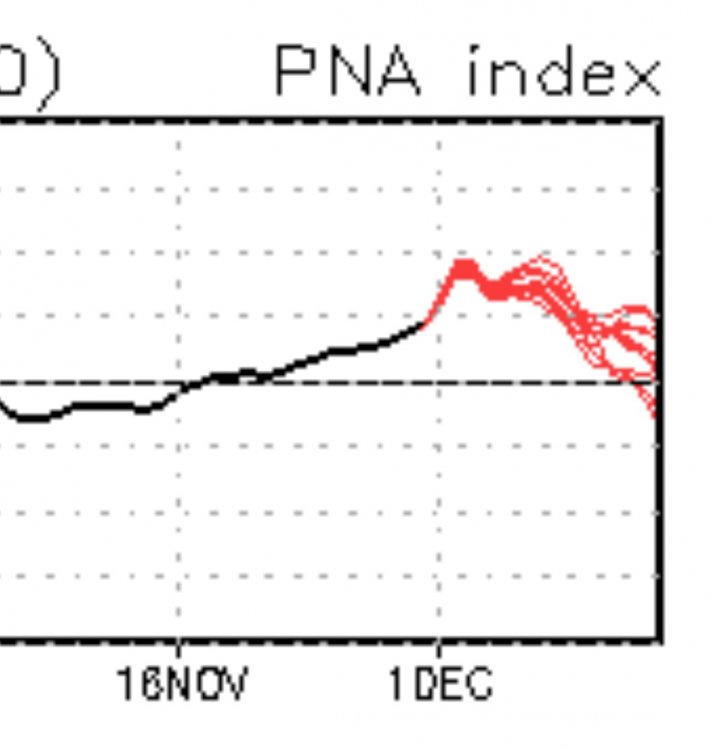
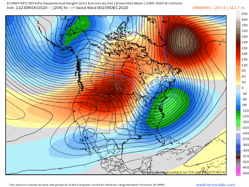
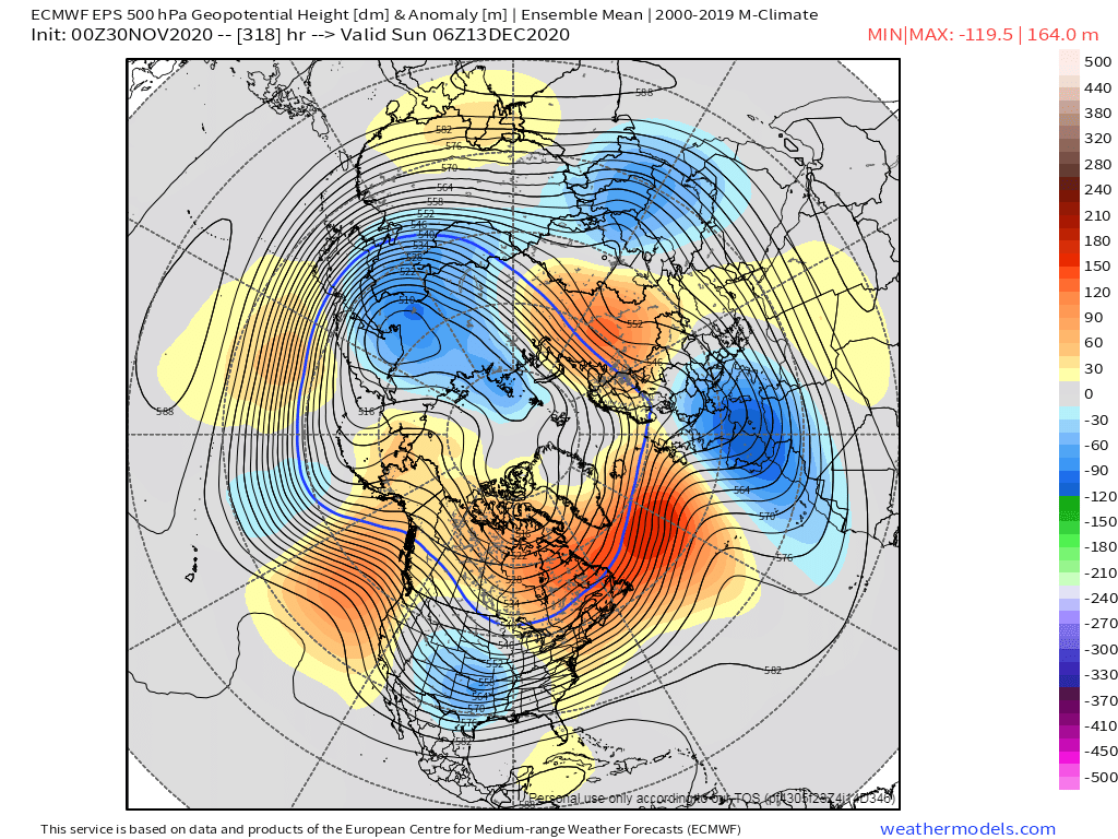
Here is the 5 day 500mb anamolies from the weeklies:
 7 points
 -
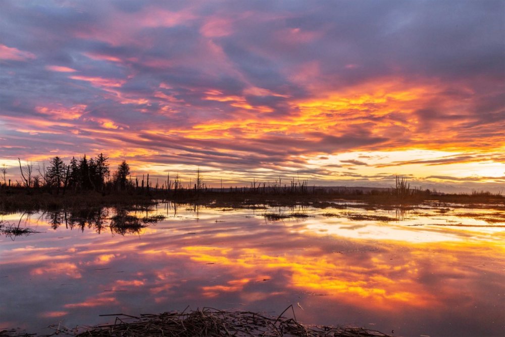
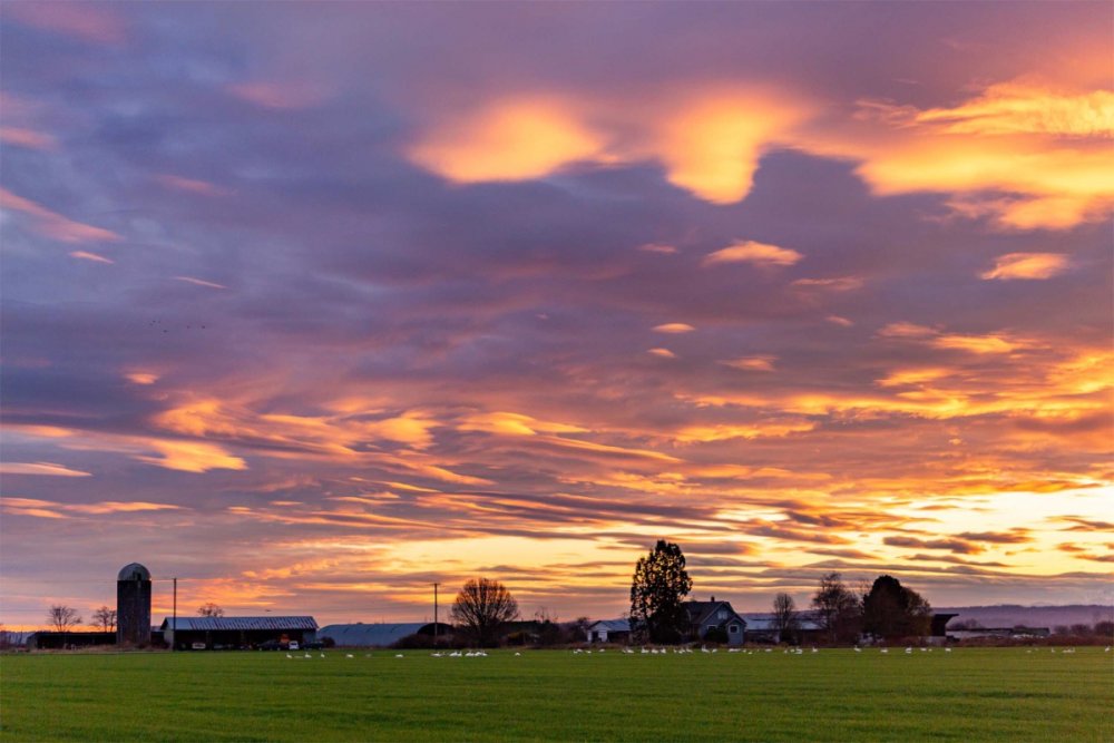
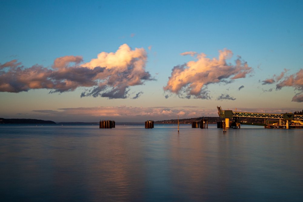
On the other hand the sunset last night at the mouth of the Skagit was stunning.
 7 points
 -
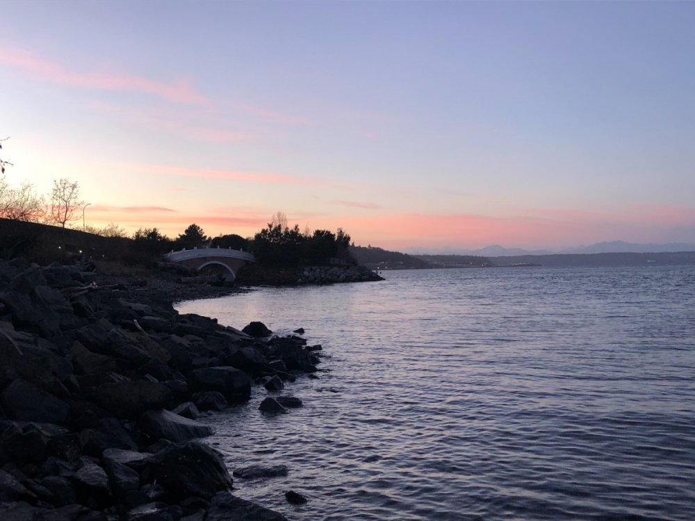
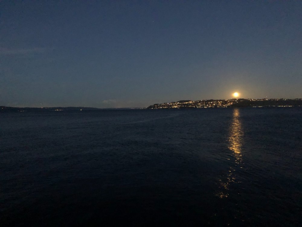
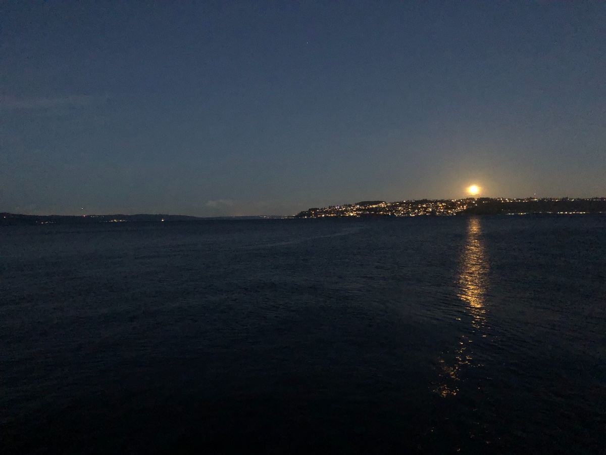
Ended up with another really nice sunset and moonrise this evening.
 6 points
 -
Last frame...it's coming6 points
-
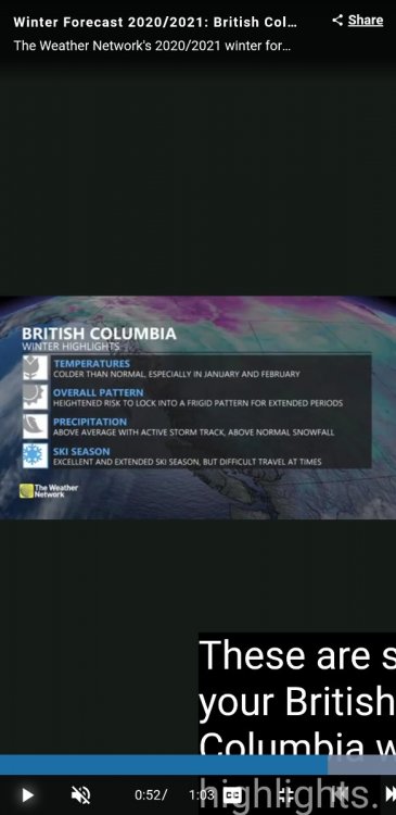
Good find. A snippet, like how they think the colder pattern locks in. BRITISH COLUMBIA A cold and stormy winter is expected to dominate across the province. While the first half of December will be rather mild, we expect a much colder pattern will develop during the second half of December and the cold pattern should continue through most of January and February. This will also bring a heightened risk for extended periods of frigid weather and heavy snow across the province, including in the Lower Mainland and Vancouver Island
 6 points
 -
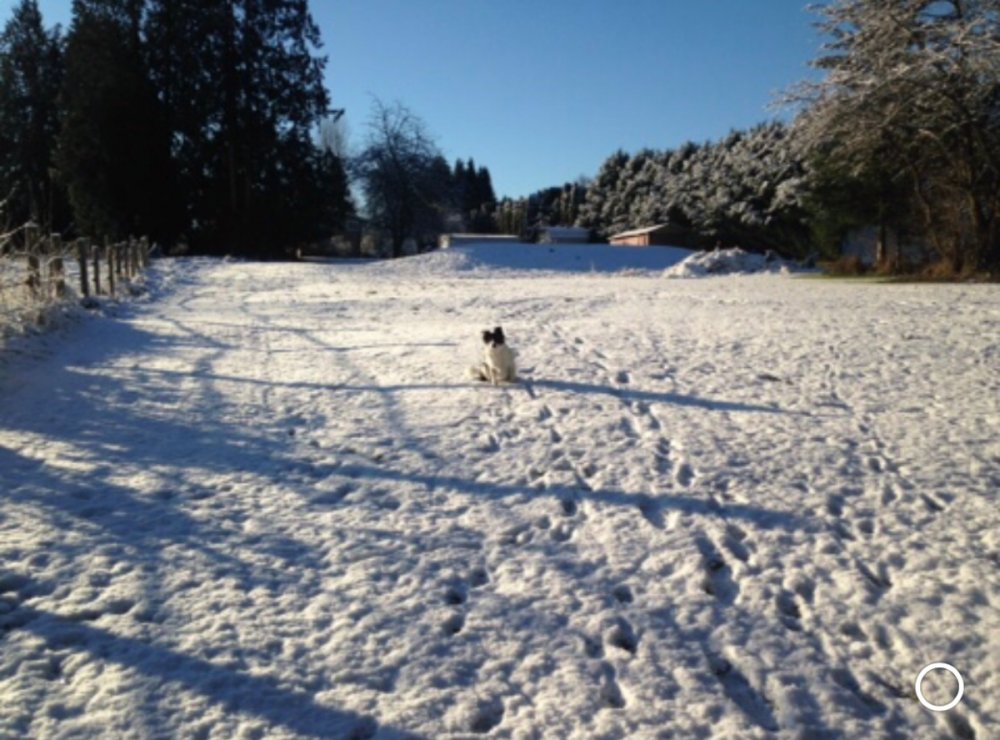
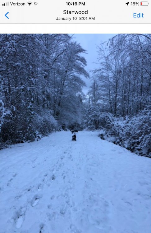
Down! Get down there!! Down boy down!!!!!
 6 points
 -
That’s a holy sh*t pattern, right smack dab in the middle of winter.5 points
-
Pretty classic fast hitting cold front today. We went from clear and calm, to cloudy with rain, to strong winds and partly cloudy, and back to clear and calm in 18 hours. Ended up with .30 here. Looks like a good shot to drop to 32 by midnight. So far 48 / 36 here today.5 points
-
There was a downpour when I woke up this morning, so I was not expecting the evening to turn out this way.
 5 points
 -
Waiting to see an improved pattern emerge 10 days out in the models before the bad pattern has even taken full effect is the worst part of following weather and weather models. These times make me wish I was blissfully unaware like most people.5 points
-
Picked up a quick 0.40" this morning. Pushed us over the 10" mark on the month.5 points
-
Pretty steep pressure rise this morning and as a result the WSW winds are roaring. Power just hanging on for now. Christmas decorations appear to be accounted for.5 points
-
5 points
-
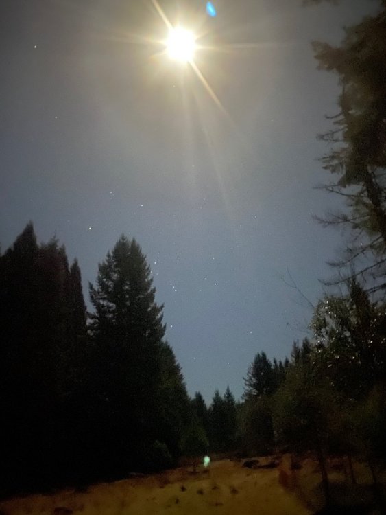
The moon is looking great out there.4 points
-
A lot more Magic -8F Balls in there.4 points
-
Warning shot!!!!4 points
-
Going to put the plow on the mower this weekend!4 points
-
yep. Gotta let the teleconnections take affect. Even if the forecasted -AO etc DO happen, it will take many days for it to take merit. Folks- we've been through this SAME thing the past several years with a late start to winter (or has what is said on this forum)-- Time after time ( year after year) expecting different results with same input (mild air/ no moisture, or if wet= rain ) - takes time to resolve. Keep the Faith- but it's not happening in the next 10-12 days as I've said in previous posts. It's now in my personal thoughts going to be the week of ( or JUST before) Christmas before any serious changes began to show themselves with BOTH cold air and snow for many reading. A False hope brings no merit to the forecaster when people hold accountable the forecaster. It may be JAN. Give merit to the persistance of the pattern, it's the real deal and no progs of maps can solve actually measured data and measured data points to a prolonged boring weather spell for many reading. Just my thoughts based on 25+ years in the forecast field. Prove me wrong. Strong data points show I'am correct. But "Hope" is still their for a White Christmas for most- but each hour that is running out. Hope all you want until the AO goes negative for at least a week. Carry on.4 points
-
Thanks! Just glad to be able to share the maps. I will leave the analysis to those more knowledgeable4 points
-
This is getting attention this morning in the Canadian forums, and since the maps therein show that the BC forecast will generally apply to WA and OR as well, figured it’s worth a share. https://www.theweathernetwork.com/ca/news/article/canada-2021-winter-forecast-snow-and-cold-temperature-predictions4 points
-
You may be the most substantive poster on this forum.4 points
-
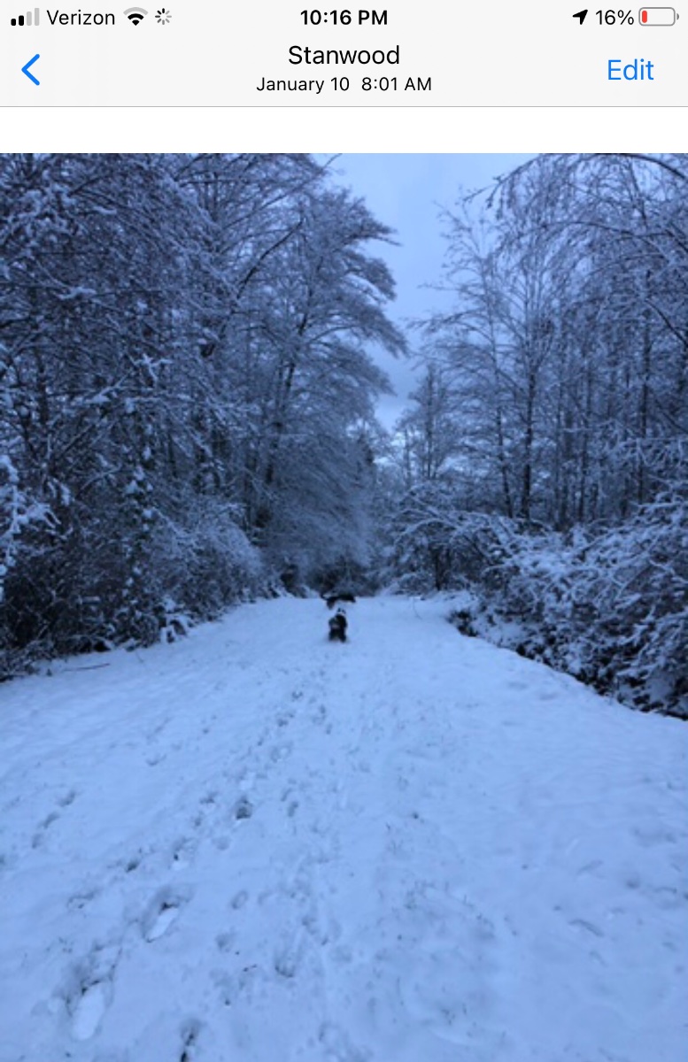
Real busy w zoom meetings today, but real quick: I am getting wind gusts to 36mph, sustained at 26mph. Current radar looks loaded w moisture and its snowing sideways. Real action starts later today into all of tanite and all of Tuesday and finally Tuesday nite. Dam, long duration! Have a feeling accumulations will go up. Currently in the 4-6inch projection line. We will see how all this plays out and will try to post wintry pics when this storm departs.4 points
-
Nice fat westerly surge just took out the power. Looks like gusts are only up near 40 mph here, but that seems like enough. Can’t remember the last time we lost power and we’ve certainly had stronger storms so there must have just been a dead tree or something over the lines.4 points
-
Meanwhile on the other side of the globe..4 points
-
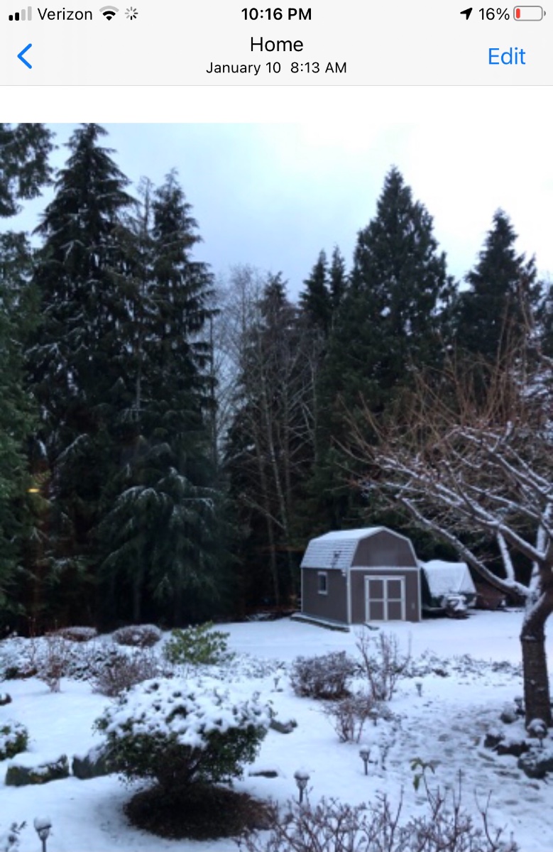
Currently snowing w temps already falling to near 33F. Everything getting snow covered. Honestly, the rain changed over to snow a lot quicker than expected.4 points
-
Shake-up occurs in mid-December.
 3 points
 -
6yrs ago today was the end of the highlight of the 14/15 season!
 3 points
 -
3 points
-
Phil’s on board!3 points
-
While we wait. The 18z GEFS has a lot of chilly members for the Columbia Basin/eastern Washington. Nice improvements. I hope we can build on this.
.thumb.png.c92504eebffcac8cb8adb4a96020fea3.png) 3 points
3 points -
Not the moon Tacoma, that my house lit up with Christmas lights here in federal Way !3 points
-
Looks like lots of inversion fog is coming over the next few days as weather remains boring especially by PNW standards. Same ridge causing California to be bone dry with extended periods of offshore flow and high fire danger. Is the Ridiculously Resilient Ridge returning?3 points
-
Nice the mountains picked up some fresh snow before going into this long dry period. The passes should stay pretty cold during the inversion, but ski areas that aren't on a pass could get pretty warm.3 points
-
https://www.mlive.com/weather/2020/11/snow-forecasts-here-are-some-important-points-to-remember-as-we-enter-winter.html?fbclid=IwAR3nx7HHELHmyAvdke_denD2t8QbONxffpEIlHMz2WQQqaPDMnfQiRvQh0U this is a good reminder for all of us I believe "First off, an exact snow forecast for a storm starting five days from now and ending seven days is not possible. We can tell you that it looks like a storm that would accumulate six inches or more somewhere in the Great Lakes region. It’s our way of saying this will be a sizable storm somewhere in our region. I know you want to know five days out how much snow exactly is on the way. It’s actually a great compliment to my field of meteorology. We have come so far in accuracy that you want more and more accuracy. That’s okay. That more and more accuracy is always improving. But for now- when you see a “scary, end of the world” snow graphic posted on Facebook, ask yourself who posted it. Also ask yourself how long before the storm starts. If it’s more than 48 hours before a storm is going to start, don’t put much belief in the snow forecast. If the snow is just starting to fall on your head, you can probably have pretty good confidence in the forecast."3 points
-
Here is the last half of the EPS. Also, the weeklies come out today, will be watching.
 3 points
 -
Better runs ahead! I hope!3 points
-
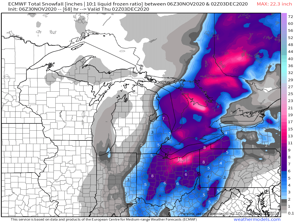
I stayed downtown CLE on business a couple years back (Mar '19). Looks like the lakeshore warmth (hello Chicago) will preclude the city proper from major totals, but yeah, the inland regions look to do well. This is still potentially historic, just disappointingly not for our Sub.3 points
-
Updated snowfall map:3 points
-
WWA posted for my area Radar looks sweet!!!3 points
-
agree with Tom- something that I haven't seen in sometime. What makes this situation unique for OH / PA is not either synoptic or lake effect- it's BOTH. Rarely do I remember something like this so early in the year.3 points
-
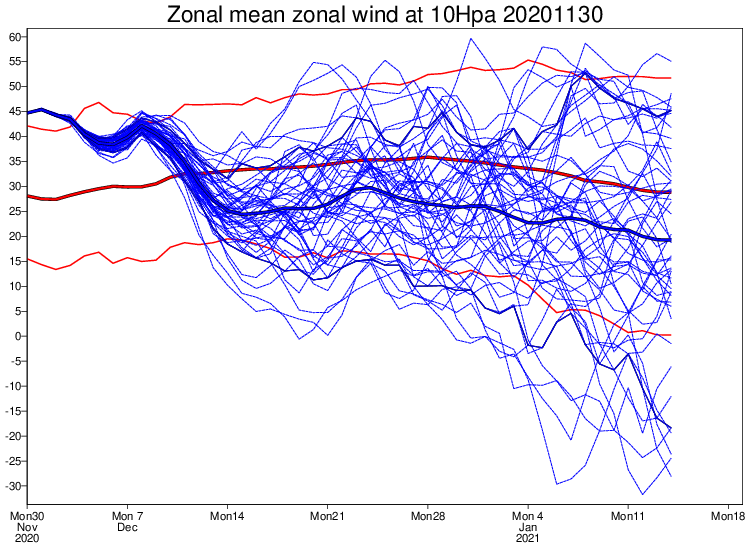
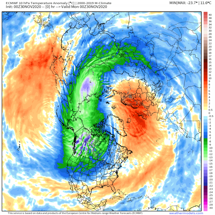
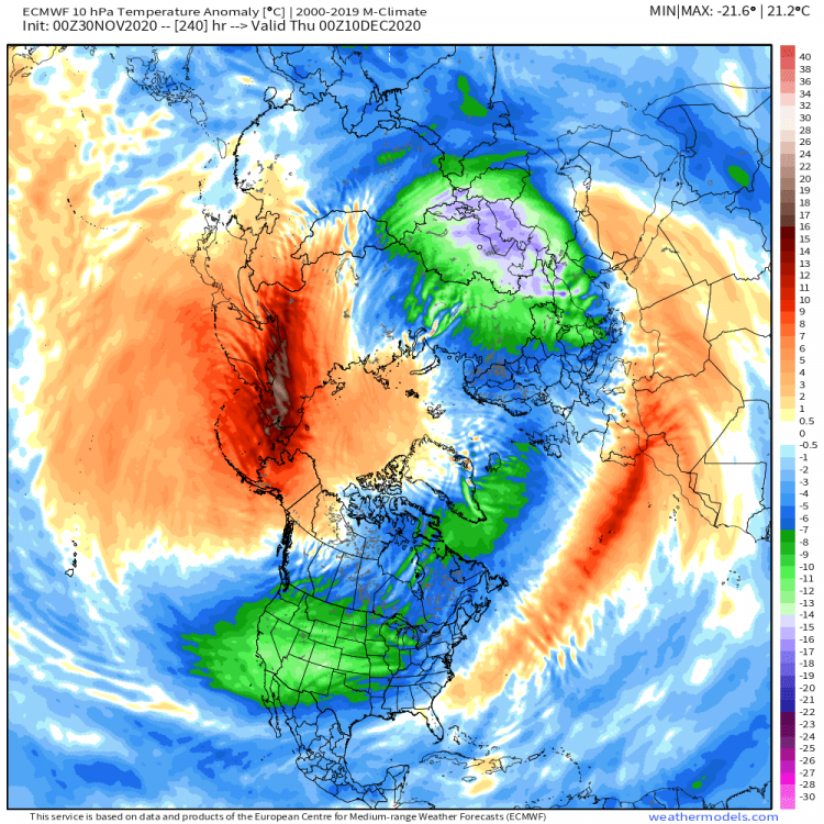
Models continue to support an active period for the 2nd weekend when the North American 500mb pattern amplifies and produces blocks in all the right places to put smiles on faces. Should be an interesting week tracking another winter storm across parts of KS into the MW and then another one on the following weekend when I believe the Winter pattern will get started. The LR clues are growing stronger and bolder that a SSW event is brewing over Siberia/Eurasia during the next 10 days. Nearly a 30-40C reversal at 10mb should get the party started. This is about as an ideal set up as you'd like to see, where you have the PV funnel frigid air into North America...perfect warming location at 10mb...reminiscent to '13-'14...#CrossPolarFlow

 3 points
 -
Going though my January 2020 snow pics I had forgotten that I had documented a good example of how just a tad more elevation makes all the difference when the setup is marginal. This was on the 10th, I had some sloppy accumulations here at my house at 550’ but had quickly melted off the trees. I took the dogs up to our neighbors 40 acres which is nearly 700’ and it was a winter wonderland. All I had to to was take a couple minute walk up the steep pathway to get to it. I love where I live!

 3 points
 -
Those Euro weeklies were something else.2 points
-
Don't know enough about it to be fair. Haven't had time to really look into it. From those I trust - they show no mention of it. Long range forecasting to those not involved (like me to knitting a rug) are already turned negative to "long range" forecasting. As- most times- we don't get it right in 2-4 days. Too them (and defense of LRC for temp) - I do think it's possible to see LRC of temps in GENERAL. But storms? ( in in a cycle? ) Of course they will come with temp grad changes. Never seen a AFD with mention of LRC is all I'am saying. Maybe indirectly. But "indirectly" this DEC for the most- is a bust. To be blunt about it. Sorry. Forecasted the weather far too long. A "change" is always coming...... Can post all the maps you want - but until it happens - it's not happening .... people get caught up in models and all - for good purpose , I s'pose, but why? One looks at anything else in life not based on "failed" models" and would be fired. The public has a right to say in this- and we posting maps "saying 196 hours this or that" is HOGWASH. We need to be humbled by our profession and then-- maybe more people would respect our "professional opinions" That's all for now. ...--2 points
-
Looks like the mountains are doing well again this morning. Probably the last snow up there for a little while.2 points
-
Yep...that is what I am thinking as well. Accumulations could boost higher as the day progresses. Snow is ripping outside (huge flakes) and the wind is howling as well.2 points
-
06z Euro...potential is there for a historic snowfall in OH and targeting CLE....
 2 points
 -
Bright out there. Down to 32.
 2 points


.png.e4cff29a1034a86a66bd130553210c9a.png)


This leaderboard is set to Vancouver/GMT-07:00