
Leaderboard


Popular Content
Showing content with the highest reputation on 05/15/21 in all areas
-
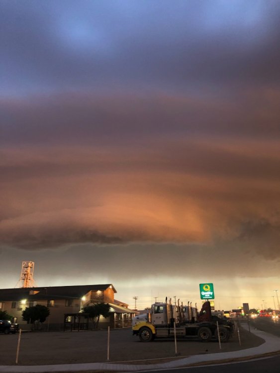
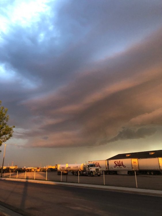
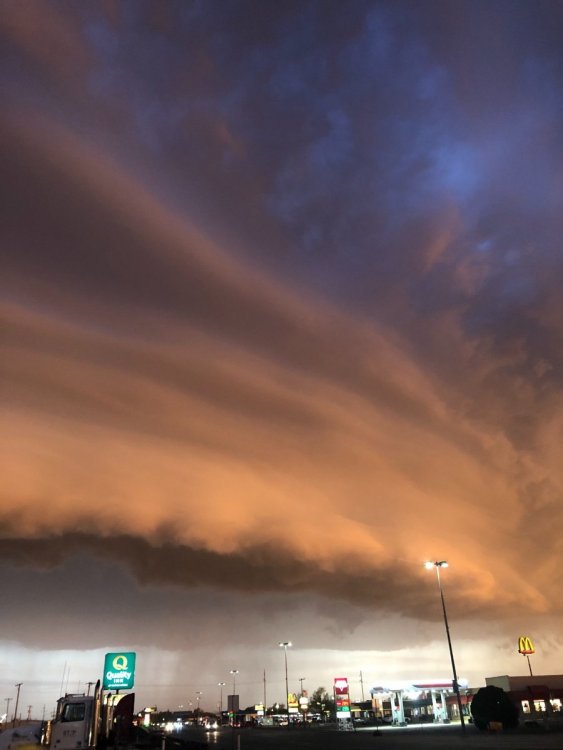
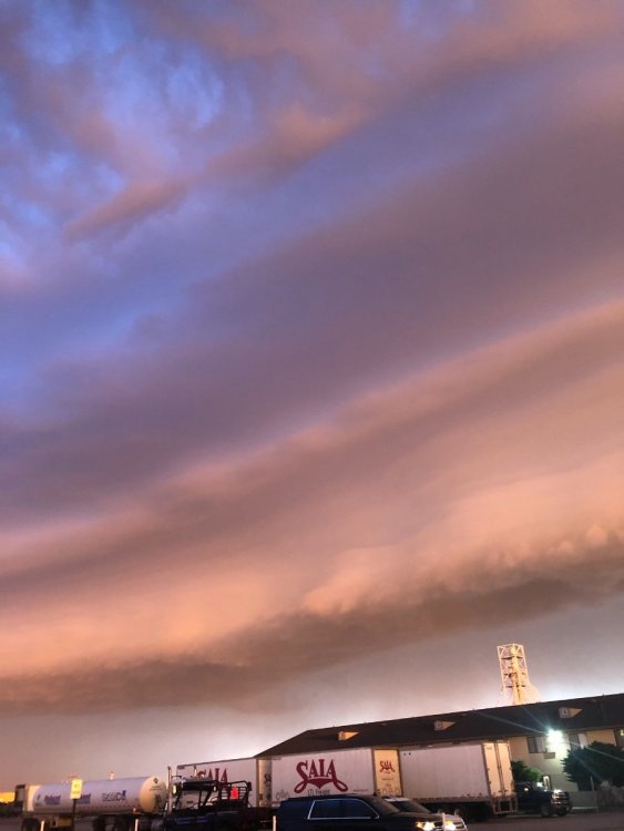
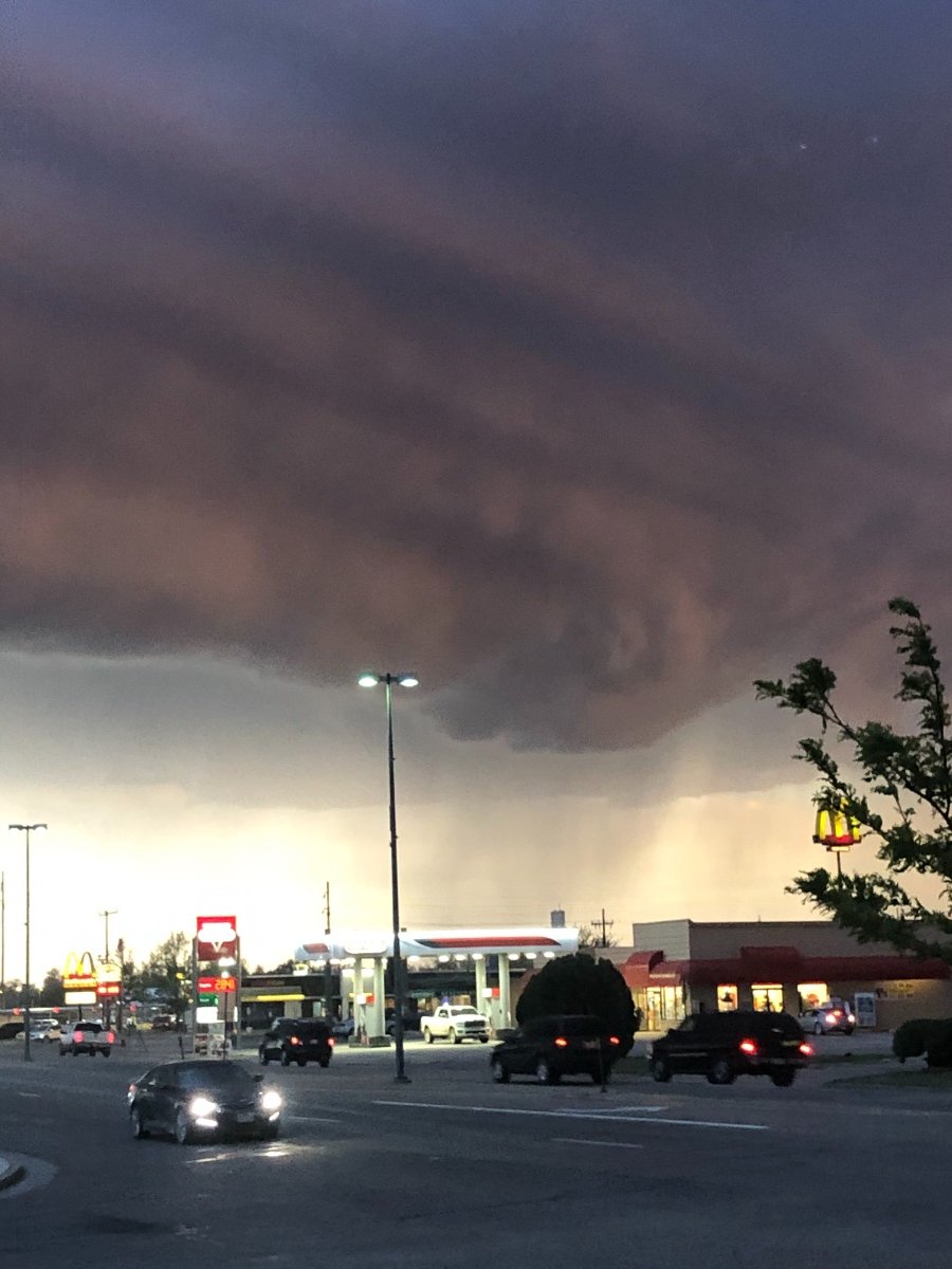
I’m in Lamar Colorado for my nephews graduation. Got to witness a gorgeous supercell thunderstorm last night! First supercell of this year, and it came right to me here in Lamar! Was tornado warned for a while.

 6 points
 -
.52” overnight. Surprised by that.5 points
-
Video. IMG_1192.MOV4 points
-
Took a drive to Bellevue and back today for work and I saw many many boats being towed...Boat launches must be quite busy on this fine Saturday! Absolute perfection!3 points
-
First cicada just emerged. Here we go.3 points
-
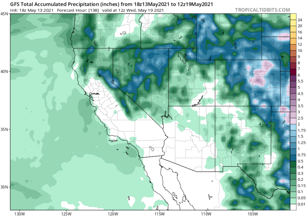
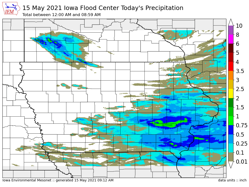
I sure wasn’t expecting as much rain 🌧 as I got which was 0.99”. This map seems to be fairly accurate for here this time.
 3 points
 -
A nice little soaker moved across east-central/southeast Iowa overnight. I picked up 0.39". Totals climbed to near 1" down by Sparky.3 points
-
Invasion of the body snatchers!2 points
-
Woah, that looks wild! Glad you were able to witness such a powerful storm. It's awesome when nature shows off her power to those wx enthusiasts like us!2 points
-
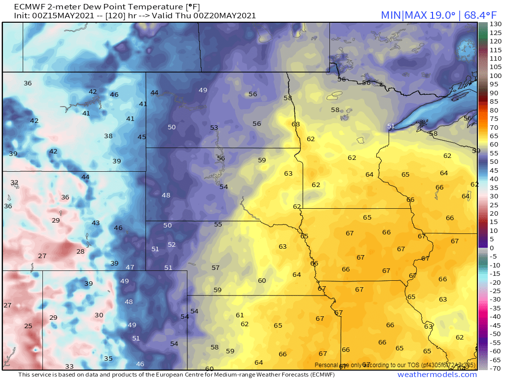
I'm hopeful we'll get some showers later today. Radar looks decent out west in W IL...meantime, with regards to precip this Spring, ORD is only at 2.31" which would hold the all time driest Spring on record since 1888 I believe it was. Based on forecast models this week, we will prob add to this total and shy away from breaking this record. N IL has been unlucky while C & S IL has reaped the rewards from nature...cooler and wetter. On the bright side, both literally and figuratively speaking, Chicago has seen a lot more sunnier and brighter days this Spring. The wait is almost over for many on here that "Real Spring" is finally going to show up for an extended period. @FAR_Weather will jump right into Summer with early season Heat as temps possibly surge into the low 90's for ND late next week while the majority of us enjoy 80's and DP's in the 60's. Gotta say, I'm going to enjoy having the windows open in the mornings instead of having the furnace on! The 00z Euro below indicating by Wed we start feeling like Spring with DP's surging.
 2 points
 -
Just looked at the 10 day outlook: Basically low to mid 70's for highs and low to mid 50's for lows with daily chances of showers & thunderstorms. We usually fluctuate much more than that in mid May. Things are lush and green around here now, and will only get greener if this forecast holds up.2 points
-
Had a very nice 0.50" rain last night between 9-11 PM. No severe weather at all for my area. My relatives that are farmers were hoping for a nice rain as corn is just starting to poke through the surface. Many chances for rain and storms in the next week.2 points
-
Fill your windshield fluid up.....stat!!!1 point
-
We are going to be one of those people tomorrow! Just checked... water temp at Lake Sammamish buoy is up to 67 today. Pretty sure it will reach 69 or 70 tomorrow. My daughter and her friends are going to have a blast tubing. They won't even mind getting sprayed with a water temp around 70 and an air temp near 80.1 point
-
Seems like troughing is continually being watered down or replaced with ridging this whole spring.1 point
-
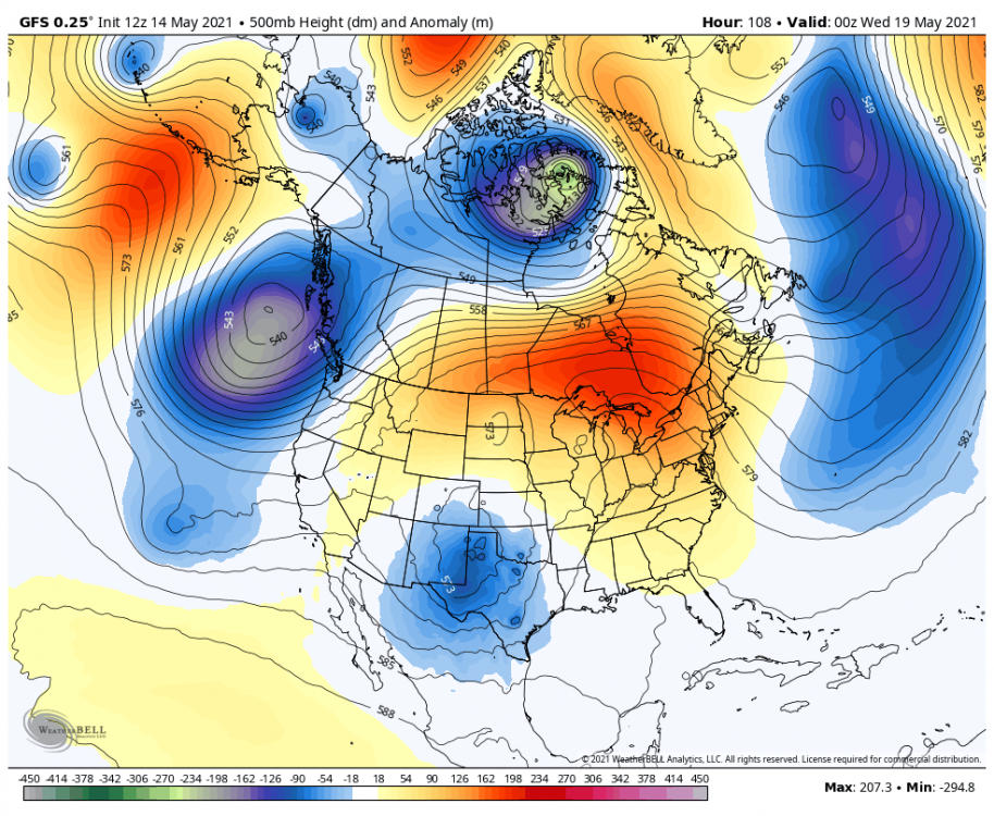
The 500mb pattern this week was "mundane" and it was absolutely gorgeous.1 point
-
Some thunderstorms are passing just south of James, in between Mason City and Waterloo.1 point
-
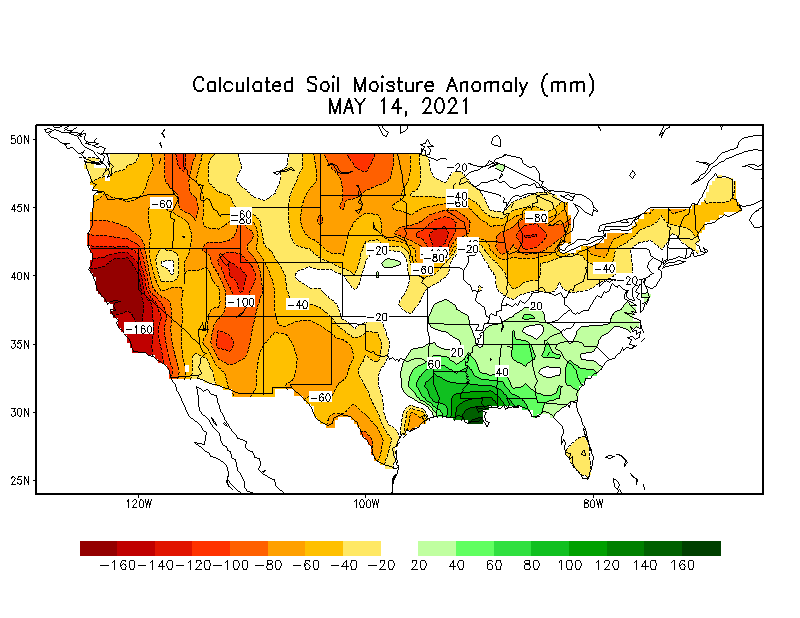
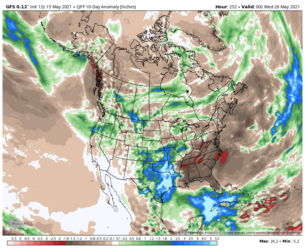
Though I’m not sure how accurate this is. Soil conditions here are easily the driest in a decade for this time of year, yet it displays normal. Though it might be a resolution issue since other nearby areas have seen more rainfall. This resolution is analogous to a GFS map from 15 years ago.
 1 point
 -
Yeah, so south-central TX in particular. But a large swath of the southern plains still has lower than average soil moisture content and is running rainfall deficits.1 point
-
No moist systems until Halloween at this rate.1 point
-
12z Was okay, but that Tuesday night system is basically gone.1 point
-
I think so. But from what I recall it was somewhat localized.1 point
-
12z GFS is actually a substantial improvement for Oregon. Jesse/PDX somehow ends up in a dry bubble.
 1 point
 -
All models were cutting that trough off too much..again. End result is a drier (and flatter) pattern overall. Seems cool anomalies will be easier to achieve out there than rainfall. Not sure how common that is out there but my recollection is the opposite is usually true?1 point
-
The sun is now out and the temperature is now up to 72 here. I just planted my tomato plants for this year and now will plant some of the flower plants that I have before I get any more. The good news is I do NOT have to cut the grass yet and in fact I think I will get the sprinkles out and start the watering season. There are now indications that it could become very warm later next week.1 point
-
And interestingly the 12Z GFS is kind of doing the same thing. Top image is 12Z GFS yesterday for Tuesday afternoon... and bottom image is the new 12Z GFS. Pretty big change for being within 5 days.
.thumb.png.de21a22ed2eb9d3d1cb0d7e3c755c319.png) 1 point
1 point -
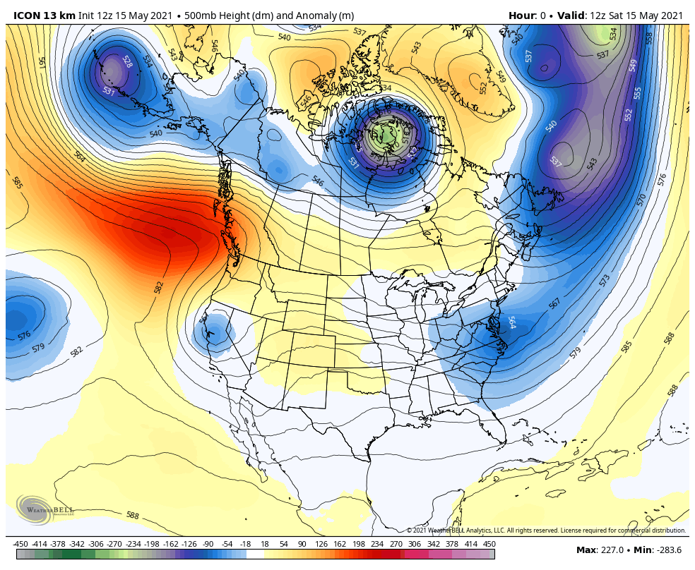
FWIW... the ICON has been trending much farther north with the trough and the 12Z run is even farther north and faster. Its so different than other models but the fact that its still trending that way and we are only 2 or 3 days out now makes me think it might be onto something. It does not show the main trough digging into CA but rather moving right through BC and WA and heading east. Its an interesting scenario... because it means more rain for WA and a much quicker return to ridging as well.
 1 point
 -
Nice looking drought update as we head into the driest time of the year. West of the mountains, moderate drought now extends up to Olympia, severe drought drought up through Clark County, and extreme drought up to Springfield (Tiger!).With California looking pretty well f'd in the a.1 point
-
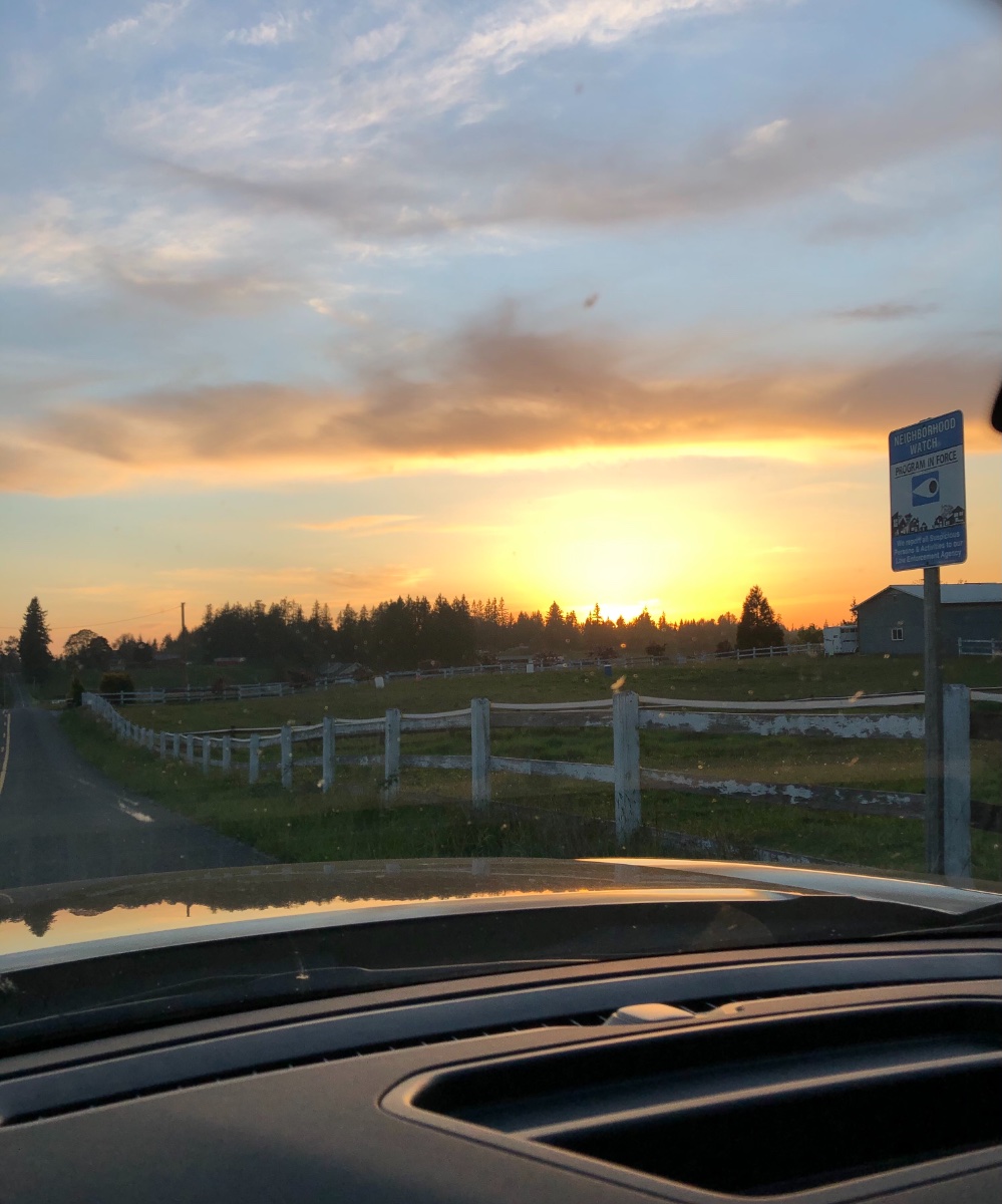
Looks like you are driving into work actually.1 point
-
Lovely sunset as I was running into work.
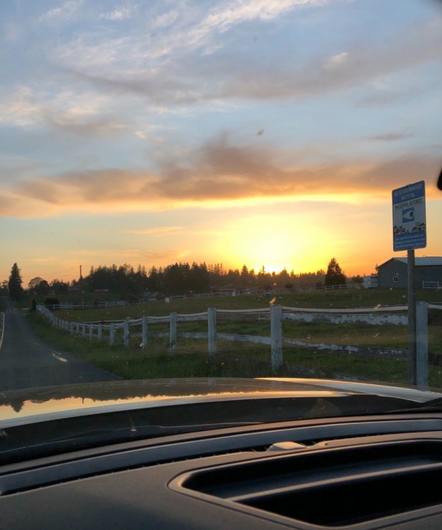 1 point
 -
Really wouldn't pay too close attention to PWAT values and depicted precip this far out... Those are often small-scale details hard to pin down this early. At least at this point we have cooler onshore flow compared to 75F death ridges.1 point
-
View from my cell, I mean lunch room.
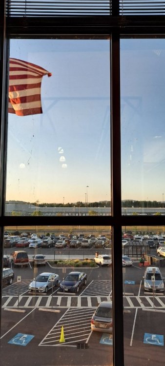 1 point
 -
Today =‘d perfection!!!1 point
-
CPC now has higher chances of a niña next winter than neutral.
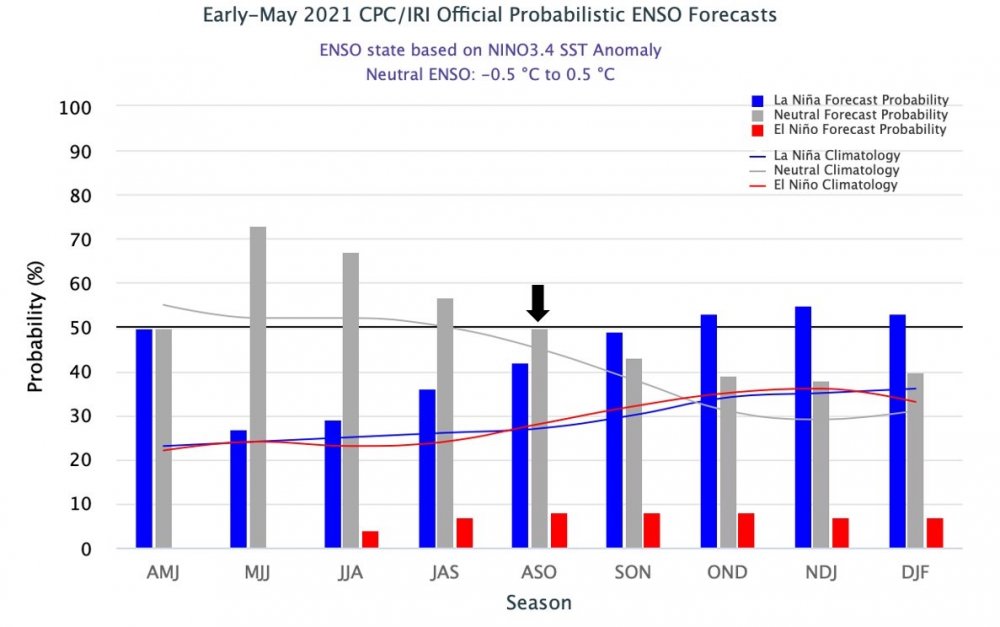 1 point
 -
I know how Mr Sun feels!1 point
-
GFS has been showing a tropical system in the Gulf off and on the last few days. The south is getting drenched1 point
-
We had our first day of diurnally-driven storms yesterday. Another day of that today with potential hail.1 point
-
I now have two outdoor temperature sensors, one is in a spot that is some times colder than the other. The overnight low at the colder one was 34 (33.7) and at the warmer one it was 37 (36.8) it looks like the official low at Grand Rapids overnight was 37. At this time it is 40 (on both) here with clear skies. It should be noted that once there is some good air movement they both are generally the same reading.1 point
-
It's definitely helped some. Though we're now past the point of building anything up there. Lots more spring precip on the way around here.
 1 point
 -
I had a dragonfly slam into my sliding glass door today. It was able to fly away.0 points
-
Not good.0 points
-
75/45 with zero critter sounds....unless my frog at the pond is awake0 points
-
You can really hear them crawling out of the ground and molting by the hundreds. IMG_0426.MOV0 points
-
I remember Texas for the intense heat with humidity in the late summer. Was at a Rangers game in DFW in late August with the temp at 105F and it felt like a 120F sauna.0 points
-
I’ve been down to texas a few times I’ve seen thunderstorms heavy rain events and snow down there even. They had a bit of snow when I was there on New Years and a few weeks after I left there was a few decent snow events. It’s an interesting place...been there during some strong north wind events too.0 points
-
Much of the precip on the 12Z ECMWF is with wrap around moisture next weekend... but that is a very tenous set up and will likely change numerous times. That pattern can be a prolific rainfall producer at this time of year though... particularly from the Cascade crest eastward. Sorry Randy!0 points
-
Well this house was nice while it lasted. Gonna be real interesting to see all the big cats roaming through town as Jasper and Pisgah have ignition and make their way into the city.0 points
-
Looks like we have 4 days of spring remaining. Then it’s onto summer for the next 4 months. Wake me up when September ends.0 points


.png.a569ac027f6dac71eed00da71df85dec.png)


This leaderboard is set to Vancouver/GMT-07:00