
Leaderboard
.thumb.jpeg.e3014abf99ef08a9f9ac2c0cd31b485b.jpeg)


Popular Content
Showing content with the highest reputation on 01/12/22 in all areas
-
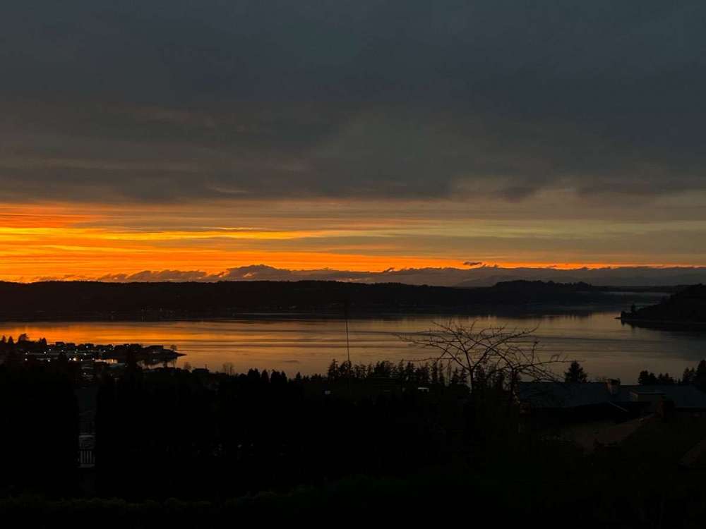
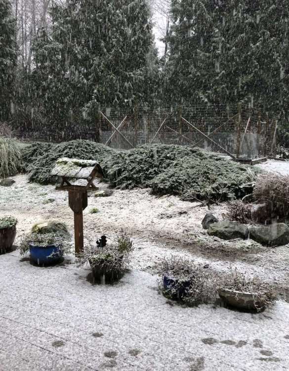
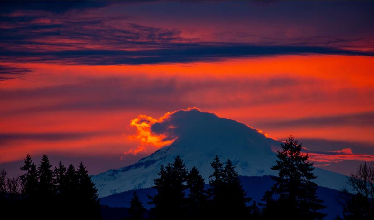
Ran out the door to get sunset pictures, forgot my phone and everything.
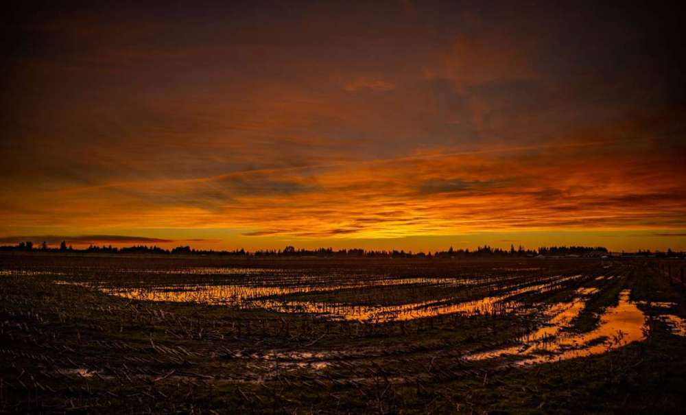
 19 points
 -
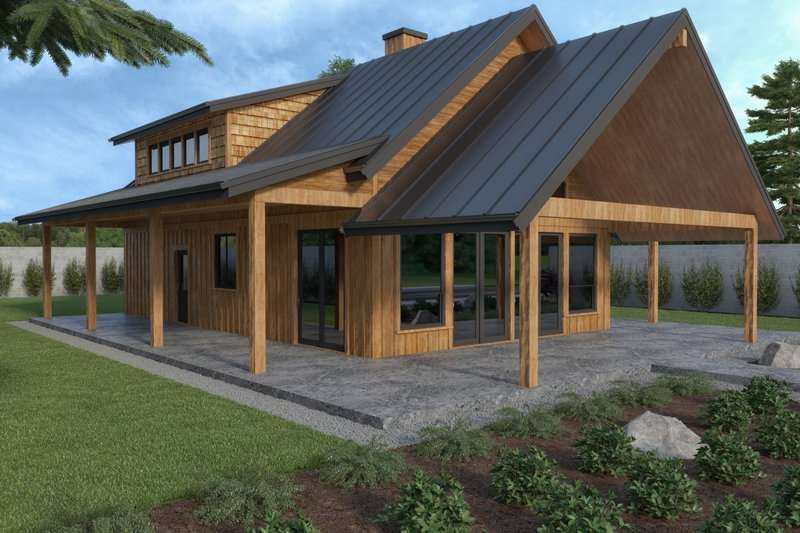
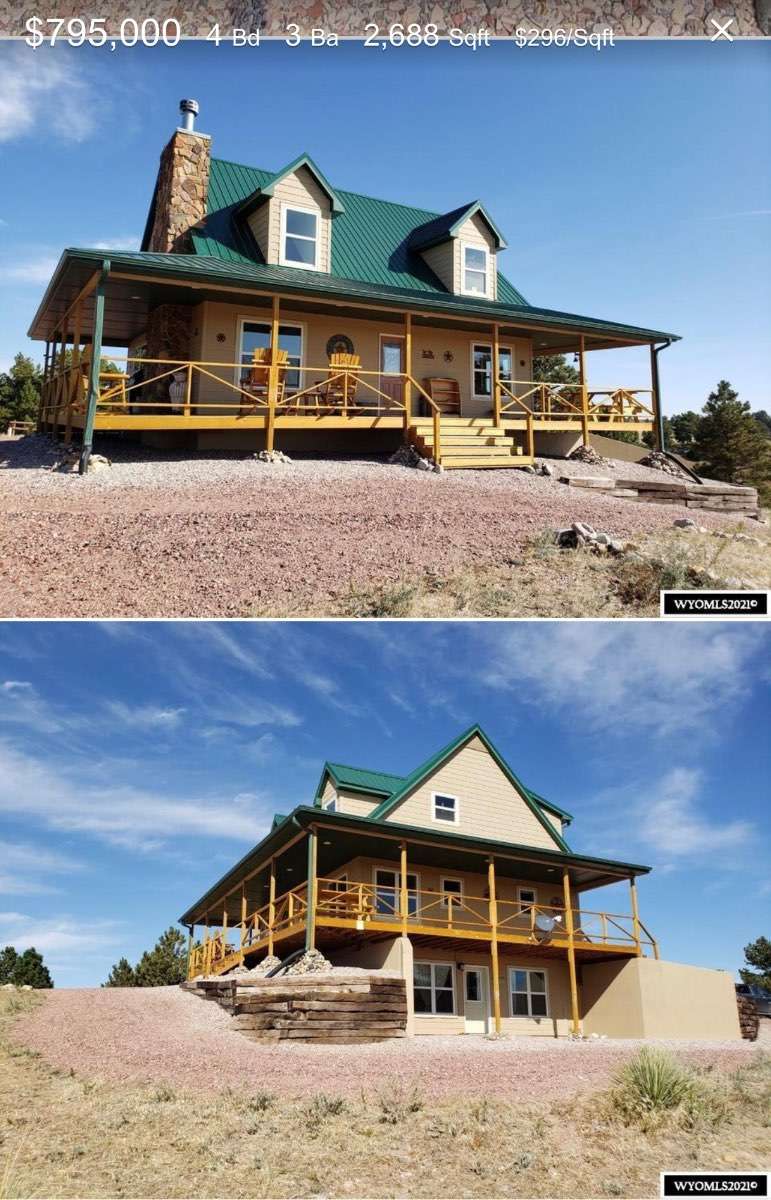
Finally got house plans engineered and approved. Picked a bad time to build but whatever I guess. Can only afford to do foundation done this year then framing following year. Here it is. It was a plan I found and we just made some changes. I really like the concrete pad around the house. Added pic of where it will be built.
.jpg.8c7da7ffb96894a2d43639c26421186c.jpg)
 17 points
 -
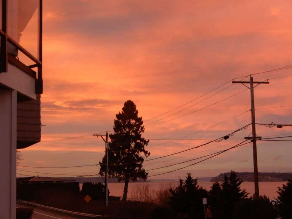
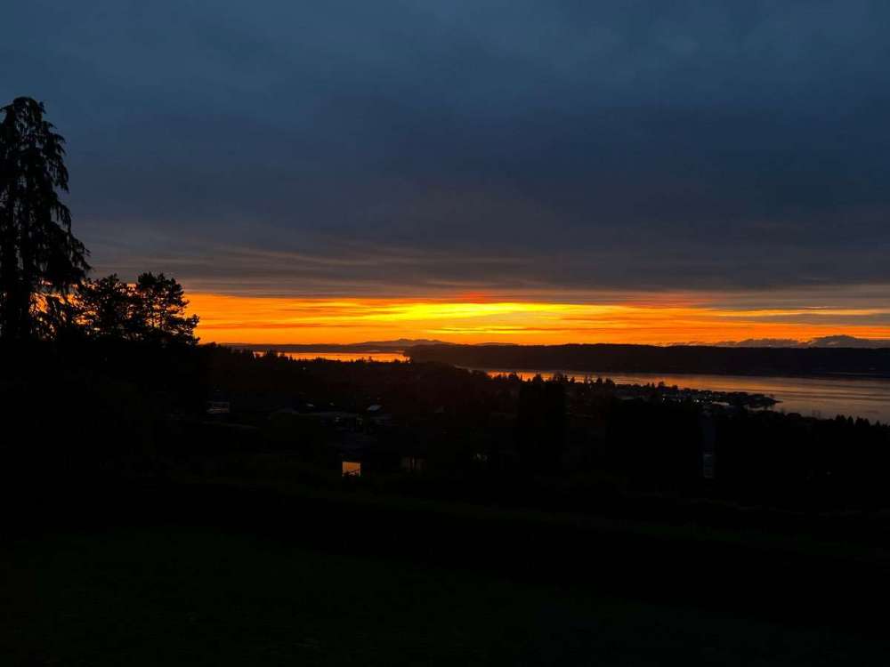
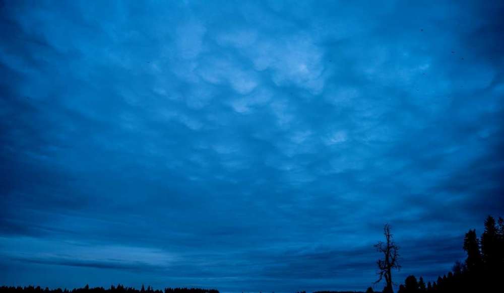
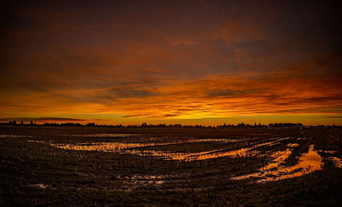
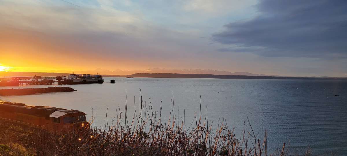
Sunset was beautiful tonight. I wasn't able to look out at the water this time, but I got some different views. The sky was pink and purple and just as the sun came down, it became orange. Here are some photos.
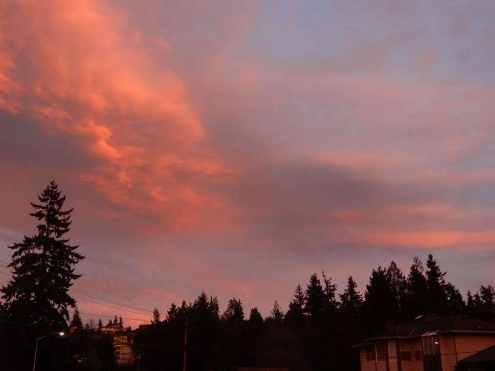
 13 points
 -
More data dumping! February's at KSEA since 2011; departures relative to 1991-2020 avg. Purple colored years indicating snow: 2011: -4.7°F/-0.71". Great cold snap at the end of the month. Subfreezing high of 31°F on the 25th and 2" of snow on the 23rd. A 19°F low on the 26th too. 2012: -0.8°F/-0.07". Various spits of nighttime snow at the end of the month. 2013: +0.4°F/-2.18". Mildish and dry. No lows below freezing. No real warm spells, either. Kind of a dud. 2014: -2.3°F/+2.35". Nice cold snap at the beginning of the month. A high of 31°F on the 5th followed by a high of 29°F on the 6th. The 6th also had a low of 21°F (monthly min); part of a three day streak with lows <=23°F, and a seven day streak of lows <=32°F. 2.9" of snow on the 8th. 2015: +4.8°F/+2.51". A complete torch. A high of 49°F on the 1st was as cool as it got; a single lone outlier in the 40s standing in a crowd of 50s and 60s. It does not belong. No subfreezing lows, though it got very close on the 23rd with a low of 33°F. A month to forget. 2016: +3.4°F/+3.21". Like a less extreme version of 2015. Up to an amazing THREE highs below 50°F! Next... 2017: -2.7°F/+5.09". A consistently chilly and very wet month. Six freezes in total as well as a pair of sub-40°F highs. Most notably however is the 7.1" snowstorm on the night of the 5th into the morning of the 6th. (My house got 1.5"...) Throw in another 0.1" of snow on the 27th and you have yourself an admirable February. 2018: -2.9°F/-1.60". An otherwise dry, variable month defined by a mid month cold snap. Several days in the mid 30s and lows in the mid-upper 20s. 1" of snow on the 21st (a high of 34°F too!), alongside multiple days with a trace. Pretty alright! 2019: -7.3°F/+0.86". A god amongst men. 20.2" of snow. 16 days with subfreezing lows. All but two days below average. The pinnacle of 21st century Februaries, and the most anomalously cold month this side of the year 2000. As good as it gets. 2020: -0.4°F/+0.28". A pair of days with a trace on the 3rd and 4th. Otherwise a very uneventful February, on the chilly and damp side. Closer to what I would consider as an "average" month than anything else. Not a bad February by any means. 2021: -2.6°F/+0.92". A mostly cool and damp month, interrupted by a very fun mid-month Arctic event. Associated with it came western Washington's biggest and most widespread snowstorm in just over 9 years when 6.8" of snow fell on 1/18/12. 11.1" of snow fell in a 18 hour time period at SeaTac on the 12th and 13th. After a subfreezing high of 31°F on the 13th, and an additional 1.3" of heavy, wet snow on the morning of the 14th, it was over. Aside from a few exceptions, the last decade of February's have been very good to us. Let's add another good one to this list!13 points
-
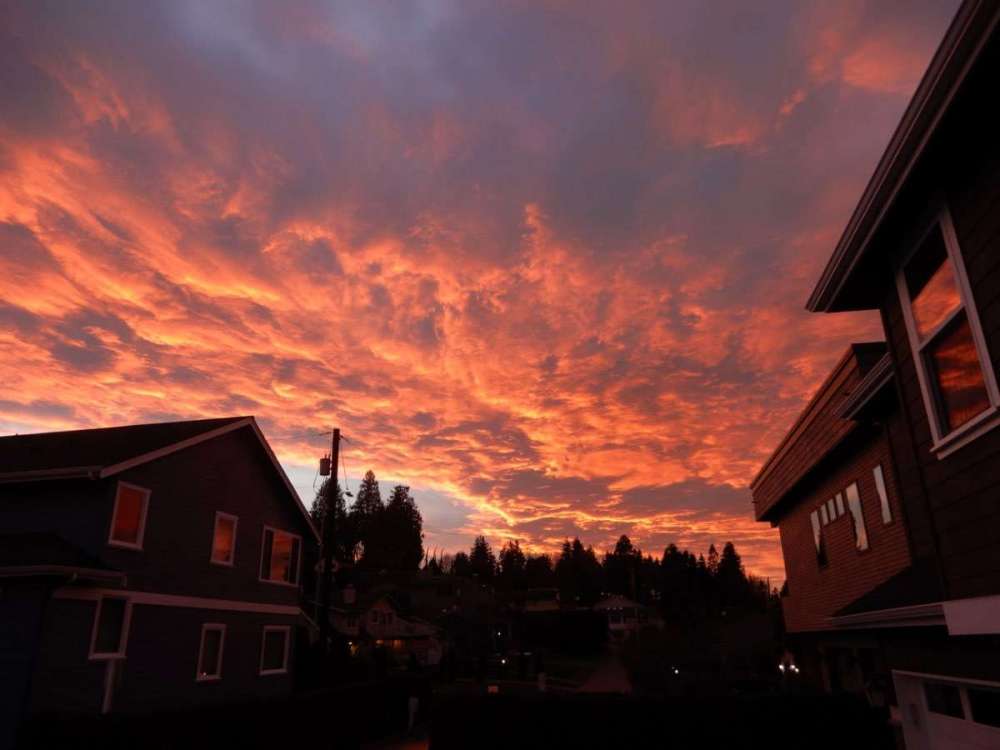
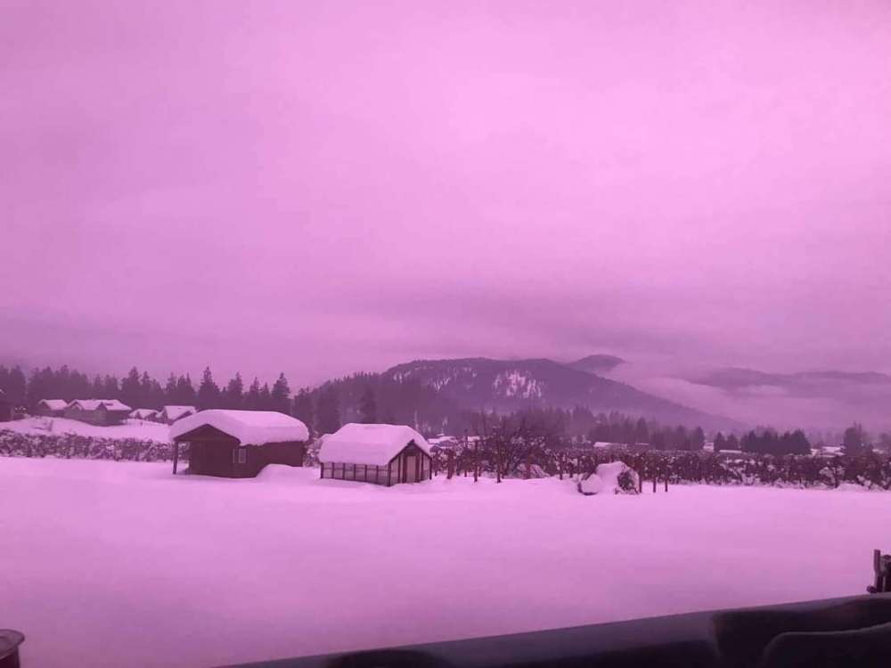
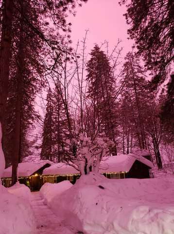
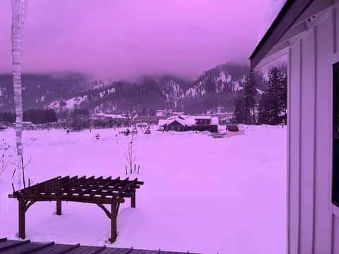
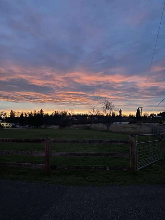
I definitely saw it! It was cloudy, but the color was amazing. I have not seen that color before. Lots of pictures on the local Facebook page. Here are a few, one from Wenatchee. Wenatchee:
 12 points
 -
She would have been D**n proud of you for pressing on and fulfilling your dream. You are honoring her memory by doing that.11 points
-
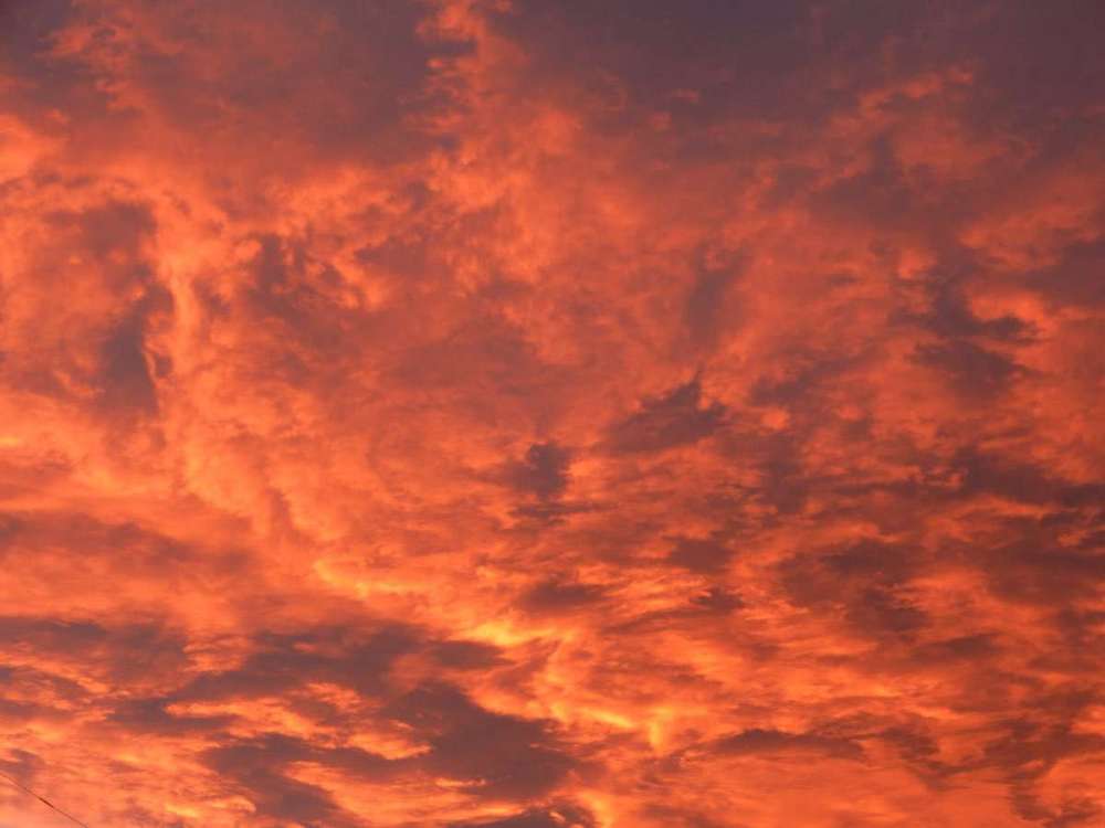
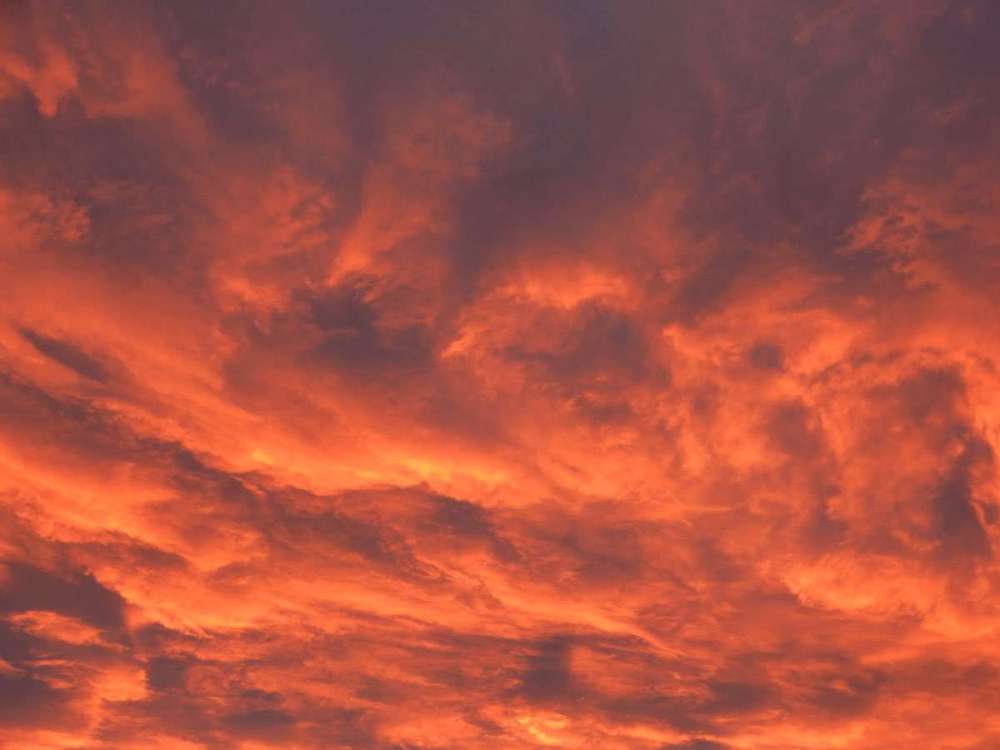
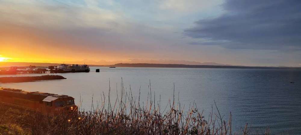
Some great sunset shots tonight. Here is my contribution.
 8 points
 -
Yeah that sunset was unreal!7 points
-
First 60 of the year...earliest on record beating out January 13th in 2018.
 7 points
 -
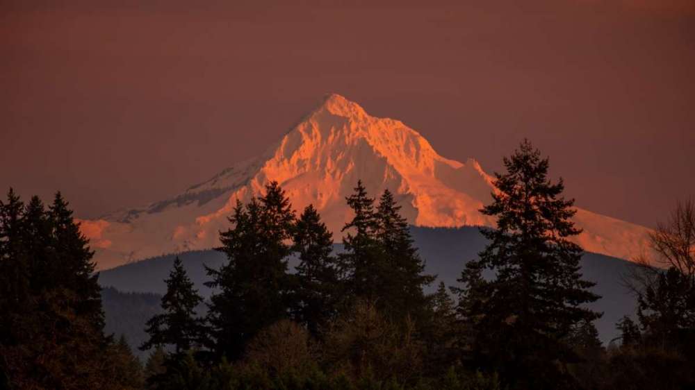
I was hoping for an epic, whole sky on fire this morning with the cool asperatus clouds. Instead, just a very small area right around Mount Hood lit up with a wave like cloud cresting over the top from SW to NE.
 7 points
 -
I started heading home about 5 minutes too late to catch the best of it.
 6 points
 -
Unfortunately, I didnt have my camera for this, but wow!
 6 points
 -
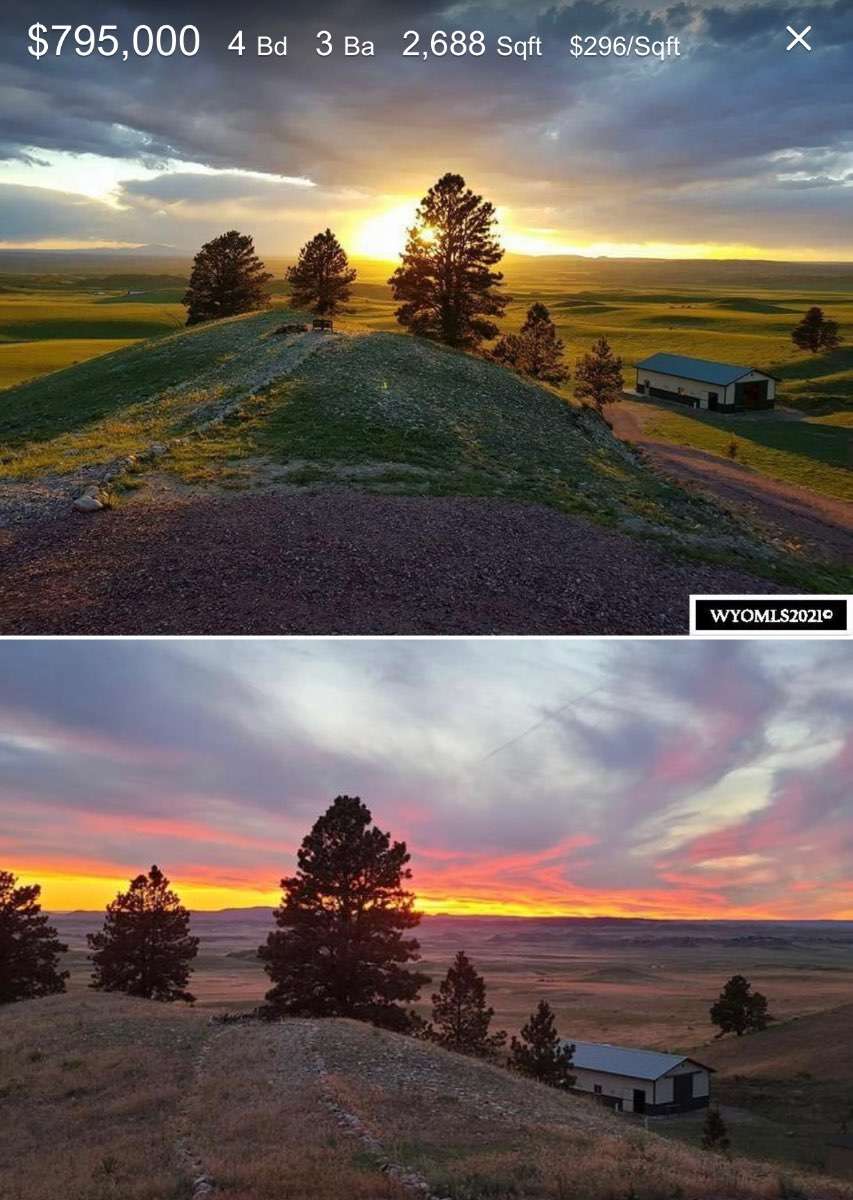
I could see myself (not sure that my wife would like it though) living here in Fort Laramie? 42 acres. Yum! And several hundred thousand less than what our current place is valued at.
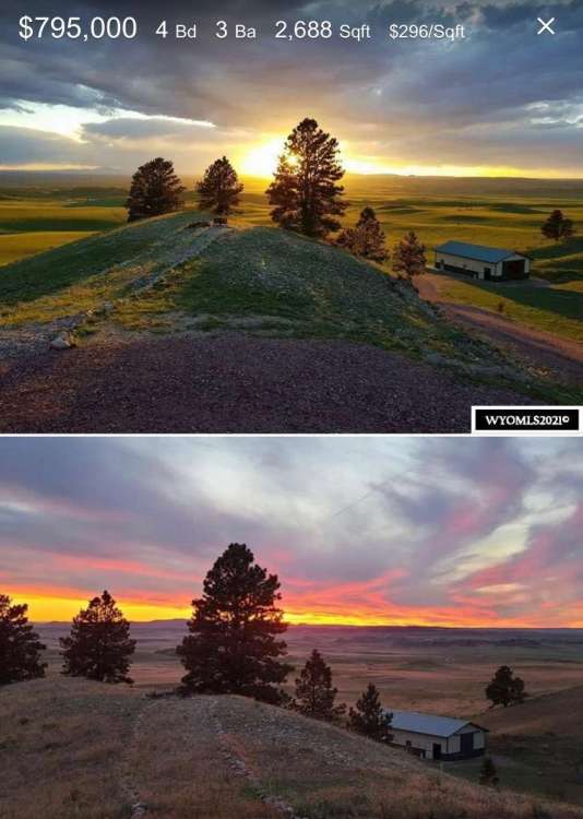
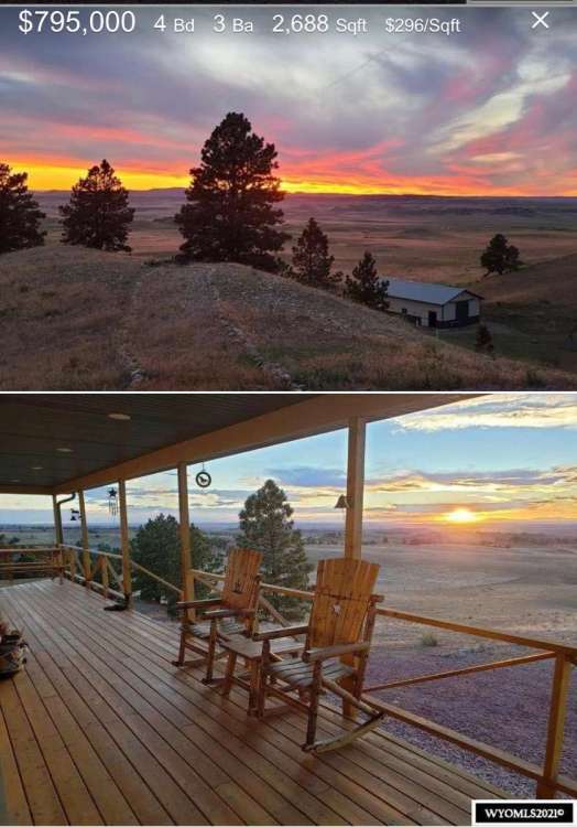
 6 points
 -
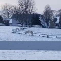
He and his family are currently looking for property in a snowier climate.6 points
-
Really some great people on here.6 points
-
Thanks man, been a dream for 30 years, God I wish my wife could of been here for it. When I found out she had cancer I built our little cabin as fast as I could so she could at least enjoy that. I better stop talking about it, just kills me.6 points
-
Long range GFS and Euro Control show very below avg -to even brutal air mass- even for late JAN. Right now DSM is 23rd for coldest JAN recorded and very likely to see coldest Jan since 1994. ( areas in the E.Dakotas to I-Falls are top 5 to top 10.)The 06Z GFS goes ballistic cold and is usually biased cold-- but even if it will likely be coldest Jan since 1994 and perhaps 1982-- that with a potential top 10-15 snow month is an amazing turn around from the torch of DEC. It will likely overcome the +7 - to +9 for many reading of DEC and make the 2 month winter so far below normal. And then comes FEB which in the last 15 years has been the coldest month of the 12 compared to avg by a long shot. It does seem that DEC's lately are laying an egg only to have a big time come back mid-late winter compared to avg- esp in snowfall for DSM. DSM snowfall has increased 4 inches annually in the last 20 years. (since the 1971-2000 30 year means) and it's still going up this decade mainly due to last years 57+ inches.6 points
-
The consistency continues across the board. Nice to see, for a change. Cobb outputs for DSM consistent around 12 to 13:1, which I will buy especially past sunset into overnight hours. In fact may be underdone for the tail end of the storm. Crossing fingers for double digit total which is hard to get here in central Iowa. And it'll make the guy on local CBS regret his 3 to 6" total he had at 6pm! (New guy initiation)5 points
-
Tyler is the king of pics on here. Always has been.5 points
-
From a statistical view, the ICON (turquoise line, a.k.a. DWD) is more or less on par with the UKMET over the last few years, and not in a good way - indeed, for the month of November, the order of models from most- to least-accurate at the 120-hour timeframe was: ECMWF GFS CMC ICON UKMET JMA On a side note, the GFS was more accurate than the ECMWF beyond hour 144.
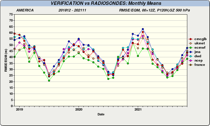
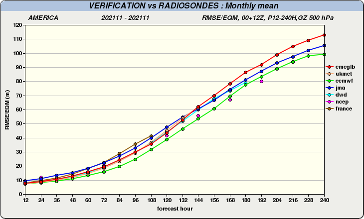 5 points
 -
5 points
-
2yrs ago today.
 5 points
 -
February!!!!5 points
-
We know where the next forum meet up will be now5 points
-
We have the Omaha and KC members riding the western edge, hoping for a nudge west. We have Cedar Rapids and Iowa City members riding the east edge, hoping we end up on the inside of the sharp edge. The central Iowa members get to relax.5 points
-
4 points
-
DMX updated at 8:29. They upped totals to 5-10" with locally higher! It was 4-7" with the afternoon update.4 points
-
Great shot from a webcam in the Olympics right now.
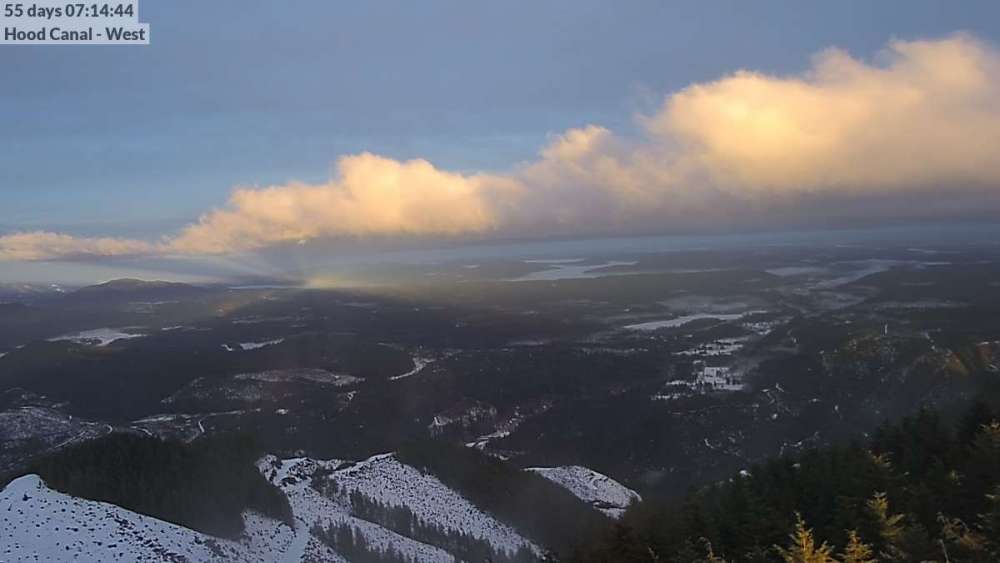 4 points
 -
The 18z depicts a storm from day 3 to day 5 that drops a bunch of snow from the Dakotas all the way down into the deep south (parts of Arkansas and Tennessee see over a foot), then moves up the Appalachians dumping a bunch more snow in the NE, but screwing Phil.4 points
-
I know it doesn't seem like much to many of you in Iowa but it's been a long time since I've had a 5 sitting on my county this close to the event.4 points
-
You should be banned to the shadow realm with Jesse for talk like that.4 points
-
looks like the CFS is continuing to honk on an Arctic plunge the first week of February4 points
-
Cheyenne is basically Denver's climate. They're only 100 miles apart. Lots of quick hitting arctic fronts and their blizzards peak in the spring months there. They'll generally see colder airmasses than Spokane, but see less in the way of sustained <32 weather during the heart of winter.4 points
-
Wind is ALWAYS blowing.4 points
-
4 points
-
At least we had a good December leading up to this. Otherwise we'd be in a real funk.4 points
-
Wow Brian thank you so much. That really makes me feel good man.4 points
-
Yes that's my property where house will be. We got so lucky finding it, 160 acres bordering national forest on 3 sides for 150k was a steal. Property value has trippled there in 4 years.4 points
-
If it weren’t a La Niña year we’d be pretty screwed... Thankfully December was kind to the west. Currently, the entirety of Oregon+Washington’s snowpack regions are above the 1991-2020 normal. Similar to the 1971-2000 normal. La Niña pattern configurations overwhelmingly get locked in in February-May during -ENSO wet seasons, sometimes well beyond that. If it were +ENSO, alongside a bad snowpack situation, well... Let’s just leave that thinking for Jan 2023 Aidan.
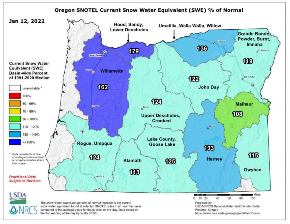 4 points
 -
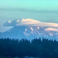
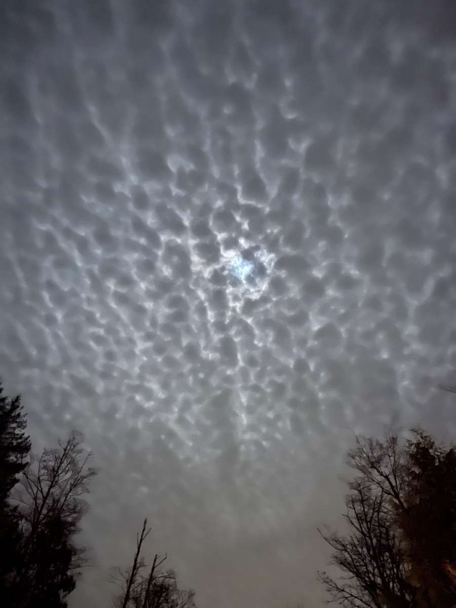
Kind of an awesome moon light as well this evening!
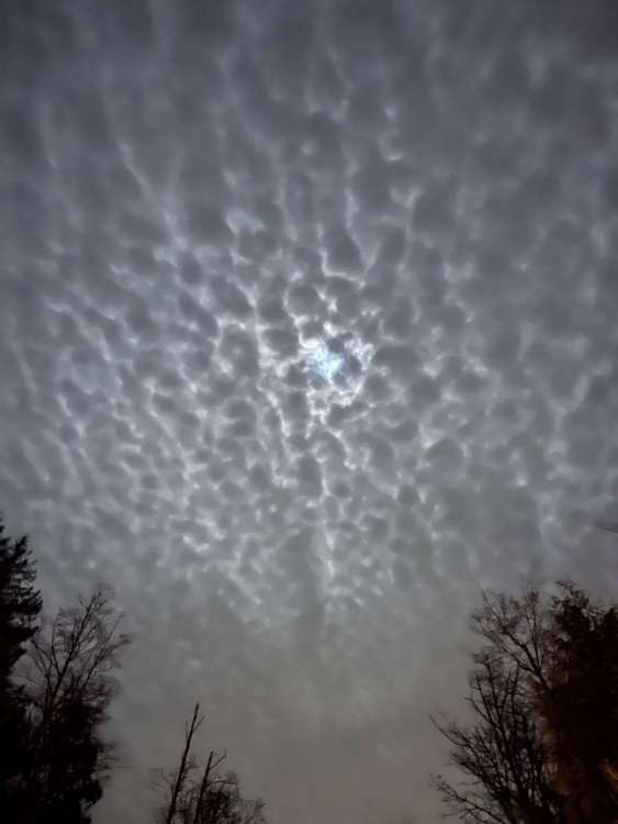 3 points
 -
Incredible shots. Is that Adams?3 points
-
Tomorrow will be 1 minute and 52 seconds longer than today!3 points
-
Was also nice to still have the sunset in progress at 5 pm. I like cold and snow but I’m not sad that the days are rapidly getting longer.3 points
-
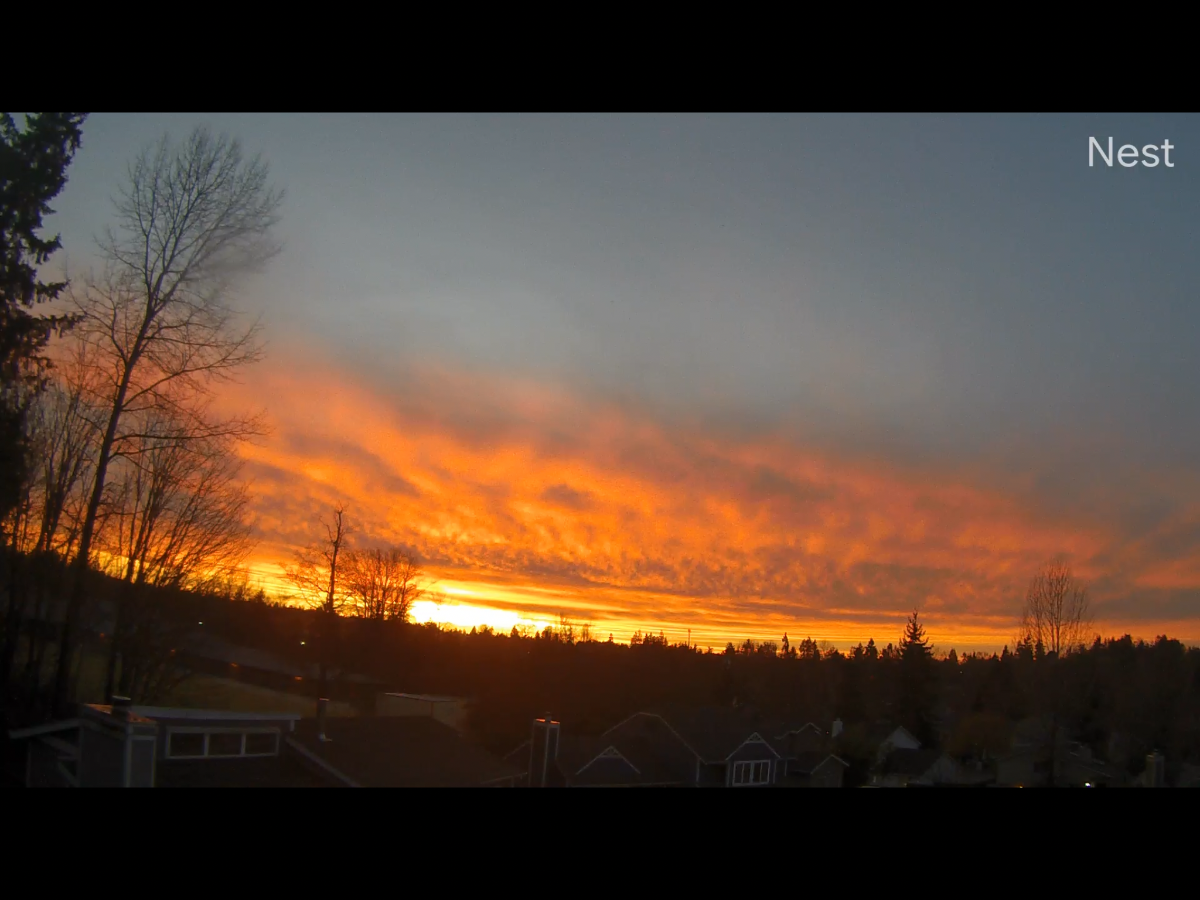
Fire in the sky tonight ! Nest cam show 56/51 currently 52*
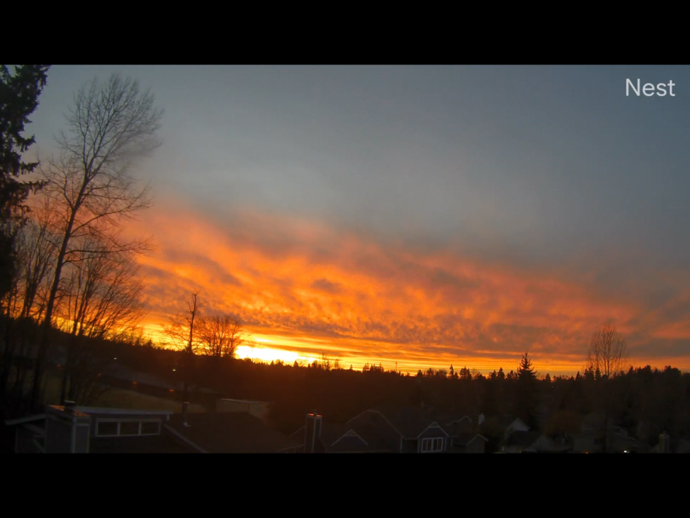 3 points
 -
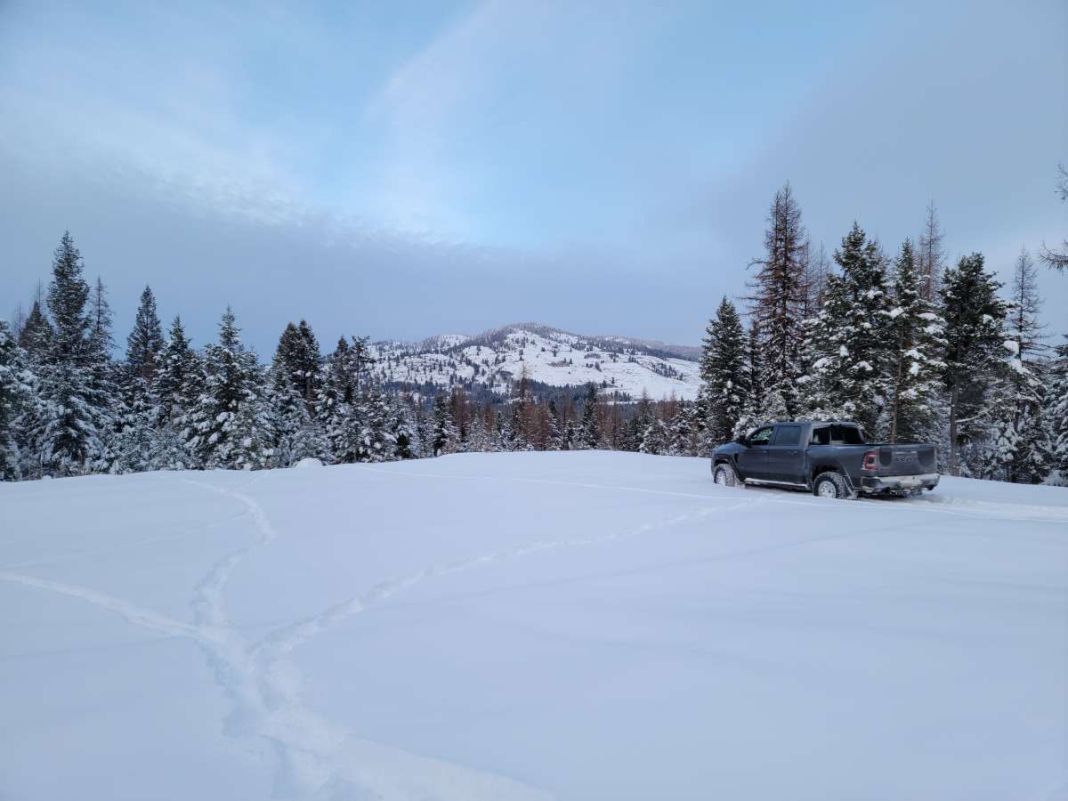
Different view-
 3 points
 -
It's not reason to get excited yet, but there's been some agreement on cold 1st week of February3 points
-
The only thing I know about Wyoming is that it has two escalators, and neither of them are in Cheyenne.3 points
-
3 points
-
Has anyone checked on Jim?3 points


.png.3b63c7695bac905ff3a9b53a8737a0ec.png)


This leaderboard is set to Vancouver/GMT-07:00