
Leaderboard


Popular Content
Showing content with the highest reputation on 03/23/22 in all areas
-
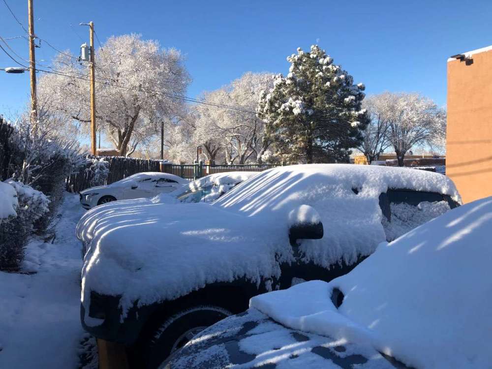
Woke up to a surprise in Santa Fe New Mexico this morning
 11 points
 -
The models totally nailed tonight's activity. A narrow heavy band formed very near me. The heaviest rain (1.50+") fell just barely west (by only a couple miles), but I did sneak under the east edge of the band and got 1.11". The east side of the city got much less. My total for the entire event is 1.34". Our wet season has begun with two straight 1" soakers. Keep them coming.6 points
-
I didn't realize SPC put us under a Tornado Watch. First one to include Boyd County since getting this house.
 5 points
 -
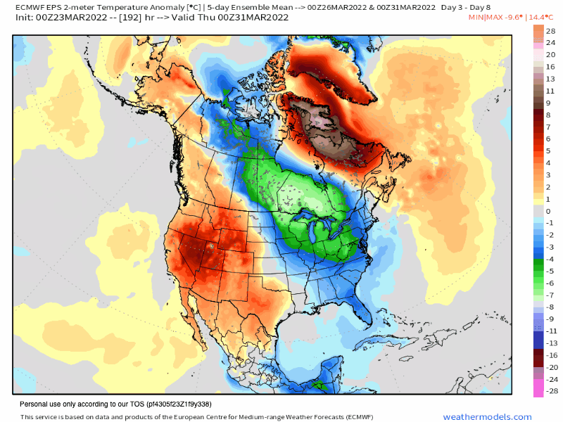
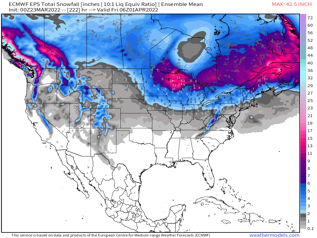
The GFS is much different than the other models next week. The GFS digs a big western trough and slowly bowls it eastward across the midwest. There is little northern stream involvement. The other models, however, show the northern stream dominating. The last two Euro runs have trended more favorably, but it's not there, yet. A few runs ago, the northern wave was way out ahead of the southern wave, but now they are aligned more closely, especially as they first move into the western US. We need to get the southern wave out ahead of the northern wave a bit.5 points
-
Fatties and some leaning pines. Trees snapping every 20min or so. 20220323_103915.mp45 points
-
A bit more rain overnight boosted my storm total to 1.43".5 points
-
This is concerning, do Y'all know Mike Ventrice?4 points
-
Multiple severe t'storm warning polygons on KJKL radar and just started raining here in Ashland!
.gif.8ab6938855e4bc344ca297e2f4eb9986.gif) 4 points
4 points -
The Southern Plains could see more Severe Weather Action Next Week, that also includes me, @OKwx2k4, &@Andie. Before that is a Mini Heatwave with Highs in the Mid to upper 80s with Dewpoints reaching the 60s. The SPC has taken note of that Consistency between global models, regarding their depiction of the synoptic-scale pattern over the U.S., deteriorates rapidly/substantially with time, during the medium-range period. The divergence in solutions manifests initially during Day 5/Sunday -- initially over the West Coast with progression of an eastern Pacific low/trough. The divergence then increases/expands with time, to the point where by the end of day 7, the GFS depicts a mature surface cyclone entering western Ohio and a trailing cold front across the Mid South/central Gulf Coast region, while the ECMWF places the low -- though similarly mature -- over western Oklahoma. Given this unusually large spread in solutions, which is particularly highlighted in the increase evident in standard-deviation fields within GEFS output through time, during the medium-range period, no severe weather assessment is being offered beyond Day 5/Sunday at this time.4 points
-
Ended up with .84” of rain. Might get a bit more today but winds up to 50 mph and temperatures in the mid 30s have made it still nasty outside4 points
-
I agree models nailed this system. Ive had 1.82" since 11 pm monday. Tues evening it just kept training south to north along hwy 63.. my pond that we dredged last July is almost full. Once again my part of Iowa can kiss the drought monitor goodbye. And yesterday was a record daily rainfall for OTM.4 points
-
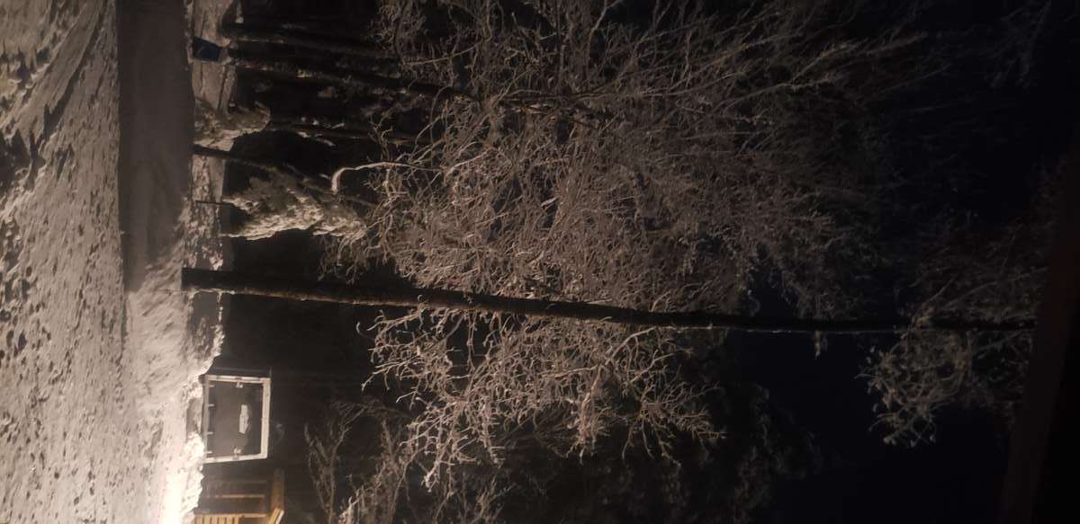
Can't see exactly, but there is a fair amount of ice on trees. After our brief snow in the evening its been freezing rain since. Can hear branches/trees breaking in the woods. Switched over to some pretty heavy snow in the last 15min.4 points
-
253 days until winter.4 points
-
47F and loud thunder rumble about 5 mins ago.3 points
-
I recorded 0.24" of rain from yesterday late afternoon to 7AM this morning. The official high yesterday at Grand Rapids was 46. The overnight low in MBY was 38 and at this time it is cloudy and 42. With a high of 85 this was the last really warm day of the heat wave of March 2012. In that March heat wave there were 9 days in a row with highs in the 70's and 80's ranging from 74 to 87. And in total there were 15 days in a row with departures of +15° or more with 5 of the days with departures of +30 or more.3 points
-
This has been a good soaker, total rainfall is up to 1.75 with light rain falling this morning. Rain may change over to snow tomorrow morning before the storm finally pulls away.3 points
-
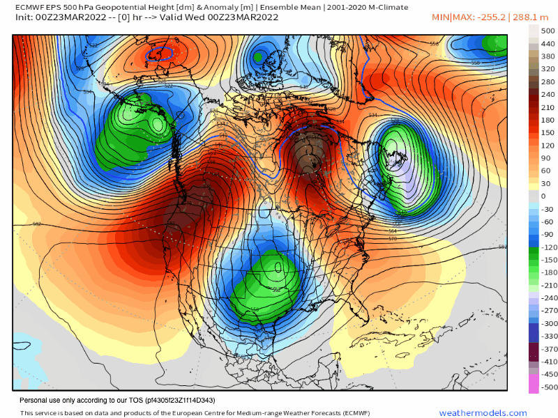
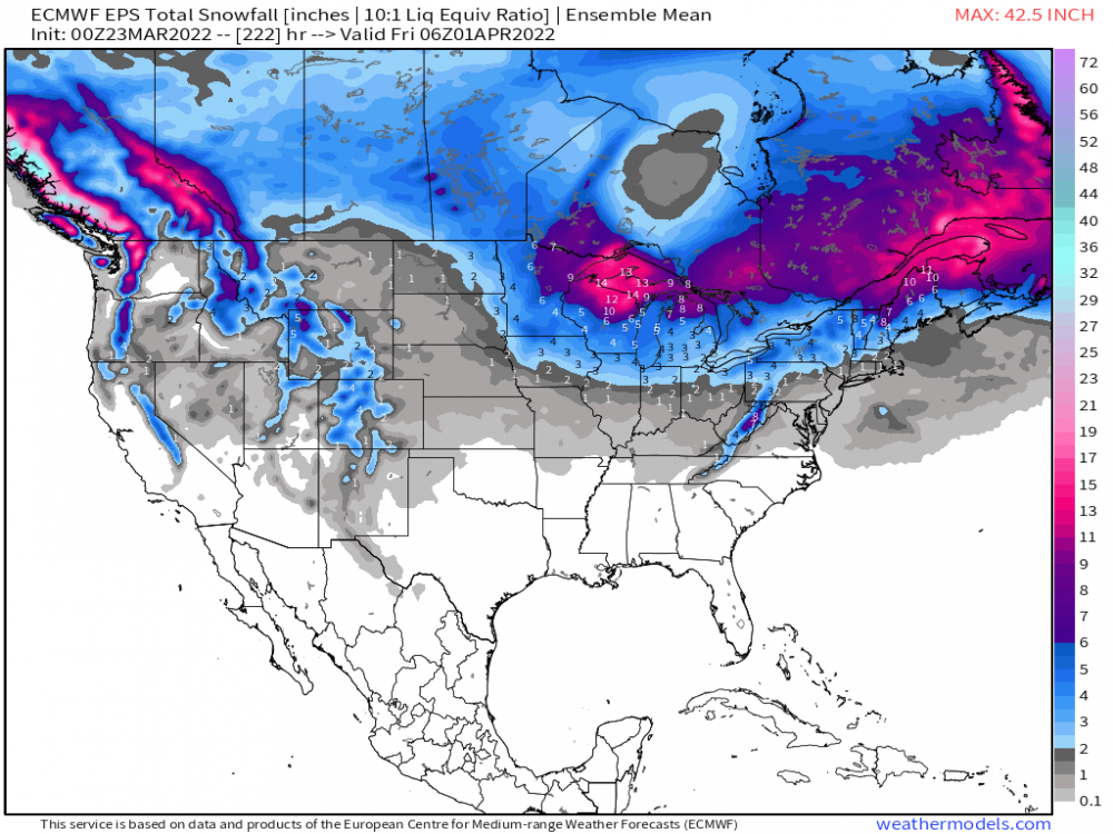
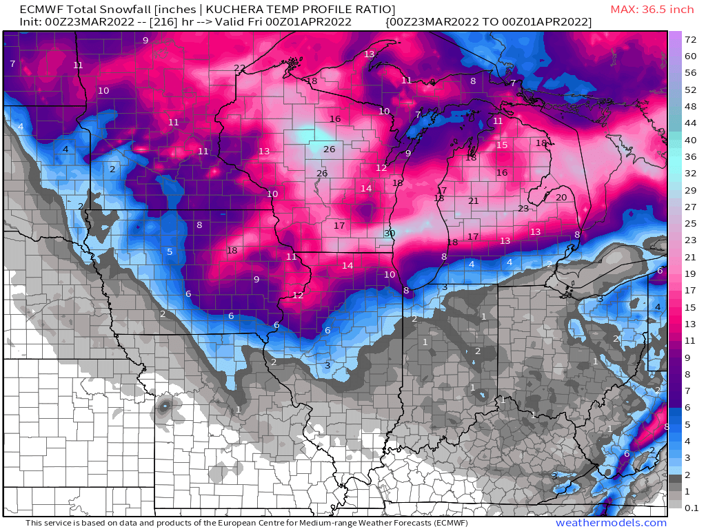
As a wx enthusiast, I marvel at the response of a late season SSW event coupled with high lat blocking can do in terms of extreme wx patterns. If the modeling is right, its suggesting a return to winter for some, while hints of Summer for the south and a parade of storms traversing our Sub. Where the heck was this blocking during Winter??? I see a hybrid clipper and another bowling ball to open APR. Wild stuff. Oh, let's not forget, but this is fascinating to see a piece of the Polar Vortex literally track from the N Pole starting later tonight and head due S and into E GL's/Ontario region by this weekend. @Niko @jaster220 won't be to happy.... Sheesh, the likelihood of these amounts are not happening, but to see this much snow on the final days of MAR is wild. @Madtown your glacier appears it will grow a bit after some melting. 0z Euro... 0z EPS...Ol' Man Winter is certainly not letting go to easy this year.... Not only are the GEFS cool/cold, but the EPS is also showing a large pool of sub normal temps to make its mark on our Sub through the extended....

 3 points
 -
I've been on the sidelines these past few days and slowly getting back into tracking this storm. The footage coming from the deep south is remarkable and I'm sending prayers and positive vibes to all that have been effected. This has turned out to be one massive and powerful storm. It's mind boggling that it literally is effecting everyone from the U.S./Canada border all the way down towards the Gulf coast. Quite and expansive system and a very slow mover...I've always enjoyed tracking these type of storms and I got a hunch that this is how our Spring wx pattern will continue into APR and MAY.3 points
-
00z GFS Re-cap More moisture for California than Oregon and Washington. Hmmm.... C'MON!!!!
.thumb.gif.fe1377e4ca35d90e8bf819f5716cb45d.gif) 3 points
3 points -
Mid September to late December is easily the most interesting and dynamic part of the year here.2 points
-
This month overall is going to end up normal for March. The last 2 haven’t been quite as interesting as 2019 or 2020. Definitely love springtime but by this point in the year the weathers very boring without the threat of actual significant winter weather…and we’re just waiting for summer to start.2 points
-
Familiar with his stuff for many years. Yes, very concerning. Got to watch this.2 points
-
My current March precip total is 3.44". This is our wettest March in thirteen years.2 points
-
Light rain still falling and it's a chilly 38 degrees. KC Precipitation: Jan 1st - Mar. 17th = 2.49" Mar. 18th - Today = 2.69"2 points
-
My final rain total is 1.54".2 points
-
I just lit a match and dropped it on the ground outside. It went out.2 points
-
Nice to know the June 2021 heat bubble is still floating around… https://www.livescience.com/arctic-and-antarctica-simultaneous-heatwaves2 points
-
Here are some more big late season snow storms in South Michigan April 6, 1886 up to 24" April 2/3 up to 17" April 5/6 1952 up to 11" March 25 1947 up to 13" May (yes May) 9th 1923 up to 12:2 points
-
@Tom We had a genuine fast start to spring last year. Basically, winter ceased for SMI with the Feb 15th large storm. March was like April, April like May. It was fantastic! Thus, not too surprised by what this year wants to do. Still not happy about it, but what can you do? It's like the lake breeze off Lake Michigan that delays your spring most years. Now, I can remember some worse years. The snowstorm in late April of 2005 in Marshall, 7" snow in April 2009. Snow-blowing my driveway on April 7th of '96 (Traverse) so I could get out to the airport for a Florida get-away. Going way back when I was a senior in HS, April of '82 was a parade of snowstorms for SMI on eastward. I remember plowed interstates near my home town in Genesee Cnty on 4/20/82.2 points
-
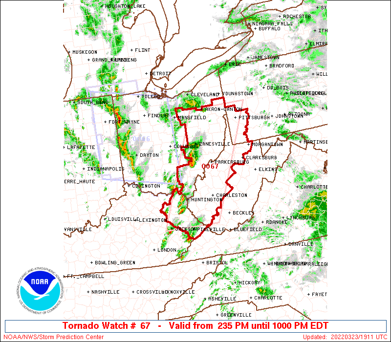
They nicely plotted out the carnage from 2 evenings ago. That’s a lot of twisters.
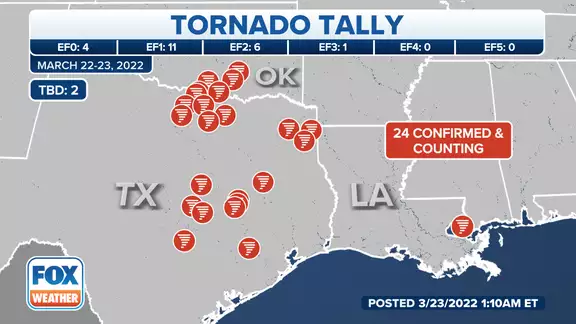 2 points
 -
The clash of airmass's is going to be interesting to see on the wx maps and I think your area may be in the vicinity of some big time boomers to close out MAR.2 points
-
That pattern could lead to a large severe weather outbreak a week from today across the middle of the country.2 points
-
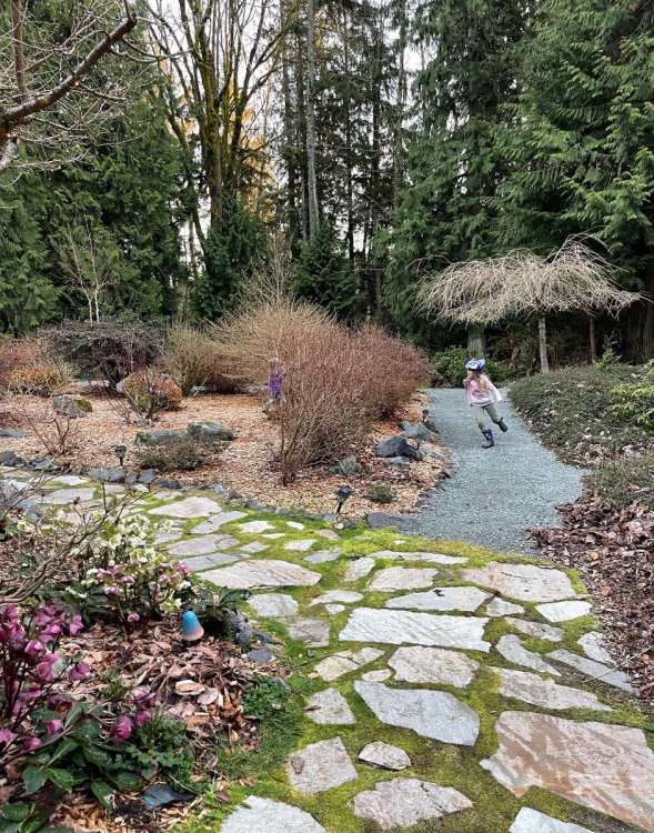
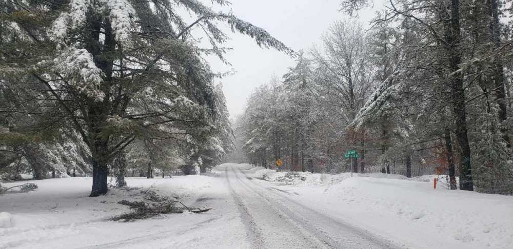
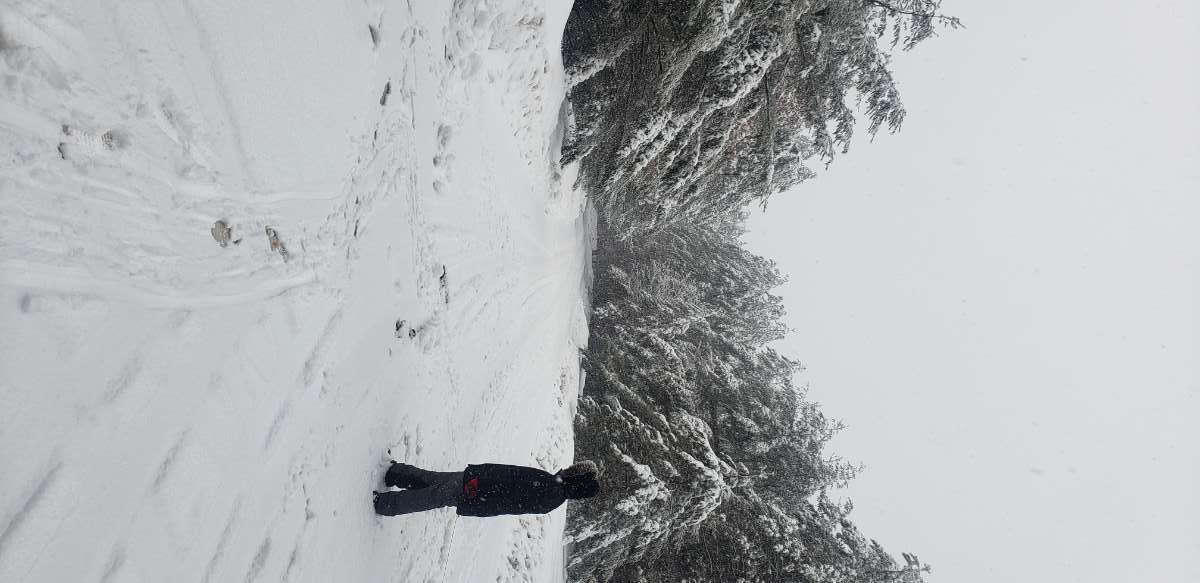
Kids were sure enjoying it!
 2 points
 -
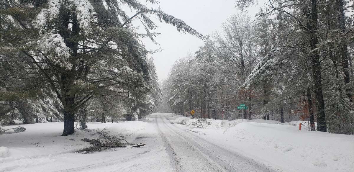
Nice day.
 2 points
 -
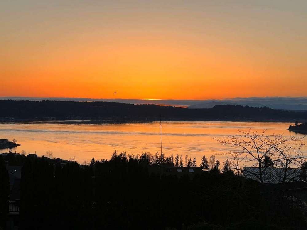
Live view from UW in Seattle...
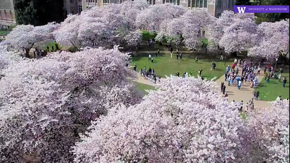 2 points
 -
It has been as wet or even wetter down there this month. Just as muddy. It will always be drier than Joshua wants... according to him. I now envision sand dunes when I think of Portland... but yet it's actually been a wetter than normal rainy season down there.1 point
-
Interesting how that’s basically the inverse of our climo. Autumn is the boring season out here. And the worst month is September.1 point
-
Trees still snapping, we have kept power since 2pm with only a few flickers. If it gets windy its lights out for a lot of people. The red and white pines are shedsing heavy branches. On a 15min walk saw and heard 7 fall. Came back to one in our driveway! Most are in the 4-6" diameter range Some 8+". It's beautiful though.....did I hear something about a big dog next week???


 1 point
 -
Yep. Time to buckle up and let the games begin.1 point
-
Long range GFS looks decent on the 18z.1 point
-
Good! Western WA doesn’t need anymore rain!!!!!!1 point
-
I don’t think it’s a sure bet anymore. At least not to the extent I was worried about a few months ago. Upcoming MJO/STJ element will favor the SW US more than the PNW for storminess, but the E-Hem forcing looks to return sometime in the middle of April.1 point
-
Ah. For some bizarre reason I read it as Feb 1st, and thought April 49 was a typo. Lol1 point
-
In the last 77 years the first 70-degree day occurred in February one time... 14 times in March... 49 times in April... and 14 times in May.1 point
-
Looks like we got down to 51F overnight. Warm.1 point
-
The loop of 6-hour max temps from the GFS shows we might be starting to gain ground with spring now... although its an ebb and flow as usual.
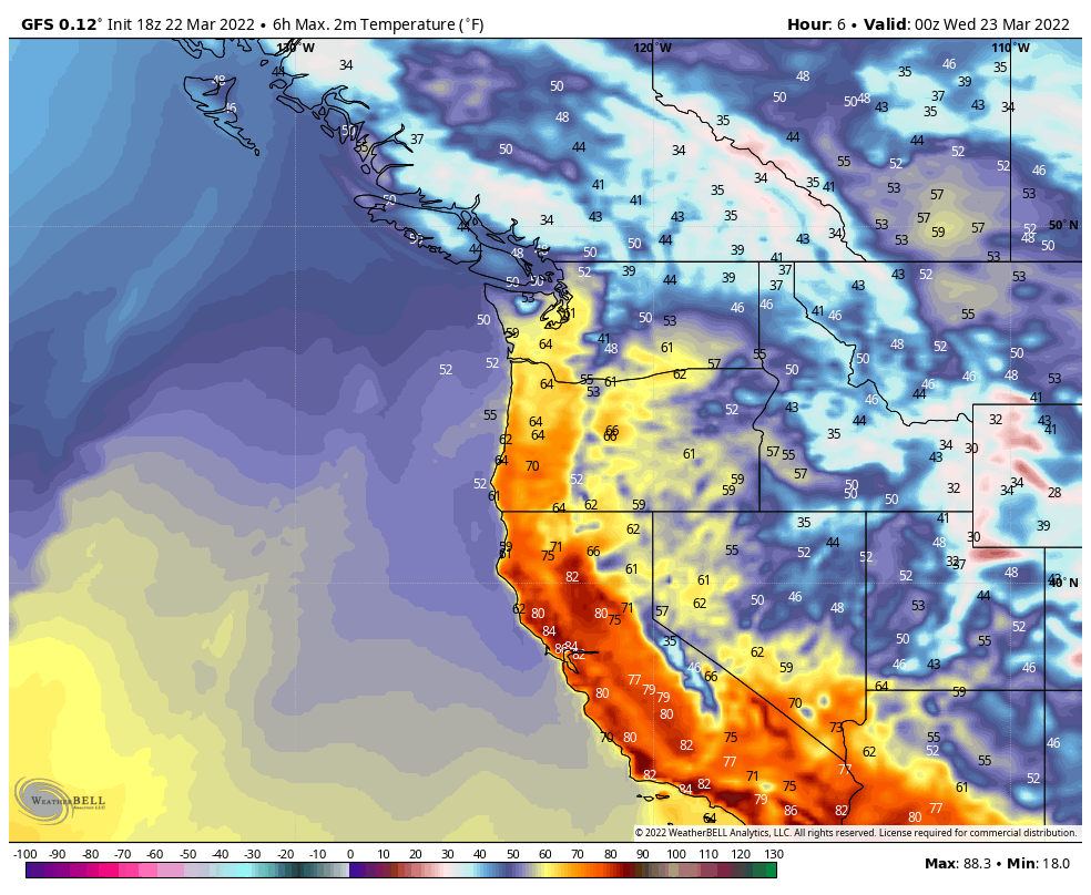 1 point
 -
Getting a pretty nice soaking. I'm at about 0.6" and lots to go. 39*F.1 point
-
0z GFS hinting at a major storm to close out the month as the pattern becomes blocked up. Could be Winters last stand.1 point


.gif.b6267712440096cf9eea69d6d2cdc1f0.gif)


This leaderboard is set to Vancouver/GMT-07:00