
Leaderboard
.thumb.jpeg.e3014abf99ef08a9f9ac2c0cd31b485b.jpeg)


Popular Content
Showing content with the highest reputation on 03/09/23 in all areas
-
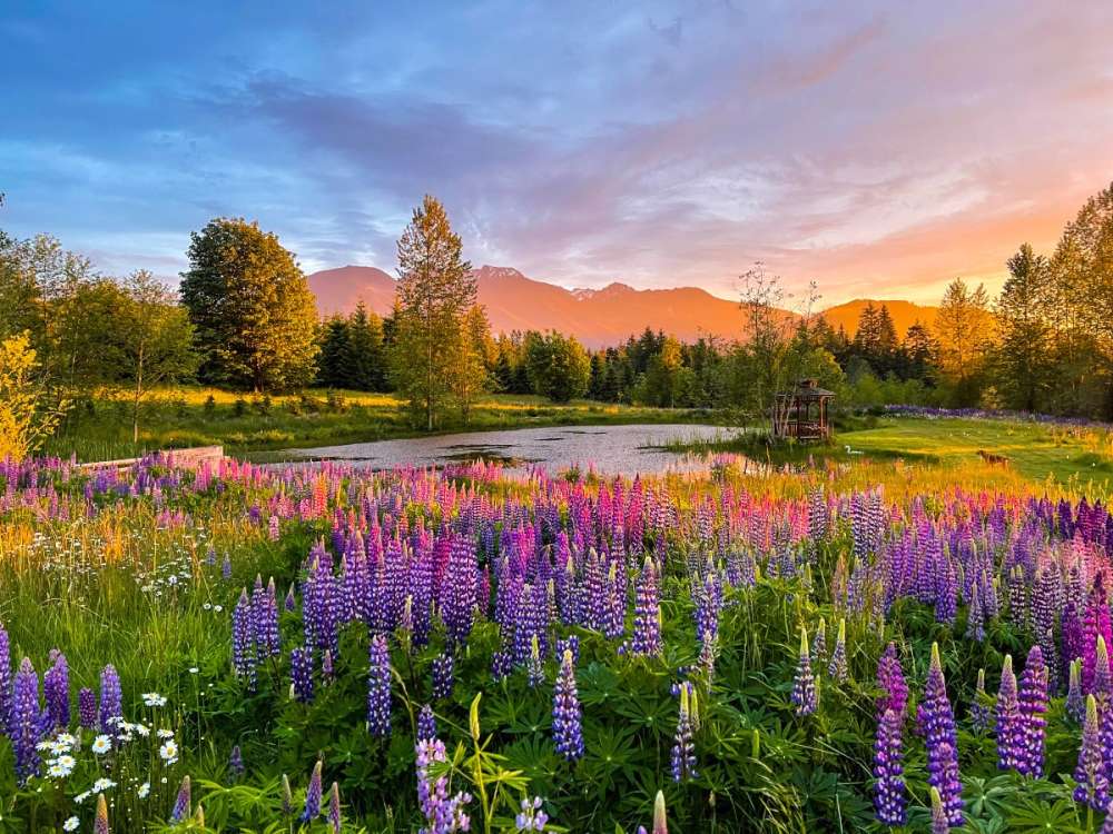
Let's reglaciate the Sierras. Hell yes. End that drought12 points
-
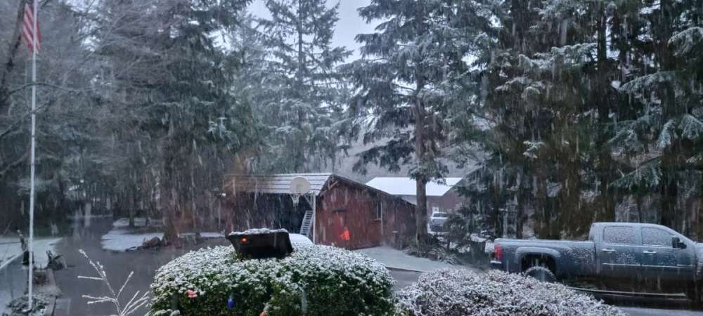
Wow dumping snow, 32 degrees.12 points
-
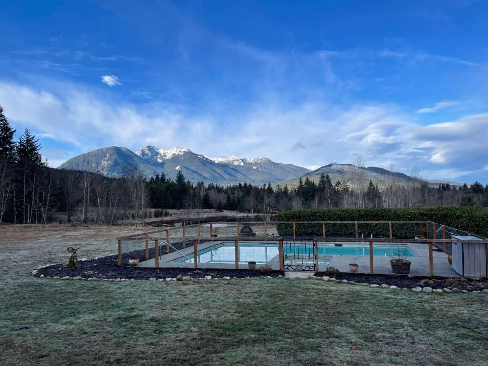
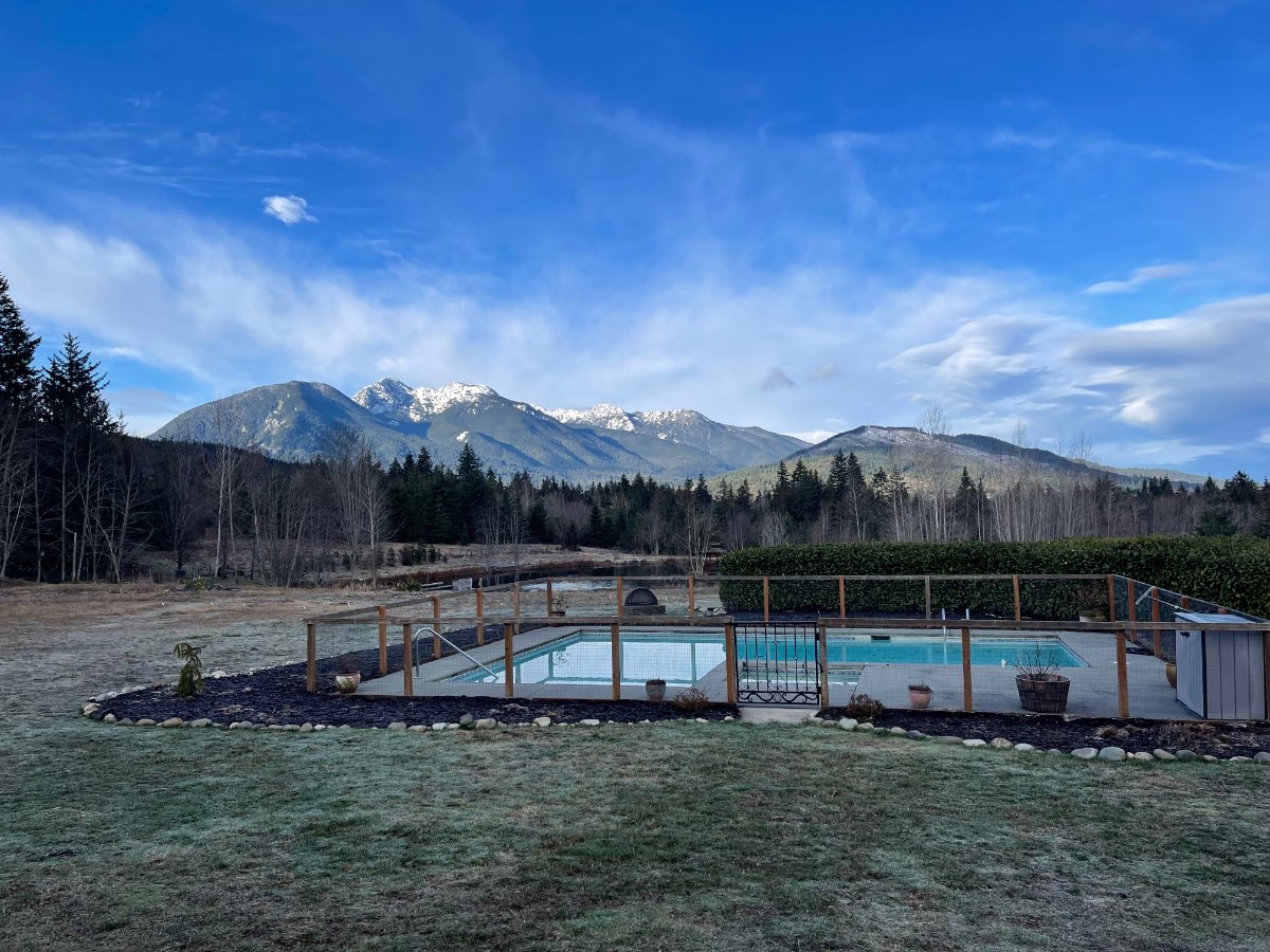
I have a half acre pond down past the pool which is where the frogs come from. My wife loves the pool in summer, but she is from Ohio and can handle the cooler temps.
 11 points
 -
Beautiful frosty morning
 10 points
 -
The fv3 model from lastnight handled this snow good this morning.
 9 points
 -
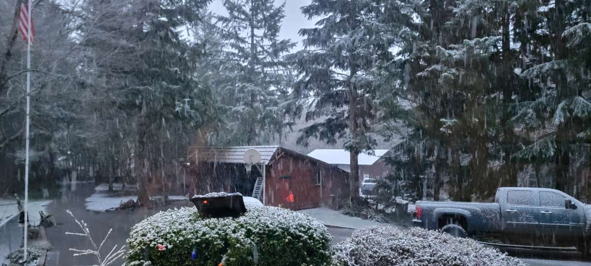
Models showed a chance of snow with this band, it started as mostly snow which is surprising. Might be looking at a decent snow event tomorrow morning as well. Absolutely dumping now and trees and ground turning white.8 points
-
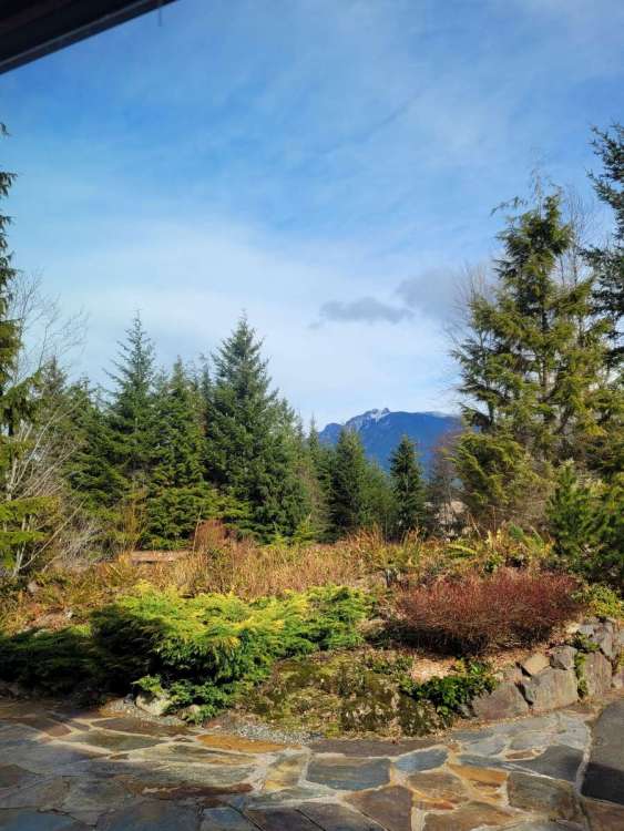
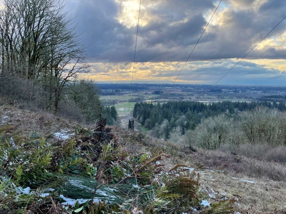
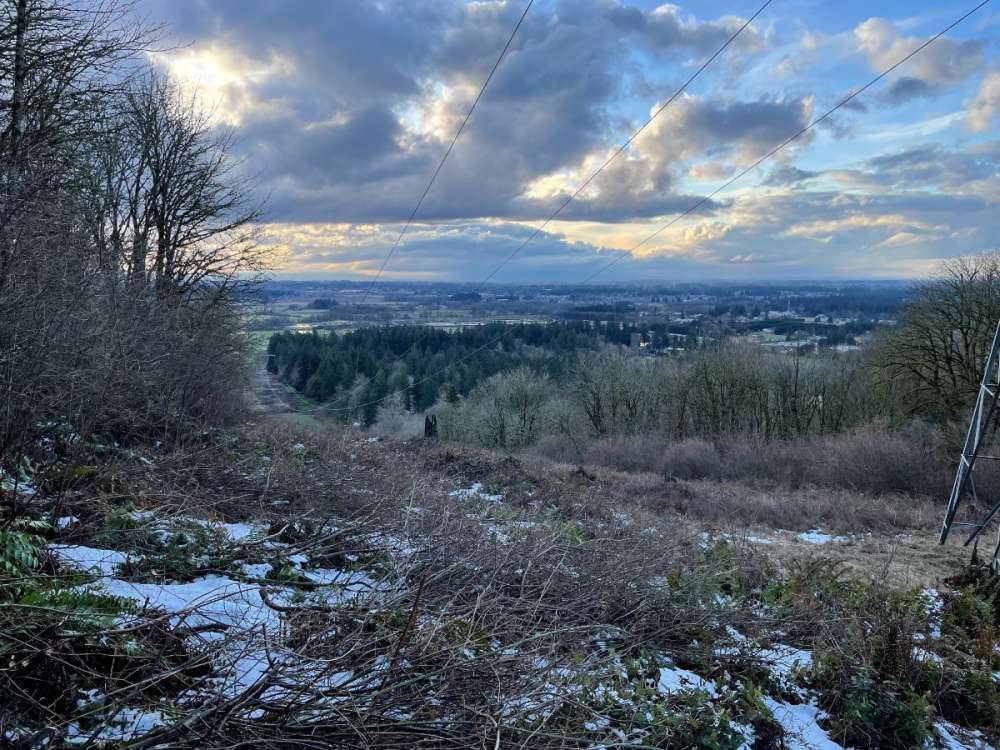
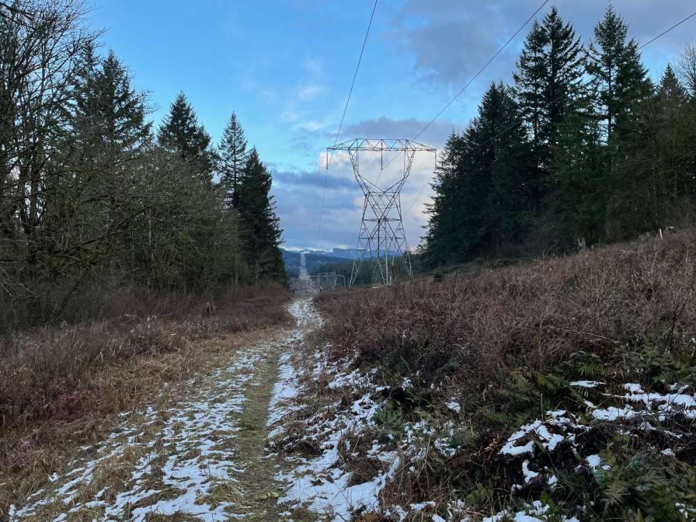
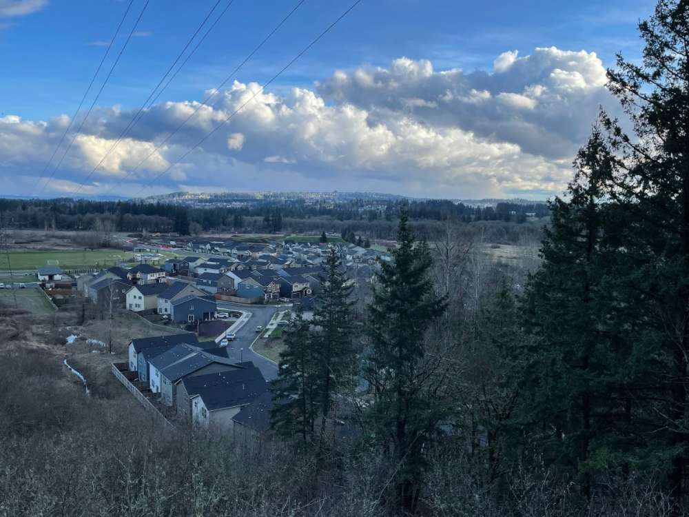
Weather window view...
 7 points
 -
Bro you got a sweet set up.7 points
-
Ah, gotcha. Nice thing about the VP2 is the sensors are detachable from the ISS, so I have the anemometer on a pole attached to the chimney, rain gauge on the top of the roof away from trees, and temp/humidity sensor 2m off ground in the shade (and 2 other sensors in different locations to measure differences and cross calibrate when replacing). I’ll take that deal if you stop spamming the thread with useless CFS updates. Sound good?7 points
-
Record low of 5 at Burns this morning breaking the record of 9 from 1951.7 points
-
The ENSO talk in this thread is getting pretty annoying already. I’m going to propose our admins bring back the old ENSO thread. That way the 3 members engaged in extreme myopia and wishcasting related to enso can knock themselves out in there.7 points
-
Here's a look at the different compressed layers.
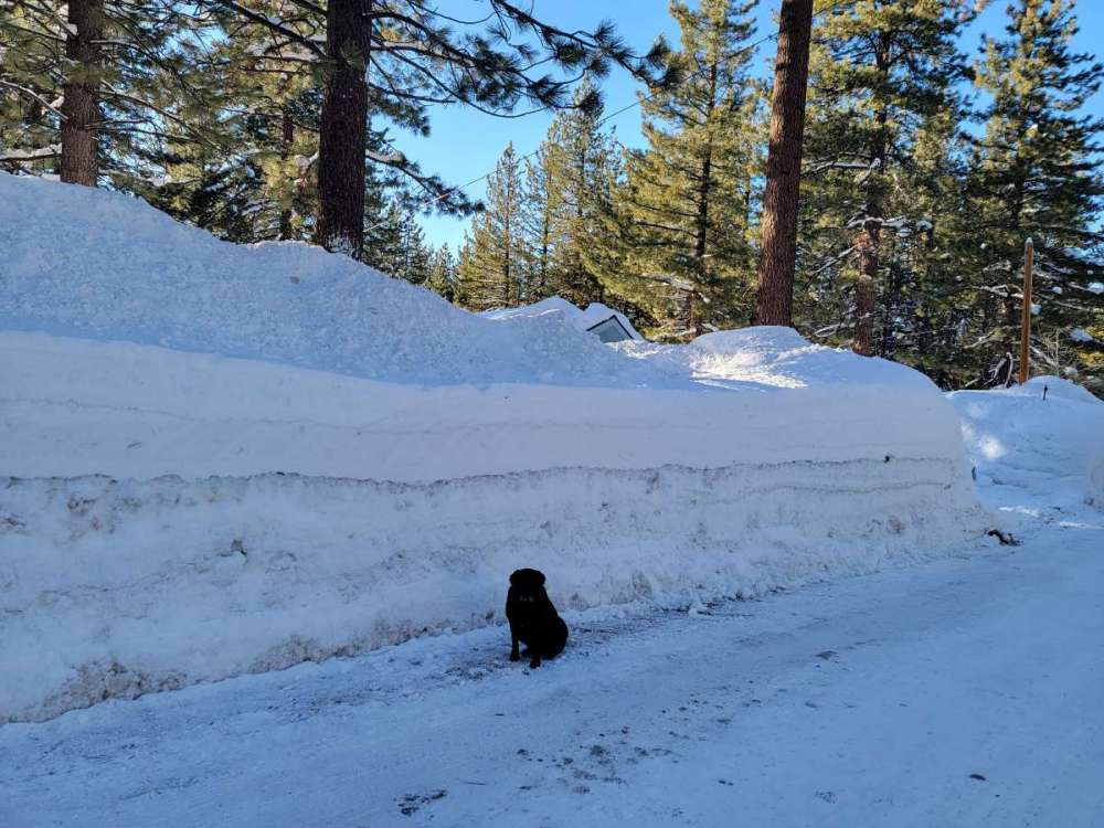
 7 points
 -
Everything is white now, coming down good.6 points
-
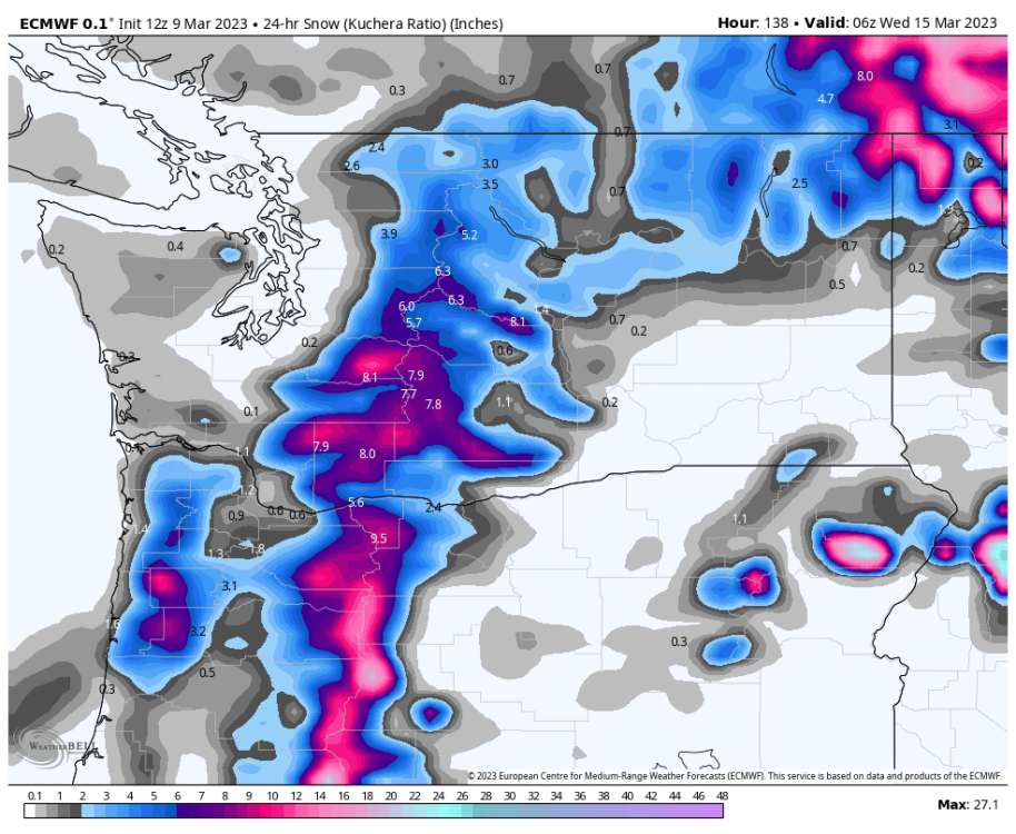
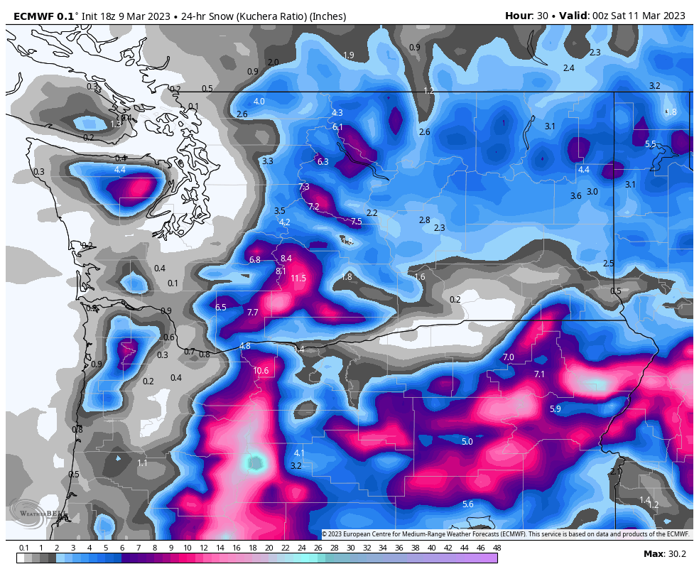
The Euro shows 10" of precip and 102" of snow for South Lake in the next 10 days. Umm ok
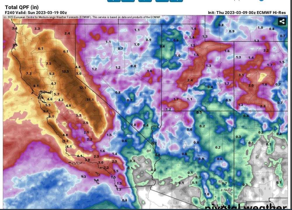 6 points
 -
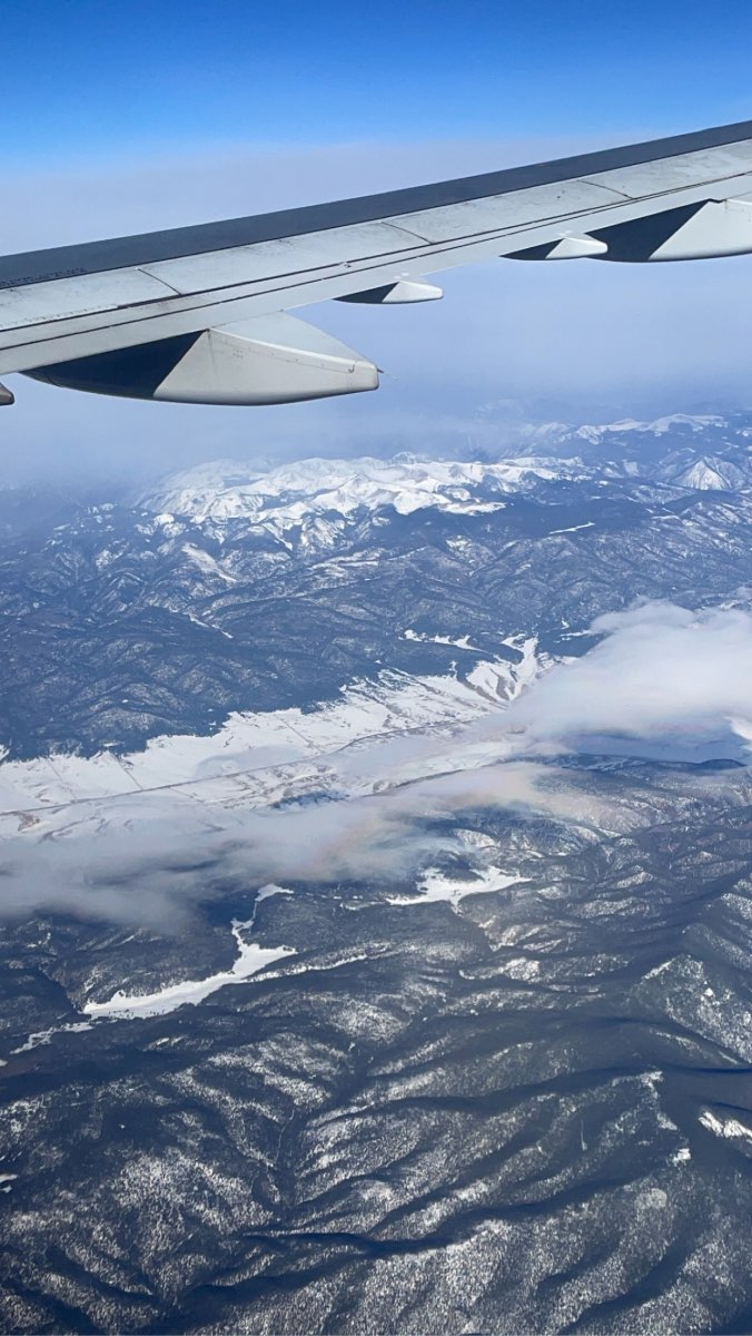
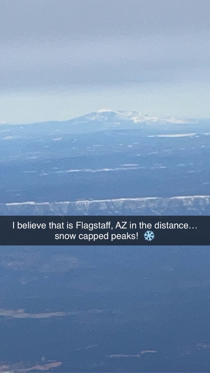
Took some cool vids and pics as we took off from ORD… IMG_2854.MOV IMG_2853.MOV As we approached the SW, the mountains of NM and AZ were caked with a lot of snow. Over the past 15+ years of flying down here, I’ve never seen this much snow and at such low elevations. IMG_2856.MOV IMG_2858.MOV IMG_2860.MOV IMG_2863.MOV
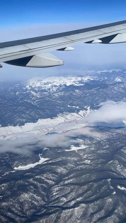
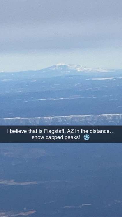 6 points
 -
Really chilly day here. 43/31 spread with 1/4” of morning snow. Great convective looking sky in the afternoon. Did a nearby hike up Green Mountain north of Camas (800’) for the sunset.
 6 points
 -
Nice and sunny out here…it was overcast earlier, but one thing you can guarantee out here, the Sun will always make a quick appearance…
 5 points
 -
Looks like many spots in NW Oregon/SW Washington and the Willamette valley are running anywhere from 5-7 degrees below average month to date.5 points
-
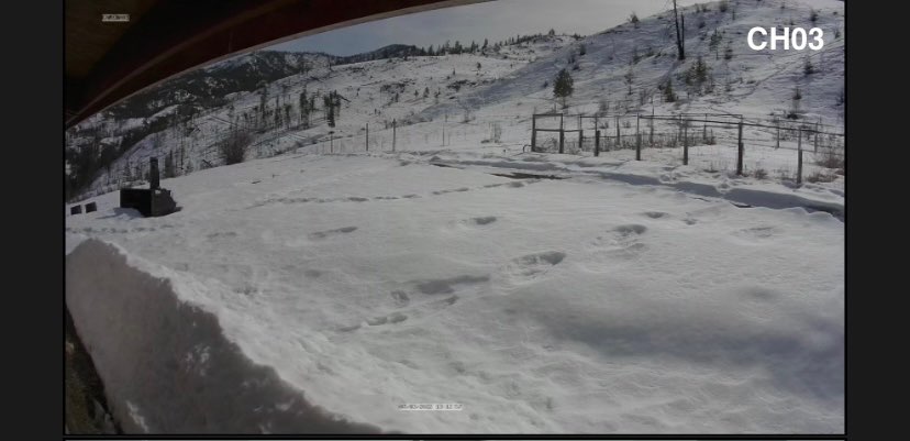
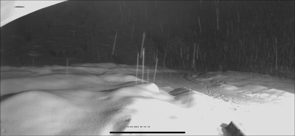
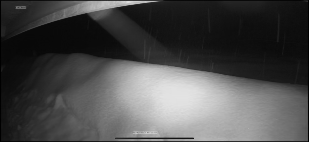
More snow in twisp. A few inches. Doesn’t look like we’re going to be melting out anytime soon. Compare to same Day a year ago for that second camera


 5 points
 -
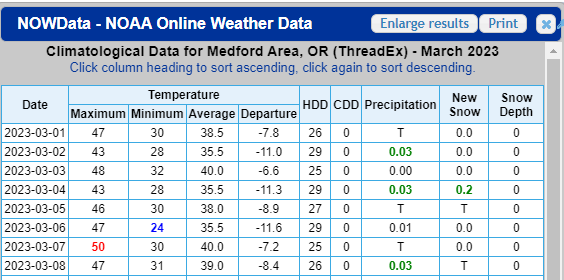
Slightly interesting tidbit is that today marks the 84th max temp below 50 at PDX this cold season. That ties 2000-01 and tomorrow should break that. Last cold season with more was 1984-85 with 86 of them, and then 1978-79 with 93.4 points
-
39 /32 here with snow this morning. Currently 36.4 points
-
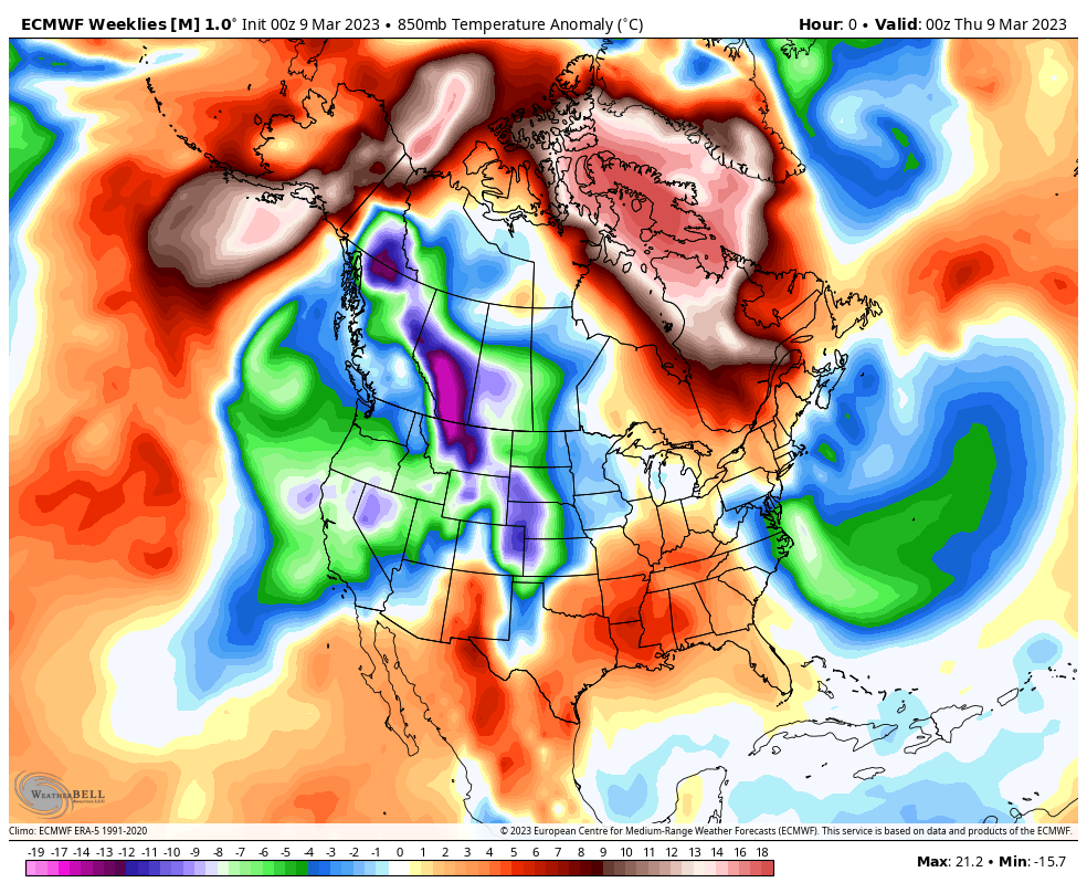
SW region is consistently cooler than average on the new EPS weeklies.
 4 points
 -
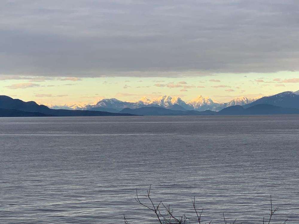
Looked clear across the Strait of Georgia:
 4 points
 -
What a start to March though!
 4 points
 -
I have a monthly average of 37.8 for March so far. Very impressive with zero snow. Also had a monthly average of 39.9 In January and 39.4 in Feb! Very impressive4 points
-
My total is 3.2 inches. The rest of the snow should be generally light. The liquid total is 0.38".4 points
-
still only 36 degrees at home!! that is impressive4 points
-
But the ECMWF is still flirting with lowland snow again on Tuesday... particularly down south.
 4 points
 -
Hopefully that snowpack is still spongeworthy when it comes to your incoming rain, meaning hopefully it will absorb most of it. My buddy lived in South Lake Tahoe in the 90's and a similar event occurred but the snowpack couldn't take it. The snow made some interesting channels of runoff, one of which came into his rental house causing tens of thousands of damage. He safely evacuated.4 points
-
I have no problem with reasonable discussion.4 points
-
Picked up about an inch of slushy snow this morning in Southwest Omaha. It was just enough to provide a nice wintry scene around here without causing any major issues on the roads… and it will be mostly melted and gone by the end of the day today.4 points
-
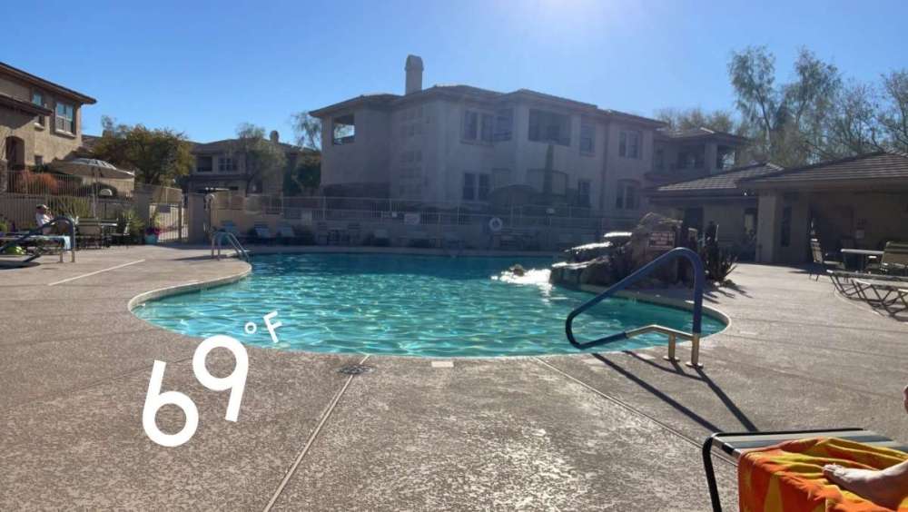
We had a wonderful day out here in the PHX valley and topped out in the low 70's. Lot's of Spring breakers and Snow birds in town as it seems like everyone has come out of hybernation! While I was at the pool yesterday catching up with all the locals (even the regular snow birds), all of them were complaining how bad and ugly this Winter has been here in Arizona. Its a catch 22 bc you want to nature deliver moisture and abundance but then you have to deal with the rain and colder weather. As the saying goes, your patience will be rewarded. Well, that appears to be what is coming down the road as we enter the official time of astronomical Spring (3/20). Let's take a look... The JMA weeklies are suggesting that good ol' SW ridge to pop and potentially Lock for a good while out here as we move into April. Unfortunately, for a lot of you out in the Heartland of the Nation, it doesn't look to nice. Where was this in Winter? Euro Weeklies are singing a similar tune, but there is somewhat of a decent signal that it warms up by the time we flip the calendar into April for parts of the MW/GL's. 500mb pattern from 3/20 into late April...

 4 points
 -
La Niña is dead and gone, and a cold ENSO outcome is increasingly unlikely. Question is whether the transition is rapid/into full blown El Niño, or slow/halts around neutral/warm neutral.4 points
-
Glenwood in the Coast Range at 650ft had a 38/34 day today. 37/33 at Timber at 1000ft3 points
-
What a day! Pretty windy with gust in the 40's. We are under wind advisory until 7pm tomorrow.3 points
-
18Z ECMWF for the next 24 hours from now through 4 p.m. tomorrow.
 3 points
 -
The final total is 1.8 inches for me. Storms over @Andie as of 4:40 PM CST.3 points
-
From my armchair meteorological understanding the cool dry air from the offshore flow will sort of pile up on the leeward side of the mountains. We see the same thing down here to a lesser extent with the coast range. It’s not like the east wind source areas are even warm relative to average, and perhaps more importantly they have low dewpoints. While the air in east wind areas is well mixed with a high temp/DP spread, cold air damming spots get a more stagnant, inversiony, “wet bulbed” version of the same airmass. Comes in handy when chilly systems move in since the relatively cool air and lack of mixing at the surface allows the airmass to become isotropic (uniform temps, in this case close to freezing throughout the column) more easily and drag the snow level to drag down to the surface. I’m probably missing a ton of technical stuff but that’s my understanding as the layman.3 points
-
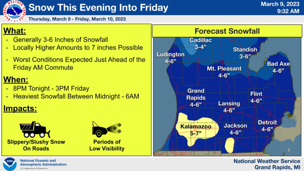
The mid-level Low gets it's act together a little better over this way for SEMI. @Niko getting a bump into yellow GRR also thinking some areas may exceed the 6" threshold:
 3 points
 -
Just measured again and surprised it's adding up as much as it did. I'm up to 4" and some spots it's nearing 5" on the grass and frozen part of the driveway. It's so heavy and wet there's barely any drifting despite a decent wind. Chunks are dropping off the trees because of melting.3 points
-
Thanks! Come have a swim... its nice and warm3 points
-
That’ll put me up to 60” on the winter. About on par with 2016-17 here. Not quite up there with the big ones of my lifetime. 1996-97 and 2008-2009.3 points
-
Can’t even remember the last time I posted one. I’ve kind of been passing the torch on the CFS.3 points
-
I was outside a bit ago and I'm about up to almost 2" on my snow boards and elsewhere. There's not much on the road or sidewalks because of it being warmer.3 points
-
La Niña is officially over! Hopefully the drought is on its way out! https://www.cpc.ncep.noaa.gov/products/analysis_monitoring/enso_advisory/ensodisc.pdf3 points
-
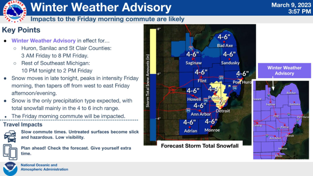
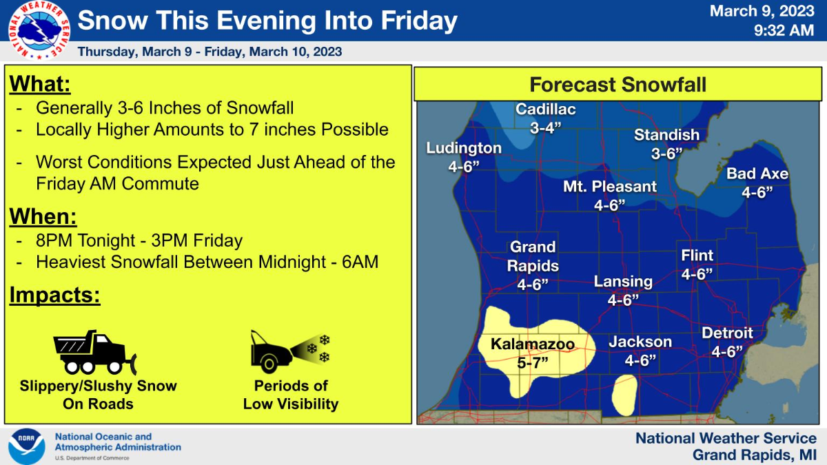
This snowstorm coming for S MI is looking pretty decent. Accumulations will be enough to shovel once again. At this rate, I would not be surprised to get to near average snowfall, if we get another one down the road, but should be a close call. Where was this active wintry stuff back in January or February. Anyways, this will be a fast mover, but will make for hazardous driving conditions.3 points
-
HEAVY SNOW in Des Moines, Iowa, just pulled up the live traffic cams, beautiful winter scene. You guessed it, rain here in KC. The winter of rain continues.3 points
-
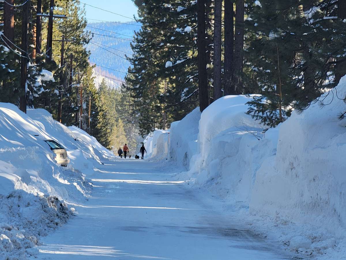
6-8' of very compressed snow. We are at 280" in town for the season with very little melting3 points
-
I'm pretty sure Eugene is done with winter so I'll give my grade: C+. We only totaled around 3" of snow or so. None of it ever lasted even a single day. One especially slick ice storm that pretty much shut down the city for around 16 hours, but thankfully not thick enough for power outages. No remarkable cold snaps, but plenty of chilly weather. Bonus is less fog and inversions than average. The best highlight is that we had snowfall in every month from Nov - March. Don't think I've ever seen that before. It was a season of all mosts.3 points
-
GFS showing upper 70s in the extended. Yes please.3 points


This leaderboard is set to Vancouver/GMT-07:00