
Leaderboard


Popular Content
Showing content with the highest reputation on 06/24/23 in all areas
-
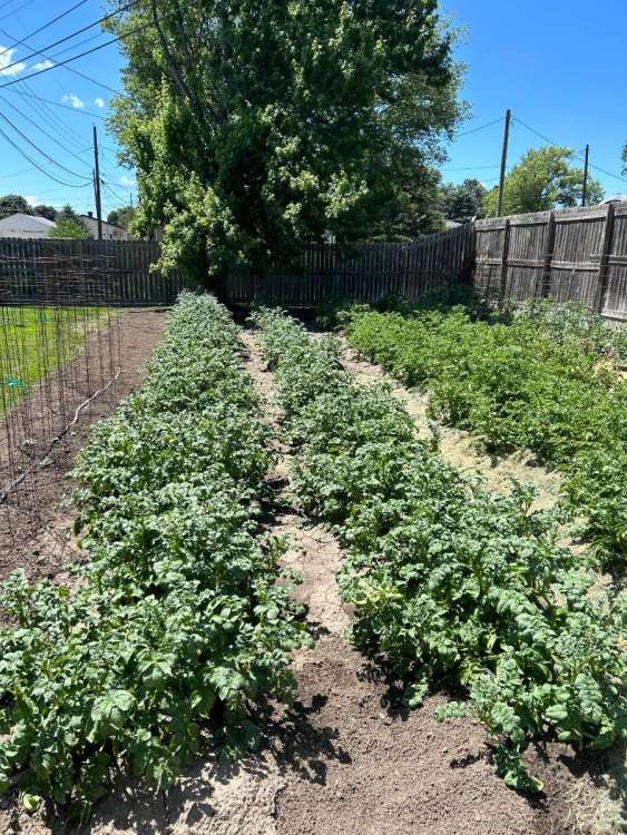
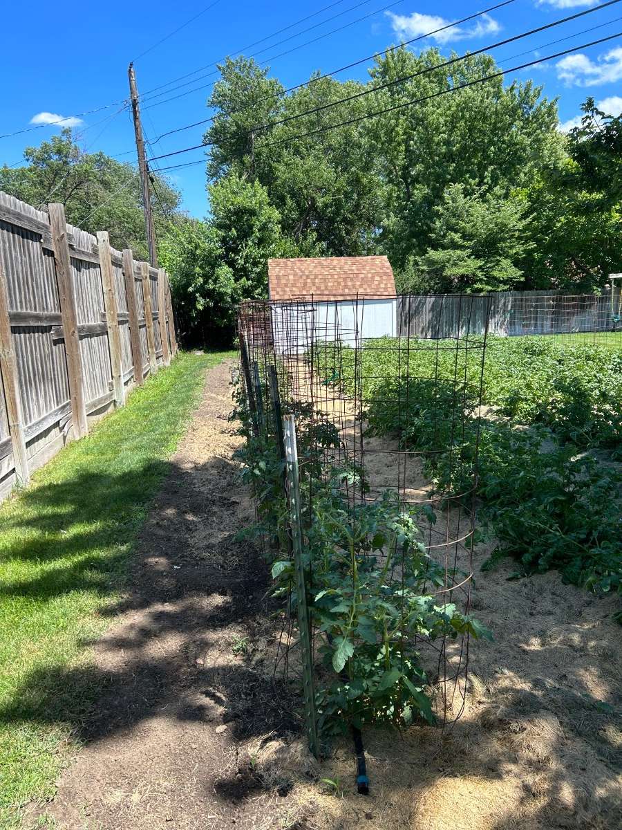
My garden sure has been liking this month so far!
 7 points
 -
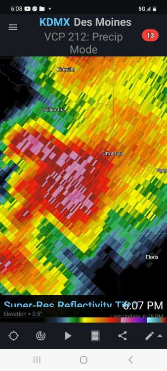
Yet another se Iowa sucker punch. Its impossible to think but its possible some spots near me dont get much over 1 inch the entire spring and summer! I've come to realize that east moving fronts and lines of storms are totally useless in my area. We need some kind of miracle sagging east to west front near the mo/ia border just to get a decent widespread rain for years now. My last 3 good summer rains over past 2 yrs were weird popups moving west! Freak stuff from the east. KDMX - Super-Res Reflectivity Tilt 1, 12_44 PM.mp45 points
-
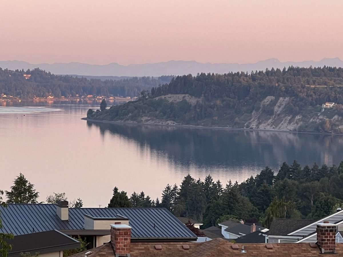
Hit 80 yesterday afternoon here but cooler today just 71 so far. Have been working nights this last week and got off a 14 hour shift at 7am today. Was some cool thunderstorm activity over the cascades last night.4 points
-
18Z GFS is not exactly cold for the 4th...
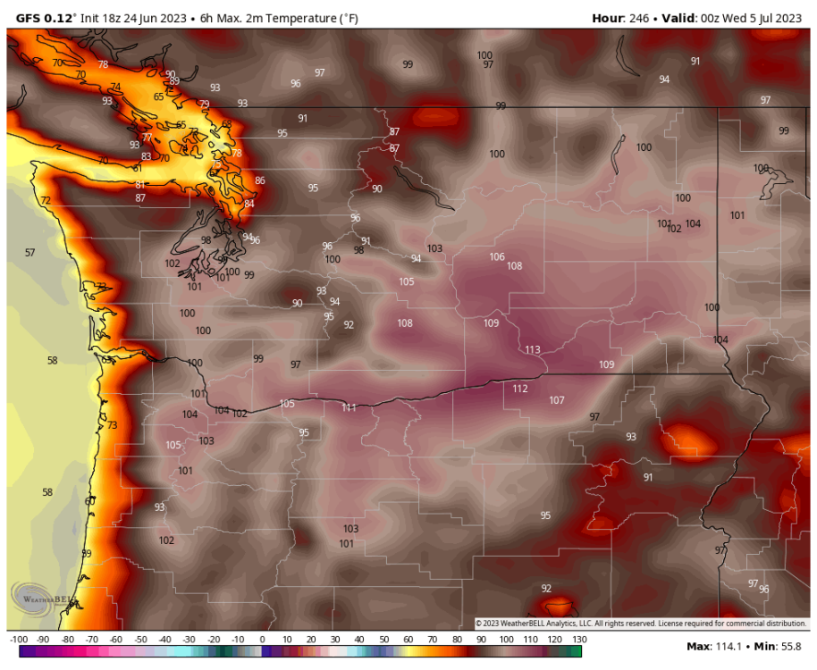 4 points
 -
Im not at home. But wow! Every time i spew off about my areas deficits (which still exist) we get hammered! A friend northside says .38 and this pic is from southside.

 4 points
 -
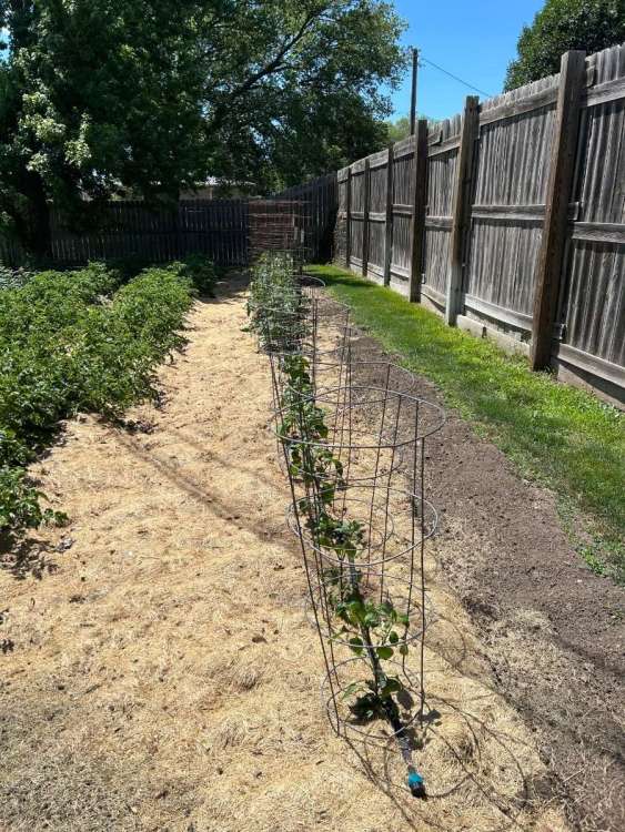
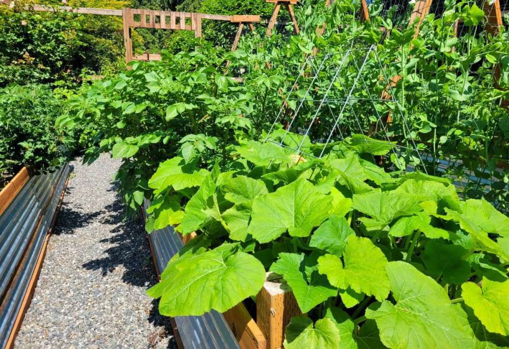
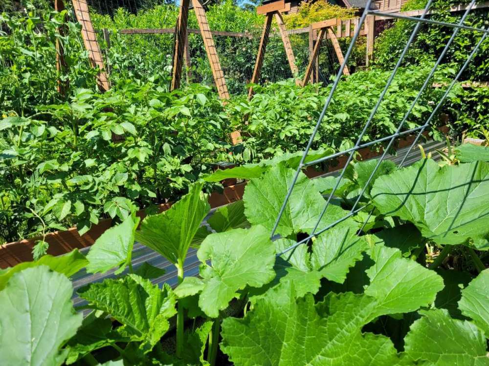
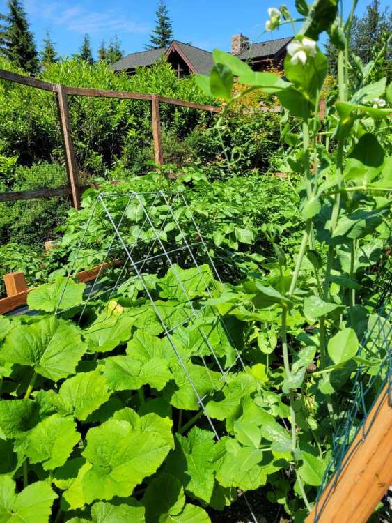
Garden has become a jungle now. The June mega-trough and consecutive days in the 50s did nothing to slow it down.
 4 points
 -
Oh it is! Best Western in Moscow, ID, across the street from the University of Idaho Kibbie Dome. I'm sure @TT-SEA has stayed there before. The pool rooms are fabulous and the indoor pool is always the perfect temperature year round. The room has a backdoor directly to the pool. I hate most pools because I like to be warm but it's just right. By comparison I need a scalding bath or shower even when it's 100F outside. Roof is well designed like you'd see in Leavenworth or Cle Elum with a sloping snow A-Frame with lots of natural light. The free breakfast is fantastic. It's become an annual tradition of ours the last three years for the 4th, staying a few nights. Planning on going to Pullman's fireworks show on the 4th. Original reason was because I wanted to go somewhere I can use A/C if the 4th is hot (i.e. smoke from fireworks) but it's one of the few nuclear family traditions we have of just us three. We had a white Christmas at this hotel in 2020. Pulled my son on a sled through the back courtyard on an incline. It was fun. Maybe 2-3 inches of snow that year.4 points
-
Ended up with .30”. The lightning was intense, me and my family was staying in our camper at our families lake and a lightning bolt struck nearby. It was crazy. Surprisingly I’m doing much better than areas all around me for the month of June! Been crazy spotty, hoping we get into a ring of fire set up to help spread rain for all areas that need it.4 points
-
Rain is almost a certainty tomorrow. How much will depend on storms, but looks like a small dent will be put in our drought with several chances of rain next week as well. It will be a very welcome pattern change after 6 weeks of hell. Difference between watering every day from the neighbor and not caring.
 4 points
 -
Went out to dinner last night with our relatives from Bloomington Illinois. They talked about their lack of rain and how most in their area are just letting their lawns turn brown. My cousin said he hasn’t mowed in over 2 weeks, and when he does it is just to keep the weeds down. Thursday night they said that they just stood outside their hotel in Kearney to watch and smell the rain.4 points
-
Big time flip of the script here lately. After months of festering in one of the driest patterns we’ve ever seen, we’ve now had ~ 6” of rain in the last week, 3” of which fell in 1hr yesterday. Storms firing almost ever afternoon of late. Tomorrow looks like a relative hiatus before more intense convection enters the picture Monday and Tuesday.3 points
-
How y'all been doing?3 points
-
Tennis ball size hail was reported on the southeast edge of Ottumwa. It does appear the south side got the worst of it.3 points
-
Texas is a big state. The heatwave is more in the southwest part, not the Dallas area. Cotulla had a week straight of double-digit departures with 2 weeks of highs around 110º. I'd say that's a legit heatwave.
 3 points
 -
3 points
-
It's looking like a big ol' nothingburger for Lincoln and Omaha this morning. I actually hope the current storms fall apart well before reaching my area. It would be better for redevelopment in my area this evening.3 points
-
Of course we are out to eat and sitting outside when the hail starts falling. Pretty good size.
 3 points
 -
At the last minute, the line filled in. It looked like the new heavy rain would miss just a hair south, but it lifted northeast and soaked the entire Cedar Rapids metro area. I finished with a beautiful 0.96", which is actually one of the lowest totals in CR. That was exactly what we needed.2 points
-
Notice how Palm Springs is not hot until they reach 110 F.
 2 points
 -
.43 at my home and farm today. I had a friend check my cocarahs gage. I have been extremely fortunate to catch some on about every thunderstorm anywhere nearby during june. I think im at 2.10 in June. But its the .89 in May that hurt.2 points
-
Watching the 2nd week of July for near normal temps.2 points
-
Some cells popped and are moving over Cedar Rapids, but the rain is really underperforming compared to the radar presentation.2 points
-
I run okay on thunder days, but I don't think Ashland has had a real severe t'storm since before I arrived in the area. There's been some 50-58mph stuff and a few medium size trees down from the early Spring storms but that's it.2 points
-
Hope everyone is safe and enjoying storms this evening. Saw a couple nasty supercells in Iowa on radar. This outlook got upgraded. I will try to get a few minutes of video if a decent storm comes through here late tomorrow night. Might not be any shelf clouds if it hits after dark.
.thumb.png.7b6d155bfc51f3d4237ec5b858c9b157.png) 2 points
2 points -
It’s June 24th2 points
-
Dark and gloomy early morning became a picture perfect summer afternoon in the mid 70s.

 2 points
 -
Well at least you are faring better than most of us in Eastern Nebraska now… some day we will get rain and a decent thunderstorm again.2 points
-
Ottumwa is about to get nailed.2 points
-
I expect next to nothing. Today and probably until at some point in September. Maybe a freak popup on occasion when we have a 10 to 30% chance. Simply put thats the Ottumwa Bloomfield Fairfield tendency. No offense but since 2012 the Ottumwa Bloomfield Kirksville Fairfield area is clearly the "hell hole of the midwest"! By aug 2022 we had a 15 inch deficit for the year. Currently for 2023 we are near 10 inch deficit! No doubt by aug 15 to sept we will be near a 17 or 18 inch deficit!2 points
-
It appears our rain day is going to be ruined by lingering crapvection moving through the area. We needed the morning storms to vanish, but, as often happens, they did not.2 points
-
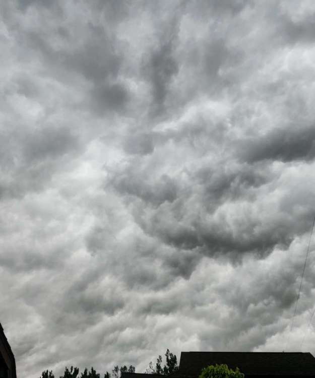
The heavens are obscured by a thick blanket of clouds here.2 points
-
We have picked up 0.64" of rain since yesterday with 0.03" since midnight here in East Nantmeal. Humdity has really ramped up since yesterday - current dew point is 70 degrees which is uncomfortable. More rain is currently moving in from the west and we could see a couple more rounds of showers and t-storms during the rest of the day today. Our unsettled and rainy pattern continues for the upcoming week the least wet day looks like tomorrow. Tomorrow looks like the only chance of an above normal temp day before we head back to below normal temps for the rest of the week. Records for today: High 96 (1894) / Low 41 (1992) / Rain 3.00" (1969)2 points
-
NWS Hastings morning disco for next week, heat and storms is the general pattern
 2 points
 -
Just a few sprinkles here, we can’t even buy a decent rain shower anymore. Amazing and laughable that we continue to keep missing out on decent moisture while those out west keep getting drenched, however I am not the least bit surprised we missed this one. The drought will always win, ugh.2 points
-
I was optimistic when looking at the radar a couple hours ago...sadly, the drought is just to D**n tough! Maybe a brief shower to wet the pavement and lawns is about it.2 points
-
Scottsbluff got hammered by this supercell!
 2 points
 -
Beautiful warm day today. Just 77F for the high and a low of 54F. One of those days where we have some of the most pleasant weather on the planet.2 points
-
That storm is showing up very clearly on the PDX radar 150 miles away.
 2 points
 -
https://twitter.com/BirdingPeepWx/status/1672423575918133249?ref_src=twsrc^google|twcamp^serp|twgr^tweet2 points
-
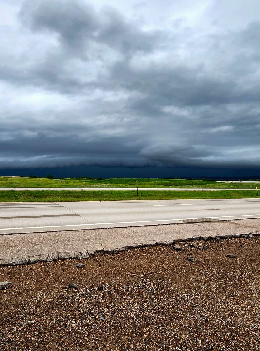
First picture is the line as it approached Spearfish, second picture is as it's overhead right now. Awesome look to the clouds but the picture doesn't do enough justice!!
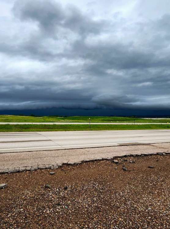
 2 points
 -
Some cool cloud formation

 2 points
 -
79 here for a high so far after a fairly cool low of 51. Some brief morning low clouds but otherwise mostly sunny and clear. Models are insanely demoralizing right now, but that’s pretty much the warm season around here anymore.1 point
-
I'm liking what some of the recent cams runs are showing, especially WRF. Maybe the current storms south of Des Moines will keep growing and pan out like those models are showing. DVN radar isn't working for me. Is it for you guys? Kind of a bummer if it doesn't work during storms1 point
-
Heavens have opened up!
 1 point
 -
Tornado Emergency for Scottsbluff,NE--- and the TWC is ignoring it. Imagine that. BULLETIN - EAS ACTIVATION REQUESTED Tornado Warning National Weather Service Cheyenne WY 731 PM MDT Fri Jun 23 2023 ...TORNADO EMERGENCY FOR GERING & SCOTTSBLUFF... The National Weather Service in Cheyenne has issued a * Tornado Warning for... Eastern Scotts Bluff County in the Panhandle of Nebraska... Northwestern Morrill County in the Panhandle of Nebraska... Southeastern Sioux County in the Panhandle of Nebraska... * Until 800 PM MDT. * At 730 PM MDT, a confirmed large and destructive tornado was observed over Scotts Bluff National Monument, or near Scottsbluff, moving northeast at 30 mph. TORNADO EMERGENCY for GERING & SCOTTSBLUFF. This is a PARTICULARLY DANGEROUS SITUATION. TAKE COVER NOW! HAZARD...Deadly tornado. SOURCE...Weather spotters confirmed tornado. IMPACT...You are in a life-threatening situation. Flying debris may be deadly to those caught without shelter. Mobile homes will be destroyed. Considerable damage to homes, businesses, and vehicles is likely and complete destruction is possible. * The tornado will be near... Terrytown around 735 PM MDT. Scottsbluff and Gering around 740 PM MDT. Scottsbluff Airport around 745 PM MDT. Minatare and Lake Alice around 750 PM MDT. Other locations in the path of this tornadic thunderstorm include Lake Minatare Campground and Lake Minatare.1 point
-
1 point
-
Windy with the rain1 point
-
Let me guess your itinerary: Book club meeting, dinner at a vegan restaurant, coffee and dessert with a few close friends, and then off to bed so you can be up early to volunteer at a soup kitchen. Am I close?1 point
-
Starting next week, the EPS resolution doubles from 18km to 9km, and the weeklies will run everyday! Big upgrade. https://confluence.ecmwf.int/plugins/servlet/mobile?contentId=246483247#content/view/2464832471 point
-
Beautiful morning. Had a friend hanging out in the backyard.


 1 point


.png.dd9b3886b21e1e096eb8ff6887febccf.png)


This leaderboard is set to Vancouver/GMT-07:00