
Leaderboard


Popular Content
Showing content with the highest reputation on 10/31/23 in all areas
-
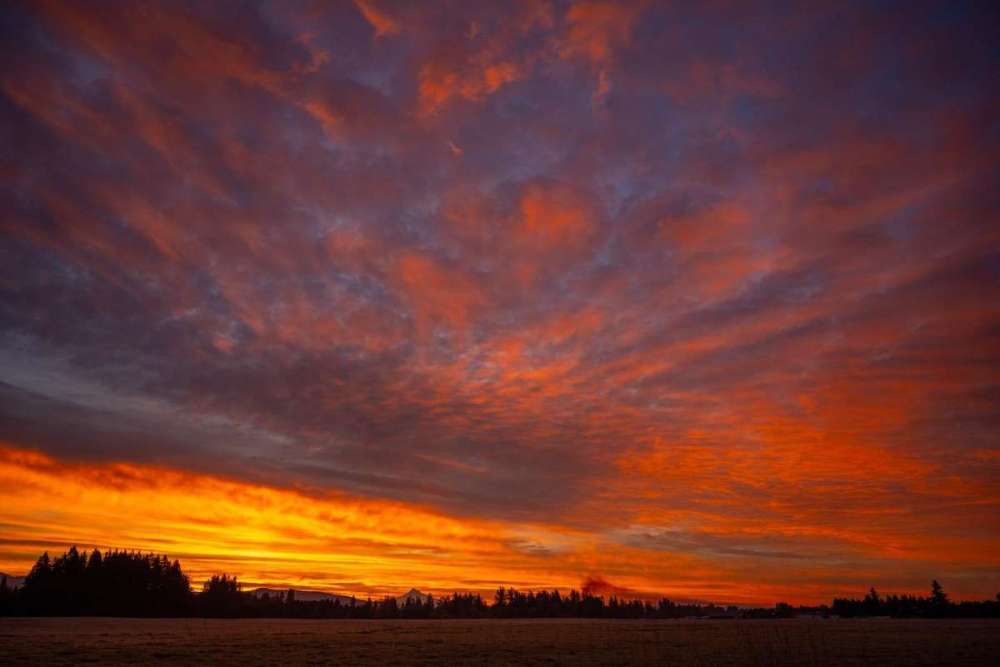
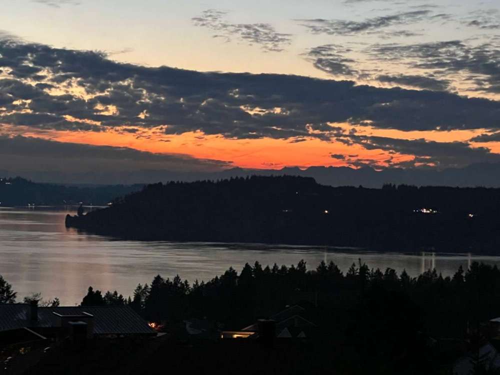
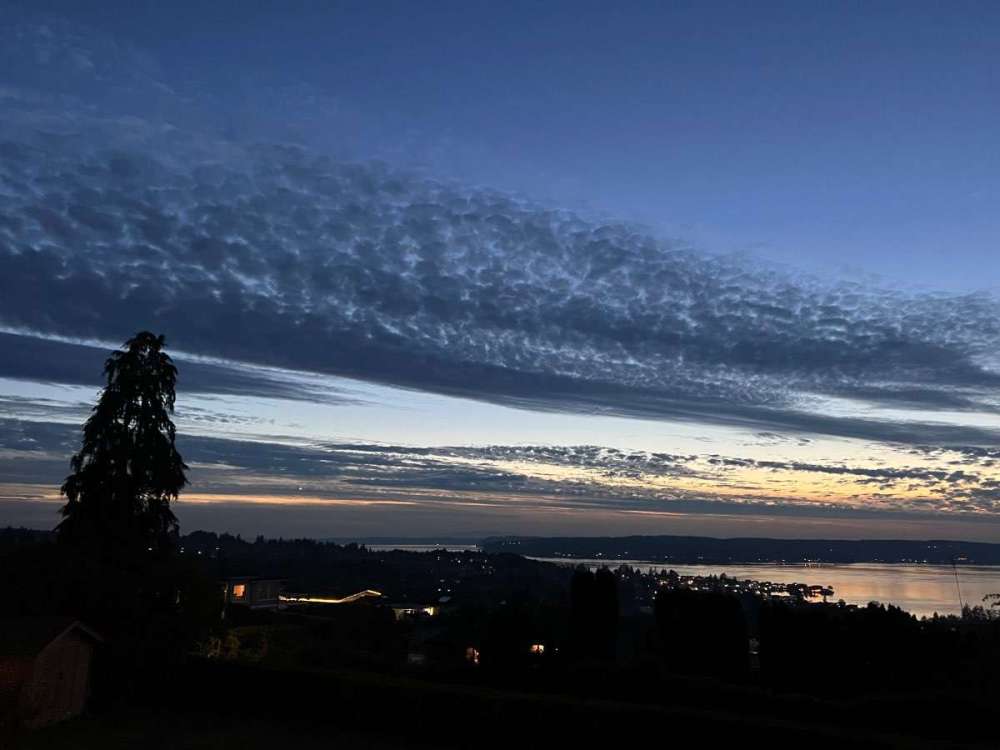
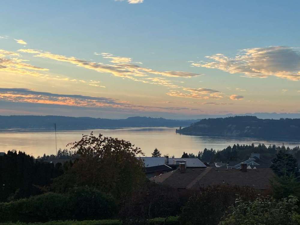
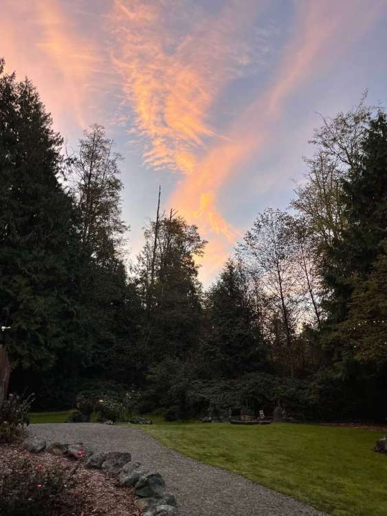
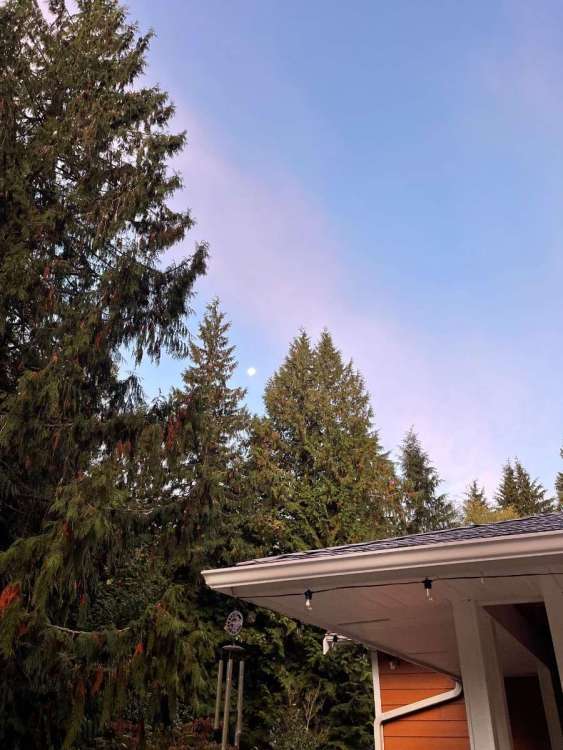
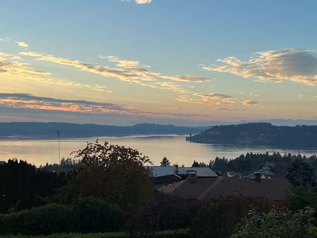
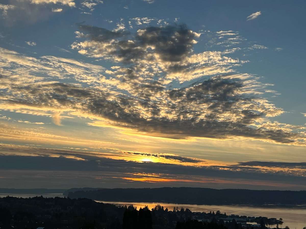
A few pictures from this morning.
 12 points
 -
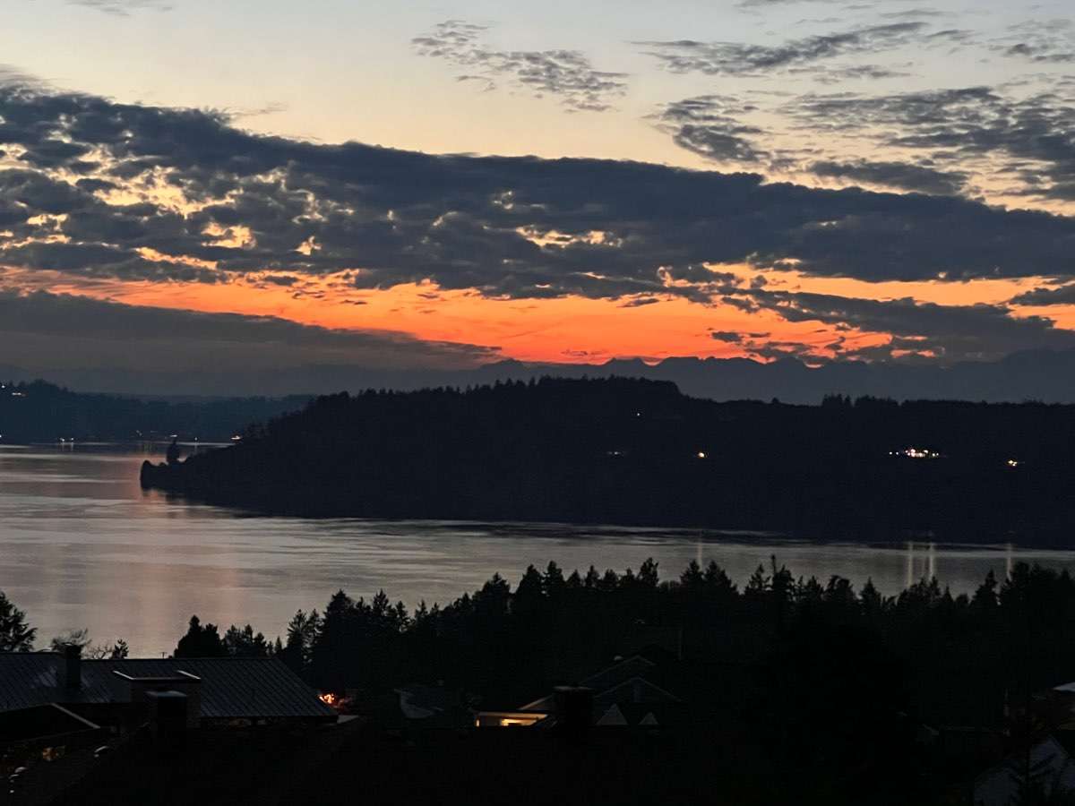
Red sky in the morning…
 10 points
 -
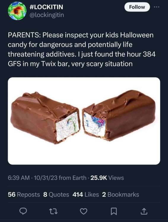
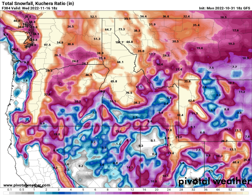
Be careful! Make sure to check your kids candy! You might find hour 384 of the GFS in there showing 2 feet of snow!
 8 points
 -
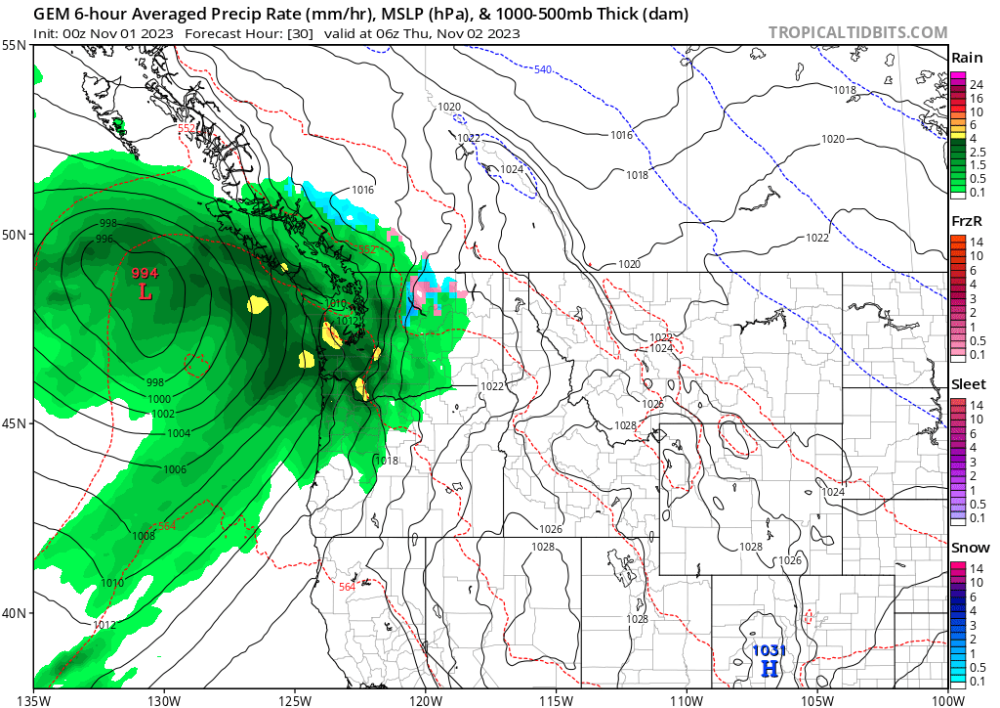
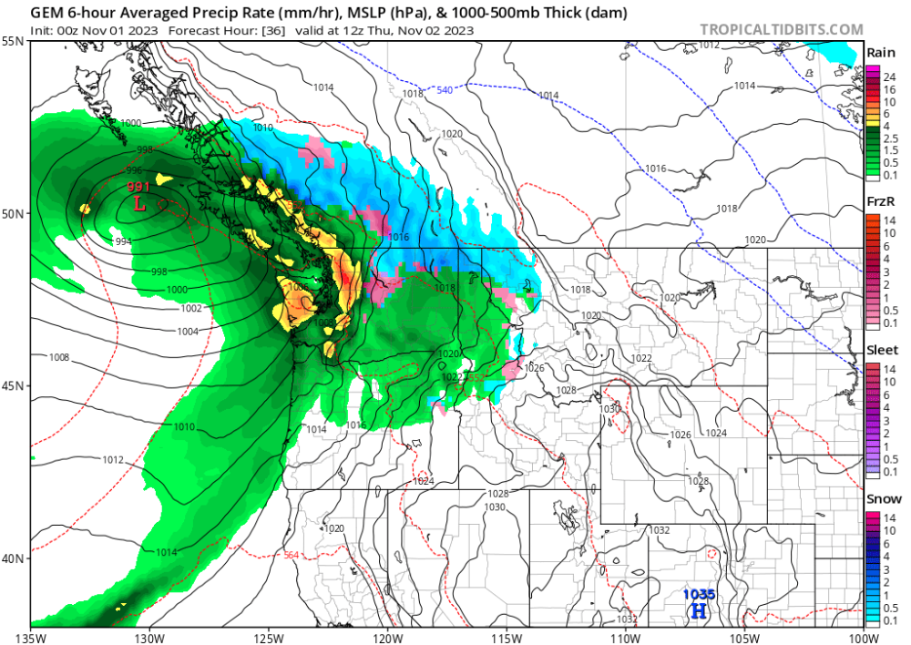
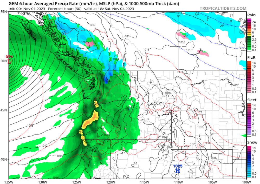
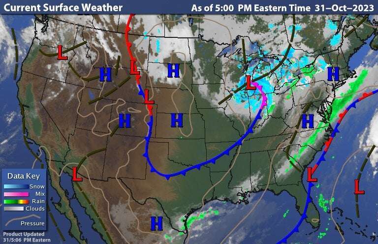
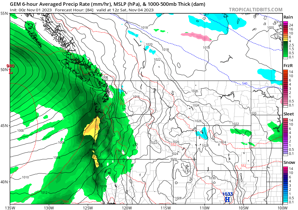
Hope everyone had a great Halloween ! Our cold dry weather is ending and rain is on the way. The midweek system has the heaviest moisture focused up in Washington but the weekend system will be focused down in Oregon.

 7 points
 -
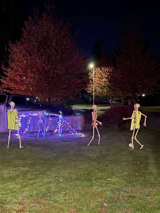
Happy Halloween! The kids really got a kick these skeletons playing soccer…With the goalies skull! Perfect night for trick or treating, crisp and dry!
 6 points
 -
48F and cool. Hope you’re all having a good one. Not too much trick or treaters, so more candy for me! Threw on random things, now I feel like Jack Skellington looking at snow and Xmas lights for the first time
 6 points
 -
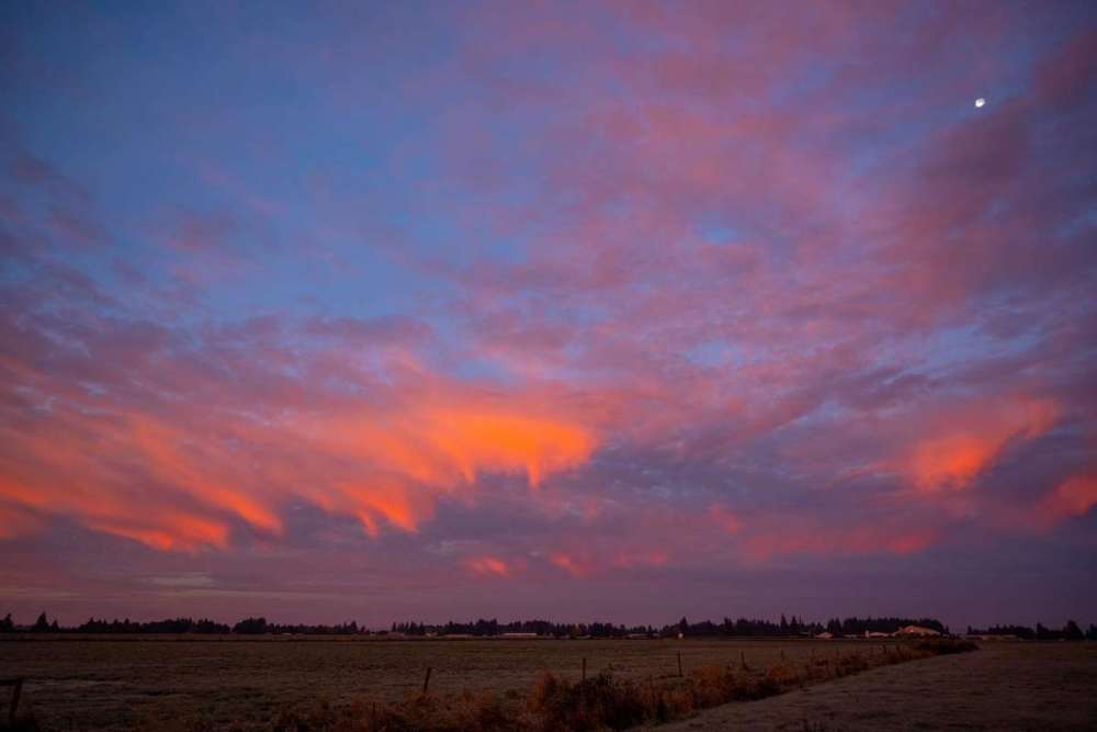
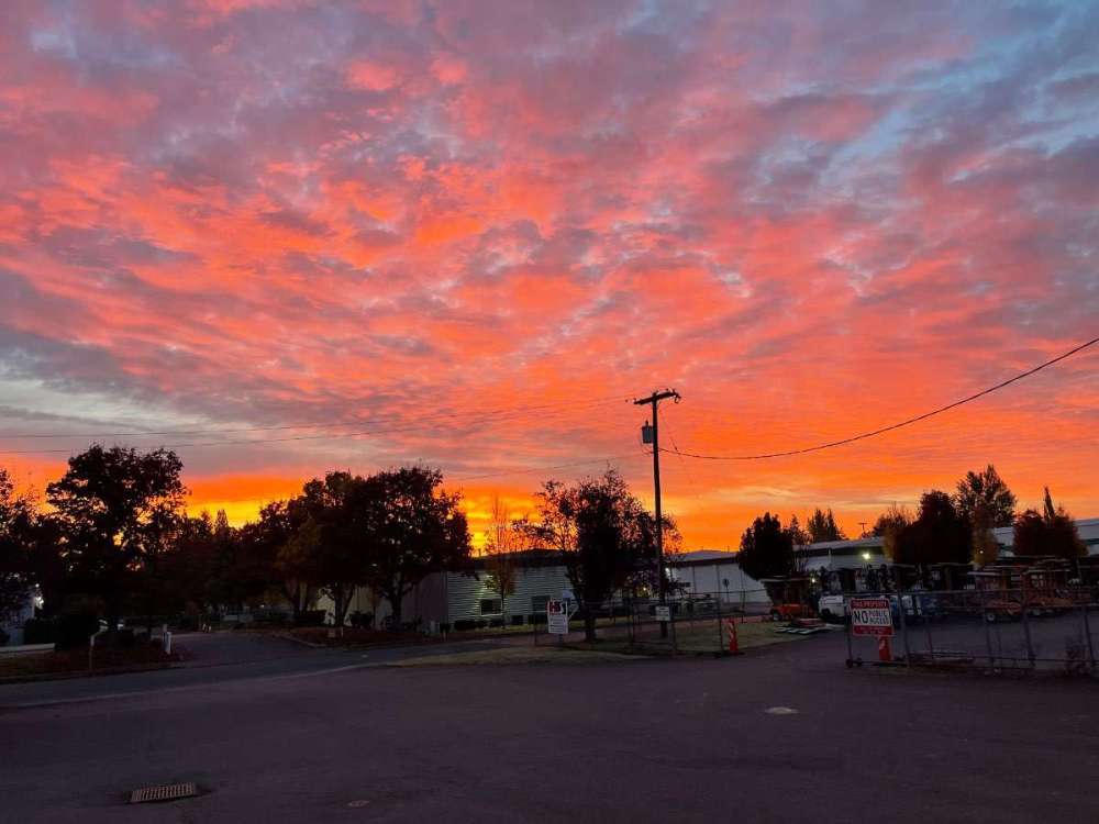
Wow what an epic sunrise! One of the best I remember seeing, especially in October.6 points
-
Yeah the Euro was quite wet.
 6 points
 -
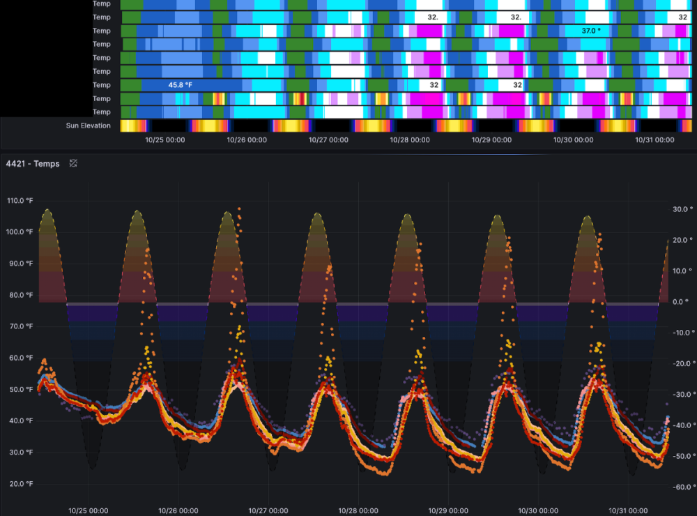
Recent streak of freezes as recorded on the east side of Everett at about 10ft asl. Interesting to see that a sensor about 20ft off the ground bottomed out at 24º but a sensor that was more exposed but on the ground had bottomed out at 28º.
 5 points
 -
I saved this Druncle map last HALLOWEEN (10/31/22) if only (btw: this didn't happen)
 5 points
 -
Winter wx advisory here. Low expectations, but suppose there's enough to justify given the potential for a period of pretty intense conditions and it being the first snow of the season.4 points
-
Went from first freeze to first snowing obs in only 7 days!
 4 points
 -
Eyeballed 3" when I left for work this morning. Definitely more than forecasted. Less accumulation on roads. Nice first taste of winter on Halloween!4 points
-
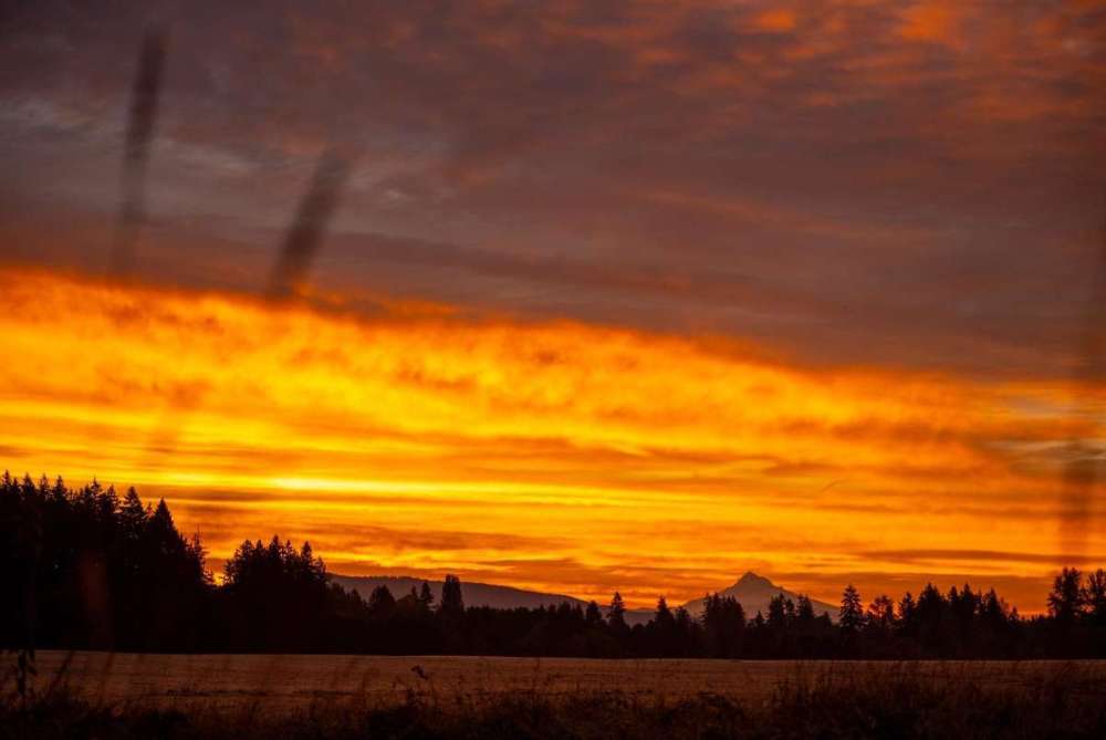
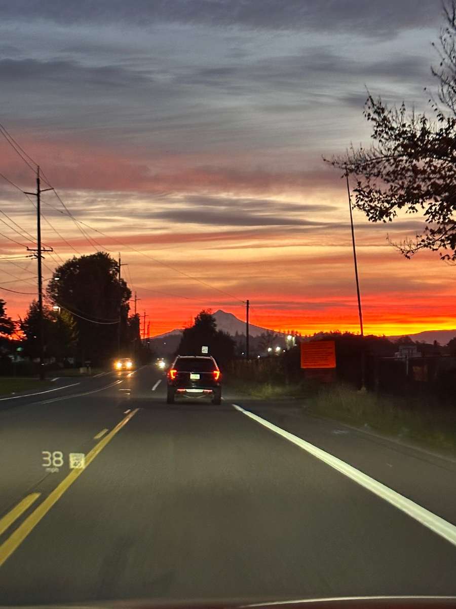
T’was a good one this morning
 4 points
 -
I've been loving these Euro runs! 3-4" of rain here by the end of the weekend would be a great start to an active November.4 points
-
It will be time to flip the calendar over to November. November is the last of the “Fall” months and here in Grand Rapids, MI it can at times be close to a winter month. Here in Grand Rapids the average H/L starts out at 53.6/37.8 and falls to 41.0/28.6 by the 30th. The warmest mean for November is 47.6 in 1931 and the coldest mean is 31.0 in 1951. The record high for the month is 81 on November 1st, 1950, and just 25 days later the low fell all the way down to -10° November 1950 for the record low. November 1950 had a spread of 90° that is the biggest temperature spread of any month at Grand Rapids. On average 7.4” of snow falls in November. The most snow fall is the 31.0” that fell in November 2014. There was no snow fall in 1906 and 1907 for the least amount of snow fall. The average rain/melted snow fall is 2.48” the most for the month is 7.90” fell the least was just 0.06” in 1904. Last year November was a wild month. The mean for November was 40.9° that was a departure of +0.9. There was 2.33” of rain/melted snow. But the month had a record daily high set on the 10th of 75. The low for the month was 18 set on the 19th, 20th, and 22nd. For the month there was 28.0” of snow fall, that is the 2nd most for any November. Daily record snow falls were recorded on the 19th (8.7”) and the 17th (7.6”) and a 2nd place total of 7.0” on the 17th. Now we can sit back and see how November 2023 will plays out. ‘3 points
-
Yessir! A liquor dispenser and mini bar I have set up with Kraken rum, tequila, and Kentucky bourbon whiskeys. Gets me through a lot of schoolwork, Seahawks games, and model riding for the winter . In moderation of course!3 points
-
Amazing sunset pictures! Our neighborhood has kind of died off, still pretty busy but not as much as it used to be. The neighborhood was starting to turn over before interest rates STB. So, some empty nesters were able to sell to young families and get out of dodge. Unfortunately, we got trapped here. My wife and I are not big on Halloween, so we hang out in the back of the house with all of the lights off. Always amazes me that despite the fact we have all the lights off and don't have ANY decorations out, we usually still get a couple of knocks at the door. Didn't get any this year, though I was surprised to see one family was already out at 4pm. A lot of folks aren't even home from work yet!3 points
-
Year seven here and still zero trick or treaters. Neighborhood is all old people and has no sidewalks or streetlights so not that surprising I guess.
 3 points
 -
First snow of the season today…and hopefully many more! Happy Halloween3 points
-
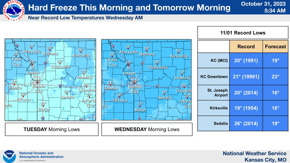
Going for a record low tomorrow morning. This cold has some bite as it looks like the air originated over northern Russia.
 3 points
 -
My old neighbor just sent this… IMG_3257.mov3 points
-
Got down to 31F for our 5th freeze. Doing well so far. Happy Halloween!3 points
-
got down to 20, almost 4 sub 20 lows in a row3 points
-
Here’s the vid… IMG_4765.mov3 points
-
Yesterday I saw my first snowshowers of the season. Did not last too long, but it was great seeing them fall under that gray, ominous cloud. Currently, at 27F under mostly cloudy skies w/ more snowshowers later today and tanite. I do not expect any accumulations. Highs do not get outta the 30s. Tbh: those 70s last week felt real good and now all of this is a shock to our bodies. I wouldn't have mind a few more days in the 60s and 70s. Oh well.....3 points
-
Happy Halloween! The official H/L yesterday at Grand Rapids was 42/34. There was a trace of rain fall and no snow was reported. The sun was out 17% of the time and the highest wind speed was 31 MPH out of the W. The current temperature here in MBY is 36 degrees with cloudy skies. So at this time any snow that falls will not stick unless it falls very heavy. Now as for some past Halloween weather conditions here in Grand Rapids The average H/L is 54/38 the record High is 79 set in 1950 and the record low of 20 was set in 1988. The wettest was in 1994 with 1.27” and the most snow fell in 1917 with 1.5”. Some other years with snow fall are 2017 with 0.4” 1932 with 0.3” and 2019 with 0.1” The coldest high was just 32 in 1917 other cold highs were 37 1996 and 1906 The high has reached 70 or better on ten Halloweens the last time was 1979 with a high of 76. Last year the H/L was 59/49 and there was 0.09” of rain fall.3 points
-
GEFS looking better for you to get some precip over the next 10 days hopefully things will get a little wetter for ya.2 points
-
We're a bunch of slackers now without your supervision!2 points
-
Temps drop nicely under the snow shield:
 2 points
 -
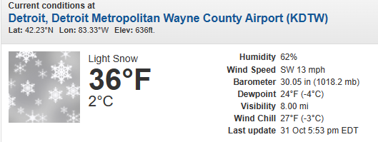
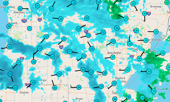
Must be quite the memorable Halloween. I was up there not too long ago (September), and folks were beaching and swimming. 000 NWUS53 KGRR 311846 LSRGRR Preliminary Local Storm Report National Weather Service Grand Rapids MI 246 PM EDT Tue Oct 31 2023 ..TIME... ...EVENT... ...CITY LOCATION... ...LAT.LON... ..DATE... ....MAG.... ..COUNTY LOCATION..ST.. ...SOURCE.... ..REMARKS.. 0242 PM Snow 1 SSE Grand Haven 43.04N 86.22W 10/31/2023 M6.8 inch Ottawa MI Broadcast Media Snow ongoing.2 points
-
18z NAM-12K liking my area about 7 pm, as said after sunset.2 points
-
Most certainly a "rare" map, and not just for Halloween! Left work at 4:45, hit first flakes 1/4 mile down the road.
 2 points
 -
LOT issued a rare Winter Weather Advisory for LES in NE IL. 1-3” expected…interesting…2 points
-
Oh man, it’s going to be one of those seasons where I’ve just got to add your ip to the table for a solid six months.2 points
-
Getting a little more interested in the lake effect setup around here this evening/overnight. The airmass looks cold enough/I think I'm inland enough for precip type to not really be a concern. My main question is how transient it is. Hi-res models sort of want to hang the band up around here or a bit east. Anybody that can manage to get a couple inches could start to have some problems as many trees still have significant foliage.2 points
-
Quite the LES event for places NW of my area about 30 -60 miles. Nothing here. But checking Muskegon Webcams looks like they are puking snow. I'd expect record snowfall in that area. 6" plus.2 points
-
Estimated annual snowfall is only 20-30' up near Cathedral Peak which is a decent amount, but not overwhelming. Too far east to get the good snowfall. Now, where I would really love to see a weather station would be up in the Fairweather Range (even if that's not technically the PNW), maybe around 8-10,000'. Based on annual precipitation amounts that area probably picks up 10-13 meters of precipitation a year almost all of which must fall as snow. So probably 100 plus meters of snowfall or more than 400' of snowfall (4-5,000"+) annually. Makes a good candidate for the snowiest location in the world although 15 meters of water equivalent snow accumulation has been measured on the Southern Patagonia Icefield (Tyndall Glacier) so that may surpass southeastern AK. Closer nearby, the mountains of Vancouver Island (specifically near Triple Peak northeast of Ucluelet based on PRISM analysis are estimated to pick up 12-13 meters of precipitation a year which would also be cool to see on a weather station.2 points
-
I got a question for y'all. If you could set up a weather station anywhere in the PNW, assuming the last century or so of records being accurately filled in, where would you put it? I'd love to set one up near Cathedral Peak up by the border in the north Cascades. Good Arctic access, high alpine Cascade climate. Probably one of the more wild locations for snowfall in the world.2 points
-
Another red Phil by morning…Front Rangers take warning. Had a low of 34. Frost on the roof.
 2 points
 -
SUNRISE ALERT FOR CLARK COUNTY!2 points
-
Snow has just started here. But it is still warm with a temperature of 38. Whoops just like it started it has now stopped snowing so will call it a snow shower.2 points
-
Please don’t automate posting to this forum. Offenders will find their accounts limited to 2kbps between September and April.2 points
-
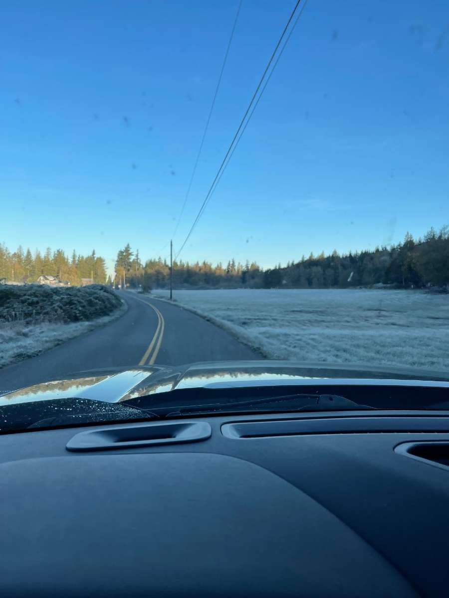
38 currently. Forgot I had taken a few frosty shot on the way to work this morning.

 2 points
 -
2 points
-
Winds are raging outside tonight. 2 hours ago it was nearly calm when the kids were candy hunting.1 point
-
Back when I frequented this forum more, these threads would always appear a week before the month started. You guys need to step your games up1 point
-
That Patagonian ice field is something else. Such a stupid amount of snow accumulates there that it spills over helplessly on all sides. That looks like an area that will always recieve ridiculous amounts of snow, no matter the climate situation or the winter weather pattern setup. Triple Peak is an excellent choice for our area. I chose Cathedral Peak due to the better access to Arctic air and fluffy powder. Some of the stations to the west even around 7k ft have a problem switching over to rain from time to time during the winter. That'll almost never be an issue as far east and high up as Cathedral Peak.1 point
-
How many left wing radicals have shot up a synagogue and killed 12 worshipers in the last 10 years?1 point
-
The 2023-24 Willamette Valley Winter Weather forecast is out. This was presented at the Winter Weather Conference hosted by the Oregon Chapter of The American Meteorological Society (AMS) and thank you again for hosting me, and all the other forecasters. Predictions only: https://youtu.be/8qIO35TdZ-o Technical version (same presentation as the conference): https://youtu.be/jPNRjI5NoIs A full report (22 pages) is in the description (link wise) of the technical version.1 point


This leaderboard is set to Vancouver/GMT-07:00