
Leaderboard


Popular Content
Showing content with the highest reputation on 11/16/23 in all areas
-
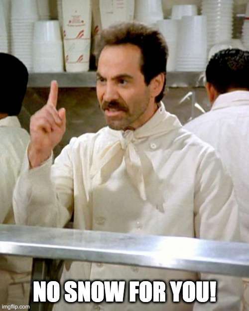
This is the first time i can remember in ten years not having snow on the ground over at the cabin this late.10 points
-
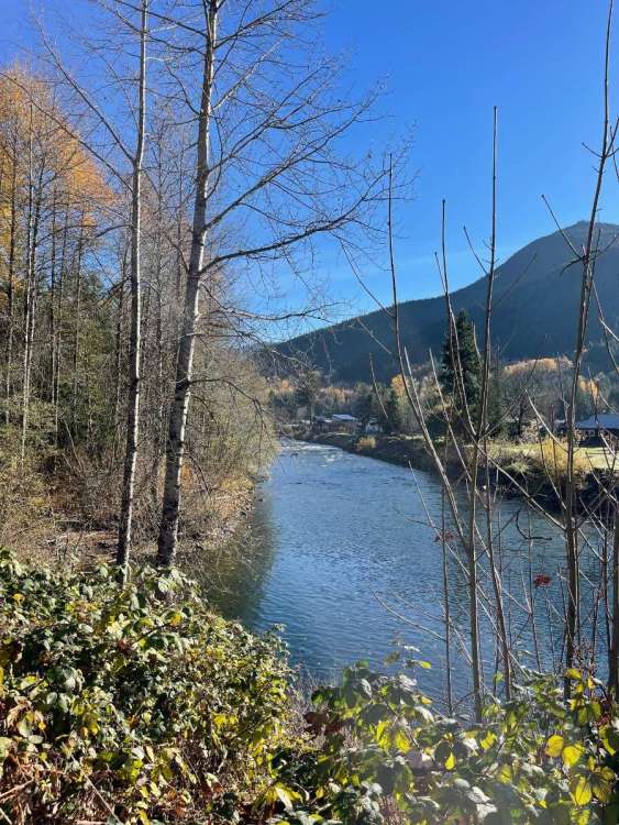
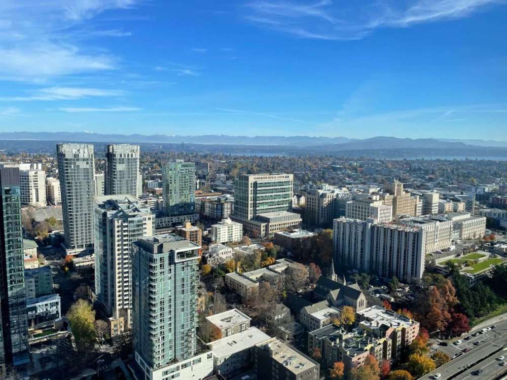
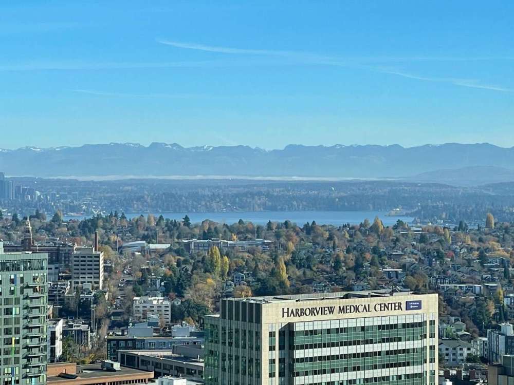
Skykomish loveliness!
 9 points
 -
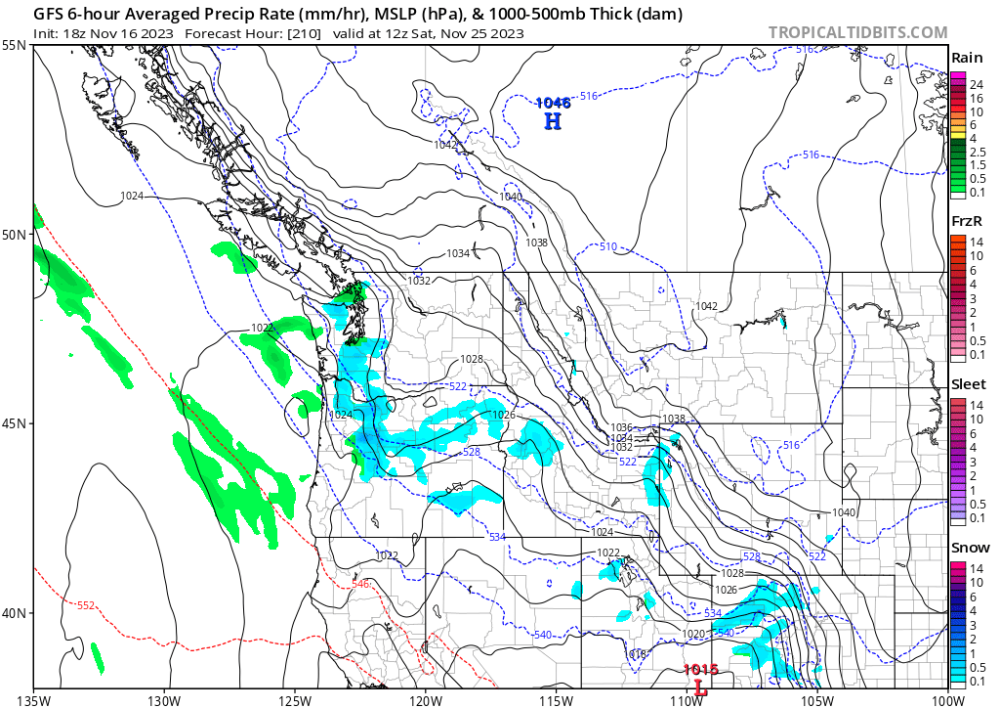
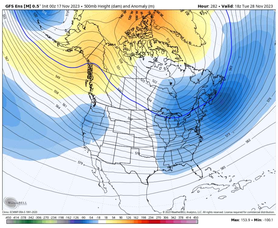
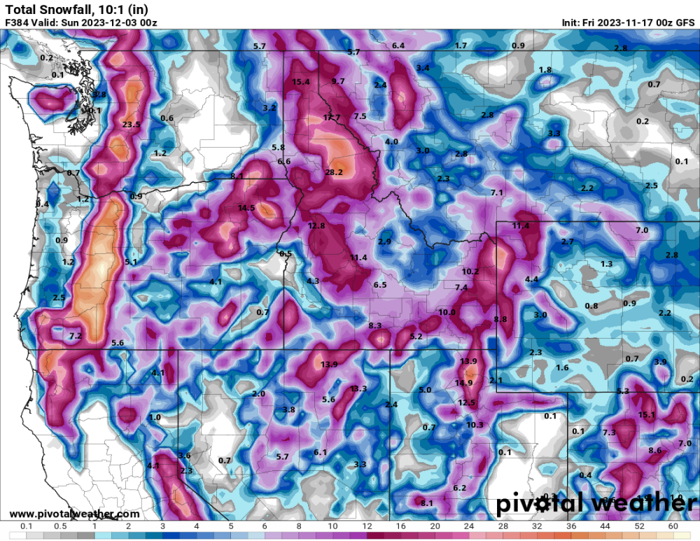
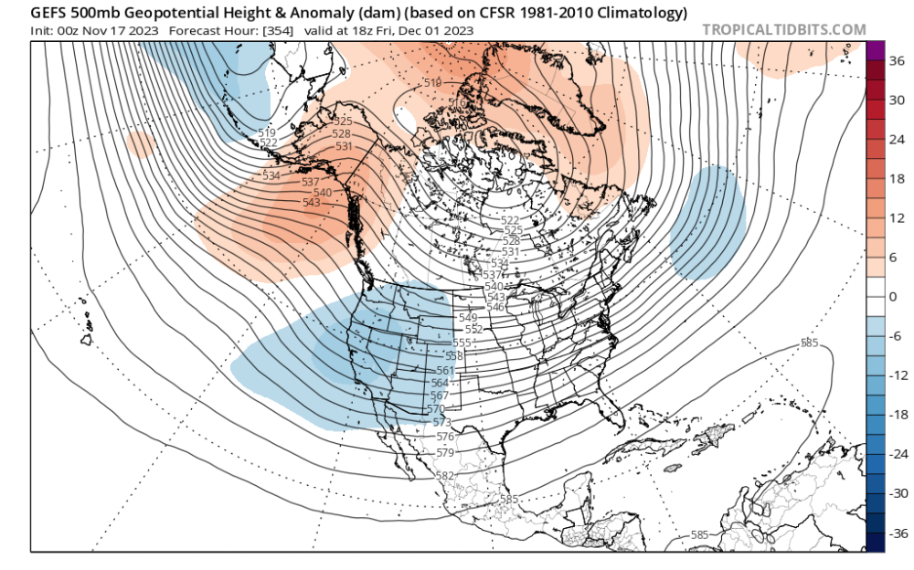
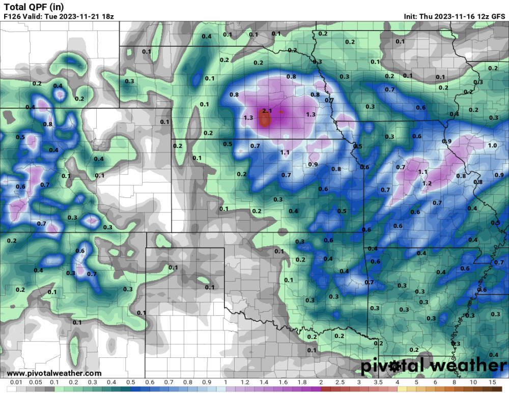
Ready for more long range bait!
 8 points
 -
HOLYf*****GSHIT!
 8 points
 -
Potential is there. Thanks for being such a positive part of my life, guys.6 points
-
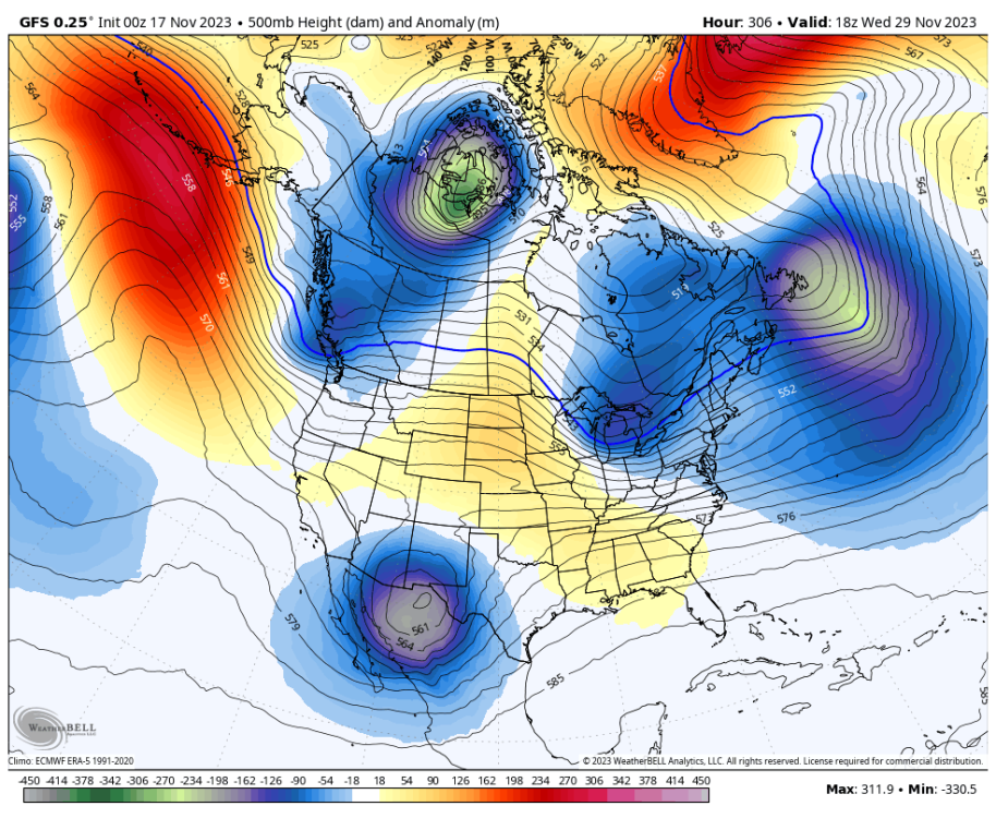
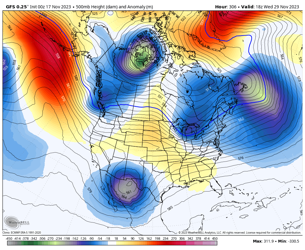
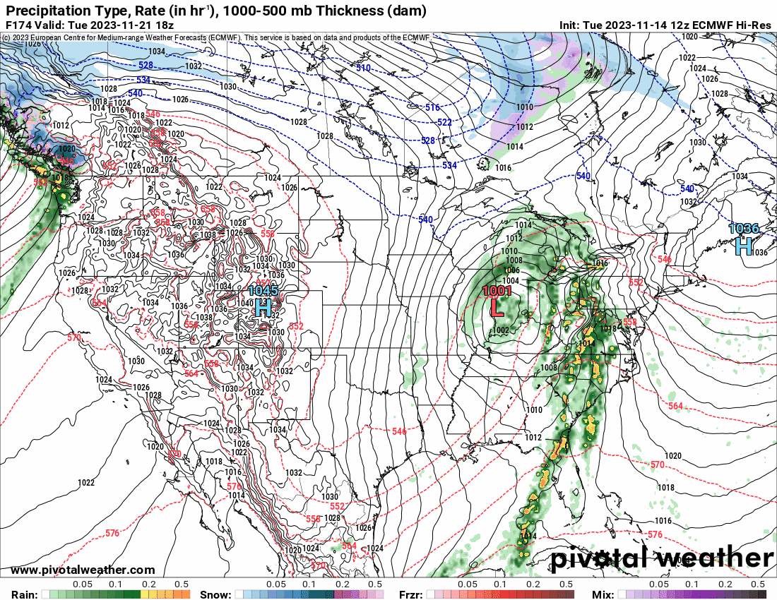
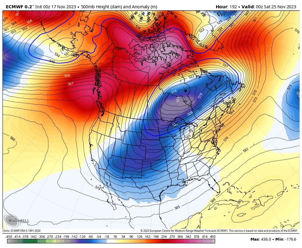
00z Euro shows a much stronger ridge which given the placement, tilt and how the energy is shunted well back northwest of Hawaii MIGHT be susceptible to retrogression. Hmmm.... If not, realistic potential for a robust cold pool.
 6 points
 -
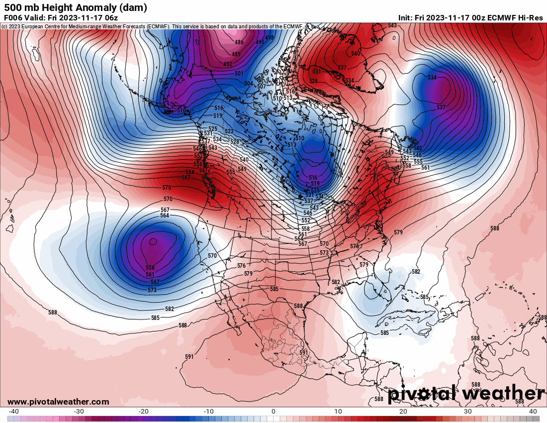
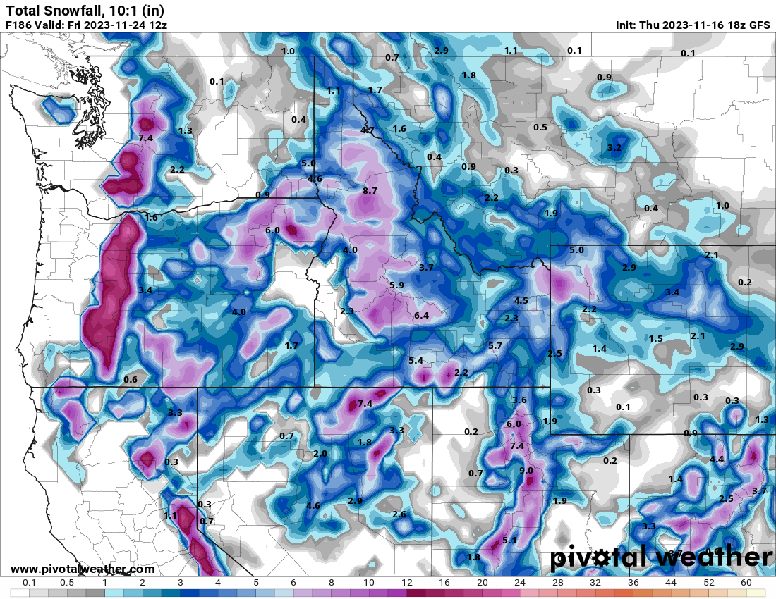
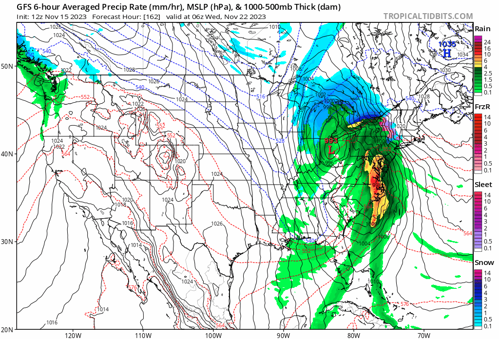
Looks like the GEFS looks better in the LR
.thumb.png.790c51ab2569178643e89344f42cf86e.png) 6 points
6 points -
I was on east coast weather twitter and they are expecting a cold PNW for December and are in full weenie mode! LFG6 points
-
Extrapolate out to day 20 and things might get real interesting6 points
-
In our dreams. Although not that yet cold at that hour actually. Alaska ridge off the scale strong.
 6 points
 -
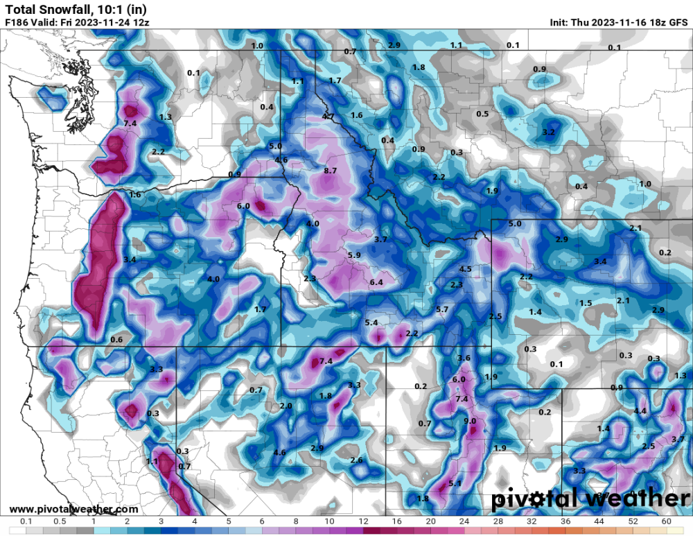
Not too bad for the bachelor area. Hopefully we can get atleast a 20+ inch depth by opening day. I remember one year it opened on 18", that was pretty awful. Current snow depth 8", GFS says 1½ feet from now to opening day. Even if there isn't enough snow by then, atleast it'll be cold enough for the snow guns. Can't wait till they open, so I can finally start working.
 6 points
 -
10 dayz awayz
 6 points
 -
Throw up a W in the chat for Tiger
 5 points
 -
5 points
-
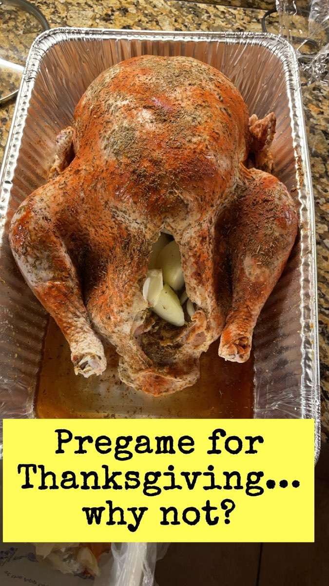
In the spirit of our upcoming Thanksgiving Holiday, I decided to pregame and freshen up some skills so I just put this 21lbs bird in the oven! My neighbors will certainly be smelling the aroma of the Turkey
 5 points
 -
I haven’t seen my barber in 3 months and my hair is getting quite long!!! Fuzzy caterpillar sign ? I hope so lol….I need some fun weather action ASAP!

 5 points
 -
Down to 31 here.4 points
-
Not bad
 4 points
 -
It’s coming! Again!4 points
-
Got to try that when we have a highly anticipated run going.4 points
-
Getting close to my door step. East Kansas and KC peeps will approve.4 points
-
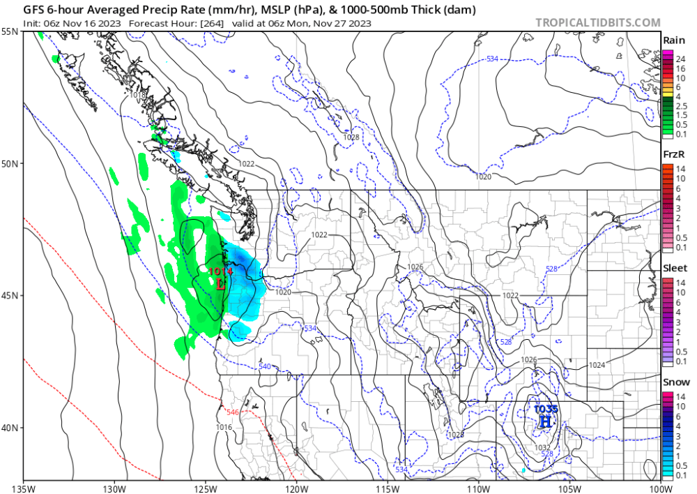
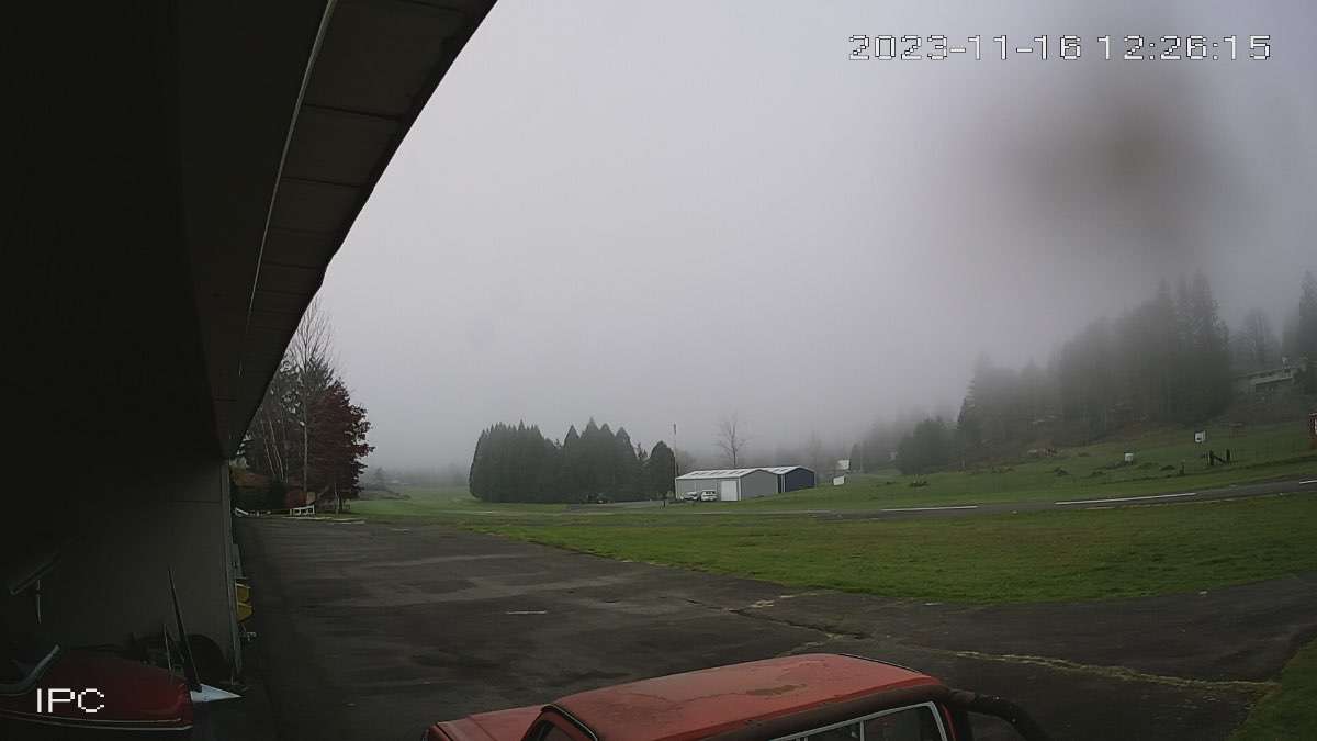
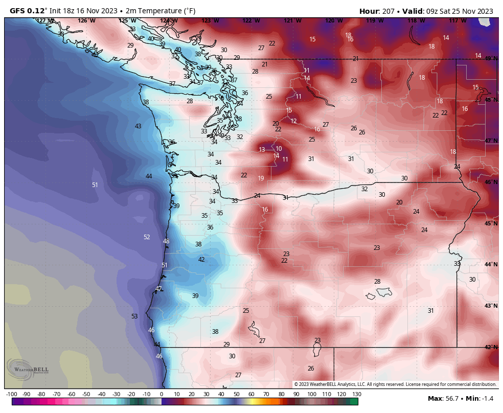
Looking out your way I can just barely see the top of some fog in the lower snoqualmie valley. here’s the fall city airport cam that still looks fogged in http://www.1wa6.com/cam_west_big.html
 4 points
 -
Cannabis Indica would do well there I bet4 points
-
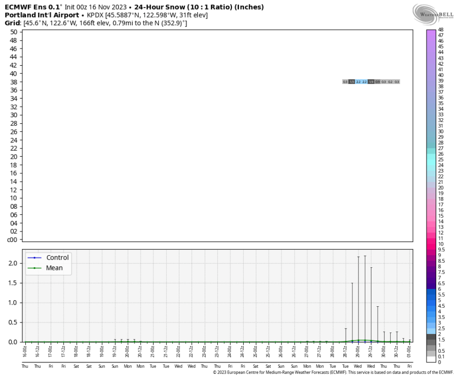
Lock that PDX snow in!
 4 points
 -
The GFS showing a nice little drink of water down here I will take it!
 4 points
 -
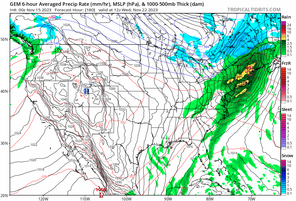
Looking at the latest global runs, all 3 have a strengthening SLP of roughly mid-990's around/near The Mitt Tuesday the 21st into Wednesday the 22nd. GEM likes a more western track shooting up over ORD and is the most aggressive with the cold air push and interaction. Thus the better event for LES belts. The Euro was heading that way with track, but latest run went further east more over DTX or even CLE like the GFS has been insistent on showing. Latest EC is showing the cold air advancing more rapidly than prior runs so that's a move in the dynamic direction. Would not be outta the question being later November and by climo that the UP and/or NMI higher elevations could be in for an early season smack-down.

 4 points
 -
The first half of November is over and TOP has officially received 0.01" of precip for the month...basically nothing. The dry weather should continue for at least the next three days so that would make the first 18 days in November with essentially no precipitation.
 4 points
 -
Sadly, on a less positive note for Michiganders. It has been reported that snow/snowmobiling Yooperland Met John Dee died this past Tuesday at the fairly young age of 57. No mention of cause. He was a legend with the snowmobilers that followed his sledding forecasts and seasonal outlook. He'll be missed for sure. Iirc, he originally worked in SWI as a Met but his love of the white gold led him to move to the W UP of Michigan. He and his family had a place that he was building on his wife's grandparent's homestead near the base of the Keweenaw peninsula. RIP fellow winter enthusiast!4 points
-
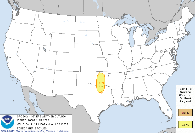
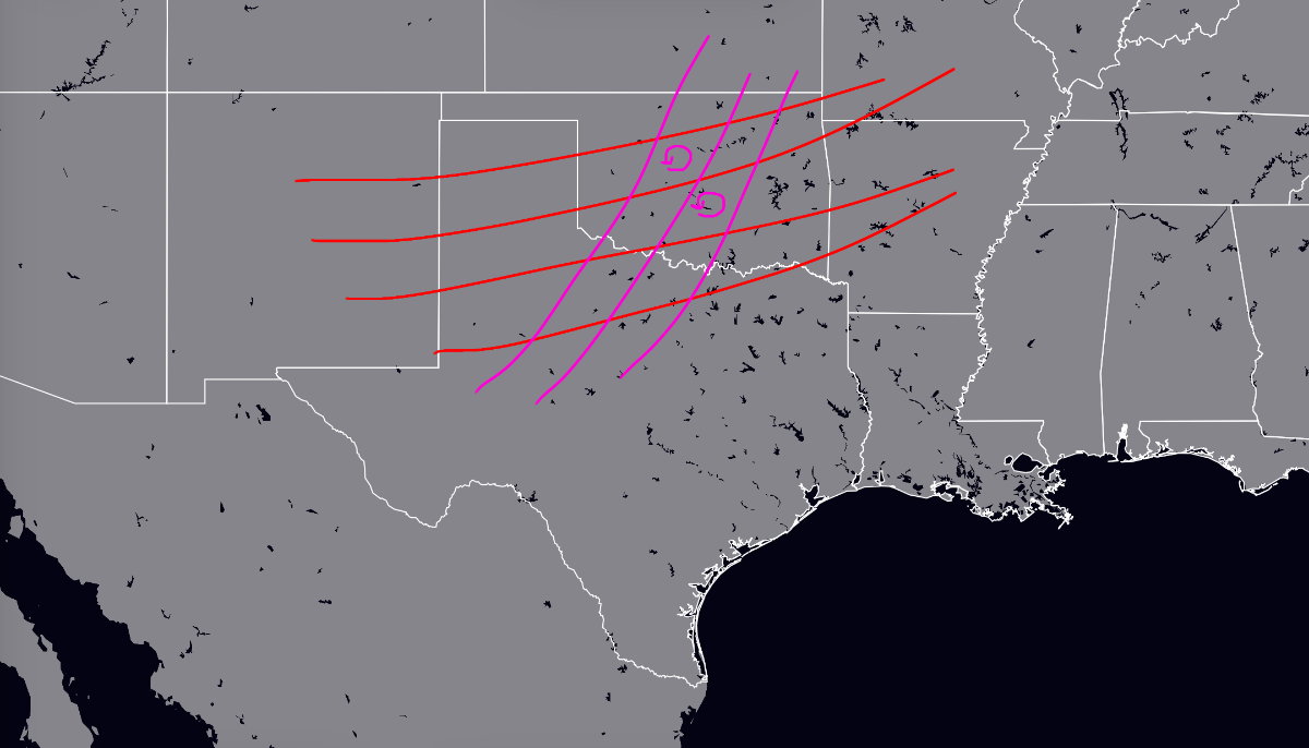
Just saw this from a Discord server, TORNADO THREAT!? Red is 500 mb wind direction, and purple is 850 mb wind direction
 4 points
 -
@Andie@Black Hole@OKwx2k4
 4 points
 -
The party is over after this weekend. Mid next week will be a big slap to the face.4 points
-
Not sure on what metric it would beat out June 2021. There are really no truly comparable events to that three day heatwave. There are many comparable events to 12/90 and several that trump its intensity.4 points
-
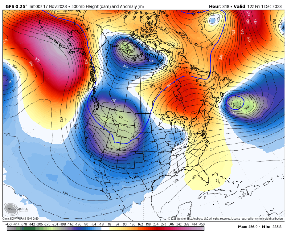
00z vs 12z comparisson. Going somewhere?
.thumb.png.7f2f28b17ebab4b98eff2c2b6248ee64.png)
 3 points
 -
In the GFS we trust. I trusted the Euro and look where it ended up.3 points
-
Post Thanksgiving looking cold and potentially snowy around here. Some of my fondest memories are snows around the holiday. Being stuck for 3 days at our grandparents during the Thanksgiving weekend blizzard of 1983 was so fun as all the relatives were there. I was a little kid, but still remember building snow forts and tunnels in the large snowdrifts.3 points
-
Nice 18z trends.3 points
-
My wife is going to Winnipeg next week. Looks like it’s going to be cold.3 points
-
Looks good for y'all up north!
 3 points
 -
Here's my final winter call for Chicago (ORD)... Temps (only DJF): 0 to +1 Snowfall (total): 28-35" Bonus prediction: 2 to 5 days below zero Main change from my initial thought was to go colder. I don't think that this Nino will reach +2.0 on the ONI, but even if it somehow does, it's not like the super Ninos of 1982-83, 1997-98, 2015-16 and so I cautiously lean away from those kind of torchy analogs. Even though my call is for not too far from average temps, I believe that it will be a winter of pretty big fluctuations that will more or less cancel out. Out of DJF, my guess would be that December is the month that comes in warmest relative to average but I don't have a strong feeling on that one way or another. Obviously when it comes to seasonal outlooks, there's typically going to be bust potential in both directions since you put forth the scenario that you feel is most reasonable. So, a warmer, colder, snowier, or less snowy outcome is all possible and nothing would really shock me. This winter has some rather unique forecasting challenges and it will be interesting to watch things unfold.3 points
-
I wouldnt have the time for a veggie garden either if I had 8 kids with two more on the way.3 points
-
Been waiting for a good Fall blow. Haven't really had one yet and hopefully this one won't weaken as time approaches.3 points
-
3 points
-
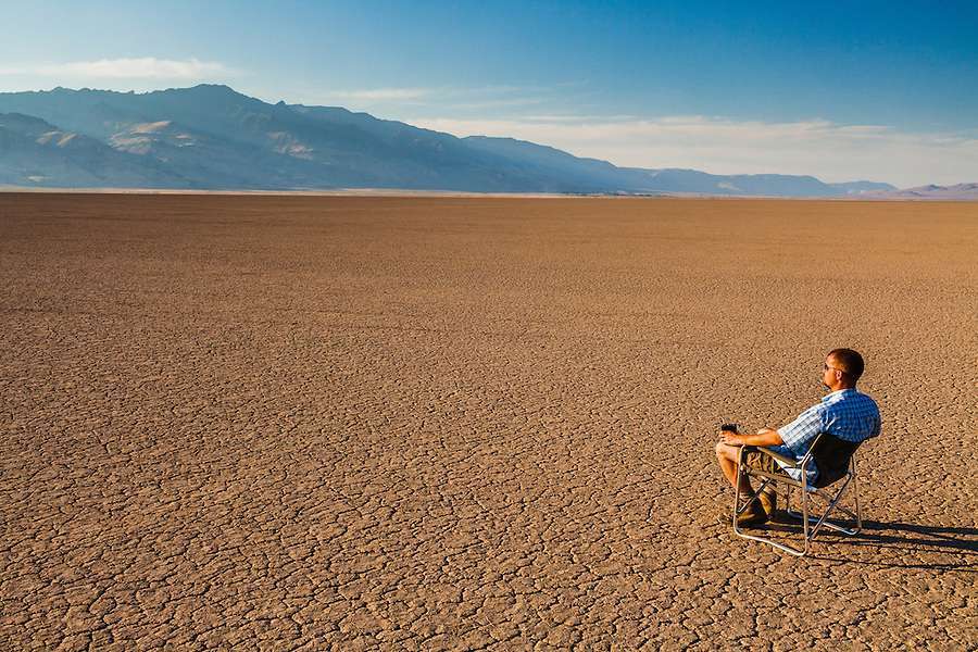
Need this so bad! We are starving for moisture in my area. I haven't seen over an 1" of rain in over 2 months.3 points
-
I mean if you're going to be that guy who needs to act like a condescending sage of ENSO, try harder as someone from North Bend has nearly two decades on you.3 points
-
i think we'd all appreciate it if you could run like an antelope and get on out of here until your attitude improves3 points
-
It’s not even winter yet.3 points
-
Storm Thread fired up...Giddy Up!!!3 points
-
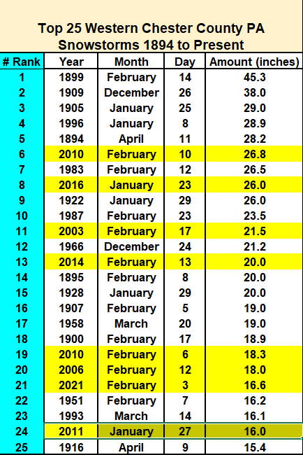
Well it is getting closer to that time of year for a snow history repost. So what are the largest snowstorms in Chester County history? See the top 25 below. Of interest...8 of the top 25 storms have fallen since the turn of the century in 2000.
 3 points
 -
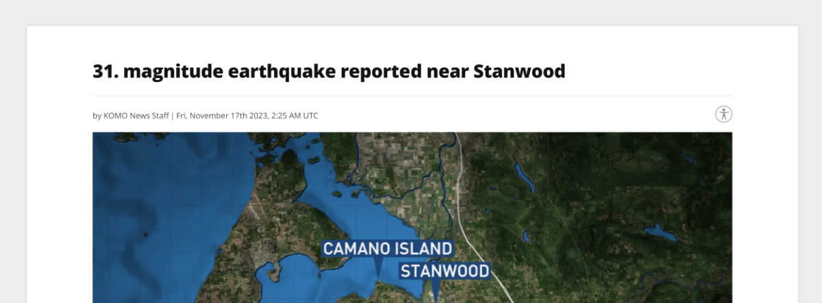
Wolrd record earthquake reported in Stanwood tonight https://komonews.com/news/local/31-magnitude-earthquake-felt-near-standwood-washington-camano-island-quake-disaster-preparedness#
 2 points
 -
I personally don't see this season as "locking in" like 2013-14 for instance. We may get a solid month if a Feb 2015 situation wants to repeat. Most of the cited analogs toggled back and forth between mild and wild and that would be my call for 2023-24. Ofc, there is always that location that does the best under both regimes and/or scores multiple storm tracks. I'd like to think that could be my region as we did in the analog 04-05 but only time will tell. Looking good for your region to have some excitement too.2 points
.thumb.jpeg.e3014abf99ef08a9f9ac2c0cd31b485b.jpeg)


.png.b2ea0caaf28957da38047f3001467f17.png)


.png.081e3e56d9f34dc0190302efc0604031.png)


This leaderboard is set to Vancouver/GMT-07:00