
Leaderboard


.thumb.jpeg.e3014abf99ef08a9f9ac2c0cd31b485b.jpeg)
Popular Content
Showing content with the highest reputation on 02/22/24 in all areas
-
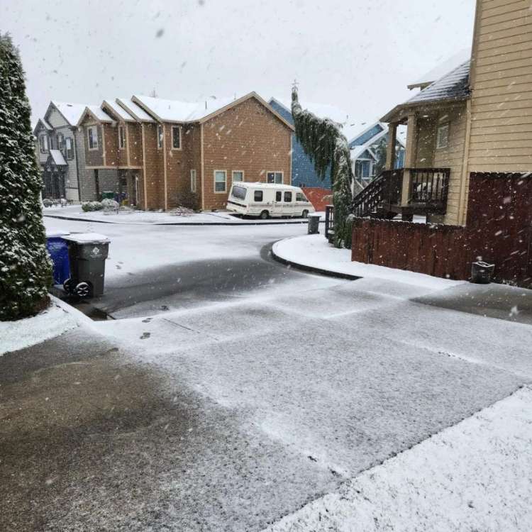
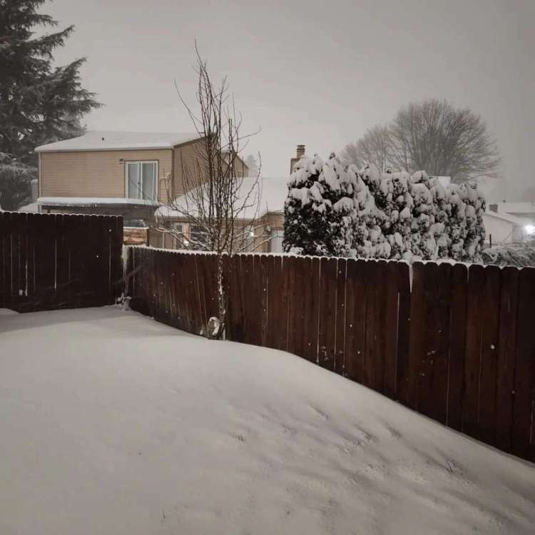
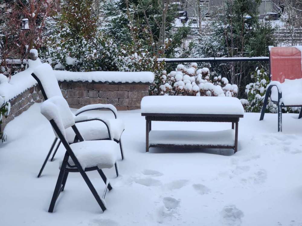
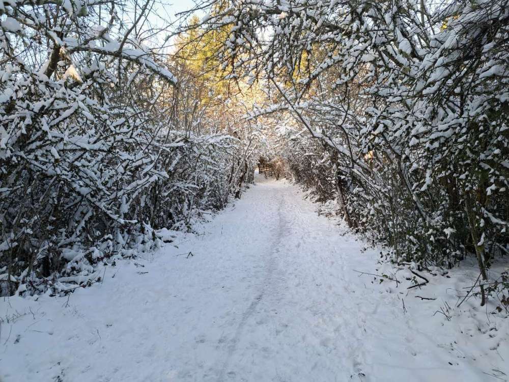
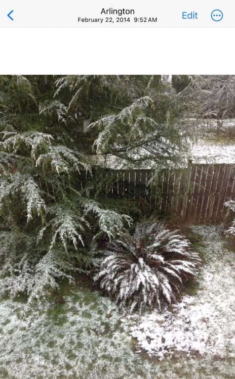
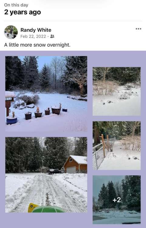
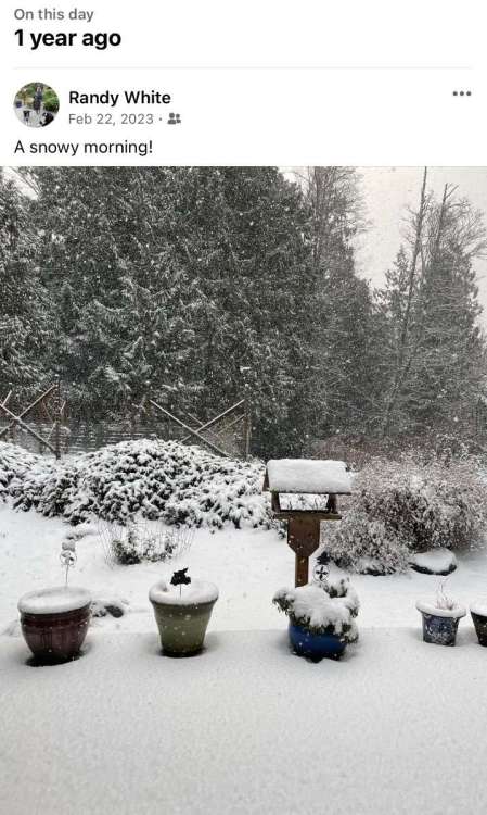
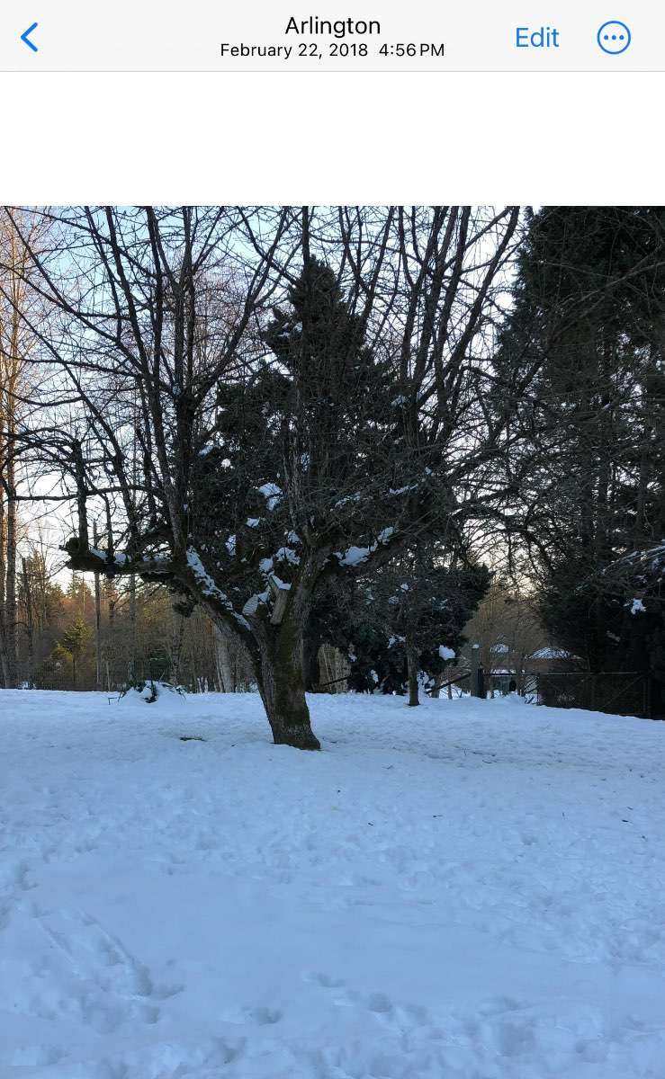
This is what it looked like one year ago today. We had a foot of snow at my place. This storm was incredible
 14 points
 -
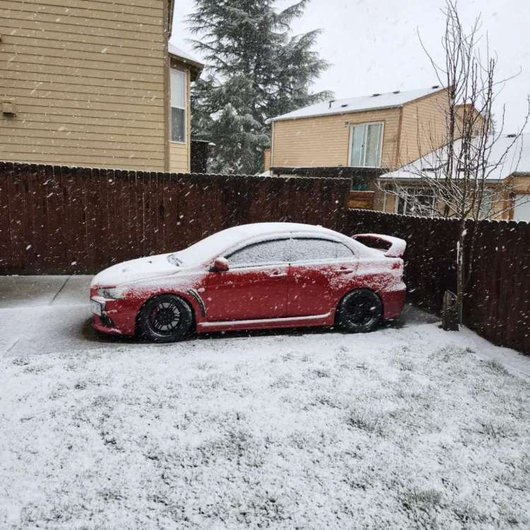
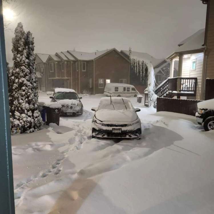
Started snowing around this time a year ago. At this point parts of Portland already had received a foot of snow, so I was bit disappointed when we had 2" from the first wave and precip stopped. But then some extremely heavy snow overnight brought us up to 6-7" of powdery snow. And then a subfreezing high on the 23rd! 20230222_170815.mp4 20230222_170815.m
 12 points
 -
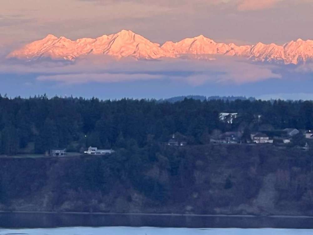
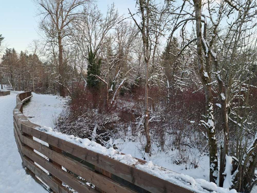
Some snow on the Olympics this morning.
 12 points
 -
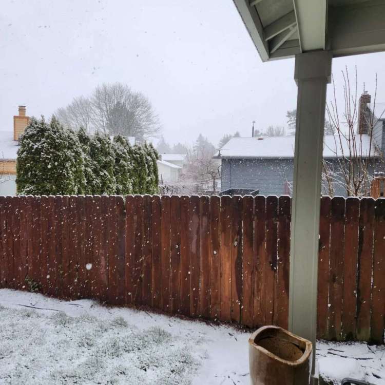
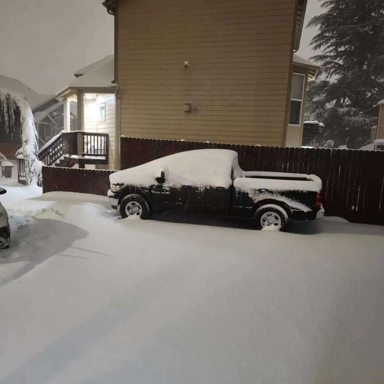
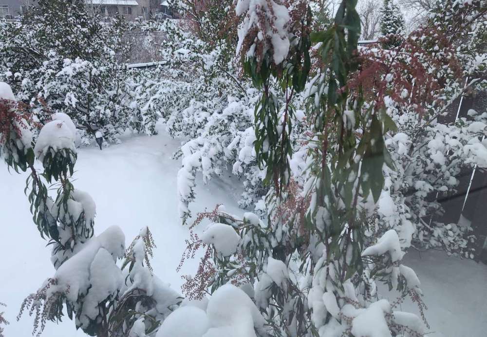
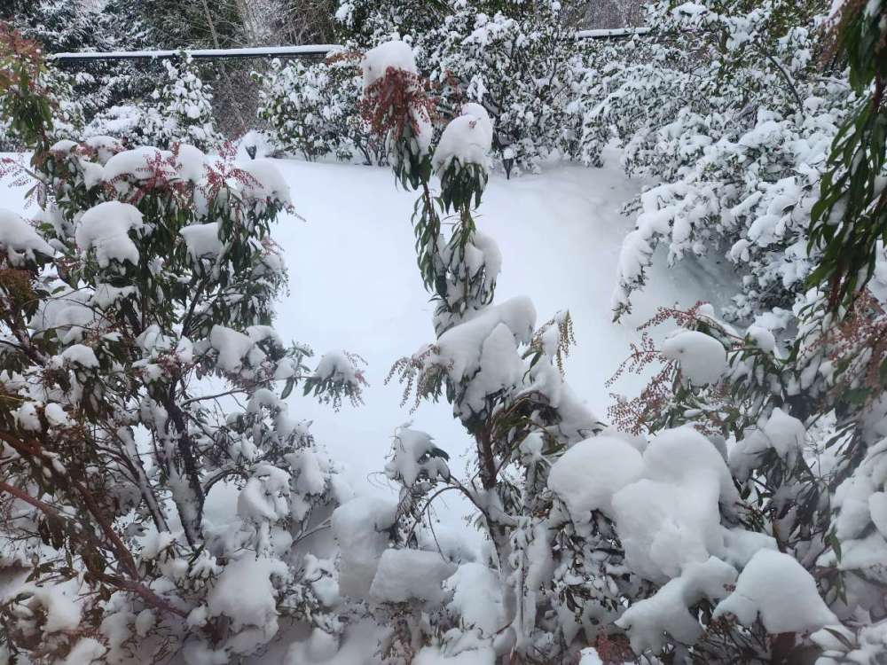
Since I wasn't on here a year ago, I'll post my pics from last year's snow. Oh, and crazy me ran 8.5 miles the day after. 9" in Sherwood that storm fell, 7" is what was settled (I did hourly measurements and noted some loss to blowing). The night pics were about 1/3 through (2 am) It was only 1 of 3 times I pulled an all lighter (grad night and a flight to Paris that got delayed was the other 2). Also, I believe a good chunk of you called a snowstorm, but using my forecast videos, it did feel odd trying to go off alone compared to the TV forecasts (but not here), and sticking to my guns after E. Metro got the deformation band/convergence zone in saying Washington/NE Yamhill County will have their turn from 11-7. In all fairness, while I forecasted that convergence zone/deformation band well ahead of time (48 hours), I underdid precip maxes (said 3-7" in the main zone with the 48 and 24 hour notice, 4-9" with isolated to 12" was my day of adjustment) and completly missed the east metro area (even though I was more aggressive than TV, saying 1-3" vs the consensus 0-1"). Never used the snow maps on that event since on a stalled low, they're useless anyways. A good blip in the middle of (then) depression. Edit: recap video I made: 20230223_033248.mp4
 10 points
 -
Amazing eastward trend with trough number 2 right now.10 points
-
Non event. At this point I don't know why people would be rooting for cold and snow given all of the damage it can do in early spring.10 points
-
I'm so confused... That first trough still looks great? With lots of marginal snow chances. Were people on this forum rooting for the models to send that deep Arctic air into the region? And that's why people are mumbling about a "rug pull"? Becuase from my eye, and I've been paying attention for a few days, models haven't really changed at all from yesterday, at least for Washington. Definitely not for Jim. Maybe some waffling in the precip/sfc pressure department but we all know those specifics are a coin flip more than a few days out. Mountains look to get some decent insurance right on time at the end of the season. The second trough in the LR is highly up for debate and could be subject to Niño-fication as it approaches the short range, perhaps trending towards more GOA-spillage and the reintroduction of BSF into our region. But the move towards relatively colder MAMs in recent years makes me believe the big carving out trough solution could be real.8 points
-
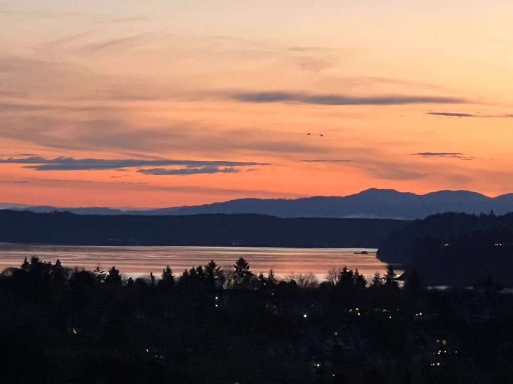
Beautiful evening.
 7 points
 -
7 points
-
MossMan special.
 6 points
 -
Getting into NAM range now! NAM is showing a little convergence zone over the King/Snohomish county border.
 6 points
 -
No matter how you slice it…Next week will look and feel like winter should!6 points
-
6 points
-
6 points
-
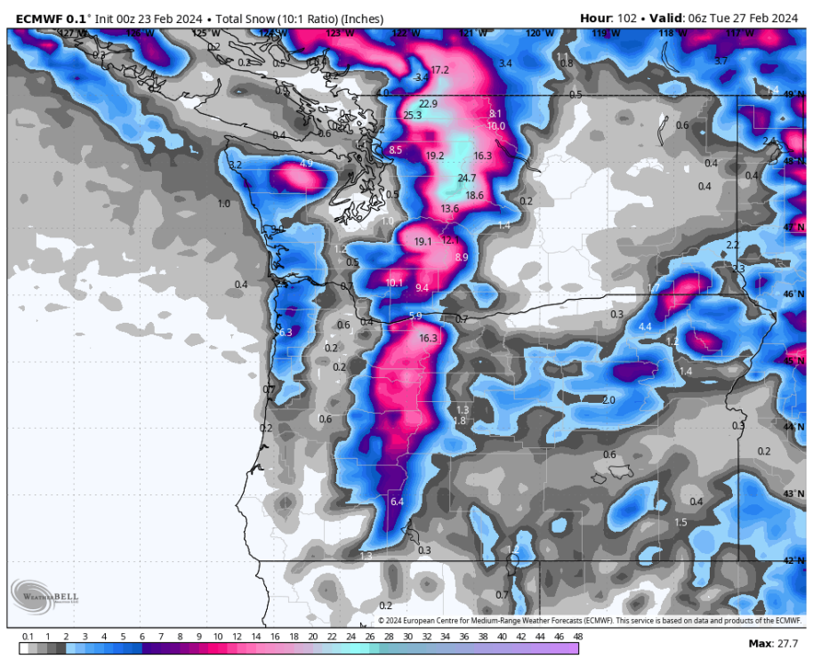
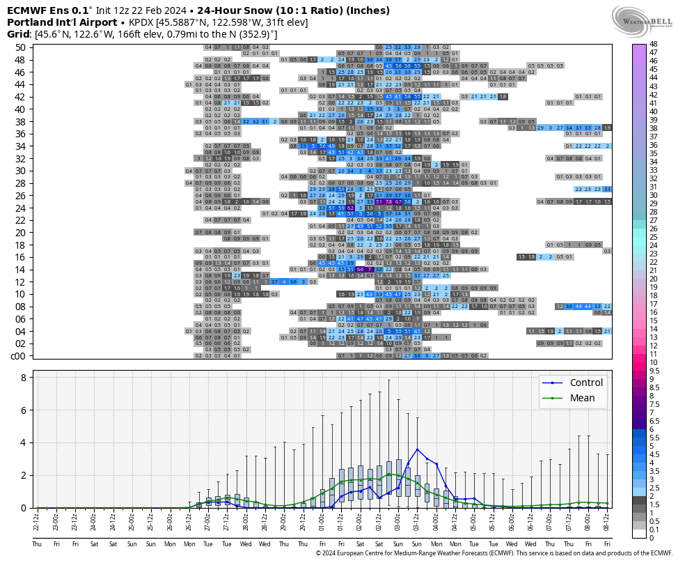
12z ECMWF was great, here's the 10:1 ratio map. Anyone got the kuchera?
.thumb.png.c1ddbc281a45c8128435dc0715d4abdb.png) 6 points
6 points -
Just a tad of uncertainty regarding the second trough.6 points
-
That’s good! Beneath the friendly trolling, I’ve always meant it when I say I’m happy for anyone that sees snow. It’s a precious commodity these days. I wish you guys could read my mind so you’d see that I legitimately pull for you all every winter. I’m just messing with Randy because he’s in the screw zone after trolling me relentlessly for years. If there’s one thing I’ve learned in this lifetime it’s that karma takes no prisoners.6 points
-
First trough looks great on gfs and the second is colder and faster. Still looks great.6 points
-
That's classic QPF waffling though. What you were looking at was a weak low/shortwave embedded in a much larger trough, over 100 hours out. That was never more than a transient feature up for scrutiny. It could still realistically come back, too. Or more likely, models will pick up on a new different feature for snowfall. The flipside of the whole deal. Also the GFS still shows spotty light snow Monday night.5 points
-
Must’ve been one hell of a lightning strike. “Structural damage to foundation wall” due to concussive effects..oof.5 points
-
4 day snow totals at hour 213. Looks pretty real. 850s hover around -7 over SEA for a good period of time.5 points
-
The GEFS is going kind of OMG on the second trough. Mean 850s on the second trough below -6 and still falling before this month is even over. I'm going to stay optimistic for now in spite of the rug pull on the Monday night snow here. I just get so frustrated with this locations sometimes.5 points
-
Good. Mountains need it5 points
-
If that comes true I could beat out Phil for the seasonal total!!5 points
-
Lots of precip overall!
 5 points
 -
Seems like we it was never going to be possible to score on both troughs. When first trended better second trended worse. Now it’s reversed.
 5 points
 -
This is the pullback.. tomorrow it will show everyone with 6in+4 points
-
Long range icon is improving.4 points
-
Icon gif.
 4 points
 -
Nope, I've had it between 75 and 80. But my area averages 94 inches, so it's usually unfair to compare Leavenworth to other areas.4 points
-
I like your optimism4 points
-
If you have any elevation you’re gonna get pounded with this setup. With the heavy precipitation rates, the snow level will likely drag down to sea level at times. Everyone should get in on the action at some point.4 points
-
Stronger CZ Sunday night in South Snohomish/North King Counties on the 18z.4 points
-
That mid-week atmospheric river looks like a jackpot, especially for the Cascades. It's rare to have a strong AR like that with the snow level remaining near 3,000 ft for the entire event (and then collapsing down to 1,000-1,500 ft in the postfrontal period later in the week). 3-6+ inches of SWE is a big deal in a bad snow year. Remains to be seen if something will spin up in the right spot in the cold sector at the end of next week.4 points
-
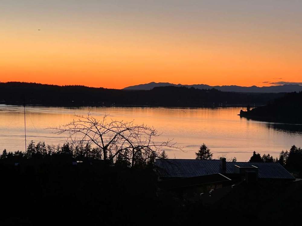
Lovely day!4 points
-
Back to an anafront situation late next week on the 12Z ECMWF.4 points
-
Western Washington NWS forecaster discussion: The upper trough will move over western Washington on Monday for cold air aloft and post-frontal onshore flow. Convective showers will be around on Monday. Given the colder air aloft, snow levels will likely drop towards the surface, particularly in heavier showers, allowing for snow or rain/snow mix for areas of the lowlands. Given the convective nature of the showers, it will be hard to pinpoint the exact location of any rain/snow mix at this time, but a favored area late Sunday night into Monday morning looks to be any convergence that develops in the vicinity of Snohomish County. With that said, given high temperatures in the 40s, any lowland snow accumulations on grassy or elevated surfaces will melt quickly. Showers look to continue into Tuesday with slight warming in temperatures. Ensembles then suggest another system bringing additional precipitation later Tuesday into Wednesday for western Washington. Overall, a cooler and wetter weather pattern is expected for much of next week.4 points
-
I did pretty decent last winter. I had a 7 inch snow event from the November snowstorm that really only dumped on the snoqualmie valley and Randy’s place. Also had a lot of minor snow events in the Feb-Early April period mainly from convergence zones.3 points
-
Haven’t been able to even make a snowman since Dec 2021. Max depth of 0.9 inches since.3 points
-
Even Seattle Weather Blog brought up on Twitter that Seattle is more due for a snow event than anywhere in the PNW.3 points
-
This has major anafront potential.3 points
-
Oh look a wet blanket. I mean Tim.3 points
-
GEFS hints at a third punch.3 points
-
It's the warmest ensemble member for a good period of time. The mean has progressed better at a ridiculous rate over the last day.3 points
-
I’m around 8-10. The January event was tough to get an accurate reading. 6-8 with that event. But since Andrew has 10” I’m going with 10”.3 points
-
Yup I’m hoping for things to continue like they have so we don’t have to constantly deal with “well Randy will get 6”” comments that just aren’t true. According to some folks on here he has 4’ of snow because any pattern will dump on him despite not being true.3 points
-
First thunder of 2024! Figured it must’ve been something else but sure enough there are a few strikes to the west. Need to score big convection this spring before the death ridge shuts it all down by midsummer. Long overdue for a dud severe season.3 points
-
Nothing has changed here, looks like 3 or 4 chances for snow here next week. A bunch of 500ft snow levels.3 points
-
Holy carp. Beautiful clear skies with the exception of a couple of pink clouds this morning. No fog. No inversion. 39 degrees. Pretty sweet.3 points
-
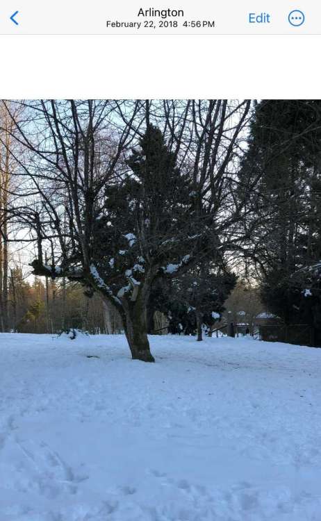
February 22nd has been a good date lately! Going to be just a few days off this year.
 3 points


.png.2fb3548cabd220ec8600d6527df5a815.png)


This leaderboard is set to Vancouver/GMT-07:00