
Leaderboard


Popular Content
Showing content with the highest reputation on 03/23/24 in all areas
-
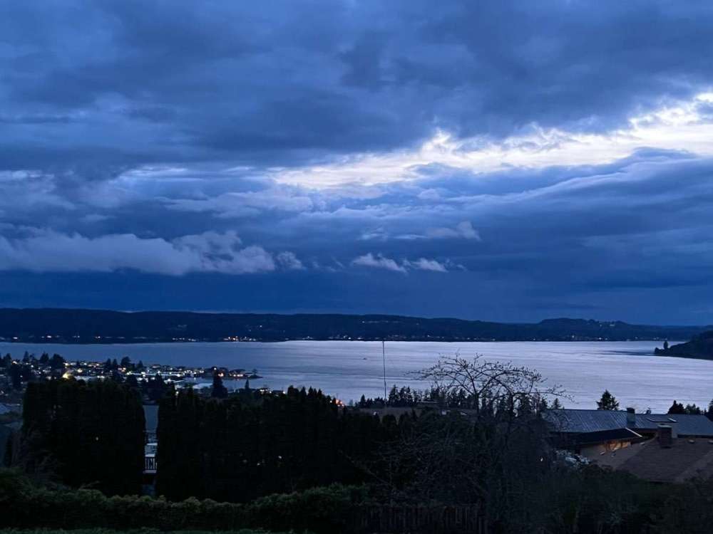
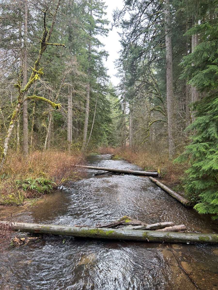
Rolling into Spring Break - beautiful afternoon on the coast
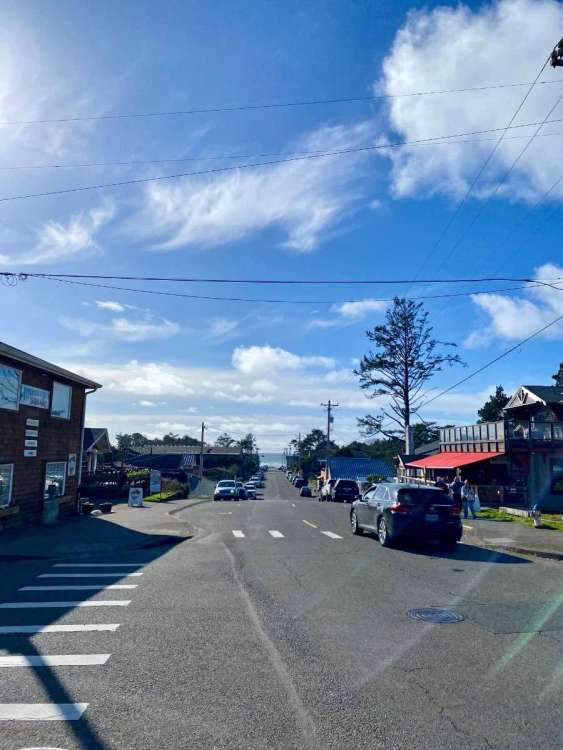 7 points
 -
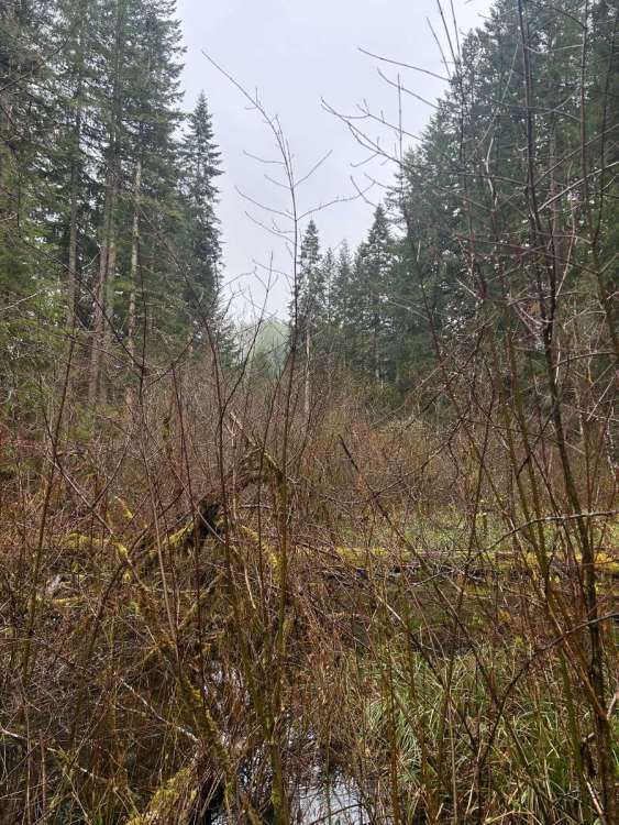
Perfect weather to work outside today, love it. Nice and cool.6 points
-
Currently at a daily low of 41.
 5 points
 -
5 points
-
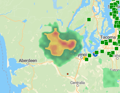
Thunderstorm heading into Olympia!5 points
-
Really getting hammered by a heavy shower right now.4 points
-
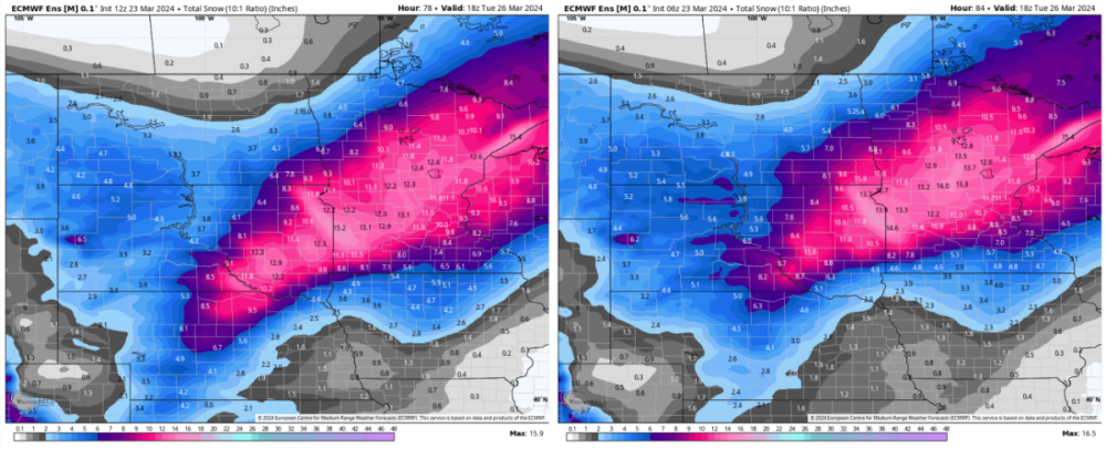
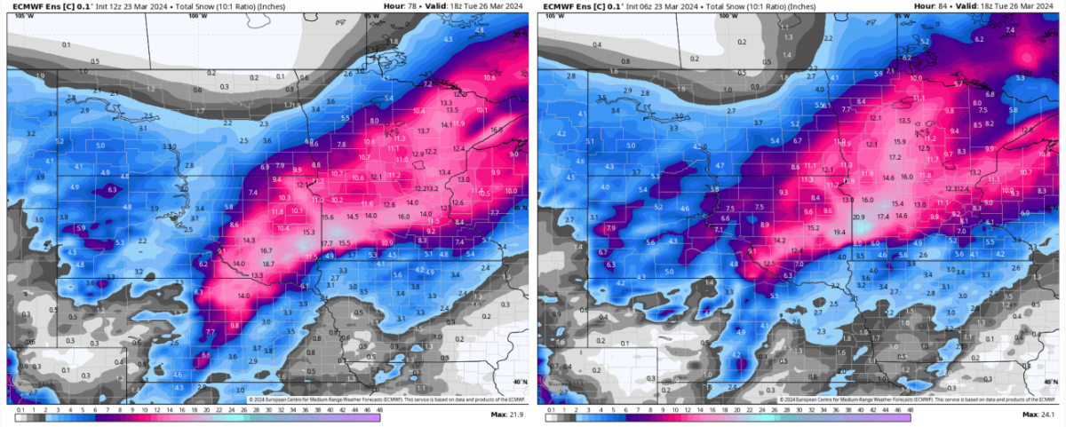
12Z ECMWF looks lovely for next weekend... which happens to be Easter.4 points
-
I once had a panic attack in my car while I was going over a bridge. I lost control and launched off the bridge. My car went airborne and I ended up in a crushed Tesla upside down in a tree 80’ off the ground. The fire department had to bring in a crane and the jaws of life to extricate me and the Tesla battery exploded just as I was pulled from the rubble. The crane collapsed and though we somehow survived I spent the next 16 months in the hospital and various rehab facilities and endured 87 surgeries.4 points
-
4 points
-
I'm driving home from a hockey game in Fargo right now, and the snow has started way earlier than expected. I'm currently just passed Fergus Falls and it's actually pretty moderate. 24°F.3 points
-
I watch Eric daily. The AI EURO certainly saw the overall pattern development. But all the long range models stunk it up for my area into Missouri. Huge dryslot now clear on all models. Snodgrass explained that the east coast system cutting off the gulf flow because of nw flow behind the east coast sys.3 points
-
Really nice jump on the 12z EPS mean and Control too.
 3 points
 -
Can’t wait to celebrate the blessed birth of the Easter bunny!3 points
-
Phils middle name is hyperbole.3 points
-
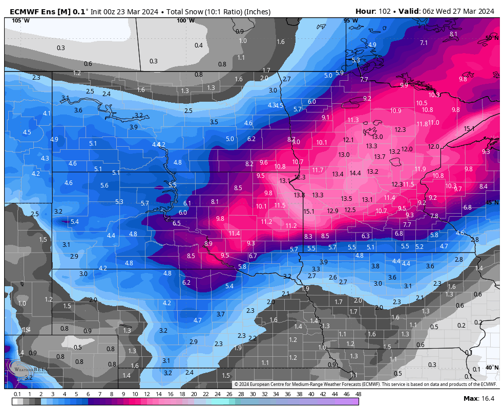
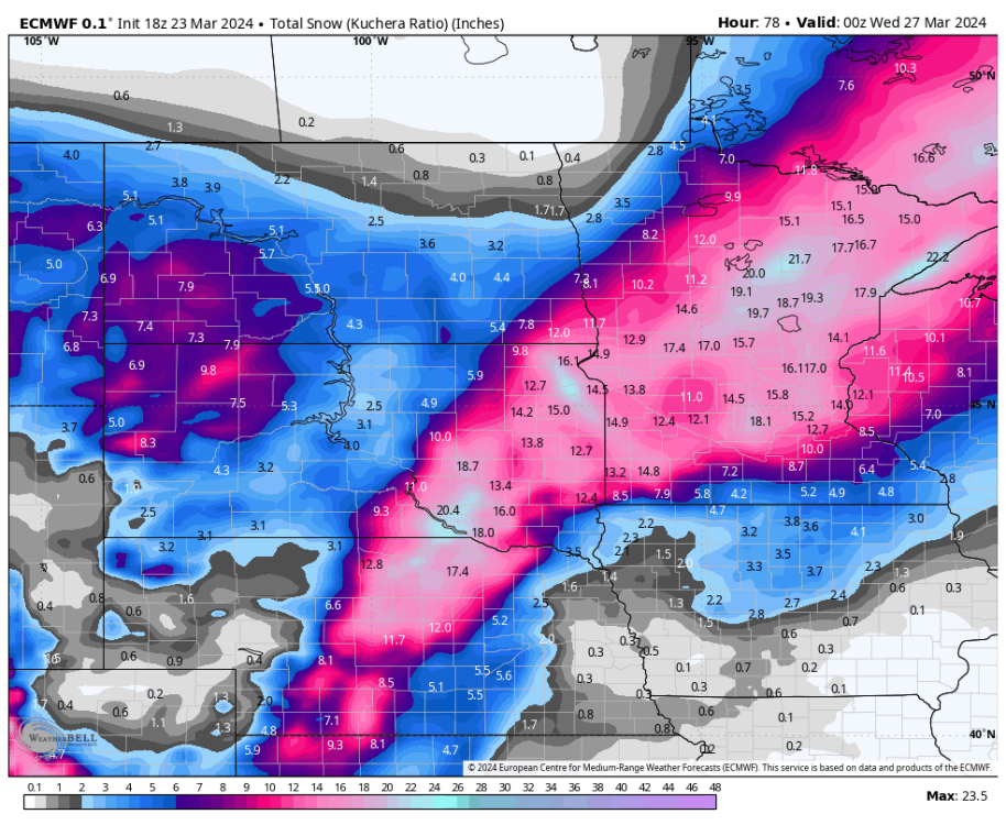
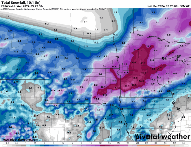
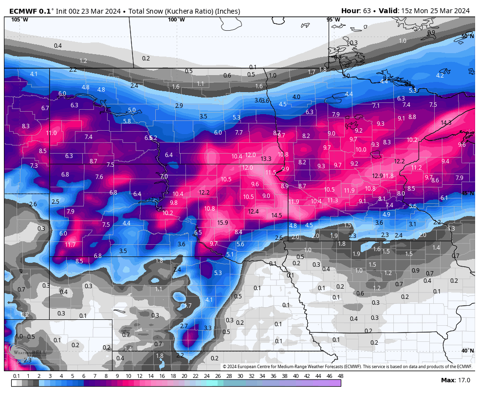
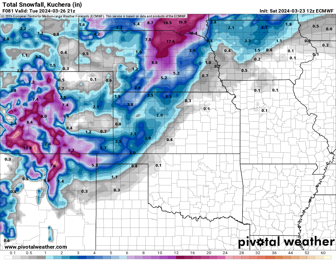
00z CMC continuing with a fairly clear southward trend over the past few runs. Not as good for our MN folks but better for me and CentralNeb's areas. Pivotal weather maps actually show a spot with 22 inches within my county, just a smidge off to my NW.
 2 points
 -
Only .08 here today but mostly cloudy all day.
 2 points
 -
Nice increases around here also.2 points
-
@hawkstwelvethanks for posting these model run comparisons to get a good handle on the trends. I really have no idea what to expect here riding the northern edge of the changeover2 points
-
53F with cool showers currently. Still not stopping family BBQ time under porch umbrellas Came to an end but nice that the Cougs represented WA well! Zags it is, then?2 points
-
Man, what a nice shift from last night's 00z to the 18z EPS. Talk about a last minute miracle. Hope it's right.
 2 points
 -
I’m on the edge of a Winter Storm Watch. NWS Hastings says they are monitoring the NAM and Euro that are showing the higher amounts through Central Nebraska. They said amounts may be increased in upcoming forecasts, and possible addition of more counties in watches or warnings are possible.2 points
-
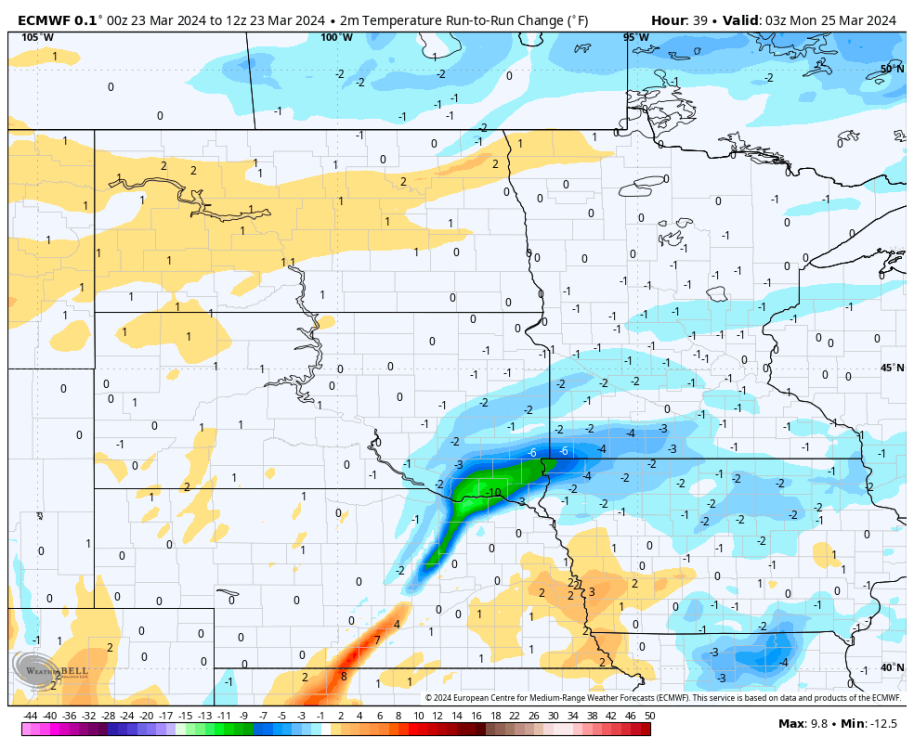
18z Euro continues to look better for here. Temps are again about 2-5 degrees colder than the 06z run. In fact, near Sioux City has had an almost -10 degree swing in temperatures when comparing to the 00z run. We now stay mostly as snow and only have rain very early in the morning on Monday. I've been comparing totals by 10AM Monday since that is when I'd have to leave for the airport and the Euro has moved from 2.6 inches to 9.6 inches over the past four runs for that timeframe. Total ends up at a little over 12 inches while the NWS is still only calling for 2-6 here. It'll be interesting to see if they bite after the 00z runs tonight.

 2 points
 -
Gonzaga into the Sweet 16! Now let’s go Cougars and Ducks. Let’s make it 3 PNW teams!!!2 points
-
It looks pretty dry down in Tim’s backyard. Deformation band has been just sitting up north all day.2 points
-
Eric Snodgrass recently gave some praise to the ECMWF AI model with how it seemingly nailed the evolution of this system pretty well. The 12z run of that model shows us only getting above freezing around 7PM before we drop back down below around 1AM Monday. Overall it's running about 2-3 degrees colder for tomorrow than it's previous runs. As alluded to earlier, in a setup like this, that small amount can make all the difference.2 points
-
I don't let my kids watch TV, but my wife does.2 points
-
Yeah in her dreams! TV is only on in the mornings during football season. She had just finished attempting a cartwheel there. This was the snap I took right before! It’s actually slightly creepy! Power is still out. Kids are at swim class, and I am enjoying a little downtime now.

 2 points
 -
I absolutely do not envy the forecasters in Minneapolis...2 points
-
I’m assuming this means we’ll be smashing record highs again by next weekend2 points
-
Nice little improvement on the 12z Euro. It keeps us so freaking close to staying as all snow. Look at that run-to-run change on the surface temps! Thing of beauty. One more shift like this one down the homestretch and this storm might just still have a shot at pulling it off here.
 2 points
 -
Euro looks like the ICON here. Ok then.
 2 points
 -
good day to do my taxes. Cloudy and depressing2 points
-
Phil has had 88 surgeries. You lose.2 points
-
Mix of sun and clouds, 50 - perfect spring morning2 points
-
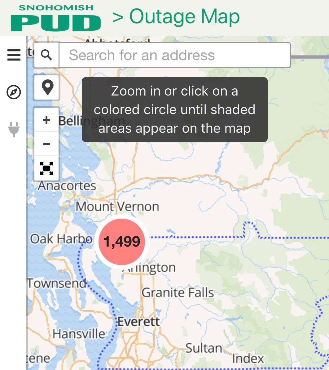
Generator power with heavy rain falling. I’m pretending it’s heavy snow falling and that is why the power is out.
 2 points
 -
Ended up with a 58/44 day yesterday. Partly to mostly cloudy and on the mild side with showers at times, in southerly flow. Hoping for today to be a little more active. Maybe some t-storm chances. Clear with a low of 43 overnight but it’s since clouded up with a temp of 49.2 points
-
Things could get interesting around here… Models seem to start showing a heavy band setting up somewhere over Central Nebraska then making its way east..2 points
-
I read this WGN Article which illustrates the incredible snow season across S/C Alaska, of which, Tom Skilling wrote while he's enjoying his retirement. He really loves traveling both up to Alaska and Hawaii (where he is currently). The correlation to the 2011-12 season is reminiscent to what transpired this season for the lower 48. https://wgntv.com/weather/weather-blog/snow-in-south-central-alaska/2 points
-
Liking the look of the SREF plume. It's lacking the couple of wacky ceiling outliers that we usually see from this, but the mean for here is still 14.5".
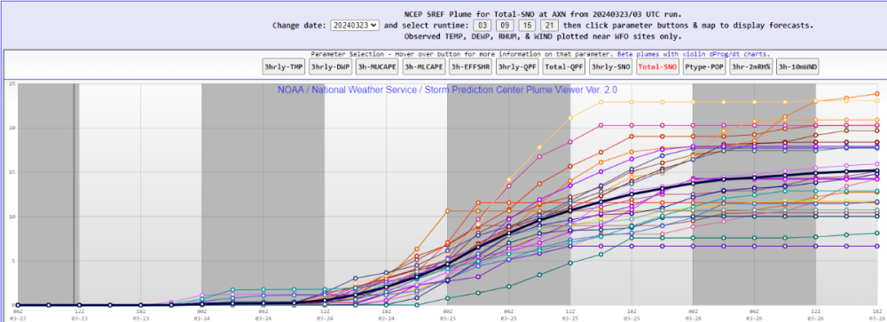 2 points
 -
A new record snowfall record for the date was set yesterday at Grand Rapids with 6.5” There is now 6” of snow on the ground. At some point there was a reported 1% of sunshine. For today the record H/L is 48/29 the record high of 74 was set in 1907 and 2021 the record low of 4 was set in 1983. The most snowfall of 8.4” fell in 1956 the wettest was in 1897 with 1.38” that fell as 4.0” of snow. The most snow on the ground was 14” in 1965. Last year the H/L was 48/36 and there was 0.04” of rainfall.2 points
-
It’s an expensive, high quality ultrasonic unit. Had to contact a foreign vendor to modify it to work with Davis ISS. If it was a standard, cheap ass Davis unit I would’ve just ordered a replacement, my dude.2 points
-
I have just a bit of it, but my body has been fighting it like the plague apparently, so glad they found it after my heart attack scare and treat it, but I got other shite going on that needs to be addressed now besides that.2 points
-
Ha, August 2018 was the month I filmed a lightning bolt hitting my nextdoor neighbor’s tree. Or..kind of (was just off-screen to the left). We usually get 1 or 2 of these every summer but catching it on camera is another story. Seems 90% of the time I’m either not home or sleeping/busy. This is the one exception to-date. IMG_8378.TRIM.mov2 points
-
My wife grew up in Corvallis at the time and said they could hear it and see the top of the ash plume. She said they got a dusting of ash from it at some point as well.2 points
-
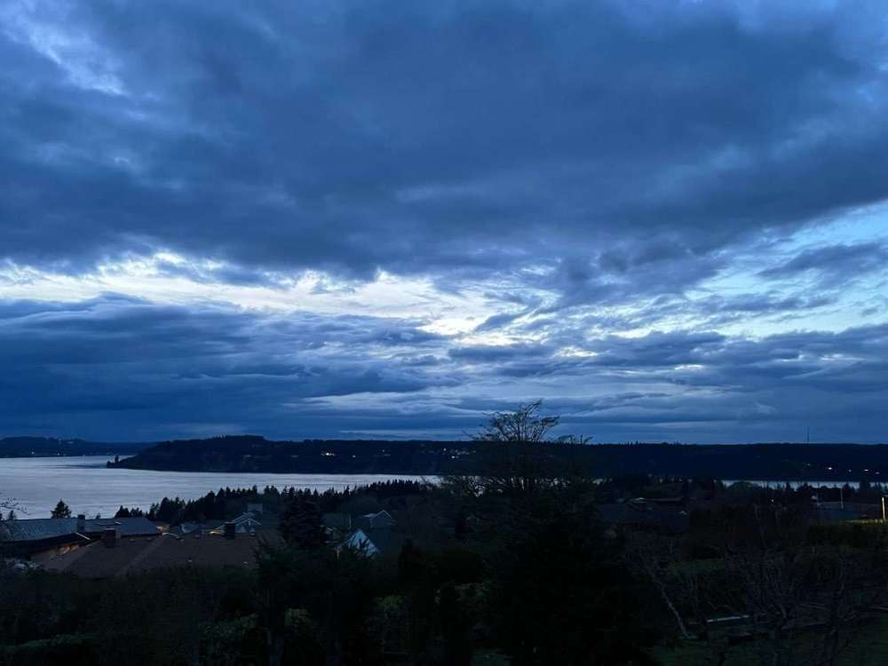
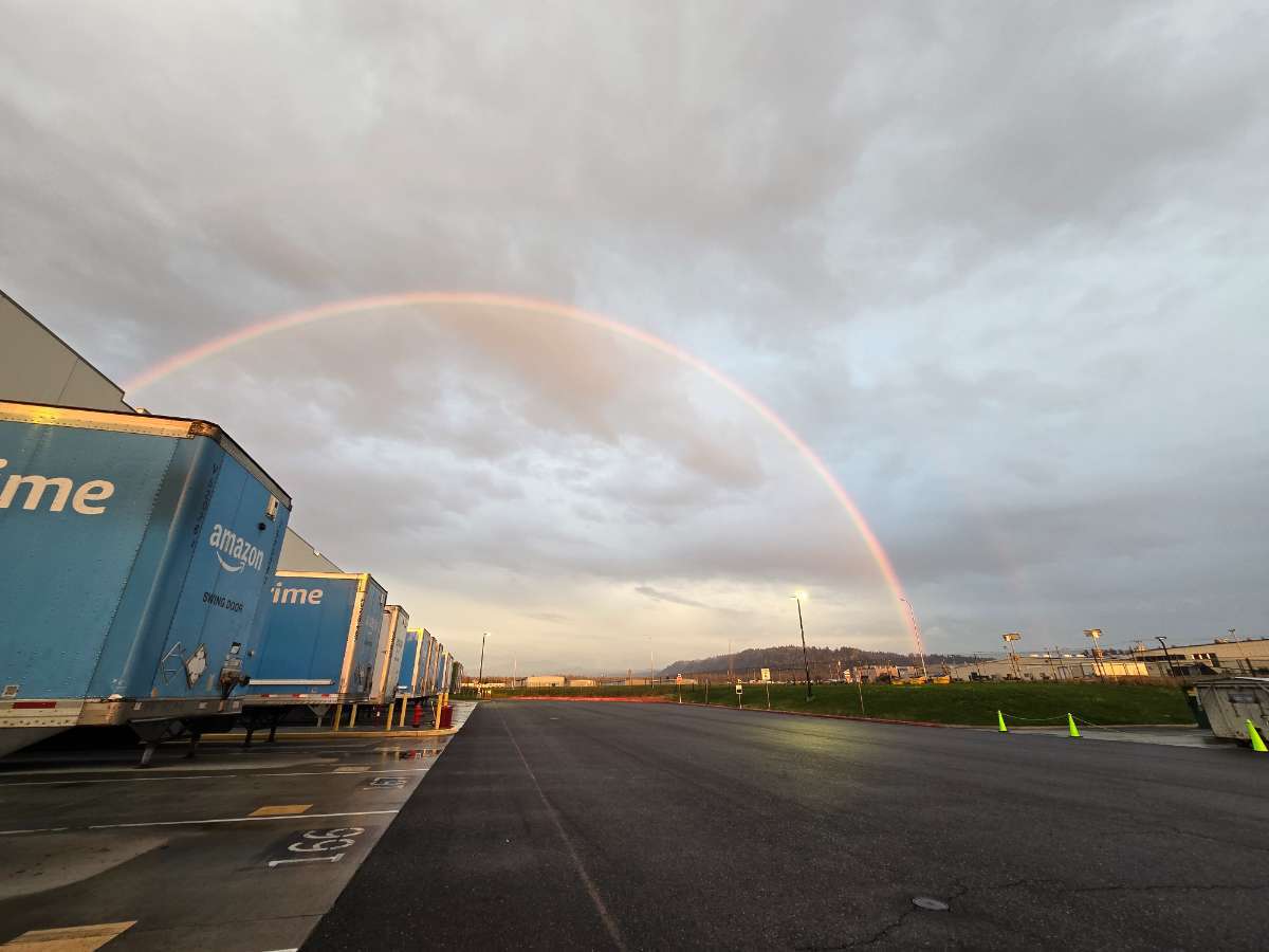
Beautiful evening out today.

 2 points
 -
I'm just gonna ride the NAM since that's the one model that still absolutely drills me.1 point
-
00z GFS made just enough of a shift south that almost my entire county now remains on the snow side of the line. Still shows some of it falling as freezing rain but NWS FSD doesn't seem to think that will be too much of an issue. Man oh man, this is going to be cutting it so close.1 point
-
The official forecast here had been for an all-day rainfest, but Environment Canada backed away from that yesterday and started forecasting showery weather. So of course the all-day rain materializes.1 point
-
Looks like I'll get atleast 12 hours of moderate-heavy snow before the changeover. I just went out and fired up the snowblower. First time since last winter lol. But I got it going just in case, although the snow might be too wet and heavy for it. We'll see!1 point
-
I guess it’s cloudy at Tim’s house, then.1 point

.thumb.jpeg.e3014abf99ef08a9f9ac2c0cd31b485b.jpeg)


This leaderboard is set to Vancouver/GMT-07:00