
Leaderboard


Popular Content
Showing content with the highest reputation on 10/06/21 in all areas
-
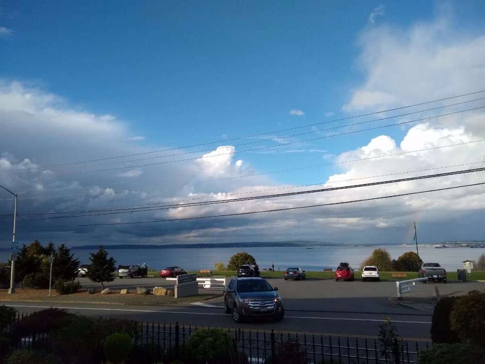
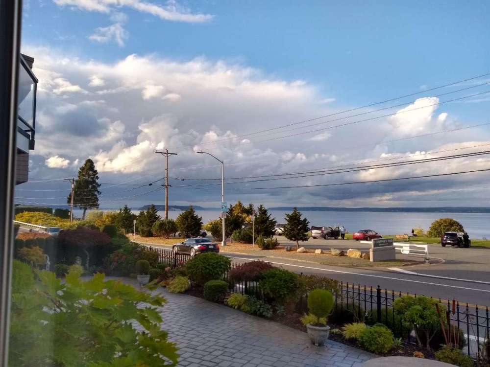
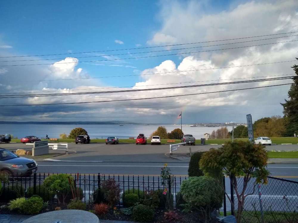
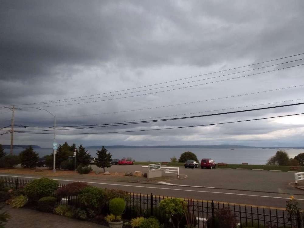
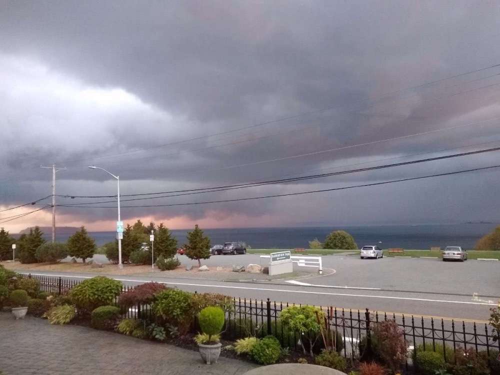
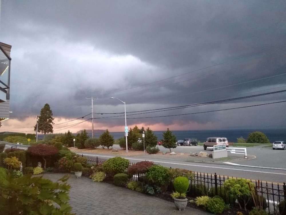
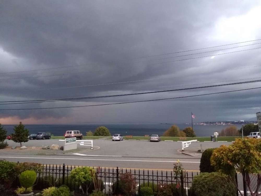
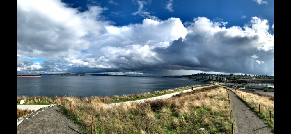
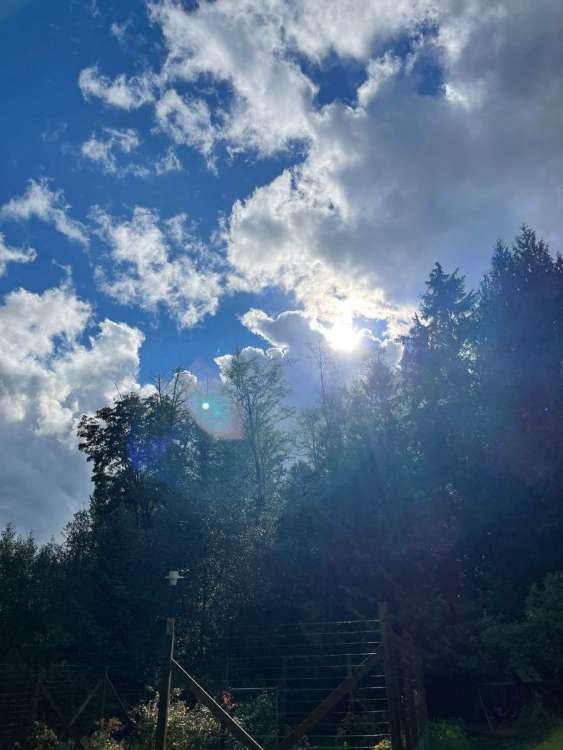
Very cool afternoon in north Everett. It was sunny to partly sunny most of the day. Then we got some rain, and now it's super dark outside with thunder being heard and lightning flashes sporadically. Heavy rain in the distance over the water, and at times rain over me. I think it will dump here soon. Some cool lighting and cloud formation I think some will appreciate.
 8 points
 -
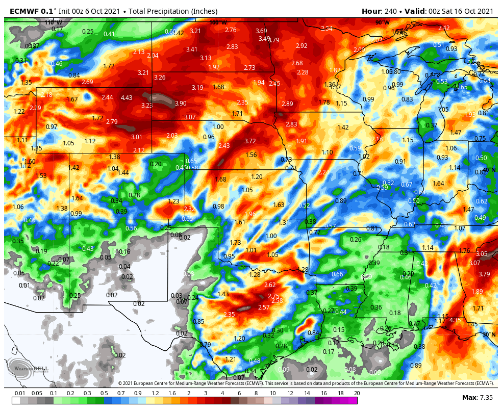
A little sneak peak at the storms I'll be getting next Spring!

 8 points
 -
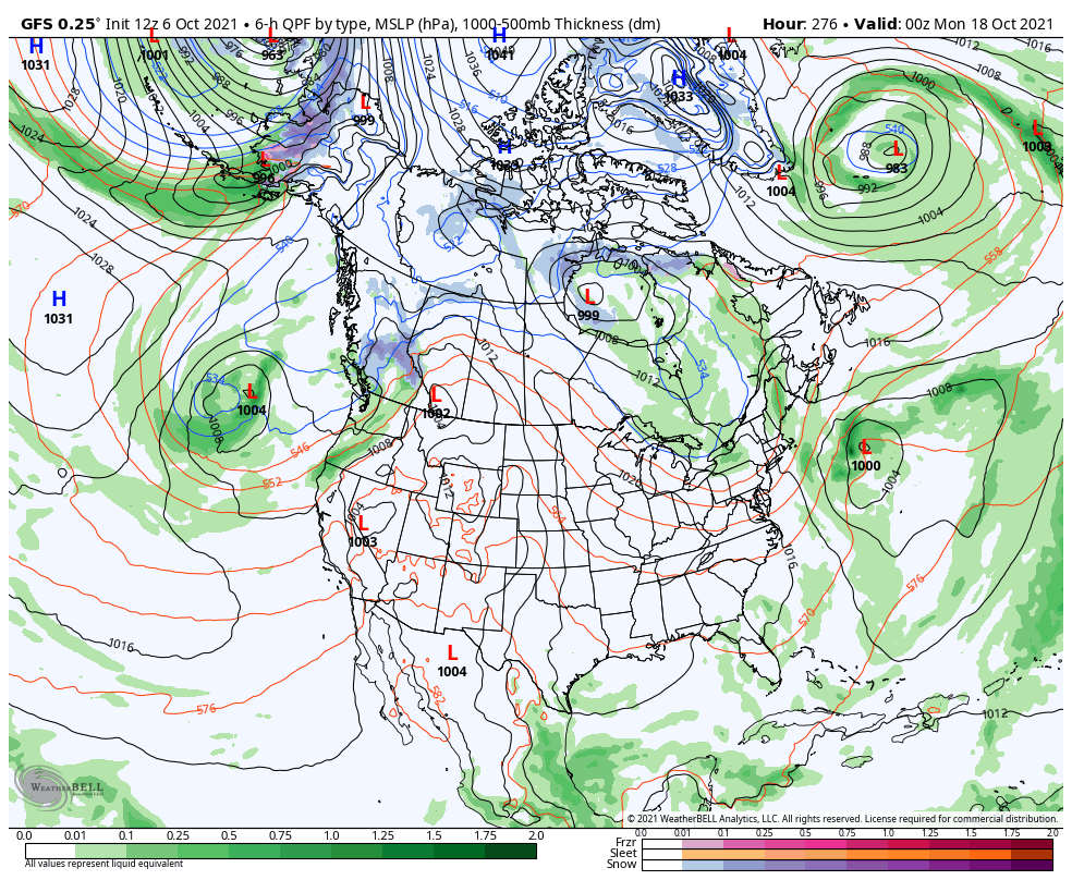
06z GFS was plentiful for out here. Not a big fan of early season cold/snow as you all know but we could REALLY use the moisture.
 8 points
 -
Standing in line at CVS for my booooster in an aisle full of these bad boys. Can’t help but think we’re all going to need them in a few weeks when the models go full on December 2021…
 7 points
 -
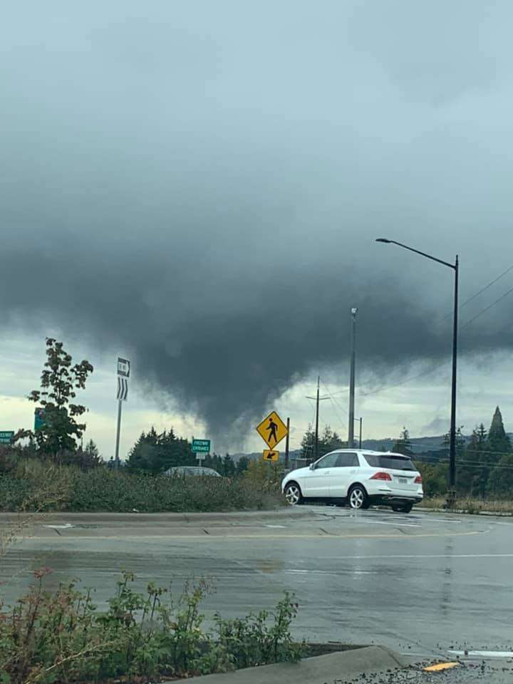
This totally looks like it's touching the ground, or within 10 feet of. Most likely scud unfortunately. North of La Center yesterday.
 7 points
 -
Thunder!!6 points
-
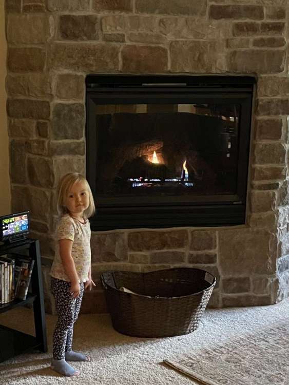
First fire of the season. I worked really hard starting it!
 6 points
 -
Team Red L seems to be going for a super spirit bomb attack in the pacific at the end of this run.
 6 points
 -
PDX is running well above average for precip since 9/15. Looks to continue.6 points
-
Another encouraging sign for the first 10 days of the new LRC is that almost all of us are forecasted to receive average to above average precipitation. That doesn't necessarily mean above average snowfall later on but a much wetter signal than how last season started out. Especially for @FAR_Weather
 6 points
 -
Nice little shower over or just east of Tacoma
 5 points
 -
It’s coming…
 5 points
 -
Took my son to school today. Overcast and rainy. 45F. Typical of fall on the west side for sure. We get more snow than rain here so I love rain.5 points
-
I don't know why, but the last couple days I haven't had the best of sleep. For some reason, I'm getting up way to early but at least I get a solid 4-5 hours of deeper sleep. Anyone else feeling the same? Anyway, today is one of those important days in early October as it could be Day 1 of the new LRC. Boy, is there a LOT going on our wx pattern that is really intriguing. I've been monitoring the models just like everyone and what excites me is how active this new pattern is starting off. What is fascinating to me is there will be 4 separate systems to track over the next 5 days across the central Sub, each of which, are progressively stronger compared to the previous system. System #1: It starts off with a cut-off ULL coming due N out of the deep south that @Clinton mentioned which is caught up in a Rex Block pattern which I believe will be a big part of the 1st half of the LRC. In future cycles, if this is indeed system 1, is quite the way to kick of the LRC for @OKwx2k4and those of us near the MW/GL's region. System #2: Then there is a fast moving wave that will traverse the Rockies which initially slams into central Cali on the 8th. A weaker piece shears off and tracks across the N Sub over the weekend.... System #3: The models have been back and forth about this one but it appears that the trough which hits CA sorta slows down while an "inside slider" kicks this trough down into the desert SW and ejects out into the TX Panhandle...aka "The Slot"...this system forms into a stronger wave along the trailing CF and cuts NE through the Plains/MW. The models differ how far east it tracks around the 10th/11th period. System #4: Finally, in what will likely be the strongest system in this wave train, we will be tracking our seasons first legit Autumn storm. A powerhouse trough tracks deep into 4 corners region around the 12th. This is one hellova trough and is a clear signal that we will have big time systems tracking out of the SW this season. I'm excited for many reasons to see this pattern setting up. Most importantly, this should bring healthy snows to the mountains and deserts of the SW this winter. The active Monsoon season was a big indicator to me that this years LRC would feature an active SW Flow. So, here we are, right at the beginning of this new pattern and its off to a rocking start!5 points
-
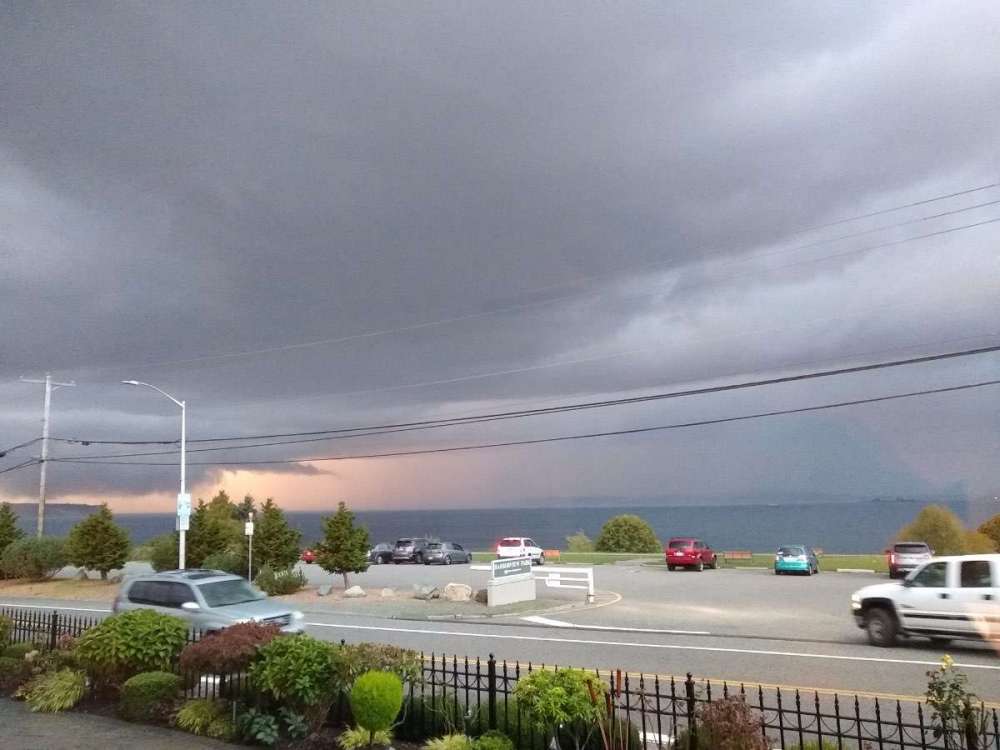
Got caught outside this evening around sunset as the thunderstorms moved through. Just two very distant flashes of lightning (no thunder) and an incredible orange sky as a slit in the clouds lit up all the virga. Currently 47F with 0.22" on the day.4 points
-
Saw 4 of those as well on my walk. Going to be a great winter!!!4 points
-
All and all, some nice fall weather is coming up, and many locations will see a frost or a freeze. Could be much worse.4 points
-
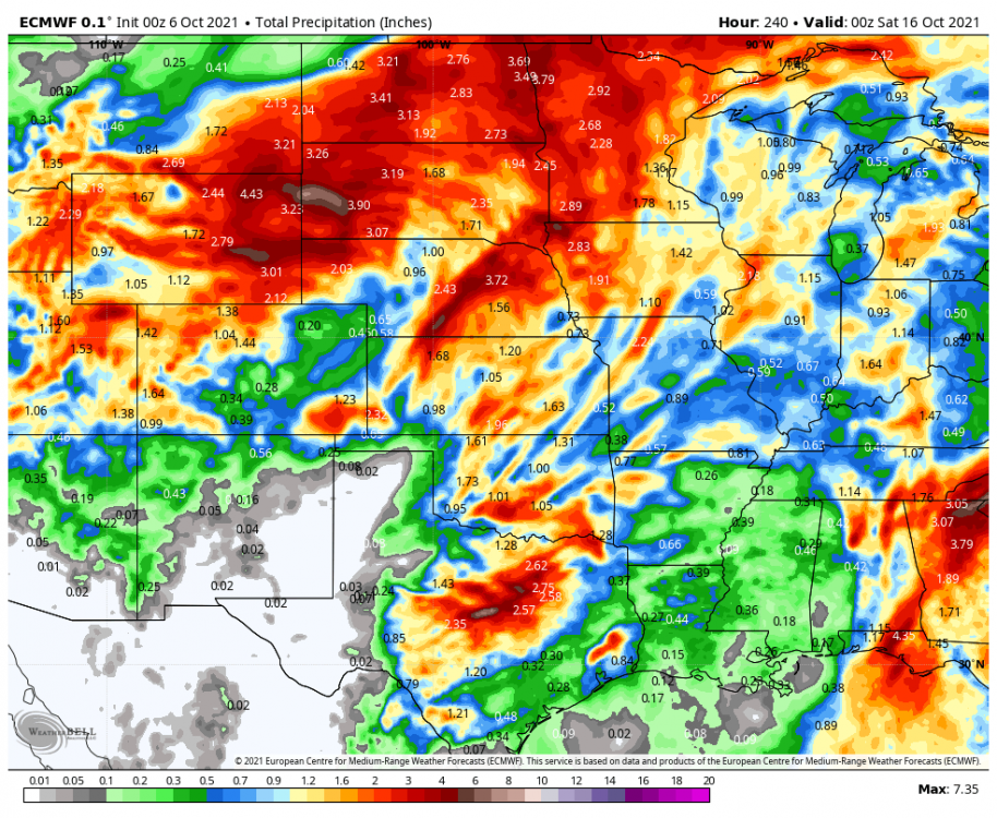
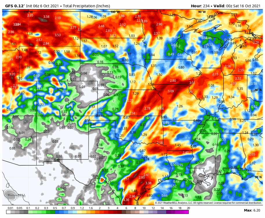
12z Euro has 2 storms coming through here, one on the 11th and the stronger one on the 13th-14th. Seems like the 2nd one has come farther south. GFS still wants to send it almost due north. Canadian looks more like the Euro. The track of both of these would bring in colder air and there might even be some flakes around, probably more towards Western Nebraska. I would guess a cold rain around here if this track verifies.4 points
-
I'm wearing one now.4 points
-
They average about 42" of yearly snowfall so yeah that shows more than half their yearly snowfall. Very unlikely to verify verbatim but you get the idea for the potential with this storm. Big October snows are somewhat common in Montana, just last year Helena saw 25" of snowfall during the month of October.4 points
-
Well said…I’m a believer of the cyclical nature of the LRC but trying to forecast a specific date in the far future is years away from perfecting. Who knows if we’ll ever see a model predict the wx in a high accuracy rate beyond D10. I’d love to see this in my lifetime as it would benefit every single person on this planet. People don’t realize it but the wx literally effects every aspect of our lives. That’s why I love learning about meteorology and the climate every day.4 points
-
The arctic airmass of January 2004 is the best one of the last 20 years. I lived in Chattaroy, WA, which is near Deer Park. Spokane dropped to -21F, and Deer Park dropped to -28F.4 points
-
happy day 1 of the new LRC everyone!4 points
-
October doesn’t typically turn wet until the 2nd half of the month.4 points
-
I mean, just depends on what model you're looking at I guess? edit: clarifying - doesn't look as dramatic an uptick to +ENSO status by summer in CFS. Still only a 20% chance or so.3 points
-
3 points
-
So the ice age that began in 2017 might finally start retreating?3 points
-
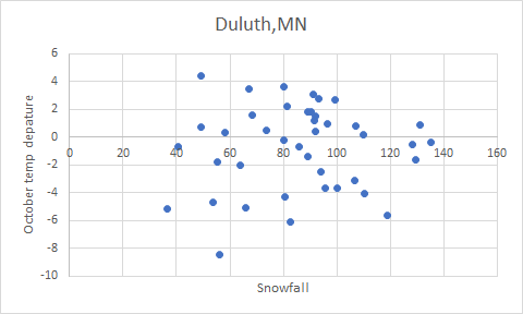
I don't have time for this either but rushed some numbers into excel for Duluth. The only annoying part was flipping through every October since 1980. Not very famillar with DLH climo, but now jealous that their worst seasons are comparable to Lincoln's best Didn't feel like calculating the snowfall departures, 1991-2020 average is 90.2". Oct departures are based off 1991-20 as well - negative departures are mostly in the 80s and 90s. Year Snowfall Oct departure 1980-81 36.5 -5.2 1981-82 95.7 -3.7 1982-83 96.5 1 1983-84 107.3 0.8 1984-85 68.2 1.6 1985-86 89.3 -1.4 1986-87 40.6 -0.7 1987-88 53.8 -4.7 1988-89 119.1 -5.6 1989-90 58.3 0.3 1990-91 63.8 -2 1991-92 100 -3.7 1992-93 94.2 -2.5 1993-94 110.4 -4.1 1994-95 91.2 3.1 1995-96 135.4 -0.4 1996-97 128.2 -0.5 1997-98 80.1 -0.2 1998-99 90.2 1.8 1999-00 55.5 -1.8 2000-01 99.3 2.7 2001-02 86 -0.7 2002-03 56.3 -8.5 2003-04 109.9 0.2 2004-05 91.5 1.2 2005-06 89.2 1.8 2006-07 80.7 -4.3 2007-08 80 3.6 2008-09 73.6 0.5 2009-10 65.8 -5.1 2010-11 93.4 2.8 2011-12 49.1 4.4 2012-13 129.4 -1.6 2013-14 131 0.9 2014-15 49.2 0.7 2015-16 81.4 2.2 2016-17 67 3.5 2017-18 91.9 1.5 2018-19 106.8 -3.1 2019-20 92.2 0.4 2020-21 82.6 -6.1 Looking at the graph, correlation looks very weak at best. Most notable things: All four seasons above 120" had an October fairly close to average. Also, no winter with over 100" of snow was more than 0.9 degrees above average. Might have a clearer picture with a larger sample size, but I thought 40 years would be plenty lmao.
 3 points
 -
Currently at my house… .01” on the day. 54 degrees.
 3 points
 -
Yeah January 2004 was three weeks off. Epic!3 points
-
Hot off the presses from Jacque
 3 points
 -
January 2004 was also a classic "It'll warm up tomorrow" event – what was supposed to be a 1-2 day snow to freezing rain event turned into a week off school. At one point out in SE Gresham there was a blizzard warning with heavy snow, 40-50mph wind gusts, and a temp hovering around 13F during the day.3 points
-
The Dec 1998 Arctic airmass matched the Dec 1990 blast in California. The only reason it barely shows up in the record books is because they happened on the same days! Most locations were tied with 1990 or 1 or 2F degrees off. Some locations were actually colder in Dec 1998.3 points
-
98-99 had a legit high tier Arctic airmass, although I’m pretty sure it was a dry blast in most places (some places got a couple inches of powder). Obviously an epic mountain winter too. I definitely wouldn’t mind a repeat.3 points
-
I'm not about to discredit it, either. I know of very reputable mets who believe in the LRC and swear by it. I just don't use it as a forecast tool to the extent that some on here do. It's a cool theory.3 points
-
Over 50,000 flashes with yesterday's storms in Arizona.
 3 points
 -
Just told my family and friends!!!3 points
-
Here is another system @Tomthat the GFS has for Oct. 19th. I lose track of what number this would be.
 3 points
 -
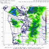
Des Moines talking severe potential next week. The forecast for Tuesday and especially just beyond the 7 day forecast on Wednesday still looks interesting as closed upper low develops and lifts into the Midwest. Won`t go into too many details at this point since it is still way out west of Alaska, but it likely will be a severe weather setup somewhere across the region along with very strong synoptic winds. Stay tuned!3 points
-
Exciting foresure! Seems like it's been 15 years since we've seen storms dig deep into the SW like this. KC folks the storm showing up on the 10th/11th should put a smile on your face.3 points
-
I forgot to mention the system that tracked into the San Diego/SoCal region yesterday which we will see if this is part of the new pattern ( I think it is). My mother flew into PHX yesterday morning and took a flight path farther south across the Tucson area to avoid the showers/storms that were targeting the typical flight path over the eastern mtn's of AZ. In essence, this new pattern is really showing an encouraging sign that we will see systems dig deep this cold season until we see periods of ridging which I see coming late month into Nov. So, we are tracking 5 systems in 5 days??? What a wild pattern.3 points
-
Up to .45” on the day! Currently 45 degrees.2 points
-
High of 49.8F here today . 50/40 on the day with 0.66” of rain. It was actually a miserable wet afternoon to be working outside.2 points
-
Bring on El Niño!2 points
-
The 2018 thread was fun to go through. Everyone was soooo done with winter and it was like 99% pictures of Tim’s moms daffodils and then Phil was like woah here comes a SSW with a modified QBO and phase 9 wave runner MJD and then Andrew was like hey the GEM isn’t so bad at day 10 and then it was off to the races! Wine es good IMG_6690.MOV2 points
-
That's quite a brash statement to be making in early October. I'm no wishcaster, and I'm not trying to manifest a cold winter here, but you seem to be banking the entirety your grave prophecy on a single index, this easterly QBO. Every other potential influence is pointing straight at deep troughing in the west. Again, I could be wrong, but you're acting as if the writing is on the wall here when in reality things are looking brighter than they have been in half a decade. Hell, we're already spying hints of a SPV breakdown. In October! That doesn't happen this early. You've been talking about searching for something to disrupt our impending zonal doom, and well, this is it.2 points


This leaderboard is set to Vancouver/GMT-07:00