Leaderboard
Popular Content
Showing content with the highest reputation on 10/01/22 in all areas
-
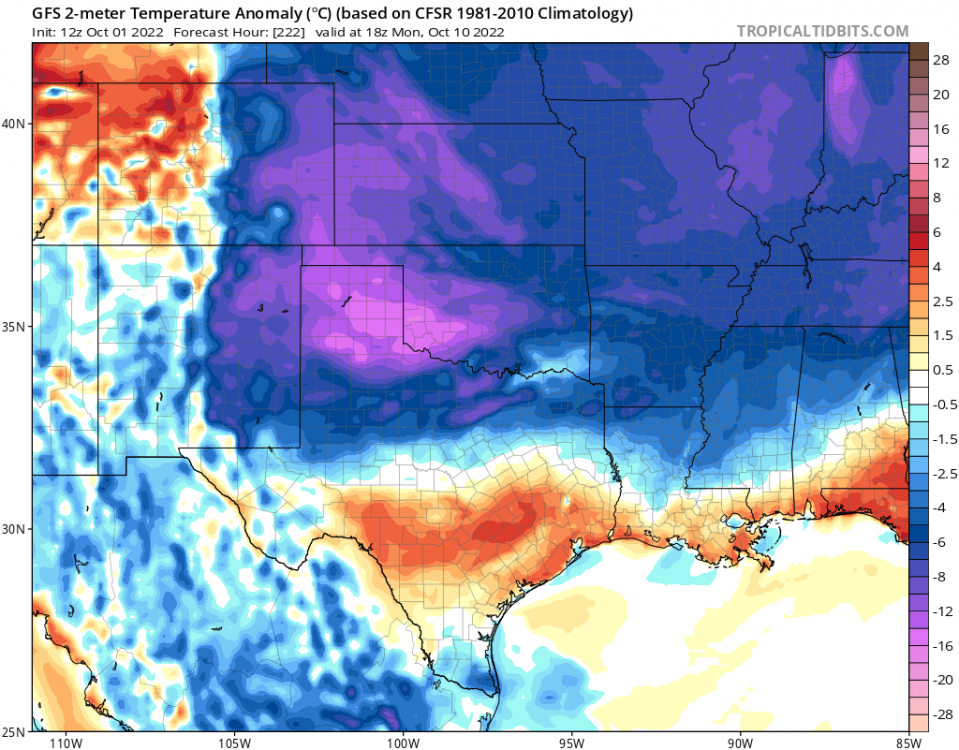
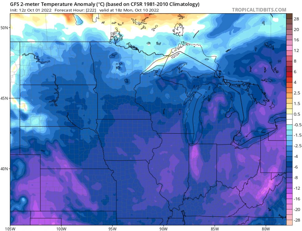
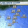
This composite of October 1942 and 1988 is pretty amazing. Both strong La Ninas with profound +PNA signature. Both winters featured historic blocking during the heart of the winter and extreme cold in the NW.7 points
-
6 points
-
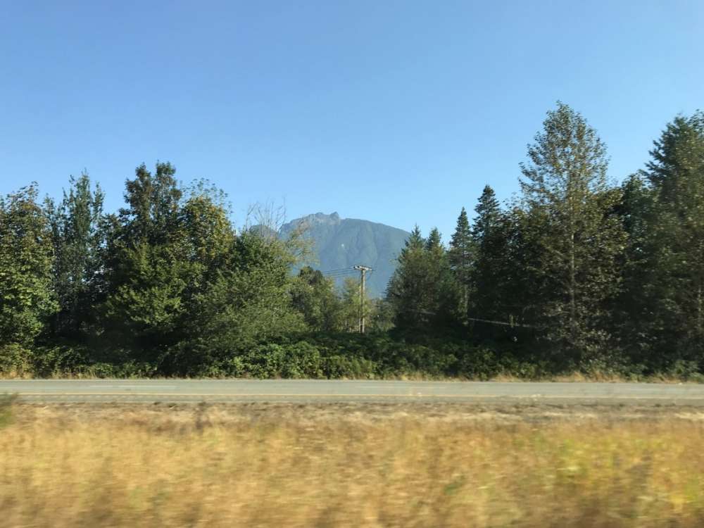
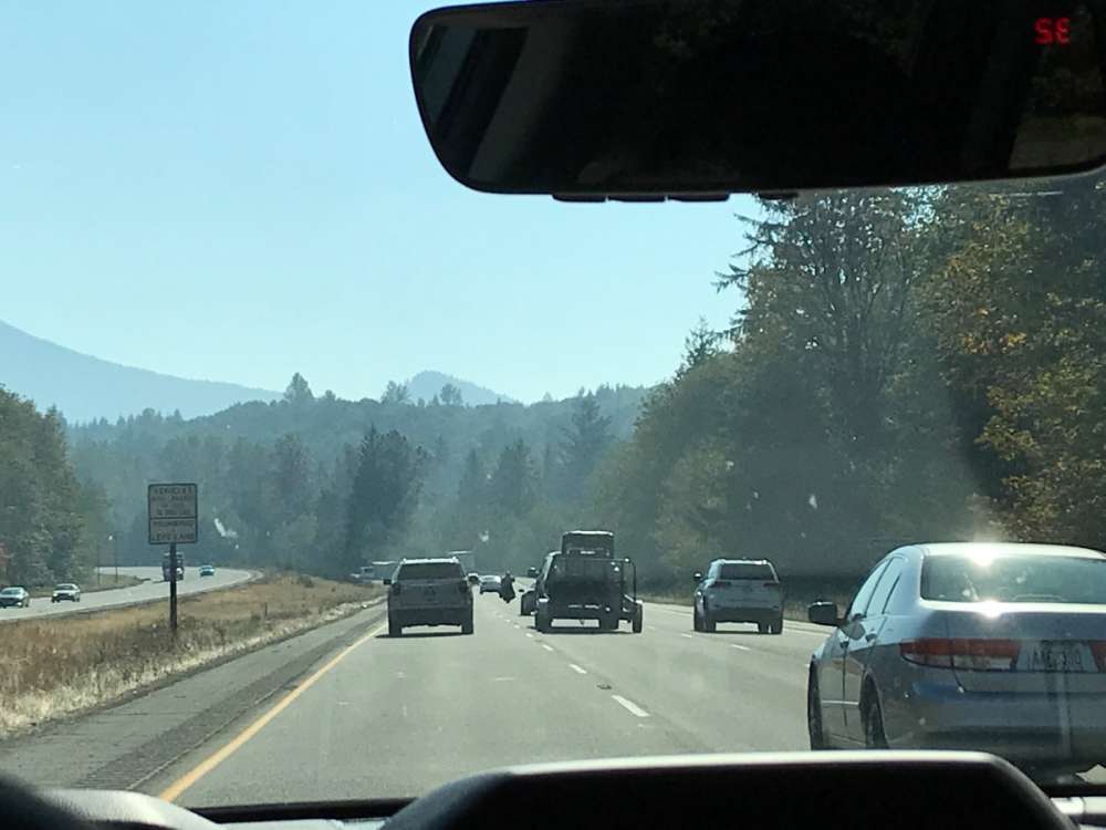
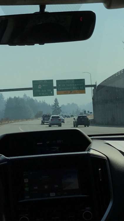
Too smoky and warm for me today. At this point the only '70's or '80's I want to see in the weather forecast is snowfall accumulations.5 points
-
Much appreciated! Thank you for the warm welcome! I haven't been in this section of the forum as much and I was sort of surprised to not see sections more broken up by region (NE, SE, midwest, etc). I probably won't have much to add, but I will be here because I would like to learn more about weather patterns out east! Look forward to hanging out!5 points
-
Won't matter whether or not the Arctic freezes when both the Columbia and the Sound are frozen over this January5 points
-
The 12z GFS is an amazing run from day 10 on.5 points
-
Let’s swing this monster in.5 points
-
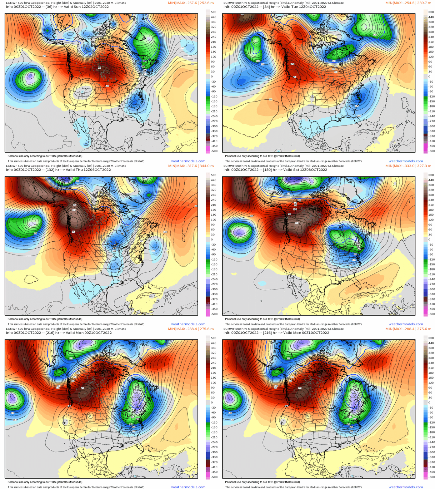
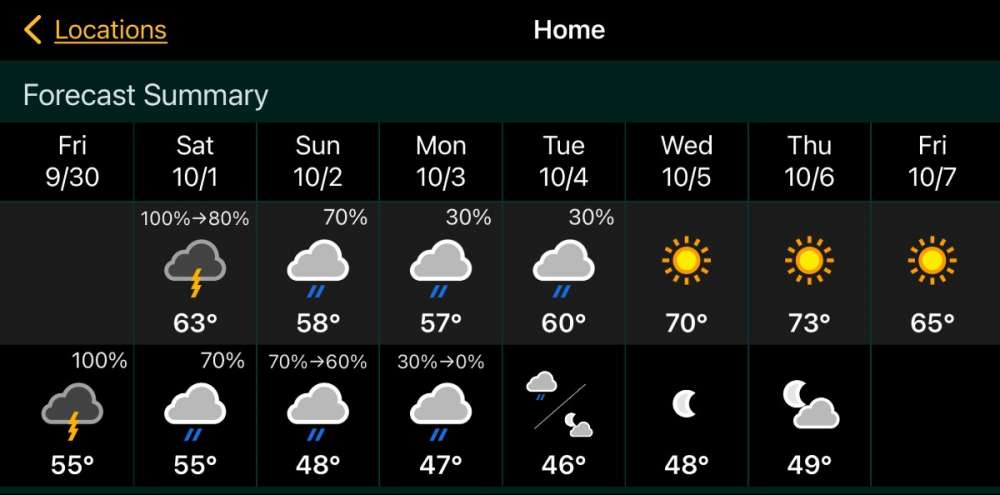
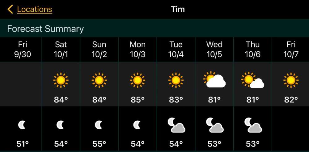
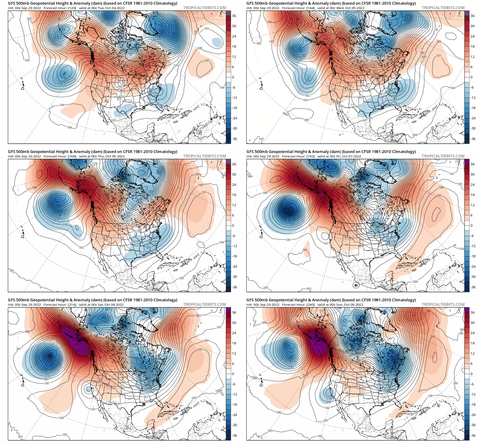
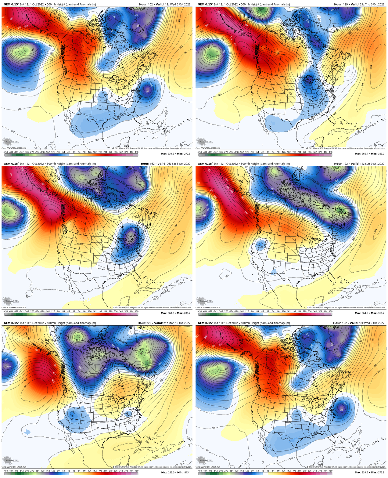
Welcome to October! Boy, you guys in the MW/GL's region are looking at enjoying some bonafide warmer & sunny days before the next powerful CF hits later next week. These are the quintessential Autumn days that @bud2380reflects about. Enjoy the next few days! Now, remember that COPC 8-14 day a few days ago? That reversed course...still looking for that sustained period of Indian Summer to those who experienced their 1st Frost/Freezes? Might have to wait a bit longer... Love the wet look for the SW and CO Rockies....Let it Snow...nice way to kick start the Snow Season...more to come... The attn now turns for our members out west to see their 1st Frost/Freezes of the season. It is looking highly likely that an impressive early shot of colder weather is targeting a majority of the Sub next Thu through the following weekend. It's pretty neat to see this pattern evolve across N. A. as the 500mb amplifies. An entirely new pattern is shaping up and I can see this setting up Long Term Long Wave Troughs/Ridges in the "key" locations to deliver some potent colder weather in the weeks & months ahead. Check this out...I'll slow this down for all to see. The 0z Euro Op run from last night just did something that is pretty wild. Did it just unleash energy off the PV from the North Pole??? Look at the small trough that tracks down from the Archipelago region on the backside of the developing Hudson Bay vortex. They both phase together and crash down over the GL's region into SE Canada. Then, another trough rides down from the Arctic in N/S fashion for Round 2 around the 7th/8th???? Man, what a way to kick start the new LRC pattern and wipe away the old pattern.5 points
-
4 points
-
No problem. More the merrier. I'm a southerly displaced 'winterlover, so I'm around a lot when interesting cold patterns or snow is expected. That said, been a rough couple years for me. Well more like 7. Lol.4 points
-
Hello everyone! I have never posted in this thread series you all are a part of! I just had a quick question. Is this topic specifically for the midwest or it is a community of everyone from the Rockies east to the Atlantic? Hope you all have a good day!4 points
-
4 points
-
4 points
-
4 points
-
4 points
-
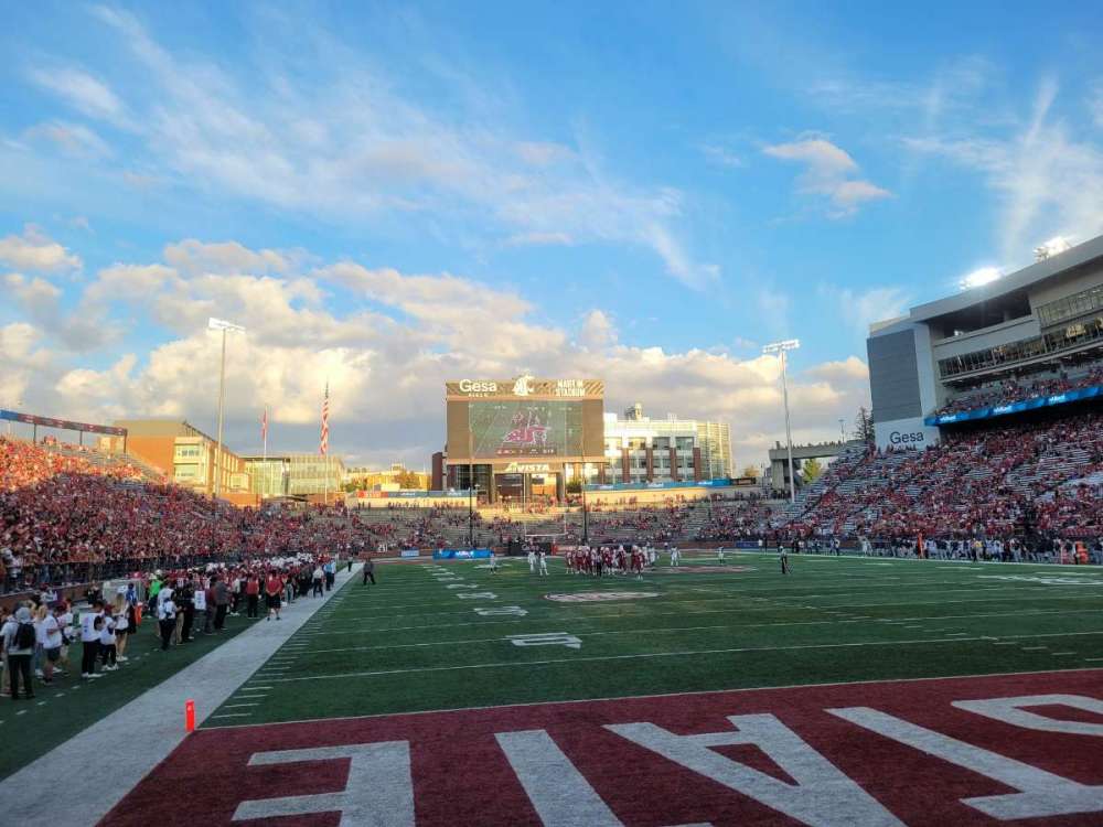
Watched the 9th inning in a packed bar in Pullman. People were glued to every pitch and the place absolutely exploded on the homerun and everyone was hugging strangers. It was one of the top sports moments I have experienced.4 points
-
I can't remember regarding the snowstorm but so far this early Fall has been nice and fall-like weather so I'm happy with that.3 points
-
I have a pic of the waterfront starting to freeze in Seattle in Jan 1950. Pretty unreal. The Columbia was frozen 30 inches thick at Portland in 1862. Those were the days!3 points
-
Lmao let’s stick to reality buddy3 points
-
3 points
-
We’re gonna get to Thanksgiving and still be in the 70s at this rate.3 points
-
Is that a little AR action I see…3 points
-
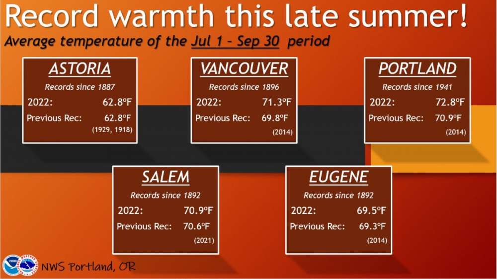
We also hit some record numbers for warm overnight lows up here. We had 21 +60 lows beating the record of 19 set just last year. Lot of the crooked warm averages set this summer have been due to very warm overnight lows.3 points
-
Totally agree its running to warm up north and into the MW from what I'm seeing. The members farther west and south will be in the more volatile areas where I see big temp contrasts once we get past the middle of the month. That CF coming down next week means business. The Euro got even colder out west into the Plains.3 points
-
Tom, I had mid 30s 4 straight mornings. On thurs am i saw some definite killing frost in some valleys here in the Ottumwa Iowa area..3 points
-
3 points
-
3 points
-
I will be in the Arrowhead of MN and on Superior this coming Monday through Thursday AM. Snow chances are in the forecast for WED PM/ Thurs AM! with the cool down posted by Tom. If the snow flies, I will post pics.3 points
-
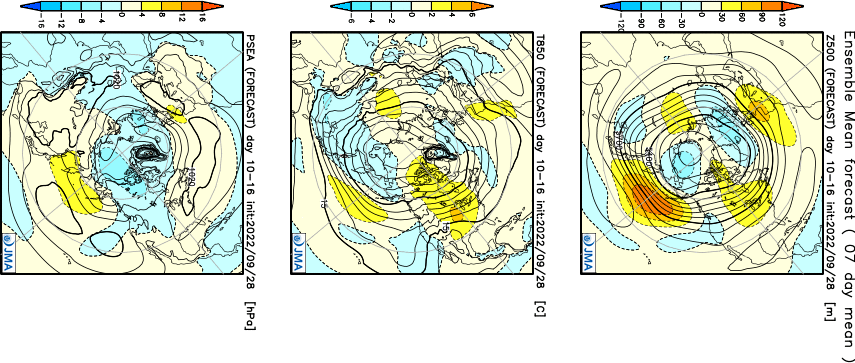
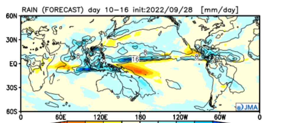
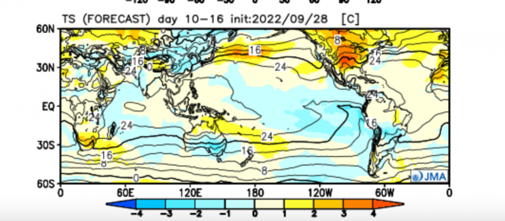
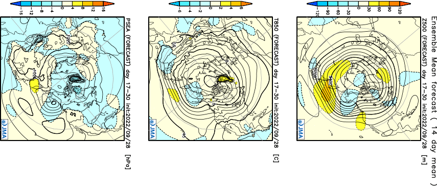
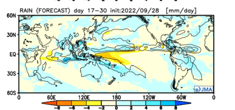
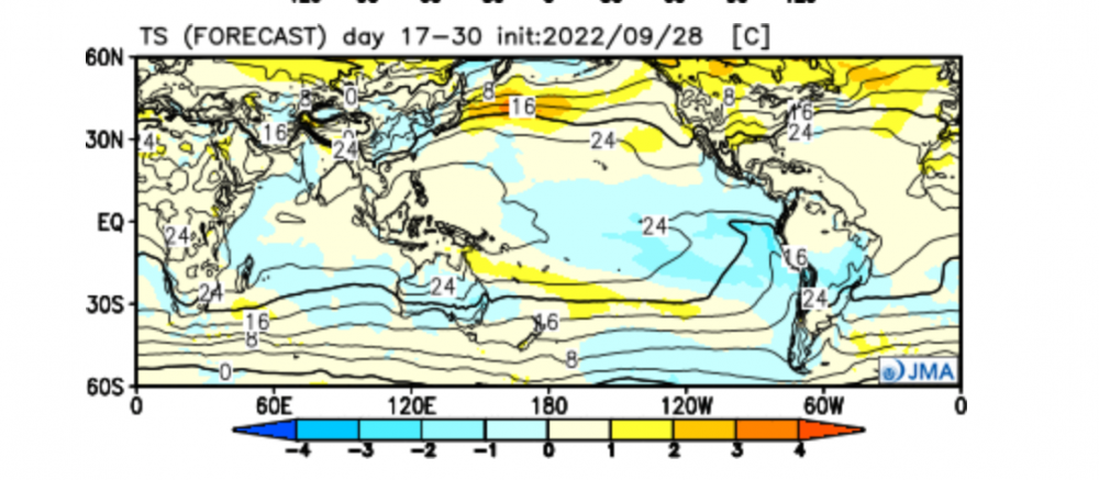
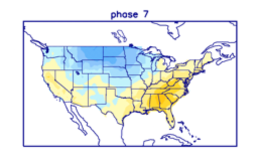
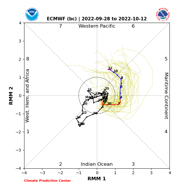
It appears that most of this Sub has welcomed Autumn in a timely manner this year and I believe the Autumnal "Look and Feel" will continue as we open up OCT. Who's ready to see the new LRC set up?? Personally, this is one of the more exciting months to look forward to as the Northern Hemisphere goes through significant seasonal changes that effect the fluid nature of the wx pattern across the Globe into North America. Let's discuss... I'm tracking a significant Cold Front to sweep across the Upper MW towards the GL's/MW region around the 6th/7th period...does it spin up a storm? Let's see if the models can pick up on a disturbance that can ride up this boundary. Everything about this N.A. 500mb is suggesting some rather fascinating clues where the Long Term Long Range pattern may be shaping up... IMHO, the biggest clue is the massive NE PAC Ridge and the placement of the Trough just N of Hawaii....then what happens is that trough "hands off" a storm into California. That's a real big deal to have this happen very early on in the season as the jet begins to strengthen. Second, the development of the North American Vortex where it has been spinning over and over again since last year's pattern throughout the entire Summer up near Baffin Bay/Hudson Bay/Archipelago. This, IMO, is a tell tale sign of a climatic change in the weather pattern up that way. Why so? It's been a common theme every single year over the past 4 or 5 that I can remember. Anyway, it's a good sign for the build up of early season cold in Canada next month. This is the month where many will see the Seasons "Firsts"...First Frost, First Freeze, First Snow Flakes....First 1" of Snow??? Now, let's see what the models have to say... The JMA weeklies are suggesting the development of what looks to be a PAC jet slamming into Cali Week 2.... Precip/Temp...the AN precip pattern or ribbon of moisture across the entire C PAC suggests and active STJ.... Looks warm over the central CONUS...we'll see if that holds... Week 3-4 look interesting as the model then reverses the flow over N. A. as a ridge develops on the west coast of USA and Trough-like pattern for the eastern CONUS. Precip/Temp...more Tropical Trouble for Florida??? No bueno. Seasonal temps from the Intermountain West and points East across the Nation with possible bias to warmth across the S Plains. The MJO will likely head into Phase 7 by mid month as it comes out of Phase 5/6 early in the month...here is Phase 7 temp anomaly for OCT...needless to say, there are plenty of fascinating LR signals that I'm seeing for this month that will keep things active and exciting across our Sub.2 points
-
It did, 65.4 avg beating out 65.0 from 19672 points
-
2 points
-
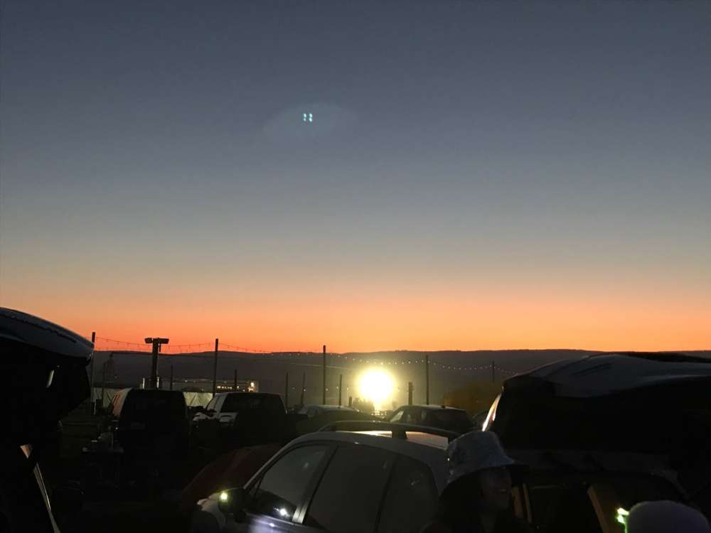
72F & sunny with a comfortable north breeze here in Motown. Absolutely postcard wx complete with a beautiful sunset.2 points
-
Nina's have delivered some really good Decembers here in Detroit. Including the all-time 2nd biggest snow on record back on 12-1-74. My current locale likely did very well per regional reports off the NOWdata website. The epicenter was near here with DTW at 19.1" and UofM Ann Arbor scoring 20". What a way to start your MET winter, eh? Ahhhh..that 70's Show. After a pair of personal duds, I'm ready for a legit winter again. As always, promising signs and signals don't guarantee the goods get delivered but here's to hoping I don't have to wait until February to get my first storm again. Niko (hey Buddy!) will tell you nature's going to do whatever it wants to, but once in a while the dice do come up with boxcars. Every autumn hope springs eternal for the upcoming snow season! But first, we need to be tracking some autumn windstorms and even a November powerhouse would be awesome. Hoping we all score a share the wealth winter.2 points
-
2 points
-
Just unbelievable how bad it’s getting. I think it’s time for some good ol’ rain dancing and repenting. The webs in my feet are about gone now and that’s saying a lot considering I live in the desert anyways. Maybe I should get in on those conference calls up at Stampede Pass to find out the scoop behind all this.2 points
-
The models are just lost right now. Run to run change on the ECMWF.2 points
-
back to the 88-89 comparison I like it. Consistently snowing in Spokane from Nov-Feb. ended up with 66.1" on the season, which is probably top 15 (need to do a deeper analysis) a decent arctic outbreak around xmas (low of -5 on 12/26/88) and another in early Feb. Feb finished 11.5 below normal with a -4/-11 on 2/2/892 points
-
Drizzly this morning. The hills around here are really green with the 2 inches of rain two weeks ago. Never seen it green this early.2 points
-
I have been pretty realistic overall lately. I hate the pattern we are in, but I'm simply pointing out this type of regime this time of year in a Nina has led to great stuff in the winter before. No doubt this is a lot like 1988 especially when looking at the 500mb level. I said many times there is also big bust potential this winter. Isn't a weather forum for throwing ideas out there? One member in particular seems to get offended by that. One thing that is nearly certain is this pattern will change. We'll have to see what that means exactly.2 points
-
Sorry to break it to you, but Seattle is still having a drought2 points
-
SEA ended up at 64.82 for September... good for 3rd warmest ever.2 points
-
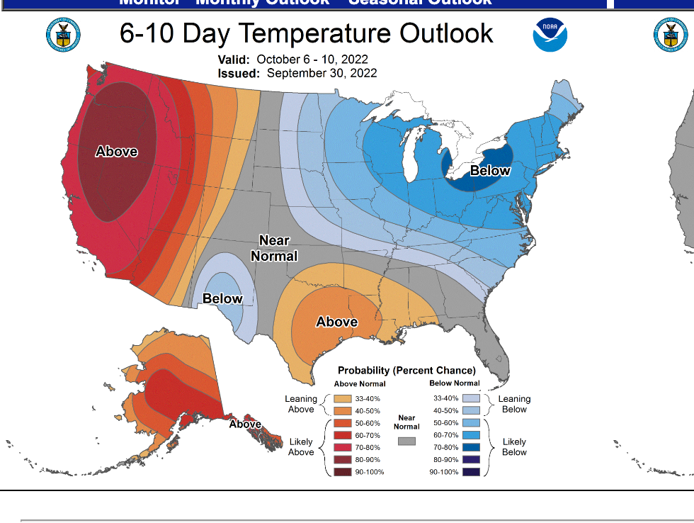
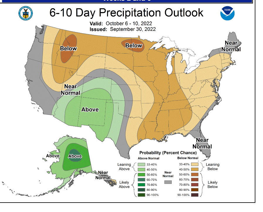
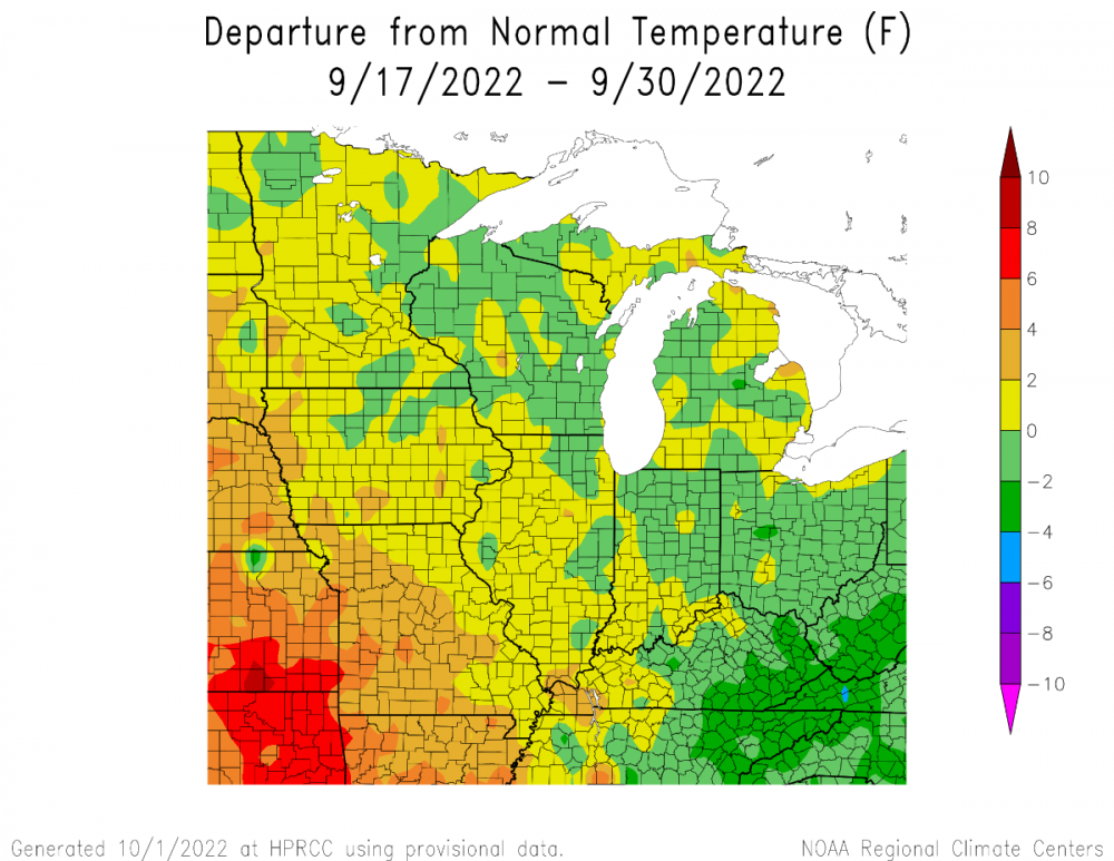
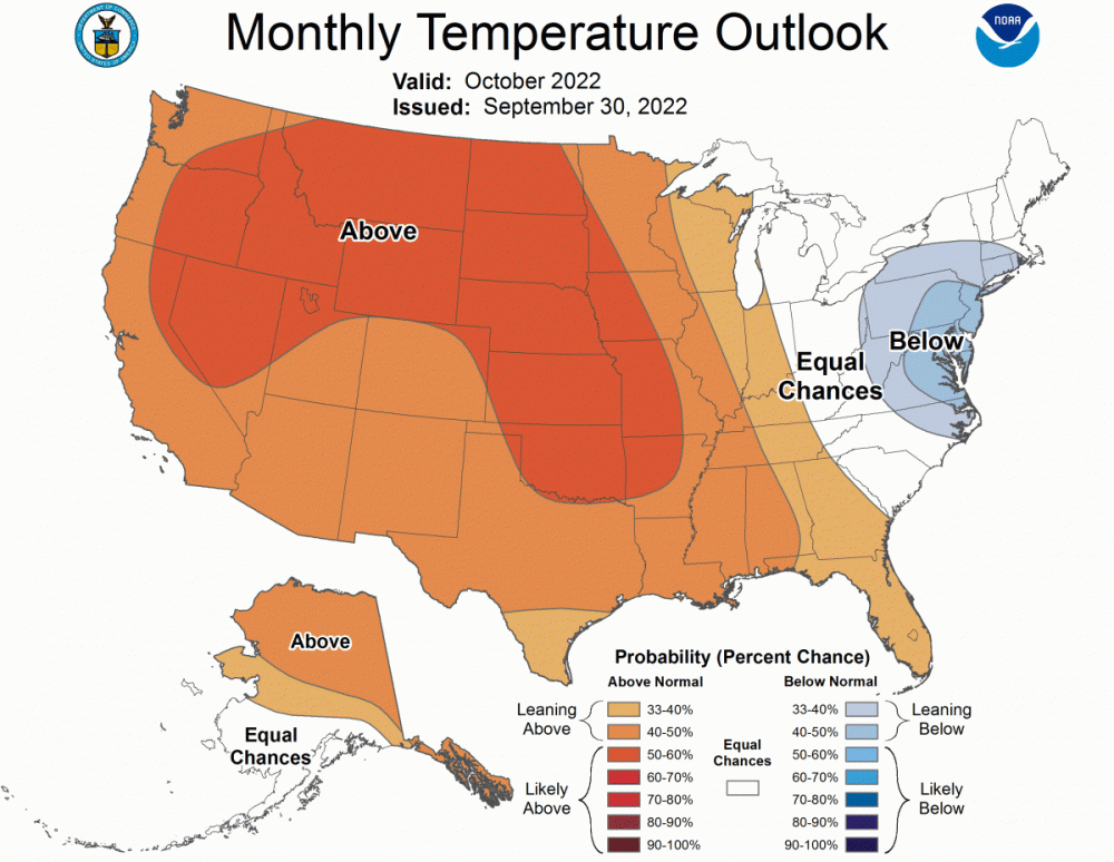
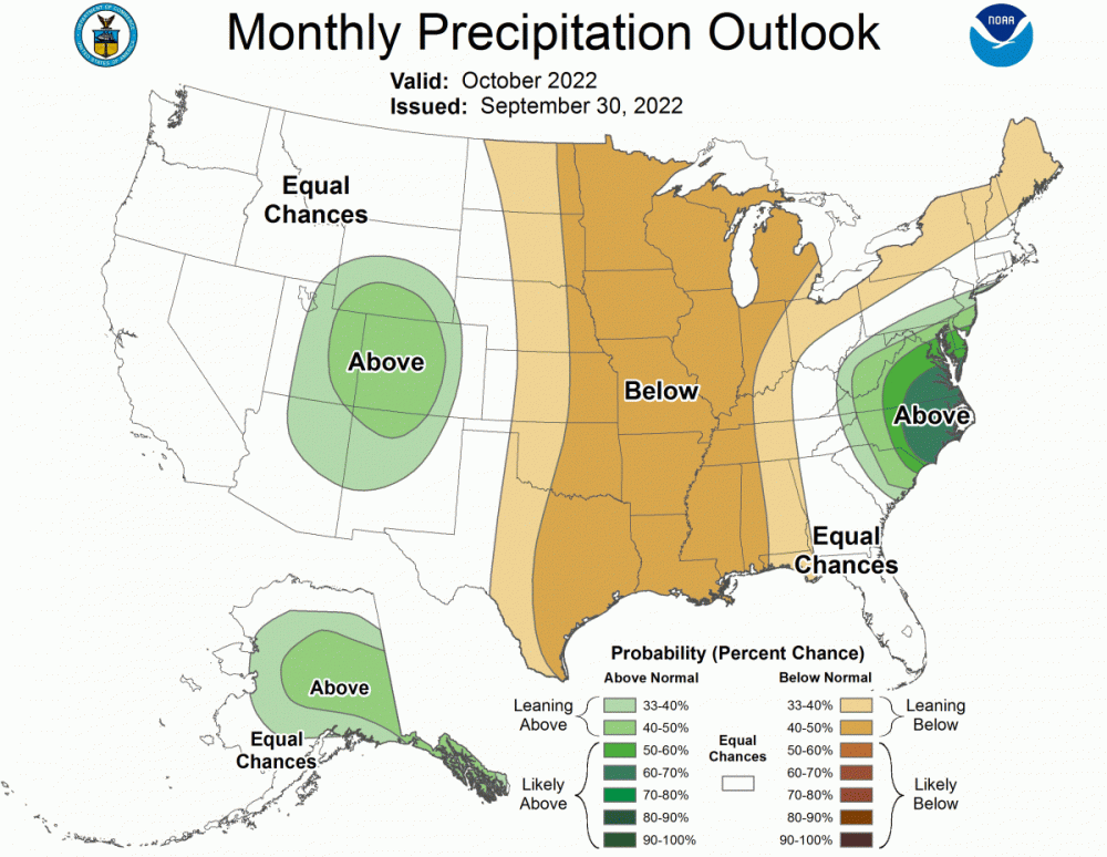
CPCs outlook still looks to warm imo, especially for those up north and around the lakes. ICON model showing a hard freeze all the way down into C. Iowa on the 8th. Unfortunately it looks like it will be mid month before most of us have any significant chance of precipitation but I agree with you that the back half of the month could be very active. Phase 7 MJO maybe.2 points
-
CPC updated it's OCT outlook...big change from the previous Mid SEP run showing AN temps nation wide. Now it looks like they are suggesting more of a nation divided...East cool and west warm?? AN precip signal for the central Rockies and SW...Like I said before, from my experience of living here in the SW, something is changing and in a positive way. Have no Fear....Nature is Here...2 points
-
Penalize kids who can’t afford good costumes/whose parents don’t help them as much. Sounds dope.2 points
-
I couldn't believe I watched that NFC Championship game live at the time with my mouth agape, and now I couldn't believe I witnessed and experienced history firsthand when Cal rocketed that pitch on a 3-2 count. Absolutely magical fairytale stuff you see in the movies. I cried and I'll probably cry again tonight, haha.2 points
-
Yeah it was insane the moment it happened. Haven’t been this hyped for Seattle sports since we came back and beat the packers in the NFC championship game. Sure we’re probably not going to be winning a World Series but it’s pretty cool that the droughts over.2 points
-
2 points
-
2 points
This leaderboard is set to Vancouver/GMT-07:00


