
Leaderboard


Popular Content
Showing content with the highest reputation on 11/03/21 in all areas
-
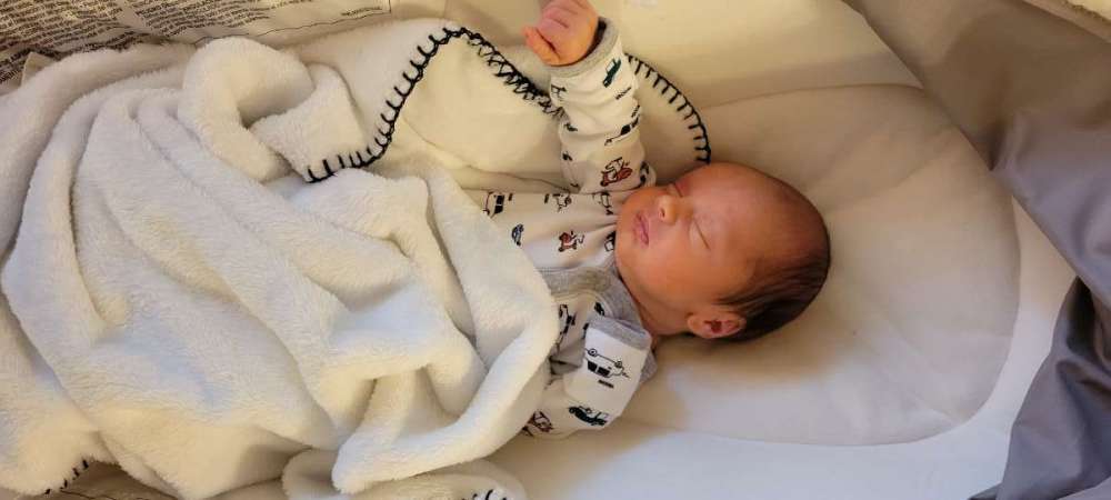
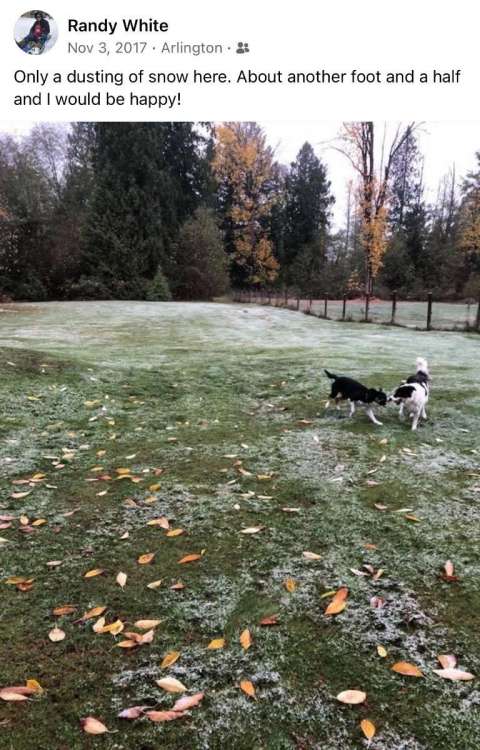
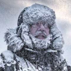
Hey all, guess I really am only a winter weather poster. I'd like to introduce Cooper, who has already requested a weather station for Christmas. He came a bit early but he's doing well! Anything to look forward to in the coming weeks?
 28 points
 -
I hope Joshua has access to the radar loop.7 points
-
7 points
-
One of the best snow cars I ever had was the 1970 Dodge Polara station wagon I had in college. A big old “lead sled” of a rustbucket, but its 383 V8 hauled *ss. Great fun to get the stink eye from people in much newer, better looking cars as I zoomed past them up the mountain passes at full highway speed in it. It had a good set of snow tires on it, and its mass meant great momentum for breaking through drifts. It was almost unstoppable in that regard. My apologies if I’ve related the story before, but I schemed long and hard to get my parents to give it to me. While a sophomore in high school, I said to my self: “Self, the old green car looks like crap but it runs great. Ask your parents if they will let you have it when you go off to college. They will probably agree because they do not believe it will still be running then.” So I did. After the gales of laughter (“He actually thinks that old heap will still be running in three years!”), they reassured me that if they still had the green car, and it still ran, then of course they would let have it when I went off to college. When the day arrived, “We weren’t being serious when we said that.” But I pressed the issue, and got the car.7 points
-
Congratulations, and welcome to the Night Shift!7 points
-
My favorite memory is the Tuesday before Thanksgiving. Forecast was for a few snow flurries at most. Had 3 straight classes that morning at WWU in Bellingham. It was clear when I woke up. After the first class there were a few clouds. After the second class it was cloudy. After the 3rd it looked like snow was imminent. Went to Pizza Hut with a friend. It started snowing. Got a free personal pizza because they didn't serve it in time. My friend had locked his keys in his Supra so we had to get a coat hanger to get in. He drove me back to the dorm and went home. Snowing hard by then. And it continued to snow hard all afternoon and evening. It was beautiful to watch. Classes were canceled on Wednesday. We had about a foot of new snow. Everything was so quiet. Nothing like the aftermath of a big snow. We walked down to the nearest auto supply store to buy chains so we could drive to Anacortes for the holiday weekend. Many students couldn't make it home and the dining areas on campus were scheduled to be closed so the University had to scramble to find food for them. One of my favorite snows ever.7 points
-
I had no idea these existed. LMAO dude is a player.... How many of these people are axe murderers? Seriously. 00z GFS in 1 hour 38 minutes
 6 points
 -
The tree that lost it’s top in the windstorm has paid the ultimate price.


 6 points
 -
6 points
-
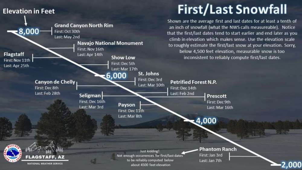
The NWS up here rarely ever does cool detailed graphics like this. Nice info from Flagstaff.
 6 points
 -
This is from Lezaks blog this morning discussing the storm next week. It may not be a hard cutter Then, by mid-next week, a negatively tilted trough will zip out into the middle of the nation. A negatively tilted trough "tilts" to the right, and a positively tilted trough leans from northeast to southwest, or to the left. Negatively tilted troughs are much more energetic, and this one needs to be watched closely next week. I will discuss this in more detail on the air tonight. This system will likely be a strong storm, but it may end up tracking north of KC. I am not sold on that yet, so let's see how the models trend.6 points
-
Got down to 21 this morning. Novemberrrrr!6 points
-
Long ways out but the GFS Extended has a cold look for the first week of Dec. Cross polar flow, Decemberrrrrr. The Euro weeklies keep the fun going.6 points
-
They wouldn't post them on Craigslist if they didn't want them seen, not embarrassing at all to them, just desperate.5 points
-
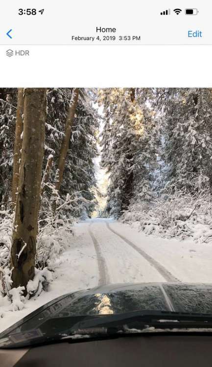
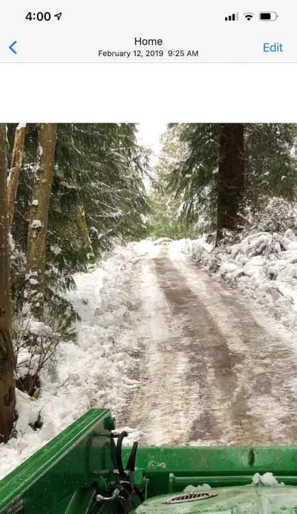
All of my vehicles after my ElCamino have been 4wd/Awd since minus my run around Jetta I had in the later 2000’s when gas prices were insane. However my 4wd truck and AWD Outback could not make it up our steep driveway in February 2019 after a few days of driving up and down it turning it into an amazingly slick compact snow/ice combo. That is when I invested in a plow attachment for my mower. The pictures do not do it Justice with just how steep the driveway is. I had to borrow the neighbors tractor that first big snow we had at our current location.
 5 points
 -
Just came back to Puyallup for the first time in a week and it looks I got some leaves to rake
 5 points
 -
When the sun was at a specific angle, color gave me flashbacks to last year's smoke around the Santiam area.


 5 points
 -
Well, some of these trees have almost entirely stripped themselves (Washington/3rd). 2nd shot was a week ago. Noticing more homes around here lately showing up on the market. This one though is way expensive for the square footage.
 5 points
 -
By the way…. The company I interviewed with called me a couple months later and offered a different job. I’ve been there for 35 years. And was working there in 1990 for the surprise convergence zone foot of snow. So, all good!5 points
-
Sky on fire
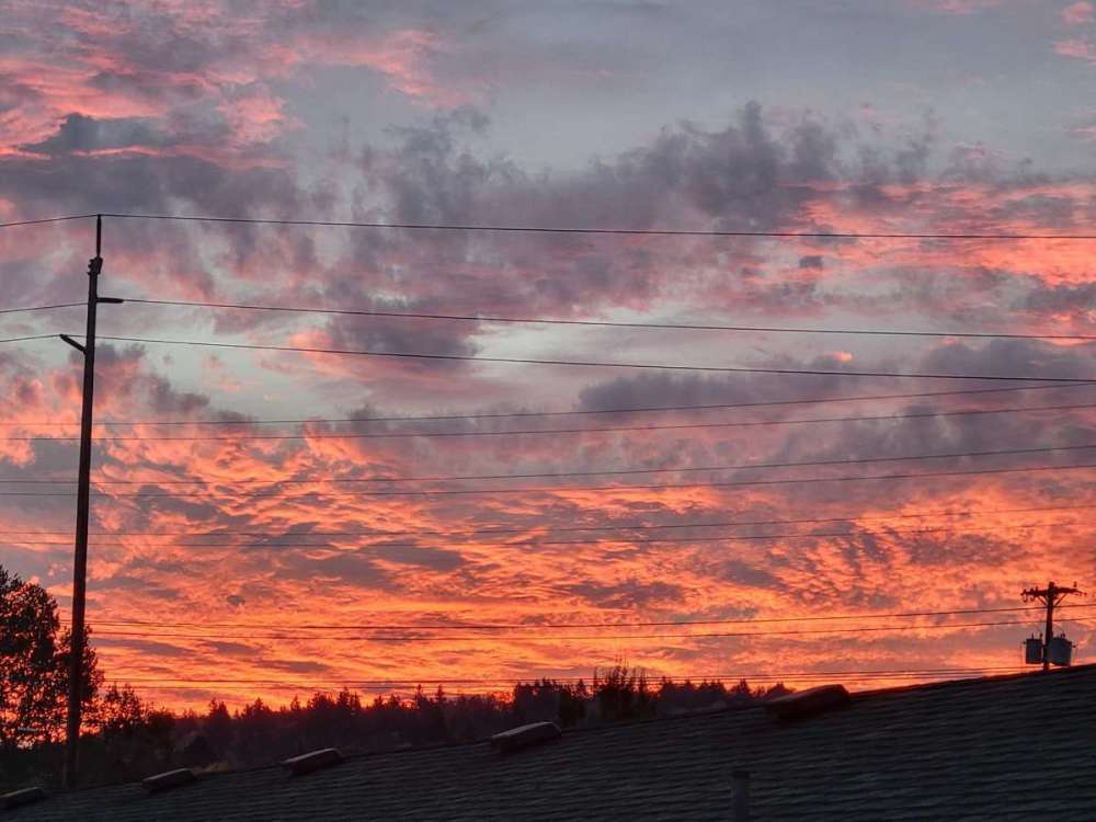 5 points
 -
There is a combination of frost, snow and ice here as there was a couple of snow showers mixed with rain and then it became clear and thus the frost.5 points
-
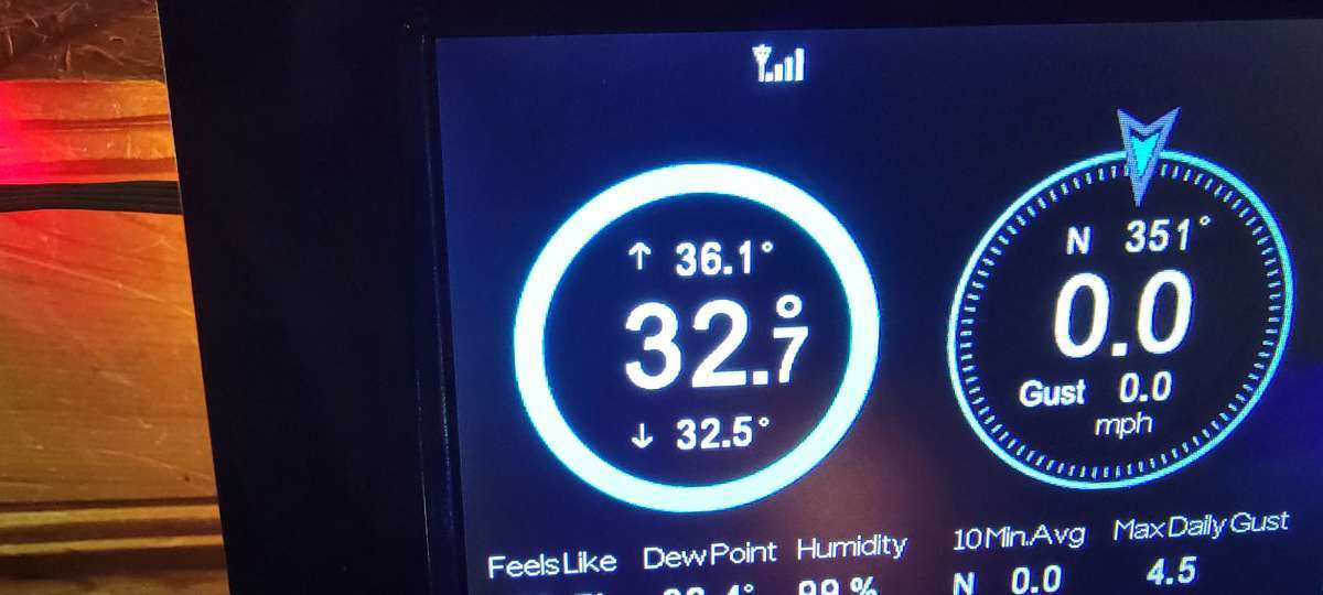
This morning I have my first frost and freeze of the season. Skies cleared overnight and the temp has dropped to 28.5 points
-
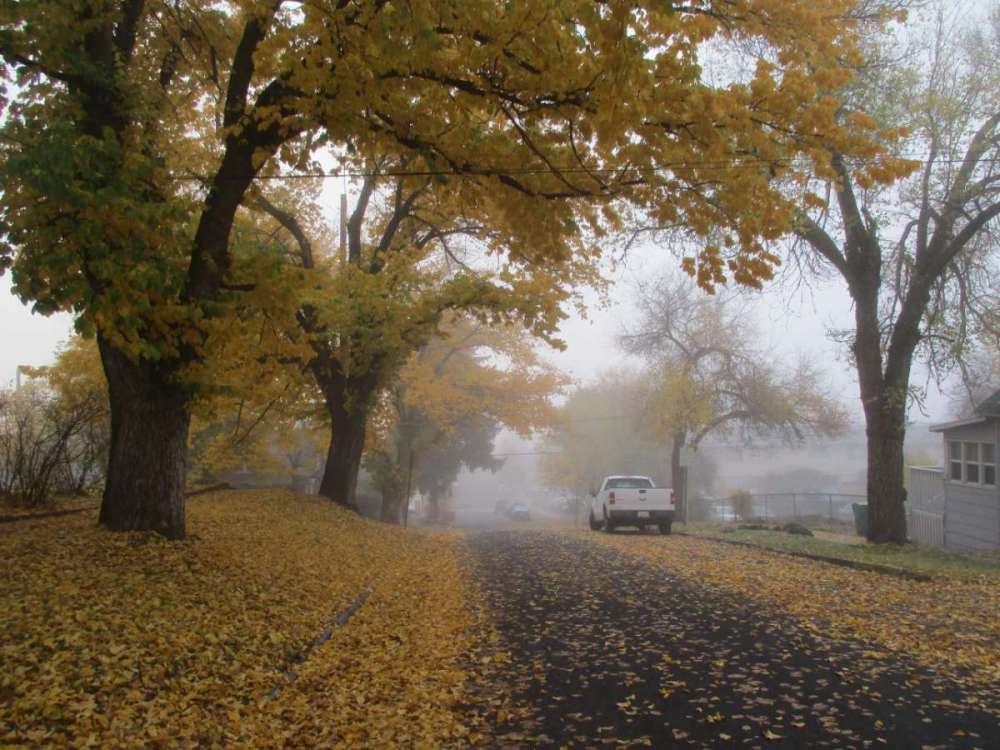
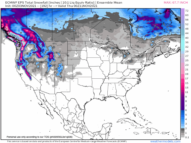
0z EPS snow mean not shying away from spreading the "white gold" from north to south...#blocking Enjoy the Indian Summer wx thats on tap for this weekend, bc we are about to get a real taste of winter post Vet's Day. All the models are locking in on a colder/wintry pattern for the eastern CONUS for the 2nd half of November. I sure as heck am going to finish up all my chores outdoors this weekend. It'll feel real nice with sunny skies and low 60's in the forecast. The fall colors are exploding in my neighborhood and actually rather vibrant. Great wx to see the last of the colors before the wind/storm later next week.
 5 points
 -
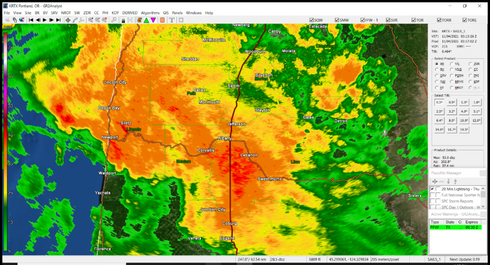
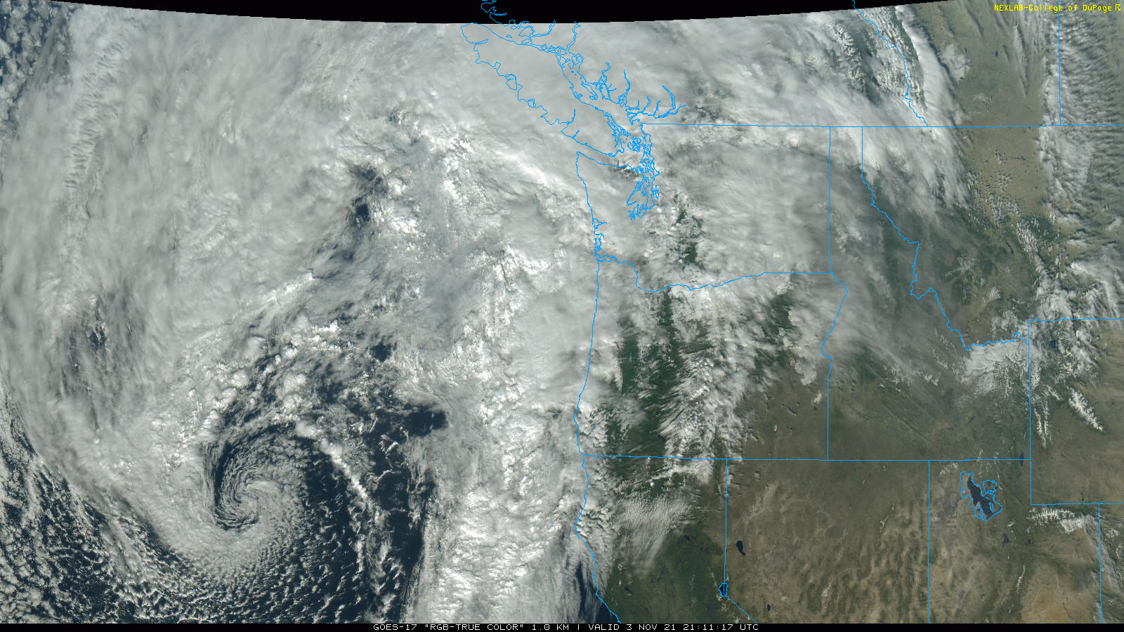
8:27 PM Radar Update It is absolutely pouring south of Portland from roughly Lincoln City to Eugene. Mega downpours perhaps. Cloud tops have some decent height to them a bit of a convective characteristic, so not sure we can entirely rule out a lightning strike, especially west of the Coast Range. This is moving north-northeast.
 4 points
 -
Hot dang it’s pouring out
 4 points
 -
Wow incredibly warm here today. Got up to an astonishing 66.4 points
-
guys.....i'm beginning to think the GFS is not a great weather model4 points
-
Inversion season is in full swing by then. Extended longwave ridging= Fog for most of us. Dirty, flatter ridging= Warm front drizzle and fog.4 points
-
Has he mentioned anything about any upcoming SSW’s?4 points
-
But yes, I think it is worth noting the closest match to the NPAC/WHEM pattern over the last 6 weeks is, indeed, 2007/08. Perhaps a bit less extreme/more canonical, but it’s very close. An attempted re-run of that regime could easily produce a warmer outcome in the PNW, though.4 points
-
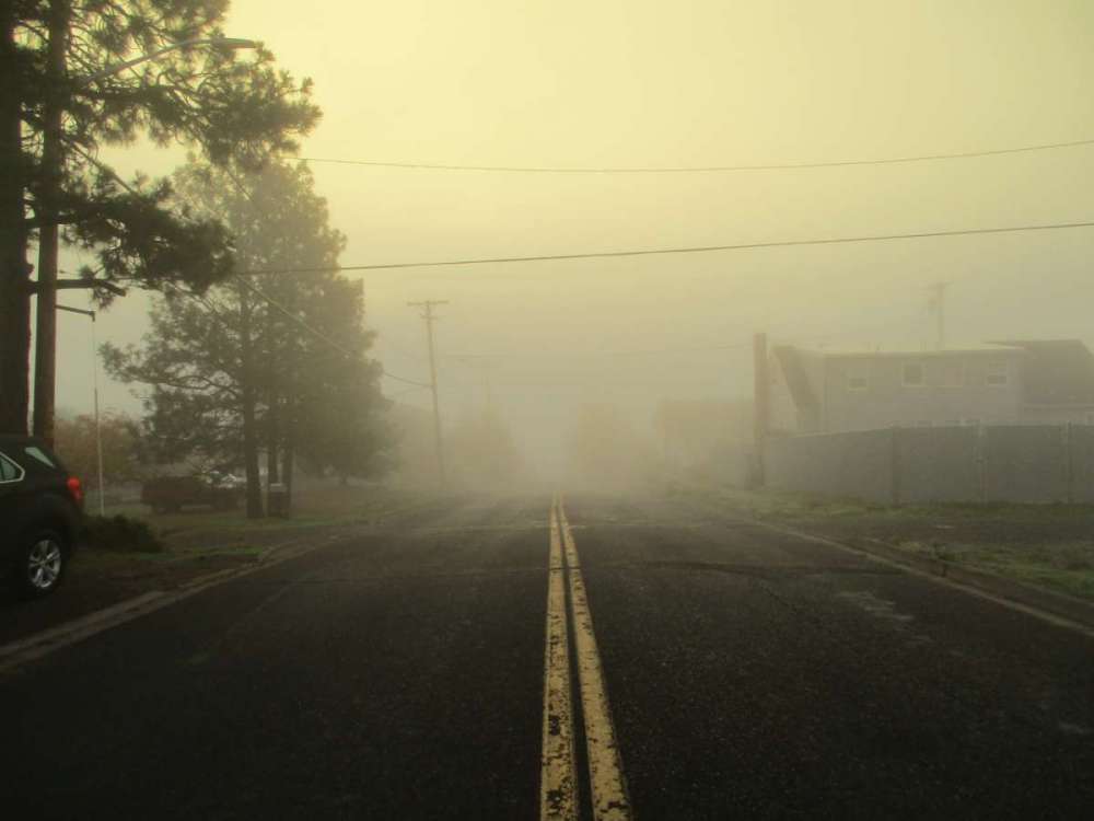
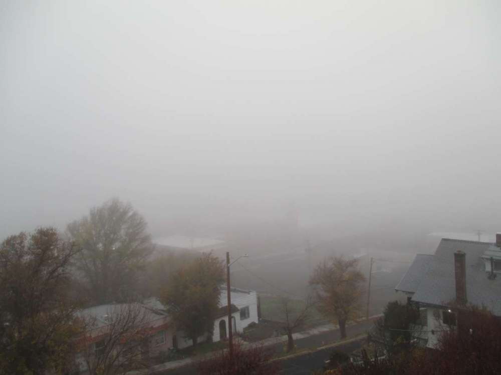
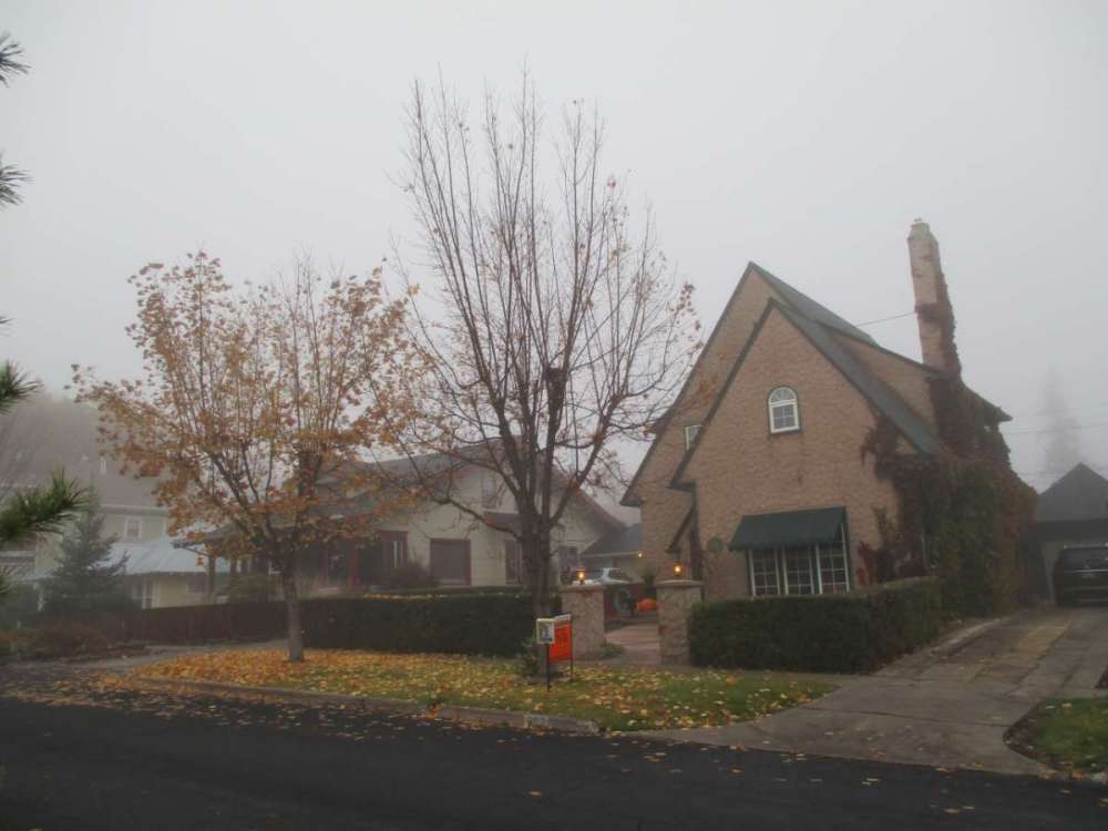
Foggy outside still. Usually it burns off by now.
 4 points
 -
.03” so far on the day, 1.48” for the month. Currently mostly cloudy and 55. Had a dusting 4yrs ago, and 1” of snow two days later!
 4 points
 -
Pretty good agreement so far on a healthy storm late next week in the upper Midwest. GRR NWS mentions "gales of November". Unfortunately it will be too warm here for anything exciting winter wise (unless something drastically changes in track). But good luck to the early winners of fall up north and west!4 points
-
First off I had the first snow fall of the season it mostly melted on contact. There was a total of 0.04" of rain and melted snow here overnight. While it was the coldest night of this fall season so far it was still warmer here than at the airport. The low here was 29 while at the airport they reported a low of 25 so far. At this time it is clear here and 29 there is trace amounts of snow and ice on the roofs and cars here.4 points
-
Tomorrow is moving day.4 points
-
Those Craigslist posts reminded me of this scene from Fargo3 points
-
That pattern showing up around day 9 just reeks of a cold wave in our future. Looks like we go from cold and wet to warmer with a real chance of a major firehose.3 points
-
It’s raining in November? No way. We average about .20’’ a day over the course of the month. Much more than that where some of you live. It looks pretty average to me precipitation-wise through the first half of the month when you account for the model over-optimism. I will bet that we will end up under the Euro ensemble 10th percentile for rainfall at PDX from today through November 15th. That amount is 3.39’’. Mean is 4.92’’. Any takers?3 points
-
Now you have something to do on your slow night shifts!3 points
-
Haha. Wow. Whoever she is, she needs to get a RO immediately! 00z ECMWF in 2 hours 16 minutes
 3 points
 -
56/49 on the day. Probably won’t see any 60+ readings again until January.3 points
-
I’ll keep it on topic from now on my bad!3 points
-
https://seattle.craigslist.org/search/tac/mis?3 points
-
Ideally....yes. Practically...no. Baby #2 is due second week of December so i'll be locked into Renton for a little bit.3 points
-
I take it you will be spending the month in TWISP.3 points
-
I've heard that a -QBO can increase the chances for SSW events, and those can deliver some of the longest cold and snowy patterns in the PNW. If this is the case, then that would be a situation where the PNW could have an epic winter under a Nina/-QBO state. But as you said, its a lot easier to amplify the N Pacific ridge under Nina/+QBO so a SSW would be less of a necessity under such a combo.3 points
-
Congrats! Make sure he doesn't gain too much information from conference calls.3 points
-
White ground attm as if it snowed. Crystal clear skies, no wind at all and a cold temp at 29F. Hello November!3 points
-
The GFS has been trending further east. 6z GFS with a Vetrans Day bomb.3 points
-
Since we were talking a bunch of blast from the past earlier in the day.... Don't think anyone mentioned 2003. What a start to November that year right? Look at that string of consecutive record lows.
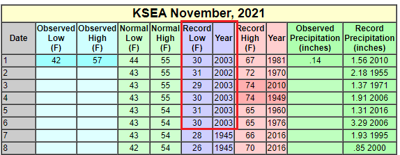 3 points


This leaderboard is set to Vancouver/GMT-07:00