
Leaderboard


Popular Content
Showing content with the highest reputation on 11/17/22 in all areas
-
For no reason at all, here is a pic of my sister's dog.
 14 points
 -
Some kid hosed down the exit to the bus barn when I was in high school and cancelled school for the whole district. He was a legend and no adults ever found out who it was.11 points
-
11 points
-
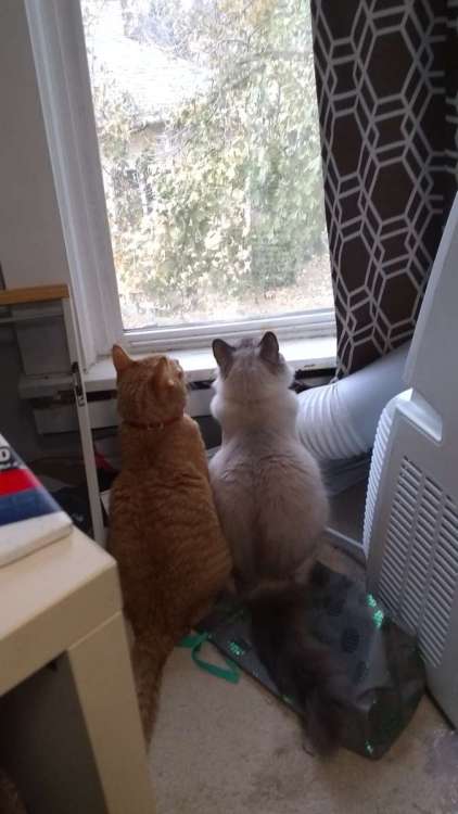
We're up to about 31 right now and the cats are watching the tree shed leaves. Most other treees have already lost their foliage by now.
 10 points
 -
A frosty 27 this morning.
 8 points
 -
Monster snowstorm in the clown range up north.
 8 points
 -
At least there’s a chance for winter bliss given blocking. Zonal flow is an automatic game over.7 points
-
Nobody posted EPS? Looks great
 7 points
 -
A bit icy. Actually seeing some snow flurries now though.
 7 points
 -
7 points
-
A Christmas Story Christmas is a really good movie.6 points
-
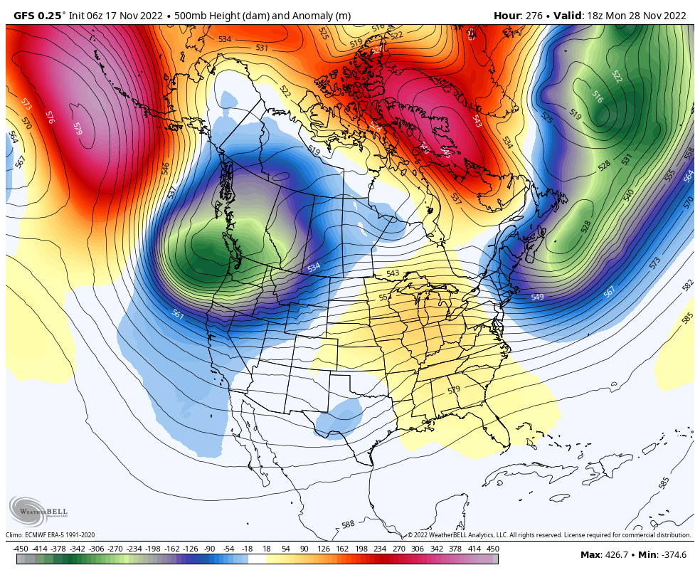
PNA still looking to dip a bit.
 6 points
 -
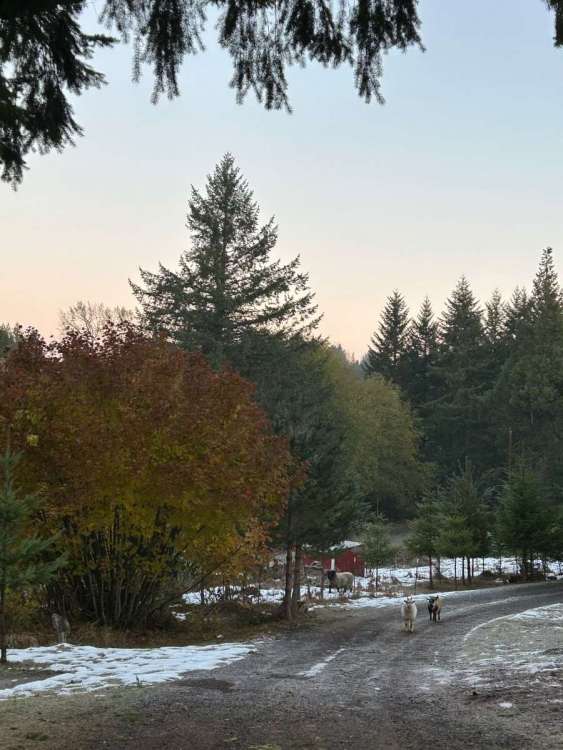
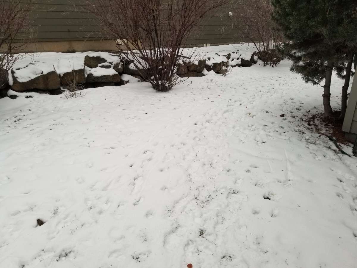
Here's a couple of pics, but I'm not sure how well the icy trees will show. Also, my sister's backyard with a couple of doggie crunchies.
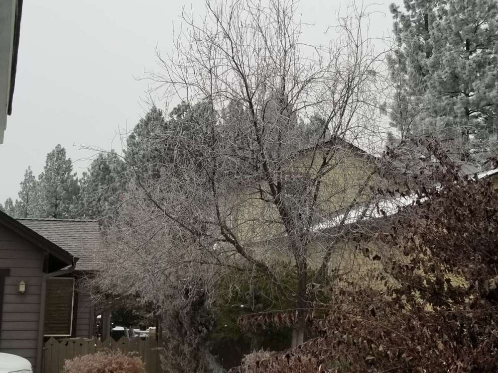
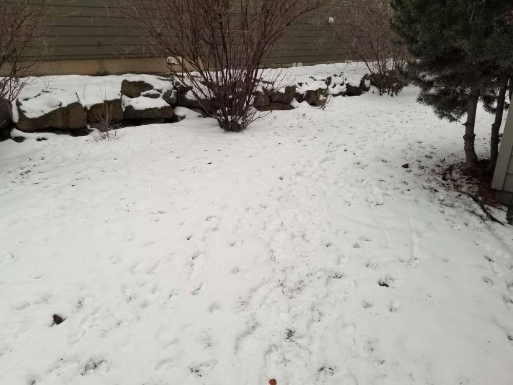 6 points
 -
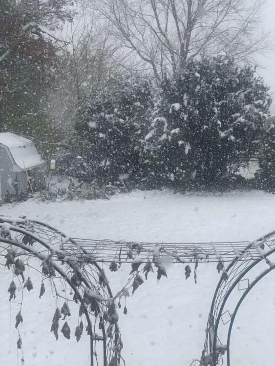
Starting out well. Just off and on right now though.
 6 points
 -
‘13-‘14 was quite a good winter over here. Lots of snow and very cold. That was the year Redmond tied their all time low twice of -28 in both December and February.5 points
-
People wanted the Pacific shut down. They wanted a winter with a blocky pattern. Now that we are getting it, they're complaining.5 points
-
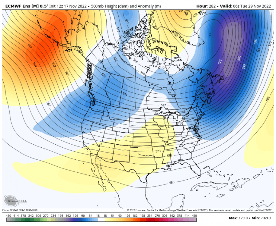
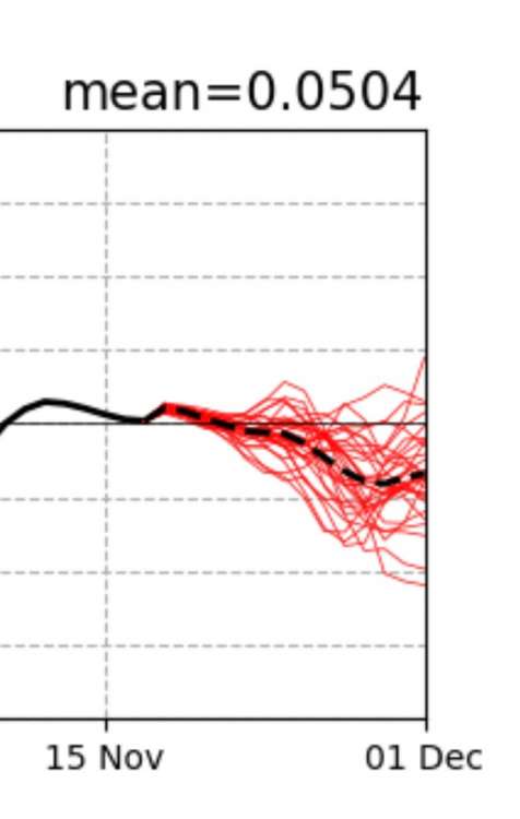
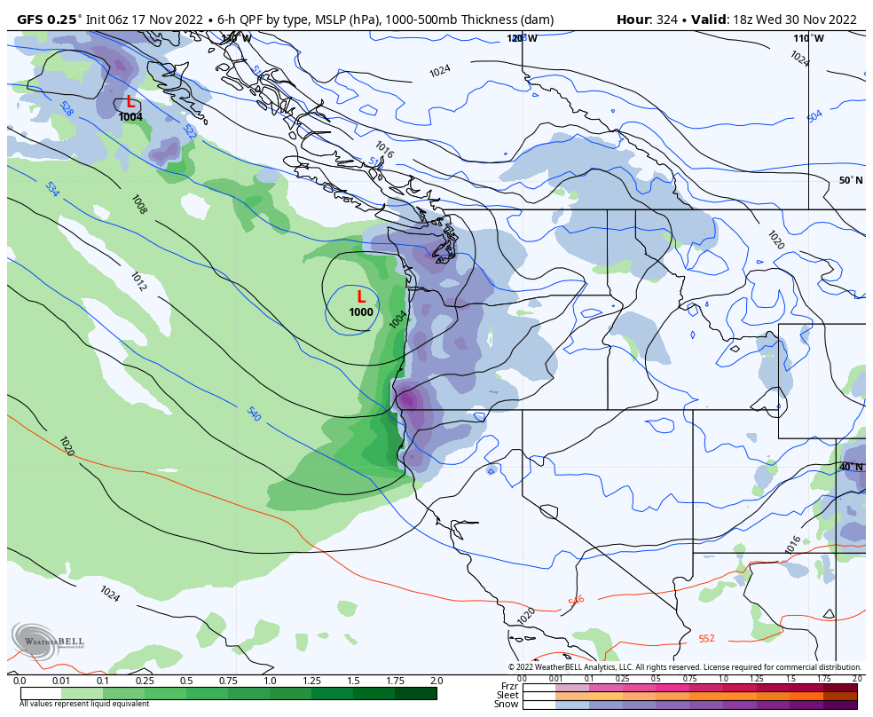
Seems like the models are always kicking the can down the road, but here is hour 300 EPS.
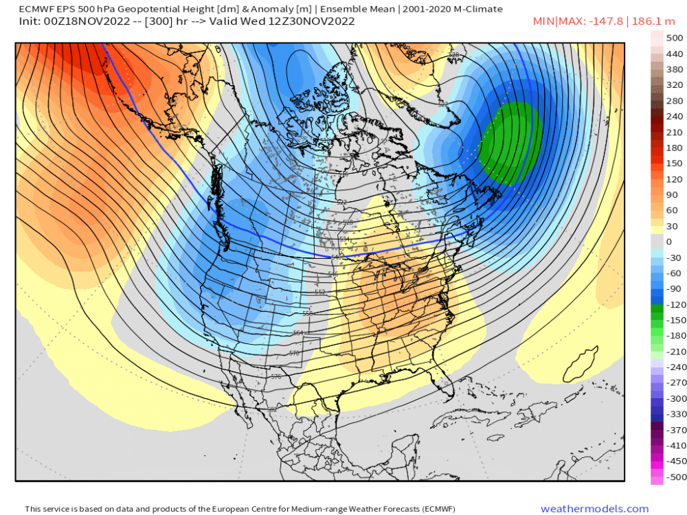 4 points
 -
We will be fine.4 points
-
Day 3 .... We've seen this many times before. The models look like trash, just a convoluted mess, and then it all changes quickly. It won't be anytime too soon, but don't be surprised of the models look far more inviting in 5-6 days. MBG4 points
-
00z GFS time! Sorry I'm late, it's my month to bathe. What? Don't judge. Maybe I'm just hugely into water conservation? Maybe I'm Amish? No offense to any Amish members in the group, or who may have future plans to do so. It's not my fault people the boring weather maps lead to pure nonsense like this. Anyways, let's see if there is a more concrete pattern change after Day 7, or renewed blocking over Alaska/150-160 W. C'MON!!!! Oh, and in case you are new here, we will ALWAYS.... Think Cold and SNOW! C'MON!!!!4 points
-
4 points
-
The weeklies have the PNA sustained around -1 for weeks. Don't think I've seen it that low in the way out period. Strong signal.4 points
-
It's still a ways out but the models have been showing this off and on for the last 4 or 5 days. I think cycle 2 is almost here.4 points
-
I agree…the active route is overall better.4 points
-
Looks like PDX has gone off line.4 points
-
That east wind makes getting home faster.4 points
-
Yesterday’s official H/L at Grand Rapids was 34/29 there was 0.03” of precipitation, 0.4” of snow fall. There was no sunshine at 7 AM there was 3’ of snow on the ground. The overnight low here in MBY was 24 when there was some clearing. At the current times it is 29 with light snow falling and there is around 1” of snow on the ground here. For today the average H/L is 47/32 the record high of 70 was recorded in 1953 and 1958 the record low of 9 was recorded in 1959. The record snow fall for today is 7.1” in 1989 there was a 6.0 snow fall in 2014. We will see how the next few days compare to past big November snow fall events. The snow fall has really picked up here and now I am getting moderate snow fall.4 points
-
That’s what we thought in July3 points
-
The wind has sure overperformed here. Still getting some big gusts at times. I can't figure out how the wind can still be this strong with fairly unimpressive surface pressure gradients. We might be getting some mid level momentum surfacing in this area. That would explain the ridiculously low dps right now.3 points
-
GEFS tonight v last night 10 days out. everyone check back in in a week
 3 points
 -
Whelk, glad I'm the only one here who likes dry and cold too. This has been a nice last couple weeks.3 points
-
Just took a snow fall measurement and here in MBY there is now 5.5" of snow on the ground. I am sure much more has fallen. But with the warm ground it has really compacted and is more like synoptic snow then lake effect. It is very wet and as I said 5.5" on the ground and just over 2" on the road. And it has been reported that Grand Rapids public schools are closed for tomorrow. The record snow fall for today is 7.1" set in 1989. For tomorrow the record is 9.6" in 2014.3 points
-
15F Windchill and SHSN making this evening feel more like quality Dec out there. Brrr3 points
-
Strongest gust at PDX since January 2021 with 48mph today3 points
-
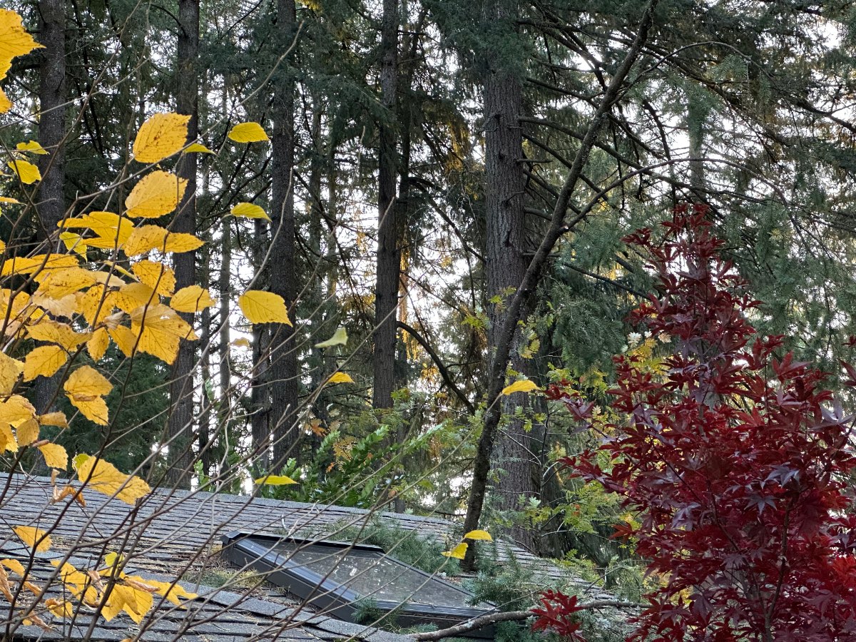
Came home to a Douglas Fir branch through the roof and into the bathroom.
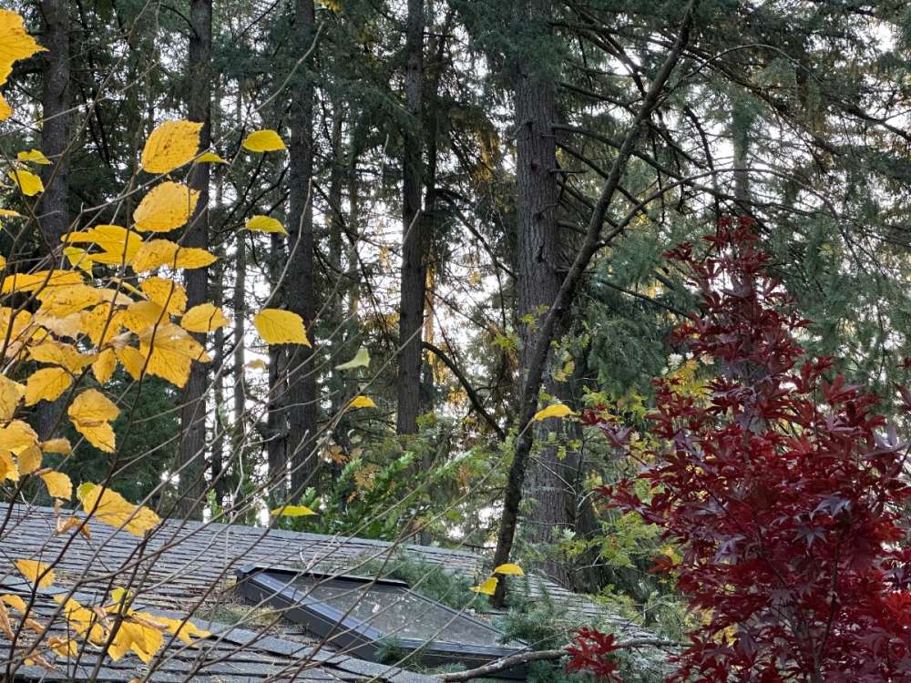
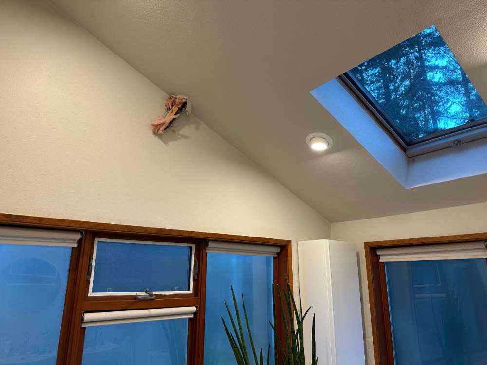 3 points
 -
People are getting impatient and it's only November. Very blocky winters are a nearly constant theme of blocking reinventing itself over and over again. It gives us a shot at having snow followed by a long period of clear and cold.3 points
-
I'm watching the Packers and the Titans play in Green Bay tonight the snow is awesome. Talk about football weather!3 points
-
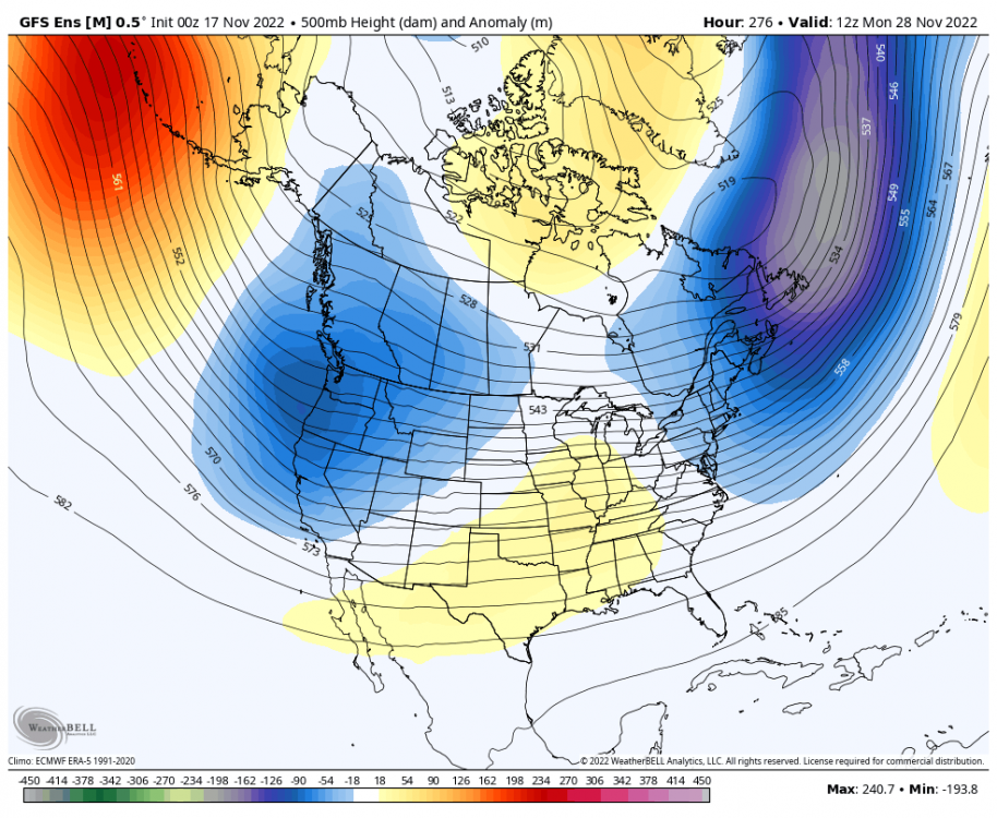
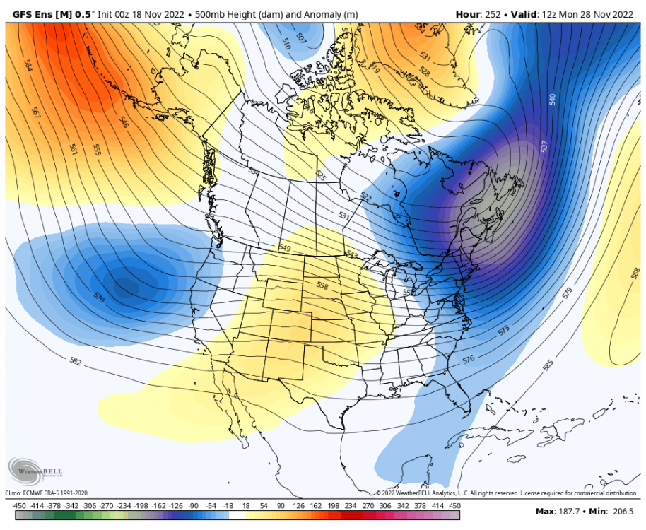
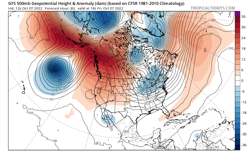
I don't know if this storm will go get lost in Mexico but I could see the energy cutting off and holding back out west and eject in pieces. We've seen that before this season. Map from Oct 7th: We had a sky high PNA Map valid Nov 25th we have more of a neutral PNA. You'll notice both maps have a trough over the lakes also.
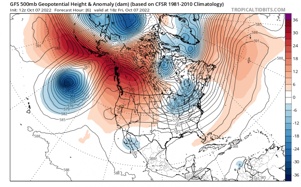 3 points
 -
If I recall correctly it was mid December of 2013 and somewhere in the February 10th range of 2014 right after the big snows here. I think between the 7th and 9th I recorded about 32”. Then it cleared and got cold. I remember it vividly since it happened right after the Hawks won the super bowl. Great year. Then I had my daughter March 8th, a month later.3 points
-
18z doesn't look quite as bad. Latest CFS runs show a cold January, slightly below average December and Feb-April.3 points
-
This dude…
 3 points
 -
Not quite where we want it, but at least the models seem to be trending towards blocking returning around Alaska/NE Pacific.3 points
-
Looks like we got down to 28F for freeze #7.3 points
-
Looks like the ICON is trying to cut off the energy from that trough back near Hawaii around day 7-8. The 6Z gfs could be onto something if that were to happen.3 points
-
East wind event in progress now for dang sure. Any stronger and we can call this an all-out east wind storm. I can't remember the east wind ever waking me up this much. Constantly since 2:30 AM. Big league gusts. 12z GFS in 1 hour 52 minutes3 points


This leaderboard is set to Vancouver/GMT-07:00