
Leaderboard


Popular Content
Showing content with the highest reputation on 09/09/23 in all areas
-
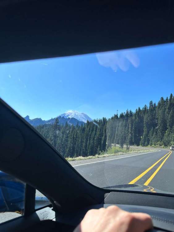
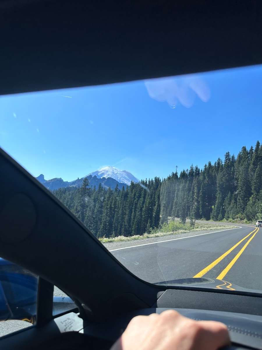
Drove back from Boise to Everett today. A pleasant drive made for great fun when I took Deadman at 70mph and also managed to see Mt Adams from Pendleton. Made it across 410, saw the ice crystals being blown off of a very close Rainer from Tipsoo and even got a chance to visit my old stomping grounds in Buckley and Bonney Lake. The weather was perfect.
 9 points
 -
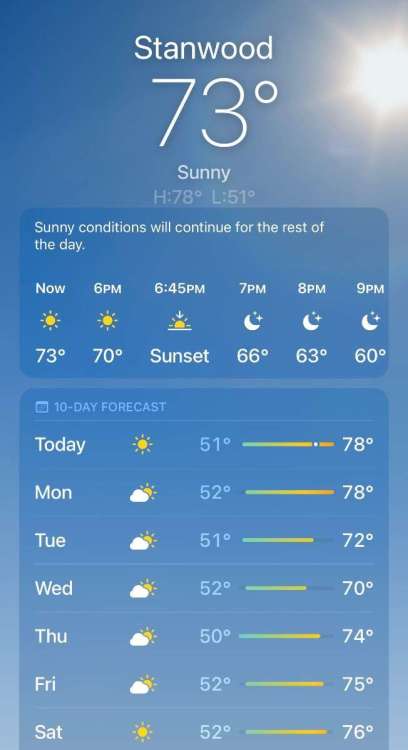
Loving the switch to fall-ish morning temps. Been around 50 the past several days with a nice heavy dew covering everything. The afternoons stay just warm enough to enjoy the heat of the sun. Currently 49 which also is the low for the morning. I was about to head out and try to get some sunrise photos but it looks like its pretty foggy up in the county, so I'll stay put and enjoy a cup of tea. Headed to SoCal on Monday for a quick trip to meet the team I work with, looks like it will be in the low-mid 80's while I am there with lows around 70.7 points
-
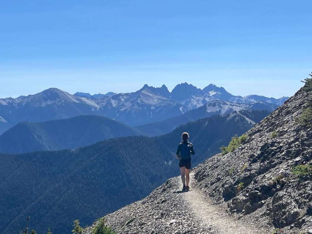
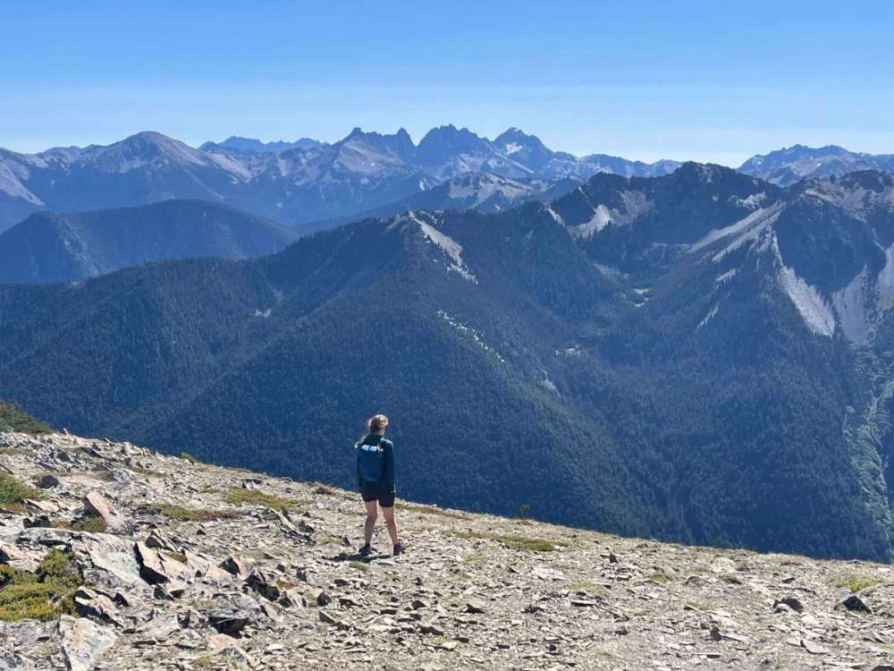
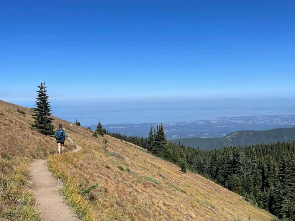
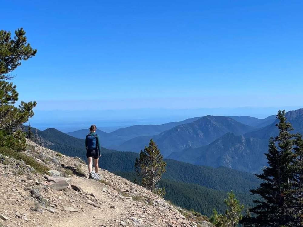
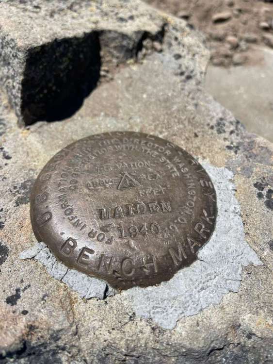
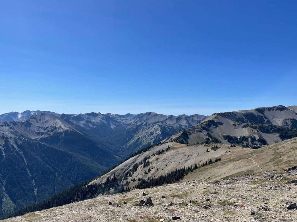
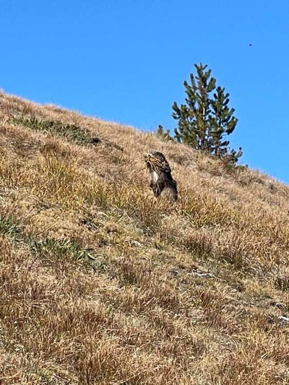
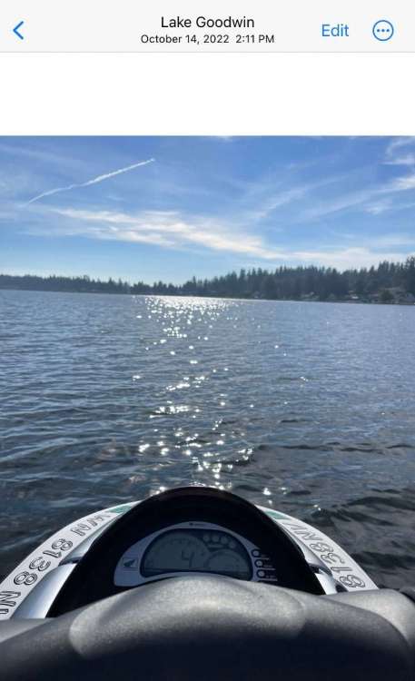
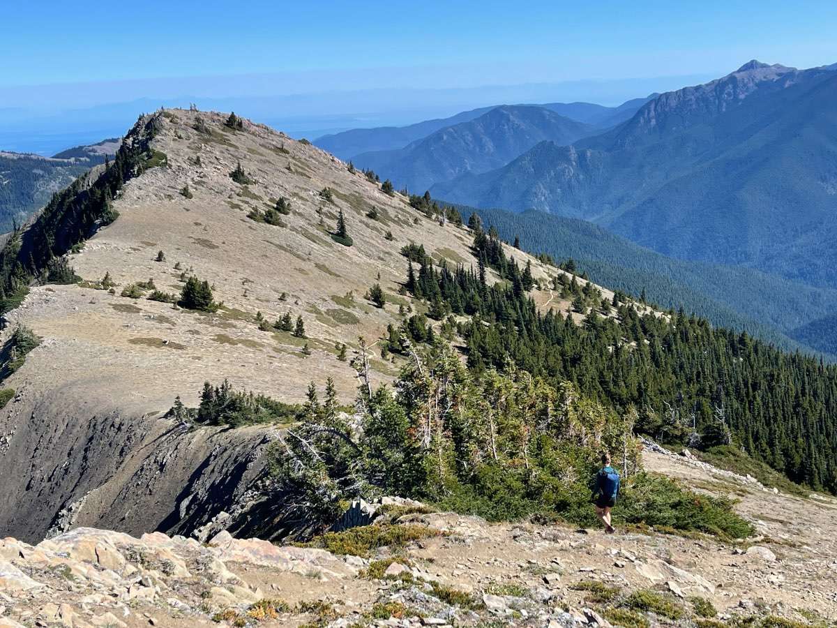
Another trip into the Olympics. Beautiful day!


 6 points
 -
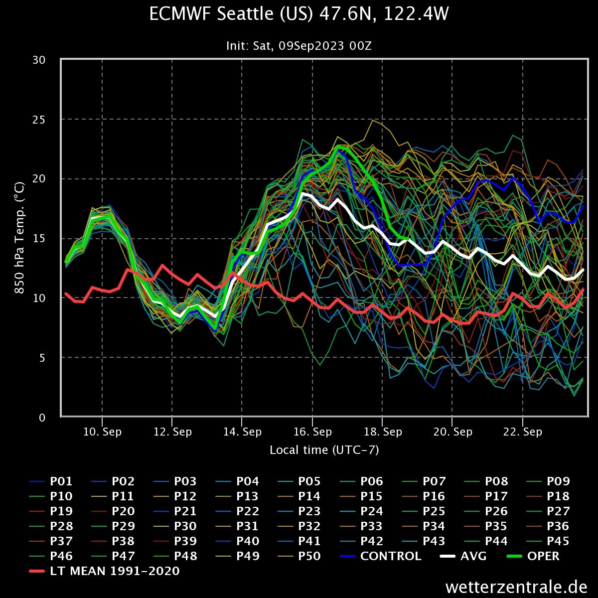
Frosty nights next week? I think the Northwoods are in a prime location as a chilly Canadian HP tracks overhead. It's going to get real nice and chilly mid next week. 40's are not out of the question in the western burbs over here. Meantime, this morning my temp dropped to a comfy 55F and I see there are plenty of 50's and 40's across the Sub this morning. @Clinton is probably enjoying this morning! Autumn has arrived and it appears to be sticking around for quite a while around these parts. "Trough after Trough" is likely to rotate through the GL's/MW region through mid month. The 0z Euro still looking good for a nice soaking across the I-80 corridor...I feel like we are tracking a west/east ribbon of SNOW...just using my imagination this morning!
 5 points
 -
2022-23 will go down as an extremely odd bookended cold season. It took us approximately one week to go from summer to winter late last year, and then it took about the same amount of time to go back from winter to summer this April/May.4 points
-
Next week (mid week period) comes a real cooldown w potential high in the upper 50s to near 60F and lows in the lower to mid 40s. Hello Autumn!!4 points
-
Devastating quake has struck Morocco.4 points
-
How’s this for a forecast? Beautiful.
 4 points
 -
Cougs just made up for the Mariners! That win is so sweet for many reasons.3 points
-
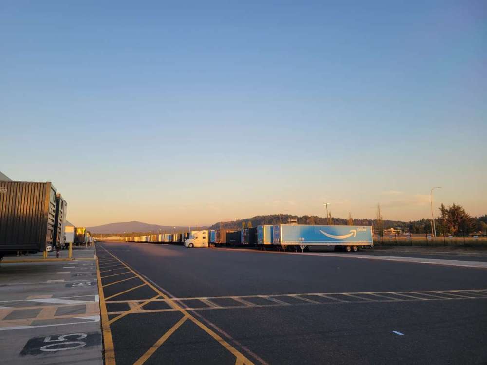
I'm training my friend on how we check our trailers this evening. The weather is perfect for it.
 3 points
 -
Zap. ️ IMG_6658.mov3 points
-
3 points
-
I gotta tell ya....it was an extremely hot summer in Greece and yes, flooded rains soaked almost everyone (Record rainfall was recorded), including my place in Andros Island. Luckily no damage, just flooded roads. Also, it was definitely needed to at least wipe out any future fires. Temps hit the mid to upper 110's (all time record highs in spots) and lows dropped in the upper 70s to mid 80s. Luckily, there is no humidity there, but still, it can get darn HOT!!!3 points
-
Beautiful morning. This can be such a lovely time of year when it’s not a smoke show.3 points
-
Latest GFS ensembles appears to suggest we are not quite done with summer-like weather yet for next weekend closer to the fall equinox. European agrees.
 3 points
 -
I'm sitting at a nice cool 60 degrees this morning. Fall is officially here in green country. I couldn't be happier. Going to be a beautiful season.3 points
-
I spoke to my cousin down in DFW and he told me that his pool water temp is a BALMY 91F! I asked him, how the heck does that cool you off? I would toss a massive ice cube in the pool and just lay on top of it...LOL, it's a testament as to how Hot its been for our Texans down south. Enjoy the pattern change next week!3 points
-
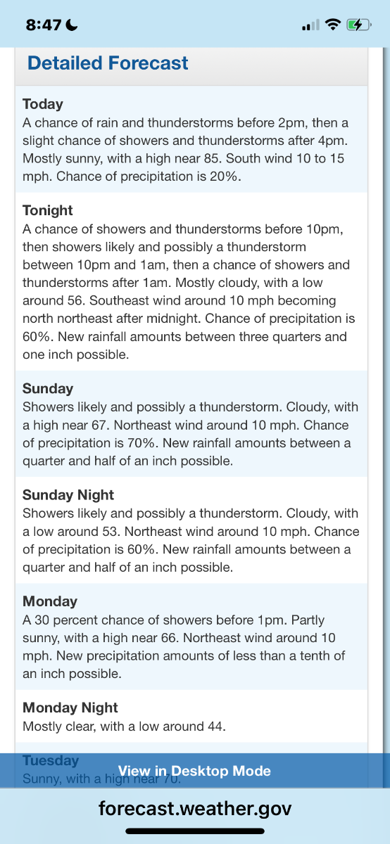
The official H/L at Grand Rapids yesterday was 64/55. That high of 64 was the coolest high at Grand Rapids since a high of 64 on June 12th the last time the high was cooler than 64 was a 62 on May 17th There was a reported trace of rain fall yesterday. The official total for September is now 0.17” for the year GR is now at 26.59” that is below the average of 27.23” for a departure of -0.64” There were 5 HDD’s since July 1st there have been 19 that is a departure of -10. There were 0 CDD’s since January 1st there have been 628 that is a departure of -55. So this year has had less energy use than average so far. It was a cloudy day yesterday with just 4% of possible sunshine that came late in the day. For today the average H/L is 77/56 the record high of 95 was set way back in 1897. The record low of 37 was set in 1975. The record rain fall amount of 2.25” fell in 1920. Last year the H/L was 81/56. From todays weather discussion from the NWS AS NOTED ALREADY, WEDNESDAY LOOKS QUITE COOL WITH HIGHS IN THE LOW 60S; THIS WILL BE FOLLOWED BY A GRADUAL WARMUP INTO THE WEEKEND. THURSDAY MORNING CURRENTLY FEATURES FORECAST LOWS IN THE LOWER TO MID 40S, BUT AGREE WITH PREVIOUS REASONING THAT FROST IS NOT OUT OF THE QUESTION IF WE EXPERIENCE MORE FAVORABLE TIMING WITH THE PASSAGE OF THE TROUGH AND ASSOCIATED CLOUDINESS.3 points
-
Little photo dump of the new kid. He is currently in 9-12 month clothing even tho he is only 5 months lol

 3 points
 -
Go Cougs!2 points
-
Doubts regarding a championship run are starting to creep in…….2 points
-
You really need to call this in to Google and tell them.2 points
-
We instituted a policy that posting model outputs more than 48 hours out requires a license or a certification in meteorology. Joe Z on Twitter, sure you’ve heard of him, had suggested as much last winter. Please refrain from any further speculation.2 points
-
Weeeee!!!
 2 points
 -
Not sure of what to think of about this upcoming winter. I do know that in an El Nino pattern, the EC does very good w heavy snows (w potential blizzards). We will see what happens, but I fear it might be a frigid, dry winter for the lower lakes. Time will tell.2 points
-
No one gets in the pool unfortunately. Just too hot. We received a heavy storm last night. Just buckets for an extended time. I don’t have a rain total right now as my gauge cracked from the heat. But it was no small rain, quite heavy for 30 mins. and so very welcomed. Lost some trees on the golf course from high winds. I’m going guesstimate that we received between .50 inches +. Currently 78. On the way to 98. Edit - At 2pm - 92*2 points
-
Last October was very much an outlier.2 points
-
I see lightning flashes to my ssw
 2 points
 -
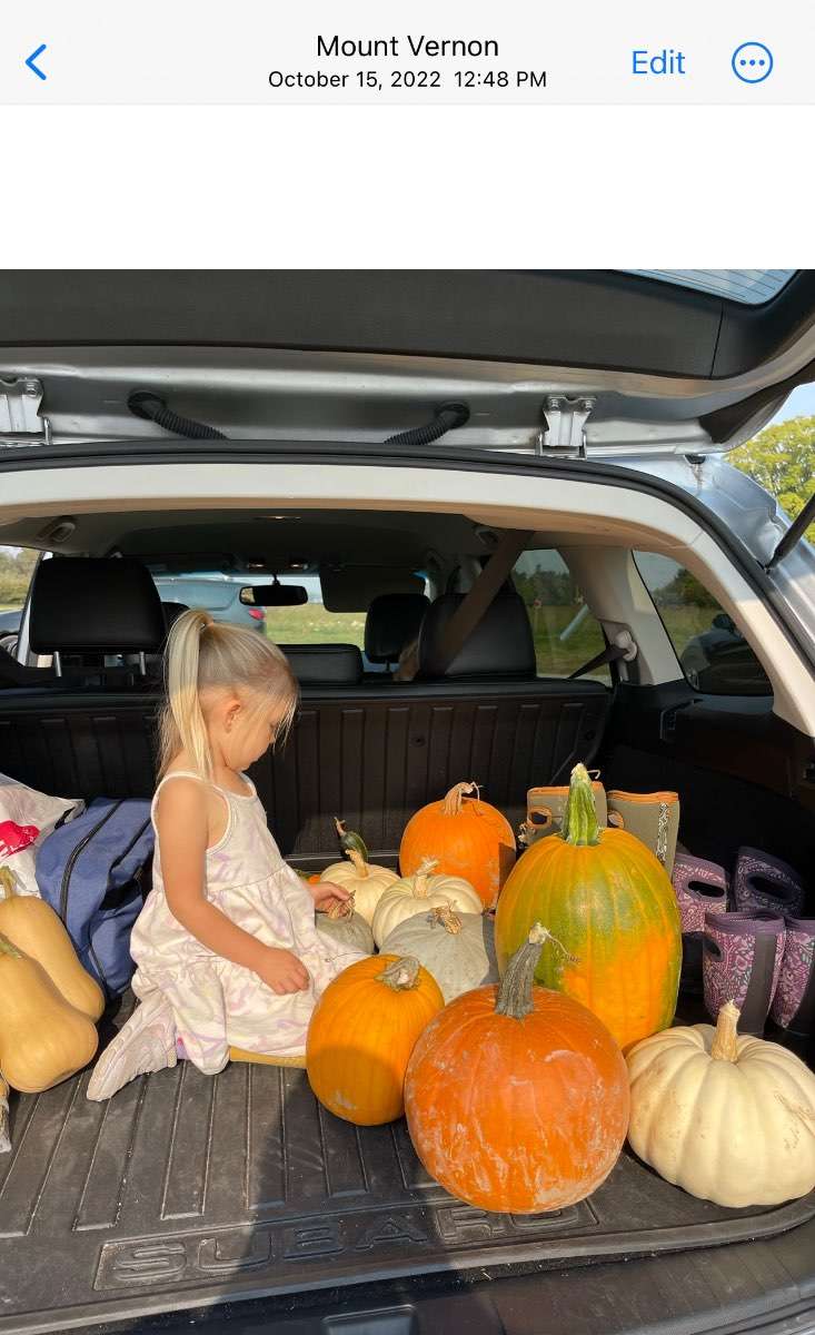
Unless we are talking October 2022 which felt more like summer than fall. I remember roasting at the pumpkin patch, jetsking, hanging on the deck…It was such a crazy month! That forecast below was from 10/2/22.


 2 points
 -
Actually it’s showing it will track over me. They’ll fade in strength but hey! Beggars aren’t choosers!2 points
-
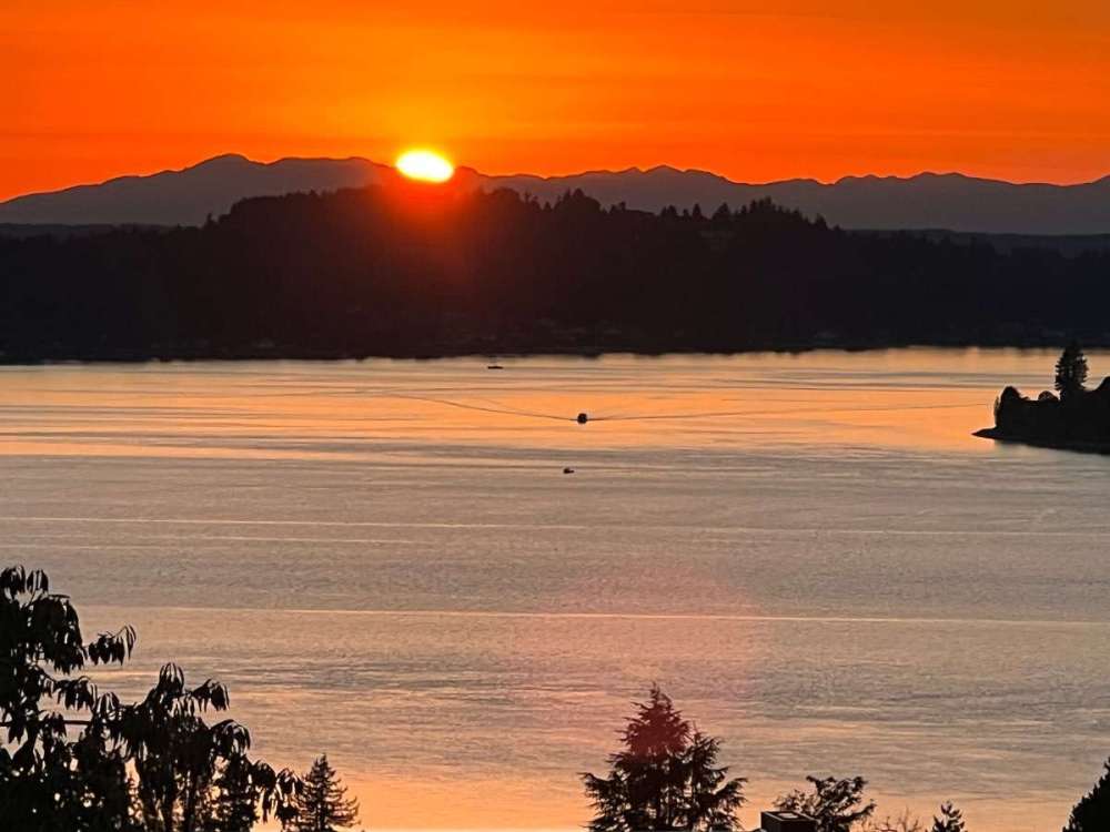
Pretty great sunset though.
 2 points
 -
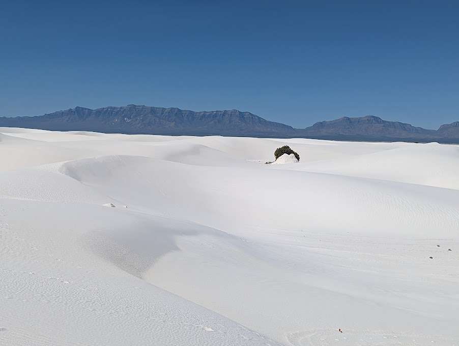
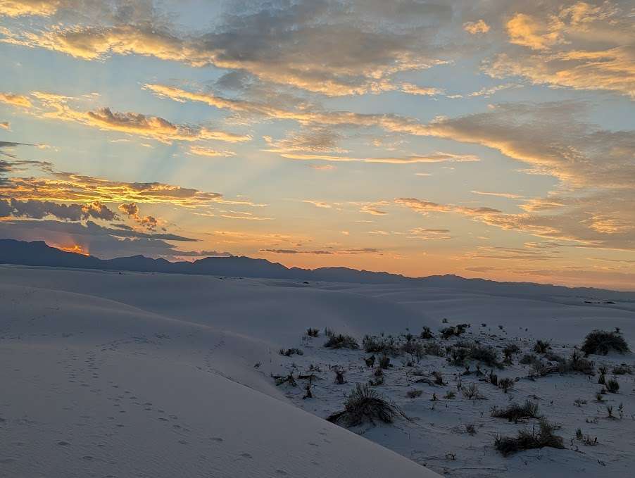
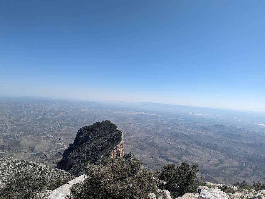
Just got back from a week romping through the desert in far west Texas and New Mexico. Looks like I didn't miss too much up here aside from the storms in the SW Portland metro last weekend. Checked out three more national parks (Guadalupe, Carlsbad Caverns, and White Sands) and even caught a weak ~35mph dust devil yesterday just north of Albuquerque. ABQ set a daily record yesterday with 97, and temps were over 100 for a couple of my days further south, very hot for this late in the season even down there.
 2 points
 -
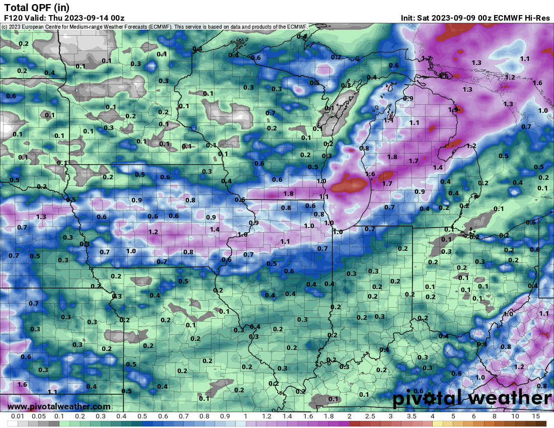
This would be very welcome around here. This is for Sunday night into Monday AM.2 points
-
1 point
-
I've never understood the rage around posting long range weather maps. It's not like most people get their weather info from random snow weenies online, let alone the weather service. I love the bright colors. They decorate the place nicely.1 point
-
102F here this afternoon.1 point
-
Rain and wind, yeah. Storm surge would be a little different than a nor’easter.1 point
-
We had a very close call this Thursday/Fri Texas narrowly avoided rolling blackouts on Wednesday and Thursday, according to multiple reports. The Electric Reliability Council of Texas (ERCOT), the state’s grid operator, declared a “stage 2” emergency on Wednesday, which is one level below declaring a need for rolling blackouts, according to The Wall Street Journal. Then, on Thursday, the Department of Energy (DOE) declared a state of energy emergency for ERCOT as sustained high temperatures kept demand high and pushed the grid dangerously close to rolling blackouts for a second consecutive night. “At one point around 7:30 p.m. CT Wednesday, ERCOT data showed just more than 1,000 MW of available dispatchable capacity,” David Blackmon, a 40-year veteran of the oil and gas business who now writes and consults on energy, told the Daily Caller News Foundation. “Had a single high-capacity natural gas or coal plant experienced a failure during that time, blackouts would have resulted.” ____________________ I just hate this summer.1 point
-
We’re feeling’ the love down here. The change is on our doorstep and most welcome…”come on in!”
 1 point
 -
I thought about watering this weekend to keep the momentum up. Maybe tomorrow.1 point
-
The transition from spring to summer can take 4-5 months but the transition to fall can be done in about a week. All of our seasons seem to be very gradual slow changes but fall usually hits fast.1 point
-
Baby got in the way of the pooch photo. -3 points.1 point
-
It's raining somewhere on Earth.1 point
-
I love the smell of that country air! Gosh, it brings me great memories of road trips when I was a kid and driving through the rolling hills and enjoying the smells in the early morning hours. Enjoy it! As for the rain, you may want to do a rain dance for Mother Nature!1 point
-
1 point
-
Pretty funny. I used to live and die with the Seahawks. When they lost I would not look at the sports section in the paper until Thursday or Friday. It ruined my week. I guess I’ve mellowed with age because now when they’re losing I just turn it off and go do something else.1 point
-
My mental rule is that the median date of the first real rain in Seattle is my birthday, 9/19. Going to be right on schedule this year.1 point
-
Topping out at 108* Humidity 21% Felt like I was standing over a hot grill as I walked out to get the mail just now. Just horrible. Equaled by the glare and my headache. There is a chance for strong to severe thunderstorms into the overnight across North Texas. Generally, after 10 p.m. thunderstorms will move into northeastern areas of North Texas from Oklahoma. Storms will continue until early Saturday morning. Looking forward to High of 80* Tuesday with thunderstorms. What a treat! Let’s hope the back is broken on this summer heat.
 1 point
 -
Obviously long range is not an exact science and many times doesn't do what it supposed to. All I've been hearing is El nino....If we take off our snow loving glasses, is it possible this winter is a massive bust, or are there enough other factors that may make it ok. Just hard to get excited for winter with El Nino in the cards.1 point
-
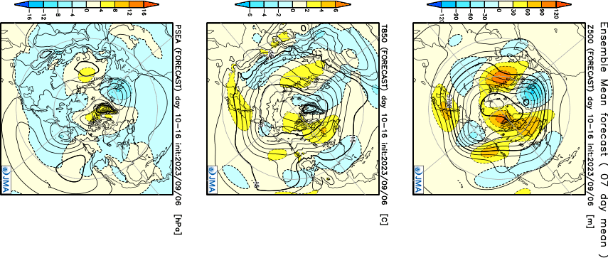
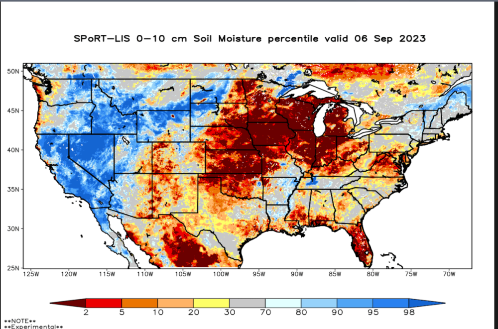
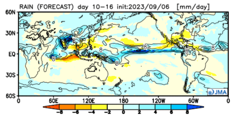
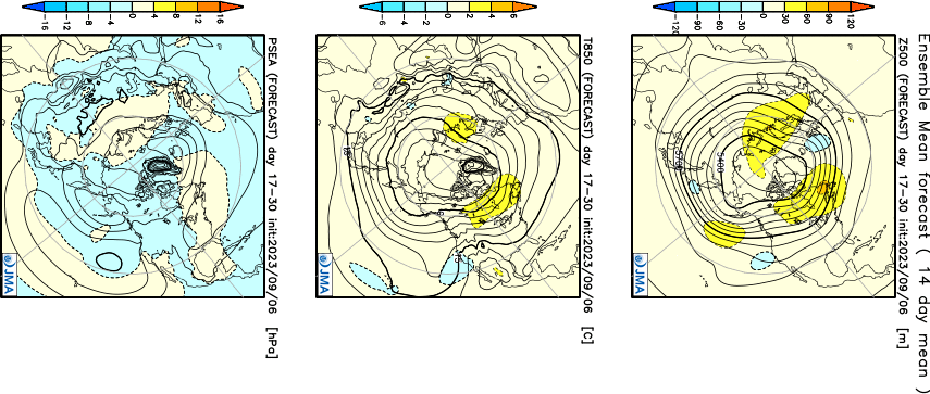
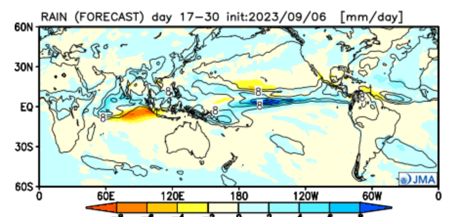
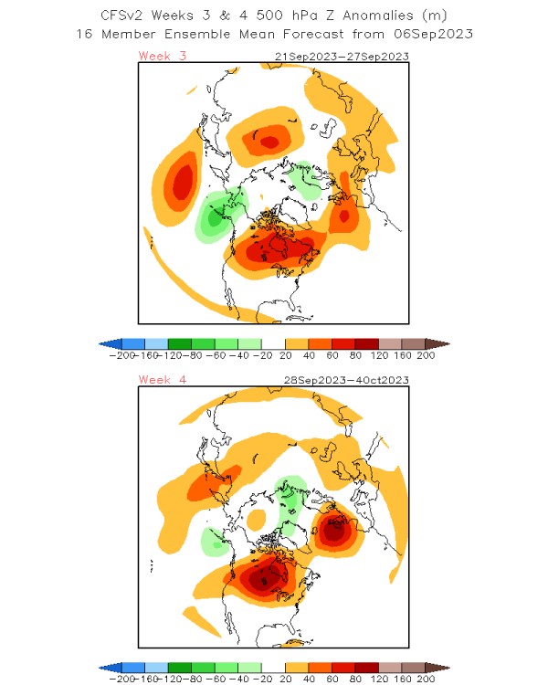
I love what I'm seeing off the latest JMA weeklies as they are mirroring the CFSv2 weeklies pointing towards a trough into the Baja/4 corners/So Cal to close out SEP and open OCT. As @hawkstwelvepointed out in our SEP thread, it has been bone dry over much of the ag belt region and we certainly need to start seeing the moisture. Well, it appears there is more optimistic data suggesting a reversal in the precip pattern during the 2nd half of SEP and into the early stages of the LRC. I'm pretty confident that the southern jet will start to come alive and early Snows will target the 4 corners region. We are already seeing evidence from nature that Winter has come a bit early this season for the mountains in the west. Week 2...look at that beauty of a 500mb pattern...wet signal is a solid look for the central CONUS... Courtesy of @hawkstwelve... Week 2 AN precip pattern is literally right on top of the dry areas.... Week 3-4.... The AN precip signal continues over the same areas. It's like nature "flipped the script"... The CFSv2 is lock step similar to JMA...Block over the Top of an active #STJ...Ya'll ready???
 1 point


This leaderboard is set to Vancouver/GMT-07:00