
-
Who's Online 11 Members, 0 Anonymous, 52 Guests (See full list)
-
Popular Contributors
-
1

-
2
-
3

-
4

-
5

-
-
Activity Stream
-
1048
2024-2025 California and Southwest Weather Thread
Try to remember the good old days when a place called sunny Southern California used to exist. -
2543
April 2024 Weather in the PNW
Ended up just shy of an inch yesterday — 0.99". At 0.27" and counting for today. 46.9˚F. -
2543
-
2543
April 2024 Weather in the PNW
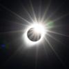
I don't think I am noticing anything, but one thing I will say about the eclipse: We are doing an off leash training class, and we had class the night after the eclipse, and all of the dogs were going absolutely batsh*t crazy. The normally "wild" ones were completely unhinged, and the dogs that are normally calm and well behaved dogs were out of control. I mentioned it to my wife, and she was skeptical. She works in the medical field, and I reminded her how things get for her on a full moon, and said "why wouldn't an eclipse have an effect on animals" I don't have any scientific data to back that up, but when we went this week (we missed last week) all of the dogs were back to their usual behaviors. -
57
April 24-29 Multi Day Central and Southern Plains Severe Weather Outbreak
Heavy rain the last 2 hours has the streams and rivers running. This is exactly what we needed!- 1
-

-


Recommended Posts
Join the conversation
You can post now and register later. If you have an account, sign in now to post with your account.