
Leaderboard


Popular Content
Showing content with the highest reputation on 12/07/20 in all areas
-
I probably shouldn’t, but…
 13 points
 -
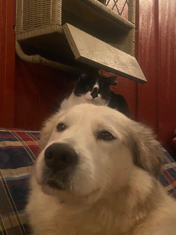
Chilling on the porch. 34
 8 points
 -
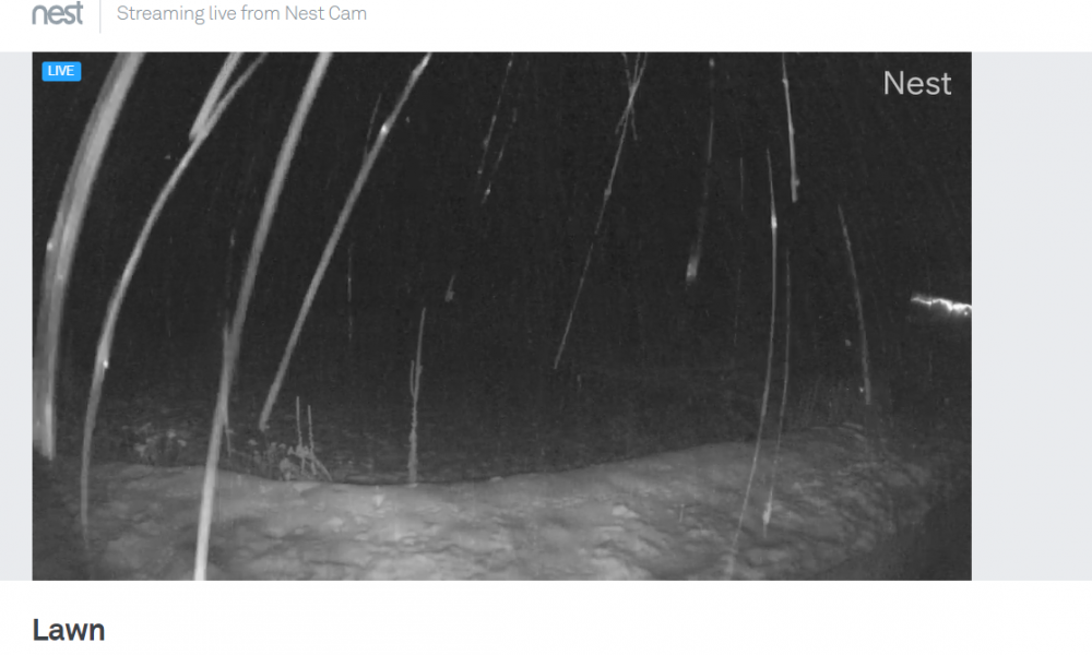
Confirmed. Snowing moderately for the past couple hours up at our cabin in the hills above Twisp/Carlton.
 6 points
 -
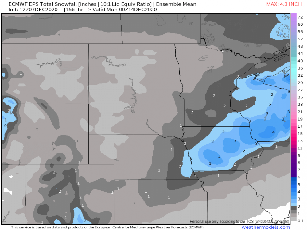
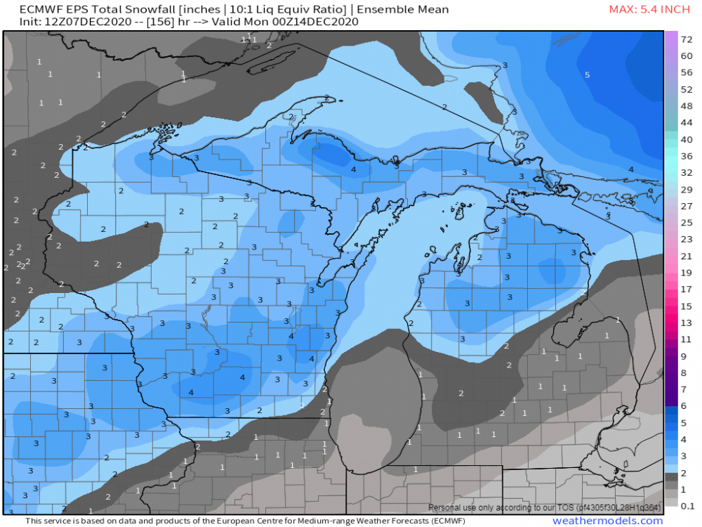
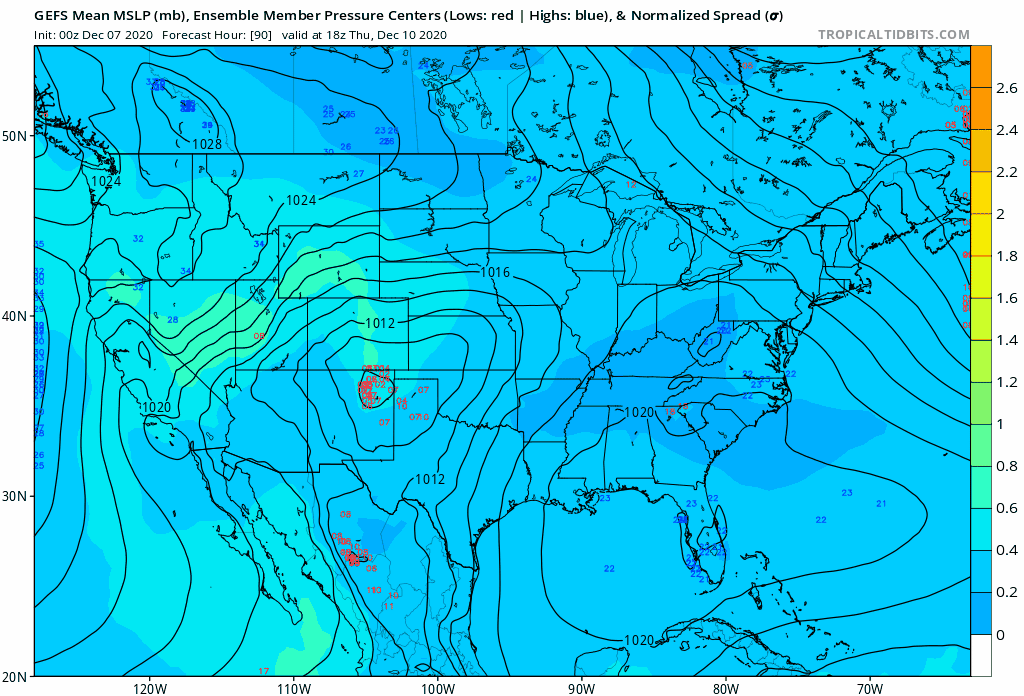
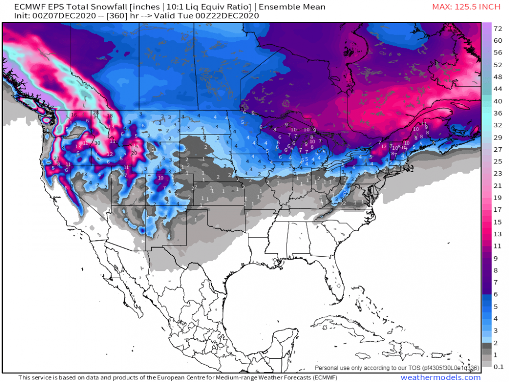
12z EPS...looks like we will have our next winter storm to track...and there will be another one following this...
 6 points
 -
Last nights 35 day GEFS, starting at day 17.
 5 points
 -
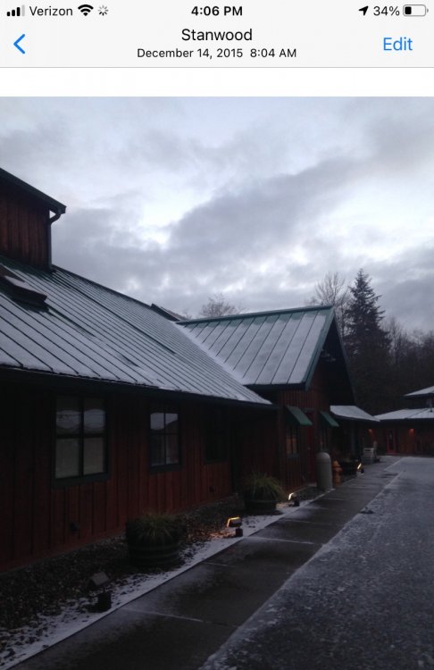
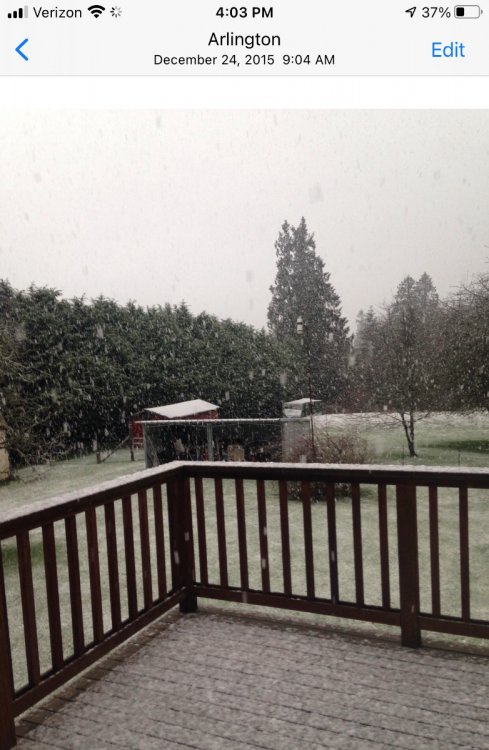
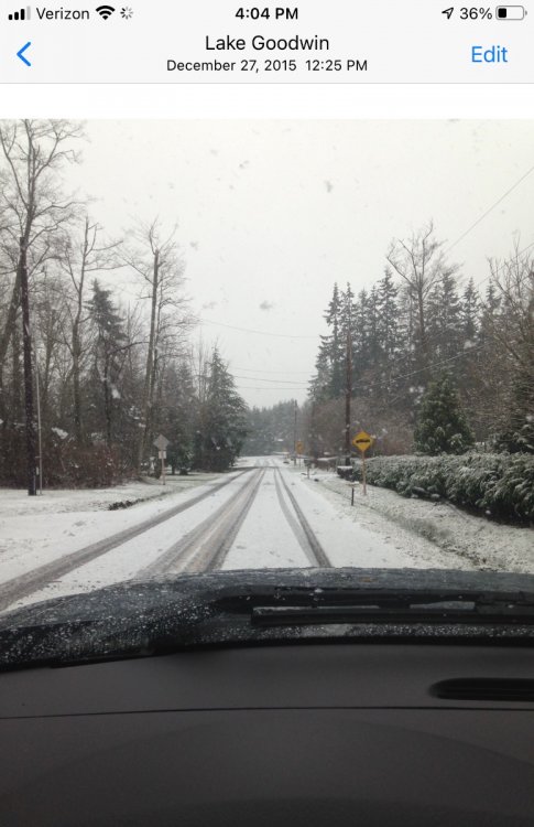
I had some slush on the 14th, 24th, and 27th in 2015! We visited Leavenworth at the end of the month and they were loaded with wonderful white stuff!! (Oh and a little more slush on 1/4/16)
 5 points
 -
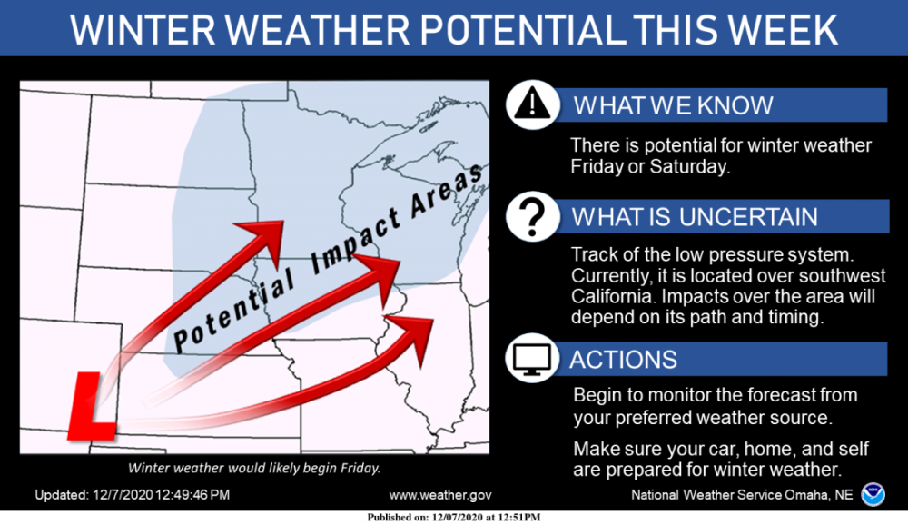
In the ‘What is Uncertain’ section it should just say ‘everything’.5 points
-
OAX first take.
 5 points
 -
Just got my COVID test result back after feeling "funky" for the past week, (Positive for COVID) I am shocked that I'm positive considering I have been working from home since early March, have groceries/other items delivered, no family or friends contact, constantly washing hands, etc. Started to feel achy/lethargic last Sunday, appetite waned the next day, periodic fever just north of 102F, occasional vomiting and tired, tired, tired. This sucks and I'm a little pissed that despite my best efforts to protect myself I still contracted this virus. My presence will be limited for the foreseeable future. Be smart guys, PLEASE don't take unnecessary risks, I'll see ya when I see ya. Take care5 points
-
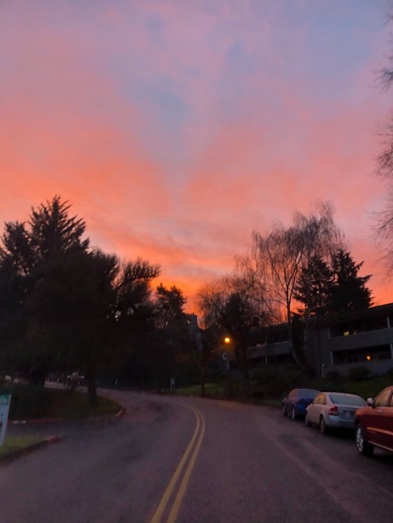
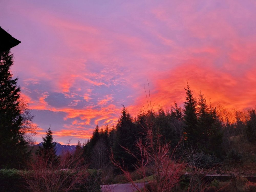
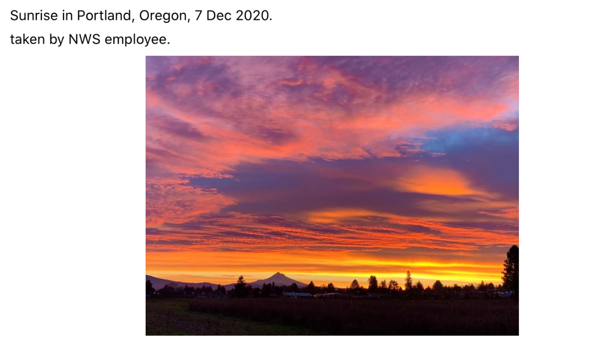
Everytime I see 20+ posts from late night I expect to see an arctic blast in the long range. You guys are wild. Another nice sunrise this morning.
 5 points
 -
00z seems like a step up. More consolidated with everything.4 points
-
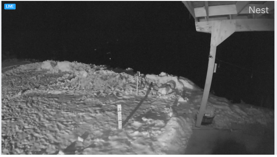
Must not be coming down as hard as it looks. maybe 1.5 inches on the (very) rough snow gauge. Plus its probably too close to the awning.
 4 points
 -
Winter in recent years: October, Late January-April (if winter comes)4 points
-
The GFS is a total disaster.4 points
-
The predominance of pacific air really hampering these systems. Little doubt they'd be decent if there was seasonably cold air around, but right now it's just mild and "less mild". This complete dominance of pacific air with the cold trapped in Alaska is very reminiscent of winters such as 2011-12.4 points
-
And then we'll get to hear Phil's acronym-laden essay about why "winter" ended up warm AGAIN this time around. jk4 points
-
Models having a rough time with a pattern change?4 points
-
That's pretty typical of most ENSO events. The forcing usually starts to really get going around the 2nd or 3rd week of January. The last couple of winters were very unusual in that they were more "back-loaded" Ninos, especially 2018-19, but they were also pretty weak ENSO events.4 points
-
Just checking in. Still no cold air to play with? Ok I'll come back in a week.4 points
-
She also HATED Jay Inslee during the Spanish flu pandemic.4 points
-
Well the GFS got more interesting for those of us in Iowa.4 points
-
4 points
-
00z Euro...will it be one wave or two wave??? Both the Euro and GFS suggest one wave will eject out of the SW... 00z GEFS clearly highlighting a TX Panhandle hard cutter... The noticeable trend among the models has been the quicker ejection of the cut-off low in the SW which has always been the questions among the models. Back in late Oct, the models had a devil of a time trying to figure this out and its been happening again this time, until now, however...it appears that it will eject faster and phase with the N stream energy sliding down S/SE out B.C. Looking deeper into the 00z EPS, I'm seeing the model picking up on stronger blocking over the Arctic circle and near Hudson Bay which allows the system to slow and dig as the SLP tracks along an elongated CF draped across the central Sub. Interestingly, it looks like this may be a system whereby it slows/deepens as it tracks towards the Lower Lakes. The 00z EPS has the main energy tracking a lot farther SE thru OK/MO/C IL/SE MI, thus shifting the snow mean farther SE now through S WI. In terms of the 500mb N Hemisphere pattern, we continue to see more blocking over the Arctic regions as we get closer in time...
 4 points
 -
Life update even though Ik you guys don't care. I just applied for graduation for my bachelors and should be done in the spring. Then onto grad school!!4 points
-
3 points
-
Yeah... its nice to have seasonal extremes. I find drizzly June days to be just as annoying for the same reason. Even though mild rain is climo here in both June and December.3 points
-
I think it's pretty clear that we're not going to be seeing any true -EPO before Christmas. Gotta root for storms and mountain snow.3 points
-
3 points
-
Potential record highs Wed in Central Iowa with lower 60s possible.3 points
-
Looks like a wet mountain snow pattern. If that ridge ever noses into Alaska we will be in business.3 points
-
Not a bad looking EPS run. Very similar to last nights run, except a bit more ridge amplification at the end of the run. Later today, the weeklies come out. Will Ventrice and his IBM computer be right and show a warm Christmas week? Or will the weeklies continue to show what they have been showing? We shall see.
 3 points
 -
That's not Phil. I don't see his parents' mini van.3 points
-
The old covering all your "tracks" forecast.3 points
-
just junk...some day we will get a wrapped up storm...maybe 2025?3 points
-
I don't know why, but 'Locations: Tim' cracked me up.3 points
-
Hope you feel better soon! Snow/cold is more enjoyable when you’re healthy!3 points
-
Not bad. Decent even.
 3 points
 -
We could extrapolate something good out of that. The GEM just loves amplifying the crap out of everything beyond day 5/6, unfortunately.3 points
-
Canadian has 3 systems in total, each dropping snow to various parts of the region.3 points
-
GFS with another system in the day 9-10 time frame. I hope this active weather continues throughout the month.3 points
-
I still think there are more surprises ahead with the models. I will say, however, it is looking better for us farther south esp if the blocking keeps trending stronger.3 points
-
Same here...
 3 points
 -
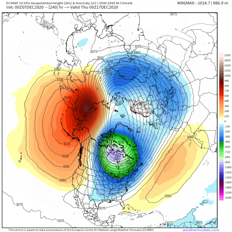
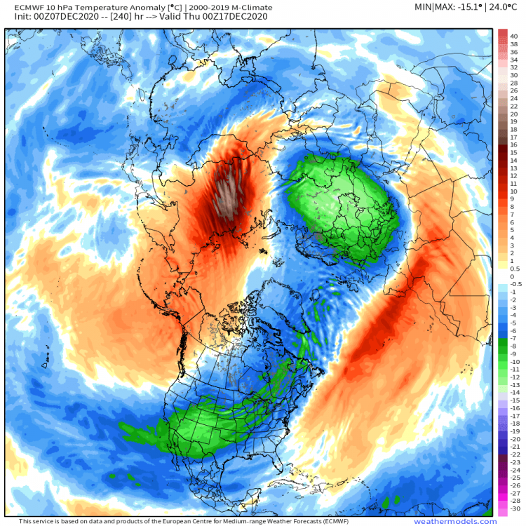
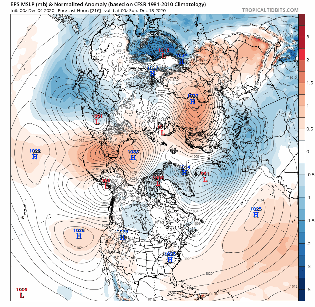
Looking ahead into the following week, run to run inconsistencies continue, but the trend is towards a more active pattern and last night's 00z EPS provides a glimmer of hope that the northern Sub begins to cash in on the white gold. For fun, I thought I'd post the 00z Euro Control for the weekend storm that has a delayed strengthening of a secondary wave along a CF boundary which spins up heading into the Lower Lakes. If we are to believe the Euro Strat forecast, how do you get N.A. cold??? This would be a classic Cross Polar Flow pattern...if this continues...watch for colder trends into parts of the N and E Sub... Siberia SSW showing signs of enlightenment...

 3 points
 -
Day 3 500th post!
.thumb.png.47ed7a77bb8499cbf3de2cf0bc868f63.png) 3 points
3 points -
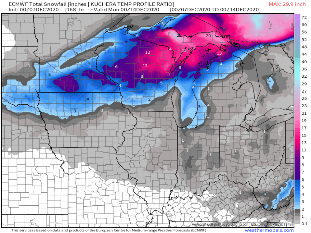
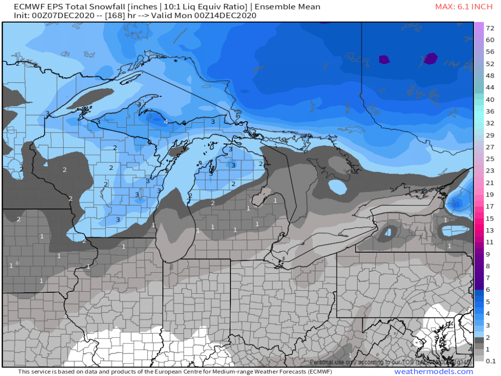
Euro is quite the storm for IA, N IL and S. WI 12-18 in the main band2 points
-
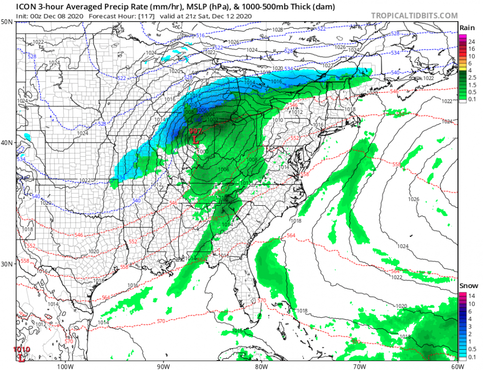
0z ICON gets the SLP surprisingly deep but this abnormal track right over my head blows chunks with the marginal cold. GR and north look ok. Track also sucks for follow-on LES chances.
 2 points
 -
Highlander's are nice. We got the Acura because her brother won $50K at the casino and bought a new Highlander, gave us his Acura. He is a nice guy.2 points


.png.8bbdd964dcd6bd7b8f89d19201a7ca55.png)


This leaderboard is set to Vancouver/GMT-07:00