
Leaderboard


Popular Content
Showing content with the highest reputation on 01/15/21 in all areas
-
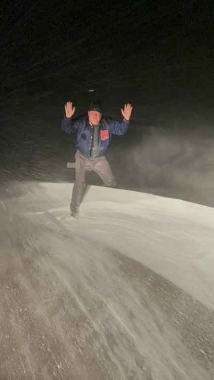
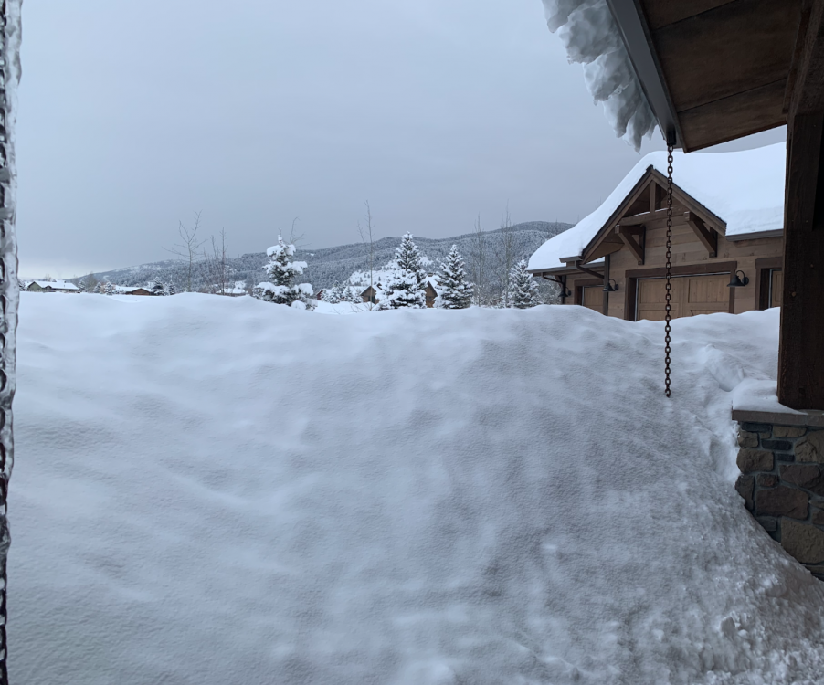
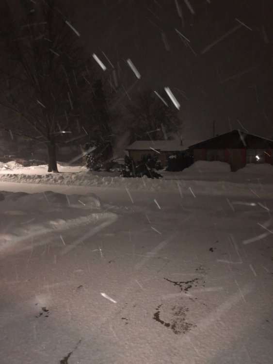
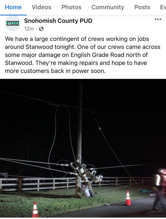
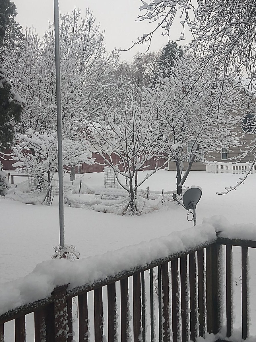
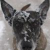
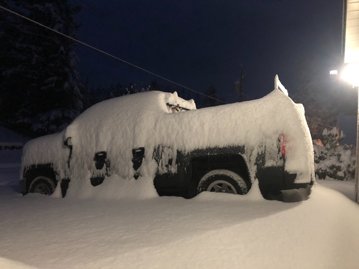
Just got in from busting drifts in the country. This is the kind of site I really don't care what I look like, let her buck!! Gotta like the 91' Twins coat!!!wind driven snow removed one of my contacts, guess is 6.5 - 7"
 15 points
 -
Hi, I'm new but I've been reading you guys for a long time (several years). Just wanted to pop in and say everything is closed in my town: manufacturing plants, banks, restaurants, even the doctors offices and county courthouse. I'm in Iowa, the top row of counties, third one in from the west, I can be in in Minnesota in 10 minutes, and I am about 20 minutes south of I-90. You guys have taught me a lot and you always have good info about when I need to start watching for storms, as I'm mom to a commuter college student. Also, y'all are very fun to read. Hopefully I didn't just screw up my first post.12 points
-
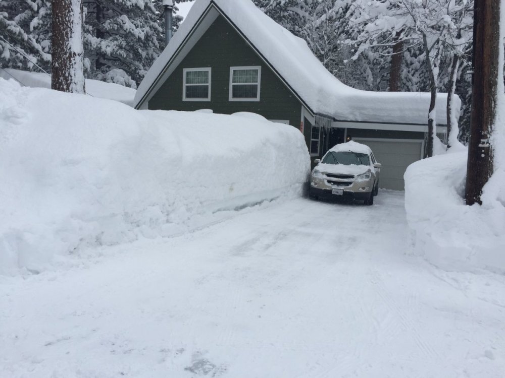
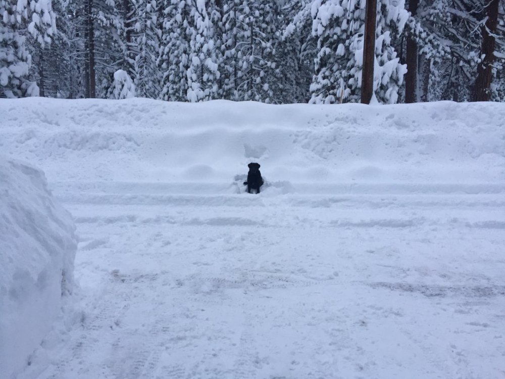
My street around that same time. Jan 2017 was awesome everywhere. House in the picture is a 2 story. My lab is 100lbs for scale. This was at lake level (banana belt)
 11 points
 -
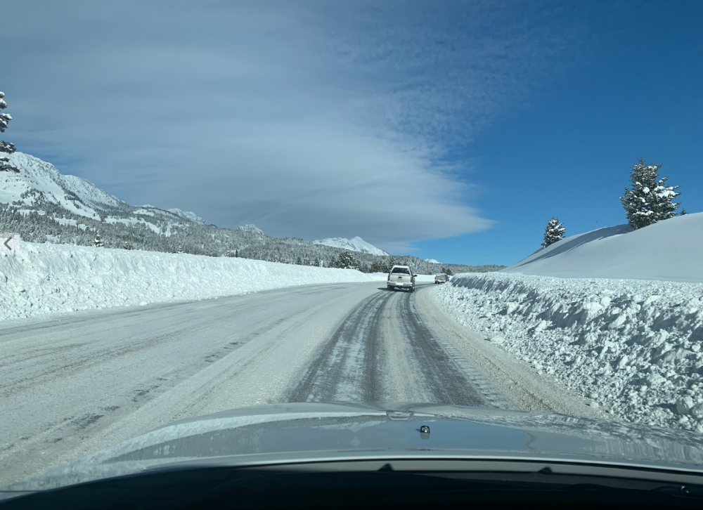
I'm not sure I got to the 6.5 they said the airport had, but with it compacting it's possible. Was pretty nonetheless
 10 points
 -
Our society and world would be far better off if Twitter remained down.8 points
-
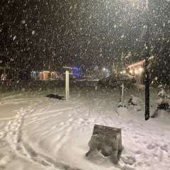
Here's a short vid of what I basically experienced earlier today...7 points
-
I wouldn't mind a February 2019 redux out here!
 7 points
 -
It was heavy and wet!
 7 points
 -
Unreal. Haven't been out yet but heaviest snow I've seen in street lights in a long time. Atmosphere is literally reverse peristalzyling itself of locked up moisture in snow. Will go for a drive in a bit. Radar continues to concentrate in and around DSM vcnty.
 7 points
 -
CPC is still onboard!6 points
-
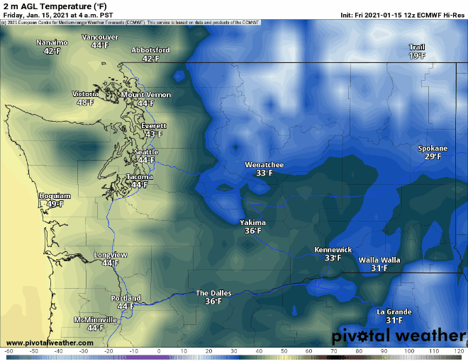
12z EMCWF Day 1-7
 6 points
 -
Around 3” at my place, wet as heck.
 6 points
 -
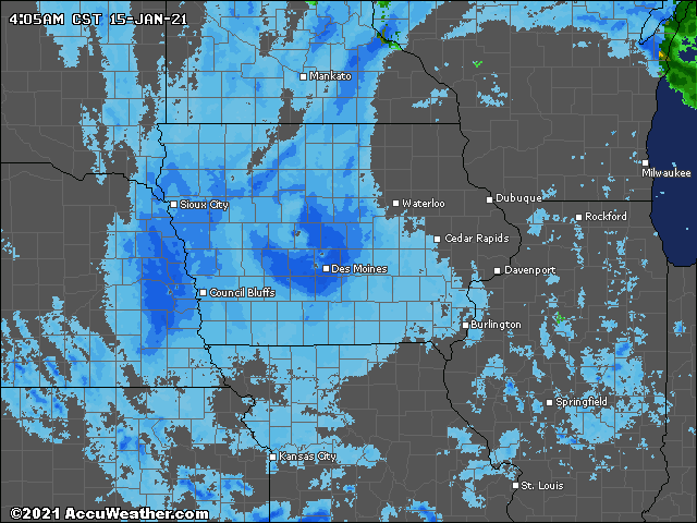
With the wind it is almost impossible to accurately measure the snow that has fallen, however it looks like I have picked up around 2 to 2.5 inches of snow in my backyard so far. Travel is not advised in the Omaha metro area and Eppley Airfield reported a 60 MPH wind gust around 7am. Fun morning around here weather-wise!6 points
-
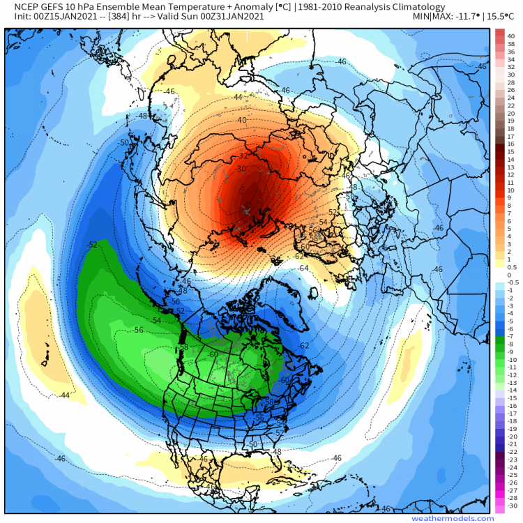
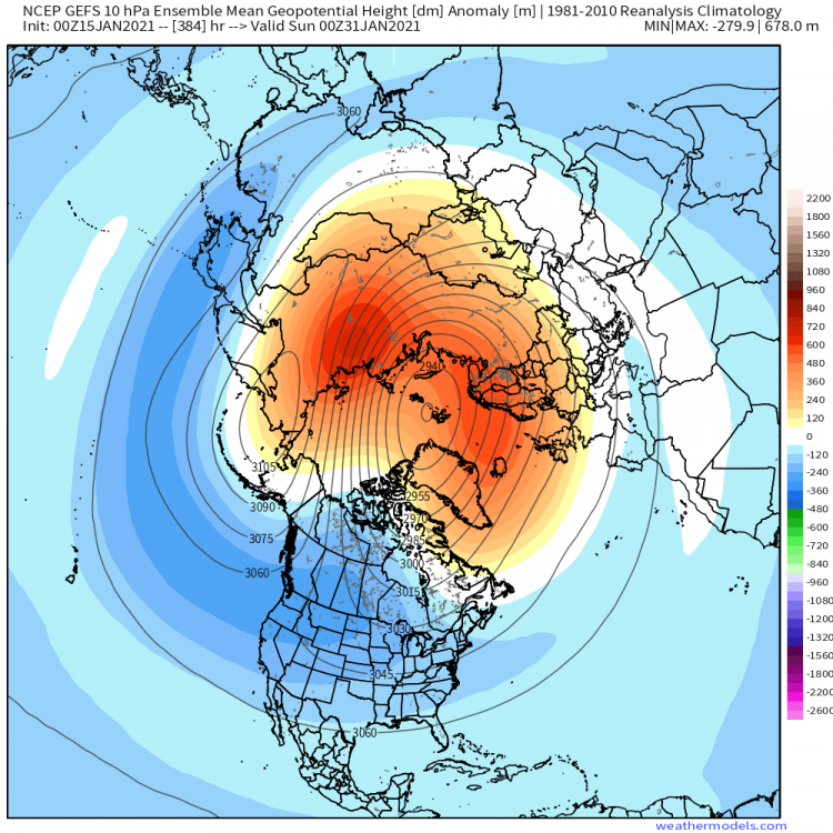
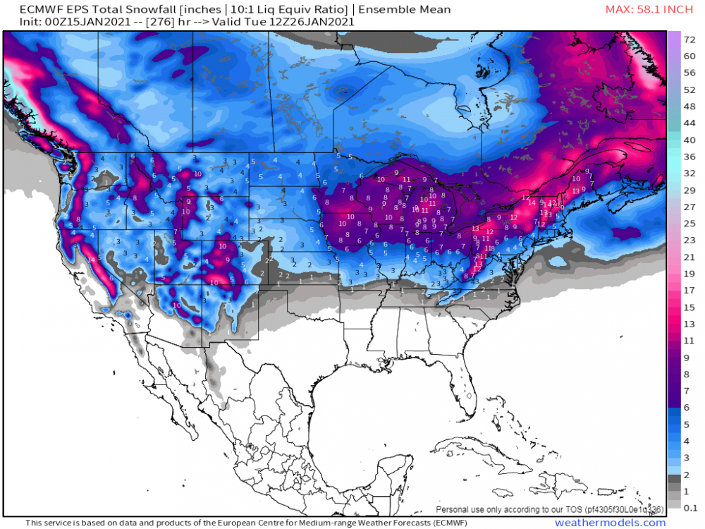
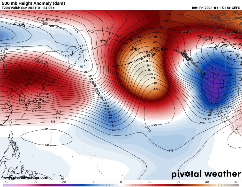
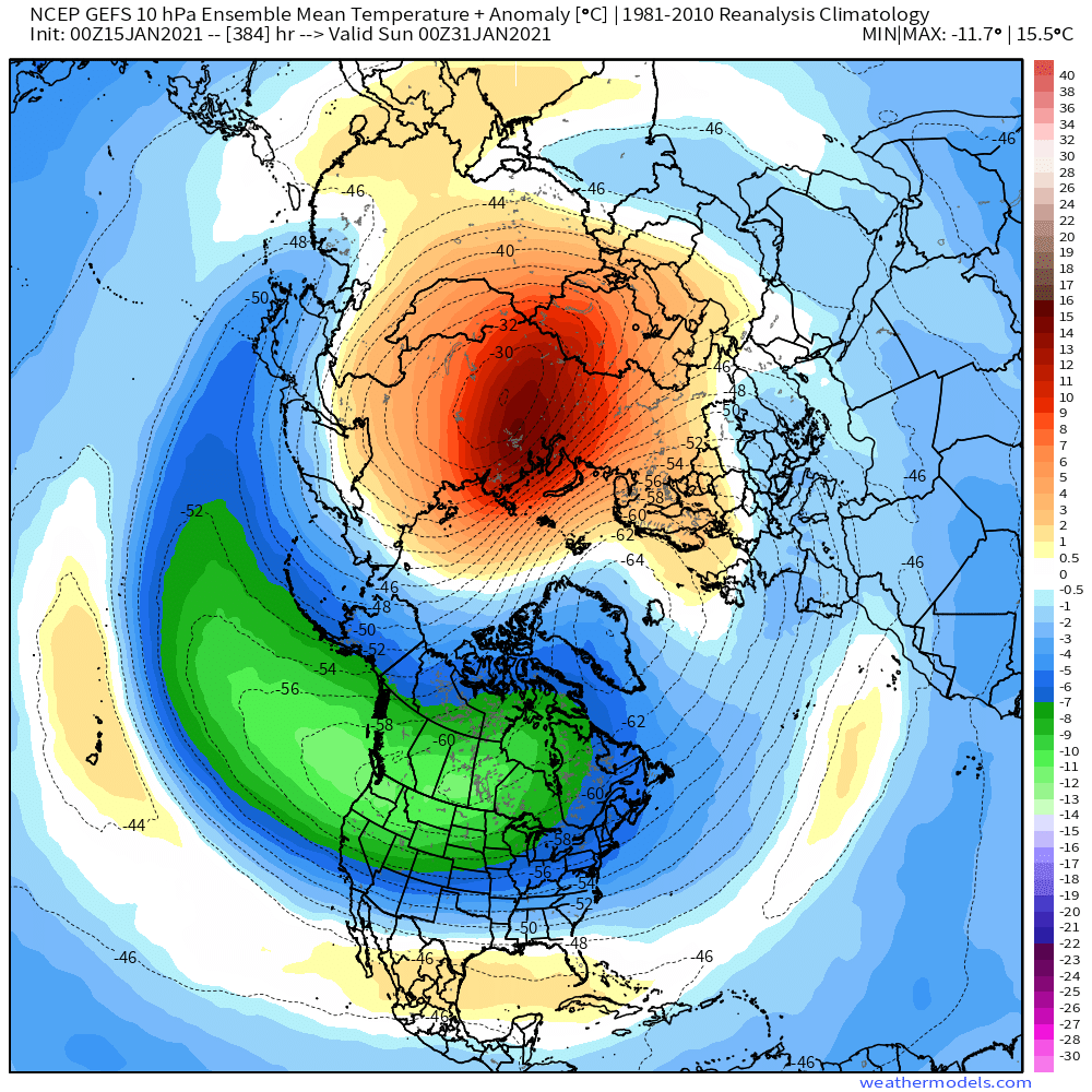
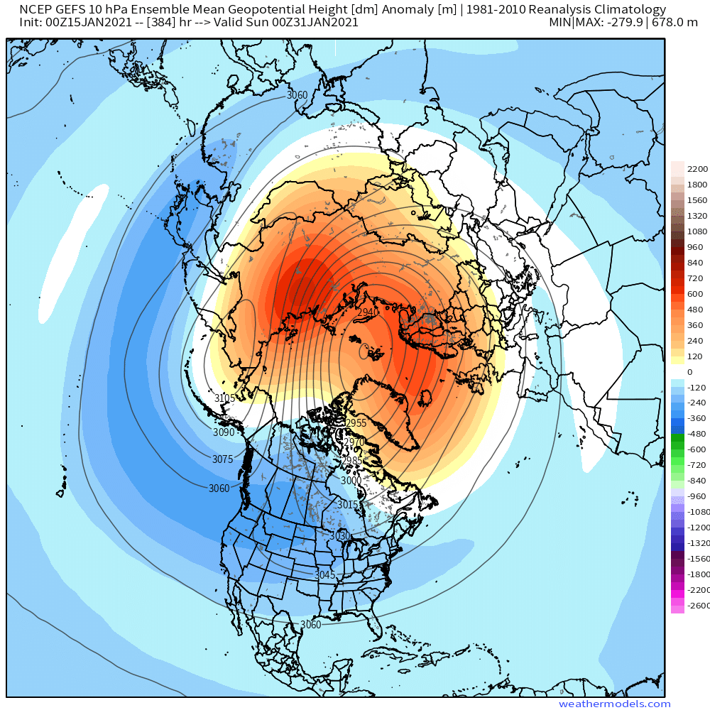
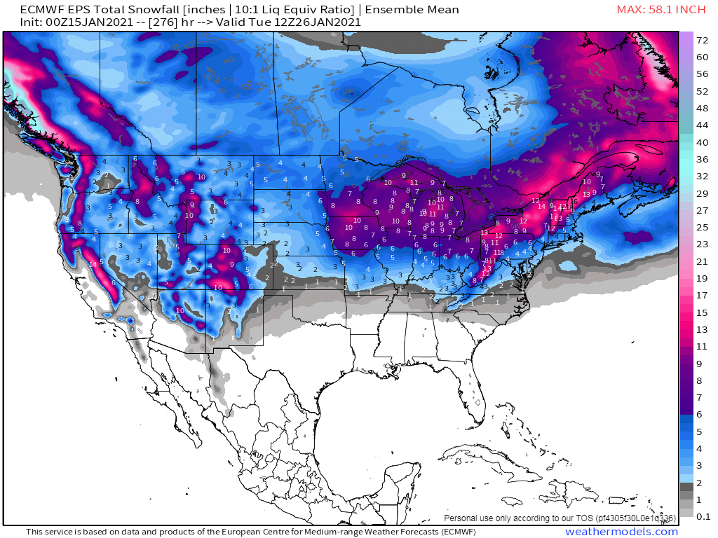
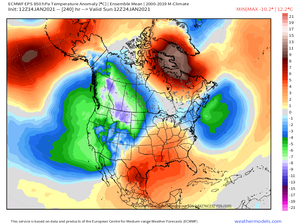
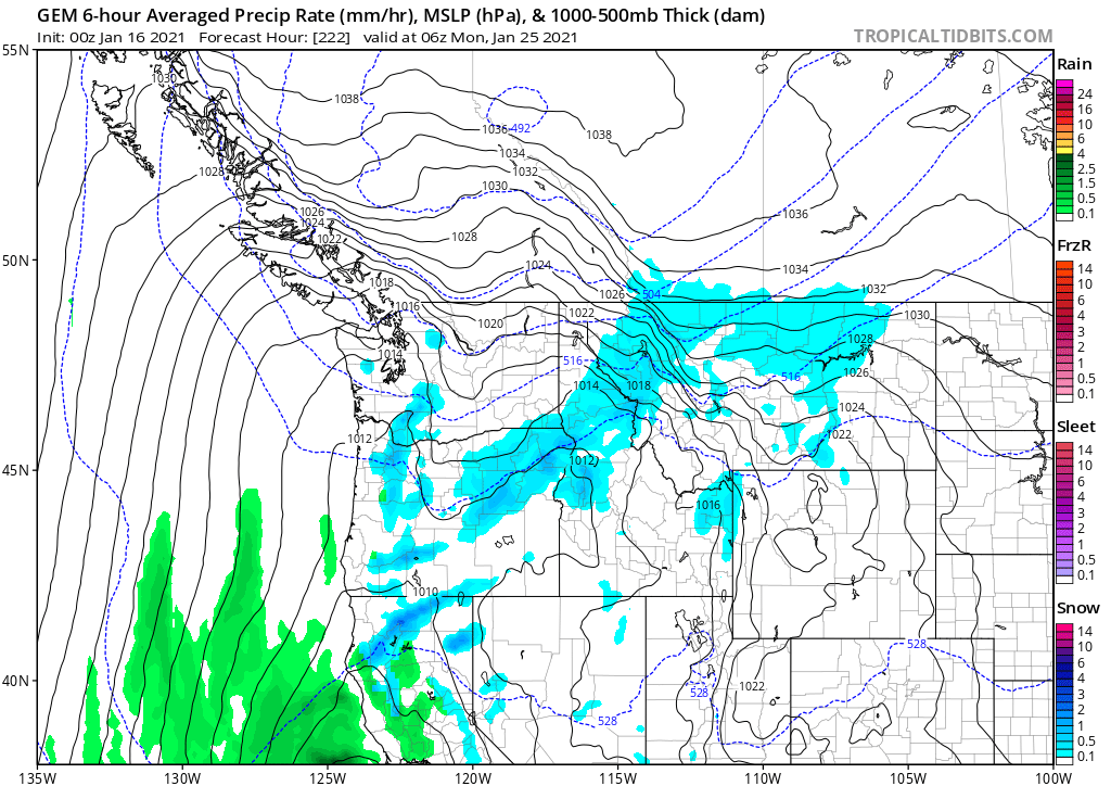
As we enter the midpoint of met Winter, we can all agree its been a very warm 1st half of Winter for nearly all of us on here. While some have done well in the snow dept, others (including myself) have had a lackluster start that brings back some ugly memories of seasons past. Will this same pattern last into the 2nd half of met Winter? What's in store for the 2nd half of January?? Let me just say, there is a lot of promise for what lies ahead for those of us that have sat on the sidelines and it starts later next week. I've long believed this season had a lot of potential. The SSW warming was a big part to the puzzle and the key blocking patterns, esp the west-based Greenland Block, but that hasn't necessarily delivered the cold which North America has been lacking. But why? It's the PV! Dr. Judah Cohen has shown examples of similar cases to this seasons SSW disruption or displacement for Europe/Eurasia to see the extreme cold first but then it's North America's turn. Well, I have been searching for these answers and I believe the models are now beginning to show those LR clues. Let me dive right in and show what I'm seeing.... Over the past couple days, I've seen the GEFS/GEPS holding onto the idea of a complete reversal in the 10mb/50mb Strat pattern as we close out January and open Feb. This is a major LR clue. For one, it is a favorable hemispheric flow that should be capable of producing long duration, sustainable cold for North American and that includes the U.S. Where the blocks set up will be key to who gets the cold and the central CONUS is sitting pretty IMHO. So, we go from the main pool of cold across Eurasia/Europe below.... To this by month's end...if this holds, the Polar Vortex is making a visit on our side of the Pole... Let's consider the above to be true, then the aforementioned Cross Polar Flow pattern would lead us towards a possibility of severe winter that is similar to what Europe/Eurasia is seeing right now. I know the LRC has produced calmer and active patterns in this year's cycle. We are now entering the active pattern and the models are absolutely heading that way. In fact, the LRC CFSv2 along with the JMA/Euro Weeklies are all agreeing that AN precip will develop across the board from now till end of Feb. This signal in the modeling is quite convincing and for all the winter wx enthusiasts who are yearning for snow, the missing link has been the cold. With that being said, if the PV does contribute as it should for North America, then I don't see why there wouldn't be a wintry/snowy pattern setting up over the next couple weeks, if not, several more weeks to come. Last night's 00z EPS continues to illustrate a wild pattern and sniffing out several snow storms and the one that has big potential is for later next weekend.
 6 points
 -
We had a heavy thump of snow on this night last year. 15” fell that night with about 12” falling in ~4.5hrs

 6 points
 -
Light at the end of the tunnel!!
 5 points
 -
The last hour
 5 points
 -
12z GEM is much improved.5 points
-
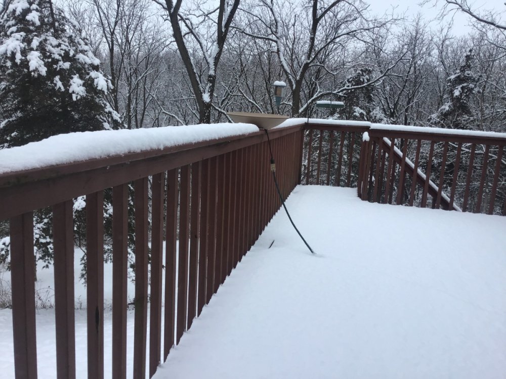
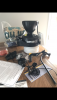
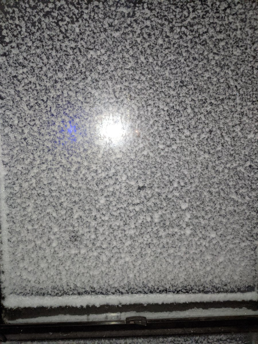
My front door plastered in spackling. Iam sure whole house is frosted.
 5 points
 -
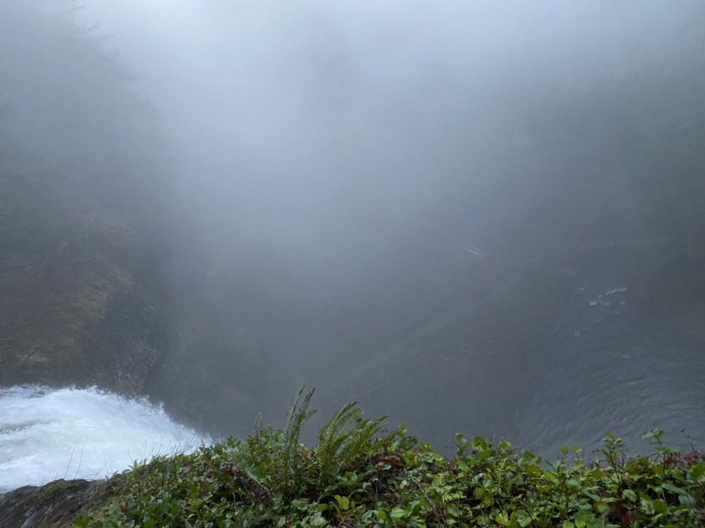
Foggy out at the falls today.
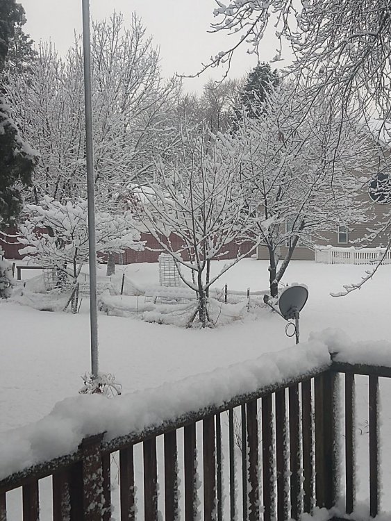
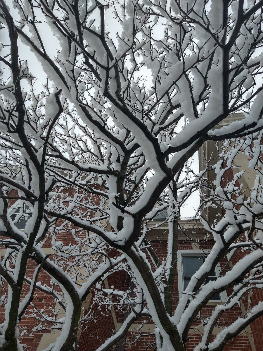
 4 points
 -
I was going to say I can’t believe how people cancel then Uncancel winter whenever the models ebb and flow from run to run 8-10 days out. Then I remembered that I do this I expect some typical flip flopping the next few days. When we are 3-4 days out I will officially release my vote for cancel or uncancel (and I will still probably be wrong) here’s to hoping for some cold and some snow4 points
-
Better! Still looks a little cut-off there on the 850s. I guess if there's any good news it's that the models often do weird things with energy on the backside of major blocks like that, and especially in the midrange seem to have a cut-off fetish. 18z is probably about the warmest solution possible given the circumstances. The block still looks to hold largely firm and that's half the battle.4 points
-
These snow squalls are legit. I was just underneath one for about 10 min that was puking fatties from the sky. It's to warm for the snow to stick but looked nice while it lasted. The clouds have a stadium look to them which illustrate the instability in the air.4 points
-
Still cant believe people actually use weather apps for winter time forecasts. Summer I understand, but winter?4 points
-
GEFS 12Z 0Z GEFS, same hour4 points
-
VID_20210115_064202..3gpp4 points
-
First off I thought you are an amputee, but I see you’re just straddling a drift! Lol Like the picture though. Thanks.4 points
-
Measured 3.6" of concrete on the deck. Clear the roof, this stuff is very wet and heavy.4 points
-
One year ago today! 20200115_113645.mp44 points
-
12Z 0Z same hour
 4 points
 -
Yeah, and then on video Jack Dorsey flaunted how this is just the beginning. His own employees are leaking videos. Here is the issue. Free Speech on these social media platforms nor adhering to the Constitution doesn't really exist and everything we are seeing unfold with growing censorship further confirms that. Perhaps the answer is to leave social media. We may be forced to do so anyhow. Life goes on outside of social media. Real life. Not this fake world of narcissism and self importance where people live in a dystopian dreamscape of thought police, group-think, cancel culture, and political correctness. I've said it before and I'll say it again, if we woke up tomorrow and Twitter didn't exist society and the world would be far better off. 6z GFS in 3 hours 39 minutes3 points
-
This is the worst run I've ever looked at, and this is also the worst planet I've ever been on.3 points
-
Canadian is about to drop the hammer
 3 points
 -
3 points
-
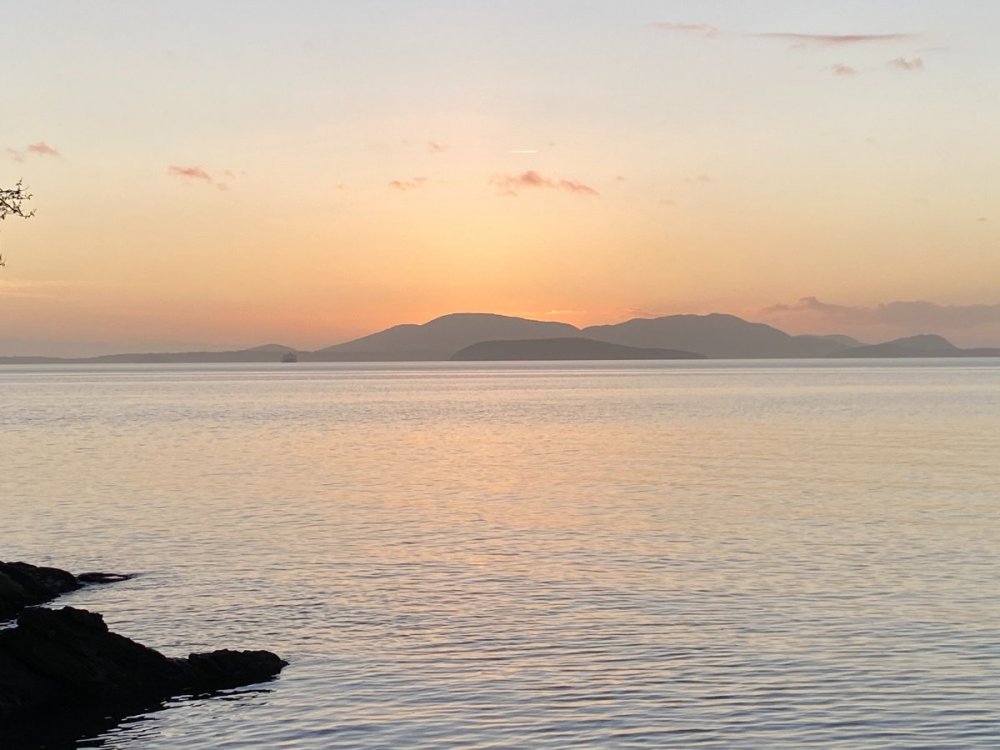
Decent sunset tonight....
 3 points
 -
Nothings gone wrong yet. These are models. The actual weather hasn't happened yet. We may still get an arctic blast. Every single time, and I mean every single time there is an actual arctic blast, the models do this. And you know that. And of course there are times when it actually does turn into a bust, and this could very well turn into a bust. Give it time, and then analyze.3 points
-
Maybe a couple on inches for us N IL folks from Saturday through Sunday
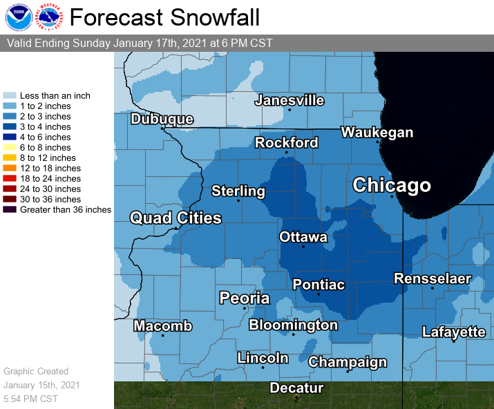 3 points
 -
I’ll wait a few days before throwing in the towel. Ensembles still look good...gfs has been so up and down really hard to put much stock into it past a week out. Ensembles have been steady.3 points
-
I swear this is at least the third time we've both posted the GEFS simultaneously! Great minds think alike...3 points
-
It looks like the OP run is on the warmer end of solutions for the 18z. In fact, mean block axis on that reorganization is primed to drop more cold air southward. Also cold air much more prevalent.
.thumb.png.81b2b602bb39f77e796ca6ac1fa05428.png)
 3 points
 -
All the snow from across the street blew into my driveway and I have four feet from my garage door all the way to the street3 points
-
Bring your Mt bike if you have one. October is the best time of the year with the lake and weather still being warm and most of the tourist are gone. Tahoe rim trail will be next to where your staying. Also go down Kingsbury grade to the little town of Genoa NV. They have the oldest bar in the state Est 1858 and it is only like a 15 minute drive from Kingsbury grade.3 points
-
Surprisingly, I picked up 1.8" of snow. Part of that total is a thick layer of slush. It's unreal how many times Des Moines has been bulls-eyed this winter.3 points
-
Wow, looks like 3.5-4” might be what we got around here. Definitely was not expecting that much.3 points
-
In a lull rn, and it has that "storm over" feeling. Hopefully some more stuff drops in from the northeast. I'd estimate around an inch so far when avoiding drifts and areas where it's competely blown away. Kinda meh but I'm surprised to even have this much so far.3 points
-
Looks further west than what was modeled. Explains why E. Neb is doing well and why my forecasted amounts have increased.3 points
-
Ripping nicely in Lincoln this morning, radar definitely looks a bit west of what was modeled. Grass is already covered.3 points
-
No joke its bad out there!3 points
-
Been around this forum for years and I love this. Because we all know, even if we do get some epic winter weather (which things are leaning that way), the models are going to back off at some point ... even if just temporarily ... and everyone will be throwing things at their laptops. Then they correct themselves and about half the people follow the models back, the other half are skeptical. We are in the current "High" of a couple GREAT model runs. Just remember, if they warm up 2-3 degrees it doesn't mean winter is over. LOL I will say, the familiar emotional whirlwind leading up to any snowstorm is comforting. It is like an episode of Law and Order... predictable and formulaic, like a warm blanket. This will be a fun two weeks.3 points


.thumb.jpeg.e3014abf99ef08a9f9ac2c0cd31b485b.jpeg)


.png.90b3efa0fe3820faa217b7b47850ff58.png)


This leaderboard is set to Vancouver/GMT-07:00