
Leaderboard


Popular Content
Showing content with the highest reputation on 12/01/19 in all areas
-
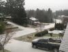
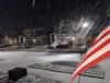
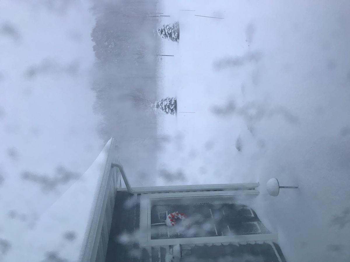
A dusting of white looking out my weather window
 16 points
 -
As the storm wraps up here, the sun emerges.
 13 points
 -
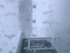
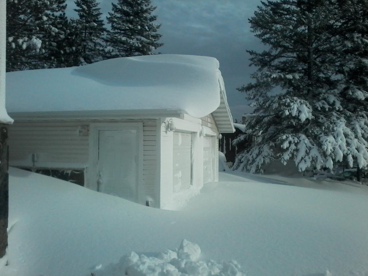
It looks like a blizzard up here in Egg Harbor, WI.
 9 points
 -
Acquaintance of mine took following pic before his wife tackled the driveway- (in Duluth). Location: 3 NE HERMANTOWN, MN ( official Duluth total) Amount: 21.7 Inches Report Time: 12:00 pm CST - 12/1/2019 Remarks: THIS IS THE 9TH HIGHEST 2 DAY SNOW TOTAL FOR DULUTH. my buddy 7 NW of Two Harbors 20.8"
 8 points
 -
Nearing an inch. 32 with moderate snow.
 8 points
 -
More blue sky now.7 points
-
Heavy sticking snow in Ridgefield7 points
-
Some photos. https://imgur.com/a/YCMWDyx6 points
-
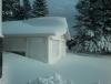
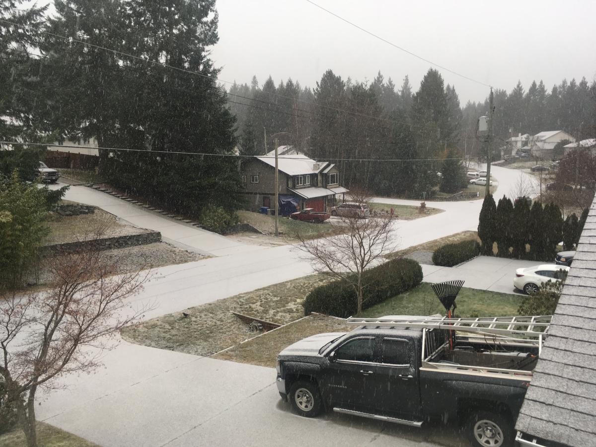
What a surprise I woke up to 3" of snow on the ground. And this is a Christmas card setting snow with snow on the ground, roofs, road, sidewalk and trees.6 points
-
Hello December 2019! Last month of this decade. Hopefully we can end this decade with a massive Arctic Blast and a regional snowstorm! ❄5 points
-
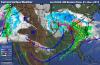
Welcome to the official start of met Winter! It's a very foggy, dreary & soggy morning here and not the winter-like feel you would expect to see this time of year. While those up north continue to enjoy the benefits of Ol' Man Winter, those of us farther south are taking a break for the time being. How long will this break last??? Throughout this morning, I've been studying and analyzing the pattern that has set up since early October and the data that has been coming in overnight. Over the past few days, the models have been rather volatile as I was expecting to see which is common during a Strat Warming that continues today. I may be stubborn holding onto the idea that the pattern should flip to more sustained cold and storminess by mid month. Call me crazy or not but I got this real gut feeling we will prob see one of the biggest model busts this seasons in the Week 2-4 period. It's pretty obvious I'm going against most of the LR models that suggest a torch throughout the month....is this a good idea on my part....or is a big Bust forthcoming??? Time will tell very soon. I'm sure some of you already have already thrown in the towel for this month...but is that a good idea??? Let me show you what I'm seeing and why I'm convinced my logic may have some reasoning behind it. First off, the models have been struggling trying to figure out the pattern in the near term let alone in the longer range. For example, the 00z Euro has trended decidedly colder later next week and into early the following week across the Upper MW/GL's region as the model is starting to see a couple decent shots of cold. This is going to be a volatile period over the opening 10 days or so across the northern half of our Sub before I expect to see the Long Term Long Wave Trough re-establish itself across the central CONUS by mid month. After studying the LRC and comparing it with the model runs out into the next 1-2 weeks, I think I'm starting to see some evidence that the cycle length may in fact be centered around 48-49 days. The powerful storm we are now experiencing is a big clue along with several other examples the models are showing in the extended. For example, back on Oct 19th -21st, Tropical Storm Nestor formed in the NE GOM and hit NW FL which tracked through GA and the Carolina's then out to sea. The 00z Euro is seeing this part of the pattern later next week/weekend in the NE GOM. Following this part of the pattern, we saw a strong clipper between Oct 14th-16th that tracked across N MN/N WI that ushered in a strong CF along with strong winds. This time, however, we are lacking the -NAO we saw in mid Oct (see below)...thus, the clipper is weaker and farther N but it is producing a similar outcome, that being a brief cold shot out of Canada. Hense, the reasoning behind the volatility I'm expecting to see during the opening week or so of December. Once this part of the pattern of the LRC arrives in late January I fully expect a major arctic outbreak. Those that have snow OTG are going to get chilly..... Furthermore, the storm on my calendar between (12/5-12/8) is showing up but a day later than my original call. Nonetheless, this looks to be directly related to the system that tracked through SD/NE back on Oct 19th/20th and also produced a major severe wx outbreak across E OK/NE TX/AR/MO. All the models are beginning to see this storm in the Day 8-10 range followed by, which I believe, will be a strong push of arctic air. Then, this is when things get very interesting and we start seeing deep low's forming across the central/southern Plains heading towards mid month and beyond. Overall, I think I got this years LRC figured out and I hope I'm right about it bc I would hate to lead anyone down the wrong path. Another clue I'm seeing that this pattern will be cycling is the development of the SW ridge by 12/9 or so which the GEFS have been suggesting for a number of days now. Dec 9th... When this pattern arrives by 12/13 - 12/15, look out....5 points
-
Starting to come down here pretty hard and the heaviest stuff is still moving up. Temp is still around 35 though. Have some more wetbulbing to do, hopefully this juicier precip can knock down the temp quick. That D**n warm nose needs to stay away for a bit longer.5 points
-
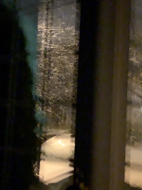
Not the greatest shot but you get the picture.....no longer need the street lamp to see it!
 5 points
 -
11:58 PM Much larger flakes now! Hell yeah!!!!5 points
-
That cell must of arrived....big flakes and sticking here as well5 points
-
November 2019 rainfall statistics: Blythe, CA (about 20 miles west of Farmboy): 1.80" Phoenix (PHX): 1.55" Portland (PDX): 1.52" Hillsboro: 1.16"4 points
-
Light snow here now. 29.6F I was down in the western communities of Victoria last night and saw some piles of “snow” in people’s driveways. I think it may have actually been hail from the other day.4 points
-
My rainfall total so far from this storm was only 0.45” bringing November monthly liquid precipitation total to 1.85”. November average temperature wasn’t as cold as November of last year. I’ve seen many wetter Novembers, especially in 1992 with a record of 8.65”! Also 6”> in a few other Novembers.4 points
-
Clinton/Tom, I appreciate all that you do and by no means am I being a troll. I have just been wanting to get answers for years and I have shown proof how the LRC has not cycled at times. So, all due respect, You guys just this morning are using past storms to try and forecast future storms. I get it. I just want to know in this potential 47-49 day cycle, what storms are you using to compare the massive storms that just hit California. If you remember, there wasn’t a drop a rain in many areas of the SW for 45 days. No storms to compare... If this LRC is accurate, can either of you give me a forecast for the following cities to cover DJF(basically winter) KC, LA, Portland, Minneapolis, St. Louis, Denver, Dallas, Cleveland, DC, Boston, and Miami. Cover the whole country... Example: KC: Week of Dec 1st: look for temps to start cool early in the week but warm up to above average by mid week and stay there the rest of the 7 day period. One storm, likely rain will hit Thursday into Friday. No wintry storms this week. I don’t think the above can happen at anything higher then a 30 percent average. Gary Lezak thinks it can be done at a 70-80 percent accurate clip. I have asked him for direct forecasts for years, what do I get, very vague ones that can be twisted into being accurate every time. Now, I believe a pattern can change at anytime. Meaning, we can go from dry to wet, rainy to snowy, etc. The LRC would argue against that most times. The LRC always has a way out, like, there was no blocking, the EPO went positive when this storm arrived and that’s why it was farther north..on and on. Seasonal differences is the big answer every time a storm is totally different then the prior cycle. I want you guys to take all those variables and excuses and make a forecast right now for the above cities I posted. Is that possible? I would say no, but you guys have me convinced that you can. Remember, I believe the LRC is a good forecasting tool, I just don’t think it is above 30-40 percent accurate.4 points
-
Some exciting stuff on last night Euro runs. The control has a monster storm showing up on the 13th and some nice cold moving in as well. Looks like after this first week of tranquil weather to open Dec, winter will come roaring back. 63 or 64 day cycle?4 points
-
Was not supposed to snow here
 4 points
 -
Dumping snow here4 points
-
32 here... about an inch of snow on the ground and heavy freezing rain falling. The street is completely covered.4 points
-
Have a thin layer of snow on nearly everything now, road is still resisting a little but sticking to a good bit of it. 33.4F. Still too warm but got some accumulation with strong precip rate. I didn't think surface temps would be much of an issue but it does seem like even that was marginally too warm. Might have just enough headroom to wetbulb down to 32 but the warm tongue of death is approaching. Probably not too much snow left. I'm not complaining though, enjoyed seeing some nice flakes and getting a tiny bit of accumulation. The bar is pretty D**n low around here .4 points
-
Snowing and accumulating on the deck. Whoa, earlier than I expected.4 points
-
Blowing sideways snow....love it4 points
-
Word of advice with the impending #2020polarvortex. Tape hand warmers around the inside of you wrists to pump warm blood to your fingers. Thick mittens are not enough!!3 points
-
Hey don't lump the rest of us that learned what antecedent means in 6th grade English grammar class with you. Phil's posts may be acronym heavy but they're not grammatically that dense. Remember Richard? That dude made reading Infinite Jest look like a walk in the park.3 points
-
The humidity tax.3 points
-
Getting our first flakes of the system. A pretty decent wrap around snow shower coming through. A dusting of snow is accumulating on parked cars.3 points
-
Courtesy of Brian Schmidt. Very sobering list.3 points
-
Ended up with almost an inch of snow. Still on ground and 34 degrees here.3 points
-
At least we can say it snowed this fall AND this winter.3 points
-
All told, ended up with a solid dusting last night. Calling it 0.1" might be a stretch, even though there was probably that much on some surfaces. But it was a fun little event with the snow in the air and the wind, and a great way to kick off the winter season3 points
-
I’m getting pumped up for some insane blocking from the winter solstice to late Jan/early Feb. Love the signs I’m seeing..downward propagating -U anoms within the NAM domain in conjunction with a well-timed EHEM MJO & AAM transfer(s). All preceded by this +EAMT/Aleutian Low regime for additional wave-1 forcing. Watch the EPO and AO during the last 10 days of December into January.3 points
-
A short wrap for November 2019. At Grand Rapids November 2019 had a mean temperature of 34.6° that is a departure of -5.5° and is a tie with last year for the 10th coldest November on record. There was 6.5” of snow fall and that is just under the 30 year average of 6.8” The high for the month was 54 on the 27th and the low was 15 on the 13th . For Muskegon the mean for the month was 35.9 that is a departure of -4.3° it was the 12th coldest November of record there. The highest for the month was 54 on the 27th and the coldest was 18 on the 13th There was a total of 10.9” of snow fall. 6.0” is average. And to the east Lansing had a mean of 33.5° that is a departure of -6.1° and it was the 16th coldest on record there where the records go way back to 1863. The high for the month was 54 on the 4th and the low was 8 on the 12th and 13th they had 6.0” of snow and that is more then the average of 3.4”3 points
-
Snowing here now Shelton3 points
-
Looks like my west side Peeps got the snow surprise I thought SEMI was in line for. You know you're in a favored place when things break your way. Overnight timing ftw! Can't remember when I've seen a surface map quite like this morning's?? At SPS - Sorry you got hosed by models and daytime heating to your south. Just got up at 8 am. The bedroom has an east facing window and I could hear pingers overnight. Looking at hourly obs -SN began at 4, and +SN as of 8 am. Looks like 1.5 or 2" by eyeball. Kudos to APX for upgrading this tier of counties to a Warning!! Down in town here it looks like a postcard with snow on every branch!
 3 points
 -
No problem bud. Very exciting and difficult to pin down this year. Thanks for your analysis and all the hard work you put into all of this, most people don't understand how hard it is to make bold predictions and get them right most of the time.3 points
-
Always good to get some bonus snow congrats!3 points
-
I think P-rates here fooled all the models. We got basically all snow. I measured 5.5” of hard compacted snow. we had to be close to 2” per hour.3 points
-
Love how pretty much all of very dry eastern Oregon is covered in snow.3 points
-
I can’t say I’ve seen it snowing at 40 degrees too often, but that’s what’s happening right now. DP is at 20.3 points
-
Last four hours - 8" of new snow at DLH - 4 consecutive hours of 2" hour rates.26" on the ground. Remarkable. Will be interesting how much a buddy of mine will report 7NW of Two Harbors. METAR: KDLH 010755Z 08023G38KT 1/2SM R09/4000V4500FT SN BLSN VV006 M02/M03 A2963 RMK AO2 PK WND 07038/0755 SLP052 SNINCR 2/26 P0008 T10171028 $ 14.5" officially for DLH for 11/30. Probably easily make 20" for total storm. Hills N and E of town may flirt with 30"3 points
-
I still see snowflakes, but now the ping of sleet is becoming apparent. D**n, models are good now.3 points
-
It’s snowing! Not really sticking, just a little on the deck.3 points
-
Looks like the gradient is relaxing just a tad, which could make sure that the snow isn't too cut into, yet still allows for the cold air transport.3 points
-
Radar says the west side could do pretty well the next few hours. Time for a Washington county special?3 points
-
Snowing harder now. Got a dusting already.3 points
-
Just got back from downtown Minneapolis. Roads are a slushy icy mess. Temp still sitting at 32F. Precip has been all snow since about 5pm. Way underperformed on snow totals so far. The warm layer was too strong during the day. We should see snow overnight but ratios are so low and with immediate compaction it’ll be impossible to measure in the morning. I would definitely say this thing underperformed. I would also say what the GFS showed a few days ago was the most accurate. Unfortunately it caved to the other models and ended up busting. Funny how weather works. This storm is a reminder that you win some, but you lose most when it comes to weather.3 points


.thumb.jpeg.e3014abf99ef08a9f9ac2c0cd31b485b.jpeg)


This leaderboard is set to Vancouver/GMT-07:00