
Leaderboard


Popular Content
Showing content with the highest reputation on 06/29/22 in all areas
-
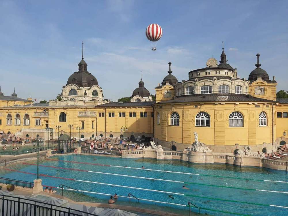
Approaching 100F here in Budapest, most days have been over 90F. There was one cool "marine push" kind of evening but it bounced back rapidly. More of a climate difference than I expected in Central Europe.
 10 points
 -
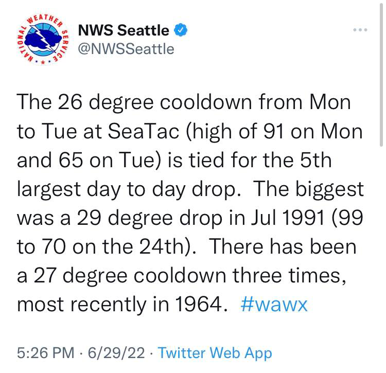
It seems the rest of the world is experiencing stuff in the same ballpark as what we saw last June. If not just to taunt us and remind us that it’s just a matter of time before it happens again here.9 points
-
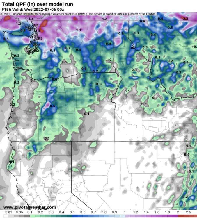
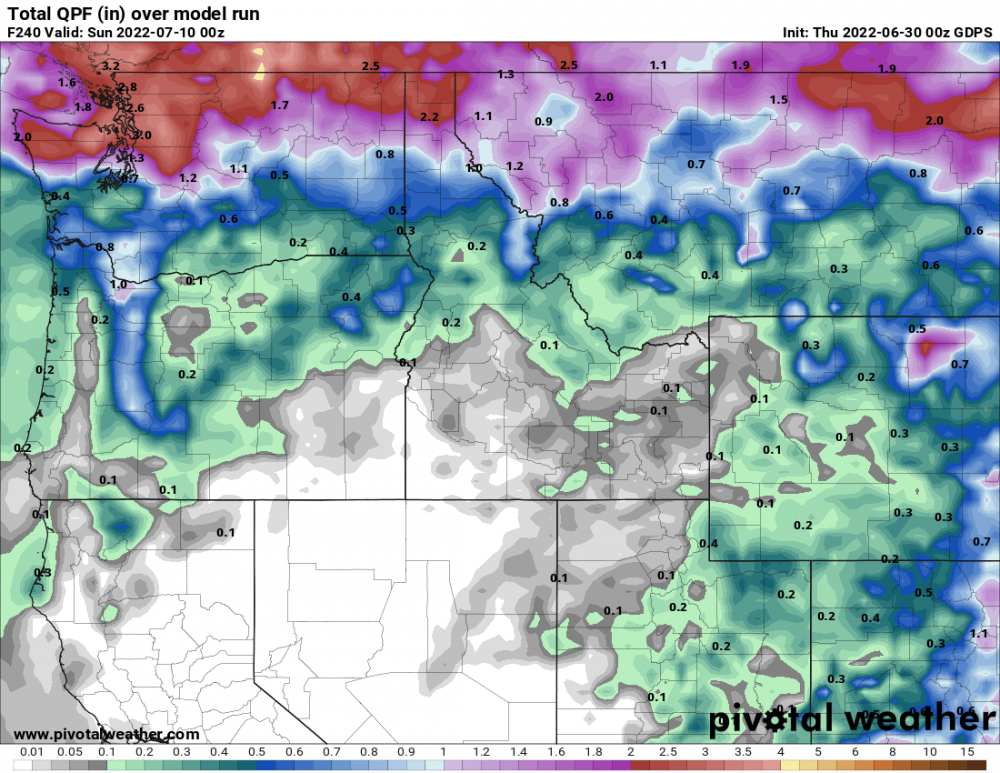
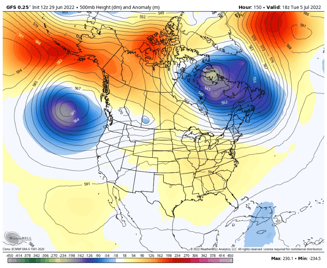
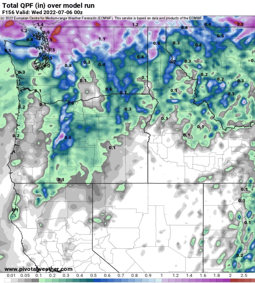
Would definitely like this verifying…would like to be in those heavier totals but 0.2” isn’t bad for early July. Definitely delaying the fire season at this point with the rain in the WA/OR cascades if it verifies.
 8 points
 -
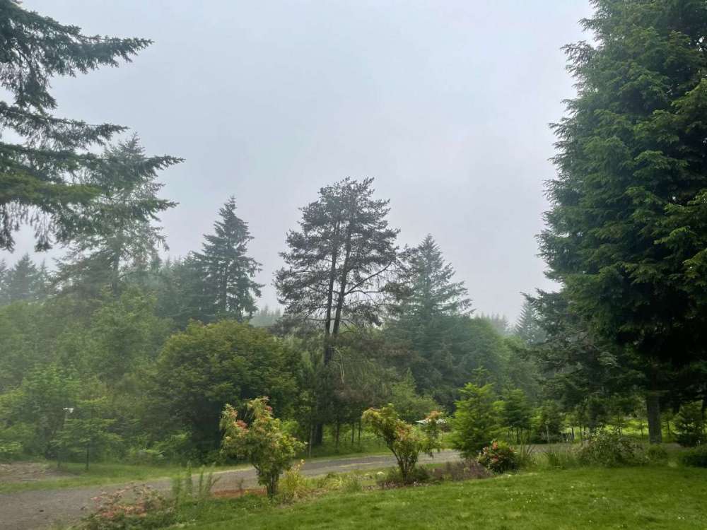
59 degrees, 100% humidity and holy fog!8 points
-
Eh I’ve lived in Bend for almost a decade. I never get sick of snow.7 points
-
Today's my bday and it was nice to have temps in the 70's instead of driving to Lewiston and praying my ice cream cake didn't melt on the 40 min drive home in official 115 record heat last year. Cake survived again :p. Not sharing though.7 points
-
This is impressive!
 6 points
 -
Thanks! I’d also be challenging them a lot more of them which buries this place in (even more) pages of debate. Just not worth it.6 points
-
But I would rather worry about some light rain that could potentially stave off fire danger for another few weeks messing up my boating plans.6 points
-
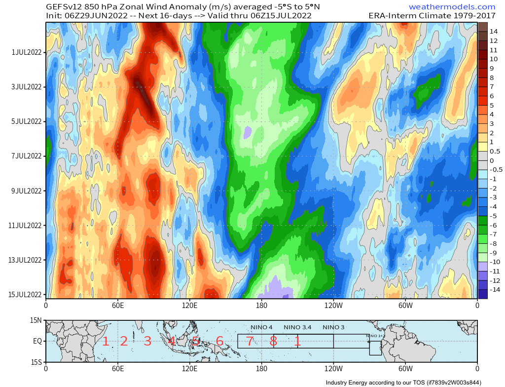
I’ve never seen purple on this Day-16 GEFS U850 hovmoller. Ever.
 6 points
 -
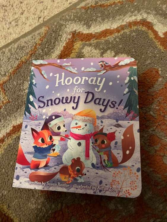
My 3yr old picked this story for bedtime reading!
 5 points
 -
The old Jesse would have given all these Tim posts downvotes instead of weenies. The dude is mellowing out!5 points
-
Weren't you just bragging all weekend about what a blast you were having on lake Sammamish? How the sun made a refreshing welcome? Hardly seemed like you were miserable. Same goes for when you visit Palm Springs every year when it's in the 90s there. I have doubts you 'don't like the torching.' Seemed like you were in nirvana while it was pushing 95F.5 points
-
Today is just a classic summer day the way I remember it growing up. Thick morning marine layer, sun by noon. PERFECTION.5 points
-
Super Computers to upgrade the GFS this fall. Great read today on Terry Swails blog. Tuesday, NOAA inaugurated the nation’s newest weather and climate supercomputers with an operational run of the National Blend of Models. The new supercomputers provide a significant upgrade to computing capacity, storage space and interconnect speed of the nation’s Weather and Climate Operational Supercomputing System. “This is a big day for NOAA and the state of weather forecasting,” said Ken Graham, director of NOAA’s National Weather Service. “Researchers are developing new ensemble-based forecast models at record speed, and now we have the computing power needed to implement many of these substantial advancements to improve weather and climate prediction.” Enhanced computing and storage capacity will allow NOAA to deploy higher-resolution models to better capture small-scale features like severe thunderstorms, more realistic model physics to better capture the formation of clouds and precipitation, and a larger number of individual model simulations to better quantify model certainty. The end result is even better forecasts and warnings to support public safety and the national economy. The new supercomputers will enable an upgrade to the U.S. Global Forecast System (GFS) this fall and the launch of a new hurricane forecast model called the Hurricane Analysis and Forecast System (HAFS), slated to be in operation for the 2023 hurricane season pending tests and evaluation.5 points
-
Should add this to the rotation:
 4 points
 -
00z Canadian is fairly whet
 4 points
 -
Ok satan4 points
-
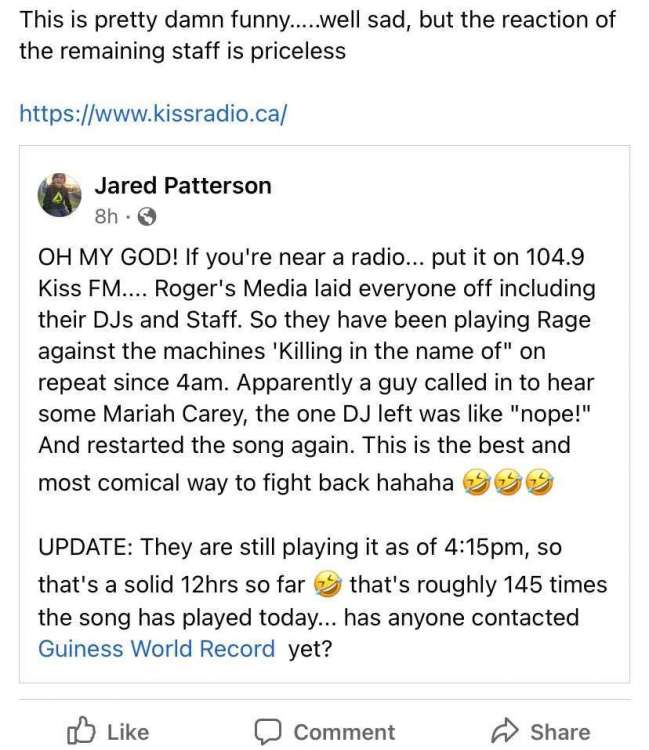
Off Topic: It would appear we have a bit of a situation with a radio station for our maple syrup loving brothers to the north of the 49th parallel I just checked and its still going Turned into a beautiful afternoon here, currently 63
 4 points
 -
Make weenie posts get weenie reacts. It’s called science4 points
-
The boat pic and lake temp spamming lead me to believe the days in the 90s were fully enjoyed up there.4 points
-
It is a beautiful day outside. 70's and glorious.4 points
-
Really makes a man want to give thanks to our Lord up above!4 points
-
Some notes: 12/30: 15/7 (might be 12/7 if going by midnight to midnight) "Blizzard conditions in area. W Union Rd closed by drifts to 2 ft. S-BS all day. 12/31: 31/8 "Sleet till noon mdt frz rain aftn. Ice on all things 1/4. Thawing eve" 1/1: 35/30 "Thawing. E PDX still E winds - high temp 27°." 1/2: 36/30 "worst snow since 1950, roads bare here icy in PDX" This is just from the first snow event as well.4 points
-
Love mornings like these heavy drizzle and up to 0.05”. We’re also about to surpass April’s 3.63” rainfall total in June which is pretty impressive considering that was also an above normal month.4 points
-
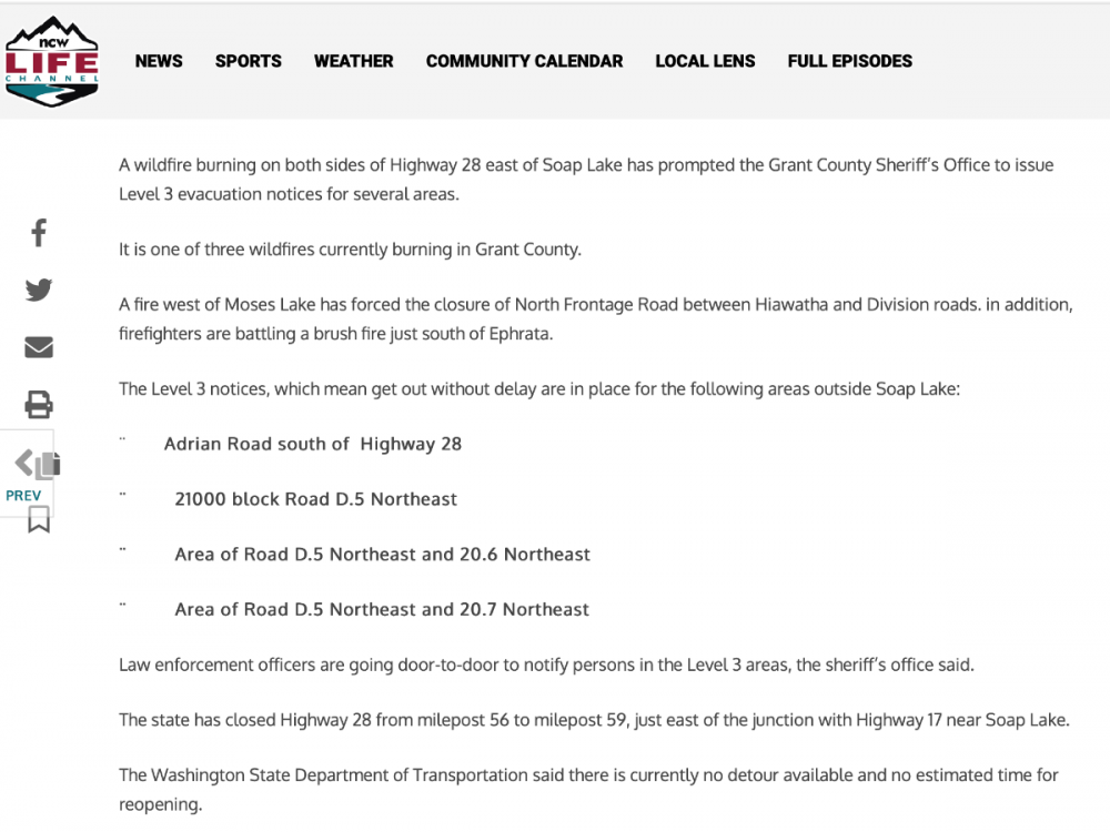
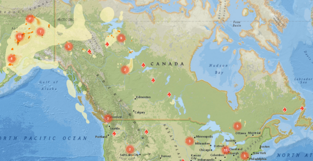
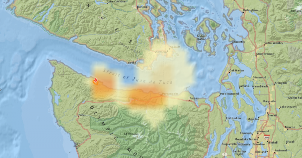
WILDFIRE / SMOKE UPDATES Not a whole lot to report quite yet, but there are three fires in Grant County. A fire near Soap Lake is requiring Level 3 area evacuations. This is the first fire of it's size so far this year in Washington. Wenatchee's local tv news channel, NCW Life News reports a total of three fires in Grant County. Wind seems fairly stable, so hopefully they can put these fires out quick with no issue and no smoke. There appears to be a new fire on the Olympic Peninsula near Neah Bay that is producing smoke over Port Angeles and the area. Unknown if it will affect the Puget Sound. I can't find much info on this fire, so hopefully it isn't big. The cool weather today should hopefully help. There is also some good news. Wildfire smoke from Alaska is dissipating over British Columbia and doesn't appear it will reach Washington in any significant fashion.
 4 points
 -
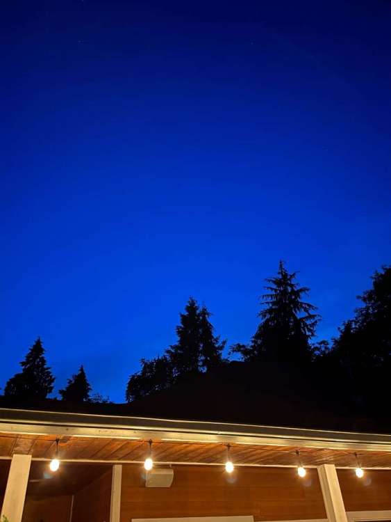
Lovely night.
 3 points
 -
I’ll see you in Valhalla, brother3 points
-
Exactly the way I feel. We have fairly similar weather 9 months of the year. We don’t need more of the same in summer. That’s why I don’t mind heatwaves as long as they’re short lived.3 points
-
3 points
-
Great post!! Well written and makes a point in a pleasurable non hostile manner.3 points
-
Yeah, although even acknowledging him is a really bad habit that I need to break.3 points
-
Hive mind moment. You posted this while I was writing my reply.3 points
-
Sunshine and 75, copy and paste the rest of summer please!3 points
-
Tom, I hope you are correct. The long range models have dismal for my area. The short range models inevitably always take it away and are miles ahead of the 4 to 10 day ones. Im ending June with 1.57. May was 2.82. Thats about 5 inches below avg in just 60 days. I have planted 65 trees in 2 yrs, fruit and white pines they will be my focus. Seems like Ottumwa Iowa will now have major drought maybe once every 3 to 5 yrs. Growing season start was very late may 10 to 15 with soil temps at record low levels. And by june 4th all significant rain stopped. A nice 20 day growing season? Here is just one of our 170 customers.
 3 points
 -
God enjoys looking down on his little patch of heaven on earth.3 points
-
Pretty amazing how cold it’s been ever since it finally dried out around the solstice.3 points
-
Can there still be a tsunami if the ocean is frozen solid?!3 points
-
And there are two blots. And the second one is stronger than the first. And it's June. Good lord.3 points
-
Operational GFS vs its ensemble mean. Always the same mistake.
 3 points
 -
55 out, turned off AC, opened all windows and fans are blazing.3 points
-
Yeah it's really fun to look at. Here's one from my location in August 1968, looks like it was a wet month. IPS-C6D13A64-23C1-465F-AF8F-8C10D383C1AD.pdf3 points
-
Justin posted a link in another thread to a really cool site with the original weather records from many locations. I have this bookmarked now. I have been checking out the handwritten records from Snoqualmie Falls and came across July of 1901. Check out the low temperatures that this guy recorded... a low of 30 on 7/13/1901? In fact lows in the 30s on many nights in July. I cross-referenced this with the data from Seattle that month and the lows were in the 50s there so I am certain none of the lows in the 30s actually happened. But what would cause a thermometer to read so cold overnight? I understand over-exposure but not sure what happened here. I also love the sky condition notes... something that is missing from the official data and lends more insight into the actual weather. This guy noted cloudy conditions on 7/18/1901 with a high of 79 and a low of 41. That seems almost impossible unless he referring to very thin high clouds. Its pretty hard to read... but you can make it out if you zoom in. https://www.ncei.noaa.gov/pub/orders/IPS/IPS-6EEC95E6-AC01-42C1-9E4B-7361541828A1.pdf3 points
-
Thicc marine layer
 3 points
 -
Jesse's back?3 points
-
Couple of severe warned storms with 75+mph winds narrowly missed me this evening which is just fine by me! Still put on quite the show. Still a decent amount of snow in the mountains as well! And to think the first snow up there usually arrives again in just a short 6-7 weeks!
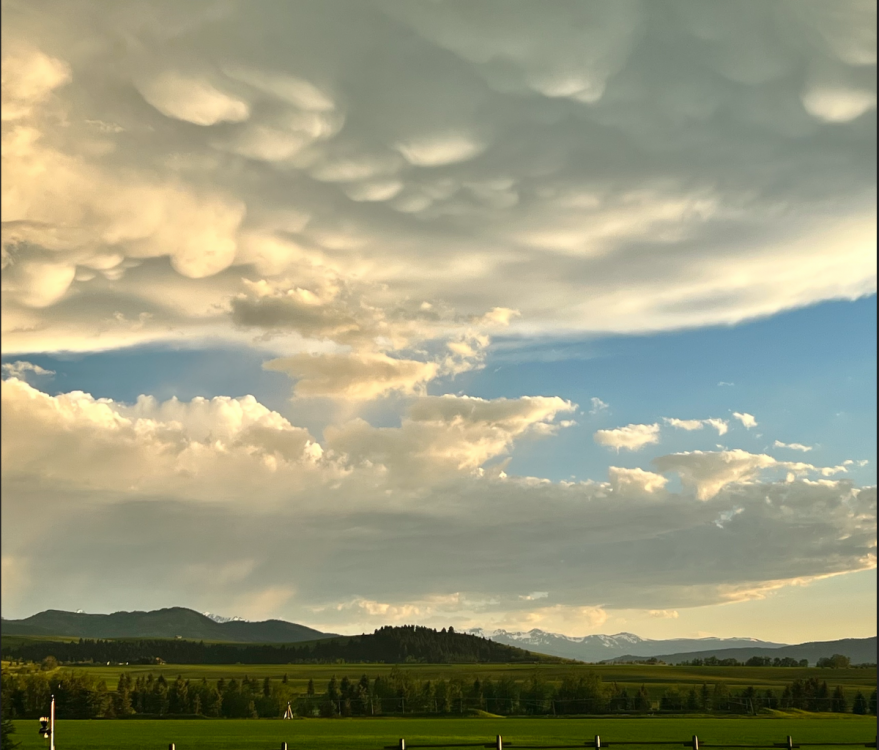
 3 points
 -
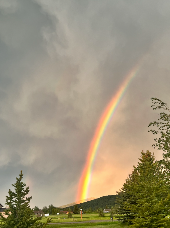
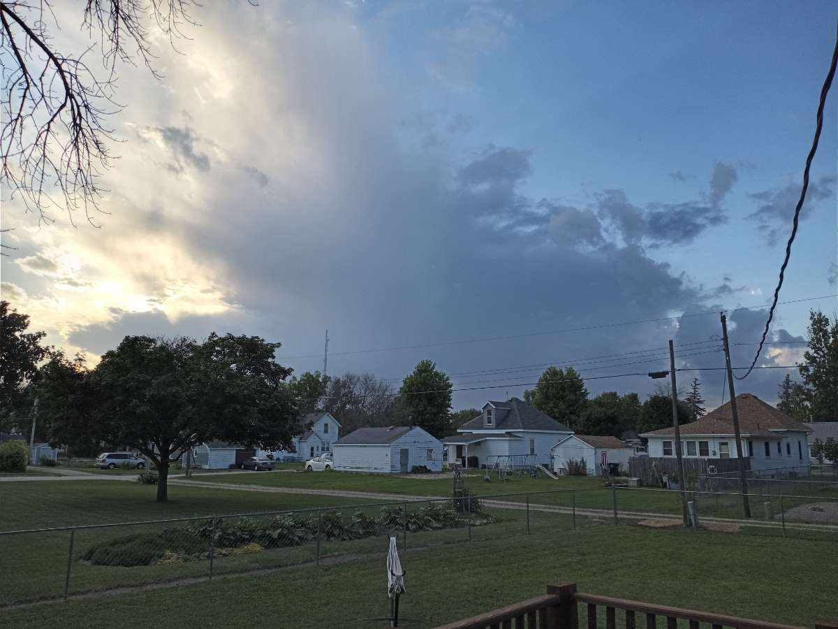
Another top notch evening out on the deck. Did some yardwork and now grilling up some late dinner on the Weber. Took this pic from the deck. Looks like an isolated storm might be moving in.
 3 points
 -
Nah he lives in North Bend.2 points
-
Models are suggesting Monday night may have some good MCS action across Iowa.2 points
-
06/29/2022 Finally received a good rain fall over night with 0.66” falling here in MBY. The official H/L yesterday at Grand Rapids was 83/48 there was no rain reported before midnight and there was 90% of possible sunshine. For today the average H/L is 83/61 the record high of 97 was set in 1913 and the record low of 43 was set in 1943. The overnight low here in MBY was 61 to go along with that 0.66” of rain fall and at this time it is cloudy and 63.2 points


This leaderboard is set to Vancouver/GMT-07:00