

-
Who's Online 21 Members, 0 Anonymous, 150 Guests (See full list)
-
Popular Contributors
-
1

-
2
-
3

-
4

-
5

-
-
Activity Stream
-
-
1666
May 2024 Pacific Northwest Weather
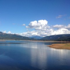
Fell asleep so I missed it but this is how it looked down here. -
1666
May 2024 Pacific Northwest Weather
The ECMWF is a really, really good model. Every piece of guidance came around to the solution it was showing 2 days ago. I’m impressed.- 1
-

-
1666
May 2024 Pacific Northwest Weather
Already 70 degrees in North Bend... boat is hooked up and waiting for my sons to get home.- 1
-

-
1666
May 2024 Pacific Northwest Weather
Dang, 00z EPS is Jesse-licious. And 06z GEFS caved further, to nobody’s surprise.
-


Recommended Posts
Join the conversation
You can post now and register later. If you have an account, sign in now to post with your account.