Jump to content

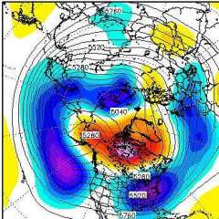
March 2019 Weather Discussion in the PNW


BLI snowman

Recommended Posts

EURO looks good. Pretty chilly the next 10 days. 

Snowfall                                  Precip

2022-23: 95.0"                      2022-23: 17.39"

2021-22: 52.6"                    2021-22: 91.46" 

2020-21: 12.0"                    2020-21: 71.59"

2019-20: 23.5"                   2019-20: 58.54"

2018-19: 63.5"                   2018-19: 66.33"

2017-18: 30.3"                   2017-18: 59.83"

2016-17: 49.2"                   2016-17: 97.58"

2015-16: 11.75"                 2015-16: 68.67"

2014-15: 3.5"
2013-14: 11.75"                  2013-14: 62.30
2012-13: 16.75"                 2012-13: 78.45  

2011-12: 98.5"                   2011-12: 92.67"

It's always sunny at Winters Hill! 
Fighting the good fight against weather evil.


Link to comment
Share on other sites

I'm just going off what my colleague at PSU found. He defended his MS thesis on this subject last month. The SPV (not TPV) made its southernmost traverse during the reanalysis era in that Dec. 1989 cold wave, based on his specific definition of what counts as the southern extent of the SPV. He was using an index based on zonal winds and gph anomalies, I think. Incidentally, he found that the southernmost excursion of the TPV was in December 1997 when it passed through Mexico. This is, again, based on his own analysis and not published literature. I actually remember the Dec. 1997 event - produced all-time record lows in Mexico and brought a famous snowstorm to Guadalajara.


Having said that, this was only a masters thesis so there's always a chance he didn't use the most appropriate methods, data, etc. Also his goal was to analyze PV extent changes in climate model projections, so maybe the metrics he used were better suited for coarse grain analysis like that, versus identifying single events.

Oh, did he mean the southern *edge* of the PV? Or just the latitude of the overall PV? I thought you were referring to the latter. It was in elongated/wave-1 mode during the 12/89 blast, but definitely still intact.


As for the TPV in Mexico..I don’t want to be dismissive or anything, but I don’t think that’s physically possible. What I’m seeing there in Dec ‘97 is a deep ULL with a consistent STJ/diabatic feed thanks to the super niño. The TPV appears to be in Siberia/AK, no?

Link to comment
Share on other sites

It would help to know what height/pressure level he’s using? The answer to the “southernmost extent” question re: SPV seems to vary by altitude. For instance, the PV structure at 100mb/tropopause is rarely homogenous to the structure at 1mb/stratopause/etc.

Link to comment
Share on other sites

Is it me or has there been some sort of shitstorm surrounding Tim for the better part of the last 12 hours? Historic stuff!

- Clear air mode.

- Maps of EPS showing ridging back in mid-Feb.

- Snowmelt trolling from Hawaii.

- SEA is warm and -50*F departures are unimpressive.

- Phil lied about Stampede Pass and wants me to suffer.

  • Like 1
Link to comment
Share on other sites

Dude, it started with the first cold trough back in early February. He just masked it with with WxBell posts.


Remember:


- Clear air mode.

- Maps of EPS showing ridging back in mid-Feb.

- Snowmelt trolling from Hawaii.

- SEA is warm and -50*F departures are unimpressive.

- Phil lied about Stampede Pass and wants me to suffer.


It’s been an epic tirade.


I have an alternative theory. Tim is actually a huge cold weather loving weenie and everything he posts otherwise is reverse psychology. He's actually super pissed he hasn't had any snow since early February and has largely missed out on this cold snap.

  • Like 1

Snowfall                                  Precip

2022-23: 95.0"                      2022-23: 17.39"

2021-22: 52.6"                    2021-22: 91.46" 

2020-21: 12.0"                    2020-21: 71.59"

2019-20: 23.5"                   2019-20: 58.54"

2018-19: 63.5"                   2018-19: 66.33"

2017-18: 30.3"                   2017-18: 59.83"

2016-17: 49.2"                   2016-17: 97.58"

2015-16: 11.75"                 2015-16: 68.67"

2014-15: 3.5"
2013-14: 11.75"                  2013-14: 62.30
2012-13: 16.75"                 2012-13: 78.45  

2011-12: 98.5"                   2011-12: 92.67"

It's always sunny at Winters Hill! 
Fighting the good fight against weather evil.


Link to comment
Share on other sites

As someone who has a parent with pancreatic and liver cancer, count your blessing at night. Anything can happen at any moment.

I’m so sorry to hear that.


The friend I lost recently died of a rare form of breast cancer (the kind that doesn’t manifest as a lump or anything like that).


The fact she didn’t tell me or anyone else that she had it and was receiving treatment made it all the more difficult and upsetting. It was like a bolt from the blue, and it helped me realize what I’ve been taking for granted all this time. I will certainly be counting my blessings daily going forward.

  • Like 2
Link to comment
Share on other sites

Emotional in here tonight.  One big happy family.  :)

  • Like 3

Springfield, Oregon regular season 2023-24 Stats:

  • Coldest high: 25F (Jan 14, 2024)
  • Coldest low: 20F (Jan 14, 2024)
  • Days with below freezing temps: 24 (Most recent: Mar 8, 2024)
  • Days with sub-40F highs: 4 (Most recent: Jan 16, 2024)
  • Total snowfall: 0.0"
  • Total ice: 2.25”
  • Last accumulating snowfall on roads: Dec 27, 2021 (1.9")
  • Last sub-freezing high: Jan 15, 2024 (27F)
  • Last White Christmas: 1990
  • Significant wind events (gusts 45+): 0

Personal Stats:

  • Last accumulating snowfall on roads: Dec 27, 2021
  • Last sub-freezing high: Jan 16, 2024 (32F)
  • Last White Christmas: 2008
  • Total snowfall since joining TheWeatherForums: 42.0"
  • Sub-freezing highs since joining TheWeatherForums: 4


Venmo

GoFundMe "College Basketball vs Epilepsy": gf.me/u/zk3pj2

My Twitter @CBBjerseys4hope

24

Link to comment
Share on other sites

Now 33 consecutive spotless days. This surpasses the longest spotless streak of the 2008 solar minimum, which was 32 days from July 31 to August 31, 2008.


Will be tough, but if we can string 13 more together, we will tie the bizarre stretch of 46 consecutive spotless days that occurred back in the 1996 solar minimum. That wasn’t a super deep minimum, but those 7-8 weeks were absolutely lights out, for whatever reason.

  • Like 1
Link to comment
Share on other sites

Now 33 consecutive spotless days. This surpasses the longest spotless streak of the 2008 solar minimum, which was 32 days from July 31 to August 31, 2008.


Will be tough, but if we can string 13 more together, we will tie the bizarre stretch of 46 consecutive spotless days that occurred back in the 1996 solar minimum. That wasn’t a super deep minimum, but those 7-8 weeks were absolutely lights out, for whatever reason.

1996 and 2008. I’m feeling a big December
  • Like 1
Link to comment
Share on other sites

Intriguingly, the frequency of prominences (smoothed) has been even less than during the last solar minimum at this stage.


Very interesting.


http://users.telenet.be/j.janssens/SC24web/BAACMX.png

Link to comment
Share on other sites

Some great information on how February in Bend, OR stacked up historically from KTVZ. All around it was an incredible month in Central Oregon. The article is worth a read, but here are some highlights.


Snowfall record: 45.8" (Previous record 23.3" February 1917)

Mean Temp: 27.0 (-7.2 departure) 3rd Coldest February on Record

Precip: 4.48" (+3.39") 2nd wettest February on record at Bend (Record 4.50" 1927)


https://www.ktvz.com/news/bend-s-nearly-4-feet-of-feb-snow-smashes-century-old-record/1049824817?fbclid=IwAR3A30tBgYHOG2Ii2zI2i_thHeibUI6fyNuGtDLaEESa0AcJN3wm7F9S9AM

  • Like 2

Snowfall                                  Precip

2022-23: 95.0"                      2022-23: 17.39"

2021-22: 52.6"                    2021-22: 91.46" 

2020-21: 12.0"                    2020-21: 71.59"

2019-20: 23.5"                   2019-20: 58.54"

2018-19: 63.5"                   2018-19: 66.33"

2017-18: 30.3"                   2017-18: 59.83"

2016-17: 49.2"                   2016-17: 97.58"

2015-16: 11.75"                 2015-16: 68.67"

2014-15: 3.5"
2013-14: 11.75"                  2013-14: 62.30
2012-13: 16.75"                 2012-13: 78.45  

2011-12: 98.5"                   2011-12: 92.67"

It's always sunny at Winters Hill! 
Fighting the good fight against weather evil.


Link to comment
Share on other sites

East wind backing off a bit at PDX and down to 28 there. 


21 at Hillsboro... Brrrrrr

Snowfall                                  Precip

2022-23: 95.0"                      2022-23: 17.39"

2021-22: 52.6"                    2021-22: 91.46" 

2020-21: 12.0"                    2020-21: 71.59"

2019-20: 23.5"                   2019-20: 58.54"

2018-19: 63.5"                   2018-19: 66.33"

2017-18: 30.3"                   2017-18: 59.83"

2016-17: 49.2"                   2016-17: 97.58"

2015-16: 11.75"                 2015-16: 68.67"

2014-15: 3.5"
2013-14: 11.75"                  2013-14: 62.30
2012-13: 16.75"                 2012-13: 78.45  

2011-12: 98.5"                   2011-12: 92.67"

It's always sunny at Winters Hill! 
Fighting the good fight against weather evil.


Link to comment
Share on other sites

26 here. Feels good out there.

Springfield, Oregon regular season 2023-24 Stats:

  • Coldest high: 25F (Jan 14, 2024)
  • Coldest low: 20F (Jan 14, 2024)
  • Days with below freezing temps: 24 (Most recent: Mar 8, 2024)
  • Days with sub-40F highs: 4 (Most recent: Jan 16, 2024)
  • Total snowfall: 0.0"
  • Total ice: 2.25”
  • Last accumulating snowfall on roads: Dec 27, 2021 (1.9")
  • Last sub-freezing high: Jan 15, 2024 (27F)
  • Last White Christmas: 1990
  • Significant wind events (gusts 45+): 0

Personal Stats:

  • Last accumulating snowfall on roads: Dec 27, 2021
  • Last sub-freezing high: Jan 16, 2024 (32F)
  • Last White Christmas: 2008
  • Total snowfall since joining TheWeatherForums: 42.0"
  • Sub-freezing highs since joining TheWeatherForums: 4


Venmo

GoFundMe "College Basketball vs Epilepsy": gf.me/u/zk3pj2

My Twitter @CBBjerseys4hope

24

Link to comment
Share on other sites

- Clear air mode.

- Maps of EPS showing ridging back in mid-Feb.

- Snowmelt trolling from Hawaii.

- SEA is warm and -50*F departures are unimpressive.

- Phil lied about Stampede Pass and wants me to suffer.

Woke up to pee. Never should check here when I do that.


Is this serious? Wow!


Such random things. Hilarious. I live in your head. :)


1) I always notice clear air mode. Always.


2) Back in mid February I originally said I just could not believe the EPS showed anything other than complete ice box. It had been a solid month of showing non stop extreme cold on that model without wavering even once. None of us had ever seen anything like that in the models.


3) National Guard was called into North Bend when we were in Hawaii. God d@mn right I was going to hope for snow melt!


4) SEA has been blessedly mild during this latest arctic blast. Same here. Still 35 here. May not even go below freezing tonight.


And I do not think a -50 departure is impressive?? My post was dripping with sarcasm to show how relatively mild it is in Seattle. I told Kayla that her -50 is nothing compared to the -6 at SEA. So you take THAT post literally and 2 minutes later I say to wxstatman that the Bozeman data is completely crazy and you ignore that? And all the other posts expressing amazement over the numbers from Bozeman.


Wow! :)

**REPORTED CONDITIONS AND ANOMALIES ARE NOT MEANT TO IMPLY ANYTHING ON A REGIONAL LEVEL UNLESS SPECIFICALLY STATED**

Link to comment
Share on other sites

Down to 1 at Pendleton, OR which ties their all-time March low. 


The Dalles down to 10, threatening their all-time March low set yesterday.


21 here, almost unthinkable back to back lows in the teens could happen in March. I can't wait until the Silver Falls data from this month and February is made public in a few months. If they hit the teens last night it would be the first time since the 1970s they dropped below 20 in March.

  • Like 1

Snowfall                                  Precip

2022-23: 95.0"                      2022-23: 17.39"

2021-22: 52.6"                    2021-22: 91.46" 

2020-21: 12.0"                    2020-21: 71.59"

2019-20: 23.5"                   2019-20: 58.54"

2018-19: 63.5"                   2018-19: 66.33"

2017-18: 30.3"                   2017-18: 59.83"

2016-17: 49.2"                   2016-17: 97.58"

2015-16: 11.75"                 2015-16: 68.67"

2014-15: 3.5"
2013-14: 11.75"                  2013-14: 62.30
2012-13: 16.75"                 2012-13: 78.45  

2011-12: 98.5"                   2011-12: 92.67"

It's always sunny at Winters Hill! 
Fighting the good fight against weather evil.


Link to comment
Share on other sites

In most years we would be making a big deal out of the system dropping in on Thursday. 850mb ensemble mean at PDX falls to -8C by Friday morning. 

  • Like 1

Snowfall                                  Precip

2022-23: 95.0"                      2022-23: 17.39"

2021-22: 52.6"                    2021-22: 91.46" 

2020-21: 12.0"                    2020-21: 71.59"

2019-20: 23.5"                   2019-20: 58.54"

2018-19: 63.5"                   2018-19: 66.33"

2017-18: 30.3"                   2017-18: 59.83"

2016-17: 49.2"                   2016-17: 97.58"

2015-16: 11.75"                 2015-16: 68.67"

2014-15: 3.5"
2013-14: 11.75"                  2013-14: 62.30
2012-13: 16.75"                 2012-13: 78.45  

2011-12: 98.5"                   2011-12: 92.67"

It's always sunny at Winters Hill! 
Fighting the good fight against weather evil.


Link to comment
Share on other sites

Looks like wind died here. Went from 35 at 2 a.m. to 29 now.


Not quite coldest reading of winter... it was 12 degrees after the first snowfall last month.


SEA is also down to 29.

**REPORTED CONDITIONS AND ANOMALIES ARE NOT MEANT TO IMPLY ANYTHING ON A REGIONAL LEVEL UNLESS SPECIFICALLY STATED**

Link to comment
Share on other sites

Jared says its mostly in the summer... and on sunny days.


Not on any day of the year in any weather. I know SEA was running colder than downtown Seattle last month when it was dumping snow there and raining in Seattle. ;)

I see what you are saying in rare circumstances but my point was that it always runs warmer than the general vicinity within 5 miles which is on top of the general UHI affect when comparing historical temps.
Link to comment
Share on other sites

Very cold this AM in eastsound San Juan’s. Says it was 26 here last night. I believe it all the ponds and even some of the water on the beaches was frozen last night in place. Never seen that on a saltwater beach...will see how cold it is above 2000’ this afternoon

Tacoma WA elevation 300’

Monthly rainfall-3.56”

Warm season rainfall-11.14”

Max temp-88

+80 highs-2

+85 highs-2

+90 highs-0


Link to comment
Share on other sites

I see what you are saying in rare circumstances but my point was that it always runs warmer than the general vicinity within 5 miles which is on top of the general UHI affect when comparing historical temps.


I don't even think that is true.   


I just checked now and its 30 at SEA... while 32 at the Normandy Park station just to the west and 30 in Burrien just to the northwest and 32 at another station just to the east.


sea5.png


Jared says it seems to be 1-2 degrees warmer but primarily on summer days and when its sunny.    So the majority of the time its pretty accurate and the sensor is functioning fine as well.   

**REPORTED CONDITIONS AND ANOMALIES ARE NOT MEANT TO IMPLY ANYTHING ON A REGIONAL LEVEL UNLESS SPECIFICALLY STATED**

Link to comment
Share on other sites

Very cold this AM in eastsound San Juan’s. Says it was 26 here last night. I believe it all the ponds and even some of the water on the beaches was frozen last night in place. Never seen that on a saltwater beach...will see how cold it is above 2000’ this afternoon


I love Eastsound!  


Gorgeous  place.  

**REPORTED CONDITIONS AND ANOMALIES ARE NOT MEANT TO IMPLY ANYTHING ON A REGIONAL LEVEL UNLESS SPECIFICALLY STATED**

Link to comment
Share on other sites

-33F at BZN this morning. Through the first 4 days this month they are running a -41.9  departure. A balmy -14F at my house this morning slightly above the valley floor.


One more fun fact with this never ending cold. Great Falls, Cut Bank and Havre, MT were all 27 to 28ºF below average for the entire month of February. These are the largest departures from normal in the lower 48 since 14 Montana stations reached equal levels in January 1969.


Still can't believe the historic nature of these past 4 weeks.

  • Like 4

Cold Season 2023/24:

Total snowfall: 26"

Highest daily snowfall: 5"

Deepest snow depth: 12"

Coldest daily high: -20ºF

Coldest daily low: -42ºF

Number of subzero days: 5

Personal Weather Station on Wunderground: 

https://www.wunderground.com/personal-weather-station/dashboard?ID=KMTBOZEM152#history

Link to comment
Share on other sites

It appears The Dalles broke the all-time March record they set yesterday when they hit 6 this morning. 

  • Like 2

Snowfall                                  Precip

2022-23: 95.0"                      2022-23: 17.39"

2021-22: 52.6"                    2021-22: 91.46" 

2020-21: 12.0"                    2020-21: 71.59"

2019-20: 23.5"                   2019-20: 58.54"

2018-19: 63.5"                   2018-19: 66.33"

2017-18: 30.3"                   2017-18: 59.83"

2016-17: 49.2"                   2016-17: 97.58"

2015-16: 11.75"                 2015-16: 68.67"

2014-15: 3.5"
2013-14: 11.75"                  2013-14: 62.30
2012-13: 16.75"                 2012-13: 78.45  

2011-12: 98.5"                   2011-12: 92.67"

It's always sunny at Winters Hill! 
Fighting the good fight against weather evil.


Link to comment
Share on other sites

-33F at BZN this morning. Through the first 4 days this month they are running a -41.9  departure. A balmy -14F at my house this morning slightly above the valley floor.


One more fun fact with this never ending cold. Great Falls, Cut Bank and Havre, MT were all 27 to 28ºF below average for the entire month of February. These are the largest departures from normal in the lower 48 since 14 Montana stations reached equal levels in January 1969.


Still can't believe the historic nature of these past 4 weeks.


Montana has really been ground zero.     Might not see this kind of persistent cold again in our lifetime.  

**REPORTED CONDITIONS AND ANOMALIES ARE NOT MEANT TO IMPLY ANYTHING ON A REGIONAL LEVEL UNLESS SPECIFICALLY STATED**

Link to comment
Share on other sites

Dipped to 19 here this morning for our 2nd straight low in the teens. In the 8 years prior our lowest March minimum was 23. Will be interesting to see if the park made it into the teens. If so it would be the first time in March they have hit the teens since 1976 and the latest in the season since 1965.

  • Like 1

Snowfall                                  Precip

2022-23: 95.0"                      2022-23: 17.39"

2021-22: 52.6"                    2021-22: 91.46" 

2020-21: 12.0"                    2020-21: 71.59"

2019-20: 23.5"                   2019-20: 58.54"

2018-19: 63.5"                   2018-19: 66.33"

2017-18: 30.3"                   2017-18: 59.83"

2016-17: 49.2"                   2016-17: 97.58"

2015-16: 11.75"                 2015-16: 68.67"

2014-15: 3.5"
2013-14: 11.75"                  2013-14: 62.30
2012-13: 16.75"                 2012-13: 78.45  

2011-12: 98.5"                   2011-12: 92.67"

It's always sunny at Winters Hill! 
Fighting the good fight against weather evil.


Link to comment
Share on other sites

19 here, latest teens I have seen here.


Very possible that is the latest low in the teens at your location since the 50s. 

Snowfall                                  Precip

2022-23: 95.0"                      2022-23: 17.39"

2021-22: 52.6"                    2021-22: 91.46" 

2020-21: 12.0"                    2020-21: 71.59"

2019-20: 23.5"                   2019-20: 58.54"

2018-19: 63.5"                   2018-19: 66.33"

2017-18: 30.3"                   2017-18: 59.83"

2016-17: 49.2"                   2016-17: 97.58"

2015-16: 11.75"                 2015-16: 68.67"

2014-15: 3.5"
2013-14: 11.75"                  2013-14: 62.30
2012-13: 16.75"                 2012-13: 78.45  

2011-12: 98.5"                   2011-12: 92.67"

It's always sunny at Winters Hill! 
Fighting the good fight against weather evil.


Link to comment
Share on other sites

I love Eastsound!


Gorgeous place.

yeah no snow here at sea level but once you go into the park and get some elevation there’s solid snowpack it’s very interesting to see on an island!

Tacoma WA elevation 300’

Monthly rainfall-3.56”

Warm season rainfall-11.14”

Max temp-88

+80 highs-2

+85 highs-2

+90 highs-0


Link to comment
Share on other sites

There's an olive garden at Stampede pass now?

Yes we covered this last night. It’s on the other side of the street from Walgreens and the Costco in the strip mall. Traffic is a ***** however.
  • Like 3

Elevation 580’ Location a few miles east of I-5 on the Snohomish Co side of the Snohomish/Skagit border. I love snow/cold AND sun/warmth! 

Link to comment
Share on other sites

Join the conversation

You can post now and register later. If you have an account, sign in now to post with your account.

Guest
Unfortunately, your content contains terms that we do not allow. Please edit your content to remove the highlighted words below.
Reply to this topic...

×   Pasted as rich text.   Paste as plain text instead

  Only 75 emoji are allowed.

×   Your link has been automatically embedded.   Display as a link instead

×   Your previous content has been restored.   Clear editor

×   You cannot paste images directly. Upload or insert images from URL.

Loading...

×
×
  • Create New...