

-
Who's Online 30 Members, 1 Anonymous, 138 Guests (See full list)
- Edmonds Husky
- umadbro
- FroYoBro
- van city
- GHweatherChris
- Mapletree
- Deweydog
- BLI snowman
- SpaceRace22
- Winterdog
- Rubus Leucodermis
- Kolk1604
- Meatyorologist
- TacomaWx
- the_convergence_zone
- Snowfan
- MossMan
- High Desert Mathew
- Doinko
- Snownerd3000
- Sunriver Snow Zone
- Cold Snap
- Clinton
- Port Angeles Foothiller
- SilverFallsAndrew
- Front Ranger
- SouthHillFrosty
- ShawniganLake
- Timmy
- Jakewestsalem
-
Popular Contributors
-
1

-
2
-
3

-
4

-
5

-
-
Activity Stream
-
4475
-
4475
October 2024 PNW Weather Discussion
"Snow bug" I made in November 2014 One of my earliest snow memories It's cool when we get an earlier than usual snowfall -
4475
October 2024 PNW Weather Discussion
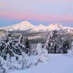
My lows consistently cold winter was without a doubt 2016-2017. Snow on the ground for months. Right when it would almost disappear it would snow again and the mounds in the parking lots would be back to 15 feet. Crazy cold and snowy. -
7866
-
7866
-


Recommended Posts
Join the conversation
You can post now and register later. If you have an account, sign in now to post with your account.