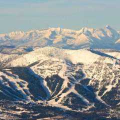
my God, this forum has devolved into the worst of the worst. It's always emotional and reactionary in here, but it seems that the rational and seasoned members have pulled back to make way for the kids.
I'm going to step back for the day too. It's just too much uninformed nonsense.
I am excited for a lot of you guys, because it seems like this is your first time tracking a PNW winter storm. I remember my first time.
We've got a moderate for severe from SPC and for rain from WPC:
Some ML guidance shows the highest threat more towards my area like nadocast:
But others like CSU is a bit further west:
I'm inclined to think the biggest severe weather threat will be further west towards OKC. I expect to see several strong tornadoes and reports of very large hail. As the storms congeal we will get a wind/QLCS threat morphing into a heavy rain/flood threat overnight. I don't think we will get anything truly crazy, but a couple of inches wouldn't shock me.
Are you talking about the 8 weeks of July and August? Because it almost always rains in June and September with only a few exceptions. SEA averages .60 in July and .97 in August. So in order to have a rainfall every 2 weeks it would need just 2 each month.
July and August in recent years has been an anomaly.
Recommended Posts
Posted by SeanNyberg,
65 reactions
Go to this post
Posted by GHweatherChris,
4 reactions
Go to this post