April 1, 20233 yr I know I keep updating ever two seconds but this is evolving quickly. The good events tend to do that. Absolutely gnarly sky. Been hearing more thunder. Weather stats for MBY Snowfall: -Total snowfall since joining: 56.25" -- Lake City, Seattle (LC) -- -2018-19: 21" -2019-20: 2.5" -2020-21: 13" -2021-22: 8.75" -2022-23: 5.75" -2023-24: 0.25" -2024-25: 4.75" -- Ballard, Seattle (B) -- -2025-26: 0.25" -Most recent snowfall: 0.25”; March 13th, 2026 (B) -Largest snowfall (single storm): 8.5"; February 12-13, 2021 (LC) -Largest snow depth: 14"; 1:30am February 12th, 2019 (LC) Temperatures: -Warmest: 109F; June 28th, 2021 (LC) -Coldest: 13F; December 27th, 2021 (LC)
April 1, 20233 yr Hail continues to fall. Here are two video clips. Temperature is 40F in Everett. Feels much colder. At noon the temp was 45F. 2023-04-01 13.39.27.mp4
April 1, 20233 yr 37 minutes ago, Doinko said: I would probably be able to see some lightning from home but I'm in Hillsboro right now. Hopefully some more storms can form! It's still early in the day. I think it's just starting. Also, we still have a chance of thunderstorms tomorrow too
April 1, 20233 yr Still hailing. Coming down hard. This might be the longest I have ever seen hail fall and at this size. Over a half and hour now officially. 2023-04-01 13.38.58.mp4
April 1, 20233 yr Currently 47/37 for the day. Decently chilly afternoon for the 1st of April especially with there being sun breaks. 2025 Warm Season Stats Number of 80+ days - 40 Number of 85+ days - 18 Number of 90+ days - 6 Number of 95+ days - 1 (Warmest 96) Number of 60+ lows - 5
April 1, 20233 yr I thought I would post another radar loop. As you can see, things are getting going. I think the thunderstorms will develop fast and could be right on top of you and not know it until it hits you.
April 1, 20233 yr I can see the dark clouds from the CZ to my north and west and it has started to get very windy here in the past 30 minutes. IMG_3284.MOV 2025 Warm Season Stats Number of 80+ days - 40 Number of 85+ days - 18 Number of 90+ days - 6 Number of 95+ days - 1 (Warmest 96) Number of 60+ lows - 5
April 1, 20233 yr To me, it’s a bit difficult to differentiate whether the stuff up north is graupel or hail. The texture looks like it should be graupel but perhaps some hail mixed in as well. Cloud
April 1, 20233 yr There is a lot of cold air out in the Pacific. All that popcorn looking clouds. With having a lot of sun breaks, that gives us a lot of instability to make those showers into thunderstorms.
April 1, 20233 yr Still hailing here in Everett. There was a short break for a few mins then it picked up again.
April 1, 20233 yr Most of the action has been a few miles south of me since this morning. Met up with my dog training friends east of Mt. Vernon earlier, had a few moments of hail but otherwise dry. Cold though, currently 39 at home. Elevation 580’ Location a few miles east of I-5 on the Snohomish Co side of the Snohomish/Skagit border. I love snow/cold AND sun/warmth!
April 1, 20233 yr Nice looking cumulus. Something to know about me... I love clouds. Kind of a shocker I know but I thought coming clean would be best. Weather stats for MBY Snowfall: -Total snowfall since joining: 56.25" -- Lake City, Seattle (LC) -- -2018-19: 21" -2019-20: 2.5" -2020-21: 13" -2021-22: 8.75" -2022-23: 5.75" -2023-24: 0.25" -2024-25: 4.75" -- Ballard, Seattle (B) -- -2025-26: 0.25" -Most recent snowfall: 0.25”; March 13th, 2026 (B) -Largest snowfall (single storm): 8.5"; February 12-13, 2021 (LC) -Largest snow depth: 14"; 1:30am February 12th, 2019 (LC) Temperatures: -Warmest: 109F; June 28th, 2021 (LC) -Coldest: 13F; December 27th, 2021 (LC)
April 1, 20233 yr Turning really dark to the west despite radar remaining relatively blank. I wonder if there's a cumulus tower shooting upwards faster than KATX scans. Would make sense since the best lift is now entering north Seattle, where the environment is quite primed. Weather stats for MBY Snowfall: -Total snowfall since joining: 56.25" -- Lake City, Seattle (LC) -- -2018-19: 21" -2019-20: 2.5" -2020-21: 13" -2021-22: 8.75" -2022-23: 5.75" -2023-24: 0.25" -2024-25: 4.75" -- Ballard, Seattle (B) -- -2025-26: 0.25" -Most recent snowfall: 0.25”; March 13th, 2026 (B) -Largest snowfall (single storm): 8.5"; February 12-13, 2021 (LC) -Largest snow depth: 14"; 1:30am February 12th, 2019 (LC) Temperatures: -Warmest: 109F; June 28th, 2021 (LC) -Coldest: 13F; December 27th, 2021 (LC)
April 1, 20233 yr It's about to pop off for sure. Weather stats for MBY Snowfall: -Total snowfall since joining: 56.25" -- Lake City, Seattle (LC) -- -2018-19: 21" -2019-20: 2.5" -2020-21: 13" -2021-22: 8.75" -2022-23: 5.75" -2023-24: 0.25" -2024-25: 4.75" -- Ballard, Seattle (B) -- -2025-26: 0.25" -Most recent snowfall: 0.25”; March 13th, 2026 (B) -Largest snowfall (single storm): 8.5"; February 12-13, 2021 (LC) -Largest snow depth: 14"; 1:30am February 12th, 2019 (LC) Temperatures: -Warmest: 109F; June 28th, 2021 (LC) -Coldest: 13F; December 27th, 2021 (LC)
April 1, 20233 yr Fun weather day. Hail looked like snow on 205 about an hour ago. Now I need to get the dog out for a walk during this sun break!
April 1, 20233 yr 10 minutes ago, Meatyorologist said: It's about to pop off for sure. Total april fool's joke. Prank'd hard. Not even a sprinkle, just some grey clouds and gusty winds as the lifting mechanism (advancing cold air pool) fell apart fast. Actually really funny how things played out given today's holiday. These parcels are sharing no pause spilling their contents all over southern snohomish county though. There have been red echoes there for like an hour now. As is the way things typically seem to play out. Weather stats for MBY Snowfall: -Total snowfall since joining: 56.25" -- Lake City, Seattle (LC) -- -2018-19: 21" -2019-20: 2.5" -2020-21: 13" -2021-22: 8.75" -2022-23: 5.75" -2023-24: 0.25" -2024-25: 4.75" -- Ballard, Seattle (B) -- -2025-26: 0.25" -Most recent snowfall: 0.25”; March 13th, 2026 (B) -Largest snowfall (single storm): 8.5"; February 12-13, 2021 (LC) -Largest snow depth: 14"; 1:30am February 12th, 2019 (LC) Temperatures: -Warmest: 109F; June 28th, 2021 (LC) -Coldest: 13F; December 27th, 2021 (LC)
April 1, 20233 yr Having a few blobs with the rain. 36F now and also the low so far after a high of 42. Picked up .29" of precip since midnight. Thanks for being you.
April 1, 20233 yr Wow. Weather stats for MBY Snowfall: -Total snowfall since joining: 56.25" -- Lake City, Seattle (LC) -- -2018-19: 21" -2019-20: 2.5" -2020-21: 13" -2021-22: 8.75" -2022-23: 5.75" -2023-24: 0.25" -2024-25: 4.75" -- Ballard, Seattle (B) -- -2025-26: 0.25" -Most recent snowfall: 0.25”; March 13th, 2026 (B) -Largest snowfall (single storm): 8.5"; February 12-13, 2021 (LC) -Largest snow depth: 14"; 1:30am February 12th, 2019 (LC) Temperatures: -Warmest: 109F; June 28th, 2021 (LC) -Coldest: 13F; December 27th, 2021 (LC)
April 1, 20233 yr 13 minutes ago, Winterdog said: Having a few blobs with the rain. 36F now and also the low so far after a high of 42. Picked up .29" of precip since midnight. Thanks for being you. I heard Everett is down to 36 as well. Crazy.
April 1, 20233 yr Had some moderate rain earlier but we’re just a little too far north with this WSW flow coming in. Flow needs to turn a bit more southerly for us to get nailed. 2026-2027 cold season stats Coldest max-60Coldest min-41
April 1, 20233 yr Up to 41 here. Precip type was hail with the last shower. Snowfall Precip 2025-26: 7.5" 2024-25: 21.0" 2023-24: 39.5" 2023-24: 76.88 2022-23: 95.0" 2022-23: 73.43" 2021-22: 52.6" 2021-22: 91.46" 2020-21: 12.0" 2020-21: 71.59" 2019-20: 23.5" 2019-20: 58.54" 2018-19: 63.5" 2018-19: 66.33" 2017-18: 30.3" 2017-18: 59.83" 2016-17: 49.2" 2016-17: 97.58" 2015-16: 11.75" 2015-16: 68.67" 2014-15: 3.5" 2013-14: 11.75" 2013-14: 62.30 2012-13: 16.75" 2012-13: 78.45 2011-12: 98.5" 2011-12: 92.67" It's always sunny at Winters Hill! Fighting the good fight against weather evil.
April 1, 20233 yr 2 minutes ago, TacomaWx said: Had some moderate rain earlier but we’re just a little too far north with this WSW flow coming in. Flow needs to turn a bit more southerly for us to get nailed. Getting a good soaking here from this shower. Some splats mixed in.
April 1, 20233 yr It has been a few minutes and the roads are starting to clear, but you can still see the heavy slush buildup on the sides and in the parking lot. Stunning this hail event we had.
April 1, 20233 yr 7 minutes ago, T-Town said: Getting a good soaking here from this shower. Some splats mixed in. Seems quite possible that there could be snowflakes in the overnight hours with how cold this airmass is. That’s if there’s precipitation of course. It’s pretty darn chilly hit 41 a bit ago in mid afternoon that’s pretty cold. 2026-2027 cold season stats Coldest max-60Coldest min-41
April 1, 20233 yr As cold as this airmass is, april 2022 was a beast in its own league. That was mid month and we pulled off 2 days with trace accumulations of snow. Coldest April day I’ve ever recorded with a 42/32 temp spread on 4/13 last year…which was totally insane for that time of year. 2026-2027 cold season stats Coldest max-60Coldest min-41
April 1, 20233 yr Two separate showers with hail today, one with a few flashes of lightning, plenty of sun as well. Really fun and active weather day to kick off April!
April 1, 20233 yr Quite the temp difference on either side of the convergence. Upper 40s to low 50s to the north and south while 30s with snow within the convergence.
April 1, 20233 yr 12 minutes ago, TacomaWx said: As cold as this airmass is, april 2022 was a beast in its own league. That was mid month and we pulled off 2 days with trace accumulations of snow. Coldest April day I’ve ever recorded with a 42/32 temp spread on 4/13 last year…which was totally insane for that time of year. Yeah this isnt much different than April airmasses we have seen in 2020, 2018, and 2015. Potential to be in the same league as 2012 which was a very cold early April airmass. Early April 2009 seems like a decent analog too. Edited April 1, 20233 yr by SilverFallsAndrew Snowfall Precip 2025-26: 7.5" 2024-25: 21.0" 2023-24: 39.5" 2023-24: 76.88 2022-23: 95.0" 2022-23: 73.43" 2021-22: 52.6" 2021-22: 91.46" 2020-21: 12.0" 2020-21: 71.59" 2019-20: 23.5" 2019-20: 58.54" 2018-19: 63.5" 2018-19: 66.33" 2017-18: 30.3" 2017-18: 59.83" 2016-17: 49.2" 2016-17: 97.58" 2015-16: 11.75" 2015-16: 68.67" 2014-15: 3.5" 2013-14: 11.75" 2013-14: 62.30 2012-13: 16.75" 2012-13: 78.45 2011-12: 98.5" 2011-12: 92.67" It's always sunny at Winters Hill! Fighting the good fight against weather evil.
April 1, 20233 yr Welp it's pouring hail upon me in Gold Bar. I'm just sitting in my car waiting for a break to go inside.
April 1, 20233 yr 14 minutes ago, TacomaWx said: As cold as this airmass is, april 2022 was a beast in its own league. That was mid month and we pulled off 2 days with trace accumulations of snow. Coldest April day I’ve ever recorded with a 42/32 temp spread on 4/13 last year…which was totally insane for that time of year. That same airmass briefly affected us here, delivering a low of 10 on 4/13, the second latest DEN has been that cold. And then 9 days later we hit 89, the second earliest to reach that temp. O the snow, the beautiful snow! Filling the sky and the earth below! Over the house-tops, over the street, Over the heads of the people you meet, Dancing, Flirting, Skimming along. Beautiful snow! it can do nothing wrong.
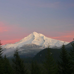
April 1, 20233 yr 5 minutes ago, smerfylicious said: Decided to snap a couple of pics. Looks like some snow flakeage too!!
April 1, 20233 yr 7 minutes ago, smerfylicious said: Decided to snap a couple of pics. Shades of the April 2008 convergence zone up north today ? 2026-2027 cold season stats Coldest max-60Coldest min-41



Join the conversation
You can post now and register later. If you have an account, sign in now to post with your account.