February 14, 20206 yr Prob just the coffee unless your heading up north...if you believe the Euro, you may score some outta this...what looked good a couple days ago isn't trending that way down here. The energy gets split up and the blocking up in S Canada splits up instead of one solid HP like it was showing a few days ago.
February 14, 20206 yr GRR this AM is NOT impressed with the system and it looks like mostly rain in west Michigan.
February 14, 20206 yr Rainstorm here. The beat goes on. Formerly *ahem*: LNK_Weather, TOL_Weather, FAR_Weather, MSP_Weather, IMoveALot_Weather.
February 14, 20206 yr FWIW, the NAVGEM continues with the suppressed route, similar to the track of the last storm. I never paid attention to it until it was mentioned in a post a few days ago. Who knows, maybe I shouldn't pay attention to it now either!
February 14, 20206 yr ICON is a good hit for many. But it's the ICON.Canadian came in snowier as well.
February 14, 20206 yr If we don't get snow around the WI/IL border, it looks like we're going to get rain. I hope this comes around.
February 14, 20206 yr The south trend will not be denied this winter so I see this coming in south and weaker.
February 14, 20206 yr I remember the days that storms would trend northwest and I was always concerned about it going to the Dakotas.
February 14, 20206 yr ICON please... A Navy Chief said, "Never change your forecast. That way you can only be wrong once."
February 14, 20206 yr This was threadworthy? 2021-22 Snowfall: (Hiawatha) TOTAL: 10.2" (12/28: 3.0") (12/29: 0.8") (1/1: 6.4")
February 14, 20206 yr This was threadworthy?These are dark times LOL Snowfall in Lincoln, NE: 2017-18: 21.4" 2018-19: 55.5" 2019-20: 17.6" 2020-21: 49.4" 2021-22: 5.1" ? Average: 26"
February 14, 20206 yr For this winter, you betcha it counts as a thread. In some previous winters, not a chance.
February 14, 20206 yr I heard rumors. Good one with the title Winter 2025-26 Snow Total = 68.1" Largest Storm: 7.5" (11/29-30) Snow/Ice Headlines: 20!! Oct: 0.0 Nov:10.1 Dec: 17.1 Jan: 21.9 Feb: 7.1 Mar: 11.6 Apr: 0.3 (116% Normal Season) Avg = 58.6" (Harrison): 2024-25 = 55.3" 2023-24 = 53.1" Avg = 45.0" (KDTW): 2022-23 = 33.5" 2021-22 = 35.6" Avg = 49.7" (KRMY): 2020-21 = 36.2" 2019-20 = 48.0" 2018-19 = 56.1" 2017-18 = 68.3" 2016-17 = 52" 2015-16 = 57.4" 2014-15 = 55.3" 2013-14 = 100.6" (coldest & snowiest in the modern record!) 2012-13 = 47.2" 2011-12 = 43.7" Legit Blizzards (high winds and dbl digit snows) I have personally experienced: Jan 2014, Feb 2011, Dec 2009, Jan 2005, Dec 2000, Jan 1999, Mar 1998, Nov 1995, Nov 1989, Jan 1978, Jan 1977, Apr 1975, Mar 1973
February 14, 20206 yr And we have the ICON completely different than what the GFS is showing. 18z Nam also showing a different look so model mayhem continues
February 15, 20206 yr 12z EPS/Euro...north goes the snow...good for another re-fresher for our friends up in N Wisco...@ Snowshoe/Money should see some decent snows...
February 15, 20206 yr Decent trends today up this way. Might squeeze out a few inches somewhere close, although south and east look better. With no big dogs in sight I’ll always take a stat padder.
February 15, 20206 yr MPX going with a general 1-3” with some possible mixed precip. 18z NAM now snowing what the globals are showing.
February 16, 20206 yr From MPX: someone south/east might see the goods..... Given the need to refine the track a bit and wait foranother run for the sake of consistency, will hold off on a WinterWeather Advisory for now. This will also give us a chance to seeif a narrow ribbon of counties could even need a Warning, givenmodel cross sections are indicating weak CSI and the potential forslantwise convection (thundersnow). Raised snowfall totals to the3-5" range from south central MN into west central WI, taperingoff to 1-3" across most of the Twin Cities metro, and down to ahalf inch or less in St Cloud/Alexandria.
February 16, 20206 yr We might get some snow out of this yet due to the event being between 7-12 tomorrow night per forecast office.
February 16, 20206 yr We love a southern snowpack.. A Navy Chief said, "Never change your forecast. That way you can only be wrong once."
February 16, 20206 yr Both 12z RGEM and GGEM keep hope alive for a few inches of snow before the switch to rain, even for southern MI. More mayhem inside 36 hours or just toss it?
February 17, 20206 yr Looks like just rain here from this storm system, but I don't mind. It's actually nice to get rain since this winter has been a big dud when it comes to snowfall.
February 17, 20206 yr Traffic cameras show Dubuque is getting solid snow. season snowfall: 31.0" '24-25: 18.9" '23-24: 35.1" '22-23: 30.2" '21-22: 27.1" '20-21: 52.5" Average snowfall: ~30"
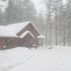
February 17, 20206 yr Traffic cameras show Dubuque is getting solid snow.Pound town here for quite awhile. Not building up but huge flakes at a moderate rate for the past few hours. Most beautiful daytime snow of the season so far. Melting at a good rate though... Dubuque 2007-2008 Winter 78.1" Total snowfall February Snowfall 32.5" City salt usage : 12,211 tons Days of measurable snow : 40
February 17, 20206 yr Got a 2-min headline for a few flakes or snizzle & 33F. Serriously?? Edit - This morning on my commute it was only from 5-8 pm (shortest winter headline I can remember) but I see late morning it was extended. .UPDATE...Issued at 1053 AM EST Mon Feb 17 2020Will make a minor adjustment to the advisory to extend the endingtime a bit for the southern areas, particularly for the LAN/JXNareas where the colder air hangs on a few hours longer than at AZOand South Haven. The end time at LAN/JXN will now be same as atGRR (1 AM). Winter 2025-26 Snow Total = 68.1" Largest Storm: 7.5" (11/29-30) Snow/Ice Headlines: 20!! Oct: 0.0 Nov:10.1 Dec: 17.1 Jan: 21.9 Feb: 7.1 Mar: 11.6 Apr: 0.3 (116% Normal Season) Avg = 58.6" (Harrison): 2024-25 = 55.3" 2023-24 = 53.1" Avg = 45.0" (KDTW): 2022-23 = 33.5" 2021-22 = 35.6" Avg = 49.7" (KRMY): 2020-21 = 36.2" 2019-20 = 48.0" 2018-19 = 56.1" 2017-18 = 68.3" 2016-17 = 52" 2015-16 = 57.4" 2014-15 = 55.3" 2013-14 = 100.6" (coldest & snowiest in the modern record!) 2012-13 = 47.2" 2011-12 = 43.7" Legit Blizzards (high winds and dbl digit snows) I have personally experienced: Jan 2014, Feb 2011, Dec 2009, Jan 2005, Dec 2000, Jan 1999, Mar 1998, Nov 1995, Nov 1989, Jan 1978, Jan 1977, Apr 1975, Mar 1973
February 17, 20206 yr It is still snowing in Dubuque. There is a recent report of 1.5". I think the models had it changed to rain by now. Madison should get a nice hit. season snowfall: 31.0" '24-25: 18.9" '23-24: 35.1" '22-23: 30.2" '21-22: 27.1" '20-21: 52.5" Average snowfall: ~30"

Join the conversation
You can post now and register later. If you have an account, sign in now to post with your account.